

Recommended
Recommended
More Related Content
Similar to wpb01.pdf
Similar to wpb01.pdf (20)
Recently uploaded
Recently uploaded (20)
wpb01.pdf
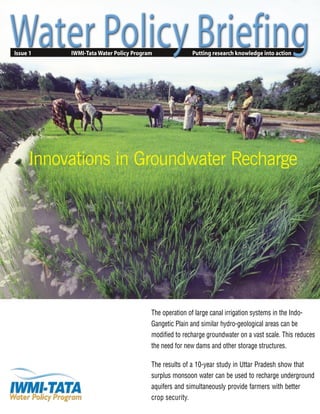
- 1. Issue 1 IWMI-Tata Water Policy Program Putting research knowledge into action The operation of large canal irrigation systems in the Indo- Gangetic Plain and similar hydro-geological areas can be modified to recharge groundwater on a vast scale. This reduces the need for new dams and other storage structures. The results of a 10-year study in Uttar Pradesh show that surplus monsoon water can be used to recharge underground aquifers and simultaneously provide farmers with better crop security. Innovations in Groundwater Recharge
- 2. LESSONS LEARNED from a 10-year pilot project in Uttar Pradesh indicate a practical and low-cost way to conserve and rejuvenate falling groundwater reserves. Here, monsoon river flows are being channeled through earthen canals to irrigate wet-season crops. Seepage water from the canals and fields simultaneously recharges the underlying aquifers. As a result, declining water tables have been arrested, pumping costs for irrigation have been reduced and the region’s agricultural productivity has been improved. This approach has the potential to improve farmers’ livelihoods in areas that have hydro-geological characteristics similar to those of the western Indo-Gangetic Plain. Putting this type of approach into action requires a shift in a State’s water policy and practice. Irrigation departments will have to move from supplying water only in the dry season to delivering adequate water during the monsoon, so that farmers can grow water-intensive crops, such as rice and sugarcane—where the water irrigates fields and simultaneously recharges groundwater aquifers. The water that is stored in the aquifers can then be pumped back up for a second post- monsoon cropping season. The advantages of this approach are that groundwater levels are maintained, farmers’ annual yields are increased, pumping costs are reduced and waterlogging is minimized. Innovations in Groundwater Recharge Earthen irrigation systems can be transformed into highly productive region-wide groundwater recharge systems—at very little cost. The amount of water pumped by farmers from India’s aquifers is greatly exceeding natural recharge in many areas.In the western part of the Indo-Gangetic Plain,where the recharge approach described here was initiated,rainfall ranges between 650 and 1,000 mm annually,but only 200 mm naturally percolate through the soil layer to replenish underlying aquifers.Most of this rainfall,which is concentrated during the 3 months of the monsoon,does not have time to be absorbed into already saturated soil and so runs off—eventually flowing unused into the sea.If a fraction of this runoff could be stored underground through artificial recharge,the problem of declining water tables that plagues much of the region could be solved. Recent research suggests that providing farmers with irrigation water during the monsoon offers a cost- effectiveoption for harnessingthis previouslywasted resource to artificially recharge groundwater.If surplus river flows can be channeledthrough an unlined system to provide farmers with irrigation for monsoon crops, seepage water from the canals and fields will refill underlying aquifers (see figure 1).This stored water can then be pumped up by farmers during the dry season for a second crop.The resulting drawdown of the aquifers maximizes their storage potential for the next monsoon and prevents waterlogging.This conjunctive management of canal water andgroundwater has proved productiveand,aboveall,sustainable. Providing canal water only during the monsoon season has a number of advantages beyond aquifer recharge. Farmers are no longer at the mercy of monsoon rains,which sometimes fail to provide enough water when and where it is needed.They are guaranteed sufficient water to irrigate both a monsoon and a post- monsoon crop. This issue of WaterPolicyBriefing is based on research presented in the technical paper ArtificialRechargingofGroundwater:An Experiment in the Madhya Ganga Canal Project, India by R. Sakthivadivel of the International Water Management Institute (IWMI) and A. S. Chawala formerly of the Water Resources Development and Training Centre (WRDTC), University of Roorkee, India. Readers interested in the details of this research are invited to read the full text of the technical paper at www.iwmi.org/iwmi-tata or request a copy at the address given below. Questions and comments on this issue may be directed to Dr. R. Sakthivadivel c/o IWMI, Elecon, Anand-Sojitra Road,Vallabh Vidyanagar 388 001, Gujarat, India or iwmi-tata@cgiar.org. Domestic and industrial users also benefit from recharged groundwater. 1 January, 2002
- 3. Head-tail differences are minimized:during the monsoon,there is enough water for users at the tail end of the irrigation system,and there is still plenty to recharge the aquifer.During the dry season,since there is no canal supply,all the farmers have to pump water if they want to irrigate a post-monsoon crop.Since pumping costs farmers money,they use the water more efficiently. Transforming irrigation systems into recharge systems The research by Roorkee University,the Water and Land Management Institute (WALMI) of Uttar Pradesh,and the State’s Irrigation Department, in collaboration with the InternationalWater Management Institute (IWMI),evaluated this ongoing experiment in large-scale recharge being carried out by the Government of Uttar Pradesh. The recharge project involved the construction of a barrage across the river Ganga at Raolighat,which diverts 234 m3 /sec of water into the Madhya Ganga Canal when the monsoon raises river flows.The Madhya Ganga Canal feeds the existing Upper Ganga Canal system and the newly constructed Lakhaoti Branch Canal system.This water is supplied to farmers, who use it to irrigate such water-intensive monsoon crops as paddy rice and sugarcane.The research documented how this diversion of surplus Ganga water duringthe monsoon season has affectedgroundwater levels,land use,cropping pattern,and the costs and benefits of agricultural operations—focusing specifically on the Lakhaoti Branch Canal system. The research showed that the water table,which had been progressively declining,has been raised from an average of 12 m below ground level to an average of 6.5 m.A simulation of the groundwater system suggests that without the artificial recharge provided by the monsoon irrigation,the water table would have fallen to an average depth of 18.5 m below the surface during the course of the 10-year study period. Farmers have benefited from the corresponding reduction in pumping costs and the improved cropping pattern.With the introduction of monsoon irrigation, the average net income has increased by 26% to Rs 11,640 per hectare.Inaddition,the recharge benefits other water users in the area—water demand for domestic purposes and industrial use are also met from recharged groundwater. Saving on water storage infrastructure The recharge effort described here can be duplicated using existing canal schemes of any size.The Lakhaoti is a medium-sized,unlined system, with a command area of about 206 thousand hectares,but any irrigation system in an area where there are viable aquifers and surplus monsoon water is a good candidate for this approach.The Indo-Gangetic Plain is ideal because it is underlain by a thick stratum of sandy soils,which readily holds and transmits groundwater. For paddy rice, around 60% of the irrigation water applied is used by the plants; most of the remaining 40% filters through the soil to recharge the aquifer below. Combined with seepage from unlined canals, these ‘losses’provide farmers with groundwater to irrigate dry season crops. Figure 1. Paddy rice irrigation aids recharge Earthen irrigation canal Paddy field Underground aquifer Overview of project results—benefits to the region · 26% increase in average net income per ha for farmers. · Average depth to groundwater decreased from an average of 12m below ground level (1988) to an average of 6.5m (1998). · Annual pumping cost savings of Rs.180 million (900,000,000 m3 of water pumped each year). · Annual energy savings of 75.6 million kWh. · Canal irrigated area increased—from 1,251 ha (1988) to 37,108 ha (1996). · 15% increase in cropped area for rice—83 ha (1988) to 14,419 (1999)—with potential for further 30,000 ha. Irrigated sugarcane area increased by 1,000 ha. · Canal water input increased from 27,202,000 m3 (1988) to 643,010,000 m3 in (1996). · Reduction of 50% in water conveyance losses with potential for further improvement. Water Policy Briefing 2
- 4. Recently published research from Punjab Agricultural University,Ludhiana suggests that the network of surface drains—that were constructed to control waterlogging and floods in the early 1950s but that are now rarely used—can be modified to catch monsoon rains and replenishfallinggroundwatertablesinmanyareasofIndia. In effect, these unused drainage channels can be transformed into temporary reservoirs. Excess water not needed for irrigation can be diverted into these unused channels, where ‘check structures’ slow it for recharge. Drainage canal Aquifer recharge Check structure Unused drainage canals can be modified to increase recharge. Research has shown that building check structures,which slow the water flow, can increase recharge by three-and-a-half times. How unused drainage canals can help maximize recharge The recharge approach has allowed the Government of Uttar Pradesh to increase agricultural production and provide farmers with irrigation water in previously existing dry pockets—without constructing dams or new reservoirs.In the area now covered by the Lakhaoti scheme,existing water rights precluded providing farmers with Ganga water for irrigation during the dry season.Building surface storage dams was not an option in this flat alluvial terrain.Even if suitable sites for such structures could be found,escalating costs of construction and stringent environmental requirements would be prohibitive. Theseproblemsarenotunique.Theyhavetroubled plannersand policymakersfor years.Practical and economicallyviablesolutionsarerequired,backedby sound science and provenresults.Thepotential to build on earlier investments and use existing structures to avoidlargecapitaloutlayscertainlymeritsconsideration. Itcould save money,conserve vital natural resources and improvethelivelihoodsof poorfarmers. The mosteffectiveway to rechargegroundwaterin the climaticand hydro-geologicalconditionsof the Indo- Gangetic Plain,this research suggests,is to modify the operationof unlinedirrigation systemsto carry surplus monsoon flows.Evenin cases where canalsare linedor partiallylined,therewillstillbebeneficialrecharge— though not as much as from an unlinedscheme. This type of recharge effort is also cost-effective. The total cost of canal water at canal head (capital cost + operation and maintenance cost at 1990 prices) is Rs 0.3162 per m3 .With each m3 of water bringing an average return of Rs 8,1 the canal water is an extremely good investment. If this irrigation policy shift is put into action on a large scale,the socioeconomic impact can be 1 As a back-of-the-envelope calculation shows, for such staple crops as wheat, farmers are producing approximately Rs 8 worth of crops for every m3 of water used.Farmers use around 6,000 m3 of water per hectare, and their average yield is 5tonsper hectare.Thevalueof 5tonsof wheatatcurrent pricesisRs49,500,making the value of each m3 of water little over Rs 8. The research by S. D.Khepar and his colleagues shows how building check structures, at suitable intervals in the drainage canal, can increase the recharge capacity of a drain by three-and-a-half times over recharge under natural flow conditions. A model developed to estimate the recharge provides water managers with guidance for organizing canal water releases,while ensuring that there is no runoff at the outflow of the drain,under natural flow conditions and with check structures. Using a combined approach—diverting monsoon water through earthen irrigation canals and the existing network of unused drainage canals offers several practical advantages. The most prominent is that the recharge ‘infrastructure’—earthen irrigation and drainage canals and groundwater aquifers—already exists, and can be modified at a very low cost, compared to planning and building dams, tanks or other water-storage facilities. See Khepar, S.D; A.K.Yadav; S.K.Sondhi; Arpan Sherring. 2000. Modelling surplus canal water releases for artificial recharge of ground water through surface drainage systems. Irrigation Science 19:95-100. The most effective way to recharge groundwater in the Indo-Gangetic Plain, this research suggests, is to modify the operation of unlined irrigation systems. 3 January, 2002
- 5. potentially huge.It will improve farmers’incomes, while helping save state expenditure on water infrastructure or dam construction,stabilizing power generation requirements,and lowering atmospheric emissions and environmental impacts. A strategy of combining groundwater recharge through monsoon irrigation with appropriate electricity pricing and groundwater use regulations, has the potential to drastically improve the productivity and sustainability of farmers’water use in areas where overpumping is currently endangering groundwater resources. Reversing groundwater decline Before the introduction of monsoon canal irrigation, withdrawal of groundwater in the area was exceeding recharge,and the water table was declining by an average of 0.5 m per year.In 1984,the average depth of the water table was 10 m below ground level; by 1988, when the recharge effort began,it had fallen to 12 m. After 10 years of providing monsoon irrigation,the depth to groundwater has been almost halved—the average for 1998 was 6.5 m below ground level.Water table depth below ground level for the years 1984 (before the project began) and 1998 (after 10 years of operation) are shown in figure 2. Groundwater hydrographs wereprepared for five observation wells located from head to tail of the Lakhaoti Branch Canal.In the head-reach villagesthey show thatthewater table fell progressively until 1988, when the recharge effort began.Here the artificial recharge had analmostimmediate impact (see figure3). In the tail-end villages,it has taken longer for the water table to rise.In one tail-end village,for example, Indian regions/areas that can benefit · Where geology favors holding, storing, and allowing groundwater to be extracted, including areas with deep alluvial soils, sandy loams with low clay and kankar contents that have good potential to store water for later use. · Riverine systems with high river flows during the monsoon where flows are not used for crops, and run out to sea— conserving this floodwater is the main aim. · Locations where constructing a dam or building a surface reservoir causes environmental damage or flat alluvial terrain where surface storage dams cannot be built. · Locations where it is too expensive to build dams, or to transport water over long distances, where land cannot be allocated for storage, and the land values are high. · Areas with no soil salinity problems. · Places where the ground slope varies gradually and where it is not subject to flooding and/or waterlogging. · Command areas of existing canal irrigation systems where the canals can be better utilized for monsoon irrigation. · Places where accurate information on hydrogeology and groundwater movement are available, thus saving the cost of detailed surveys. Figure2.Comparisonofwatertabledepthbelowgroundlevelbefore(1984)andafter(1998)recharge Maps of the Lakhaoti Branch Canal command area, Uttar Pradesh,showing post- monsoon depth to groundwater both in 1984,four years before the artificial recharge began, and in 1998,after the project had been in operation for 10 years. Dark blue areas show where the groundwater level is close to the surface;lighter blue areas show where the groundwater level is deeper below the surface. A comparison of these maps clearly shows the positive impact of recharge from field and canal- seepage water.The level of the groundwater has risen almost uniformly,with the exception of a few small pockets in the tail reach where the water distribution infrastructure is incomplete. Water Policy Briefing 4
- 6. the water table continuedto decline until 1990,then remained constant until 1997,when it finally began to rise (see figure 4).The primary reason it has taken the tail reach areas longer to respond to the canal water recharge is incomplete infrastructure for water distribution in the tail reach. The groundwaterbalance calculatedfor the Lakhaoti command area shows that in a normal year,rainfall recharge is 370 million m3 .Canal and field seepage contributesapproximately328millionm3 .Totalrecharge, without considering the lateral inflow of 63 million m3 from other aquifers,works out to 698 million m3 .Net pumping for irrigation averages around 663 million m3 —leaving 35 million m3 to help raise depleted water tables.Once water tables have reached an optimal level (approximately 3 m below ground level),farmers will need to increase pumping to balance rechargeand preventwaterlevelsfromincreasingfurther. Impact on farm budgets When water tables drop,farmers’pumping costs go up.After the introduction of the recharge effort, the groundwater level rose and consequently the cost of pumping fell.A simulation of the groundwater system shows that without the artificial recharge the water table would have dropped to an average depth of approximately 18.5 m over the 10-year study period. Lower groundwater tables would have increased the cost of pumping,and forced users to deepen wells and lower their pumping sets. The cost of pumping with the water table at 18.5 m would have been Rs 0.465 per m3 .Under current conditions,with groundwater at an average depth of 6.5 m,the cost of pumping groundwater is Rs 0.265 per m3 —a savings of almost 50%. Considering that altogether farmers pump close to 900 million m3 (gross) annually,the amount saved in pumping costs comes to Rs 180 million per year. Farmers’incomes have also benefited from the increased production and from the better cropping pattern enabled by themonsoon irrigation.In the past, there was not always sufficient water for a post-monsoon crop; now, farmers are guaranteed enough water for two cropping seasons. Direct benefits to farmers · Savings in pumping costs, and stable pumpset locations. · Better cropping patterns and operating conditions (availability of pumped groundwater for post-monsoon crop irrigation, and avoiding waterlogging). · Stable irrigation supply guaranteed by canal water supplements. · More annual income from additional rice and sugarcane. Figure 3.Hydrograph—showing impact of recharge project on water table at a head-end village Figure 4. Hydrograph—showing impact of recharge project on water table at a tail-end village 5 January, 2002
- 7. Consolidated farm budgets1 for Lakhaoti Branch command area with and without canal inputs Without canal inputs With canal inputs Season Yield Gross Cost of Net Weighted Cost of Net Weighted Crop (t/ha) receipts cultivation benefit Weightage2 mean benefit cultivation benefit Weightage mean benefit Monsoon Rice (-canal) 2.2 18.0 15.40 2.60 0.02 0.05 13.20 7.80 0.15 1.17 Rice (+ canal) 3.5 21.0 Maize 2.0 9.0 7.10 1.90 0.35 0.66 6.60 2.40 0.20 0.48 Pearlmillet 2.0 8.0 7.05 0.95 0.10 0.10 6.15 1.85 0.10 0.19 Sugarcane 60.0 43.0 23.40 9.60 0.13 2.55 21.10 21.90 0.15 3.29 Fodder 1.50 0.20 0.30 1.50 0.20 0.30 Total 0.80 3.66 0.80 5.42 Post-monsoon Wheat 3.5 17.0 11.00 6.00 0.60 3.60 10.20 6.80 0.60 4.08 Barley 3.5 17.0 10.70 6.30 0.10 0.63 9.80 7.20 0.10 0.72 Potato 20.0 50.0 18.00 32.00 0.03 0.96 17.30 32.70 0.03 0.98 Peas/chickpea 2.0 15.5 10.00 5.50 0.07 0.39 9.25 6.25 0.07 0.44 Total 0.80 5.58 0.80 6.22 Annual Total 1.60 9.24 1.60 11.64 1 All costs and receipts in Rs ’000/ha. 2 Weightage was calculated by multiplying the net benefit by the percentage of the crop within the total cropping pattern. With the additional water provided by the monsoon irrigation,farmers have been able to expand the area irrigated.The canal irrigated area increased from 1,251 hectares for the 1988/89 season,to a maximum of 35,798 hectares in the 1997/98 season.The costs of cultivation, and gross and net benefits of major crops,with and withoutmonsoonirrigation,aregiveninthetable below. Why is a policy change needed? Over the years,State Irrigation Departments have aimed to store and distribute water to farmers in the dry season,so that at least two crops can be grown in a year.It is generally assumed that the monsoon brings enough water to go round and that farmers don’t need help.This is not always true.Monsoons are erratic and sometimes do not bring the promised rainfall. Another fact is that the torrential monsoon rains bring vast amounts of water that are not needed for agriculture at that very moment.Most of the monsoon rains flood fields,filling rivers and streams that rush—unused—to the sea.This is the very water that could help the farmer year-round,if it could be diverted and its flows slowed down enough to percolate through to underground aquifers.Fast-flowing torrents wash away topsoil,and waterlogged fields are a farmer’s nightmare for such crops as pigeon pea that cannot tolerateexcessively wet conditions. From the farmers’perspective,having better‘crop security’for monsoon crops by making irrigation water available to supplement an erratic supply of rain—and still having enough water stored in aquifers to grow another crop later—is an attractive proposition.But policy makers and water managers will have to clearly articulate the advantages and positive impact of the change if farmers are to be convinced.Farmers live with risks the year-round, so removing one of their main worries—the possibility of drought caused by monsoon failure—will give them the confidence to face their many other challenges. Farmers will need to be convinced that this new approach will work for them.If they can be sure that their hard-earned pumps will continue to find water in the aquifers after the monsoon,that the pumps will not need to be lowered into ever-deepening borewells,and that the stable water table means lower power costs, then they will support changing cropping patterns as part of a new groundwater recharge strategy. Most monsoon rains flood fields, filling rivers and streams with water that rushes out—unused—to the sea. This is the very water that could help the farmer year-round. Water Policy Briefing 6
- 8. Water Policy Briefing Series The Water Policy Briefing Series translates the findings of research in water resources management into useful information for Indian policy makers. The Series is put out by the International Water Management Institute (IWMI) in collaboration with national and state research organizations. It is made possible by a grant from the Sir Ratan Tata Trust. Each Briefing is supported by detailed research documentation, available on the Institute’s web site (www.iwmi.org/iwmi-tata) or by direct request (iwmi-tata@cgiar.org). The editors of the Series welcome comments and questions. Please send correspondence to: The Editor, Water Policy Briefing, IWMI, Elecon, Anand-Sojitra Road,Vallabh Vidyanagar 388 001, Gujarat, India Telephone: +91-2692 29311-13 · Fax: +91-2692 60684 · E-mail: t.shah@cgiar.org IWMI-Tata Water Policy Program The IWMI-Tata Water Policy Program was launched in 2000.This is a new initiative supported by the Sir Ratan Tata Trust. The program presents new perspectives and practical solutions derived from the wealth of research done in India on water resources management. Its objective is to help policy makers at the central, state and local levels address their water challenges—in areas such as sustainable groundwater management, water scarcity, and rural poverty—by translating research findings into practical policy recommendations. Through this program, IWMI collaborates with a range of partners across India to identify, analyze and document relevant water management approaches and current practices.These practices are assessed and synthesized for maximum policy impact in the Water Policy Briefing Series. The Policy Program’s web site (www.iwmi.org/iwmi-tata) promotes the exchange of knowledge on water resources management, within the research community and between researchers and policy makers in India. IWMI in the Indian Region Over the past decade, researchers from IWMI have been collaborating with Indian scientists and development organizations in the areas of: irrigation performance; satellite remote sensing; irrigation management transfer; analysis of gender, water and poverty; and malaria control. In January 2001, a field office was established in Anand, Gujarat to work with Indian partners on groundwater management and governance. In October 2001, IWMI established its India Regional Office in Patancheru, Hyderabad, Andhra Pradesh. IWMI’s research and cooperation in India focuses on three key areas: river basin water productivity, water and land management in watersheds, and groundwater management. IWMI’s principal partners and collaborators for its work in India are the Indian Council of Agricultural Research (ICAR), the International Crops Research Institute for the Semi-Arid Tropics (ICRISAT),and a host of state irrigation departments, agricultural universities, and non-governmental organizations. For further information, see www.iwmi.org/india or write to iwmi-india@cgiar.org About IWMI IWMI is one of the 16 Future Harvest Centers supported by the Consultative Group on International Agricultural Research (CGIAR). The research program of IWMI centers for around five core themes: · Integrated Water Resources Management for Agriculture · Sustainable Groundwater Management · Sustainable Smallholder Water & Land · Water, Health and Environment Management Systems · Water Resources Institutions and Policy The Institute fields a team of some 50 senior researchers with significant international experience, supported by national research staff and a corps of some 20 post-doctoral scientists, mostly from developing countries. IWMI is headquartered in Sri Lanka with regional offices in India, South Africa and Thailand. All IWMI research is done with local partners (universities, government agencies, NGOs, research centers, etc.).The Institute’s outputs are public goods that are freely available for use by all actors in water management and development. The IWMI Research Reports, data and other publications can be downloaded from the IWMI web site or received free of charge from the IWMI publications office.A series of tools for improved water management is also available. For further information, see www.iwmi.org or write to m.devlin@cgiar.org Water Management InternationaI I n s t i t u t e