SlideShare a Scribd company logo
1 of 10
Presentation of Geology-II Date:-12-13/06/2019
1
Group G
Table of Content
 Maps: Topographic map, Engineering Geological map, Geological map (definition).
Topic No.01
 Difference between Topographic and Engineering Geological map.
Topic No.02
 Uses of Topographic map.
Topic No.03
 Uses of Engineering Geological map.
Topic No.04
Group G
Members of Group G Roll Number
1. Lax man Karki JEC/074/041
2. Leeza Kunwar JEC/074/042
3. Kanchan Joshi JEC/074/039
4. Kamal Chaudhary JEC/074/038
5. Lalit Kumar Kushawa JEC/074/040
6. Kamal Khadka JEC/074/037
Presentation of Geology-II Date:-12-13/06/2019
2
Group G
Topic No: 01
 Topographical Map
A topographic map is a detailed and accurate two-dimensional representation of
natural and human-made features on the Earth's surface. Mapping is a crucial part of
earth science. Topographic maps represent the locations of major geological
features. Topographic maps use a special type of line, called a contour line, to show
different elevations on a map. Contour lines are drawn on a topographic map to show
the location of hills, mountains and valleys. These maps are used for a number of
applications, from camping, hunting, fishing, and hiking to urban planning, resource
management, and surveying.
 Engineering Geological Map
A geologic map or geological map is a special-purpose map made to
show geological features. Rock units or geologic strata are shown by color or symbols
to indicate where they are exposed at the surface. Bedding planes and structural
features such as faults, folds, foliations, and lineation are shown with strike and
dip symbols which give these features three-dimensional orientations.
Stratigraphic contour lines may be used to illustrate the surface of a
selected stratum illustrating the subsurface topographic trends of the strata. Isopach
maps detail the variations in thickness of stratigraphic units. It is not always possible
to properly show this when the strata are extremely fractured, mixed, in some
discontinuities, or where they are otherwise disturbed.
1. Rock
A rock is any naturally occurring solid mass or aggregate
of minerals or mineraloid matter. It is categorized by the minerals included,
its chemical composition and the way in which it is formed. Rocks are usually
grouped into three main groups:-
a) Igneous rocks
b) Metamorphic rocks and,
c) Sedimentary rocks.
Presentation of Geology-II Date:-12-13/06/2019
3
Group G
Figure 1:-Photos of Upper Mustang
Presentation of Geology-II Date:-12-13/06/2019
4
Group G
2. Bedding Planes
Beds are the layers of sedimentary rocks that are distinctly different from
overlying and underlying subsequent beds of different sedimentary rocks.
Layers of beds are called stratigraphy or strata. They are formed from
sedimentary rocks being deposited on the Earth's solid surface over a long
periods of time.
Figure:- Photos of Bedding Planes
3. Faults
A fault is a crack or fracture in Earth's crust caused by the movement of
landmasses, called plates, on either side of the fault line. Faults are found
either at the surface (fault surface) or underground (fault plane). Most
earthquakes occur along fault lines. The principle types of faults are: normal,
Presentation of Geology-II Date:-12-13/06/2019
5
Group G
reverse, thrust, and slip-strike.
4. Folds
Folds occur when one or a stack of originally flat and planar surfaces, such
as sedimentary strata, are bent or curved as a result of
permanent deformation. Folds form under varied conditions
of stress, hydrostatic pressure, pore pressure, and temperature gradient, as
evidenced by their presence in soft sediments, the full spectrum of
Presentation of Geology-II Date:-12-13/06/2019
6
Group G
metamorphic rocks, and even as primary flow structures in some igneous rocks.
5. Foliations
Foliation in geology refers to repetitive layering in metamorphic rocks. Each
layer can be as thin as a sheet of paper, or over a meter in thickness. It is
caused by shearing forces (pressures pushing different sections of the rock in
different directions), or differential pressure (higher pressure from one
Presentation of Geology-II Date:-12-13/06/2019
7
Group G
direction than in others).
6. Lineation
Lineation may be defined in a more precise way as any linear fabric element; it
may be primary igneous or sedimentary structure or a secondary related to
deformation.
7. Isopach Maps
An isopach map illustrates thickness variations within a tabular unit, layer
or stratum. Isopachs are contour lines of equal thickness over an area.
Isopach maps are utilized in hydrographic
survey, stratigraphy, sedimentology, structural geology, petroleum geology
and volcanology. An isopach map is similar to an isochore map, but these terms
actually describe different methods of displaying thickness variations within a
Presentation of Geology-II Date:-12-13/06/2019
8
Group G
layer.
 Geological Maps
A map on which is recorded geologic information, such as the distribution, nature, and
age relationships of rock units (surficial deposits may or may not be mapped
separately), and the occurrence of structural features (folds, faults, joints), mineral
deposits, and fossil localities. It may indicate geologic structure by means of
formationaloutcrop patterns, by conventional symbols giving the direction and
amount of dip at certain points, or by structure-contour lines.
Presentation of Geology-II Date:-12-13/06/2019
9
Group G
Topic No.02
 Difference between Topographic and Engineering Geological Map.
Topographic maps reveal the shape of a landscape. Elevations indicate height above
sea level. Contour intervals are the difference in elevation between two contour
lines. Geologic maps show rock units and geologic features, like faults and folds.
Topic No.03
 Uses of Topographic map.
A topographic map is a detailed and accurate two-dimensional representation of
natural and human-made features on the Earth's surface. These maps are used for a
number of applications, from camping, hunting, fishing, and hiking to urban planning,
resource management, and surveying.
Topic No.04
 Uses of Engineering Geological map.
Engineering Geologic maps represent the distribution of different types of rock and
surficial deposits, as well as locations of geologic structures such as faults and folds.
Geologic maps are the primary source of information for various aspects of land-use
planning, including the siting of buildings and transportation systems.
Presentation of Geology-II Date:-12-13/06/2019
10
Group G

More Related Content

What's hot

e-SOTER Regional pilot platform as EU contribution to a Global Soil Observing...
e-SOTER Regional pilot platform as EU contribution to a Global Soil Observing...e-SOTER Regional pilot platform as EU contribution to a Global Soil Observing...
e-SOTER Regional pilot platform as EU contribution to a Global Soil Observing...FAO
 
2015 Broken Hill Resources Investment Symposium - Geological Survey of New So...
2015 Broken Hill Resources Investment Symposium - Geological Survey of New So...2015 Broken Hill Resources Investment Symposium - Geological Survey of New So...
2015 Broken Hill Resources Investment Symposium - Geological Survey of New So...Symposium
 
Thesis Proposal Simon Fraser University
Thesis Proposal Simon Fraser UniversityThesis Proposal Simon Fraser University
Thesis Proposal Simon Fraser UniversityDanilo Moretti
 
earth science (32)- Syllabus
earth science (32)- Syllabusearth science (32)- Syllabus
earth science (32)- SyllabusPramoda Raj
 
Introduction to engineering geology
Introduction to engineering geologyIntroduction to engineering geology
Introduction to engineering geologySumanRawat34
 
ENGINEERING GEOLOGY
ENGINEERING GEOLOGYENGINEERING GEOLOGY
ENGINEERING GEOLOGYTarun kumar
 
Introduction of Engineering Geology
Introduction of Engineering GeologyIntroduction of Engineering Geology
Introduction of Engineering GeologyVasu Goel
 
Introduction of Engineering Geology
Introduction of Engineering Geology Introduction of Engineering Geology
Introduction of Engineering Geology BINDUSARA TS
 
The earths engine tectonics, weathering and erosion (2)
The earths engine tectonics, weathering and erosion (2)The earths engine tectonics, weathering and erosion (2)
The earths engine tectonics, weathering and erosion (2)Dr.Pankaj Mehta
 
Geology report by jitu
Geology report by jituGeology report by jitu
Geology report by jituJitendra Gupta
 

What's hot (18)

e-SOTER Regional pilot platform as EU contribution to a Global Soil Observing...
e-SOTER Regional pilot platform as EU contribution to a Global Soil Observing...e-SOTER Regional pilot platform as EU contribution to a Global Soil Observing...
e-SOTER Regional pilot platform as EU contribution to a Global Soil Observing...
 
2015 Broken Hill Resources Investment Symposium - Geological Survey of New So...
2015 Broken Hill Resources Investment Symposium - Geological Survey of New So...2015 Broken Hill Resources Investment Symposium - Geological Survey of New So...
2015 Broken Hill Resources Investment Symposium - Geological Survey of New So...
 
Scope of studying engineering geology
Scope of studying engineering geologyScope of studying engineering geology
Scope of studying engineering geology
 
Donaldson-2015
Donaldson-2015Donaldson-2015
Donaldson-2015
 
1.4 importance of structural geology
1.4 importance of structural geology  1.4 importance of structural geology
1.4 importance of structural geology
 
Engineering Geology
Engineering Geology Engineering Geology
Engineering Geology
 
Thesis Proposal Simon Fraser University
Thesis Proposal Simon Fraser UniversityThesis Proposal Simon Fraser University
Thesis Proposal Simon Fraser University
 
2.engineering geology
2.engineering geology2.engineering geology
2.engineering geology
 
Landslide aw
Landslide aw Landslide aw
Landslide aw
 
Geology
Geology Geology
Geology
 
Geology
GeologyGeology
Geology
 
earth science (32)- Syllabus
earth science (32)- Syllabusearth science (32)- Syllabus
earth science (32)- Syllabus
 
Introduction to engineering geology
Introduction to engineering geologyIntroduction to engineering geology
Introduction to engineering geology
 
ENGINEERING GEOLOGY
ENGINEERING GEOLOGYENGINEERING GEOLOGY
ENGINEERING GEOLOGY
 
Introduction of Engineering Geology
Introduction of Engineering GeologyIntroduction of Engineering Geology
Introduction of Engineering Geology
 
Introduction of Engineering Geology
Introduction of Engineering Geology Introduction of Engineering Geology
Introduction of Engineering Geology
 
The earths engine tectonics, weathering and erosion (2)
The earths engine tectonics, weathering and erosion (2)The earths engine tectonics, weathering and erosion (2)
The earths engine tectonics, weathering and erosion (2)
 
Geology report by jitu
Geology report by jituGeology report by jitu
Geology report by jitu
 

Similar to Geology Maps Types Uses

Guidelines for lithological, structural and geomorphic interpretation
Guidelines for lithological, structural and geomorphic interpretationGuidelines for lithological, structural and geomorphic interpretation
Guidelines for lithological, structural and geomorphic interpretationNikhil Sherekar
 
Evaluation of Structural Geology of Jabal Omar
Evaluation of Structural Geology of Jabal OmarEvaluation of Structural Geology of Jabal Omar
Evaluation of Structural Geology of Jabal OmarIJERD Editor
 
Introduction.ppt
Introduction.pptIntroduction.ppt
Introduction.pptSakib311
 
Engineering geology gs 119 pdf
Engineering geology gs 119 pdfEngineering geology gs 119 pdf
Engineering geology gs 119 pdfSaqib Imran
 
Geoengineering Characterization of the Rock Masses of Northern Face of Jabal ...
Geoengineering Characterization of the Rock Masses of Northern Face of Jabal ...Geoengineering Characterization of the Rock Masses of Northern Face of Jabal ...
Geoengineering Characterization of the Rock Masses of Northern Face of Jabal ...IJERA Editor
 
Geological Subsurface Maps
Geological Subsurface MapsGeological Subsurface Maps
Geological Subsurface MapsMaliha Mehr
 
The International Journal of Engineering and Science (The IJES)
The International Journal of Engineering and Science (The IJES)The International Journal of Engineering and Science (The IJES)
The International Journal of Engineering and Science (The IJES)theijes
 
What is Geoscience?Objectives.
What is Geoscience?Objectives.What is Geoscience?Objectives.
What is Geoscience?Objectives.Uday Kumar Shil
 
Field work in geology courses by different science
Field work in geology courses by different scienceField work in geology courses by different science
Field work in geology courses by different scienceThomIya
 
The study of sequence stratigraphy and sedimentary system in Muglad Basin
The study of sequence stratigraphy and sedimentary system in Muglad BasinThe study of sequence stratigraphy and sedimentary system in Muglad Basin
The study of sequence stratigraphy and sedimentary system in Muglad Basiniosrjce
 
Engineering Geology I Report-MALEKHU
Engineering Geology I Report-MALEKHUEngineering Geology I Report-MALEKHU
Engineering Geology I Report-MALEKHUSabin Acharya
 
Outcrops of SG_KK & KL_August 2016_Final_20.09.16
Outcrops of SG_KK & KL_August 2016_Final_20.09.16Outcrops of SG_KK & KL_August 2016_Final_20.09.16
Outcrops of SG_KK & KL_August 2016_Final_20.09.16KYI KHIN
 
Preperation of Geologic Section
Preperation of Geologic SectionPreperation of Geologic Section
Preperation of Geologic SectionJudyMaeJugar
 

Similar to Geology Maps Types Uses (20)

Guidelines for lithological, structural and geomorphic interpretation
Guidelines for lithological, structural and geomorphic interpretationGuidelines for lithological, structural and geomorphic interpretation
Guidelines for lithological, structural and geomorphic interpretation
 
Lecture 10p
Lecture 10pLecture 10p
Lecture 10p
 
GTE MP.docx
GTE MP.docxGTE MP.docx
GTE MP.docx
 
chapter 4.ppt
chapter 4.pptchapter 4.ppt
chapter 4.ppt
 
Evaluation of Structural Geology of Jabal Omar
Evaluation of Structural Geology of Jabal OmarEvaluation of Structural Geology of Jabal Omar
Evaluation of Structural Geology of Jabal Omar
 
Introduction.ppt
Introduction.pptIntroduction.ppt
Introduction.ppt
 
Engineering geology gs 119 pdf
Engineering geology gs 119 pdfEngineering geology gs 119 pdf
Engineering geology gs 119 pdf
 
Geoengineering Characterization of the Rock Masses of Northern Face of Jabal ...
Geoengineering Characterization of the Rock Masses of Northern Face of Jabal ...Geoengineering Characterization of the Rock Masses of Northern Face of Jabal ...
Geoengineering Characterization of the Rock Masses of Northern Face of Jabal ...
 
Geological Subsurface Maps
Geological Subsurface MapsGeological Subsurface Maps
Geological Subsurface Maps
 
The International Journal of Engineering and Science (The IJES)
The International Journal of Engineering and Science (The IJES)The International Journal of Engineering and Science (The IJES)
The International Journal of Engineering and Science (The IJES)
 
What is Geoscience?Objectives.
What is Geoscience?Objectives.What is Geoscience?Objectives.
What is Geoscience?Objectives.
 
Field work in geology courses by different science
Field work in geology courses by different scienceField work in geology courses by different science
Field work in geology courses by different science
 
Geology Introduction
Geology IntroductionGeology Introduction
Geology Introduction
 
The study of sequence stratigraphy and sedimentary system in Muglad Basin
The study of sequence stratigraphy and sedimentary system in Muglad BasinThe study of sequence stratigraphy and sedimentary system in Muglad Basin
The study of sequence stratigraphy and sedimentary system in Muglad Basin
 
The study of sequence stratigraphy and sedimentary system in Muglad Basin
The study of sequence stratigraphy and sedimentary system in Muglad BasinThe study of sequence stratigraphy and sedimentary system in Muglad Basin
The study of sequence stratigraphy and sedimentary system in Muglad Basin
 
Engineering Geology I Report-MALEKHU
Engineering Geology I Report-MALEKHUEngineering Geology I Report-MALEKHU
Engineering Geology I Report-MALEKHU
 
A2100107
A2100107A2100107
A2100107
 
Outcrops of SG_KK & KL_August 2016_Final_20.09.16
Outcrops of SG_KK & KL_August 2016_Final_20.09.16Outcrops of SG_KK & KL_August 2016_Final_20.09.16
Outcrops of SG_KK & KL_August 2016_Final_20.09.16
 
Preperation of Geologic Section
Preperation of Geologic SectionPreperation of Geologic Section
Preperation of Geologic Section
 
EG NOTES.docx
EG NOTES.docxEG NOTES.docx
EG NOTES.docx
 

Recently uploaded

Software Development Life Cycle By Team Orange (Dept. of Pharmacy)
Software Development Life Cycle By  Team Orange (Dept. of Pharmacy)Software Development Life Cycle By  Team Orange (Dept. of Pharmacy)
Software Development Life Cycle By Team Orange (Dept. of Pharmacy)Suman Mia
 
chaitra-1.pptx fake news detection using machine learning
chaitra-1.pptx  fake news detection using machine learningchaitra-1.pptx  fake news detection using machine learning
chaitra-1.pptx fake news detection using machine learningmisbanausheenparvam
 
Gfe Mayur Vihar Call Girls Service WhatsApp -> 9999965857 Available 24x7 ^ De...
Gfe Mayur Vihar Call Girls Service WhatsApp -> 9999965857 Available 24x7 ^ De...Gfe Mayur Vihar Call Girls Service WhatsApp -> 9999965857 Available 24x7 ^ De...
Gfe Mayur Vihar Call Girls Service WhatsApp -> 9999965857 Available 24x7 ^ De...srsj9000
 
Introduction to IEEE STANDARDS and its different types.pptx
Introduction to IEEE STANDARDS and its different types.pptxIntroduction to IEEE STANDARDS and its different types.pptx
Introduction to IEEE STANDARDS and its different types.pptxupamatechverse
 
The Most Attractive Pune Call Girls Budhwar Peth 8250192130 Will You Miss Thi...
The Most Attractive Pune Call Girls Budhwar Peth 8250192130 Will You Miss Thi...The Most Attractive Pune Call Girls Budhwar Peth 8250192130 Will You Miss Thi...
The Most Attractive Pune Call Girls Budhwar Peth 8250192130 Will You Miss Thi...ranjana rawat
 
Introduction and different types of Ethernet.pptx
Introduction and different types of Ethernet.pptxIntroduction and different types of Ethernet.pptx
Introduction and different types of Ethernet.pptxupamatechverse
 
(SHREYA) Chakan Call Girls Just Call 7001035870 [ Cash on Delivery ] Pune Esc...
(SHREYA) Chakan Call Girls Just Call 7001035870 [ Cash on Delivery ] Pune Esc...(SHREYA) Chakan Call Girls Just Call 7001035870 [ Cash on Delivery ] Pune Esc...
(SHREYA) Chakan Call Girls Just Call 7001035870 [ Cash on Delivery ] Pune Esc...ranjana rawat
 
(MEERA) Dapodi Call Girls Just Call 7001035870 [ Cash on Delivery ] Pune Escorts
(MEERA) Dapodi Call Girls Just Call 7001035870 [ Cash on Delivery ] Pune Escorts(MEERA) Dapodi Call Girls Just Call 7001035870 [ Cash on Delivery ] Pune Escorts
(MEERA) Dapodi Call Girls Just Call 7001035870 [ Cash on Delivery ] Pune Escortsranjana rawat
 
College Call Girls Nashik Nehal 7001305949 Independent Escort Service Nashik
College Call Girls Nashik Nehal 7001305949 Independent Escort Service NashikCollege Call Girls Nashik Nehal 7001305949 Independent Escort Service Nashik
College Call Girls Nashik Nehal 7001305949 Independent Escort Service NashikCall Girls in Nagpur High Profile
 
Call for Papers - African Journal of Biological Sciences, E-ISSN: 2663-2187, ...
Call for Papers - African Journal of Biological Sciences, E-ISSN: 2663-2187, ...Call for Papers - African Journal of Biological Sciences, E-ISSN: 2663-2187, ...
Call for Papers - African Journal of Biological Sciences, E-ISSN: 2663-2187, ...Christo Ananth
 
VIP Call Girls Service Kondapur Hyderabad Call +91-8250192130
VIP Call Girls Service Kondapur Hyderabad Call +91-8250192130VIP Call Girls Service Kondapur Hyderabad Call +91-8250192130
VIP Call Girls Service Kondapur Hyderabad Call +91-8250192130Suhani Kapoor
 
Microscopic Analysis of Ceramic Materials.pptx
Microscopic Analysis of Ceramic Materials.pptxMicroscopic Analysis of Ceramic Materials.pptx
Microscopic Analysis of Ceramic Materials.pptxpurnimasatapathy1234
 
the ladakh protest in leh ladakh 2024 sonam wangchuk.pptx
the ladakh protest in leh ladakh 2024 sonam wangchuk.pptxthe ladakh protest in leh ladakh 2024 sonam wangchuk.pptx
the ladakh protest in leh ladakh 2024 sonam wangchuk.pptxhumanexperienceaaa
 
(ANJALI) Dange Chowk Call Girls Just Call 7001035870 [ Cash on Delivery ] Pun...
(ANJALI) Dange Chowk Call Girls Just Call 7001035870 [ Cash on Delivery ] Pun...(ANJALI) Dange Chowk Call Girls Just Call 7001035870 [ Cash on Delivery ] Pun...
(ANJALI) Dange Chowk Call Girls Just Call 7001035870 [ Cash on Delivery ] Pun...ranjana rawat
 
Porous Ceramics seminar and technical writing
Porous Ceramics seminar and technical writingPorous Ceramics seminar and technical writing
Porous Ceramics seminar and technical writingrakeshbaidya232001
 
OSVC_Meta-Data based Simulation Automation to overcome Verification Challenge...
OSVC_Meta-Data based Simulation Automation to overcome Verification Challenge...OSVC_Meta-Data based Simulation Automation to overcome Verification Challenge...
OSVC_Meta-Data based Simulation Automation to overcome Verification Challenge...Soham Mondal
 
Structural Analysis and Design of Foundations: A Comprehensive Handbook for S...
Structural Analysis and Design of Foundations: A Comprehensive Handbook for S...Structural Analysis and Design of Foundations: A Comprehensive Handbook for S...
Structural Analysis and Design of Foundations: A Comprehensive Handbook for S...Dr.Costas Sachpazis
 
HARDNESS, FRACTURE TOUGHNESS AND STRENGTH OF CERAMICS
HARDNESS, FRACTURE TOUGHNESS AND STRENGTH OF CERAMICSHARDNESS, FRACTURE TOUGHNESS AND STRENGTH OF CERAMICS
HARDNESS, FRACTURE TOUGHNESS AND STRENGTH OF CERAMICSRajkumarAkumalla
 

Recently uploaded (20)

Software Development Life Cycle By Team Orange (Dept. of Pharmacy)
Software Development Life Cycle By  Team Orange (Dept. of Pharmacy)Software Development Life Cycle By  Team Orange (Dept. of Pharmacy)
Software Development Life Cycle By Team Orange (Dept. of Pharmacy)
 
chaitra-1.pptx fake news detection using machine learning
chaitra-1.pptx  fake news detection using machine learningchaitra-1.pptx  fake news detection using machine learning
chaitra-1.pptx fake news detection using machine learning
 
Gfe Mayur Vihar Call Girls Service WhatsApp -> 9999965857 Available 24x7 ^ De...
Gfe Mayur Vihar Call Girls Service WhatsApp -> 9999965857 Available 24x7 ^ De...Gfe Mayur Vihar Call Girls Service WhatsApp -> 9999965857 Available 24x7 ^ De...
Gfe Mayur Vihar Call Girls Service WhatsApp -> 9999965857 Available 24x7 ^ De...
 
Introduction to IEEE STANDARDS and its different types.pptx
Introduction to IEEE STANDARDS and its different types.pptxIntroduction to IEEE STANDARDS and its different types.pptx
Introduction to IEEE STANDARDS and its different types.pptx
 
The Most Attractive Pune Call Girls Budhwar Peth 8250192130 Will You Miss Thi...
The Most Attractive Pune Call Girls Budhwar Peth 8250192130 Will You Miss Thi...The Most Attractive Pune Call Girls Budhwar Peth 8250192130 Will You Miss Thi...
The Most Attractive Pune Call Girls Budhwar Peth 8250192130 Will You Miss Thi...
 
Introduction and different types of Ethernet.pptx
Introduction and different types of Ethernet.pptxIntroduction and different types of Ethernet.pptx
Introduction and different types of Ethernet.pptx
 
(SHREYA) Chakan Call Girls Just Call 7001035870 [ Cash on Delivery ] Pune Esc...
(SHREYA) Chakan Call Girls Just Call 7001035870 [ Cash on Delivery ] Pune Esc...(SHREYA) Chakan Call Girls Just Call 7001035870 [ Cash on Delivery ] Pune Esc...
(SHREYA) Chakan Call Girls Just Call 7001035870 [ Cash on Delivery ] Pune Esc...
 
(MEERA) Dapodi Call Girls Just Call 7001035870 [ Cash on Delivery ] Pune Escorts
(MEERA) Dapodi Call Girls Just Call 7001035870 [ Cash on Delivery ] Pune Escorts(MEERA) Dapodi Call Girls Just Call 7001035870 [ Cash on Delivery ] Pune Escorts
(MEERA) Dapodi Call Girls Just Call 7001035870 [ Cash on Delivery ] Pune Escorts
 
College Call Girls Nashik Nehal 7001305949 Independent Escort Service Nashik
College Call Girls Nashik Nehal 7001305949 Independent Escort Service NashikCollege Call Girls Nashik Nehal 7001305949 Independent Escort Service Nashik
College Call Girls Nashik Nehal 7001305949 Independent Escort Service Nashik
 
Call for Papers - African Journal of Biological Sciences, E-ISSN: 2663-2187, ...
Call for Papers - African Journal of Biological Sciences, E-ISSN: 2663-2187, ...Call for Papers - African Journal of Biological Sciences, E-ISSN: 2663-2187, ...
Call for Papers - African Journal of Biological Sciences, E-ISSN: 2663-2187, ...
 
VIP Call Girls Service Kondapur Hyderabad Call +91-8250192130
VIP Call Girls Service Kondapur Hyderabad Call +91-8250192130VIP Call Girls Service Kondapur Hyderabad Call +91-8250192130
VIP Call Girls Service Kondapur Hyderabad Call +91-8250192130
 
Microscopic Analysis of Ceramic Materials.pptx
Microscopic Analysis of Ceramic Materials.pptxMicroscopic Analysis of Ceramic Materials.pptx
Microscopic Analysis of Ceramic Materials.pptx
 
the ladakh protest in leh ladakh 2024 sonam wangchuk.pptx
the ladakh protest in leh ladakh 2024 sonam wangchuk.pptxthe ladakh protest in leh ladakh 2024 sonam wangchuk.pptx
the ladakh protest in leh ladakh 2024 sonam wangchuk.pptx
 
(ANJALI) Dange Chowk Call Girls Just Call 7001035870 [ Cash on Delivery ] Pun...
(ANJALI) Dange Chowk Call Girls Just Call 7001035870 [ Cash on Delivery ] Pun...(ANJALI) Dange Chowk Call Girls Just Call 7001035870 [ Cash on Delivery ] Pun...
(ANJALI) Dange Chowk Call Girls Just Call 7001035870 [ Cash on Delivery ] Pun...
 
Porous Ceramics seminar and technical writing
Porous Ceramics seminar and technical writingPorous Ceramics seminar and technical writing
Porous Ceramics seminar and technical writing
 
★ CALL US 9953330565 ( HOT Young Call Girls In Badarpur delhi NCR
★ CALL US 9953330565 ( HOT Young Call Girls In Badarpur delhi NCR★ CALL US 9953330565 ( HOT Young Call Girls In Badarpur delhi NCR
★ CALL US 9953330565 ( HOT Young Call Girls In Badarpur delhi NCR
 
Exploring_Network_Security_with_JA3_by_Rakesh Seal.pptx
Exploring_Network_Security_with_JA3_by_Rakesh Seal.pptxExploring_Network_Security_with_JA3_by_Rakesh Seal.pptx
Exploring_Network_Security_with_JA3_by_Rakesh Seal.pptx
 
OSVC_Meta-Data based Simulation Automation to overcome Verification Challenge...
OSVC_Meta-Data based Simulation Automation to overcome Verification Challenge...OSVC_Meta-Data based Simulation Automation to overcome Verification Challenge...
OSVC_Meta-Data based Simulation Automation to overcome Verification Challenge...
 
Structural Analysis and Design of Foundations: A Comprehensive Handbook for S...
Structural Analysis and Design of Foundations: A Comprehensive Handbook for S...Structural Analysis and Design of Foundations: A Comprehensive Handbook for S...
Structural Analysis and Design of Foundations: A Comprehensive Handbook for S...
 
HARDNESS, FRACTURE TOUGHNESS AND STRENGTH OF CERAMICS
HARDNESS, FRACTURE TOUGHNESS AND STRENGTH OF CERAMICSHARDNESS, FRACTURE TOUGHNESS AND STRENGTH OF CERAMICS
HARDNESS, FRACTURE TOUGHNESS AND STRENGTH OF CERAMICS
 

Geology Maps Types Uses

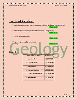
  • 1. Presentation of Geology-II Date:-12-13/06/2019 1 Group G Table of Content  Maps: Topographic map, Engineering Geological map, Geological map (definition). Topic No.01  Difference between Topographic and Engineering Geological map. Topic No.02  Uses of Topographic map. Topic No.03  Uses of Engineering Geological map. Topic No.04 Group G Members of Group G Roll Number 1. Lax man Karki JEC/074/041 2. Leeza Kunwar JEC/074/042 3. Kanchan Joshi JEC/074/039 4. Kamal Chaudhary JEC/074/038 5. Lalit Kumar Kushawa JEC/074/040 6. Kamal Khadka JEC/074/037
  • 2. Presentation of Geology-II Date:-12-13/06/2019 2 Group G Topic No: 01  Topographical Map A topographic map is a detailed and accurate two-dimensional representation of natural and human-made features on the Earth's surface. Mapping is a crucial part of earth science. Topographic maps represent the locations of major geological features. Topographic maps use a special type of line, called a contour line, to show different elevations on a map. Contour lines are drawn on a topographic map to show the location of hills, mountains and valleys. These maps are used for a number of applications, from camping, hunting, fishing, and hiking to urban planning, resource management, and surveying.  Engineering Geological Map A geologic map or geological map is a special-purpose map made to show geological features. Rock units or geologic strata are shown by color or symbols to indicate where they are exposed at the surface. Bedding planes and structural features such as faults, folds, foliations, and lineation are shown with strike and dip symbols which give these features three-dimensional orientations. Stratigraphic contour lines may be used to illustrate the surface of a selected stratum illustrating the subsurface topographic trends of the strata. Isopach maps detail the variations in thickness of stratigraphic units. It is not always possible to properly show this when the strata are extremely fractured, mixed, in some discontinuities, or where they are otherwise disturbed. 1. Rock A rock is any naturally occurring solid mass or aggregate of minerals or mineraloid matter. It is categorized by the minerals included, its chemical composition and the way in which it is formed. Rocks are usually grouped into three main groups:- a) Igneous rocks b) Metamorphic rocks and, c) Sedimentary rocks.
  • 3. Presentation of Geology-II Date:-12-13/06/2019 3 Group G Figure 1:-Photos of Upper Mustang
  • 4. Presentation of Geology-II Date:-12-13/06/2019 4 Group G 2. Bedding Planes Beds are the layers of sedimentary rocks that are distinctly different from overlying and underlying subsequent beds of different sedimentary rocks. Layers of beds are called stratigraphy or strata. They are formed from sedimentary rocks being deposited on the Earth's solid surface over a long periods of time. Figure:- Photos of Bedding Planes 3. Faults A fault is a crack or fracture in Earth's crust caused by the movement of landmasses, called plates, on either side of the fault line. Faults are found either at the surface (fault surface) or underground (fault plane). Most earthquakes occur along fault lines. The principle types of faults are: normal,
  • 5. Presentation of Geology-II Date:-12-13/06/2019 5 Group G reverse, thrust, and slip-strike. 4. Folds Folds occur when one or a stack of originally flat and planar surfaces, such as sedimentary strata, are bent or curved as a result of permanent deformation. Folds form under varied conditions of stress, hydrostatic pressure, pore pressure, and temperature gradient, as evidenced by their presence in soft sediments, the full spectrum of
  • 6. Presentation of Geology-II Date:-12-13/06/2019 6 Group G metamorphic rocks, and even as primary flow structures in some igneous rocks. 5. Foliations Foliation in geology refers to repetitive layering in metamorphic rocks. Each layer can be as thin as a sheet of paper, or over a meter in thickness. It is caused by shearing forces (pressures pushing different sections of the rock in different directions), or differential pressure (higher pressure from one
  • 7. Presentation of Geology-II Date:-12-13/06/2019 7 Group G direction than in others). 6. Lineation Lineation may be defined in a more precise way as any linear fabric element; it may be primary igneous or sedimentary structure or a secondary related to deformation. 7. Isopach Maps An isopach map illustrates thickness variations within a tabular unit, layer or stratum. Isopachs are contour lines of equal thickness over an area. Isopach maps are utilized in hydrographic survey, stratigraphy, sedimentology, structural geology, petroleum geology and volcanology. An isopach map is similar to an isochore map, but these terms actually describe different methods of displaying thickness variations within a
  • 8. Presentation of Geology-II Date:-12-13/06/2019 8 Group G layer.  Geological Maps A map on which is recorded geologic information, such as the distribution, nature, and age relationships of rock units (surficial deposits may or may not be mapped separately), and the occurrence of structural features (folds, faults, joints), mineral deposits, and fossil localities. It may indicate geologic structure by means of formationaloutcrop patterns, by conventional symbols giving the direction and amount of dip at certain points, or by structure-contour lines.
  • 9. Presentation of Geology-II Date:-12-13/06/2019 9 Group G Topic No.02  Difference between Topographic and Engineering Geological Map. Topographic maps reveal the shape of a landscape. Elevations indicate height above sea level. Contour intervals are the difference in elevation between two contour lines. Geologic maps show rock units and geologic features, like faults and folds. Topic No.03  Uses of Topographic map. A topographic map is a detailed and accurate two-dimensional representation of natural and human-made features on the Earth's surface. These maps are used for a number of applications, from camping, hunting, fishing, and hiking to urban planning, resource management, and surveying. Topic No.04  Uses of Engineering Geological map. Engineering Geologic maps represent the distribution of different types of rock and surficial deposits, as well as locations of geologic structures such as faults and folds. Geologic maps are the primary source of information for various aspects of land-use planning, including the siting of buildings and transportation systems.
  • 10. Presentation of Geology-II Date:-12-13/06/2019 10 Group G