SlideShare a Scribd company logo
1 of 24
Download to read offline
Практичне застосування ГІСПрактичне застосування ГІС
в НПП “Дворічанський”в НПП “Дворічанський”
Начальник віддіу науки, моніторингу
та еколого-освітньої роботи НПП
«Дворічанський»
Клетьонкін В.Г.
Використання технічного
обладнання
Для збору даних (місця зустрічі рідкісних тварин і рослин, облік тварин та
рослин на облікових ділянках, картування ареалів рослин ЧКУ,
маршрутів, факторів антропогенного впливу, порушень на території
парку (браконьєрство, пожежі, розорювання), проведення уточнення
меж заказників тощо), створення бази даних використовувався пристрій
HTC HD2. Даний мобільний пристрій використовувався також для
орієнтування на місцевості.
Для обробки зібраних даних, виготовлення картографічного матеріалу,
розробки маршрутів тощо використовувалась комп’ютерна техніка
надана в рамках програми „ГИС и заповедные территории”, на якій
встановлене програмне забезпечення ArcGIS. Крім вказаного ПО окремі
задачі вирішувались за допомогою QGIS, яке встановлено на інших
комп’ютерах. Для вивчення розповсюдження об’єктів використовуючи
різноманітні характеристики екологічної ніші застосовувалось ПО
MaxEnt, а детальна обробка моделей проводилась у ArcGIS та QGIS.
1. Картування гнізд хижих птахів і великих воронових на
території парку.
2. Моніторинг поширення навколоводних ссавців (бобер, видра,
американська норка) на р. Оскол і в заплавних водоймах.
3. Моніторинг розподілу сов по території парку.
5. Картування нір і моніторинг хижих ссавців (лисиця, борсук).
6. Картування місць зростання рідкісних видів рослин.
7. Виявлення засобами ГІС та ДДЗ місць, придатних для
реінтродукції на території парку вовче лико Софії.
8. Моніторинг поширення та чисельності рідкісних видів тварин.
9. Геоботанічне картування території парку.
10. Виявлення чинників, як природних, так і антропогенних, що
впливають на поширення та чисельність як окремих видів тварин і
рослин, так і їх угруповань.
11. Картування території парку та малих ПЗО району.
План роботи з використанням ГІС на
2015 рік
Знімання та
моніторинг території
Спільно зі
співробітником
компанії «Intetics»
Селіверстовим
О.Ю. в рамках
програми «ГІС і
ПЗФ» проведено
знімання ключової
моніторингової
ділянки НПП за
допомогою
безпілотного
літального
апарату з
подальшою
обробкою
матеріалу за
допомогою
інструментів ГІС.
Проведено картування ПЗО
Дворічанського району
Невідповідність площ ПЗО
51,7 га 94,5 га
Модельна ділянка
Спільно з науковцями ХНУ ім.В.Н.Каразіна розпочата робота, з використанням
ГІС, по дослідженню крейдяних відслонень та проведенню просторового
моніторингу рослинних угруповань, цінних і рідкісних видів тварин
Картування стаціонарних маршрутів
та облікових ділянок
Картування результатів науково-дослідної роботи на
постійних маршрутах та облікових ділянках
Проведення кількісних обліків птахів і тварин
Проведено картування розташування вокалізуючих
самців просянки (Emberiza calandra) в південній частині
Парку. Останніми роками відбувається розширення
ареалу виду і збільшення чисельності. Результати
картування будуть використані у подальшому як для
моделювання розповсюдження виду, так і для оцінки
чисельності на території Парку і Харківської області.
Проведена інвентаризація козулі (Capreolus
capreolus) на території парку та суміжних
територіях. Протяжність облікових маршрутів
склала 26,5 км, з яких по лісових угіддях
прокладено 8,8 км, по «переліскам» - 8,5 км, по
польовим угіддям - 9,2 км. При проведенні
обліків використовувалася метод весняного
обліку ратичних по дефекації (Основы
охотустройства УССР…, 1985, Шейгас и др.,
1991). При виявлення зимових дефекацій козулі
здійснювалась їх реєстрація за допомогою GPS-
навігатора, і запис результатів обліків для даної
облікового точки і опису відповідного біотопу.
Здійснюється моніторинг
рідкісних видів флори та
фауни національного
парку, його околиць та в
інших регіонах області та
країни. Ведеться робота
по створенню бази даних
рослин і тварин
Моніторинг ЧКУ видів тварин
Розповсюдження гадюки степової
у Харківській області
Розповсюдження візерункового
полозу у Донецькій області
Моніторинг ЧКУ видів тварин
Розповсюдження візерункового полоза в Україні
Моніторинг малих ПЗО району
Проведено картування території двох заказників
Дворічанського району з метою їх моніторингу
Моделювання екологічних ніш
візерункового полоза та гадюки степової
за біокліматичними показниками
Моделювання екологічних ніш
візерункового полоза та гадюки
степової на основі даних
багатозонального супутника
Природоохоронні рекомендації щодо випасу великої рогатої
худоби на заплавних ділянках НПП «Дворічанський»
Проведено аналіз антропічних чинників тиску на природні
комплекси НПП „Дворічанський”
Взято на облік розташування ділянок з
підгодівельними площами
та вежами ДП “Бірюк” в урочищі „Залівне”
Моніторинг пожеж на території
Парку
Ділянки самовільного видобутку крейди на території заказнику
«Колодязнянський»
Картування правопорушень на
території Парку
Здійснюється
виявлення
правопорушень
на території
Парку та їх
моніторинг.
ДЯКУЮ ЗА
УВАГУ!
Дякуємо за увагу!

More Related Content

Viewers also liked

Brusentsova n. gis-analysis spatial distribution poinly objects in the ecol...
Brusentsova n.   gis-analysis spatial distribution poinly objects in the ecol...Brusentsova n.   gis-analysis spatial distribution poinly objects in the ecol...
Brusentsova n. gis-analysis spatial distribution poinly objects in the ecol...Anton Biatov
 
Bezrodnova o.v. turboveg possibilities for data storage and processing of e...
Bezrodnova o.v.   turboveg possibilities for data storage and processing of e...Bezrodnova o.v.   turboveg possibilities for data storage and processing of e...
Bezrodnova o.v. turboveg possibilities for data storage and processing of e...Anton Biatov
 
Baryshnikov o. georeference maps of protected areas in arc gis and digitizi...
Baryshnikov o.   georeference maps of protected areas in arc gis and digitizi...Baryshnikov o.   georeference maps of protected areas in arc gis and digitizi...
Baryshnikov o. georeference maps of protected areas in arc gis and digitizi...Anton Biatov
 
Brusentsova n. gis in the work of slobozhanskiy national park
Brusentsova n.   gis in the work of slobozhanskiy national parkBrusentsova n.   gis in the work of slobozhanskiy national park
Brusentsova n. gis in the work of slobozhanskiy national parkAnton Biatov
 
Korotyeyeva a. the study of water quality of wetlands in slobozhansky natio...
Korotyeyeva a.   the study of water quality of wetlands in slobozhansky natio...Korotyeyeva a.   the study of water quality of wetlands in slobozhansky natio...
Korotyeyeva a. the study of water quality of wetlands in slobozhansky natio...Anton Biatov
 
Ovcharenko a., bodnia o. identification of landscapes by overlay gis analysis
Ovcharenko a., bodnia o.   identification of landscapes by overlay gis analysisOvcharenko a., bodnia o.   identification of landscapes by overlay gis analysis
Ovcharenko a., bodnia o. identification of landscapes by overlay gis analysisAnton Biatov
 
Kozyr m. use big data in the exploration zoning protected areas, gomylshans...
Kozyr m.   use big data in the exploration zoning protected areas, gomylshans...Kozyr m.   use big data in the exploration zoning protected areas, gomylshans...
Kozyr m. use big data in the exploration zoning protected areas, gomylshans...Anton Biatov
 
Pylypiuk a. Experience cavern mapping in podilski tovtry national park and ...
Pylypiuk a.   Experience cavern mapping in podilski tovtry national park and ...Pylypiuk a.   Experience cavern mapping in podilski tovtry national park and ...
Pylypiuk a. Experience cavern mapping in podilski tovtry national park and ...Anton Biatov
 
Sizo r. Society for conservation gis
Sizo r.   Society for conservation gisSizo r.   Society for conservation gis
Sizo r. Society for conservation gisAnton Biatov
 
Sizo r. Not a single landsat. to meet the sentinel
Sizo r.   Not a single landsat. to meet the sentinelSizo r.   Not a single landsat. to meet the sentinel
Sizo r. Not a single landsat. to meet the sentinelAnton Biatov
 
Khlyestkova a., bodnia o. exploration of not sanction recreation on the nat...
Khlyestkova a., bodnia o.   exploration of not sanction recreation on the nat...Khlyestkova a., bodnia o.   exploration of not sanction recreation on the nat...
Khlyestkova a., bodnia o. exploration of not sanction recreation on the nat...Anton Biatov
 
Olejnikov I. Тational park as an object of multi scale landscape mapping
Olejnikov I. Тational park as an object of multi scale landscape mappingOlejnikov I. Тational park as an object of multi scale landscape mapping
Olejnikov I. Тational park as an object of multi scale landscape mappingAnton Biatov
 
Bodnia O. The study of landscape structure national park Slobozhansky in the ...
Bodnia O. The study of landscape structure national park Slobozhansky in the ...Bodnia O. The study of landscape structure national park Slobozhansky in the ...
Bodnia O. The study of landscape structure national park Slobozhansky in the ...Anton Biatov
 
Sirenko I. Information analytical database - Chronicle of nature
Sirenko I. Information analytical database - Chronicle of natureSirenko I. Information analytical database - Chronicle of nature
Sirenko I. Information analytical database - Chronicle of natureAnton Biatov
 
Ponomareva A. Spatial distribution of wild boar (Sus scropha L.) in the natio...
Ponomareva A. Spatial distribution of wild boar (Sus scropha L.) in the natio...Ponomareva A. Spatial distribution of wild boar (Sus scropha L.) in the natio...
Ponomareva A. Spatial distribution of wild boar (Sus scropha L.) in the natio...Anton Biatov
 
Biatov A. The report about the results of work of the «ESRI Conservation Prog...
Biatov A. The report about the results of work of the «ESRI Conservation Prog...Biatov A. The report about the results of work of the «ESRI Conservation Prog...
Biatov A. The report about the results of work of the «ESRI Conservation Prog...Anton Biatov
 
Ovcharenko A. Landscape mapping for management of the national parks
Ovcharenko A. Landscape mapping for management of the national parksOvcharenko A. Landscape mapping for management of the national parks
Ovcharenko A. Landscape mapping for management of the national parksAnton Biatov
 
Yatsjuk I. Working with international online resources on biodiversity
Yatsjuk I. Working with international online resources on biodiversityYatsjuk I. Working with international online resources on biodiversity
Yatsjuk I. Working with international online resources on biodiversityAnton Biatov
 
Pasternak V. Using PTC Field Map for large-scale mapping of areas monitoring
Pasternak V. Using PTC Field Map for large-scale mapping of areas monitoringPasternak V. Using PTC Field Map for large-scale mapping of areas monitoring
Pasternak V. Using PTC Field Map for large-scale mapping of areas monitoringAnton Biatov
 
Ponomareva A. The habitats of European mink (Mustela lutreola) and the Americ...
Ponomareva A. The habitats of European mink (Mustela lutreola) and the Americ...Ponomareva A. The habitats of European mink (Mustela lutreola) and the Americ...
Ponomareva A. The habitats of European mink (Mustela lutreola) and the Americ...Anton Biatov
 

Viewers also liked (20)

Brusentsova n. gis-analysis spatial distribution poinly objects in the ecol...
Brusentsova n.   gis-analysis spatial distribution poinly objects in the ecol...Brusentsova n.   gis-analysis spatial distribution poinly objects in the ecol...
Brusentsova n. gis-analysis spatial distribution poinly objects in the ecol...
 
Bezrodnova o.v. turboveg possibilities for data storage and processing of e...
Bezrodnova o.v.   turboveg possibilities for data storage and processing of e...Bezrodnova o.v.   turboveg possibilities for data storage and processing of e...
Bezrodnova o.v. turboveg possibilities for data storage and processing of e...
 
Baryshnikov o. georeference maps of protected areas in arc gis and digitizi...
Baryshnikov o.   georeference maps of protected areas in arc gis and digitizi...Baryshnikov o.   georeference maps of protected areas in arc gis and digitizi...
Baryshnikov o. georeference maps of protected areas in arc gis and digitizi...
 
Brusentsova n. gis in the work of slobozhanskiy national park
Brusentsova n.   gis in the work of slobozhanskiy national parkBrusentsova n.   gis in the work of slobozhanskiy national park
Brusentsova n. gis in the work of slobozhanskiy national park
 
Korotyeyeva a. the study of water quality of wetlands in slobozhansky natio...
Korotyeyeva a.   the study of water quality of wetlands in slobozhansky natio...Korotyeyeva a.   the study of water quality of wetlands in slobozhansky natio...
Korotyeyeva a. the study of water quality of wetlands in slobozhansky natio...
 
Ovcharenko a., bodnia o. identification of landscapes by overlay gis analysis
Ovcharenko a., bodnia o.   identification of landscapes by overlay gis analysisOvcharenko a., bodnia o.   identification of landscapes by overlay gis analysis
Ovcharenko a., bodnia o. identification of landscapes by overlay gis analysis
 
Kozyr m. use big data in the exploration zoning protected areas, gomylshans...
Kozyr m.   use big data in the exploration zoning protected areas, gomylshans...Kozyr m.   use big data in the exploration zoning protected areas, gomylshans...
Kozyr m. use big data in the exploration zoning protected areas, gomylshans...
 
Pylypiuk a. Experience cavern mapping in podilski tovtry national park and ...
Pylypiuk a.   Experience cavern mapping in podilski tovtry national park and ...Pylypiuk a.   Experience cavern mapping in podilski tovtry national park and ...
Pylypiuk a. Experience cavern mapping in podilski tovtry national park and ...
 
Sizo r. Society for conservation gis
Sizo r.   Society for conservation gisSizo r.   Society for conservation gis
Sizo r. Society for conservation gis
 
Sizo r. Not a single landsat. to meet the sentinel
Sizo r.   Not a single landsat. to meet the sentinelSizo r.   Not a single landsat. to meet the sentinel
Sizo r. Not a single landsat. to meet the sentinel
 
Khlyestkova a., bodnia o. exploration of not sanction recreation on the nat...
Khlyestkova a., bodnia o.   exploration of not sanction recreation on the nat...Khlyestkova a., bodnia o.   exploration of not sanction recreation on the nat...
Khlyestkova a., bodnia o. exploration of not sanction recreation on the nat...
 
Olejnikov I. Тational park as an object of multi scale landscape mapping
Olejnikov I. Тational park as an object of multi scale landscape mappingOlejnikov I. Тational park as an object of multi scale landscape mapping
Olejnikov I. Тational park as an object of multi scale landscape mapping
 
Bodnia O. The study of landscape structure national park Slobozhansky in the ...
Bodnia O. The study of landscape structure national park Slobozhansky in the ...Bodnia O. The study of landscape structure national park Slobozhansky in the ...
Bodnia O. The study of landscape structure national park Slobozhansky in the ...
 
Sirenko I. Information analytical database - Chronicle of nature
Sirenko I. Information analytical database - Chronicle of natureSirenko I. Information analytical database - Chronicle of nature
Sirenko I. Information analytical database - Chronicle of nature
 
Ponomareva A. Spatial distribution of wild boar (Sus scropha L.) in the natio...
Ponomareva A. Spatial distribution of wild boar (Sus scropha L.) in the natio...Ponomareva A. Spatial distribution of wild boar (Sus scropha L.) in the natio...
Ponomareva A. Spatial distribution of wild boar (Sus scropha L.) in the natio...
 
Biatov A. The report about the results of work of the «ESRI Conservation Prog...
Biatov A. The report about the results of work of the «ESRI Conservation Prog...Biatov A. The report about the results of work of the «ESRI Conservation Prog...
Biatov A. The report about the results of work of the «ESRI Conservation Prog...
 
Ovcharenko A. Landscape mapping for management of the national parks
Ovcharenko A. Landscape mapping for management of the national parksOvcharenko A. Landscape mapping for management of the national parks
Ovcharenko A. Landscape mapping for management of the national parks
 
Yatsjuk I. Working with international online resources on biodiversity
Yatsjuk I. Working with international online resources on biodiversityYatsjuk I. Working with international online resources on biodiversity
Yatsjuk I. Working with international online resources on biodiversity
 
Pasternak V. Using PTC Field Map for large-scale mapping of areas monitoring
Pasternak V. Using PTC Field Map for large-scale mapping of areas monitoringPasternak V. Using PTC Field Map for large-scale mapping of areas monitoring
Pasternak V. Using PTC Field Map for large-scale mapping of areas monitoring
 
Ponomareva A. The habitats of European mink (Mustela lutreola) and the Americ...
Ponomareva A. The habitats of European mink (Mustela lutreola) and the Americ...Ponomareva A. The habitats of European mink (Mustela lutreola) and the Americ...
Ponomareva A. The habitats of European mink (Mustela lutreola) and the Americ...
 

More from Anton Biatov

Anton Biatov - How to effectively collect data for biologists
Anton Biatov - How to effectively collect data for biologistsAnton Biatov - How to effectively collect data for biologists
Anton Biatov - How to effectively collect data for biologistsAnton Biatov
 
Anton Biatov - GIS for fieldworker Biologists.
Anton Biatov - GIS for fieldworker Biologists. Anton Biatov - GIS for fieldworker Biologists.
Anton Biatov - GIS for fieldworker Biologists. Anton Biatov
 
University ITMO - the first non-classical university of Russia in the field o...
University ITMO - the first non-classical university of Russia in the field o...University ITMO - the first non-classical university of Russia in the field o...
University ITMO - the first non-classical university of Russia in the field o...Anton Biatov
 
Anton Biatov - Report about ArcGIS using by ESRI conservation program in GIS...
Anton Biatov - Report about ArcGIS using  by ESRI conservation program in GIS...Anton Biatov - Report about ArcGIS using  by ESRI conservation program in GIS...
Anton Biatov - Report about ArcGIS using by ESRI conservation program in GIS...Anton Biatov
 
Anton Biatov - Geocoding museum collection as basic tool for studying animal ...
Anton Biatov - Geocoding museum collection as basic tool for studying animal ...Anton Biatov - Geocoding museum collection as basic tool for studying animal ...
Anton Biatov - Geocoding museum collection as basic tool for studying animal ...Anton Biatov
 
Yuriy Strus An attempt to study the biotope distribution of black stork by ...
Yuriy Strus   An attempt to study the biotope distribution of black stork by ...Yuriy Strus   An attempt to study the biotope distribution of black stork by ...
Yuriy Strus An attempt to study the biotope distribution of black stork by ...Anton Biatov
 
Yuriy Protsenko Annual experience of using the GIS of the Pyriatynsky natio...
Yuriy Protsenko   Annual experience of using the GIS of the Pyriatynsky natio...Yuriy Protsenko   Annual experience of using the GIS of the Pyriatynsky natio...
Yuriy Protsenko Annual experience of using the GIS of the Pyriatynsky natio...Anton Biatov
 
Yevhen Skubak Use of GIS to map northern predators of mammals into the Svya...
Yevhen Skubak   Use of GIS to map northern predators of mammals into the Svya...Yevhen Skubak   Use of GIS to map northern predators of mammals into the Svya...
Yevhen Skubak Use of GIS to map northern predators of mammals into the Svya...Anton Biatov
 
Volodymyr Pasternak Application of GIS-technologies for research of forest ...
Volodymyr Pasternak   Application of GIS-technologies for research of forest ...Volodymyr Pasternak   Application of GIS-technologies for research of forest ...
Volodymyr Pasternak Application of GIS-technologies for research of forest ...Anton Biatov
 
Vasyl Korets The experience of using the geographic information system qgis...
Vasyl Korets   The experience of using the geographic information system qgis...Vasyl Korets   The experience of using the geographic information system qgis...
Vasyl Korets The experience of using the geographic information system qgis...Anton Biatov
 
Svetlana Vinokurova Visualization of time, web map of the dynamics of the r...
Svetlana Vinokurova   Visualization of time, web map of the dynamics of the r...Svetlana Vinokurova   Visualization of time, web map of the dynamics of the r...
Svetlana Vinokurova Visualization of time, web map of the dynamics of the r...Anton Biatov
 
Svetlana Vinokurova Assessment of the condition of reed associations in the...
Svetlana Vinokurova   Assessment of the condition of reed associations in the...Svetlana Vinokurova   Assessment of the condition of reed associations in the...
Svetlana Vinokurova Assessment of the condition of reed associations in the...Anton Biatov
 
Sergei Gorodilov Geocoding. What, why and how
Sergei Gorodilov   Geocoding. What, why and howSergei Gorodilov   Geocoding. What, why and how
Sergei Gorodilov Geocoding. What, why and howAnton Biatov
 
Roman Sizo Society for conservation gis - ua
Roman Sizo   Society for conservation gis - uaRoman Sizo   Society for conservation gis - ua
Roman Sizo Society for conservation gis - uaAnton Biatov
 
Roman Sizo open software and data - history, license types, beer
Roman Sizo   open software and data - history, license types, beerRoman Sizo   open software and data - history, license types, beer
Roman Sizo open software and data - history, license types, beerAnton Biatov
 
Oleg Prilutsky Experience in organizing distributed data collection for mus...
Oleg Prilutsky   Experience in organizing distributed data collection for mus...Oleg Prilutsky   Experience in organizing distributed data collection for mus...
Oleg Prilutsky Experience in organizing distributed data collection for mus...Anton Biatov
 
Natalia Kasyanova Development of gis-project of Dvorichansky national park ...
Natalia Kasyanova   Development of gis-project of Dvorichansky national park ...Natalia Kasyanova   Development of gis-project of Dvorichansky national park ...
Natalia Kasyanova Development of gis-project of Dvorichansky national park ...Anton Biatov
 
Natalia Brusentsova Cerviformes seu artiodactyla monitoring organization in...
Natalia Brusentsova   Cerviformes seu artiodactyla monitoring organization in...Natalia Brusentsova   Cerviformes seu artiodactyla monitoring organization in...
Natalia Brusentsova Cerviformes seu artiodactyla monitoring organization in...Anton Biatov
 
Natalia Atamas Using a meteorological sounding balloon with a video camera ...
Natalia Atamas   Using a meteorological sounding balloon with a video camera ...Natalia Atamas   Using a meteorological sounding balloon with a video camera ...
Natalia Atamas Using a meteorological sounding balloon with a video camera ...Anton Biatov
 
Mykola Kozyr Git Hub and GIS from user to developer
Mykola Kozyr   Git Hub and GIS from user to developerMykola Kozyr   Git Hub and GIS from user to developer
Mykola Kozyr Git Hub and GIS from user to developerAnton Biatov
 

More from Anton Biatov (20)

Anton Biatov - How to effectively collect data for biologists
Anton Biatov - How to effectively collect data for biologistsAnton Biatov - How to effectively collect data for biologists
Anton Biatov - How to effectively collect data for biologists
 
Anton Biatov - GIS for fieldworker Biologists.
Anton Biatov - GIS for fieldworker Biologists. Anton Biatov - GIS for fieldworker Biologists.
Anton Biatov - GIS for fieldworker Biologists.
 
University ITMO - the first non-classical university of Russia in the field o...
University ITMO - the first non-classical university of Russia in the field o...University ITMO - the first non-classical university of Russia in the field o...
University ITMO - the first non-classical university of Russia in the field o...
 
Anton Biatov - Report about ArcGIS using by ESRI conservation program in GIS...
Anton Biatov - Report about ArcGIS using  by ESRI conservation program in GIS...Anton Biatov - Report about ArcGIS using  by ESRI conservation program in GIS...
Anton Biatov - Report about ArcGIS using by ESRI conservation program in GIS...
 
Anton Biatov - Geocoding museum collection as basic tool for studying animal ...
Anton Biatov - Geocoding museum collection as basic tool for studying animal ...Anton Biatov - Geocoding museum collection as basic tool for studying animal ...
Anton Biatov - Geocoding museum collection as basic tool for studying animal ...
 
Yuriy Strus An attempt to study the biotope distribution of black stork by ...
Yuriy Strus   An attempt to study the biotope distribution of black stork by ...Yuriy Strus   An attempt to study the biotope distribution of black stork by ...
Yuriy Strus An attempt to study the biotope distribution of black stork by ...
 
Yuriy Protsenko Annual experience of using the GIS of the Pyriatynsky natio...
Yuriy Protsenko   Annual experience of using the GIS of the Pyriatynsky natio...Yuriy Protsenko   Annual experience of using the GIS of the Pyriatynsky natio...
Yuriy Protsenko Annual experience of using the GIS of the Pyriatynsky natio...
 
Yevhen Skubak Use of GIS to map northern predators of mammals into the Svya...
Yevhen Skubak   Use of GIS to map northern predators of mammals into the Svya...Yevhen Skubak   Use of GIS to map northern predators of mammals into the Svya...
Yevhen Skubak Use of GIS to map northern predators of mammals into the Svya...
 
Volodymyr Pasternak Application of GIS-technologies for research of forest ...
Volodymyr Pasternak   Application of GIS-technologies for research of forest ...Volodymyr Pasternak   Application of GIS-technologies for research of forest ...
Volodymyr Pasternak Application of GIS-technologies for research of forest ...
 
Vasyl Korets The experience of using the geographic information system qgis...
Vasyl Korets   The experience of using the geographic information system qgis...Vasyl Korets   The experience of using the geographic information system qgis...
Vasyl Korets The experience of using the geographic information system qgis...
 
Svetlana Vinokurova Visualization of time, web map of the dynamics of the r...
Svetlana Vinokurova   Visualization of time, web map of the dynamics of the r...Svetlana Vinokurova   Visualization of time, web map of the dynamics of the r...
Svetlana Vinokurova Visualization of time, web map of the dynamics of the r...
 
Svetlana Vinokurova Assessment of the condition of reed associations in the...
Svetlana Vinokurova   Assessment of the condition of reed associations in the...Svetlana Vinokurova   Assessment of the condition of reed associations in the...
Svetlana Vinokurova Assessment of the condition of reed associations in the...
 
Sergei Gorodilov Geocoding. What, why and how
Sergei Gorodilov   Geocoding. What, why and howSergei Gorodilov   Geocoding. What, why and how
Sergei Gorodilov Geocoding. What, why and how
 
Roman Sizo Society for conservation gis - ua
Roman Sizo   Society for conservation gis - uaRoman Sizo   Society for conservation gis - ua
Roman Sizo Society for conservation gis - ua
 
Roman Sizo open software and data - history, license types, beer
Roman Sizo   open software and data - history, license types, beerRoman Sizo   open software and data - history, license types, beer
Roman Sizo open software and data - history, license types, beer
 
Oleg Prilutsky Experience in organizing distributed data collection for mus...
Oleg Prilutsky   Experience in organizing distributed data collection for mus...Oleg Prilutsky   Experience in organizing distributed data collection for mus...
Oleg Prilutsky Experience in organizing distributed data collection for mus...
 
Natalia Kasyanova Development of gis-project of Dvorichansky national park ...
Natalia Kasyanova   Development of gis-project of Dvorichansky national park ...Natalia Kasyanova   Development of gis-project of Dvorichansky national park ...
Natalia Kasyanova Development of gis-project of Dvorichansky national park ...
 
Natalia Brusentsova Cerviformes seu artiodactyla monitoring organization in...
Natalia Brusentsova   Cerviformes seu artiodactyla monitoring organization in...Natalia Brusentsova   Cerviformes seu artiodactyla monitoring organization in...
Natalia Brusentsova Cerviformes seu artiodactyla monitoring organization in...
 
Natalia Atamas Using a meteorological sounding balloon with a video camera ...
Natalia Atamas   Using a meteorological sounding balloon with a video camera ...Natalia Atamas   Using a meteorological sounding balloon with a video camera ...
Natalia Atamas Using a meteorological sounding balloon with a video camera ...
 
Mykola Kozyr Git Hub and GIS from user to developer
Mykola Kozyr   Git Hub and GIS from user to developerMykola Kozyr   Git Hub and GIS from user to developer
Mykola Kozyr Git Hub and GIS from user to developer
 

Kletenkyn v. practical application of gis in dvurechansky national park

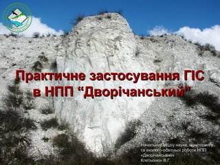
  • 1. Практичне застосування ГІСПрактичне застосування ГІС в НПП “Дворічанський”в НПП “Дворічанський” Начальник віддіу науки, моніторингу та еколого-освітньої роботи НПП «Дворічанський» Клетьонкін В.Г.
  • 2. Використання технічного обладнання Для збору даних (місця зустрічі рідкісних тварин і рослин, облік тварин та рослин на облікових ділянках, картування ареалів рослин ЧКУ, маршрутів, факторів антропогенного впливу, порушень на території парку (браконьєрство, пожежі, розорювання), проведення уточнення меж заказників тощо), створення бази даних використовувався пристрій HTC HD2. Даний мобільний пристрій використовувався також для орієнтування на місцевості. Для обробки зібраних даних, виготовлення картографічного матеріалу, розробки маршрутів тощо використовувалась комп’ютерна техніка надана в рамках програми „ГИС и заповедные территории”, на якій встановлене програмне забезпечення ArcGIS. Крім вказаного ПО окремі задачі вирішувались за допомогою QGIS, яке встановлено на інших комп’ютерах. Для вивчення розповсюдження об’єктів використовуючи різноманітні характеристики екологічної ніші застосовувалось ПО MaxEnt, а детальна обробка моделей проводилась у ArcGIS та QGIS.
  • 3. 1. Картування гнізд хижих птахів і великих воронових на території парку. 2. Моніторинг поширення навколоводних ссавців (бобер, видра, американська норка) на р. Оскол і в заплавних водоймах. 3. Моніторинг розподілу сов по території парку. 5. Картування нір і моніторинг хижих ссавців (лисиця, борсук). 6. Картування місць зростання рідкісних видів рослин. 7. Виявлення засобами ГІС та ДДЗ місць, придатних для реінтродукції на території парку вовче лико Софії. 8. Моніторинг поширення та чисельності рідкісних видів тварин. 9. Геоботанічне картування території парку. 10. Виявлення чинників, як природних, так і антропогенних, що впливають на поширення та чисельність як окремих видів тварин і рослин, так і їх угруповань. 11. Картування території парку та малих ПЗО району. План роботи з використанням ГІС на 2015 рік
  • 4. Знімання та моніторинг території Спільно зі співробітником компанії «Intetics» Селіверстовим О.Ю. в рамках програми «ГІС і ПЗФ» проведено знімання ключової моніторингової ділянки НПП за допомогою безпілотного літального апарату з подальшою обробкою матеріалу за допомогою інструментів ГІС.
  • 7. Модельна ділянка Спільно з науковцями ХНУ ім.В.Н.Каразіна розпочата робота, з використанням ГІС, по дослідженню крейдяних відслонень та проведенню просторового моніторингу рослинних угруповань, цінних і рідкісних видів тварин
  • 8.
  • 10. Картування результатів науково-дослідної роботи на постійних маршрутах та облікових ділянках
  • 11. Проведення кількісних обліків птахів і тварин Проведено картування розташування вокалізуючих самців просянки (Emberiza calandra) в південній частині Парку. Останніми роками відбувається розширення ареалу виду і збільшення чисельності. Результати картування будуть використані у подальшому як для моделювання розповсюдження виду, так і для оцінки чисельності на території Парку і Харківської області. Проведена інвентаризація козулі (Capreolus capreolus) на території парку та суміжних територіях. Протяжність облікових маршрутів склала 26,5 км, з яких по лісових угіддях прокладено 8,8 км, по «переліскам» - 8,5 км, по польовим угіддям - 9,2 км. При проведенні обліків використовувалася метод весняного обліку ратичних по дефекації (Основы охотустройства УССР…, 1985, Шейгас и др., 1991). При виявлення зимових дефекацій козулі здійснювалась їх реєстрація за допомогою GPS- навігатора, і запис результатів обліків для даної облікового точки і опису відповідного біотопу.
  • 12. Здійснюється моніторинг рідкісних видів флори та фауни національного парку, його околиць та в інших регіонах області та країни. Ведеться робота по створенню бази даних рослин і тварин
  • 13. Моніторинг ЧКУ видів тварин Розповсюдження гадюки степової у Харківській області Розповсюдження візерункового полозу у Донецькій області
  • 14. Моніторинг ЧКУ видів тварин Розповсюдження візерункового полоза в Україні
  • 15. Моніторинг малих ПЗО району Проведено картування території двох заказників Дворічанського району з метою їх моніторингу
  • 16. Моделювання екологічних ніш Моделювання екологічних ніш візерункового полоза та гадюки степової за біокліматичними показниками
  • 17. Моделювання екологічних ніш Моделювання екологічних ніш візерункового полоза та гадюки степової на основі даних багатозонального супутника
  • 18. Природоохоронні рекомендації щодо випасу великої рогатої худоби на заплавних ділянках НПП «Дворічанський»
  • 19. Проведено аналіз антропічних чинників тиску на природні комплекси НПП „Дворічанський”
  • 20. Взято на облік розташування ділянок з підгодівельними площами та вежами ДП “Бірюк” в урочищі „Залівне”
  • 21. Моніторинг пожеж на території Парку
  • 22. Ділянки самовільного видобутку крейди на території заказнику «Колодязнянський»
  • 23. Картування правопорушень на території Парку Здійснюється виявлення правопорушень на території Парку та їх моніторинг.