SlideShare a Scribd company logo
1 of 19
Download to read offline
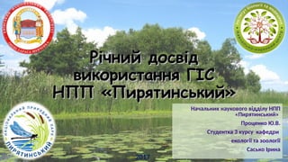
Рiчний досвідРiчний досвід
використання ГІСвикористання ГІС
НПП «Пирятинський»НПП «Пирятинський»
Начальник наукового відділу НПП
«Пирятинський»
Проценко Ю.В.
Студентка 3 курсу кафедри
екології та зоології
Сасько Ірина
2017
ВикористанняВикористання
соціальної мережісоціальної мережі
«ВКонтакте» у вивченні«ВКонтакте» у вивченні
функціонуванняфункціонування
НПП «Пирятинський»НПП «Пирятинський»
Виконала: студентка 3 курсу
кафедри екології та зоології
ННЦ «Інститут біології та медицини»
КНУ ім. Т. Г. Шевченка
Сасько І.С.
Науковий керівник: Проценко Ю.В.
2017
3Сасько Ірина
Основа роботи
Козир М.М
ВикористанняВикористання
соціальної мережісоціальної мережі
«ВКонтакте» у«ВКонтакте» у
вивченнівивченні
функціонуванняфункціонування
НППНПП
«Пирятинський»«Пирятинський»
!!!!!!«5.12. … Розміщуючи інформацію на персональній сторінці, у тому числі
свої персональні дані, користувач усвідомлює і погоджується з тим, що
зазначена інформація може бути доступна іншим користувачам мережі
Інтернет з урахуванням особливостей архітектури та функціоналу
сайту.» 4
Мета та завдання
МетаМета: використання відкритих даних соціальної
мережі «ВКонтакте» для оцінки рекреаційної
структури НПП «Пирятинський».
Завдання:Завдання:
отримати дані з мережі «Вконтакте»;
на їх основі побудувати карту відвідуваності парку;
порівняти точки відвідування з розташування
рекреаційних пунктів, туристичних та
екопросвітницьких маршрутів, функціональним
зонуванням.
5
Матеріали та методи досліджень
Козир М.М., інженер
НДС "Регіональних проблем
економіки і політики"
географічного факультету
КНУ імені Тараса Шевченка
Приклад представлення отриманих
даних
Використані програми:Використані програми:
•Microsoft Excel 2016
•програми Парсера
•QGIS
Загалом було опрацьовано 36863686
фотографії від 15671567 користувачів
соціальної мережі «ВКонтакте». 6
Поява фотографій з географічною прив’язкою
7
Публікація фотографій з географічною прив'язкою
на території НПП «Пирятинський»
8
Природні обПриродні об’’єкти таєкти та
історичні памісторичні пам’’яткиятки
НПП «Пирятинський»НПП «Пирятинський»
9
Природні обПриродні об’’єкти таєкти та
історичні памісторичні пам’’яткиятки
НПП «Пирятинський»НПП «Пирятинський»
10
Рекреаційні пунктиРекреаційні пункти
НПП «Пирятинський»НПП «Пирятинський»
11
Екологічні стежкиЕкологічні стежки
та екотуристичніта екотуристичні
маршрути НППмаршрути НПП
«Пирятинський»«Пирятинський»
12
ФункціональнеФункціональне
зонування НППзонування НПП
«Пирятинський»«Пирятинський»
13
Висновки
1. Розроблені рекомендації для відділу рекреації та
екоосвіти.
Але…….
14
Нюанси робити…
15
Частина 2
16
Відмітка встановлених гнізд
(джмелівникі та штучні гнізда)
Малювання треків та полігонів
Точки
17
Але…
Перенос точок із GPS
Трекі
18
19

More Related Content

Viewers also liked

Yuriy Strus An attempt to study the biotope distribution of black stork by ...
Yuriy Strus   An attempt to study the biotope distribution of black stork by ...Yuriy Strus   An attempt to study the biotope distribution of black stork by ...
Yuriy Strus An attempt to study the biotope distribution of black stork by ...Anton Biatov
 
Vasyl Korets The experience of using the geographic information system qgis...
Vasyl Korets   The experience of using the geographic information system qgis...Vasyl Korets   The experience of using the geographic information system qgis...
Vasyl Korets The experience of using the geographic information system qgis...Anton Biatov
 
Natalia Kasyanova Development of gis-project of Dvorichansky national park ...
Natalia Kasyanova   Development of gis-project of Dvorichansky national park ...Natalia Kasyanova   Development of gis-project of Dvorichansky national park ...
Natalia Kasyanova Development of gis-project of Dvorichansky national park ...Anton Biatov
 
Natalia Atamas Using a meteorological sounding balloon with a video camera ...
Natalia Atamas   Using a meteorological sounding balloon with a video camera ...Natalia Atamas   Using a meteorological sounding balloon with a video camera ...
Natalia Atamas Using a meteorological sounding balloon with a video camera ...Anton Biatov
 
Dmitry Lyashenko Geoinformation environmental mapping in Ukraine
Dmitry Lyashenko   Geoinformation environmental mapping in UkraineDmitry Lyashenko   Geoinformation environmental mapping in Ukraine
Dmitry Lyashenko Geoinformation environmental mapping in UkraineAnton Biatov
 
Natalia Brusentsova Cerviformes seu artiodactyla monitoring organization in...
Natalia Brusentsova   Cerviformes seu artiodactyla monitoring organization in...Natalia Brusentsova   Cerviformes seu artiodactyla monitoring organization in...
Natalia Brusentsova Cerviformes seu artiodactyla monitoring organization in...Anton Biatov
 
Oleg Prilutsky Experience in organizing distributed data collection for mus...
Oleg Prilutsky   Experience in organizing distributed data collection for mus...Oleg Prilutsky   Experience in organizing distributed data collection for mus...
Oleg Prilutsky Experience in organizing distributed data collection for mus...Anton Biatov
 
Egor Yatsjuk Experience in collecting and organizing data using next gis an...
Egor Yatsjuk   Experience in collecting and organizing data using next gis an...Egor Yatsjuk   Experience in collecting and organizing data using next gis an...
Egor Yatsjuk Experience in collecting and organizing data using next gis an...Anton Biatov
 
Anton Biatov the experience of using ua vs for surveying the natural areas ...
Anton Biatov   the experience of using ua vs for surveying the natural areas ...Anton Biatov   the experience of using ua vs for surveying the natural areas ...
Anton Biatov the experience of using ua vs for surveying the natural areas ...Anton Biatov
 
Galina Guz Web-database biodiversity of lugansk nature reserve in literary ...
Galina Guz   Web-database biodiversity of lugansk nature reserve in literary ...Galina Guz   Web-database biodiversity of lugansk nature reserve in literary ...
Galina Guz Web-database biodiversity of lugansk nature reserve in literary ...Anton Biatov
 
Roman Sizo open software and data - history, license types, beer
Roman Sizo   open software and data - history, license types, beerRoman Sizo   open software and data - history, license types, beer
Roman Sizo open software and data - history, license types, beerAnton Biatov
 
Ivan Oliynikov Using data of multiscale mapping to analyze the development ...
Ivan Oliynikov   Using data of multiscale mapping to analyze the development ...Ivan Oliynikov   Using data of multiscale mapping to analyze the development ...
Ivan Oliynikov Using data of multiscale mapping to analyze the development ...Anton Biatov
 
Svetlana Vinokurova Assessment of the condition of reed associations in the...
Svetlana Vinokurova   Assessment of the condition of reed associations in the...Svetlana Vinokurova   Assessment of the condition of reed associations in the...
Svetlana Vinokurova Assessment of the condition of reed associations in the...Anton Biatov
 
Dmitry Dyadin the experience of using mobile gis applications for urban env...
Dmitry Dyadin   the experience of using mobile gis applications for urban env...Dmitry Dyadin   the experience of using mobile gis applications for urban env...
Dmitry Dyadin the experience of using mobile gis applications for urban env...Anton Biatov
 
Yevhen Skubak Use of GIS to map northern predators of mammals into the Svya...
Yevhen Skubak   Use of GIS to map northern predators of mammals into the Svya...Yevhen Skubak   Use of GIS to map northern predators of mammals into the Svya...
Yevhen Skubak Use of GIS to map northern predators of mammals into the Svya...Anton Biatov
 
Volodymyr Pasternak Application of GIS-technologies for research of forest ...
Volodymyr Pasternak   Application of GIS-technologies for research of forest ...Volodymyr Pasternak   Application of GIS-technologies for research of forest ...
Volodymyr Pasternak Application of GIS-technologies for research of forest ...Anton Biatov
 
Irina Yakovleva Prospects for using modern technologies and adaptations in ...
Irina Yakovleva   Prospects for using modern technologies and adaptations in ...Irina Yakovleva   Prospects for using modern technologies and adaptations in ...
Irina Yakovleva Prospects for using modern technologies and adaptations in ...Anton Biatov
 
Roman Sizo Society for conservation gis - ua
Roman Sizo   Society for conservation gis - uaRoman Sizo   Society for conservation gis - ua
Roman Sizo Society for conservation gis - uaAnton Biatov
 
Svetlana Vinokurova Visualization of time, web map of the dynamics of the r...
Svetlana Vinokurova   Visualization of time, web map of the dynamics of the r...Svetlana Vinokurova   Visualization of time, web map of the dynamics of the r...
Svetlana Vinokurova Visualization of time, web map of the dynamics of the r...Anton Biatov
 
Mykola Kozyr Git Hub and GIS from user to developer
Mykola Kozyr   Git Hub and GIS from user to developerMykola Kozyr   Git Hub and GIS from user to developer
Mykola Kozyr Git Hub and GIS from user to developerAnton Biatov
 

Viewers also liked (20)

Yuriy Strus An attempt to study the biotope distribution of black stork by ...
Yuriy Strus   An attempt to study the biotope distribution of black stork by ...Yuriy Strus   An attempt to study the biotope distribution of black stork by ...
Yuriy Strus An attempt to study the biotope distribution of black stork by ...
 
Vasyl Korets The experience of using the geographic information system qgis...
Vasyl Korets   The experience of using the geographic information system qgis...Vasyl Korets   The experience of using the geographic information system qgis...
Vasyl Korets The experience of using the geographic information system qgis...
 
Natalia Kasyanova Development of gis-project of Dvorichansky national park ...
Natalia Kasyanova   Development of gis-project of Dvorichansky national park ...Natalia Kasyanova   Development of gis-project of Dvorichansky national park ...
Natalia Kasyanova Development of gis-project of Dvorichansky national park ...
 
Natalia Atamas Using a meteorological sounding balloon with a video camera ...
Natalia Atamas   Using a meteorological sounding balloon with a video camera ...Natalia Atamas   Using a meteorological sounding balloon with a video camera ...
Natalia Atamas Using a meteorological sounding balloon with a video camera ...
 
Dmitry Lyashenko Geoinformation environmental mapping in Ukraine
Dmitry Lyashenko   Geoinformation environmental mapping in UkraineDmitry Lyashenko   Geoinformation environmental mapping in Ukraine
Dmitry Lyashenko Geoinformation environmental mapping in Ukraine
 
Natalia Brusentsova Cerviformes seu artiodactyla monitoring organization in...
Natalia Brusentsova   Cerviformes seu artiodactyla monitoring organization in...Natalia Brusentsova   Cerviformes seu artiodactyla monitoring organization in...
Natalia Brusentsova Cerviformes seu artiodactyla monitoring organization in...
 
Oleg Prilutsky Experience in organizing distributed data collection for mus...
Oleg Prilutsky   Experience in organizing distributed data collection for mus...Oleg Prilutsky   Experience in organizing distributed data collection for mus...
Oleg Prilutsky Experience in organizing distributed data collection for mus...
 
Egor Yatsjuk Experience in collecting and organizing data using next gis an...
Egor Yatsjuk   Experience in collecting and organizing data using next gis an...Egor Yatsjuk   Experience in collecting and organizing data using next gis an...
Egor Yatsjuk Experience in collecting and organizing data using next gis an...
 
Anton Biatov the experience of using ua vs for surveying the natural areas ...
Anton Biatov   the experience of using ua vs for surveying the natural areas ...Anton Biatov   the experience of using ua vs for surveying the natural areas ...
Anton Biatov the experience of using ua vs for surveying the natural areas ...
 
Galina Guz Web-database biodiversity of lugansk nature reserve in literary ...
Galina Guz   Web-database biodiversity of lugansk nature reserve in literary ...Galina Guz   Web-database biodiversity of lugansk nature reserve in literary ...
Galina Guz Web-database biodiversity of lugansk nature reserve in literary ...
 
Roman Sizo open software and data - history, license types, beer
Roman Sizo   open software and data - history, license types, beerRoman Sizo   open software and data - history, license types, beer
Roman Sizo open software and data - history, license types, beer
 
Ivan Oliynikov Using data of multiscale mapping to analyze the development ...
Ivan Oliynikov   Using data of multiscale mapping to analyze the development ...Ivan Oliynikov   Using data of multiscale mapping to analyze the development ...
Ivan Oliynikov Using data of multiscale mapping to analyze the development ...
 
Svetlana Vinokurova Assessment of the condition of reed associations in the...
Svetlana Vinokurova   Assessment of the condition of reed associations in the...Svetlana Vinokurova   Assessment of the condition of reed associations in the...
Svetlana Vinokurova Assessment of the condition of reed associations in the...
 
Dmitry Dyadin the experience of using mobile gis applications for urban env...
Dmitry Dyadin   the experience of using mobile gis applications for urban env...Dmitry Dyadin   the experience of using mobile gis applications for urban env...
Dmitry Dyadin the experience of using mobile gis applications for urban env...
 
Yevhen Skubak Use of GIS to map northern predators of mammals into the Svya...
Yevhen Skubak   Use of GIS to map northern predators of mammals into the Svya...Yevhen Skubak   Use of GIS to map northern predators of mammals into the Svya...
Yevhen Skubak Use of GIS to map northern predators of mammals into the Svya...
 
Volodymyr Pasternak Application of GIS-technologies for research of forest ...
Volodymyr Pasternak   Application of GIS-technologies for research of forest ...Volodymyr Pasternak   Application of GIS-technologies for research of forest ...
Volodymyr Pasternak Application of GIS-technologies for research of forest ...
 
Irina Yakovleva Prospects for using modern technologies and adaptations in ...
Irina Yakovleva   Prospects for using modern technologies and adaptations in ...Irina Yakovleva   Prospects for using modern technologies and adaptations in ...
Irina Yakovleva Prospects for using modern technologies and adaptations in ...
 
Roman Sizo Society for conservation gis - ua
Roman Sizo   Society for conservation gis - uaRoman Sizo   Society for conservation gis - ua
Roman Sizo Society for conservation gis - ua
 
Svetlana Vinokurova Visualization of time, web map of the dynamics of the r...
Svetlana Vinokurova   Visualization of time, web map of the dynamics of the r...Svetlana Vinokurova   Visualization of time, web map of the dynamics of the r...
Svetlana Vinokurova Visualization of time, web map of the dynamics of the r...
 
Mykola Kozyr Git Hub and GIS from user to developer
Mykola Kozyr   Git Hub and GIS from user to developerMykola Kozyr   Git Hub and GIS from user to developer
Mykola Kozyr Git Hub and GIS from user to developer
 

More from Anton Biatov

Anton Biatov - How to effectively collect data for biologists
Anton Biatov - How to effectively collect data for biologistsAnton Biatov - How to effectively collect data for biologists
Anton Biatov - How to effectively collect data for biologistsAnton Biatov
 
Anton Biatov - GIS for fieldworker Biologists.
Anton Biatov - GIS for fieldworker Biologists. Anton Biatov - GIS for fieldworker Biologists.
Anton Biatov - GIS for fieldworker Biologists. Anton Biatov
 
University ITMO - the first non-classical university of Russia in the field o...
University ITMO - the first non-classical university of Russia in the field o...University ITMO - the first non-classical university of Russia in the field o...
University ITMO - the first non-classical university of Russia in the field o...Anton Biatov
 
Anton Biatov - Report about ArcGIS using by ESRI conservation program in GIS...
Anton Biatov - Report about ArcGIS using  by ESRI conservation program in GIS...Anton Biatov - Report about ArcGIS using  by ESRI conservation program in GIS...
Anton Biatov - Report about ArcGIS using by ESRI conservation program in GIS...Anton Biatov
 
Anton Biatov - Geocoding museum collection as basic tool for studying animal ...
Anton Biatov - Geocoding museum collection as basic tool for studying animal ...Anton Biatov - Geocoding museum collection as basic tool for studying animal ...
Anton Biatov - Geocoding museum collection as basic tool for studying animal ...Anton Biatov
 
Sergei Gorodilov Geocoding. What, why and how
Sergei Gorodilov   Geocoding. What, why and howSergei Gorodilov   Geocoding. What, why and how
Sergei Gorodilov Geocoding. What, why and howAnton Biatov
 
Alina Ovcharenko Mapping the territory of Slobozhansky national park for la...
Alina Ovcharenko   Mapping the territory of Slobozhansky national park for la...Alina Ovcharenko   Mapping the territory of Slobozhansky national park for la...
Alina Ovcharenko Mapping the territory of Slobozhansky national park for la...Anton Biatov
 
Sizo r. Society for conservation gis
Sizo r.   Society for conservation gisSizo r.   Society for conservation gis
Sizo r. Society for conservation gisAnton Biatov
 

More from Anton Biatov (8)

Anton Biatov - How to effectively collect data for biologists
Anton Biatov - How to effectively collect data for biologistsAnton Biatov - How to effectively collect data for biologists
Anton Biatov - How to effectively collect data for biologists
 
Anton Biatov - GIS for fieldworker Biologists.
Anton Biatov - GIS for fieldworker Biologists. Anton Biatov - GIS for fieldworker Biologists.
Anton Biatov - GIS for fieldworker Biologists.
 
University ITMO - the first non-classical university of Russia in the field o...
University ITMO - the first non-classical university of Russia in the field o...University ITMO - the first non-classical university of Russia in the field o...
University ITMO - the first non-classical university of Russia in the field o...
 
Anton Biatov - Report about ArcGIS using by ESRI conservation program in GIS...
Anton Biatov - Report about ArcGIS using  by ESRI conservation program in GIS...Anton Biatov - Report about ArcGIS using  by ESRI conservation program in GIS...
Anton Biatov - Report about ArcGIS using by ESRI conservation program in GIS...
 
Anton Biatov - Geocoding museum collection as basic tool for studying animal ...
Anton Biatov - Geocoding museum collection as basic tool for studying animal ...Anton Biatov - Geocoding museum collection as basic tool for studying animal ...
Anton Biatov - Geocoding museum collection as basic tool for studying animal ...
 
Sergei Gorodilov Geocoding. What, why and how
Sergei Gorodilov   Geocoding. What, why and howSergei Gorodilov   Geocoding. What, why and how
Sergei Gorodilov Geocoding. What, why and how
 
Alina Ovcharenko Mapping the territory of Slobozhansky national park for la...
Alina Ovcharenko   Mapping the territory of Slobozhansky national park for la...Alina Ovcharenko   Mapping the territory of Slobozhansky national park for la...
Alina Ovcharenko Mapping the territory of Slobozhansky national park for la...
 
Sizo r. Society for conservation gis
Sizo r.   Society for conservation gisSizo r.   Society for conservation gis
Sizo r. Society for conservation gis
 

Yuriy Protsenko Annual experience of using the GIS of the Pyriatynsky national park