Submit Search
Upload
Svetlana Vinokurova Visualization of time, web map of the dynamics of the red book wader species
•
0 likes
•
1,062 views
Anton Biatov
Follow
Презентация с семинара "ГИС и заповедные территории - 2017" http://pzf.gis.kh.ua
Read less
Read more
Environment
Report
Share
Report
Share
1 of 10
Download now
Download to read offline
Recommended
красноярск
красноярск
GalleryMedia
Seliverstov O. GIS support for protected areas
Anton Biatov
Oleg Prilutsky Experience in organizing distributed data collection for mus...
Anton Biatov
Anton Biatov Vegetation indices (general concepts)
Anton Biatov
Alina Ovcharenko Mapping the territory of Slobozhansky national park for la...
Anton Biatov
Roman Sizo open software and data - history, license types, beer
Anton Biatov
Vladimir Kletenkin Practical use of GIS in the Dvurechansky national park i...
Anton Biatov
Sergei Gorodilov Geocoding. What, why and how
Anton Biatov
Roman Sizo Society for conservation gis - ua
Anton Biatov
Dmitry Dyadin the experience of using mobile gis applications for urban env...
Anton Biatov
Ivan Oliynikov Using data of multiscale mapping to analyze the development ...
Anton Biatov
Yevhen Skubak Use of GIS to map northern predators of mammals into the Svya...
Anton Biatov
Svetlana Vinokurova Assessment of the condition of reed associations in the...
Anton Biatov
Volodymyr Pasternak Application of GIS-technologies for research of forest ...
Anton Biatov
Irina Yakovleva Prospects for using modern technologies and adaptations in ...
Anton Biatov
Yuriy Protsenko Annual experience of using the GIS of the Pyriatynsky natio...
Anton Biatov
Mykola Kozyr Git Hub and GIS from user to developer
Anton Biatov
Anton Biatov the experience of using ua vs for surveying the natural areas ...
Anton Biatov
Galina Guz Web-database biodiversity of lugansk nature reserve in literary ...
Anton Biatov
Natalia Kasyanova Development of gis-project of Dvorichansky national park ...
Anton Biatov
Natalia Atamas Using a meteorological sounding balloon with a video camera ...
Anton Biatov
Yuriy Strus An attempt to study the biotope distribution of black stork by ...
Anton Biatov
Vasyl Korets The experience of using the geographic information system qgis...
Anton Biatov
Egor Yatsjuk Experience in collecting and organizing data using next gis an...
Anton Biatov
Natalia Brusentsova Cerviformes seu artiodactyla monitoring organization in...
Anton Biatov
Dmitry Lyashenko Geoinformation environmental mapping in Ukraine
Anton Biatov
Anton Biatov - Report about ArcGIS using by ESRI conservation program in GIS...
Anton Biatov
More Related Content
Viewers also liked
Roman Sizo Society for conservation gis - ua
Anton Biatov
Dmitry Dyadin the experience of using mobile gis applications for urban env...
Anton Biatov
Ivan Oliynikov Using data of multiscale mapping to analyze the development ...
Anton Biatov
Yevhen Skubak Use of GIS to map northern predators of mammals into the Svya...
Anton Biatov
Svetlana Vinokurova Assessment of the condition of reed associations in the...
Anton Biatov
Volodymyr Pasternak Application of GIS-technologies for research of forest ...
Anton Biatov
Irina Yakovleva Prospects for using modern technologies and adaptations in ...
Anton Biatov
Yuriy Protsenko Annual experience of using the GIS of the Pyriatynsky natio...
Anton Biatov
Mykola Kozyr Git Hub and GIS from user to developer
Anton Biatov
Anton Biatov the experience of using ua vs for surveying the natural areas ...
Anton Biatov
Galina Guz Web-database biodiversity of lugansk nature reserve in literary ...
Anton Biatov
Natalia Kasyanova Development of gis-project of Dvorichansky national park ...
Anton Biatov
Natalia Atamas Using a meteorological sounding balloon with a video camera ...
Anton Biatov
Yuriy Strus An attempt to study the biotope distribution of black stork by ...
Anton Biatov
Vasyl Korets The experience of using the geographic information system qgis...
Anton Biatov
Egor Yatsjuk Experience in collecting and organizing data using next gis an...
Anton Biatov
Natalia Brusentsova Cerviformes seu artiodactyla monitoring organization in...
Anton Biatov
Dmitry Lyashenko Geoinformation environmental mapping in Ukraine
Anton Biatov
Anton Biatov - Report about ArcGIS using by ESRI conservation program in GIS...
Anton Biatov
Viewers also liked
(19)
Roman Sizo Society for conservation gis - ua
Dmitry Dyadin the experience of using mobile gis applications for urban env...
Ivan Oliynikov Using data of multiscale mapping to analyze the development ...
Yevhen Skubak Use of GIS to map northern predators of mammals into the Svya...
Svetlana Vinokurova Assessment of the condition of reed associations in the...
Volodymyr Pasternak Application of GIS-technologies for research of forest ...
Irina Yakovleva Prospects for using modern technologies and adaptations in ...
Yuriy Protsenko Annual experience of using the GIS of the Pyriatynsky natio...
Mykola Kozyr Git Hub and GIS from user to developer
Anton Biatov the experience of using ua vs for surveying the natural areas ...
Galina Guz Web-database biodiversity of lugansk nature reserve in literary ...
Natalia Kasyanova Development of gis-project of Dvorichansky national park ...
Natalia Atamas Using a meteorological sounding balloon with a video camera ...
Yuriy Strus An attempt to study the biotope distribution of black stork by ...
Vasyl Korets The experience of using the geographic information system qgis...
Egor Yatsjuk Experience in collecting and organizing data using next gis an...
Natalia Brusentsova Cerviformes seu artiodactyla monitoring organization in...
Dmitry Lyashenko Geoinformation environmental mapping in Ukraine
Anton Biatov - Report about ArcGIS using by ESRI conservation program in GIS...
Svetlana Vinokurova Visualization of time, web map of the dynamics of the red book wader species
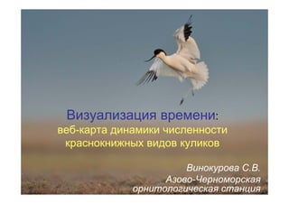
1.
Визуализация времени: веб-карта динамики
численности краснокнижных видов куликов Винокурова С.В. Азово-Черноморская орнитологическая станция
2.
Материал • Результаты августовских учетов
2004, 2006, 2009, 2012, 2015 гг. • Данные опубликованы в Бюллетенях РОМ
3.
Recurvirostra avosetta Фото П.Хара
4.
Glareola pratincola Фото М.Яковлева
5.
Glareola pratincola Фото М.Яковлева
6.
Glareola pratincola Фото М.Яковлева
7.
Настройка визуализации
8.
• Проанализирована динамика
численности 11 видов «краснокнижных» куликов и создана MapStory с помощью ArcGis on-line
9.
10.
Спасибо за внимание
Download now