SlideShare a Scribd company logo
1 of 21
Download to read offline
ГИС в работе НПП
«Слобожанский»
Брусенцова Н.А.
Сбор данных
Базы данных
Интеграция данных в ГИС
Научные исследования
Рекреационная деятельность
Общие задачи парка
Использование ArcGIS on-line
Научно-методический семинар
«ГИС и заповедные территории»
Развитие
1. Формирование ГИС-сообщества в Харькове.
2. Esri Conservation Program и аналогичные
программы поддержки природоохранной
деятельности.
3. Занятия с сотрудниками парков, проведение
семинаров и тренингов.
4. ...
Недостатки
1. Сложности передачи опыта и знаний, смена
сотрудников.
2.Отсутствие ГИС-специалиста в штате.
3. Отсутствие системности в использовании
оборудования и в обучении.
4. Не достаточное материально-техническое
обеспечение.
5. ...
Спасибо за внимание!

More Related Content

Viewers also liked

Pylypiuk a. Experience cavern mapping in podilski tovtry national park and ...
Pylypiuk a.   Experience cavern mapping in podilski tovtry national park and ...Pylypiuk a.   Experience cavern mapping in podilski tovtry national park and ...
Pylypiuk a. Experience cavern mapping in podilski tovtry national park and ...Anton Biatov
 
Sizo r. Not a single landsat. to meet the sentinel
Sizo r.   Not a single landsat. to meet the sentinelSizo r.   Not a single landsat. to meet the sentinel
Sizo r. Not a single landsat. to meet the sentinelAnton Biatov
 
Ovcharenko a., bodnia o. identification of landscapes by overlay gis analysis
Ovcharenko a., bodnia o.   identification of landscapes by overlay gis analysisOvcharenko a., bodnia o.   identification of landscapes by overlay gis analysis
Ovcharenko a., bodnia o. identification of landscapes by overlay gis analysisAnton Biatov
 
Khlyestkova a., bodnia o. exploration of not sanction recreation on the nat...
Khlyestkova a., bodnia o.   exploration of not sanction recreation on the nat...Khlyestkova a., bodnia o.   exploration of not sanction recreation on the nat...
Khlyestkova a., bodnia o. exploration of not sanction recreation on the nat...Anton Biatov
 
Olejnikov I. Тational park as an object of multi scale landscape mapping
Olejnikov I. Тational park as an object of multi scale landscape mappingOlejnikov I. Тational park as an object of multi scale landscape mapping
Olejnikov I. Тational park as an object of multi scale landscape mappingAnton Biatov
 
Bodnia O. The study of landscape structure national park Slobozhansky in the ...
Bodnia O. The study of landscape structure national park Slobozhansky in the ...Bodnia O. The study of landscape structure national park Slobozhansky in the ...
Bodnia O. The study of landscape structure national park Slobozhansky in the ...Anton Biatov
 
Sirenko I. Information analytical database - Chronicle of nature
Sirenko I. Information analytical database - Chronicle of natureSirenko I. Information analytical database - Chronicle of nature
Sirenko I. Information analytical database - Chronicle of natureAnton Biatov
 
Biatov A. The report about the results of work of the «ESRI Conservation Prog...
Biatov A. The report about the results of work of the «ESRI Conservation Prog...Biatov A. The report about the results of work of the «ESRI Conservation Prog...
Biatov A. The report about the results of work of the «ESRI Conservation Prog...Anton Biatov
 
Sizo R. Hydromorphological survey of the waterbodies in the Danube Delta Sub ...
Sizo R. Hydromorphological survey of the waterbodies in the Danube Delta Sub ...Sizo R. Hydromorphological survey of the waterbodies in the Danube Delta Sub ...
Sizo R. Hydromorphological survey of the waterbodies in the Danube Delta Sub ...Anton Biatov
 
Ovcharenko A. Landscape mapping for management of the national parks
Ovcharenko A. Landscape mapping for management of the national parksOvcharenko A. Landscape mapping for management of the national parks
Ovcharenko A. Landscape mapping for management of the national parksAnton Biatov
 
Ponomareva A. Spatial distribution of wild boar (Sus scropha L.) in the natio...
Ponomareva A. Spatial distribution of wild boar (Sus scropha L.) in the natio...Ponomareva A. Spatial distribution of wild boar (Sus scropha L.) in the natio...
Ponomareva A. Spatial distribution of wild boar (Sus scropha L.) in the natio...Anton Biatov
 
Yatsjuk I. Working with international online resources on biodiversity
Yatsjuk I. Working with international online resources on biodiversityYatsjuk I. Working with international online resources on biodiversity
Yatsjuk I. Working with international online resources on biodiversityAnton Biatov
 
Ponomareva A. The habitats of European mink (Mustela lutreola) and the Americ...
Ponomareva A. The habitats of European mink (Mustela lutreola) and the Americ...Ponomareva A. The habitats of European mink (Mustela lutreola) and the Americ...
Ponomareva A. The habitats of European mink (Mustela lutreola) and the Americ...Anton Biatov
 
Pasternak V. Using PTC Field Map for large-scale mapping of areas monitoring
Pasternak V. Using PTC Field Map for large-scale mapping of areas monitoringPasternak V. Using PTC Field Map for large-scale mapping of areas monitoring
Pasternak V. Using PTC Field Map for large-scale mapping of areas monitoringAnton Biatov
 
2016-02-13 02 Дмитрий Ульянов. ГИС, форматы данных
2016-02-13 02 Дмитрий Ульянов. ГИС, форматы данных2016-02-13 02 Дмитрий Ульянов. ГИС, форматы данных
2016-02-13 02 Дмитрий Ульянов. ГИС, форматы данныхОмские ИТ-субботники
 
HappyDev-lite-2016-весна 09 Алексей Дударев. Электронная картография и гис
HappyDev-lite-2016-весна 09 Алексей Дударев. Электронная картография и гисHappyDev-lite-2016-весна 09 Алексей Дударев. Электронная картография и гис
HappyDev-lite-2016-весна 09 Алексей Дударев. Электронная картография и гисHappyDev-lite
 
Как мы выбирали PostgreSQL для ГИС ЖКХ. Егор Савочкин, ЛАНИТ
Как мы выбирали PostgreSQL для ГИС ЖКХ. Егор Савочкин, ЛАНИТКак мы выбирали PostgreSQL для ГИС ЖКХ. Егор Савочкин, ЛАНИТ
Как мы выбирали PostgreSQL для ГИС ЖКХ. Егор Савочкин, ЛАНИТLANITgk
 

Viewers also liked (20)

Pylypiuk a. Experience cavern mapping in podilski tovtry national park and ...
Pylypiuk a.   Experience cavern mapping in podilski tovtry national park and ...Pylypiuk a.   Experience cavern mapping in podilski tovtry national park and ...
Pylypiuk a. Experience cavern mapping in podilski tovtry national park and ...
 
Sizo r. Not a single landsat. to meet the sentinel
Sizo r.   Not a single landsat. to meet the sentinelSizo r.   Not a single landsat. to meet the sentinel
Sizo r. Not a single landsat. to meet the sentinel
 
Ovcharenko a., bodnia o. identification of landscapes by overlay gis analysis
Ovcharenko a., bodnia o.   identification of landscapes by overlay gis analysisOvcharenko a., bodnia o.   identification of landscapes by overlay gis analysis
Ovcharenko a., bodnia o. identification of landscapes by overlay gis analysis
 
Khlyestkova a., bodnia o. exploration of not sanction recreation on the nat...
Khlyestkova a., bodnia o.   exploration of not sanction recreation on the nat...Khlyestkova a., bodnia o.   exploration of not sanction recreation on the nat...
Khlyestkova a., bodnia o. exploration of not sanction recreation on the nat...
 
Olejnikov I. Тational park as an object of multi scale landscape mapping
Olejnikov I. Тational park as an object of multi scale landscape mappingOlejnikov I. Тational park as an object of multi scale landscape mapping
Olejnikov I. Тational park as an object of multi scale landscape mapping
 
Bodnia O. The study of landscape structure national park Slobozhansky in the ...
Bodnia O. The study of landscape structure national park Slobozhansky in the ...Bodnia O. The study of landscape structure national park Slobozhansky in the ...
Bodnia O. The study of landscape structure national park Slobozhansky in the ...
 
Sirenko I. Information analytical database - Chronicle of nature
Sirenko I. Information analytical database - Chronicle of natureSirenko I. Information analytical database - Chronicle of nature
Sirenko I. Information analytical database - Chronicle of nature
 
Biatov A. The report about the results of work of the «ESRI Conservation Prog...
Biatov A. The report about the results of work of the «ESRI Conservation Prog...Biatov A. The report about the results of work of the «ESRI Conservation Prog...
Biatov A. The report about the results of work of the «ESRI Conservation Prog...
 
Sizo R. Hydromorphological survey of the waterbodies in the Danube Delta Sub ...
Sizo R. Hydromorphological survey of the waterbodies in the Danube Delta Sub ...Sizo R. Hydromorphological survey of the waterbodies in the Danube Delta Sub ...
Sizo R. Hydromorphological survey of the waterbodies in the Danube Delta Sub ...
 
Ovcharenko A. Landscape mapping for management of the national parks
Ovcharenko A. Landscape mapping for management of the national parksOvcharenko A. Landscape mapping for management of the national parks
Ovcharenko A. Landscape mapping for management of the national parks
 
Ponomareva A. Spatial distribution of wild boar (Sus scropha L.) in the natio...
Ponomareva A. Spatial distribution of wild boar (Sus scropha L.) in the natio...Ponomareva A. Spatial distribution of wild boar (Sus scropha L.) in the natio...
Ponomareva A. Spatial distribution of wild boar (Sus scropha L.) in the natio...
 
Yatsjuk I. Working with international online resources on biodiversity
Yatsjuk I. Working with international online resources on biodiversityYatsjuk I. Working with international online resources on biodiversity
Yatsjuk I. Working with international online resources on biodiversity
 
Ponomareva A. The habitats of European mink (Mustela lutreola) and the Americ...
Ponomareva A. The habitats of European mink (Mustela lutreola) and the Americ...Ponomareva A. The habitats of European mink (Mustela lutreola) and the Americ...
Ponomareva A. The habitats of European mink (Mustela lutreola) and the Americ...
 
Pasternak V. Using PTC Field Map for large-scale mapping of areas monitoring
Pasternak V. Using PTC Field Map for large-scale mapping of areas monitoringPasternak V. Using PTC Field Map for large-scale mapping of areas monitoring
Pasternak V. Using PTC Field Map for large-scale mapping of areas monitoring
 
Презентация ГИС
Презентация ГИСПрезентация ГИС
Презентация ГИС
 
2016-04-30 03 Антон Рожков. Android + iOS = ?
2016-04-30 03 Антон Рожков. Android + iOS = ?2016-04-30 03 Антон Рожков. Android + iOS = ?
2016-04-30 03 Антон Рожков. Android + iOS = ?
 
2016-02-13 02 Дмитрий Ульянов. ГИС, форматы данных
2016-02-13 02 Дмитрий Ульянов. ГИС, форматы данных2016-02-13 02 Дмитрий Ульянов. ГИС, форматы данных
2016-02-13 02 Дмитрий Ульянов. ГИС, форматы данных
 
HappyDev-lite-2016-весна 09 Алексей Дударев. Электронная картография и гис
HappyDev-lite-2016-весна 09 Алексей Дударев. Электронная картография и гисHappyDev-lite-2016-весна 09 Алексей Дударев. Электронная картография и гис
HappyDev-lite-2016-весна 09 Алексей Дударев. Электронная картография и гис
 
Регрессионные анализ в ГИС
Регрессионные анализ в ГИСРегрессионные анализ в ГИС
Регрессионные анализ в ГИС
 
Как мы выбирали PostgreSQL для ГИС ЖКХ. Егор Савочкин, ЛАНИТ
Как мы выбирали PostgreSQL для ГИС ЖКХ. Егор Савочкин, ЛАНИТКак мы выбирали PostgreSQL для ГИС ЖКХ. Егор Савочкин, ЛАНИТ
Как мы выбирали PostgreSQL для ГИС ЖКХ. Егор Савочкин, ЛАНИТ
 

More from Anton Biatov

Anton Biatov - How to effectively collect data for biologists
Anton Biatov - How to effectively collect data for biologistsAnton Biatov - How to effectively collect data for biologists
Anton Biatov - How to effectively collect data for biologistsAnton Biatov
 
Anton Biatov - GIS for fieldworker Biologists.
Anton Biatov - GIS for fieldworker Biologists. Anton Biatov - GIS for fieldworker Biologists.
Anton Biatov - GIS for fieldworker Biologists. Anton Biatov
 
University ITMO - the first non-classical university of Russia in the field o...
University ITMO - the first non-classical university of Russia in the field o...University ITMO - the first non-classical university of Russia in the field o...
University ITMO - the first non-classical university of Russia in the field o...Anton Biatov
 
Anton Biatov - Report about ArcGIS using by ESRI conservation program in GIS...
Anton Biatov - Report about ArcGIS using  by ESRI conservation program in GIS...Anton Biatov - Report about ArcGIS using  by ESRI conservation program in GIS...
Anton Biatov - Report about ArcGIS using by ESRI conservation program in GIS...Anton Biatov
 
Anton Biatov - Geocoding museum collection as basic tool for studying animal ...
Anton Biatov - Geocoding museum collection as basic tool for studying animal ...Anton Biatov - Geocoding museum collection as basic tool for studying animal ...
Anton Biatov - Geocoding museum collection as basic tool for studying animal ...Anton Biatov
 
Yuriy Strus An attempt to study the biotope distribution of black stork by ...
Yuriy Strus   An attempt to study the biotope distribution of black stork by ...Yuriy Strus   An attempt to study the biotope distribution of black stork by ...
Yuriy Strus An attempt to study the biotope distribution of black stork by ...Anton Biatov
 
Yuriy Protsenko Annual experience of using the GIS of the Pyriatynsky natio...
Yuriy Protsenko   Annual experience of using the GIS of the Pyriatynsky natio...Yuriy Protsenko   Annual experience of using the GIS of the Pyriatynsky natio...
Yuriy Protsenko Annual experience of using the GIS of the Pyriatynsky natio...Anton Biatov
 
Yevhen Skubak Use of GIS to map northern predators of mammals into the Svya...
Yevhen Skubak   Use of GIS to map northern predators of mammals into the Svya...Yevhen Skubak   Use of GIS to map northern predators of mammals into the Svya...
Yevhen Skubak Use of GIS to map northern predators of mammals into the Svya...Anton Biatov
 
Volodymyr Pasternak Application of GIS-technologies for research of forest ...
Volodymyr Pasternak   Application of GIS-technologies for research of forest ...Volodymyr Pasternak   Application of GIS-technologies for research of forest ...
Volodymyr Pasternak Application of GIS-technologies for research of forest ...Anton Biatov
 
Vladimir Kletenkin Practical use of GIS in the Dvurechansky national park i...
Vladimir Kletenkin   Practical use of GIS in the Dvurechansky national park i...Vladimir Kletenkin   Practical use of GIS in the Dvurechansky national park i...
Vladimir Kletenkin Practical use of GIS in the Dvurechansky national park i...Anton Biatov
 
Vasyl Korets The experience of using the geographic information system qgis...
Vasyl Korets   The experience of using the geographic information system qgis...Vasyl Korets   The experience of using the geographic information system qgis...
Vasyl Korets The experience of using the geographic information system qgis...Anton Biatov
 
Svetlana Vinokurova Visualization of time, web map of the dynamics of the r...
Svetlana Vinokurova   Visualization of time, web map of the dynamics of the r...Svetlana Vinokurova   Visualization of time, web map of the dynamics of the r...
Svetlana Vinokurova Visualization of time, web map of the dynamics of the r...Anton Biatov
 
Svetlana Vinokurova Assessment of the condition of reed associations in the...
Svetlana Vinokurova   Assessment of the condition of reed associations in the...Svetlana Vinokurova   Assessment of the condition of reed associations in the...
Svetlana Vinokurova Assessment of the condition of reed associations in the...Anton Biatov
 
Sergei Gorodilov Geocoding. What, why and how
Sergei Gorodilov   Geocoding. What, why and howSergei Gorodilov   Geocoding. What, why and how
Sergei Gorodilov Geocoding. What, why and howAnton Biatov
 
Roman Sizo Society for conservation gis - ua
Roman Sizo   Society for conservation gis - uaRoman Sizo   Society for conservation gis - ua
Roman Sizo Society for conservation gis - uaAnton Biatov
 
Roman Sizo open software and data - history, license types, beer
Roman Sizo   open software and data - history, license types, beerRoman Sizo   open software and data - history, license types, beer
Roman Sizo open software and data - history, license types, beerAnton Biatov
 
Oleg Prilutsky Experience in organizing distributed data collection for mus...
Oleg Prilutsky   Experience in organizing distributed data collection for mus...Oleg Prilutsky   Experience in organizing distributed data collection for mus...
Oleg Prilutsky Experience in organizing distributed data collection for mus...Anton Biatov
 
Natalia Kasyanova Development of gis-project of Dvorichansky national park ...
Natalia Kasyanova   Development of gis-project of Dvorichansky national park ...Natalia Kasyanova   Development of gis-project of Dvorichansky national park ...
Natalia Kasyanova Development of gis-project of Dvorichansky national park ...Anton Biatov
 
Natalia Brusentsova Cerviformes seu artiodactyla monitoring organization in...
Natalia Brusentsova   Cerviformes seu artiodactyla monitoring organization in...Natalia Brusentsova   Cerviformes seu artiodactyla monitoring organization in...
Natalia Brusentsova Cerviformes seu artiodactyla monitoring organization in...Anton Biatov
 
Natalia Atamas Using a meteorological sounding balloon with a video camera ...
Natalia Atamas   Using a meteorological sounding balloon with a video camera ...Natalia Atamas   Using a meteorological sounding balloon with a video camera ...
Natalia Atamas Using a meteorological sounding balloon with a video camera ...Anton Biatov
 

More from Anton Biatov (20)

Anton Biatov - How to effectively collect data for biologists
Anton Biatov - How to effectively collect data for biologistsAnton Biatov - How to effectively collect data for biologists
Anton Biatov - How to effectively collect data for biologists
 
Anton Biatov - GIS for fieldworker Biologists.
Anton Biatov - GIS for fieldworker Biologists. Anton Biatov - GIS for fieldworker Biologists.
Anton Biatov - GIS for fieldworker Biologists.
 
University ITMO - the first non-classical university of Russia in the field o...
University ITMO - the first non-classical university of Russia in the field o...University ITMO - the first non-classical university of Russia in the field o...
University ITMO - the first non-classical university of Russia in the field o...
 
Anton Biatov - Report about ArcGIS using by ESRI conservation program in GIS...
Anton Biatov - Report about ArcGIS using  by ESRI conservation program in GIS...Anton Biatov - Report about ArcGIS using  by ESRI conservation program in GIS...
Anton Biatov - Report about ArcGIS using by ESRI conservation program in GIS...
 
Anton Biatov - Geocoding museum collection as basic tool for studying animal ...
Anton Biatov - Geocoding museum collection as basic tool for studying animal ...Anton Biatov - Geocoding museum collection as basic tool for studying animal ...
Anton Biatov - Geocoding museum collection as basic tool for studying animal ...
 
Yuriy Strus An attempt to study the biotope distribution of black stork by ...
Yuriy Strus   An attempt to study the biotope distribution of black stork by ...Yuriy Strus   An attempt to study the biotope distribution of black stork by ...
Yuriy Strus An attempt to study the biotope distribution of black stork by ...
 
Yuriy Protsenko Annual experience of using the GIS of the Pyriatynsky natio...
Yuriy Protsenko   Annual experience of using the GIS of the Pyriatynsky natio...Yuriy Protsenko   Annual experience of using the GIS of the Pyriatynsky natio...
Yuriy Protsenko Annual experience of using the GIS of the Pyriatynsky natio...
 
Yevhen Skubak Use of GIS to map northern predators of mammals into the Svya...
Yevhen Skubak   Use of GIS to map northern predators of mammals into the Svya...Yevhen Skubak   Use of GIS to map northern predators of mammals into the Svya...
Yevhen Skubak Use of GIS to map northern predators of mammals into the Svya...
 
Volodymyr Pasternak Application of GIS-technologies for research of forest ...
Volodymyr Pasternak   Application of GIS-technologies for research of forest ...Volodymyr Pasternak   Application of GIS-technologies for research of forest ...
Volodymyr Pasternak Application of GIS-technologies for research of forest ...
 
Vladimir Kletenkin Practical use of GIS in the Dvurechansky national park i...
Vladimir Kletenkin   Practical use of GIS in the Dvurechansky national park i...Vladimir Kletenkin   Practical use of GIS in the Dvurechansky national park i...
Vladimir Kletenkin Practical use of GIS in the Dvurechansky national park i...
 
Vasyl Korets The experience of using the geographic information system qgis...
Vasyl Korets   The experience of using the geographic information system qgis...Vasyl Korets   The experience of using the geographic information system qgis...
Vasyl Korets The experience of using the geographic information system qgis...
 
Svetlana Vinokurova Visualization of time, web map of the dynamics of the r...
Svetlana Vinokurova   Visualization of time, web map of the dynamics of the r...Svetlana Vinokurova   Visualization of time, web map of the dynamics of the r...
Svetlana Vinokurova Visualization of time, web map of the dynamics of the r...
 
Svetlana Vinokurova Assessment of the condition of reed associations in the...
Svetlana Vinokurova   Assessment of the condition of reed associations in the...Svetlana Vinokurova   Assessment of the condition of reed associations in the...
Svetlana Vinokurova Assessment of the condition of reed associations in the...
 
Sergei Gorodilov Geocoding. What, why and how
Sergei Gorodilov   Geocoding. What, why and howSergei Gorodilov   Geocoding. What, why and how
Sergei Gorodilov Geocoding. What, why and how
 
Roman Sizo Society for conservation gis - ua
Roman Sizo   Society for conservation gis - uaRoman Sizo   Society for conservation gis - ua
Roman Sizo Society for conservation gis - ua
 
Roman Sizo open software and data - history, license types, beer
Roman Sizo   open software and data - history, license types, beerRoman Sizo   open software and data - history, license types, beer
Roman Sizo open software and data - history, license types, beer
 
Oleg Prilutsky Experience in organizing distributed data collection for mus...
Oleg Prilutsky   Experience in organizing distributed data collection for mus...Oleg Prilutsky   Experience in organizing distributed data collection for mus...
Oleg Prilutsky Experience in organizing distributed data collection for mus...
 
Natalia Kasyanova Development of gis-project of Dvorichansky national park ...
Natalia Kasyanova   Development of gis-project of Dvorichansky national park ...Natalia Kasyanova   Development of gis-project of Dvorichansky national park ...
Natalia Kasyanova Development of gis-project of Dvorichansky national park ...
 
Natalia Brusentsova Cerviformes seu artiodactyla monitoring organization in...
Natalia Brusentsova   Cerviformes seu artiodactyla monitoring organization in...Natalia Brusentsova   Cerviformes seu artiodactyla monitoring organization in...
Natalia Brusentsova Cerviformes seu artiodactyla monitoring organization in...
 
Natalia Atamas Using a meteorological sounding balloon with a video camera ...
Natalia Atamas   Using a meteorological sounding balloon with a video camera ...Natalia Atamas   Using a meteorological sounding balloon with a video camera ...
Natalia Atamas Using a meteorological sounding balloon with a video camera ...
 

Brusentsova n. gis in the work of slobozhanskiy national park
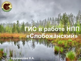