Geo-stationary satellites orbit at an altitude of about 35,786 km above the equator, matching the rate of Earth's rotation so that they appear stationary relative to a point on Earth. They are used for television broadcasts, weather forecasting, and satellite communications. Polar satellites orbit over the Earth's poles and travel pole to pole in about 102 minutes at an altitude of 500-800 km. They are used for mapping, surveying, and helped identify the location of Malaysian Airlines Flight 370 through comparisons of maps.
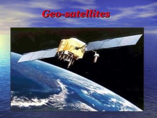
2. What is geo-stationary
satellites?
A Geo-stationary satellite is a
particular type used in television
and telephone communication.
Television programs or events
occuring in other countries are
often transmitted ‘live’ with the
help of these satellites.
3. Speed of the Satellite in its orbit
v=circumference of orbit⁄ Time period
v=2Πr⁄ T
Centripetal force is F = mv²⁄r
F = 4mΠ²r⁄T²
gravitational force on the satellite due to the earth
F=GMm⁄r²
Stable orbital motion 4mΠ²⁄T²=GMm⁄r² (or)
r³=GMT²⁄4Π² we know that g=GM⁄R²
r³=gR²T²⁄4Π² so r=(gR²T²⁄4Π²)1⁄3
4. Additional information
Geostationary satellite is used for
satellite TV, weather forecasting,
satellite and radio communications.
Geostationary satellites are used
for communication.
Geostationary satellites is an earth-orbiting
satellite, that revolves in
the same direction the earth
rotates.
6. What is polar satellites?
The polar satellites revolve around
the earth in a north-south orbit
passing over the poles as the earth
spins about its north-south axis.
The polar satellites positioned
nearly 500 to 800 km above the
earth travels pole in 102 minutes.
The satellites are used for mapping
and surveying (look over).
7. Additional information
Malaysian airlines was also
identified by the help of polar
satellites.
It is identified by comparing
previous map and latest map
Polar is an atmospheric studies
satellite in polar orbit with an
orbital period of 18 hours.