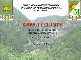
2. Location
The castle is located on the plateau of Mount
Cetatea, facing the west side of the Transfăgărășan,
on a canyon formed on the Argeș River valley, close
to the Făgăraș Mountains.
3. History
Poenari Castle was erected around the beginning of the 13th century by
Wallachians.[dubious – discuss][citation needed] Around the 14th century, Poenari
was the main citadel of the Basarab rulers.[citation needed] In the next few decades,
the name and the residents changed a few times but eventually the castle was
abandoned and left in ruins.
The citadel seen from the national road
However, in the 15th century, realizing the potential for a castle perched high on a
steep precipice of rock, Vlad III the Impaler repaired and consolidated the structure,
making it one of his main fortresses. Although the castle was used for many years
after Vlad's death in 1476, it eventually was abandoned again in the first half of the
16th century and was in ruins by the 17th century. The size and location of the castle
made it difficult to conquer. In 1888, a landslide caused by an earthquake brought
down parts of the castle which crashed into the river far below. It was slightly
repaired and the walls and its towers still stand today. To reach the castle, visitors
need to climb 1,480 steps.
4. During the Communist era in Romania, foreign visitors sometimes spent the night
inside the ruined structure. Since 2009, the site has been administered by the Argeș
County Museum.
Claims that the Poenari Castle would be the "real" Castle Dracula as featured in
Bram Stoker's famous Dracula novel have no basis in Stoker's book. Stoker never
heard of the Poenari Castle. It is ca. 200 km away from the novel's place of action in
the north-east corner of Transylvania. As discovered by the Dutch author Hans
Corneel de Roos, Stoker's own handwritten research notes confirm that the novelist
had a specific location in that region for the Vampire's stronghold in mind while
writing his novel: an empty mountain top 2,033 m high, located in the Transylvanian
Carpathian Mountains, near the former border with Moldavia.
5. In Popular Culture
A modern rendering of Poenari Castle was featured in the 2013 STARZ
television series Da Vinci's Demons in the episode titled "The Devil" in
which Leonardo da Vinci travels to Poenari Castle in Wallachia to meet
with Vlad III.
The episode "The Hardy Boys & Nancy Drew Meet Dracula" of The
Hardy Boys/Nancy Drew Mysteries show in the '70s takes place inside
"Dracula's Castle" in "Poenari". Shots of the castle used in the episode
are Poenari Castle, though the episode shows folks driving up to the
castle gates for a rock festival—impossible to do, as you must climb
stairs to get anywhere near the ruins.
6. The Transfăgărășan (trans [over, across] + Făgăraș) or DN7C,
also known as Ceaușescu's Folly, is a paved mountain road
crossing the southern section of the Carpathian Mountains
of Romania. It has national-road ranking and is the second-
highest paved road in the country after the Transalpina. It
starts near the village of Bascov, near Pitești, and stretches
90 kilometres (56 mi) to the crossroad between the DN1 and
Sibiu, between the highest peaks in the country,
Moldoveanu and Negoiu. The road, built in the early 1970s
as a strategic military route, connects the historic regions of
Transylvania and Wallachia.
7. History
The Transfăgărășan was constructed between 1970 and 1974 during
the rule of Nicolae Ceaușescu as a response to the 1968 invasion of
Czechoslovakia by the Soviet Union. Ceaușescu wanted to ensure quick
military access across the mountains in case of a Soviet invasion. At the
time, Romania already had several strategic mountain passes through
the Southern Carpathians, whether inherited from the pre-communist
era (the DN1 and the high-pass DN67C) or built during the initial years
of the Communist regime (the DN66). These passes, however, were
mainly through river valleys, and would be easy for the Soviets to
block and attack. Ceauşescu therefore ordered the construction of a
road across the Făgăraş Mountains, which divide northwestern and
southern Romania.
8.
9. Lake Vidraru (romanian Lacul Vidraru) is an artificial lake in Romania. It was created in 1965
by the construction of the Vidraru Dam on the Argeș River.
It lies in the shadow of the Făgăraș Mountains. A village lies submerged at the bottom of this
lake.
Vidraru Lake is a lake, with 465 million cubic metres of water, with a length of 10.3 km and a
width of 2.2 km, thus accumulating a total area of 870 hectares and maximum depth of 155
metres. Underground power station is situated in massive Cetatuia to a depth of 104 metres
and can provide annual energy production of 400 GWh.
Vidraru Lake is a reservoir lake created in 1965 on the Arges River for electricity production.
Situated between the mountains and the Massif Ghitu brow, lake gathers the waters of rivers
Capra, Buda and several direct tributaries (River Lady, and Valsan Cernatul, topology, Valea lui
Stan and clear), with a total flow of about 5.5 m3 / s .
The total area of the lake is 893 ha, length of 10.3 kilometers, maximum width of 2.2 km in the
Wolf Valley – mantis and a circumference of 28 km. Maximum water depth is 155 m high
curved dam near 166 m with a length of 307 metres crown. Water volume is 465 million m³.
The normal retention is 830.00 metres above sea level (mdM).
10. Vidraru dam construction took five years and a half starting in 1960 . For this achievement, it
took 42 km of underground tunnels were excavated 1.768 million m3 of rock, of which about 1
million underground bands have 930,000 m3 of concrete of which 400,000 m3 underground
and also were installed 6300 tonnes of electromechanical equipment.
On completion it was located, measured in height, approximately the 8th place in Europe and
ranked 20th in the world.
On Lake Vidraru, people can practice the extreme sport of bungee jumping
In an average hydrological year, Vidraru hydroelectric power plant located underground, can
produce approximately 400 GWh of electricity. It has an installed capacity of 220 MW.
The town of Curtea de Arges coming to DN1 (Cartisoara village, SB), the road passing through
hydropower plant to Vidraru the dam, followed by right lake is spectacular Vidraru
Transfagarasan (DN7C).
Mount Plesa was famous statue of Prometheus by lightning in his hand, a symbol of
electricity. Only a few hundred metres of the dam tourists can go to the House Argeseana
“and the pier where the practice of leisure boat racing.