
Recommended
More Related Content
Similar to ArcGIS por
Similar to ArcGIS por (20)
Recently uploaded
Recently uploaded (20)
ArcGIS por
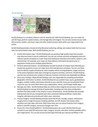
- 1. ArcGIS Desktop ArcGIS Desktop is a complete software suite for desktop GIS. With ArcGIS Desktop, you can create 2D and 3D maps, perform spatial analysis, and manage data and imagery. You can also connect to your web GIS to access, publish, and share maps and other hosted services, both within your organization and online. ArcGIS Desktop provides a broad set of professional authoring, editing, and analysis tools that turn your data into authoritative maps. With ArcGIS Desktop, you can: • Create informative maps—ArcGIS Desktop lets you produce high-quality maps that visualize your data and make it easy to understand. You can use context-sensitive cartography tools and industry-specific templates to create maps that emphasize important information, patterns, and relationships. For example, your maps can show delivery information by postal area, or population trends across multiple postal districts. • Perform advanced analysis—ArcGIS Desktop includes hundreds of analysis tools that help you answer key questions so you can make more informed decisions and plans. You can use these tools to identify supply and demand, solve complex vehicle routing problems, target resources to the areas of greatest need, plan contingency response activities, and more. ArcGIS Desktop also lets you automate your analysis to help you maintain consistent and repeatable workflows. • Share your findings—Many ArcGIS Desktop users are responsible for providing authoritative geographic information to others. ArcGIS Desktop lets you publish maps, layers, geodatabases, imagery, analytic models, and locators directly to your web GIS. Once you’ve published these resources, you can share them within your organization, online, and through mobile apps. • Manage your data—ArcGIS Desktop helps you enforce data integrity and accuracy. You can use ArcGIS Desktop to manage all kinds of spatial data, including real-time data and big data— whether that data resides in the cloud or in your infrastructure. ArcGIS Desktop also provides editing tools that let you manipulate your data, automate editing workflows, review data integrity, edit data concurrently with other users, and more. • Process imagery—ArcGIS Desktop provides tools that let you manage, analyze, and process imagery from a range of sources including satellites, aircraft, drones, full-motion video, elevation and Lidar data, and more. With these tools, you can extract features from imagery, perform scientific analysis, and assess changes over time. • Access the entire ArcGIS platform—ArcGIS Desktop gives you a user identity that lets you connect to your web GIS and access maps, imagery, services, and other content available within your organization. You can also access focused apps that help you improve workflows in the
- 2. field, in the office, and when engaging the public. In addition, you can use ArcGIS developer tools to build your own desktop, web, and mobile apps. Expand your capabilities—You can add even more professional GIS capabilities to ArcGIS Desktop with optional extensions. These extensions provide advanced tools in areas like 3D modeling and analysis, network analysis, geostatistics, spatial analysis, workflow management, and comprehensive data interoperability. ArcGIS Desktop is a core component of the ArcGIS platform. As the premier desktop GIS suite, ArcGIS Desktop gives you the tools needed to integrate, visualize, and analyze all kinds of data. These tools help you transform your data into a variety of information products—such as web maps, dashboards, and data collection apps—that are useful to staff throughout your organization. ArcGIS Desktop also works with your web GIS, making it easy to publish and share your authoritative GIS resources so they can be accessed anywhere and on any device.