SlideShare a Scribd company logo
1 of 18
The GIS certification institute (gisc) Professional Certification West Virginia Association of Geospatial Professionals 2011 WVAGP/EPAN Annual MeetingJune 14-15, 2011National Conservation Training Center, Shepherdstown, WV Samuel R. Lammie GIS Program Manager Monongahela National Forest 200 Sycamore Street Elkins, West Virginia  26241 Phone:  304-636-1800 ext 207 Email:  slammie@fs.fed.us
2011 WVAGP/EPAN Annual MeetingJune 14-15, 2011National Conservation Training Center, Shepherdstown, WV Background Urban and Regional Information Systems Association’s (URISA) Certification Committee was formed in 1999  GIS Certification Institute (GISCI) adopted certification program in late 2003 and Scott Grams is named the Executive Director Program went online on January 1, 2004 GISC provides GIS community with a complete certification program
2011 WVAGP/EPAN Annual MeetingJune 14-15, 2011National Conservation Training Center, Shepherdstown, WV Terminolgy Certification: A process, often voluntary, by which individuals who have demonstrated a level of expertise in the profession are identified to the public and other stakeholders by a third party. Designed to recognize expertise. Licensure: The granting of a license to practice a profession. Often regulated by states and indoctrinated in legislation. Designed to guard against incompetence. (ie WV State Code §30-13A-10 Surveying license requirements) Accreditation: The process of evaluating the academic qualifications or standards of an institution or program of study in accordance with pre-established criteria. Certificate: An award given to an individual recognizing completion of an academic or training program.
2011 WVAGP/EPAN Annual MeetingJune 14-15, 2011National Conservation Training Center, Shepherdstown, WV Member Organizations Urban & Regional  Info Systems Assn Formally endorsed by a number of states (e.g., Oregon and North Carolina) National States  Geographic  Information  Council American Assn of Geographers
2011 WVAGP/EPAN Annual MeetingJune 14-15, 2011National Conservation Training Center, Shepherdstown, WV The Mission of GISCI To maintain the high standards and integrity of the GIS profession and promote ethical conduct within it.
2011 WVAGP/EPAN Annual MeetingJune 14-15, 2011National Conservation Training Center, Shepherdstown, WV Geospatial Technology  as a Core Tool Impacts everything  from navigating  to law enforcement May 11, 2011 article  in US News & World Report Why Certify? GISCI reflects a GIS standing and profession GIS professionalsare typically trained for and are required to apply a diverse set of GIS skills and capabilities, as part of their primary professional role.  Department of Labor considers Geospatial Technologiesa high-growth industry and because of that has developed a corresponding competency model  (one of 16 models that are available and  is shown here) (http://www.careeronestop.org)/
2011 WVAGP/EPAN Annual MeetingJune 14-15, 2011National Conservation Training Center, Shepherdstown, WV Who Qualifies? GISCI strives to identify and recognize GIS professionals. GISCI does not look to restrict the use of GIS. Other professionals (surveyors, cartographers,  	landscape ecologists, etc.) can be GIS professionals.
2011 WVAGP/EPAN Annual MeetingJune 14-15, 2011National Conservation Training Center, Shepherdstown, WV What can Certification Provide? 1) Professional recognition program for established GIS professionals. 2) Means of identification that can be used by colleagues, employers, the public, and other licensed or certified professionals. 3) Implementation of a professional code of ethics that identifies bad practice and upholds good practice. 4) Professional development yardstick through initial and recertification requirements.
2011 WVAGP/EPAN Annual MeetingJune 14-15, 2011National Conservation Training Center, Shepherdstown, WV process Point-based, self-documented, non-examination system Based on achievement in threecategories: Educational achievement Professional experience Contributionsto the profession Currently there is no exam although GISCI has recently proposed a competency-based examination process that will be integrated in to the certification process in 2014
2011 WVAGP/EPAN Annual MeetingJune 14-15, 2011National Conservation Training Center, Shepherdstown, WV Minimum Category Points Educational Achievement (EDU)  30 points Professional Experience (EXP)60 points Contributions to the Profession (CON)     8 points Additional (Flex) Points in any of the three Categories:	52 points 	Total = 150 points Flex points allows one to make up for a lack in one category with an excess in another (i.e., long on GIS experience, short on education)
2011 WVAGP/EPAN Annual MeetingJune 14-15, 2011National Conservation Training Center, Shepherdstown, WV 1. Educational Achievement (EDU) There are three EDU components:  Credential Points (degrees in any field) Course Points (geospatial technology courses & workshops) Conference Attendance Points (days spent at  	relevant meetings and conferences)
2011 WVAGP/EPAN Annual MeetingJune 14-15, 2011National Conservation Training Center, Shepherdstown, WV 2. Professional Experience (EXP) Tier 1:  Analyst, System Design, ProgrammingTypical tasks include database design or management, documentation or analysis of functional requirements, application design and evaluation, implementation management, and system administration.  = 25 Points Per Year Tier 2:  Data Compilation, Data Maintenance, TeachingTypical tasks include editing data, map composition, report generation, database maintenance, data validation, instructional training, and teaching. = 15 Points Per Year Tier 3:  GIS UserTypical tasks include utilization of applications involving geospatial technologies.  Candidates may be involved in managing or coordinating GIS, but not involved in the technical implementation of GIS. = 10 Points Per Year
2011 WVAGP/EPAN Annual MeetingJune 14-15, 2011National Conservation Training Center, Shepherdstown, WV 2. Professional experience (contd) Applicants must have a combination of at least 4 years (48 months) of professional GIS experience to apply for GIS Certification.  If the applicant has met the minimum requirement with less then 4 years of experience then the applicant must wait until 4 years of professional GIS experience is accrued.
2011 WVAGP/EPAN Annual MeetingJune 14-15, 2011National Conservation Training Center, Shepherdstown, WV 3. Contributions to the        Profession (CON) Eight categories of contribution points: GIS publications GIS professional association involvement GIS conference participation GIS workshop instruction GIS conference presentation GIS awards received GIS volunteer efforts Other GIS contributions
2011 WVAGP/EPAN Annual MeetingJune 14-15, 2011National Conservation Training Center, Shepherdstown, WV Additional Requirements Code of Ethics & Rules of Conduct      All accepted candidates must sign the GISCI Code of Ethics.  Renewal ,[object Object]
Minimum points in each category 	and total since initial certification Grandfathering provision expired in December, 2008
2011 WVAGP/EPAN Annual MeetingJune 14-15, 2011National Conservation Training Center, Shepherdstown, WV The Application Review Process	 The GISCI Staff performs a QUANTITATIVEreview to determine if points documented and added correctly. QUALITATIVE review conducted by the GISCI Review Board. Candidates notified within 2 – 3 months of acceptance/rejection.  Cost of certification is $250 for a five year period. A five-year renewal is $115. WVAGP will pay 50% of the GIS certification or renewal fee for its members who reside or work in West Virginia. WVAGP resolution
2011 WVAGP/EPAN Annual MeetingJune 14-15, 2011National Conservation Training Center, Shepherdstown, WV Current GISCI status 4,760 certified GIS Professionals  	(GISPs) as of April 25, 2011 Currently, 26 GIS Professionals  	are certified in the State

More Related Content

Viewers also liked

Balatonfoldvar
BalatonfoldvarBalatonfoldvar
BalatonfoldvarIvan Szedo
 
Autumn In 2006, Budapest
Autumn In 2006, BudapestAutumn In 2006, Budapest
Autumn In 2006, BudapestIvan Szedo
 
Rovinj pictures (Croatia)
Rovinj pictures (Croatia)Rovinj pictures (Croatia)
Rovinj pictures (Croatia)Ivan Szedo
 
Holistic Health Dr. Shriniwas Kashalikar
Holistic Health Dr. Shriniwas KashalikarHolistic Health Dr. Shriniwas Kashalikar
Holistic Health Dr. Shriniwas Kashalikarcwkashalikar
 

Viewers also liked (20)

Practical GIS Applications (EPAN 2010)
Practical GIS Applications (EPAN 2010)Practical GIS Applications (EPAN 2010)
Practical GIS Applications (EPAN 2010)
 
Monongalia County GIS Implementation (3Nov2011)
Monongalia County GIS Implementation (3Nov2011)Monongalia County GIS Implementation (3Nov2011)
Monongalia County GIS Implementation (3Nov2011)
 
GIS and Automated Vehicle Locator Communications System (AVL)
GIS and Automated Vehicle Locator Communications System (AVL)GIS and Automated Vehicle Locator Communications System (AVL)
GIS and Automated Vehicle Locator Communications System (AVL)
 
WV Geo Explorer Project (epan 2011)
WV Geo Explorer Project (epan 2011)WV Geo Explorer Project (epan 2011)
WV Geo Explorer Project (epan 2011)
 
Greenbrier County Sharing Parcel data (2010)
Greenbrier County Sharing Parcel data (2010)Greenbrier County Sharing Parcel data (2010)
Greenbrier County Sharing Parcel data (2010)
 
GIS for Search & Rescue Strategies & Concepts
 GIS for Search & Rescue Strategies & Concepts GIS for Search & Rescue Strategies & Concepts
GIS for Search & Rescue Strategies & Concepts
 
WV Flood Tool (www.mapWV.gov/flood)
WV Flood Tool (www.mapWV.gov/flood)WV Flood Tool (www.mapWV.gov/flood)
WV Flood Tool (www.mapWV.gov/flood)
 
Python and ArcGIS 10.1
Python and ArcGIS 10.1Python and ArcGIS 10.1
Python and ArcGIS 10.1
 
2011 ArcGIS 10 Land Records Seminar
2011 ArcGIS 10 Land Records Seminar2011 ArcGIS 10 Land Records Seminar
2011 ArcGIS 10 Land Records Seminar
 
GIS User for Countywide Groundwater Assessment, Jefferson County, WV
GIS User for Countywide Groundwater Assessment, Jefferson County, WVGIS User for Countywide Groundwater Assessment, Jefferson County, WV
GIS User for Countywide Groundwater Assessment, Jefferson County, WV
 
Ccawv 2011 a
Ccawv 2011 aCcawv 2011 a
Ccawv 2011 a
 
ArcGIS Python Programming (3Nov11)
ArcGIS Python Programming (3Nov11)ArcGIS Python Programming (3Nov11)
ArcGIS Python Programming (3Nov11)
 
Balatonfoldvar
BalatonfoldvarBalatonfoldvar
Balatonfoldvar
 
Autumn In 2006, Budapest
Autumn In 2006, BudapestAutumn In 2006, Budapest
Autumn In 2006, Budapest
 
Ptujska
PtujskaPtujska
Ptujska
 
Tihany
TihanyTihany
Tihany
 
Rovinj pictures (Croatia)
Rovinj pictures (Croatia)Rovinj pictures (Croatia)
Rovinj pictures (Croatia)
 
Holistic Health Dr. Shriniwas Kashalikar
Holistic Health Dr. Shriniwas KashalikarHolistic Health Dr. Shriniwas Kashalikar
Holistic Health Dr. Shriniwas Kashalikar
 
Csobaj
CsobajCsobaj
Csobaj
 
Tanah
TanahTanah
Tanah
 

Similar to GISP Presentation (epan 2011)

Veronica Marcella Resume updated
Veronica Marcella Resume updatedVeronica Marcella Resume updated
Veronica Marcella Resume updateddudud
 
CV of LH D Bandusoma - 2015-12-02
CV of LH D Bandusoma  - 2015-12-02CV of LH D Bandusoma  - 2015-12-02
CV of LH D Bandusoma - 2015-12-02Dias Bandusoma
 
ITOP_Resume English
ITOP_Resume EnglishITOP_Resume English
ITOP_Resume EnglishIbrahima Top
 
ITOP_Resume English
ITOP_Resume EnglishITOP_Resume English
ITOP_Resume EnglishIbrahima Top
 
Overview of MEASURE Evaluation Support to OVC M&E in Nigeria
Overview of MEASURE Evaluation Support to OVC M&E in NigeriaOverview of MEASURE Evaluation Support to OVC M&E in Nigeria
Overview of MEASURE Evaluation Support to OVC M&E in NigeriaMEASURE Evaluation
 
CountrySTAT / FENIX CountrySTAT system in Afghanistan 25 – 26 June 2015 FAO ...
CountrySTAT / FENIX CountrySTAT system in Afghanistan  25 – 26 June 2015 FAO ...CountrySTAT / FENIX CountrySTAT system in Afghanistan  25 – 26 June 2015 FAO ...
CountrySTAT / FENIX CountrySTAT system in Afghanistan 25 – 26 June 2015 FAO ...FAO
 
1 Peoria Mobile Technology As An Rt I Assessment Tool For[1]
1 Peoria Mobile Technology As An Rt I Assessment Tool For[1]1 Peoria Mobile Technology As An Rt I Assessment Tool For[1]
1 Peoria Mobile Technology As An Rt I Assessment Tool For[1]guest539850
 
Initial Teacher Training - Eligio Cerval-Pena
Initial Teacher Training - Eligio Cerval-PenaInitial Teacher Training - Eligio Cerval-Pena
Initial Teacher Training - Eligio Cerval-PenaIMI PQ NET Romania
 
Session 2_Roderick Planta.pdf
Session 2_Roderick Planta.pdfSession 2_Roderick Planta.pdf
Session 2_Roderick Planta.pdfOECD Environment
 
Carroll CV 11-08-2016
Carroll CV 11-08-2016Carroll CV 11-08-2016
Carroll CV 11-08-2016David Carroll
 
1 Institutional Assessment Report 2012-13
1  Institutional Assessment Report 2012-13  1  Institutional Assessment Report 2012-13
1 Institutional Assessment Report 2012-13 SilvaGraf83
 
1 Institutional Assessment Report 2012-13
1  Institutional Assessment Report 2012-13  1  Institutional Assessment Report 2012-13
1 Institutional Assessment Report 2012-13 MartineMccracken314
 
Tahseen Raza Panesa Ahmad, CPA
Tahseen Raza Panesa Ahmad, CPATahseen Raza Panesa Ahmad, CPA
Tahseen Raza Panesa Ahmad, CPATahseen Raza Ahmad
 
Final implementation report presentation 14 august 2014
Final implementation report presentation 14 august  2014Final implementation report presentation 14 august  2014
Final implementation report presentation 14 august 2014kaleylemottee
 

Similar to GISP Presentation (epan 2011) (20)

Veronica Marcella Resume updated
Veronica Marcella Resume updatedVeronica Marcella Resume updated
Veronica Marcella Resume updated
 
Gamboa Resume
Gamboa ResumeGamboa Resume
Gamboa Resume
 
CV of LH D Bandusoma - 2015-12-02
CV of LH D Bandusoma  - 2015-12-02CV of LH D Bandusoma  - 2015-12-02
CV of LH D Bandusoma - 2015-12-02
 
ITOP_Resume English
ITOP_Resume EnglishITOP_Resume English
ITOP_Resume English
 
ITOP_Resume English
ITOP_Resume EnglishITOP_Resume English
ITOP_Resume English
 
Rich agnello pm resume
Rich agnello pm resumeRich agnello pm resume
Rich agnello pm resume
 
Opening the Door to Teacher Education for Paraprofessionals: Building Distric...
Opening the Door to Teacher Education for Paraprofessionals: Building Distric...Opening the Door to Teacher Education for Paraprofessionals: Building Distric...
Opening the Door to Teacher Education for Paraprofessionals: Building Distric...
 
Overview of MEASURE Evaluation Support to OVC M&E in Nigeria
Overview of MEASURE Evaluation Support to OVC M&E in NigeriaOverview of MEASURE Evaluation Support to OVC M&E in Nigeria
Overview of MEASURE Evaluation Support to OVC M&E in Nigeria
 
CountrySTAT / FENIX CountrySTAT system in Afghanistan 25 – 26 June 2015 FAO ...
CountrySTAT / FENIX CountrySTAT system in Afghanistan  25 – 26 June 2015 FAO ...CountrySTAT / FENIX CountrySTAT system in Afghanistan  25 – 26 June 2015 FAO ...
CountrySTAT / FENIX CountrySTAT system in Afghanistan 25 – 26 June 2015 FAO ...
 
1 Peoria Mobile Technology As An Rt I Assessment Tool For[1]
1 Peoria Mobile Technology As An Rt I Assessment Tool For[1]1 Peoria Mobile Technology As An Rt I Assessment Tool For[1]
1 Peoria Mobile Technology As An Rt I Assessment Tool For[1]
 
Initial Teacher Training - Eligio Cerval-Pena
Initial Teacher Training - Eligio Cerval-PenaInitial Teacher Training - Eligio Cerval-Pena
Initial Teacher Training - Eligio Cerval-Pena
 
Session 2_Roderick Planta.pdf
Session 2_Roderick Planta.pdfSession 2_Roderick Planta.pdf
Session 2_Roderick Planta.pdf
 
Carroll CV 11-08-2016
Carroll CV 11-08-2016Carroll CV 11-08-2016
Carroll CV 11-08-2016
 
1 Institutional Assessment Report 2012-13
1  Institutional Assessment Report 2012-13  1  Institutional Assessment Report 2012-13
1 Institutional Assessment Report 2012-13
 
1 Institutional Assessment Report 2012-13
1  Institutional Assessment Report 2012-13  1  Institutional Assessment Report 2012-13
1 Institutional Assessment Report 2012-13
 
Tahseen Raza Panesa Ahmad, CPA
Tahseen Raza Panesa Ahmad, CPATahseen Raza Panesa Ahmad, CPA
Tahseen Raza Panesa Ahmad, CPA
 
Jessica's Resume
Jessica's ResumeJessica's Resume
Jessica's Resume
 
Riippi ppt
Riippi pptRiippi ppt
Riippi ppt
 
Dap briefer
Dap brieferDap briefer
Dap briefer
 
Final implementation report presentation 14 august 2014
Final implementation report presentation 14 august  2014Final implementation report presentation 14 august  2014
Final implementation report presentation 14 august 2014
 

More from WV Assocation of Geospatial Professionals

More from WV Assocation of Geospatial Professionals (20)

Flood Risk Review (FRR) Meeting - Upper Monongahela Watershed
Flood Risk Review (FRR) Meeting - Upper Monongahela WatershedFlood Risk Review (FRR) Meeting - Upper Monongahela Watershed
Flood Risk Review (FRR) Meeting - Upper Monongahela Watershed
 
Conservation Innovation - Tools and Trends in GIS
Conservation Innovation - Tools and Trends in GISConservation Innovation - Tools and Trends in GIS
Conservation Innovation - Tools and Trends in GIS
 
High Accuracy Data Collection with Esri's Collector App
High Accuracy Data Collection with Esri's Collector AppHigh Accuracy Data Collection with Esri's Collector App
High Accuracy Data Collection with Esri's Collector App
 
Integrating Survey Data into a GIS
Integrating Survey Data into a GISIntegrating Survey Data into a GIS
Integrating Survey Data into a GIS
 
Implementation of Parcel Fabric in West Virginia
Implementation of Parcel Fabric in West VirginiaImplementation of Parcel Fabric in West Virginia
Implementation of Parcel Fabric in West Virginia
 
Proceedings for 2016 WV EPAN GIS Users Group Meeting
Proceedings for 2016 WV EPAN GIS Users Group MeetingProceedings for 2016 WV EPAN GIS Users Group Meeting
Proceedings for 2016 WV EPAN GIS Users Group Meeting
 
Evaluating Riparian Buffers of WV Landowners in Chesapeake Bay Drainage
Evaluating Riparian Buffers of WV Landowners in Chesapeake Bay Drainage Evaluating Riparian Buffers of WV Landowners in Chesapeake Bay Drainage
Evaluating Riparian Buffers of WV Landowners in Chesapeake Bay Drainage
 
2016 Agenda for WV EPAN Users Group Meeting
2016 Agenda for WV EPAN Users Group Meeting2016 Agenda for WV EPAN Users Group Meeting
2016 Agenda for WV EPAN Users Group Meeting
 
WV Local GIS Data Contributions to State/Federal Datasets
WV Local GIS Data Contributions to State/Federal DatasetsWV Local GIS Data Contributions to State/Federal Datasets
WV Local GIS Data Contributions to State/Federal Datasets
 
Agenda EPAN 2015
Agenda EPAN 2015Agenda EPAN 2015
Agenda EPAN 2015
 
Transitioning Applications to the Web App Builder
Transitioning Applications to the Web App BuilderTransitioning Applications to the Web App Builder
Transitioning Applications to the Web App Builder
 
Stormwater and GIS
Stormwater and GISStormwater and GIS
Stormwater and GIS
 
Pictometry Imagery for West Virginia
Pictometry Imagery for West VirginiaPictometry Imagery for West Virginia
Pictometry Imagery for West Virginia
 
Device Locational Accuracy
Device Locational AccuracyDevice Locational Accuracy
Device Locational Accuracy
 
WV Statewide Addressing and Mapping Update (SAMS-II)
WV Statewide Addressing and Mapping Update (SAMS-II)WV Statewide Addressing and Mapping Update (SAMS-II)
WV Statewide Addressing and Mapping Update (SAMS-II)
 
Agenda for WVAGP 2015 Annual Meeting
Agenda for WVAGP 2015 Annual MeetingAgenda for WVAGP 2015 Annual Meeting
Agenda for WVAGP 2015 Annual Meeting
 
WV 3D Elevation Program (3DEP) / BAA Overview
WV 3D Elevation Program (3DEP) / BAA OverviewWV 3D Elevation Program (3DEP) / BAA Overview
WV 3D Elevation Program (3DEP) / BAA Overview
 
WV National Hydrography Dataset (NHD) Update
WV National Hydrography Dataset (NHD) UpdateWV National Hydrography Dataset (NHD) Update
WV National Hydrography Dataset (NHD) Update
 
Three Rivers Quest (WV Water Research Institute)
Three Rivers Quest (WV Water Research Institute)Three Rivers Quest (WV Water Research Institute)
Three Rivers Quest (WV Water Research Institute)
 
Geospatial Initiatives: A National Perspective
 Geospatial Initiatives: A National Perspective Geospatial Initiatives: A National Perspective
Geospatial Initiatives: A National Perspective
 

Recently uploaded

Raspberry Pi 5: Challenges and Solutions in Bringing up an OpenGL/Vulkan Driv...
Raspberry Pi 5: Challenges and Solutions in Bringing up an OpenGL/Vulkan Driv...Raspberry Pi 5: Challenges and Solutions in Bringing up an OpenGL/Vulkan Driv...
Raspberry Pi 5: Challenges and Solutions in Bringing up an OpenGL/Vulkan Driv...Igalia
 
Handwritten Text Recognition for manuscripts and early printed texts
Handwritten Text Recognition for manuscripts and early printed textsHandwritten Text Recognition for manuscripts and early printed texts
Handwritten Text Recognition for manuscripts and early printed textsMaria Levchenko
 
GenCyber Cyber Security Day Presentation
GenCyber Cyber Security Day PresentationGenCyber Cyber Security Day Presentation
GenCyber Cyber Security Day PresentationMichael W. Hawkins
 
Finology Group – Insurtech Innovation Award 2024
Finology Group – Insurtech Innovation Award 2024Finology Group – Insurtech Innovation Award 2024
Finology Group – Insurtech Innovation Award 2024The Digital Insurer
 
Tech-Forward - Achieving Business Readiness For Copilot in Microsoft 365
Tech-Forward - Achieving Business Readiness For Copilot in Microsoft 365Tech-Forward - Achieving Business Readiness For Copilot in Microsoft 365
Tech-Forward - Achieving Business Readiness For Copilot in Microsoft 3652toLead Limited
 
Data Cloud, More than a CDP by Matt Robison
Data Cloud, More than a CDP by Matt RobisonData Cloud, More than a CDP by Matt Robison
Data Cloud, More than a CDP by Matt RobisonAnna Loughnan Colquhoun
 
Presentation on how to chat with PDF using ChatGPT code interpreter
Presentation on how to chat with PDF using ChatGPT code interpreterPresentation on how to chat with PDF using ChatGPT code interpreter
Presentation on how to chat with PDF using ChatGPT code interpreternaman860154
 
08448380779 Call Girls In Civil Lines Women Seeking Men
08448380779 Call Girls In Civil Lines Women Seeking Men08448380779 Call Girls In Civil Lines Women Seeking Men
08448380779 Call Girls In Civil Lines Women Seeking MenDelhi Call girls
 
Maximizing Board Effectiveness 2024 Webinar.pptx
Maximizing Board Effectiveness 2024 Webinar.pptxMaximizing Board Effectiveness 2024 Webinar.pptx
Maximizing Board Effectiveness 2024 Webinar.pptxOnBoard
 
IAC 2024 - IA Fast Track to Search Focused AI Solutions
IAC 2024 - IA Fast Track to Search Focused AI SolutionsIAC 2024 - IA Fast Track to Search Focused AI Solutions
IAC 2024 - IA Fast Track to Search Focused AI SolutionsEnterprise Knowledge
 
Slack Application Development 101 Slides
Slack Application Development 101 SlidesSlack Application Development 101 Slides
Slack Application Development 101 Slidespraypatel2
 
Transforming Data Streams with Kafka Connect: An Introduction to Single Messa...
Transforming Data Streams with Kafka Connect: An Introduction to Single Messa...Transforming Data Streams with Kafka Connect: An Introduction to Single Messa...
Transforming Data Streams with Kafka Connect: An Introduction to Single Messa...HostedbyConfluent
 
[2024]Digital Global Overview Report 2024 Meltwater.pdf
[2024]Digital Global Overview Report 2024 Meltwater.pdf[2024]Digital Global Overview Report 2024 Meltwater.pdf
[2024]Digital Global Overview Report 2024 Meltwater.pdfhans926745
 
The Codex of Business Writing Software for Real-World Solutions 2.pptx
The Codex of Business Writing Software for Real-World Solutions 2.pptxThe Codex of Business Writing Software for Real-World Solutions 2.pptx
The Codex of Business Writing Software for Real-World Solutions 2.pptxMalak Abu Hammad
 
Salesforce Community Group Quito, Salesforce 101
Salesforce Community Group Quito, Salesforce 101Salesforce Community Group Quito, Salesforce 101
Salesforce Community Group Quito, Salesforce 101Paola De la Torre
 
Google AI Hackathon: LLM based Evaluator for RAG
Google AI Hackathon: LLM based Evaluator for RAGGoogle AI Hackathon: LLM based Evaluator for RAG
Google AI Hackathon: LLM based Evaluator for RAGSujit Pal
 
Breaking the Kubernetes Kill Chain: Host Path Mount
Breaking the Kubernetes Kill Chain: Host Path MountBreaking the Kubernetes Kill Chain: Host Path Mount
Breaking the Kubernetes Kill Chain: Host Path MountPuma Security, LLC
 
Boost PC performance: How more available memory can improve productivity
Boost PC performance: How more available memory can improve productivityBoost PC performance: How more available memory can improve productivity
Boost PC performance: How more available memory can improve productivityPrincipled Technologies
 
🐬 The future of MySQL is Postgres 🐘
🐬  The future of MySQL is Postgres   🐘🐬  The future of MySQL is Postgres   🐘
🐬 The future of MySQL is Postgres 🐘RTylerCroy
 
FULL ENJOY 🔝 8264348440 🔝 Call Girls in Diplomatic Enclave | Delhi
FULL ENJOY 🔝 8264348440 🔝 Call Girls in Diplomatic Enclave | DelhiFULL ENJOY 🔝 8264348440 🔝 Call Girls in Diplomatic Enclave | Delhi
FULL ENJOY 🔝 8264348440 🔝 Call Girls in Diplomatic Enclave | Delhisoniya singh
 

Recently uploaded (20)

Raspberry Pi 5: Challenges and Solutions in Bringing up an OpenGL/Vulkan Driv...
Raspberry Pi 5: Challenges and Solutions in Bringing up an OpenGL/Vulkan Driv...Raspberry Pi 5: Challenges and Solutions in Bringing up an OpenGL/Vulkan Driv...
Raspberry Pi 5: Challenges and Solutions in Bringing up an OpenGL/Vulkan Driv...
 
Handwritten Text Recognition for manuscripts and early printed texts
Handwritten Text Recognition for manuscripts and early printed textsHandwritten Text Recognition for manuscripts and early printed texts
Handwritten Text Recognition for manuscripts and early printed texts
 
GenCyber Cyber Security Day Presentation
GenCyber Cyber Security Day PresentationGenCyber Cyber Security Day Presentation
GenCyber Cyber Security Day Presentation
 
Finology Group – Insurtech Innovation Award 2024
Finology Group – Insurtech Innovation Award 2024Finology Group – Insurtech Innovation Award 2024
Finology Group – Insurtech Innovation Award 2024
 
Tech-Forward - Achieving Business Readiness For Copilot in Microsoft 365
Tech-Forward - Achieving Business Readiness For Copilot in Microsoft 365Tech-Forward - Achieving Business Readiness For Copilot in Microsoft 365
Tech-Forward - Achieving Business Readiness For Copilot in Microsoft 365
 
Data Cloud, More than a CDP by Matt Robison
Data Cloud, More than a CDP by Matt RobisonData Cloud, More than a CDP by Matt Robison
Data Cloud, More than a CDP by Matt Robison
 
Presentation on how to chat with PDF using ChatGPT code interpreter
Presentation on how to chat with PDF using ChatGPT code interpreterPresentation on how to chat with PDF using ChatGPT code interpreter
Presentation on how to chat with PDF using ChatGPT code interpreter
 
08448380779 Call Girls In Civil Lines Women Seeking Men
08448380779 Call Girls In Civil Lines Women Seeking Men08448380779 Call Girls In Civil Lines Women Seeking Men
08448380779 Call Girls In Civil Lines Women Seeking Men
 
Maximizing Board Effectiveness 2024 Webinar.pptx
Maximizing Board Effectiveness 2024 Webinar.pptxMaximizing Board Effectiveness 2024 Webinar.pptx
Maximizing Board Effectiveness 2024 Webinar.pptx
 
IAC 2024 - IA Fast Track to Search Focused AI Solutions
IAC 2024 - IA Fast Track to Search Focused AI SolutionsIAC 2024 - IA Fast Track to Search Focused AI Solutions
IAC 2024 - IA Fast Track to Search Focused AI Solutions
 
Slack Application Development 101 Slides
Slack Application Development 101 SlidesSlack Application Development 101 Slides
Slack Application Development 101 Slides
 
Transforming Data Streams with Kafka Connect: An Introduction to Single Messa...
Transforming Data Streams with Kafka Connect: An Introduction to Single Messa...Transforming Data Streams with Kafka Connect: An Introduction to Single Messa...
Transforming Data Streams with Kafka Connect: An Introduction to Single Messa...
 
[2024]Digital Global Overview Report 2024 Meltwater.pdf
[2024]Digital Global Overview Report 2024 Meltwater.pdf[2024]Digital Global Overview Report 2024 Meltwater.pdf
[2024]Digital Global Overview Report 2024 Meltwater.pdf
 
The Codex of Business Writing Software for Real-World Solutions 2.pptx
The Codex of Business Writing Software for Real-World Solutions 2.pptxThe Codex of Business Writing Software for Real-World Solutions 2.pptx
The Codex of Business Writing Software for Real-World Solutions 2.pptx
 
Salesforce Community Group Quito, Salesforce 101
Salesforce Community Group Quito, Salesforce 101Salesforce Community Group Quito, Salesforce 101
Salesforce Community Group Quito, Salesforce 101
 
Google AI Hackathon: LLM based Evaluator for RAG
Google AI Hackathon: LLM based Evaluator for RAGGoogle AI Hackathon: LLM based Evaluator for RAG
Google AI Hackathon: LLM based Evaluator for RAG
 
Breaking the Kubernetes Kill Chain: Host Path Mount
Breaking the Kubernetes Kill Chain: Host Path MountBreaking the Kubernetes Kill Chain: Host Path Mount
Breaking the Kubernetes Kill Chain: Host Path Mount
 
Boost PC performance: How more available memory can improve productivity
Boost PC performance: How more available memory can improve productivityBoost PC performance: How more available memory can improve productivity
Boost PC performance: How more available memory can improve productivity
 
🐬 The future of MySQL is Postgres 🐘
🐬  The future of MySQL is Postgres   🐘🐬  The future of MySQL is Postgres   🐘
🐬 The future of MySQL is Postgres 🐘
 
FULL ENJOY 🔝 8264348440 🔝 Call Girls in Diplomatic Enclave | Delhi
FULL ENJOY 🔝 8264348440 🔝 Call Girls in Diplomatic Enclave | DelhiFULL ENJOY 🔝 8264348440 🔝 Call Girls in Diplomatic Enclave | Delhi
FULL ENJOY 🔝 8264348440 🔝 Call Girls in Diplomatic Enclave | Delhi
 

GISP Presentation (epan 2011)

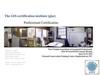
  • 1. The GIS certification institute (gisc) Professional Certification West Virginia Association of Geospatial Professionals 2011 WVAGP/EPAN Annual MeetingJune 14-15, 2011National Conservation Training Center, Shepherdstown, WV Samuel R. Lammie GIS Program Manager Monongahela National Forest 200 Sycamore Street Elkins, West Virginia 26241 Phone: 304-636-1800 ext 207 Email: slammie@fs.fed.us
  • 2. 2011 WVAGP/EPAN Annual MeetingJune 14-15, 2011National Conservation Training Center, Shepherdstown, WV Background Urban and Regional Information Systems Association’s (URISA) Certification Committee was formed in 1999 GIS Certification Institute (GISCI) adopted certification program in late 2003 and Scott Grams is named the Executive Director Program went online on January 1, 2004 GISC provides GIS community with a complete certification program
  • 3. 2011 WVAGP/EPAN Annual MeetingJune 14-15, 2011National Conservation Training Center, Shepherdstown, WV Terminolgy Certification: A process, often voluntary, by which individuals who have demonstrated a level of expertise in the profession are identified to the public and other stakeholders by a third party. Designed to recognize expertise. Licensure: The granting of a license to practice a profession. Often regulated by states and indoctrinated in legislation. Designed to guard against incompetence. (ie WV State Code §30-13A-10 Surveying license requirements) Accreditation: The process of evaluating the academic qualifications or standards of an institution or program of study in accordance with pre-established criteria. Certificate: An award given to an individual recognizing completion of an academic or training program.
  • 4. 2011 WVAGP/EPAN Annual MeetingJune 14-15, 2011National Conservation Training Center, Shepherdstown, WV Member Organizations Urban & Regional Info Systems Assn Formally endorsed by a number of states (e.g., Oregon and North Carolina) National States Geographic Information Council American Assn of Geographers
  • 5. 2011 WVAGP/EPAN Annual MeetingJune 14-15, 2011National Conservation Training Center, Shepherdstown, WV The Mission of GISCI To maintain the high standards and integrity of the GIS profession and promote ethical conduct within it.
  • 6. 2011 WVAGP/EPAN Annual MeetingJune 14-15, 2011National Conservation Training Center, Shepherdstown, WV Geospatial Technology as a Core Tool Impacts everything from navigating to law enforcement May 11, 2011 article in US News & World Report Why Certify? GISCI reflects a GIS standing and profession GIS professionalsare typically trained for and are required to apply a diverse set of GIS skills and capabilities, as part of their primary professional role. Department of Labor considers Geospatial Technologiesa high-growth industry and because of that has developed a corresponding competency model (one of 16 models that are available and is shown here) (http://www.careeronestop.org)/
  • 7. 2011 WVAGP/EPAN Annual MeetingJune 14-15, 2011National Conservation Training Center, Shepherdstown, WV Who Qualifies? GISCI strives to identify and recognize GIS professionals. GISCI does not look to restrict the use of GIS. Other professionals (surveyors, cartographers, landscape ecologists, etc.) can be GIS professionals.
  • 8. 2011 WVAGP/EPAN Annual MeetingJune 14-15, 2011National Conservation Training Center, Shepherdstown, WV What can Certification Provide? 1) Professional recognition program for established GIS professionals. 2) Means of identification that can be used by colleagues, employers, the public, and other licensed or certified professionals. 3) Implementation of a professional code of ethics that identifies bad practice and upholds good practice. 4) Professional development yardstick through initial and recertification requirements.
  • 9. 2011 WVAGP/EPAN Annual MeetingJune 14-15, 2011National Conservation Training Center, Shepherdstown, WV process Point-based, self-documented, non-examination system Based on achievement in threecategories: Educational achievement Professional experience Contributionsto the profession Currently there is no exam although GISCI has recently proposed a competency-based examination process that will be integrated in to the certification process in 2014
  • 10. 2011 WVAGP/EPAN Annual MeetingJune 14-15, 2011National Conservation Training Center, Shepherdstown, WV Minimum Category Points Educational Achievement (EDU) 30 points Professional Experience (EXP)60 points Contributions to the Profession (CON) 8 points Additional (Flex) Points in any of the three Categories: 52 points Total = 150 points Flex points allows one to make up for a lack in one category with an excess in another (i.e., long on GIS experience, short on education)
  • 11. 2011 WVAGP/EPAN Annual MeetingJune 14-15, 2011National Conservation Training Center, Shepherdstown, WV 1. Educational Achievement (EDU) There are three EDU components: Credential Points (degrees in any field) Course Points (geospatial technology courses & workshops) Conference Attendance Points (days spent at relevant meetings and conferences)
  • 12. 2011 WVAGP/EPAN Annual MeetingJune 14-15, 2011National Conservation Training Center, Shepherdstown, WV 2. Professional Experience (EXP) Tier 1: Analyst, System Design, ProgrammingTypical tasks include database design or management, documentation or analysis of functional requirements, application design and evaluation, implementation management, and system administration. = 25 Points Per Year Tier 2: Data Compilation, Data Maintenance, TeachingTypical tasks include editing data, map composition, report generation, database maintenance, data validation, instructional training, and teaching. = 15 Points Per Year Tier 3: GIS UserTypical tasks include utilization of applications involving geospatial technologies. Candidates may be involved in managing or coordinating GIS, but not involved in the technical implementation of GIS. = 10 Points Per Year
  • 13. 2011 WVAGP/EPAN Annual MeetingJune 14-15, 2011National Conservation Training Center, Shepherdstown, WV 2. Professional experience (contd) Applicants must have a combination of at least 4 years (48 months) of professional GIS experience to apply for GIS Certification. If the applicant has met the minimum requirement with less then 4 years of experience then the applicant must wait until 4 years of professional GIS experience is accrued.
  • 14. 2011 WVAGP/EPAN Annual MeetingJune 14-15, 2011National Conservation Training Center, Shepherdstown, WV 3. Contributions to the Profession (CON) Eight categories of contribution points: GIS publications GIS professional association involvement GIS conference participation GIS workshop instruction GIS conference presentation GIS awards received GIS volunteer efforts Other GIS contributions
  • 15.
  • 16. Minimum points in each category and total since initial certification Grandfathering provision expired in December, 2008
  • 17. 2011 WVAGP/EPAN Annual MeetingJune 14-15, 2011National Conservation Training Center, Shepherdstown, WV The Application Review Process The GISCI Staff performs a QUANTITATIVEreview to determine if points documented and added correctly. QUALITATIVE review conducted by the GISCI Review Board. Candidates notified within 2 – 3 months of acceptance/rejection. Cost of certification is $250 for a five year period. A five-year renewal is $115. WVAGP will pay 50% of the GIS certification or renewal fee for its members who reside or work in West Virginia. WVAGP resolution
  • 18. 2011 WVAGP/EPAN Annual MeetingJune 14-15, 2011National Conservation Training Center, Shepherdstown, WV Current GISCI status 4,760 certified GIS Professionals (GISPs) as of April 25, 2011 Currently, 26 GIS Professionals are certified in the State
  • 19. 2011 WVAGP/EPAN Annual MeetingJune 14-15, 2011National Conservation Training Center, Shepherdstown, WV Thank You…Any Questions? David DiBiase President Sheila Wilson, Executive Director