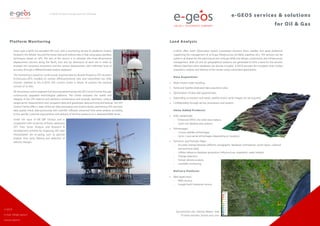
e-GEOS Services & Solutions for Oil & Gas
•
1 like•606 views

Since 1998 e-GEOS has provided ENI Spa with a monitoring service for platforms (mainly located in the Adriatic Sea and the Ionian Sea) and onshore sites in Italy using space geodesy techniques based on GPS. The aim of the service is to estimate the three-dimensional displacement (vectors along the North, East and Up directions) of each site in order to evaluate the horizontal movement and the vertical displacement with millimeter level of accuracy through a differential data analysis approach.

Recommended
Recommended
More Related Content
What's hot
What's hot (20)
Similar to e-GEOS Services & Solutions for Oil & Gas
Similar to e-GEOS Services & Solutions for Oil & Gas (20)
More from Finmeccanica
More from Finmeccanica (20)
Recently uploaded
Recently uploaded (20)
e-GEOS Services & Solutions for Oil & Gas
- 1. Land Analysis e-GEOS offers Earth Observation based customized solutions (from satellite and aerial platforms) supporting the management of oil & gas infrastructure (oil fields, pipelines etc.). The services can be useful in all phases for the planning of new oil & gas fields and design, construction and infrastructure management. Both 2D and 3D geographical products are generated to form a base for the services offered. Data from other databases can also be included. e-GEOS provides the complete chain of data acquisition, analysis and delivery of the results using customized applications. Data Acquisition: • Multi-mission order handling, • Aerial and Satellite dedicated data acquisition plan, • Optimization of data take opportunities, • Depending on location and needs, satellite and/or aerial images can be acquired, • Confidentiality through ad-hoc procedures and systems Value Added Products: • DTM (DEM/DSM): –– Enhanced DTED 2 for wide-area analysis, –– Level 2 for detailed area analysis, • Orthoimages: –– 1:10.000 satellite orthoimages, –– Up to 1:1.000 aerial orthoimages (depending on location), • Technical and Thematic Maps: –– Accurate overlap between different cartographic databases (orthophoto, vector layers, cadastral and technical data), –– Utilities reference database generation (infrastructure, vegetation, water bodies); –– Change detection, –– Human density analysis, –– Landslide monitoring, Delivery Platform: • Web Application, –– WMS Service; –– Google Earth Enterprise Service e-GEOS services & solutions for Oil & Gas Platform Monitoring Since 1998 e-GEOS has provided ENI S.p.A. with a monitoring service for platforms (mainly located in the Adriatic Sea and the Ionian Sea) and onshore sites in Italy using space geodesy techniques based on GPS. The aim of the service is to estimate the three-dimensional displacement (vectors along the North, East and Up directions) of each site in order to evaluate the horizontal movement and the vertical displacement with millimeter level of accuracy through a differential data analysis approach. The monitoring is based on continuously acquired data by double frequency GPS receivers (Continuous-GPS) installed on remote offshore/onshore sites and transmitted (via GSM, Internet, Satellite) to the e-GEOS GPS Control Centre in Rome. At present the network consists of 70 sites. All the primary control segment functions are performed by the GPS Control Centre through continuously upgraded technological platforms. The Centre evaluates the health and integrity of the GPS stations and performs maintenance and anomaly resolution, collects range/carrier measurements and navigation data and guarantees data archiving and backup. The GPS Control Centre offers a state-of-the-art data processing and analysis facility, performing GPS real-time data quality check, data processing with scientific software, advanced time series analysis according to the specific customer requirements and delivery of the final products on a dedicated WEB Server. Under the input of ENI E&P Division and in cooperation with University of Rome, advanced GPS Time Series Analysis and Research & Development activities for improving GPS data interpretation are on-going, such as spectral analysis, time series filtering and detection of velocity changes. e-GEOS services and solutions for Oil & Gas e-GEOS e-mail: info@e-geos.it www.e-geos.it Gas extraction sites Policoro, Matera - Italy PS mean velocities, Envisat 2003–2010
- 2. Oil Spill e-GEOS is a world leader in satellite-based Maritime Surveillance services, providing Maritime intergrated reportstoprivate(includingOil&Gas)andpublicentities. e-GEOS also participates in all the major European R&D and pre-operational programmes, such as Copernicus (formerly GMES – Global Monitoring for Environment and Security) and leading the projects MARISS (Maritime Security Services, an ESA-GMES Service Element) and Dolphin (Development of Pre- operational Services for Highly Innovative Maritime Surveillance Capabilities – an EU-funded project), and providing the European Maritime Safety Agency (EMSA) with Oil Spill and Vessel Detection Services as part of the CleanSeaNet public service. e-GEOSoperatesaradarhubinfrastructurewheredata from most of the available commercial radar satellites areprocessedandanalysedonanH24basis.Inaddition, e-GEOS is the world-wide exclusive distributor of COSMO-SkyMed constellation data, providing at least 4 data acquisition opportunities every day, anywhere in the world. Nigeria, 2012. COSMO-SkyMed ©ASI, processed and distributed by e-GEOS Oil Spill Products The operational use of satellite data in maritime applications allows the monitoring of sea waters worldwide. In particular radar satellites are able to provide information on oil spills independently on the day time and weather conditions (cloud/fog). The detection of oil pollution at sea through satellites has been an effective operational European service since 2007 in the hands of the European Maritime Safety Agency (EMSA). Oil damps down capillary waves on the sea surface. SAR sensors detect oil slicks as areas of lower back- scattered signal. The principal information reported within the Oil Spill Products are: a map showing detected oil spill locations, their classification (low or high detection confidence) and characteristics (width, length, surface). Applications of oil slick detection encompass disasters (vessel/rig accidents), illegal activities (tank washing) and oil exploration (natural seepage), accidental leaks. In particular, the COSMO-SkyMed constellation supports large scale monitoring for oil spills with its ScanSAR observing mode. The minimum 4 times/day revisit time supports operational use of a SAR-based oil spill monitoring service. H24 Emergency Service Capability e-GEOS is currently able to provide the best solution for emergency response due to: • complete control and world-wide commercialisation of the Satellite Radar constellation COSMO-SkyMed giving a daily revisit time even at equatorial latitudes • an emergency team available 24/7 to task, process and analyse data in near-real time in a multi-mission approach • procedures validated through more than 50 international events over the last 2 years • a WEB-GIS delivery platform to disseminate information to Customer’s Control Headquarters and to the areas where the emergency is ongoing • proprietary systems to detect vessels and to extract oil spill and wind and wave information from detected images in a format ready to be ingested by simulation models • support to recovery activities with transmission of vector files and oil spill drift simulations to response vessels and/or onshore teams Given the above, the capability to efficiently respond in case of emergency is also tied to other components of the responding systems: • efficient and tested activation procedures between the satellite data/service providers and the oil & gas operators • tasking time of the satellites • location of ground segment reception facilities e-GEOS: #1 in Maritime Emergency e-GEOS was ranked as the #1 service provider of the European Maritime Safety Agency (EMSA) during the renewal of EMSA CleanSeaNet service in 2011. e-GEOS has also been selected as the sole provider of the European Union’s Emergency Response Service (ERS) in 2012, and for the next 3 years, providing data and maps for emergency management. Acquisitions/day with the 4-satellite constellation (Aquisitions are not spread uniformly through the day) e-GEOS services and solutions for Oil & Gas Off-Shore Oil Seep Mapping and Analysis e-GEOS provides Oil&Gas companies with Natural Oil Seepage analysis and monitoring services on specified Customers’areas of interest. Natural oil seepage from the ocean floor can be detected by satellite. Crude oil seeps naturally go out of fissures in the ocean seabed, eroding sedimentary rock. The key point in identifying natural seepages is to detect repeating leakages having similar features in time. A repeated monitoring approach is then necessary to identify emission points. Natural seepage detection criteria: • double/triple signature, due to multiple emissions at short time intervals • hook/like shape, due to the sea current transport • multiple occurrence in time, due to emissions in different periods of the year 9°0°0° E 9°0°0° E 8°0°0°S 8°0°0°S 7°0°0°S 7°0°0°S 6°0°0°S 6°0°0°S 10°0°0° E 10°0°0° E 11°0°0° E 11°0°0° E 12°0°0° E 12°0°0° E Legend Nr. SAR scenes oil slicks (incl. seeps) AOI