SlideShare a Scribd company logo
1 of 13
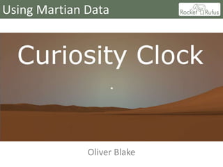
Using Martian Data


              Oliver Blake
Using Martian Data - Curiosity Clock


  •   The Curiosity Clock app
  •   Telling the time on Mars
  •   Building the Gale Crater
  •   Sunlight and shadows
  •   The Martian sky
  •   Viewing stars from Mars
The Curiosity Clock app


  • Mars Science Laboratory (Curiosity Rover) landed in
    the Gale Crater in August 2012
  • Operations on Mars are dictated by the day/night
    cycle, so calculations of time help with mission
    planning
  • Using the time algorithms, and in conjunction with
    other available data, an Android app was created that
    gives a virtual view as seen from the rover
  • App features are...
The Curiosity Clock app
   Sols (Martian days)                       Solar Time (and current
      since landing                             displayed offset)


                                                            Position of
Sky colour                                                   the sun


  Sunrise/set times      Heading indicator           Local terrain
Telling the time on Mars
  • The time format used for Mars missions is based on the solar day -
    a Martian day (or Sol) is 24.6 Earth hours long
  • Local Mean Solar Time is a format where there are 24 hours in a
    Sol, but each Mars hour is slightly longer to allow for the longer day
  • Mars time calculations are based on the paper :
      – “A post-Pathfinder evaluation of areocentric solar coordinates with improved timing
        recipes for Mars seasonal/diurnal climate studies” by M Allison and M McEwen –
        Planetary and Space Science 48 (2000)
  • A series of numerical recipes contained within calculate the position
    of Mars with relation to the sun for a given date, and with reference
    to the landing information (time and location) for a particular Mars
    lander, can be used to calculate the Sol number and solar time
  • (Sol 0 is usually defined as starting at the local solar midnight on the
    landing day)
  • As part of the calculation the sun’s position relative to the landing
    position is also worked out (more on this later)
Building the Gale Crater - Terrain


 • The source data set – MOLA data from Mars Global
   Surveyor (launched 1996)
Building the Gale Crater - Terrain
                                  • MOLA data available for whole planet
                                  • Different levels of detail available
                                      – Lowest 4 pixels per degree – 4 * 2MB raw image files
                                      – Highest 128 pixels per degree – 32 * 124MB files
                                  • Need to balance level of detail with
                                    processing requirements


 • Image shows sub-set of data used for
   Curiosity Clock app (brighter=higher)
 • Raw image data and profile plotted with open
   source ImageJ software (not to scale
   vertically)
 • In app, data is converted to a 3D polygon
   terrain model
Building the Gale Crater - Detail


  • After creating 3D terrain
    model, image textures
    can be added to give
    more detail
  • This image of the Gale
    Crater was taken by an
    orbiter (probably MGS
    MOC) and tinted with a
    generic Martian colour!
Comparison of app view with real view


  • First panorama from Curiosity showing Mount
    Sharp (Aug 2012), and recreation from Curiosity
    Clock app
Sunlight and shadows
  • The sunlight and shadows are more a programming task, but using data
    from the first two sources
  • The Mars time algorithm can also be used to calculate the azimuth and
    elevation of the sun in the Martian sky
  • A shadow map is created by checking for any points on the terrain where a
    direct line to the sun intersects with another point on the terrain
  • This images from the app show an aerial view of the Gale Crater, with
    some shadowing visible from Mount Sharp, and a sun image with the size
    adjusted accordingly for the increased distance compared to earth
The Martian sky
  • There exist several sets of algorithms for calculating the sky colour
    on Earth, taking into account the suns position in the sky and
    atmospheric effects such as fog and haze.
  • The basic effect is suitable for Mars – brighter as sun rises, bright in
    direction of sun etc.
  • Main difference is sky colour (usually referred to as butterscotch)
  • Studies done of Mars sky                                               2006

    colour using images from
    Spirit and Opportunity Rovers
  • Other difference from Earth
    is blue sunsets (Spirit image)
Viewing stars from Mars
  • Roughly half the time (depending on season) app is
    used will be darkness – obvious answer to add interest
    was to add some stars
  • Bright Stars Catalogue lists brightest 9110 stars as seen
    from Earth – position in sky, magnitude and colour
  • Celestial sphere same for
    Mars – although offset due                          VAUCOULEURS 1964

    to different axial tilt – both
    angle and direction (pole
    stars etc. different)
  • Drew the line at adding
    moons, Phobos and
    Deimos! (shapes, orbits etc)
24 hours on Mars

More Related Content

What's hot

Presentation thesis
Presentation thesisPresentation thesis
Presentation thesiss1150048
 
Global positioning system_Surveying, Civil Engineering
Global positioning system_Surveying, Civil EngineeringGlobal positioning system_Surveying, Civil Engineering
Global positioning system_Surveying, Civil EngineeringA Makwana
 
The Integration of Geospatial Technologies: GIS and GPS
The Integration of Geospatial Technologies: GIS and GPS	The Integration of Geospatial Technologies: GIS and GPS
The Integration of Geospatial Technologies: GIS and GPS Lindsey Landolfi
 
Remote sensing and gps
Remote sensing and gpsRemote sensing and gps
Remote sensing and gpsmsfbi1521
 
Android GPS Tutorial
Android GPS TutorialAndroid GPS Tutorial
Android GPS TutorialAhsanul Karim
 
GLOBAL POSITIONING SYSTEM(GPS)
GLOBAL POSITIONING SYSTEM(GPS)GLOBAL POSITIONING SYSTEM(GPS)
GLOBAL POSITIONING SYSTEM(GPS)Pratik Patil
 
Gps (global positioning system)
Gps (global positioning system)Gps (global positioning system)
Gps (global positioning system)Yousuf S A
 
Envi sat satellite
Envi sat satelliteEnvi sat satellite
Envi sat satelliteEhsanYousaf1
 
Applications of remote sensing in glaciology
Applications of remote sensing in glaciologyApplications of remote sensing in glaciology
Applications of remote sensing in glaciologyAmenu
 
MINERAL EXPLORATION USING ASTER IMAGE
MINERAL EXPLORATION USING ASTER IMAGE MINERAL EXPLORATION USING ASTER IMAGE
MINERAL EXPLORATION USING ASTER IMAGE Abhiram Kanigolla
 
How to use GPS and GIS in Surveying - Report
How to use GPS and GIS in Surveying - ReportHow to use GPS and GIS in Surveying - Report
How to use GPS and GIS in Surveying - ReportSarchia Khursheed
 
Applications of remote sensing in geological aspects
Applications of remote sensing in geological aspectsApplications of remote sensing in geological aspects
Applications of remote sensing in geological aspectsPramoda Raj
 
Application of GIS and Remote Sensing
Application of GIS and Remote SensingApplication of GIS and Remote Sensing
Application of GIS and Remote SensingApu Nayem
 
Presentation on GPS
Presentation  on GPSPresentation  on GPS
Presentation on GPSAmit Bshwas
 
Band Combination of Landsat 8 Earth-observing Satellite Images
Band Combination of Landsat 8 Earth-observing Satellite ImagesBand Combination of Landsat 8 Earth-observing Satellite Images
Band Combination of Landsat 8 Earth-observing Satellite ImagesKabir Uddin
 
The Global Positioning System (GPS)
The Global Positioning System (GPS) The Global Positioning System (GPS)
The Global Positioning System (GPS) Lotfy Helal
 

What's hot (20)

Remote sensing
Remote sensingRemote sensing
Remote sensing
 
Presentation thesis
Presentation thesisPresentation thesis
Presentation thesis
 
GPS & GIS
GPS & GISGPS & GIS
GPS & GIS
 
Global positioning system_Surveying, Civil Engineering
Global positioning system_Surveying, Civil EngineeringGlobal positioning system_Surveying, Civil Engineering
Global positioning system_Surveying, Civil Engineering
 
The Integration of Geospatial Technologies: GIS and GPS
The Integration of Geospatial Technologies: GIS and GPS	The Integration of Geospatial Technologies: GIS and GPS
The Integration of Geospatial Technologies: GIS and GPS
 
Remote sensing and gps
Remote sensing and gpsRemote sensing and gps
Remote sensing and gps
 
Android GPS Tutorial
Android GPS TutorialAndroid GPS Tutorial
Android GPS Tutorial
 
GLOBAL POSITIONING SYSTEM(GPS)
GLOBAL POSITIONING SYSTEM(GPS)GLOBAL POSITIONING SYSTEM(GPS)
GLOBAL POSITIONING SYSTEM(GPS)
 
GPS
GPS GPS
GPS
 
Gps (global positioning system)
Gps (global positioning system)Gps (global positioning system)
Gps (global positioning system)
 
Envi sat satellite
Envi sat satelliteEnvi sat satellite
Envi sat satellite
 
Applications of remote sensing in glaciology
Applications of remote sensing in glaciologyApplications of remote sensing in glaciology
Applications of remote sensing in glaciology
 
MINERAL EXPLORATION USING ASTER IMAGE
MINERAL EXPLORATION USING ASTER IMAGE MINERAL EXPLORATION USING ASTER IMAGE
MINERAL EXPLORATION USING ASTER IMAGE
 
How to use GPS and GIS in Surveying - Report
How to use GPS and GIS in Surveying - ReportHow to use GPS and GIS in Surveying - Report
How to use GPS and GIS in Surveying - Report
 
Applications of remote sensing in geological aspects
Applications of remote sensing in geological aspectsApplications of remote sensing in geological aspects
Applications of remote sensing in geological aspects
 
Application of GIS and Remote Sensing
Application of GIS and Remote SensingApplication of GIS and Remote Sensing
Application of GIS and Remote Sensing
 
Landsat program
Landsat programLandsat program
Landsat program
 
Presentation on GPS
Presentation  on GPSPresentation  on GPS
Presentation on GPS
 
Band Combination of Landsat 8 Earth-observing Satellite Images
Band Combination of Landsat 8 Earth-observing Satellite ImagesBand Combination of Landsat 8 Earth-observing Satellite Images
Band Combination of Landsat 8 Earth-observing Satellite Images
 
The Global Positioning System (GPS)
The Global Positioning System (GPS) The Global Positioning System (GPS)
The Global Positioning System (GPS)
 

Viewers also liked

героические страницы пос боровуха
героические страницы пос боровухагероические страницы пос боровуха
героические страницы пос боровухаBSH15
 
HUB:BLE-1 Boosting Local Enterprise - Business Advice
HUB:BLE-1 Boosting Local Enterprise - Business AdviceHUB:BLE-1 Boosting Local Enterprise - Business Advice
HUB:BLE-1 Boosting Local Enterprise - Business AdviceSpace IDEAS Hub
 
Adjectives 1
Adjectives 1Adjectives 1
Adjectives 1Rosie18
 
Brochure bevande
Brochure bevandeBrochure bevande
Brochure bevandeseatlecco
 
HUB:BLE-2 07 Finding Your Market
HUB:BLE-2 07   Finding Your MarketHUB:BLE-2 07   Finding Your Market
HUB:BLE-2 07 Finding Your MarketSpace IDEAS Hub
 
HUB:BLE-3 - Session 1 Business and Technology
HUB:BLE-3 - Session 1 Business and TechnologyHUB:BLE-3 - Session 1 Business and Technology
HUB:BLE-3 - Session 1 Business and TechnologySpace IDEAS Hub
 
Medical Imaging Seminar Session 3a
Medical Imaging Seminar Session 3aMedical Imaging Seminar Session 3a
Medical Imaging Seminar Session 3aSpace IDEAS Hub
 
Brochure acqua
Brochure acquaBrochure acqua
Brochure acquaseatlecco
 
Brochure birra
Brochure birraBrochure birra
Brochure birraseatlecco
 
Brochure vino
Brochure vinoBrochure vino
Brochure vinoseatlecco
 
Brochure acqua
Brochure acquaBrochure acqua
Brochure acquaseatlecco
 
Brochure acqua
Brochure acquaBrochure acqua
Brochure acquaseatlecco
 
Stratified Medicine - Applications and Case Studies
Stratified Medicine - Applications and Case StudiesStratified Medicine - Applications and Case Studies
Stratified Medicine - Applications and Case StudiesSpace IDEAS Hub
 
Stratified medicine - How Can We Help Each Other
Stratified medicine  - How Can We Help Each OtherStratified medicine  - How Can We Help Each Other
Stratified medicine - How Can We Help Each OtherSpace IDEAS Hub
 
How Real is Nerium's Social Media Performance?
How Real is Nerium's Social Media Performance?How Real is Nerium's Social Media Performance?
How Real is Nerium's Social Media Performance?Unmetric
 

Viewers also liked (20)

героические страницы пос боровуха
героические страницы пос боровухагероические страницы пос боровуха
героические страницы пос боровуха
 
HUB:BLE-1 Boosting Local Enterprise - Business Advice
HUB:BLE-1 Boosting Local Enterprise - Business AdviceHUB:BLE-1 Boosting Local Enterprise - Business Advice
HUB:BLE-1 Boosting Local Enterprise - Business Advice
 
In class powerpoint
In class powerpointIn class powerpoint
In class powerpoint
 
Adjectives 1
Adjectives 1Adjectives 1
Adjectives 1
 
Brochure bevande
Brochure bevandeBrochure bevande
Brochure bevande
 
Assignment#2
Assignment#2Assignment#2
Assignment#2
 
9 frame analysis 2
9 frame analysis 29 frame analysis 2
9 frame analysis 2
 
HUB:BLE-2 07 Finding Your Market
HUB:BLE-2 07   Finding Your MarketHUB:BLE-2 07   Finding Your Market
HUB:BLE-2 07 Finding Your Market
 
HUB:BLE-3 - Session 1 Business and Technology
HUB:BLE-3 - Session 1 Business and TechnologyHUB:BLE-3 - Session 1 Business and Technology
HUB:BLE-3 - Session 1 Business and Technology
 
Medical Imaging Seminar Session 3a
Medical Imaging Seminar Session 3aMedical Imaging Seminar Session 3a
Medical Imaging Seminar Session 3a
 
Brochure acqua
Brochure acquaBrochure acqua
Brochure acqua
 
Brochure birra
Brochure birraBrochure birra
Brochure birra
 
Brochure vino
Brochure vinoBrochure vino
Brochure vino
 
Brochure acqua
Brochure acquaBrochure acqua
Brochure acqua
 
Brochure acqua
Brochure acquaBrochure acqua
Brochure acqua
 
Stratified Medicine - Applications and Case Studies
Stratified Medicine - Applications and Case StudiesStratified Medicine - Applications and Case Studies
Stratified Medicine - Applications and Case Studies
 
Stratified medicine - How Can We Help Each Other
Stratified medicine  - How Can We Help Each OtherStratified medicine  - How Can We Help Each Other
Stratified medicine - How Can We Help Each Other
 
Chris Shaw feature
Chris Shaw featureChris Shaw feature
Chris Shaw feature
 
How Real is Nerium's Social Media Performance?
How Real is Nerium's Social Media Performance?How Real is Nerium's Social Media Performance?
How Real is Nerium's Social Media Performance?
 
Siete Sicuri
Siete SicuriSiete Sicuri
Siete Sicuri
 

Similar to Curiosity clock presentation

INMWG-23feb2016.ppt
INMWG-23feb2016.pptINMWG-23feb2016.ppt
INMWG-23feb2016.pptAditi108918
 
Solar System Facts and Brochure Project
Solar System Facts and Brochure ProjectSolar System Facts and Brochure Project
Solar System Facts and Brochure Projectiesbscience
 
Solar system facts and brochure project
Solar system facts and brochure projectSolar system facts and brochure project
Solar system facts and brochure projectiesbscience
 
All the presentation o Alf Christian.ppt
All the presentation o Alf Christian.pptAll the presentation o Alf Christian.ppt
All the presentation o Alf Christian.pptUnknown102754
 
Mars Mission of india (MANGALYAN)
Mars Mission of india (MANGALYAN)Mars Mission of india (MANGALYAN)
Mars Mission of india (MANGALYAN)Pravin Dahale
 
Satellite and aerial surveys
Satellite and aerial surveysSatellite and aerial surveys
Satellite and aerial surveysJulian Swindell
 
Unreal Summit 2016 Seoul Lighting the Planetary World of Project A1
Unreal Summit 2016 Seoul Lighting the Planetary World of Project A1Unreal Summit 2016 Seoul Lighting the Planetary World of Project A1
Unreal Summit 2016 Seoul Lighting the Planetary World of Project A1Ki Hyunwoo
 
Satellite Geodesy Lecture Notes MSU 2015.pptx
Satellite Geodesy Lecture Notes MSU 2015.pptxSatellite Geodesy Lecture Notes MSU 2015.pptx
Satellite Geodesy Lecture Notes MSU 2015.pptxTNNNelson
 
FIELD ASTRONOMY SURVEYING
FIELD ASTRONOMY SURVEYINGFIELD ASTRONOMY SURVEYING
FIELD ASTRONOMY SURVEYINGKavin Raval
 
sunpath diagrams- different forms and their uses in functional design
sunpath diagrams- different forms and their uses in functional designsunpath diagrams- different forms and their uses in functional design
sunpath diagrams- different forms and their uses in functional designKOMPELLA KASYAPA SRIRAM
 
Satellite science
Satellite scienceSatellite science
Satellite scienceVishwas N
 
MARS Images ISRO-NASA-Compiled by Sanjoy Sanyal
MARS Images ISRO-NASA-Compiled by Sanjoy SanyalMARS Images ISRO-NASA-Compiled by Sanjoy Sanyal
MARS Images ISRO-NASA-Compiled by Sanjoy SanyalSanjoy Sanyal
 
History of Earth Gravity Model
History of Earth Gravity ModelHistory of Earth Gravity Model
History of Earth Gravity ModelPawan Singh
 
palnet.pptx
palnet.pptxpalnet.pptx
palnet.pptxmijknewz
 
mateorological and ocean monitoring satellite (2).pptx
mateorological and ocean monitoring satellite (2).pptxmateorological and ocean monitoring satellite (2).pptx
mateorological and ocean monitoring satellite (2).pptxsapna kinattinkara
 
Asteroid deflection methods for mining purposes
Asteroid deflection methods for mining purposesAsteroid deflection methods for mining purposes
Asteroid deflection methods for mining purposesRemco Timmermans
 

Similar to Curiosity clock presentation (20)

INMWG-23feb2016.ppt
INMWG-23feb2016.pptINMWG-23feb2016.ppt
INMWG-23feb2016.ppt
 
Solar System Facts and Brochure Project
Solar System Facts and Brochure ProjectSolar System Facts and Brochure Project
Solar System Facts and Brochure Project
 
Solar system facts and brochure project
Solar system facts and brochure projectSolar system facts and brochure project
Solar system facts and brochure project
 
Mangalyan Mission
Mangalyan MissionMangalyan Mission
Mangalyan Mission
 
All the presentation o Alf Christian.ppt
All the presentation o Alf Christian.pptAll the presentation o Alf Christian.ppt
All the presentation o Alf Christian.ppt
 
Mangalyaan By YOGEESH
Mangalyaan By YOGEESHMangalyaan By YOGEESH
Mangalyaan By YOGEESH
 
Mars Mission of india (MANGALYAN)
Mars Mission of india (MANGALYAN)Mars Mission of india (MANGALYAN)
Mars Mission of india (MANGALYAN)
 
Satellite and aerial surveys
Satellite and aerial surveysSatellite and aerial surveys
Satellite and aerial surveys
 
Unreal Summit 2016 Seoul Lighting the Planetary World of Project A1
Unreal Summit 2016 Seoul Lighting the Planetary World of Project A1Unreal Summit 2016 Seoul Lighting the Planetary World of Project A1
Unreal Summit 2016 Seoul Lighting the Planetary World of Project A1
 
Satellite Geodesy Lecture Notes MSU 2015.pptx
Satellite Geodesy Lecture Notes MSU 2015.pptxSatellite Geodesy Lecture Notes MSU 2015.pptx
Satellite Geodesy Lecture Notes MSU 2015.pptx
 
429Talk
429Talk429Talk
429Talk
 
Lunar Laser Ranging
Lunar Laser RangingLunar Laser Ranging
Lunar Laser Ranging
 
FIELD ASTRONOMY SURVEYING
FIELD ASTRONOMY SURVEYINGFIELD ASTRONOMY SURVEYING
FIELD ASTRONOMY SURVEYING
 
sunpath diagrams- different forms and their uses in functional design
sunpath diagrams- different forms and their uses in functional designsunpath diagrams- different forms and their uses in functional design
sunpath diagrams- different forms and their uses in functional design
 
Satellite science
Satellite scienceSatellite science
Satellite science
 
MARS Images ISRO-NASA-Compiled by Sanjoy Sanyal
MARS Images ISRO-NASA-Compiled by Sanjoy SanyalMARS Images ISRO-NASA-Compiled by Sanjoy Sanyal
MARS Images ISRO-NASA-Compiled by Sanjoy Sanyal
 
History of Earth Gravity Model
History of Earth Gravity ModelHistory of Earth Gravity Model
History of Earth Gravity Model
 
palnet.pptx
palnet.pptxpalnet.pptx
palnet.pptx
 
mateorological and ocean monitoring satellite (2).pptx
mateorological and ocean monitoring satellite (2).pptxmateorological and ocean monitoring satellite (2).pptx
mateorological and ocean monitoring satellite (2).pptx
 
Asteroid deflection methods for mining purposes
Asteroid deflection methods for mining purposesAsteroid deflection methods for mining purposes
Asteroid deflection methods for mining purposes
 

More from Space IDEAS Hub

HUB:BLE-2 01 Day 1 Plenary
HUB:BLE-2 01 Day 1 PlenaryHUB:BLE-2 01 Day 1 Plenary
HUB:BLE-2 01 Day 1 PlenarySpace IDEAS Hub
 
HUB:BLE-2 02 Growth and Entrepreneurship
HUB:BLE-2 02 Growth and EntrepreneurshipHUB:BLE-2 02 Growth and Entrepreneurship
HUB:BLE-2 02 Growth and EntrepreneurshipSpace IDEAS Hub
 
HUB:BLE-2 03 Developing Your Idea
HUB:BLE-2 03 Developing Your IdeaHUB:BLE-2 03 Developing Your Idea
HUB:BLE-2 03 Developing Your IdeaSpace IDEAS Hub
 
HUB:BLE-2 04 Help Along the Way
HUB:BLE-2 04 Help Along the WayHUB:BLE-2 04 Help Along the Way
HUB:BLE-2 04 Help Along the WaySpace IDEAS Hub
 
HUB:BLE -2 05 Business Needs from Education
HUB:BLE -2 05 Business Needs from EducationHUB:BLE -2 05 Business Needs from Education
HUB:BLE -2 05 Business Needs from EducationSpace IDEAS Hub
 
HUB:BLE-2 06 Day 2 Plenary
HUB:BLE-2 06  Day 2 PlenaryHUB:BLE-2 06  Day 2 Plenary
HUB:BLE-2 06 Day 2 PlenarySpace IDEAS Hub
 
HUB:BLE-2 08 reaching the world
HUB:BLE-2 08   reaching the worldHUB:BLE-2 08   reaching the world
HUB:BLE-2 08 reaching the worldSpace IDEAS Hub
 
HUB:BLE-2 09 short company pitches
HUB:BLE-2 09   short company pitchesHUB:BLE-2 09   short company pitches
HUB:BLE-2 09 short company pitchesSpace IDEAS Hub
 
HUB:BLE-1 Session 3 ESNC and Company Pitches
HUB:BLE-1 Session 3 ESNC and Company PitchesHUB:BLE-1 Session 3 ESNC and Company Pitches
HUB:BLE-1 Session 3 ESNC and Company PitchesSpace IDEAS Hub
 
Dark matter and teaspoons
Dark matter and teaspoonsDark matter and teaspoons
Dark matter and teaspoonsSpace IDEAS Hub
 
Stratified Medicine - Setting the Scene
Stratified Medicine - Setting the SceneStratified Medicine - Setting the Scene
Stratified Medicine - Setting the SceneSpace IDEAS Hub
 
Stratified medicine - Company Pitches
Stratified medicine  - Company PitchesStratified medicine  - Company Pitches
Stratified medicine - Company PitchesSpace IDEAS Hub
 
Hubble session 1 case studies
Hubble session 1 case studiesHubble session 1 case studies
Hubble session 1 case studiesSpace IDEAS Hub
 
Hubble session 2 business advice
Hubble session 2 business adviceHubble session 2 business advice
Hubble session 2 business adviceSpace IDEAS Hub
 
Medical Imaging Seminar Session 2
Medical Imaging Seminar Session 2Medical Imaging Seminar Session 2
Medical Imaging Seminar Session 2Space IDEAS Hub
 
Medical Imaging Seminar Company Presentations
Medical Imaging Seminar Company PresentationsMedical Imaging Seminar Company Presentations
Medical Imaging Seminar Company PresentationsSpace IDEAS Hub
 
Medical Imaging Seminar Session 3b
Medical Imaging Seminar Session 3bMedical Imaging Seminar Session 3b
Medical Imaging Seminar Session 3bSpace IDEAS Hub
 

More from Space IDEAS Hub (20)

HUB:BLE-2 01 Day 1 Plenary
HUB:BLE-2 01 Day 1 PlenaryHUB:BLE-2 01 Day 1 Plenary
HUB:BLE-2 01 Day 1 Plenary
 
HUB:BLE-2 02 Growth and Entrepreneurship
HUB:BLE-2 02 Growth and EntrepreneurshipHUB:BLE-2 02 Growth and Entrepreneurship
HUB:BLE-2 02 Growth and Entrepreneurship
 
HUB:BLE-2 03 Developing Your Idea
HUB:BLE-2 03 Developing Your IdeaHUB:BLE-2 03 Developing Your Idea
HUB:BLE-2 03 Developing Your Idea
 
HUB:BLE-2 04 Help Along the Way
HUB:BLE-2 04 Help Along the WayHUB:BLE-2 04 Help Along the Way
HUB:BLE-2 04 Help Along the Way
 
HUB:BLE -2 05 Business Needs from Education
HUB:BLE -2 05 Business Needs from EducationHUB:BLE -2 05 Business Needs from Education
HUB:BLE -2 05 Business Needs from Education
 
HUB:BLE-2 06 Day 2 Plenary
HUB:BLE-2 06  Day 2 PlenaryHUB:BLE-2 06  Day 2 Plenary
HUB:BLE-2 06 Day 2 Plenary
 
HUB:BLE-2 08 reaching the world
HUB:BLE-2 08   reaching the worldHUB:BLE-2 08   reaching the world
HUB:BLE-2 08 reaching the world
 
HUB:BLE-2 09 short company pitches
HUB:BLE-2 09   short company pitchesHUB:BLE-2 09   short company pitches
HUB:BLE-2 09 short company pitches
 
HUB:BLE-1 Session 3 ESNC and Company Pitches
HUB:BLE-1 Session 3 ESNC and Company PitchesHUB:BLE-1 Session 3 ESNC and Company Pitches
HUB:BLE-1 Session 3 ESNC and Company Pitches
 
Dark matter and teaspoons
Dark matter and teaspoonsDark matter and teaspoons
Dark matter and teaspoons
 
Engaging the public
Engaging the publicEngaging the public
Engaging the public
 
Stratified Medicine - Setting the Scene
Stratified Medicine - Setting the SceneStratified Medicine - Setting the Scene
Stratified Medicine - Setting the Scene
 
Stratified medicine - Company Pitches
Stratified medicine  - Company PitchesStratified medicine  - Company Pitches
Stratified medicine - Company Pitches
 
Hubble welcome address
Hubble welcome addressHubble welcome address
Hubble welcome address
 
Hubble session 1 case studies
Hubble session 1 case studiesHubble session 1 case studies
Hubble session 1 case studies
 
Hubble session 2 business advice
Hubble session 2 business adviceHubble session 2 business advice
Hubble session 2 business advice
 
Hubble company pitches
Hubble company pitchesHubble company pitches
Hubble company pitches
 
Medical Imaging Seminar Session 2
Medical Imaging Seminar Session 2Medical Imaging Seminar Session 2
Medical Imaging Seminar Session 2
 
Medical Imaging Seminar Company Presentations
Medical Imaging Seminar Company PresentationsMedical Imaging Seminar Company Presentations
Medical Imaging Seminar Company Presentations
 
Medical Imaging Seminar Session 3b
Medical Imaging Seminar Session 3bMedical Imaging Seminar Session 3b
Medical Imaging Seminar Session 3b
 

Curiosity clock presentation

  • 1. Using Martian Data Oliver Blake
  • 2. Using Martian Data - Curiosity Clock • The Curiosity Clock app • Telling the time on Mars • Building the Gale Crater • Sunlight and shadows • The Martian sky • Viewing stars from Mars
  • 3. The Curiosity Clock app • Mars Science Laboratory (Curiosity Rover) landed in the Gale Crater in August 2012 • Operations on Mars are dictated by the day/night cycle, so calculations of time help with mission planning • Using the time algorithms, and in conjunction with other available data, an Android app was created that gives a virtual view as seen from the rover • App features are...
  • 4. The Curiosity Clock app Sols (Martian days) Solar Time (and current since landing displayed offset) Position of Sky colour the sun Sunrise/set times Heading indicator Local terrain
  • 5. Telling the time on Mars • The time format used for Mars missions is based on the solar day - a Martian day (or Sol) is 24.6 Earth hours long • Local Mean Solar Time is a format where there are 24 hours in a Sol, but each Mars hour is slightly longer to allow for the longer day • Mars time calculations are based on the paper : – “A post-Pathfinder evaluation of areocentric solar coordinates with improved timing recipes for Mars seasonal/diurnal climate studies” by M Allison and M McEwen – Planetary and Space Science 48 (2000) • A series of numerical recipes contained within calculate the position of Mars with relation to the sun for a given date, and with reference to the landing information (time and location) for a particular Mars lander, can be used to calculate the Sol number and solar time • (Sol 0 is usually defined as starting at the local solar midnight on the landing day) • As part of the calculation the sun’s position relative to the landing position is also worked out (more on this later)
  • 6. Building the Gale Crater - Terrain • The source data set – MOLA data from Mars Global Surveyor (launched 1996)
  • 7. Building the Gale Crater - Terrain • MOLA data available for whole planet • Different levels of detail available – Lowest 4 pixels per degree – 4 * 2MB raw image files – Highest 128 pixels per degree – 32 * 124MB files • Need to balance level of detail with processing requirements • Image shows sub-set of data used for Curiosity Clock app (brighter=higher) • Raw image data and profile plotted with open source ImageJ software (not to scale vertically) • In app, data is converted to a 3D polygon terrain model
  • 8. Building the Gale Crater - Detail • After creating 3D terrain model, image textures can be added to give more detail • This image of the Gale Crater was taken by an orbiter (probably MGS MOC) and tinted with a generic Martian colour!
  • 9. Comparison of app view with real view • First panorama from Curiosity showing Mount Sharp (Aug 2012), and recreation from Curiosity Clock app
  • 10. Sunlight and shadows • The sunlight and shadows are more a programming task, but using data from the first two sources • The Mars time algorithm can also be used to calculate the azimuth and elevation of the sun in the Martian sky • A shadow map is created by checking for any points on the terrain where a direct line to the sun intersects with another point on the terrain • This images from the app show an aerial view of the Gale Crater, with some shadowing visible from Mount Sharp, and a sun image with the size adjusted accordingly for the increased distance compared to earth
  • 11. The Martian sky • There exist several sets of algorithms for calculating the sky colour on Earth, taking into account the suns position in the sky and atmospheric effects such as fog and haze. • The basic effect is suitable for Mars – brighter as sun rises, bright in direction of sun etc. • Main difference is sky colour (usually referred to as butterscotch) • Studies done of Mars sky 2006 colour using images from Spirit and Opportunity Rovers • Other difference from Earth is blue sunsets (Spirit image)
  • 12. Viewing stars from Mars • Roughly half the time (depending on season) app is used will be darkness – obvious answer to add interest was to add some stars • Bright Stars Catalogue lists brightest 9110 stars as seen from Earth – position in sky, magnitude and colour • Celestial sphere same for Mars – although offset due VAUCOULEURS 1964 to different axial tilt – both angle and direction (pole stars etc. different) • Drew the line at adding moons, Phobos and Deimos! (shapes, orbits etc)
  • 13. 24 hours on Mars