
Recommended
More Related Content
What's hot
What's hot (20)
Similar to Satellite and Space Communication
Similar to Satellite and Space Communication (20)
Recently uploaded
Recently uploaded (20)
Satellite and Space Communication
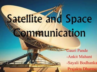
- 1. Satellite and Space Communication Gauri Pande -Ankit Mahant -Sayali Bodhanka Prajakta Dharme
- 4. Types of satellites ARTIFICIAL -astronomical -biosatellites -communication -earth observing and navigational -weather forecasting -military -killer NATURAL Planets have their own satellites. Earth has moon as it’s satellite.
- 5. Launching of a Satellite
- 8. M M!!!!! Cost efficient. Total cost was only 450 crore making it the least expensive mission till date. Fuel efficient. India is the only country successful in sending a satellite to mars in first attempt.
- 10. Space Communication • The receiving, sending and processing of information using space as a medium is called SPACE COMMUNICATION. • In satellite communication, signal transferring between the sender and receiver is done with the help of satellite.
- 11. GPS Official name of GPS is Navigational Satellite Timing And Ranging Global Positioning System (NAVSTAR GPS). First developed by the United States Department of Defense. Consists of 2 dozen GPS satellites in medium Earth orbit. GPS operates using radio signals sent from satellites orbiting the earth.
- 12. Primary functions of a GPS Position and coordinates. The distance and direction between any two waypoints, or a position and a waypoint. Travel progress reports. Accurate time measurement.
- 13. TrilaterationProcess of determining absolute or relative location of the points by measurement of distances using the geometry of spheres, circles and triangles
- 15. Google Maps Google Map makes navigating your world faster and easier. Voice-guided GPS navigation for driving, cycling and walking. Live traffic conditions and automatic re- routing to find the best route possible. Detailed information on more than 100 million places.
- 16. How A Receiver “Sees” Your Route Yellow stars: where you want to go. Green stars: where the GPS receiver may take you. Blue circles: the potential circle of GPS error at each waypoint.
- 17. Google street view Google Street View is a technology featured in Google Maps and Google Earth that provides 360 degree view from positions along many streets in the world. Launched in 2007 in several cities in the United States, and has since expanded to include cities and rural areas worldwide.
- 21. Potential Threats • Time delay. • Overcrowding of available bandwidth. • Repair of satellites once it is launched? • Huge installation cost. • Space Debris
- 24. Communication satellites bring the world to you anywhere and any time………………….
Editor's Notes
- How a GPS Receiver “Sees” the Route If you could visualize how a GPS receiver “sees” a route programmed into its memory, it might look something like the diagram above. Each plotted waypoint is represented by a yellow star in the center of each circle. However due to signal interference and other errors the receiver is fooled into seeing multiple potential waypoints at each site within the limits of the current sphere of error (which could be anywhere from a couple of meters to more than a kilometer depending on the cumulative effects of errors the receiver is subjected to). Those circles of possible error are represented by the circles in the diagram. As the receiver approaches each designated waypoint, errors identify multiple potential sites where the receiver thinks the waypoint coordinates may exist. As the navigator moves closer to, and around, the target waypoint, the receiver is continuously fooled by conflicting errors. When approaching a waypoint or destination it’s up to the user to not rely on the receiver to navigate the last few meters to the destination, but rather, it’s better to use other means of navigation or site location to reach the final destination. Here’s an example. Let’s say that a mountain climber is navigating by GPS back to his tent in a whiteout. Visibility is less than twenty feet. The climber had programmed the tent’s location into his GPS receiver that morning before leaving camp. As the climber nears his tent, say roughly forty feet, the GPS receiver may no longer be reliable enough for navigating the last short distance to the tent. The climber may have to rely on other means to reach the tent safely. The next diagram demonstrates the conflicting path a GPS receiver may plot as it nears a waypoint.