
Recommended
More Related Content
Similar to Precipitation.pptx
Similar to Precipitation.pptx (20)
Recently uploaded
Recently uploaded (20)
Precipitation.pptx
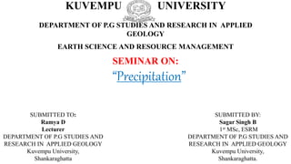
- 1. KUVEMPU UNIVERSITY DEPARTMENT OF P.G STUDIES AND RESEARCH IN APPLIED GEOLOGY EARTH SCIENCE AND RESOURCE MANAGEMENT SEMINAR ON: SUBMITTED TO: Ramya D Lecturer DEPARTMENT OF P.G STUDIES AND RESEARCH IN APPLIED GEOLOGY Kuvempu University, Shankaraghatta “Precipitation” SUBMITTED BY: Sagar Singh B 1st MSc, ESRM DEPARTMENT OF P.G STUDIES AND RESEARCH IN APPLIED GEOLOGY Kuvempu University, Shankaraghatta.
- 3. Precipitation Precipitation is the process in which the condensed products (clouds) fall on surface under the influence of gravity in form of rain, snow drizzle etc.
- 4. Forms Of Precipitation • Liquid Precipitation- Rain(>0.5mm), Drizzle(<0.5mm) • Frozen Precipitation- Snow, Hail, Glaze • Freezing Precipitation- Rime, Sleet • Mixed Precipitation-
- 5. Rain • Diameter =or> than 0.5 mm. • Rain originates in either Nimbostratus clouds or in towering Cumulonimbus. • Depending on the humidity of the air and the size of the drops, the rain may completely evaporate before reaching the ground. This phenomenon produces Virga
- 6. Drizzle • Diameter < 0.5 mm are called Drizzle. • Drizzle and small rain drops generally are produced in stratus or nimbostratus clouds. • Precipitation may be continuous for several hours or for days on rare occasions • Depending on the humidity of the air and the size of the drops similar to virga, ice crystals may sublimate when they enter the dry air below. These wisps of ice particles are called Fall streaks.
- 7. Snow • Snow is precipitation in the form of ice crystals or, more often, aggregates of ice crystals. • The size, shape, and concentration of snowflakes depend to a great extent on the temperature at which they form.. • By contrast, at temperatures warmer than about −5°C (23°F), the ice crystals join together into larger clumps consisting of tangled aggregates of crystals. • Snowfalls consisting of these composite snowflakes are generally heavy and have a high moisture content, which makes them ideal for making snowballs
- 8. Hail • Hail is precipitation in the form of hard, rounded pellets or irregular lumps of ice. • It is produced only in large cumulonimbus clouds where updrafts can sometimes reach speeds approaching 160 kilometers (100 miles) per hour and where there is an abundant supply of supercooled water. • Hailstones begin as small embryonic ice pellets (graupel) that grow by collecting supercooled droplets as they fall through the cloud. • If they encounter a strong updraft, they may be carried upward again and begin the return downward journey.
- 9. Glaze • In these situations, the raindrops become super cooled because the subfreezing air near the ground is not thick enough to cause them to freeze. • Upon striking objects on Earth’s surface, these supercooled raindrops instantly turn to ice. • The result can be a thick coating of glaze that has sufficient weight to break tree limbs, down power lines, and make walking and driving extremely hazardous.
- 10. Rime • Rime is a deposit of ice crystals formed by the freezing of supercooled fog or cloud droplets on objects whose surface temperature is below freezing. • When rime forms on trees, it adorns them with its characteristic ice feathers, which can be spectacular to observe • In these situations, objects such as pine needles act as freezing nuclei, causing the supercooled droplets to freeze on contact. • On occasions when the wind is blowing, only the windward surfaces of objects will accumulate the layer of rime.
- 11. Sleet • Sleet is a wintertime phenomenon that involves the fall of clear to translucent particles of ice. • An above-freezing air layer must overlie a subfreezing layer near the ground. • When the raindrops, which are often melted snow, leave the warmer air and encounter the colder air below, they freeze and reach the ground as small pellets of ice roughly the size of the raindrops from which they formed.
- 12. Precipitation Formation • Precipitation from Warm Clouds [The Collision-Coalescence Process] • Precipitation from Cold Clouds [The Bergeron Process]
- 13. The Collision-Coalescence Process • If a droplet with a negative charge collides with a positively charged droplet, their electrical attraction may bind them together. • Within developing cumulus clouds, the largest drops quickly gather smaller droplets to generate the warm afternoon showers associated with tropical climates. • In the middle latitudes the collision–coalescence process may contribute to the precipitation from a large cumulonimbus cloud by working in tandem with the Bergeron process particularly during the hot, humid summer months. High in these towers the Bergeron process generates snow that melts as it passes below the freezing level. Melting generates relatively large drops with fast fall velocities. • As these large drops descend, they overtake and coalesce with the slower and smaller cloud droplets that comprise much of the lower regions of the cloud. The result can be a heavy downpour.
- 14. The Bergeron Process • Cloud at a temperature of –10°C (14°F), where each ice crystal (snow crystal) is surrounded by many thousands of liquid droplets. • The ice crystals collect water molecules, lowering the relative humidity of the air. • Large snowflakes may consist of many individual ice crystals. The Bergeron process can produce precipitation throughout the year in the middle latitudes, provided that at least the upper portions of clouds are cold enough to generate ice crystals. • The type of precipitation (snow, sleet, rain, or freezing rain) that reaches the ground depends on the temperature profile in the lower few kilometers of the atmosphere. • When the surface temperature is above 4°C (39°F), snowflakes usually melt before they reach the ground and continue their descent as rain. Even on a hot summer day, a heavy rainfall may have begun as a snowstorm high in the clouds overhead.
- 15. Precipitation Measurements • Standard Instruments • Measuring Snowfall • Measurement by Weather RADAR
- 19. International Weather Modification • Snow and Rain Making • Fog and Cloud Dispersal • Hail Suppression • Frost Prevention
- 20. Snow and Rain Making
- 21. Fog and Cloud Dispersal
- 22. Hail Suppression
- 23. Frost Prevention
- 24. Conclusion
- 25. References Malcom G Anderson & Jeffery J McDonnel (2005) Encyclopedia of Hydrological sciences 440, 441. Lutgens & Tarbuck (2013) The atmosphere-An introduction to Meteorology 145, 146, 147, 148, 149, 150, 151, 152, 153, 154, 155. Warren Viessman, Jr & Gary L Lewis (Fourth edition) Introduction to Hydrology 15.
Editor's Notes
- Precipitation
- the term rain is restricted to drops of water that fall from a cloud and have a diameter of at least 0.5 millimeter. (Drizzle and mist have smaller droplets, and are therefore not considered rain.) Most rain originates in either nimbostratus clouds or in towering cumulonimbus clouds that are capable of producing unusually heavy rainfalls known as cloudbursts. As rain enters the unsaturated air below the cloud, it begins to evaporate. Depending on the humidity of the air and the size of the drops, the rain may completely evaporate before reaching the ground. This phenomenon produces Virga, which appear as streaks of precipitation falling from a cloud that extend toward Earth’s surface without reaching it
- Fine, uniform droplets of water having a diameter less than 0.5 millimeter are called Drizzle. Drizzle and small rain drops generally are produced in stratus or nimbostratus clouds, where precipitation may be continuous for several hours or for days on rare occasions. As rain enters the unsaturated air below the cloud, it begins to evaporate. Depending on the humidity of the air and the size of the drops similar to virga, ice crystals may sublimate when they enter the dry air below. These wisps of ice particles are called Fall streaks.
- Snow is precipitation in the form of ice crystals or, more often, aggregates of ice crystals. The size, shape, and concentration of snowflakes depend to a great extent on the temperature at which they form. Recall that at very low temperatures, the moisture content of air is low. The result is the generation of very light and fluffy snow made up of individual six-sided ice crystals. This is the “powder” that downhill skiers covet. By contrast, at temperatures warmer than about −5°C (23°F), the ice crystals join together into larger clumps consisting of tangled aggregates of crystals. Snowfalls consisting of these composite snowflakes are generally heavy and have a high moisture content, which makes them ideal for making snowballs
- Hail is precipitation in the form of hard, rounded pellets or irregular lumps of ice. Hail is produced only in large cumulonimbus clouds where updrafts can sometimes reach speeds approaching 160 kilometers (100 miles) per hour and where there is an abundant supply of supercooled water. Hailstones begin as small embryonic ice pellets (graupel) that grow by collecting supercooled droplets as they fall through the cloud. If they encounter a strong updraft, they may be carried upward again and begin the return downward journey. Each trip through the supercooled portion of the cloud results in an additional layer of ice. Hailstones can also form from a single descent through an updraft. Either way, the process continues until the hailstone grows too heavy to remain suspended by the thunderstorm’s updraft or encounters a downdraft.
- Occasionally, the distribution of temperatures in a column of air is such that freezing rain, or glaze, results. In these situations, the raindrops become super cooled because the subfreezing air near the ground is not thick enough to cause them to freeze. Upon striking objects on Earth’s surface, these supercooled raindrops instantly turn to ice. The result can be a thick coating of glaze that has sufficient weight to break tree limbs, down power lines, and make walking and driving extremely hazardous.
- Sleet is a wintertime phenomenon that involves the fall of clear to translucent particles of ice. Figure 3 illustrates how sleet is produced. An above-freezing air layer must overlie a subfreezing layer near the ground. When the raindrops, which are often melted snow, leave the warmer air and encounter the colder air below, they freeze and reach the ground as small pellets of ice roughly the size of the raindrops from which they formed.
- The standard rain gauge has a diameter of about 20 centimeters (8 inches) at the top. Once the water is caught, a funnel conducts the rain through a narrow opening into a cylindrical measuring tube that has a cross-sectional area only one-tenth as large as the receiver. Consequently, rainfall depth is magnified 10 times, which allows for accurate measurements to the nearest 0.025 centimeter (0.01 inch). When the amount of rain is less than 0.025 centimeter (0.01 inch), it is generally reported as being a trace of precipitation. The tipping-bucket gauge consists of two compartments, each one capable of holding 0.025 centimeter (0.01 inch) of rain, situated at the base of a funnel. When one “bucket” fills, it tips and empties its water. Meanwhile, the other “bucket” takes its place at the mouth of the funnel. Each time a compartment tips, an electrical circuit is closed, and 0.025 centimeter (0.01 inch) of precipitation is automatically recorded on a graph. A weighing gauge collects precipitation in a cylinder that rests on a spring balance. As the cylinder fills, the movement is transmitted to a pen that records the data.
- When snow records are kept, two measurements are normally taken—depth and water equivalent (Figure 9). Usually, the depth of snow is measured with a calibrated stick. The actual measurement is not difficult, but choosing a representative spot can be. Even when winds are light or moderate, snow drifts freely. As a rule, it is best to take several measurements in an open place, away from trees and obstructions, and then average them. To obtain the water equivalent, samples may be melted and then weighed or measured as rain.
- A radar unit has a transmitter that sends out short pulses of radio waves. The specific wavelengths that are used depend on the objects the user wants to detect. When radar is used to monitor precipitation, wavelengths between 3 and 10 centimeters are employed. These radio waves are able to penetrate small cloud droplets but are reflected by larger raindrops, ice crystals, and hailstones. The reflected signal, called an echo, is received and displayed on a TV monitor. Because the echo is “brighter” when the precipitation is more intense, modern radar is able to depict both the regional extent and rate of precipitation. Figure 10 is a typical radar display in which colours show precipitation intensity.
- The first breakthrough in weather modification came in 1946, when Vincent J. Schaefer discovered that dry ice, dropped into a supercooled cloud, spurred the growth of ice crystals. Recall that once ice crystals form in a supercooled cloud, they grow larger, at the expense of the remaining liquid cloud droplets and, upon reaching a sufficient size, fall as precipitation. Later it was learned that silver iodide crystals could also be used for cloud seeding. Unlike dry ice, which simply chills the air, silver iodide crystals act as freezing nuclei. Because silver iodide can be easily delivered to clouds from burners on the ground or from aircraft, it is a more cost-effective alternative than dry ice. For cloud seeding to trigger precipitation, certain atmospheric conditions must exist. Most importantly, a portion of the cloud must be supercooled—that is, consist of liquid droplets with temperatures at or below 0°C (32°F). Seeding of winter clouds that form along mountain barriers (orographic clouds) has been tried on numerous occasions. These clouds are thought to be good candidates for seeding because, under normal conditions, only a small percentage of the water that condenses in cold orographic clouds actually falls as precipitation. Since 1977 Colorado’s Vail and Beaver Creek ski areas have used this method to increase winter snows. An additional benefit to cloud seeding is that the increased precipitation, which melts and runs off during spring and summer months, can be collected in reservoirs for irrigation and hydroelectric power generation.
- Seeding of winter clouds that form along mountain barriers (orographic clouds) has been tried on numerous occasions. These clouds are thought to be good candidates for seeding because, under normal conditions, only a small percentage of the water that condenses in cold orographic clouds actually falls as precipitation. Since 1977 Colorado’s Vail and Beaver Creek ski areas have used this method to thereby improve visibility. Airports, harbors, and foggy stretches of interstate highway are obvious candidates. Such applications trigger a transformation in cloud composition from supercooled water droplets to ice crystals. The ice crystals then settle out, leaving an opening in the cloud or fog (Figure). The U.S. Air Force has practiced this technology for many years at airbases, and commercial airlines have used this method at selected foggy airports in the western United States.
- In 1880, a new hypothesis of hail formation sparked renewed interest in hail suppression. This untested proposal suggested that hailstones form in cold moist clouds during calm conditions. (We now know that large hailstones form in clouds with strong vertical air currents.) In this environment the pointed ends of tiny ice needles were thought to collect around a central embryo to form a spherical ice pel let. Once a layer was complete, another layer of ice crystals was added, which explains the layered structure of hailstones. It was also believed that the migration of the tiny crystals toward the embryo would not take place if there was chaos in the environment. This incorrect hypothesis of hail formation led to the development of the first “anti-hail cannons” in the 1890s. These hail cannons were vertical muzzle-loading mortars that resembled huge megaphon weighted 9000 kilograms (10 tons), was 9 meters (30 feet) tall, and pivoted in all directions. When fired, the cannons produced a loud whistling noise and a large smoke ring that rose to a height of about 300 meters (1000 feet). The noise from the cannons was thought to disrupt the development of large hailstones.
- . Warming methods employ water sprinklers, air mixing techniques, and/or orchard heaters. Sprinklers add heat in two ways: first, from the warmth of the water and, more importantly, from the latent heat of fusion released when the water freezes. As long as an ice-water mixture remains on the plants, the latent heat released will keep the temperature from dropping below 0°C (32°F). Air mixing works best when the air temperature 15 meters (50 feet) above the ground is at least 5°C (9°F) warmer than the surface temperature. By using a wind machine, the warmer air aloft is mixed with the colder surface air Orchard heaters probably produce the most successful results. However, because as many as 30 to 40 heaters are required per acre, fuel cost can be significant.