
Recommended
More Related Content
Similar to Geological Hazzard ELS 11 PDF.pdf
Similar to Geological Hazzard ELS 11 PDF.pdf (20)
More from RODELAZARES3
More from RODELAZARES3 (20)
Recently uploaded
Recently uploaded (20)
Geological Hazzard ELS 11 PDF.pdf
- 4. GEOLOGICAL HAZARDS - A geologic hazard is an extreme natural events in the crust of the earth that pose a threat to life and property. These hazards are geological and environmental conditions and involve long-term or short-term geological processes. Geohazards can be relatively small features, but they can also attain huge dimensions and affect local and regional socio-economics to a large extent.
- 5. The Philippines ranks among the world’s most disaster-prone countries. It is highly prone to natural disasters, particularly typhoons, floods, landslides, volcanic eruptions, earthquakes, and tsunamis, lying as it does in the typhoon belt, in the active volcanic region known as the “Pacific Ring of Fire,” and in the geologically unstable region between the Pacific and Eurasian tectonic plates. Aside from the natural disasters that reap an especially heavy human toll each year, thousands are also displaced by human-made disasters like armed conflict and development aggression. The intensifying effect of climate change also aggravates the already burdened citizens with the worsening economic instability worldwide (CDRC, 2014)
- 7. VOLCANIC ERUPTION A volcano is an opening or rupture in the earth’s surface that allows magma (hot liquid and semi-liquid rock), volcanic ash and gases to escape. They are generally found where tectonic plates come together or separate but they can also occur in the middle of plates due to volcanic hotspots. A volcanic eruption is when lava and gas are released from a volcano—sometimes explosively.
- 8. Mayon Volcano ( Active Volcano) Mayon is located southeastern Luzon, Philippines, dominating the city of Legaspi. Called the world's most perfect volcanic cone because of the symmetry of its shape. And it is located on the Ring of Fire, the chain of volcanoes that sits along the edge of the Pacific Ocean. There are several subduction zones of various ages colliding slowly together near the Philippines, so volcanic activity is frequent there. Taal Volcano ( Active Volcano ) It is located in the province of Batangas, the volcano is second of the most active volcanoes in the country,
- 9. On 12 June 2022 at 3:37 PM, an eruption was detected by the BVN. The eruption lasted for approximately 18 minutes and was recorded as an explosion type earthquake by seismic and infrasound instruments, but could not be visually observed in the dark of night. The explosion was felt at Intensity III by residents of Brgy.
- 10. The region that are prone to volcanic eruption are mostly in the Eastern Luzon, Central Mindanao, and parts of the Central Visayas.
- 11. These are either the sites of the most active or potentially-active volcanoes, or their land areas are small and can therefore be affected entirely by an eruption. The ten provinces are Camiguin, Sulu, Biliran, Albay, Bataan, Sorsogon, South Cotabato, Laguna, Camarines Sur and Batanes.
- 12. LANDSLIDES A landslide is the movement of rock, earth, or debris down a sloped section of land. Landslides are caused by rain, earthquakes, volcanoes, or other factors that make the slope unstable
- 14. Heavy rainfall and thunderstorms affected Northern Mindanao Region from 17 October 2022. The region's Civil Defence reported 5 people died after the rain triggered a landslide which buried a house in Malitbog town, Bukidnon province.
- 15. So as you can see in this hazard map, almost part of the country are prone in the landslide. The province of Apayao, Kalinga, Illocus Sur Mountain, Ifugao, Batangas, Marinduque, Romblon, Dinagat Islands, Davao Oriental, Sultan Kudarat are the very high chance prone to landslide Only the small part of the country are low.
- 16. Based on Department of Environment and Natural Resources, Mines and Geo- Science Bureau (DENR0MGB) had listed top 10 landslides prone provinces such as Benguet, Mountain Province, Nueve Vizcaya, Kalinga Apayao, Southern Leyte, Abra, Marinduque, Cebu, Catanduanes, and Ifugao.
- 17. EARTHQUAKE An earthquake is the sudden release of strain energy in the Earth’s crust, resulting in waves of shaking that radiate outwards from the earthquake source. When stresses in the crust exceed the strength of the rock, it breaks along lines of weakness, either a pre- existing or new fault plane. The point where an earthquake starts is termed the focus or hypocentre and may be many kilometres deep within the earth. The point at the surface directly above the focus is called the earthquake epicentre.
- 19. The Latest Dangerous Earthquake That Hit The Philippines: At 10:59 PM Philippine Standard Time (PST) on 25 October 2022 (Tuesday), a strong Magnitude (Mw) 6.4 Earthquake shook the provinces of Northern Luzon. The epicenter of the earthquake is located 5 kilometers northeast of Lagayan, Abra, at a depth of 16 kilometers (Figure 1). As of 7:00 PM PST on 26 October 2022, the DOST-PHIVOLCS Philippine Seismic Network has recorded a total of 528 aftershocks ranging from M 1.4 to M 4.8. The M6.4 Earthquake occurred near the epicentral location of the 27 July 2022 Mw 7.0 Earthquake and its associated aftershocks.
- 20. The islands in the Philippines that are prone to earthquakes are Northern Luzon, the Eastern Visayas, Parts of Western and Central Visayas and almost all region of Mindanao. Also it is also included the parts of Palawan and Mimaropa.
- 21. The proximity of Southern Mindanao to Celebes Sea, where undersea earthquakes frequently occur, makes this part of the country most vulnerable to tsunamis. Three of the ten provinces most at risk to tsunamis are located in Southern Mindanao, namely Sulu, Tawi–tawi and Basilan.
- 22. TSUNAMI ( Tidal Waves) Tsunamis are giant waves caused by earthquakes or volcanic eruptions under the sea. Out in the depths of the ocean, tsunami waves do not dramatically increase in height. But as the waves travel inland, they build up to higher and higher heights as the depth of the ocean decreases. The speed of tsunami waves depends on ocean depth rather than the distance from the source of the wave. Tsunami waves may travel as fast as jet planes over deep waters, only slowing down when reaching shallow waters.
- 23. The Philippines is vulnerable to tsunami due to the presence of offshore faults and trenches such as Manila Trench, Negros Trench, Sulu Trench, Cotabato Trench, Philippine Trench, and East Luzon Trough. Tsunamis in the Philippines are rare but could be devastating.
- 24. In the past, 38 people drowned as a result of a tsunami caused by a magnitude 7.1 earthquake in Mindoro on November 15, 1994. A magnitude 8.1 earthquake on August 17, 1976 generated by the movement along the Cotabato trench produced massive tsunami waves as high as nine meters. Around 8,000 people were killed or missing and it is known as the most disastrous tsunami to hit the Philippines in the last four decades.
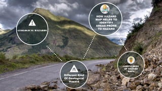
- 25. HOW HAZARD MAP HELPS TO IDENTIFY AREAS PRONE TO HAZARD
- 26. Volcanic hazard maps are visual, geospatial depictions of the areas that could be impacted by various volcanic phenomena during or subsequent to an eruption. They are developed to communicate a complex array of hazard information to those at risk, or those responsible for managing those at risk.
- 27. Volcanic Hazard maps play an important role in identifying the location, magnitude and countermeasures to be undertaken during volcanic crises. In the planning process, PHIVOLCS is expected to arrive at volcanic hazard maps to show basic information about volcanic activity.
- 28. € Landslide hazard maps indicate the possibility of landslide hazard map shows not only the chances that a landslide might form at a padownslope a given distance. landslides occurring throughout a given area. An idealrticular place, but also the chance that it might travel downslope a given distance.
- 29. Several kinds of maps are used to depict danger from landslides. These maps might be as simple as a map that uses the locations of old landslides to indicate potential instability, or as complex as a map incorporating probabilities based on variables such as rainfall, slope angle, soil type, and levels of earthquake shaking.
- 30. The seismic hazard maps address this need by integrating what scientists have learned about earthquake sources, crustal deformation, active faulting, and ground shaking. This information is translated into a form that can be used to reduce the risk from earthquakes and to improve public safety.
- 31. The mapped hazard refers to an estimate of the probability of exceeding a certain amount of ground shaking, or ground motion, in 50 years. The hazard depends on the magnitudes and locations of likely earthquakes, how often they occur, and the properties of the rocks and sediments that earthquake waves travel through.
- 33. A geological hazard map is a map indicating the areas that are vulnerable to hazards caused by earthquakes, volcanic eruptions, and landslides. It is a tool used by scientists and local government authorities to anticipate any hazard that a geological event may bring. It also helps the public be informed and prepared for the geological hazard.
- 34. QUIZ TIME!
- 35. 1. It is an extreme natural events in the crust of the Earth that pose a threat to life and property. a. Hazard b. Geological Hazard c. Hazard Map d. All of the above
- 36. 2. It is an opening or rupture in the Earth’s Surface that allows Magma, Volcanic ashes and Gases to escape. a. Volcanic Eruption b. Landslide c. Tsunami d. Earthquake
- 37. 3. It is a map indicating the areas that are vulnerable to hazard caused by earthquakes, Volcanic eruption, and Landslides. a. Hazard b. Geological Hazard Map c. Map d. Geological Hazard
- 38. 4. It is the movement of rock, earth, or debris down a sloped section of land. a. Earthquake b. Slump c. Volcanic eruption d. Landslides
- 39. 5. It is the sudden release of strain energy in the Earth’s crust. a. Volcanic Eruption b. Landslide c. Tsunami d. Earthquake
- 40. Bonus Question: (5 points) What is the subject handled by Mr. Rodel Azares? ( Acronym is not allowed)