SlideShare a Scribd company logo
1 of 7
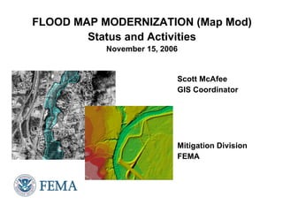
FLOOD MAP MODERNIZATION (Map Mod) Status and Activities November 15, 2006 Scott McAfee GIS Coordinator Mitigation Division FEMA
Purposes of Map Modernization ,[object Object],[object Object],[object Object],[object Object],[object Object],[object Object],[object Object]
 
Mid-Course Adjustment—FY2006 ,[object Object],[object Object],[object Object],[object Object],[object Object],[object Object],[object Object],[object Object]
Map Modernization Outputs 30%  Percent of mapped stream miles with validated, new or updated engineering analysis 75%  Percent of mapped stream miles meeting 2005 Floodplain Boundary Standard 65%  Percent of land area of continental United States covered by digital flood maps 92%  Percent of U.S. population covered by digital flood maps Mid-Course Adjustment Outputs FY03-FY08 Funding Map Modernization Outputs
Digital Products/Plans ,[object Object],[object Object],[object Object],[object Object],[object Object],[object Object],[object Object],[object Object],[object Object],[object Object],[object Object],[object Object]
Post-Disaster Data Collection ,[object Object],[object Object],[object Object],[object Object],[object Object]

More Related Content

What's hot

New information system for enhancing climate & water governance
New information system for enhancing climate & water governanceNew information system for enhancing climate & water governance
New information system for enhancing climate & water governanceRemya Ramesh
 
Collect earth & earth map
Collect earth & earth mapCollect earth & earth map
Collect earth & earth mapFAO
 
2050 San Diego Population and Housing Forecast
2050 San Diego Population and Housing Forecast2050 San Diego Population and Housing Forecast
2050 San Diego Population and Housing Forecastdanielscl
 
Progresses on the Global Solar and Wind Atlas, Data Quality Information Frame...
Progresses on the Global Solar and Wind Atlas, Data Quality Information Frame...Progresses on the Global Solar and Wind Atlas, Data Quality Information Frame...
Progresses on the Global Solar and Wind Atlas, Data Quality Information Frame...IRENA Global Atlas
 
Environmental gis gabon
Environmental gis gabonEnvironmental gis gabon
Environmental gis gabonTTI Production
 
Geospatial tools to guide targeting of technologies
Geospatial tools to guide targeting of technologiesGeospatial tools to guide targeting of technologies
Geospatial tools to guide targeting of technologiesafrica-rising
 
Geospatial Open Data and Urban Growth Modelling for Evidence-based Decision M...
Geospatial Open Data and Urban Growth Modelling for Evidence-based Decision M...Geospatial Open Data and Urban Growth Modelling for Evidence-based Decision M...
Geospatial Open Data and Urban Growth Modelling for Evidence-based Decision M...Piyush Yadav
 
Remote sensing applications for seismic planning
Remote sensing applications for seismic planningRemote sensing applications for seismic planning
Remote sensing applications for seismic planningTTI Production
 
Geographic Information Systems in the Oil & Gas Industry
Geographic Information Systems in the Oil & Gas IndustryGeographic Information Systems in the Oil & Gas Industry
Geographic Information Systems in the Oil & Gas IndustryFrancois Viljoen
 
Applications of GIS to Logistics and Transportation
Applications of GIS to Logistics and TransportationApplications of GIS to Logistics and Transportation
Applications of GIS to Logistics and Transportationsorbi
 
Application of gis in urban traffic air quality
Application of gis in urban traffic air qualityApplication of gis in urban traffic air quality
Application of gis in urban traffic air qualitySAMITINJAY SHARMA
 
Michael_Tierney_INAM_SURE_2
Michael_Tierney_INAM_SURE_2Michael_Tierney_INAM_SURE_2
Michael_Tierney_INAM_SURE_2Michael Tierney
 
Aerial photography-for-aerial-mapping
Aerial photography-for-aerial-mappingAerial photography-for-aerial-mapping
Aerial photography-for-aerial-mappingHigh Exposure
 
Geospatial Techniques for Measuring SI Assessment Indicators
Geospatial Techniques for Measuring SI Assessment IndicatorsGeospatial Techniques for Measuring SI Assessment Indicators
Geospatial Techniques for Measuring SI Assessment Indicatorsafrica-rising
 
IAOS 2018 - Canada's statistics on land cover and land use change in metropol...
IAOS 2018 - Canada's statistics on land cover and land use change in metropol...IAOS 2018 - Canada's statistics on land cover and land use change in metropol...
IAOS 2018 - Canada's statistics on land cover and land use change in metropol...StatsCommunications
 
Global Atlas for Renewable Energy - application to Mauritania
Global Atlas for Renewable Energy - application to MauritaniaGlobal Atlas for Renewable Energy - application to Mauritania
Global Atlas for Renewable Energy - application to MauritaniaIRENA Global Atlas
 
Pan_European and pan-African Early Warning on Floods and Droughts: From the E...
Pan_European and pan-African Early Warning on Floods and Droughts: From the E...Pan_European and pan-African Early Warning on Floods and Droughts: From the E...
Pan_European and pan-African Early Warning on Floods and Droughts: From the E...Global Risk Forum GRFDavos
 

What's hot (20)

New information system for enhancing climate & water governance
New information system for enhancing climate & water governanceNew information system for enhancing climate & water governance
New information system for enhancing climate & water governance
 
Collect earth & earth map
Collect earth & earth mapCollect earth & earth map
Collect earth & earth map
 
Flood modeling and mapping system for emergency responders
Flood modeling and mapping system for emergency respondersFlood modeling and mapping system for emergency responders
Flood modeling and mapping system for emergency responders
 
2050 San Diego Population and Housing Forecast
2050 San Diego Population and Housing Forecast2050 San Diego Population and Housing Forecast
2050 San Diego Population and Housing Forecast
 
Progresses on the Global Solar and Wind Atlas, Data Quality Information Frame...
Progresses on the Global Solar and Wind Atlas, Data Quality Information Frame...Progresses on the Global Solar and Wind Atlas, Data Quality Information Frame...
Progresses on the Global Solar and Wind Atlas, Data Quality Information Frame...
 
Environmental gis gabon
Environmental gis gabonEnvironmental gis gabon
Environmental gis gabon
 
Geospatial tools to guide targeting of technologies
Geospatial tools to guide targeting of technologiesGeospatial tools to guide targeting of technologies
Geospatial tools to guide targeting of technologies
 
Geospatial Open Data and Urban Growth Modelling for Evidence-based Decision M...
Geospatial Open Data and Urban Growth Modelling for Evidence-based Decision M...Geospatial Open Data and Urban Growth Modelling for Evidence-based Decision M...
Geospatial Open Data and Urban Growth Modelling for Evidence-based Decision M...
 
Remote sensing applications for seismic planning
Remote sensing applications for seismic planningRemote sensing applications for seismic planning
Remote sensing applications for seismic planning
 
Geographic Information Systems in the Oil & Gas Industry
Geographic Information Systems in the Oil & Gas IndustryGeographic Information Systems in the Oil & Gas Industry
Geographic Information Systems in the Oil & Gas Industry
 
Applications of GIS to Logistics and Transportation
Applications of GIS to Logistics and TransportationApplications of GIS to Logistics and Transportation
Applications of GIS to Logistics and Transportation
 
Application of gis in urban traffic air quality
Application of gis in urban traffic air qualityApplication of gis in urban traffic air quality
Application of gis in urban traffic air quality
 
Michael_Tierney_INAM_SURE_2
Michael_Tierney_INAM_SURE_2Michael_Tierney_INAM_SURE_2
Michael_Tierney_INAM_SURE_2
 
Aerial photography-for-aerial-mapping
Aerial photography-for-aerial-mappingAerial photography-for-aerial-mapping
Aerial photography-for-aerial-mapping
 
Geospatial Techniques for Measuring SI Assessment Indicators
Geospatial Techniques for Measuring SI Assessment IndicatorsGeospatial Techniques for Measuring SI Assessment Indicators
Geospatial Techniques for Measuring SI Assessment Indicators
 
IAOS 2018 - Canada's statistics on land cover and land use change in metropol...
IAOS 2018 - Canada's statistics on land cover and land use change in metropol...IAOS 2018 - Canada's statistics on land cover and land use change in metropol...
IAOS 2018 - Canada's statistics on land cover and land use change in metropol...
 
Global Atlas for Renewable Energy - application to Mauritania
Global Atlas for Renewable Energy - application to MauritaniaGlobal Atlas for Renewable Energy - application to Mauritania
Global Atlas for Renewable Energy - application to Mauritania
 
Pan_European and pan-African Early Warning on Floods and Droughts: From the E...
Pan_European and pan-African Early Warning on Floods and Droughts: From the E...Pan_European and pan-African Early Warning on Floods and Droughts: From the E...
Pan_European and pan-African Early Warning on Floods and Droughts: From the E...
 
Icelandic Bathy model
Icelandic Bathy modelIcelandic Bathy model
Icelandic Bathy model
 
application of gis
application of gisapplication of gis
application of gis
 

Similar to FLOOD MAP MODERNIZATION

Coastal Urban DEM project - Mapping the vulnerability of Australia's Coast
Coastal Urban DEM project - Mapping the vulnerability of Australia's CoastCoastal Urban DEM project - Mapping the vulnerability of Australia's Coast
Coastal Urban DEM project - Mapping the vulnerability of Australia's CoastFungis Queensland
 
Accès ouvert aux données météorologiques d’Environnement Canada
Accès ouvert aux données météorologiques d’Environnement CanadaAccès ouvert aux données météorologiques d’Environnement Canada
Accès ouvert aux données météorologiques d’Environnement CanadaVisionGEOMATIQUE2014
 
Using GIS for effective flood management
Using GIS for effective flood managementUsing GIS for effective flood management
Using GIS for effective flood managementJames Thompson
 
The National Elevation Data Framework
The National Elevation Data FrameworkThe National Elevation Data Framework
The National Elevation Data Frameworkfungis
 
Climate Information for Resilient Development and Adaptation (CIRDA) and its ...
Climate Information for Resilient Development and Adaptation (CIRDA) and its ...Climate Information for Resilient Development and Adaptation (CIRDA) and its ...
Climate Information for Resilient Development and Adaptation (CIRDA) and its ...NAP Events
 
Richland_County_JMG_Award_Application_2016
Richland_County_JMG_Award_Application_2016Richland_County_JMG_Award_Application_2016
Richland_County_JMG_Award_Application_2016Patrick Bresnahan
 
Building Climate Resilience: Translating Climate Data into Risk Assessments
Building Climate Resilience: Translating Climate Data into Risk Assessments Building Climate Resilience: Translating Climate Data into Risk Assessments
Building Climate Resilience: Translating Climate Data into Risk Assessments Safe Software
 
National Floodplain Mapping Assessment - Final Report
National Floodplain Mapping Assessment - Final ReportNational Floodplain Mapping Assessment - Final Report
National Floodplain Mapping Assessment - Final Reportglennmcgillivray
 
GAO-04-417 FLOOD MAP MODERNIZATION: Program Strategy Shows Promise, but Chal...
GAO-04-417 FLOOD MAP MODERNIZATION:  Program Strategy Shows Promise, but Chal...GAO-04-417 FLOOD MAP MODERNIZATION:  Program Strategy Shows Promise, but Chal...
GAO-04-417 FLOOD MAP MODERNIZATION: Program Strategy Shows Promise, but Chal...Brian James
 
Coastal Landcover Trends & Applications in the NW
Coastal Landcover Trends & Applications in the NWCoastal Landcover Trends & Applications in the NW
Coastal Landcover Trends & Applications in the NWEric Morris
 
National Geospatial Program Presentation - IMIA Asia Pacific Conference
National Geospatial Program Presentation - IMIA Asia Pacific ConferenceNational Geospatial Program Presentation - IMIA Asia Pacific Conference
National Geospatial Program Presentation - IMIA Asia Pacific ConferenceInternational Map Industry Association
 
Tamil nadu wb review tn_hpii_delhi_may2014
Tamil nadu wb review tn_hpii_delhi_may2014Tamil nadu wb review tn_hpii_delhi_may2014
Tamil nadu wb review tn_hpii_delhi_may2014hydrologyproject0
 
2017 ASPRS-RMR Big Data Track: The National Map
2017 ASPRS-RMR Big Data Track: The National Map2017 ASPRS-RMR Big Data Track: The National Map
2017 ASPRS-RMR Big Data Track: The National MapGIS in the Rockies
 

Similar to FLOOD MAP MODERNIZATION (20)

Floodplain Mapping Status in Wisconsin
Floodplain Mapping Status in WisconsinFloodplain Mapping Status in Wisconsin
Floodplain Mapping Status in Wisconsin
 
LiDAR Project Specifications Part 1
LiDAR Project Specifications Part 1LiDAR Project Specifications Part 1
LiDAR Project Specifications Part 1
 
Coastal Urban DEM project - Mapping the vulnerability of Australia's Coast
Coastal Urban DEM project - Mapping the vulnerability of Australia's CoastCoastal Urban DEM project - Mapping the vulnerability of Australia's Coast
Coastal Urban DEM project - Mapping the vulnerability of Australia's Coast
 
Accès ouvert aux données météorologiques d’Environnement Canada
Accès ouvert aux données météorologiques d’Environnement CanadaAccès ouvert aux données météorologiques d’Environnement Canada
Accès ouvert aux données météorologiques d’Environnement Canada
 
Using GIS for effective flood management
Using GIS for effective flood managementUsing GIS for effective flood management
Using GIS for effective flood management
 
The National Elevation Data Framework
The National Elevation Data FrameworkThe National Elevation Data Framework
The National Elevation Data Framework
 
Climate Information for Resilient Development and Adaptation (CIRDA) and its ...
Climate Information for Resilient Development and Adaptation (CIRDA) and its ...Climate Information for Resilient Development and Adaptation (CIRDA) and its ...
Climate Information for Resilient Development and Adaptation (CIRDA) and its ...
 
Richland_County_JMG_Award_Application_2016
Richland_County_JMG_Award_Application_2016Richland_County_JMG_Award_Application_2016
Richland_County_JMG_Award_Application_2016
 
Building Climate Resilience: Translating Climate Data into Risk Assessments
Building Climate Resilience: Translating Climate Data into Risk Assessments Building Climate Resilience: Translating Climate Data into Risk Assessments
Building Climate Resilience: Translating Climate Data into Risk Assessments
 
TNM for NSGIC
TNM for NSGICTNM for NSGIC
TNM for NSGIC
 
Nws floodplain inundation project
Nws floodplain inundation projectNws floodplain inundation project
Nws floodplain inundation project
 
National Floodplain Mapping Assessment - Final Report
National Floodplain Mapping Assessment - Final ReportNational Floodplain Mapping Assessment - Final Report
National Floodplain Mapping Assessment - Final Report
 
GAO-04-417 FLOOD MAP MODERNIZATION: Program Strategy Shows Promise, but Chal...
GAO-04-417 FLOOD MAP MODERNIZATION:  Program Strategy Shows Promise, but Chal...GAO-04-417 FLOOD MAP MODERNIZATION:  Program Strategy Shows Promise, but Chal...
GAO-04-417 FLOOD MAP MODERNIZATION: Program Strategy Shows Promise, but Chal...
 
Ortho Benefits
Ortho BenefitsOrtho Benefits
Ortho Benefits
 
Coastal Landcover Trends & Applications in the NW
Coastal Landcover Trends & Applications in the NWCoastal Landcover Trends & Applications in the NW
Coastal Landcover Trends & Applications in the NW
 
03Flood_Prone_Area.pdf
03Flood_Prone_Area.pdf03Flood_Prone_Area.pdf
03Flood_Prone_Area.pdf
 
National Geospatial Program Presentation - IMIA Asia Pacific Conference
National Geospatial Program Presentation - IMIA Asia Pacific ConferenceNational Geospatial Program Presentation - IMIA Asia Pacific Conference
National Geospatial Program Presentation - IMIA Asia Pacific Conference
 
Tamil nadu wb review tn_hpii_delhi_may2014
Tamil nadu wb review tn_hpii_delhi_may2014Tamil nadu wb review tn_hpii_delhi_may2014
Tamil nadu wb review tn_hpii_delhi_may2014
 
E-shape climate showcase
E-shape climate showcaseE-shape climate showcase
E-shape climate showcase
 
2017 ASPRS-RMR Big Data Track: The National Map
2017 ASPRS-RMR Big Data Track: The National Map2017 ASPRS-RMR Big Data Track: The National Map
2017 ASPRS-RMR Big Data Track: The National Map
 

More from Penn Institute for Urban Research

Human Capital-Centered Regionalism in Economic Development: A Case of Analyti...
Human Capital-Centered Regionalism in Economic Development: A Case of Analyti...Human Capital-Centered Regionalism in Economic Development: A Case of Analyti...
Human Capital-Centered Regionalism in Economic Development: A Case of Analyti...Penn Institute for Urban Research
 
The Benefits of Smart Grid Technology for Buildings, Cities, and Sustainability
The Benefits of Smart Grid Technology for Buildings, Cities, and SustainabilityThe Benefits of Smart Grid Technology for Buildings, Cities, and Sustainability
The Benefits of Smart Grid Technology for Buildings, Cities, and SustainabilityPenn Institute for Urban Research
 
Chairman of the Federal Energy Regulatory Commission Jon Wellinghoff
Chairman of the Federal Energy Regulatory Commission Jon WellinghoffChairman of the Federal Energy Regulatory Commission Jon Wellinghoff
Chairman of the Federal Energy Regulatory Commission Jon WellinghoffPenn Institute for Urban Research
 

More from Penn Institute for Urban Research (20)

Michael Meehan
Michael MeehanMichael Meehan
Michael Meehan
 
Matt Kwatinetz
Matt KwatinetzMatt Kwatinetz
Matt Kwatinetz
 
James Finlay: Top 10 EE Concept Missteps
James Finlay: Top 10 EE Concept MisstepsJames Finlay: Top 10 EE Concept Missteps
James Finlay: Top 10 EE Concept Missteps
 
Tim Weaver
Tim WeaverTim Weaver
Tim Weaver
 
Nancy Peter
Nancy PeterNancy Peter
Nancy Peter
 
Erika Kitzmiller
Erika KitzmillerErika Kitzmiller
Erika Kitzmiller
 
Anne Bradley Mitchell
Anne Bradley MitchellAnne Bradley Mitchell
Anne Bradley Mitchell
 
Shahana Chattaraj
Shahana ChattarajShahana Chattaraj
Shahana Chattaraj
 
Human Capital-Centered Regionalism in Economic Development: A Case of Analyti...
Human Capital-Centered Regionalism in Economic Development: A Case of Analyti...Human Capital-Centered Regionalism in Economic Development: A Case of Analyti...
Human Capital-Centered Regionalism in Economic Development: A Case of Analyti...
 
The Bull & the Ballot Box: Art Museum Economic Strategies
The Bull & the Ballot Box: Art Museum Economic StrategiesThe Bull & the Ballot Box: Art Museum Economic Strategies
The Bull & the Ballot Box: Art Museum Economic Strategies
 
The Park of a Thousand Pieces
The Park of a Thousand PiecesThe Park of a Thousand Pieces
The Park of a Thousand Pieces
 
The Park of a Thousand Pieces
The Park of a Thousand PiecesThe Park of a Thousand Pieces
The Park of a Thousand Pieces
 
Susan Covino - Smart Grids and Microgrids
Susan Covino - Smart Grids and MicrogridsSusan Covino - Smart Grids and Microgrids
Susan Covino - Smart Grids and Microgrids
 
The Benefits of Smart Grid Technology for Buildings, Cities, and Sustainability
The Benefits of Smart Grid Technology for Buildings, Cities, and SustainabilityThe Benefits of Smart Grid Technology for Buildings, Cities, and Sustainability
The Benefits of Smart Grid Technology for Buildings, Cities, and Sustainability
 
Michael Smith - Envision Charlotte
Michael Smith - Envision CharlotteMichael Smith - Envision Charlotte
Michael Smith - Envision Charlotte
 
Matthew Summy - Illinois Science and Technology Coalition
Matthew Summy - Illinois Science and Technology CoalitionMatthew Summy - Illinois Science and Technology Coalition
Matthew Summy - Illinois Science and Technology Coalition
 
Doug Laub - Living City Block
Doug Laub - Living City BlockDoug Laub - Living City Block
Doug Laub - Living City Block
 
Brewster McCracken - Pecan Street Project
Brewster McCracken - Pecan Street ProjectBrewster McCracken - Pecan Street Project
Brewster McCracken - Pecan Street Project
 
Wayne Gardner - Pennsylvania Public Utility Commission
Wayne Gardner - Pennsylvania Public Utility CommissionWayne Gardner - Pennsylvania Public Utility Commission
Wayne Gardner - Pennsylvania Public Utility Commission
 
Chairman of the Federal Energy Regulatory Commission Jon Wellinghoff
Chairman of the Federal Energy Regulatory Commission Jon WellinghoffChairman of the Federal Energy Regulatory Commission Jon Wellinghoff
Chairman of the Federal Energy Regulatory Commission Jon Wellinghoff
 

Recently uploaded

SOC 101 Demonstration of Learning Presentation
SOC 101 Demonstration of Learning PresentationSOC 101 Demonstration of Learning Presentation
SOC 101 Demonstration of Learning Presentationcamerronhm
 
On National Teacher Day, meet the 2024-25 Kenan Fellows
On National Teacher Day, meet the 2024-25 Kenan FellowsOn National Teacher Day, meet the 2024-25 Kenan Fellows
On National Teacher Day, meet the 2024-25 Kenan FellowsMebane Rash
 
Mixin Classes in Odoo 17 How to Extend Models Using Mixin Classes
Mixin Classes in Odoo 17  How to Extend Models Using Mixin ClassesMixin Classes in Odoo 17  How to Extend Models Using Mixin Classes
Mixin Classes in Odoo 17 How to Extend Models Using Mixin ClassesCeline George
 
How to Give a Domain for a Field in Odoo 17
How to Give a Domain for a Field in Odoo 17How to Give a Domain for a Field in Odoo 17
How to Give a Domain for a Field in Odoo 17Celine George
 
Making communications land - Are they received and understood as intended? we...
Making communications land - Are they received and understood as intended? we...Making communications land - Are they received and understood as intended? we...
Making communications land - Are they received and understood as intended? we...Association for Project Management
 
Key note speaker Neum_Admir Softic_ENG.pdf
Key note speaker Neum_Admir Softic_ENG.pdfKey note speaker Neum_Admir Softic_ENG.pdf
Key note speaker Neum_Admir Softic_ENG.pdfAdmir Softic
 
Explore beautiful and ugly buildings. Mathematics helps us create beautiful d...
Explore beautiful and ugly buildings. Mathematics helps us create beautiful d...Explore beautiful and ugly buildings. Mathematics helps us create beautiful d...
Explore beautiful and ugly buildings. Mathematics helps us create beautiful d...christianmathematics
 
Magic bus Group work1and 2 (Team 3).pptx
Magic bus Group work1and 2 (Team 3).pptxMagic bus Group work1and 2 (Team 3).pptx
Magic bus Group work1and 2 (Team 3).pptxdhanalakshmis0310
 
Third Battle of Panipat detailed notes.pptx
Third Battle of Panipat detailed notes.pptxThird Battle of Panipat detailed notes.pptx
Third Battle of Panipat detailed notes.pptxAmita Gupta
 
Holdier Curriculum Vitae (April 2024).pdf
Holdier Curriculum Vitae (April 2024).pdfHoldier Curriculum Vitae (April 2024).pdf
Holdier Curriculum Vitae (April 2024).pdfagholdier
 
How to Manage Global Discount in Odoo 17 POS
How to Manage Global Discount in Odoo 17 POSHow to Manage Global Discount in Odoo 17 POS
How to Manage Global Discount in Odoo 17 POSCeline George
 
1029-Danh muc Sach Giao Khoa khoi 6.pdf
1029-Danh muc Sach Giao Khoa khoi  6.pdf1029-Danh muc Sach Giao Khoa khoi  6.pdf
1029-Danh muc Sach Giao Khoa khoi 6.pdfQucHHunhnh
 
PROCESS RECORDING FORMAT.docx
PROCESS      RECORDING        FORMAT.docxPROCESS      RECORDING        FORMAT.docx
PROCESS RECORDING FORMAT.docxPoojaSen20
 
Seal of Good Local Governance (SGLG) 2024Final.pptx
Seal of Good Local Governance (SGLG) 2024Final.pptxSeal of Good Local Governance (SGLG) 2024Final.pptx
Seal of Good Local Governance (SGLG) 2024Final.pptxnegromaestrong
 
Accessible Digital Futures project (20/03/2024)
Accessible Digital Futures project (20/03/2024)Accessible Digital Futures project (20/03/2024)
Accessible Digital Futures project (20/03/2024)Jisc
 
ComPTIA Overview | Comptia Security+ Book SY0-701
ComPTIA Overview | Comptia Security+ Book SY0-701ComPTIA Overview | Comptia Security+ Book SY0-701
ComPTIA Overview | Comptia Security+ Book SY0-701bronxfugly43
 
UGC NET Paper 1 Mathematical Reasoning & Aptitude.pdf
UGC NET Paper 1 Mathematical Reasoning & Aptitude.pdfUGC NET Paper 1 Mathematical Reasoning & Aptitude.pdf
UGC NET Paper 1 Mathematical Reasoning & Aptitude.pdfNirmal Dwivedi
 
Sociology 101 Demonstration of Learning Exhibit
Sociology 101 Demonstration of Learning ExhibitSociology 101 Demonstration of Learning Exhibit
Sociology 101 Demonstration of Learning Exhibitjbellavia9
 

Recently uploaded (20)

SOC 101 Demonstration of Learning Presentation
SOC 101 Demonstration of Learning PresentationSOC 101 Demonstration of Learning Presentation
SOC 101 Demonstration of Learning Presentation
 
On National Teacher Day, meet the 2024-25 Kenan Fellows
On National Teacher Day, meet the 2024-25 Kenan FellowsOn National Teacher Day, meet the 2024-25 Kenan Fellows
On National Teacher Day, meet the 2024-25 Kenan Fellows
 
Mixin Classes in Odoo 17 How to Extend Models Using Mixin Classes
Mixin Classes in Odoo 17  How to Extend Models Using Mixin ClassesMixin Classes in Odoo 17  How to Extend Models Using Mixin Classes
Mixin Classes in Odoo 17 How to Extend Models Using Mixin Classes
 
Asian American Pacific Islander Month DDSD 2024.pptx
Asian American Pacific Islander Month DDSD 2024.pptxAsian American Pacific Islander Month DDSD 2024.pptx
Asian American Pacific Islander Month DDSD 2024.pptx
 
How to Give a Domain for a Field in Odoo 17
How to Give a Domain for a Field in Odoo 17How to Give a Domain for a Field in Odoo 17
How to Give a Domain for a Field in Odoo 17
 
Making communications land - Are they received and understood as intended? we...
Making communications land - Are they received and understood as intended? we...Making communications land - Are they received and understood as intended? we...
Making communications land - Are they received and understood as intended? we...
 
Key note speaker Neum_Admir Softic_ENG.pdf
Key note speaker Neum_Admir Softic_ENG.pdfKey note speaker Neum_Admir Softic_ENG.pdf
Key note speaker Neum_Admir Softic_ENG.pdf
 
Spatium Project Simulation student brief
Spatium Project Simulation student briefSpatium Project Simulation student brief
Spatium Project Simulation student brief
 
Explore beautiful and ugly buildings. Mathematics helps us create beautiful d...
Explore beautiful and ugly buildings. Mathematics helps us create beautiful d...Explore beautiful and ugly buildings. Mathematics helps us create beautiful d...
Explore beautiful and ugly buildings. Mathematics helps us create beautiful d...
 
Magic bus Group work1and 2 (Team 3).pptx
Magic bus Group work1and 2 (Team 3).pptxMagic bus Group work1and 2 (Team 3).pptx
Magic bus Group work1and 2 (Team 3).pptx
 
Third Battle of Panipat detailed notes.pptx
Third Battle of Panipat detailed notes.pptxThird Battle of Panipat detailed notes.pptx
Third Battle of Panipat detailed notes.pptx
 
Holdier Curriculum Vitae (April 2024).pdf
Holdier Curriculum Vitae (April 2024).pdfHoldier Curriculum Vitae (April 2024).pdf
Holdier Curriculum Vitae (April 2024).pdf
 
How to Manage Global Discount in Odoo 17 POS
How to Manage Global Discount in Odoo 17 POSHow to Manage Global Discount in Odoo 17 POS
How to Manage Global Discount in Odoo 17 POS
 
1029-Danh muc Sach Giao Khoa khoi 6.pdf
1029-Danh muc Sach Giao Khoa khoi  6.pdf1029-Danh muc Sach Giao Khoa khoi  6.pdf
1029-Danh muc Sach Giao Khoa khoi 6.pdf
 
PROCESS RECORDING FORMAT.docx
PROCESS      RECORDING        FORMAT.docxPROCESS      RECORDING        FORMAT.docx
PROCESS RECORDING FORMAT.docx
 
Seal of Good Local Governance (SGLG) 2024Final.pptx
Seal of Good Local Governance (SGLG) 2024Final.pptxSeal of Good Local Governance (SGLG) 2024Final.pptx
Seal of Good Local Governance (SGLG) 2024Final.pptx
 
Accessible Digital Futures project (20/03/2024)
Accessible Digital Futures project (20/03/2024)Accessible Digital Futures project (20/03/2024)
Accessible Digital Futures project (20/03/2024)
 
ComPTIA Overview | Comptia Security+ Book SY0-701
ComPTIA Overview | Comptia Security+ Book SY0-701ComPTIA Overview | Comptia Security+ Book SY0-701
ComPTIA Overview | Comptia Security+ Book SY0-701
 
UGC NET Paper 1 Mathematical Reasoning & Aptitude.pdf
UGC NET Paper 1 Mathematical Reasoning & Aptitude.pdfUGC NET Paper 1 Mathematical Reasoning & Aptitude.pdf
UGC NET Paper 1 Mathematical Reasoning & Aptitude.pdf
 
Sociology 101 Demonstration of Learning Exhibit
Sociology 101 Demonstration of Learning ExhibitSociology 101 Demonstration of Learning Exhibit
Sociology 101 Demonstration of Learning Exhibit
 

FLOOD MAP MODERNIZATION

  • 1. FLOOD MAP MODERNIZATION (Map Mod) Status and Activities November 15, 2006 Scott McAfee GIS Coordinator Mitigation Division FEMA
  • 2.
  • 3.  
  • 4.
  • 5. Map Modernization Outputs 30%  Percent of mapped stream miles with validated, new or updated engineering analysis 75%  Percent of mapped stream miles meeting 2005 Floodplain Boundary Standard 65%  Percent of land area of continental United States covered by digital flood maps 92%  Percent of U.S. population covered by digital flood maps Mid-Course Adjustment Outputs FY03-FY08 Funding Map Modernization Outputs
  • 6.
  • 7.