SlideShare a Scribd company logo
1 of 37
Download to read offline
Neda Mohsenian-Rad
Master of Community Planning
University of Cincinnati
Architectural, Urban Design,
and Urban Planning Portfolio
Master of Community Planning, University of Cincinnati, 2014-2016 GPA:3.87
Specialization: Urban Design and Physical Planning
Courses: Plan Making Workshop, Land Use, Methods of Physical Analysis, Structure & Dynamic of Human settlements
Co-op, Architecture Internship, Summer 2015
Gresham, Smith and Partners, Nashville, TN
School of Planning Newsletter Editor, Spring 2015
University of Cincinnati
Research Assistant, Fall 2014 - 2016
University of Cincinnati
Worked on informal settlements research project on five Iranian cities
Intern Architect, 2011-2012
Nahour Company
Bachelor of Architecture, Shahid Beheshti University, 2007-2012 GPA:17.4/20
Courses: Architecture Design Studios, Structure, Construction, Environment Conditions Control, Architecture History
Certificate in Urban Design, University of Cincinnati, 2014-2016
Courses: Placemaking, Urban Design & Urbanism, Sustainable Development, Site Planning, Urban Design Practicum
Neda Mohsenian-Rad
Architect/Urban Designer
Education
Work Experience
Teaching Assistant, Urban Planning & Design Studios, Fall 2014-Summer 2016
University of Cincinnati
Graduate Assistant Scholarship, 2014-2016
University of Cincinnati
Covering 100% tuition
Outstanding Student Award, Graduate Assistant, 2016
University of Cincinnati
Directors’ Choice Award for Best Thesis, 2016
University of Cincinnati
1st Place & $2,000 Prize,
2012Tehran Municipality, Tehran, Iran
Tehran Contemporary Urban Facade Competition,
2nd Place & $1,000, 2012
Iran University of Science & Technology
Designing Iran-Iraq War Veteran’s Memorial Competition
Awards & Honors
Revit
SketchUp
Photoshop
Illustrator
InDesign
V-Ray
AutoCad
Microsoft Office
GIS
Rhino
Web Design
Will be provided upon request
Contact Me
Skills
References
Recreation
neda.m.rad@gmail.com
neda-mohsenian-rad.com
An Architect by training with postgraduate education in
Urban Design and Planning. Self-motivated with
extensive experience in working as part of a team and
under pressure to meet challenging deadlines and
objectives. Excellent in hand-sketching and 3D
modeling, visualization, and graphic software.
Reading
Hiking
Travel
Politic
Craft
Music
Profile
Teaching assistant for graduate and undergrad design studios. Prepared course syllabus and schedule. Taught sketching and hand drawing
techniques, short lectures on assignments and tutorial for graphic softwares including Photoshop, InDesign, and Illustrator, and technical softwares
such as GIS. Worked with students on their design concept to develop their works. Taught the physical model creating techniques. Graded
students’ assignments and final projects.
Course names: Methods of Physical Planning ( graduate studio), Planning Design Studio: Topical (fourth year studio), and Principles of
Planning Design Graphics I, (freshman studio)
Corporate and urban design studio, worked on three projects, including civic and office buildings on different phases of design and documentation,
SD, DD, and CD. Primary used Revit to prepare all the design and construction documents. Also used sketchUp for conceptual design and
Photoshop for post rendering image production.
Weekly newsletter published for over 1300 recipients, including alumni, graduate and undergraduate students, and faculty, informing about the
news, activities, accomplishments, and events by SOP community.
Worked on luxury high-rise residential buildings. Prepared SD and DD documents with AutoCad.
2nd Place, 2010
Shahid Beheshti University
Design & Sketch Competition for Medium Size Urban Retail
17
Revitalizing theTradition
University of Dramatic Arts
Layers of Life
Residential Complex
Diloville
TheCanalDistrict for theFuture
of NewOrleans
Re-Greening the Place
Green Infrastructure
Improvement
GIS
Neighborhood Analysis
Photography
Free-hand Drawing
& Sketches
01 07
TABLE OF
CONTENT
13
31
2523
1
LAYERS OF LIFE
Residential Complex,Tehran
ArchitectureThesis Studio, Fall 2011
Background:
The site is located in “Dar-Band” district, an originally summer house area in mid-20th century. Over the last three decades, gardens and
villas in this area have been converted to apartments due to the overpopulation of the capital and the sprawl of the city to near lands, and
Dar-band now became a dense urban environment.
With overpopulation and using maximum lands for housing (due to high land prices), open spaces for social interaction has became hard
to find. In addition, in contrast to the near past that most people used to live in large houses with yards and terraces, now apartments and
condos are the regular places for leaving; however, people’s need for open and semi-open spaces is still vital.
2
Above: one of the first conceptual drawing, illustrating my
design concept of multi-level gardens, and residential units that
are surrounded by trees.
Below: parking spaces moved down to provide a car-free
community, providing a space for events and social interaction
3
The priority of the design:
1. Common area for communities: open spaces of Tehran’s residential complexes are mainly used as surface parking, interfacing
pedestrian movement and making open spaces inappropriate for social interaction. Strengthening social interaction in a community provokes
safety and promote liveliness of the environment. In comparison with gated communities, which are isolated and disconnected, this project is
designed to d bind with its surrounding area. In addition, this project provides open, semi-open, and close places for community usage.
4
2. Open spaces for each unit: with the increase in population and density, Tehran’s residences are losing the benefits of open
spaces and natural landscape for their homes, while the needs for these spaces is high. Therefore, the concept of this project is to build units
surrounded by trees, where each has its own, in some completely private yard or terrace.
5
3. Following the topography and urban fabric: the site is located in foot of a mountain with steep slope. The neighborhood is
occupied with gardens, that are last from the past, and small apartments making a fine-grained urban fabric with narrow organic roads and
long steps for pedestrians. The project tries to imitate a fine-grained style despite the fact that this is a big project site. It also follows the
topography, providing the continuity of the coming up and down of the urban fabric and gets benefit of this difference in height. The benefits
include: enjoying cityscape for several units and in common open spaces, indoor sunlight in units, and yards for apartments.
6
7
DILLOVILLE
District Design, New Orleans
ULI Hines Competition, Spring 2015
The Competition:
A two weeks design project, ULI Hines Competition is an urban design and real estate challenge engages multidisciplinary students teams
consists of five graduate students. Our team were made of two master of Urban Planning, one Master of Architecture, one Master of Business
Administration, and one Master of Design. My role in group were varied from research, urban design and buildings arrangement, post rendering
works, and creating info graphs.
8
Project Narrative:
New Orleans is an incredibly vibrant city suffered devastating consequences after Hurricane Katrina in 2005. As the displaced population
continues to return to the city among a broader and younger demographic, the newly envisioned Diloville development will create a memorable
place while bringing a new awareness of water that is so deeply woven into the cultural and historic fabric of the City. The site is located
adjacent to two upcoming BioDistrict development, bringing about 34,000 new jobs. It is, in addition, in close distance from CBD and the
French Quarter, the main tourism attraction of New Orleans.
9
10
Below: creating a community that provides diverse range of amenity and
needs, and is active during the day and night.Active street will help the safety
of the community, generate financial benefit to the community and city, and
provide a walkable environment.
Right: the infograph show different layers of thinking and design that
shape the new community, and help it to be a cohesive and connected living,
working, and fun neighborhood.
11
12
13
RE-GREENING THE PLACE
Using Forgotten spaces to re-activate a neighborhood,West End, Cincinnati
Green Infrastructure, Fall 2016
Background:
Vacant places and forgotten spaces overwhelm the landscape of Cincinnati’s West End neighborhood.
The target area for this green infrastructure improvement is the area with highest vacant land and lack of designed green spaces.
This improvement is an addition to a revitalization plan that includes re-energizing the street, re-operating the storefronts, adding pocket parks,
and new developments to the target area.
14
Store Fronts
Community Activity Points
Existing Buildings
Legend
Vacant Lots
Green Infrastructure
improvement corridors
B
A
C
D
C D
BA
Green Alleys with permeable
pavement create a new network
for pedestrian and cyclists.
Complete street provide safe
place for pedestrians as well as
manage storm water run-off.
Shared space with permeable
pavement in narrow streets with
low traffic.
Trees and shrubs filter the air
close to the highway and help to
absorb the water runoff.
15
E
E
I
J
H
G
K
FreemanAve.
Dayton Street
A
B
C
A
B
C
York Street
N
F
E
G
I
Light garden improve the safety and
provide an attraction in the area
An example for sidewalks
Small sitting area in front of stores and
restaurants
16
Section A-A
Section B-B
Section C-C
F
H
J
Permeable pavement with concrete
blocks and grass
An example of permeable pavement
for green alleys
An example of permeable pavement
for shared streets
K An example of rain gardens
17
REVITALIZING TRADITION
University of Dramatic Arts,Tehran
Architecture StudioVII, Fall 2010
Background:
The district of “Niavaran”, in North of Tehran, houses a series of buildings and places that are nationally recognized because of their modern
and contemporary architecture styles, all noble in design but also influenced by the Persian architecture. From the North, there is a complex of
palaces, nowadays function as museum and garden, a research institute, and cultural and entertainment places. Niavaran Street itself is one of
the major and old streets in Tehran. Considering the location, function, and prestige of the buildings and their national architectural recognition,
Niavaran has became a center and a representation of todays Iranian culture and art. This project aimed to utilize an empty land in Niavaran
to build the University of Dramatic Arts to future improve Niavaran’s cultural and art landscape.
18
1. Considering the topography and the shape of the site, we can divide the site into two areas. 2. It also
has the front, facing the main street and continuity of urban buildings and the back facing the secondary
street, residential core. 3. Niavaran Street curves in front of the site, making the corner of the building
more visible for passers.
Multi-level yards: Multi-level yards are common in traditional Iranian architecture, especially on hilly sites, as they allow differentiating
users, usage, and level of privacy and create a hierarchy of open spaces. This helps the building to have yards that interact with outside areas
and yards that are private for student. Each yard will have different characteristics according to its usage. The topography of the site itself also
nicely allows the multi-level yards.
Persian Design Concepts
19
Koshk: The University of Dramatic Art will be located in a land full of trees, likely to be a center for
novel dramatic art by young Iranian generation. Thinking of a building that looks to outside and proudly
shows itself, reminds the concept of Koshk, a stand-alone historic Persian building located in the middle
of a garden, facing openly to all sides.
20
21
Axis and Geometry: Following specific axis and a clear geometry to allow easy visual understanding of the place is also an important
factor in the Persian architecture and a design goal.
22
23
GIS for Physical Planning Analysis
City of Reading, OH
Methods of Physical Planning, Spring 2015
The following maps are created by GIS as part of a physical analysis of the City of Reading, OH. The City of Reading, Ohio is located just
north of Cincinnati. It is a relatively small community but a very walkable one.
Buffer Zone; Five Minutes Walking Distance From the CBD Intersection
24
Land Cover AnalysisExisting Land Use Map
ConnectivityClassification of Urban Street Hierarchy Five Minutes Walking Distance Buffer Zone
from the Schools
Zoning Map
25
SKETCHES
The following free-hand drawings area made by marker, water color, and pen.
26
27
28
29
30
31
PHOTOGRAPHY
Photos area from my trips to historic sites of Iran, India, and Turkey over the past few years.
Dance of Light and Color, Paradise on the Earth
Mosque, Shiraz, Iran
32
TheFrame
AnOldHouseinGorgan,Iran
MesmerisingSimplicity
TajMahal,Angra,India
God’sPresenceintheDesert
Mosque,Iran
DetailsDefinetheWhole
House,Kashan,Iran
33
Harmony
RedFort,Agra,India
34
StreetCafe
Istanbul,Turkey
Refulgence
AyaSofia,Istanbul,Turkey

More Related Content

What's hot

Sustainable Group Housing Projects: Setting Up a Methodological and Substant...
Sustainable Group Housing Projects:  Setting Up a Methodological and Substant...Sustainable Group Housing Projects:  Setting Up a Methodological and Substant...
Sustainable Group Housing Projects: Setting Up a Methodological and Substant...DS2BE
 
Raj Rewal Asian games village case study
Raj Rewal Asian games village case studyRaj Rewal Asian games village case study
Raj Rewal Asian games village case studyRadhikaJadhav8
 
60782357 final-case-study-0506
60782357 final-case-study-050660782357 final-case-study-0506
60782357 final-case-study-0506homeworkping4
 
kutchh bhunga architecture
kutchh bhunga architecturekutchh bhunga architecture
kutchh bhunga architectureMadhulika Sanyal
 
Vernacular architecture of bohra houses
Vernacular architecture of bohra housesVernacular architecture of bohra houses
Vernacular architecture of bohra housesBala Hari Krishnan S
 
Long span structures case study (LINK IN DESCRIPTION FOR DOWNLOAD)
Long span structures case study (LINK IN DESCRIPTION FOR DOWNLOAD)Long span structures case study (LINK IN DESCRIPTION FOR DOWNLOAD)
Long span structures case study (LINK IN DESCRIPTION FOR DOWNLOAD)Dimple Poddar
 
Artist's village Belapur
 Artist's village Belapur Artist's village Belapur
Artist's village BelapurBipasa Das
 
Sheikh sarai hosing, New Delhi.
Sheikh sarai hosing, New Delhi.Sheikh sarai hosing, New Delhi.
Sheikh sarai hosing, New Delhi.Mayur Waghulde
 
Brutalist architecture
Brutalist architectureBrutalist architecture
Brutalist architectureNehal Gherwada
 
Case study cummunity. center presentation
Case study cummunity. center presentationCase study cummunity. center presentation
Case study cummunity. center presentationSispap1
 
Mixed use building case study
Mixed use building case studyMixed use building case study
Mixed use building case studySimi Sayed
 

What's hot (20)

Sustainable Group Housing Projects: Setting Up a Methodological and Substant...
Sustainable Group Housing Projects:  Setting Up a Methodological and Substant...Sustainable Group Housing Projects:  Setting Up a Methodological and Substant...
Sustainable Group Housing Projects: Setting Up a Methodological and Substant...
 
Kanchanjunga apartments
Kanchanjunga apartmentsKanchanjunga apartments
Kanchanjunga apartments
 
Raj Rewal Asian games village case study
Raj Rewal Asian games village case studyRaj Rewal Asian games village case study
Raj Rewal Asian games village case study
 
60782357 final-case-study-0506
60782357 final-case-study-050660782357 final-case-study-0506
60782357 final-case-study-0506
 
kutchh bhunga architecture
kutchh bhunga architecturekutchh bhunga architecture
kutchh bhunga architecture
 
Incremental housing
Incremental housingIncremental housing
Incremental housing
 
Vernacular architecture of bohra houses
Vernacular architecture of bohra housesVernacular architecture of bohra houses
Vernacular architecture of bohra houses
 
Long span structures case study (LINK IN DESCRIPTION FOR DOWNLOAD)
Long span structures case study (LINK IN DESCRIPTION FOR DOWNLOAD)Long span structures case study (LINK IN DESCRIPTION FOR DOWNLOAD)
Long span structures case study (LINK IN DESCRIPTION FOR DOWNLOAD)
 
Artist's village Belapur
 Artist's village Belapur Artist's village Belapur
Artist's village Belapur
 
Sheikh sarai hosing, New Delhi.
Sheikh sarai hosing, New Delhi.Sheikh sarai hosing, New Delhi.
Sheikh sarai hosing, New Delhi.
 
Aranya Low Cost Housing
Aranya Low Cost HousingAranya Low Cost Housing
Aranya Low Cost Housing
 
Brutalist architecture
Brutalist architectureBrutalist architecture
Brutalist architecture
 
Tara Apartment - New Delhi
Tara Apartment - New DelhiTara Apartment - New Delhi
Tara Apartment - New Delhi
 
Literature of apartment
Literature of apartmentLiterature of apartment
Literature of apartment
 
courtyard thesis
courtyard thesiscourtyard thesis
courtyard thesis
 
Sabarmati Ashram
Sabarmati AshramSabarmati Ashram
Sabarmati Ashram
 
Case study cummunity. center presentation
Case study cummunity. center presentationCase study cummunity. center presentation
Case study cummunity. center presentation
 
Office case study
Office case studyOffice case study
Office case study
 
Charles correa
Charles correaCharles correa
Charles correa
 
Mixed use building case study
Mixed use building case studyMixed use building case study
Mixed use building case study
 

Viewers also liked

Portfolios for Urban Planners and Landscape Architects
Portfolios for Urban Planners and Landscape ArchitectsPortfolios for Urban Planners and Landscape Architects
Portfolios for Urban Planners and Landscape ArchitectsLohren Deeg
 
Hamzeh Shakib - Seismic Risk Reduction Program for the Mega City of Theran, Iran
Hamzeh Shakib - Seismic Risk Reduction Program for the Mega City of Theran, IranHamzeh Shakib - Seismic Risk Reduction Program for the Mega City of Theran, Iran
Hamzeh Shakib - Seismic Risk Reduction Program for the Mega City of Theran, IranGlobal Risk Forum GRFDavos
 
MSLab - Cairo, area di progetto
MSLab - Cairo, area di progettoMSLab - Cairo, area di progetto
MSLab - Cairo, area di progettoMSLab Polimi
 
Congestion In Tehran
Congestion In TehranCongestion In Tehran
Congestion In TehranArefeh Nasri
 
Dr. mohd . montazeri tehran metro
Dr. mohd . montazeri  tehran metroDr. mohd . montazeri  tehran metro
Dr. mohd . montazeri tehran metroIbrahim Al-Hudhaif
 
Tehran Mega Capital Of Iran
Tehran Mega Capital Of IranTehran Mega Capital Of Iran
Tehran Mega Capital Of IranNafass
 
MSLab - Tehran : A paradigmatic design method in Tehran metropolitan context
MSLab - Tehran : A paradigmatic design method in Tehran metropolitan contextMSLab - Tehran : A paradigmatic design method in Tehran metropolitan context
MSLab - Tehran : A paradigmatic design method in Tehran metropolitan contextMSLab Polimi
 
MSLab - A paradigmatic model to shape the metropolitan growth 2
MSLab - A paradigmatic model to shape the metropolitan growth 2MSLab - A paradigmatic model to shape the metropolitan growth 2
MSLab - A paradigmatic model to shape the metropolitan growth 2MSLab Polimi
 
Urban planning and urban design portfolio
Urban planning and urban design portfolioUrban planning and urban design portfolio
Urban planning and urban design portfolioezra esdras
 
Landscape Architecture Portfolio
Landscape Architecture PortfolioLandscape Architecture Portfolio
Landscape Architecture Portfoliojonnoyes
 
Landscape Architecture Portfolio
Landscape Architecture PortfolioLandscape Architecture Portfolio
Landscape Architecture Portfolioflybyker
 
Portfolio: Urban Design and Development
Portfolio: Urban Design and DevelopmentPortfolio: Urban Design and Development
Portfolio: Urban Design and DevelopmentShusei Kakimoto
 
90_The Fight of the Wayuu Ethnic Community against the Drought in Guajira
90_The Fight of the Wayuu Ethnic Community against the Drought in Guajira90_The Fight of the Wayuu Ethnic Community against the Drought in Guajira
90_The Fight of the Wayuu Ethnic Community against the Drought in GuajiraGlobal Risk Forum GRFDavos
 
Tehran Flood Risk Reduction Master Plan, Maryamsadat SHARIFVAGHEEI
Tehran Flood Risk Reduction Master Plan, Maryamsadat SHARIFVAGHEEITehran Flood Risk Reduction Master Plan, Maryamsadat SHARIFVAGHEEI
Tehran Flood Risk Reduction Master Plan, Maryamsadat SHARIFVAGHEEIGlobal Risk Forum GRFDavos
 
Urban Planning Portfolio
Urban Planning PortfolioUrban Planning Portfolio
Urban Planning PortfolioRobert Platt
 

Viewers also liked (20)

Portfolios for Urban Planners and Landscape Architects
Portfolios for Urban Planners and Landscape ArchitectsPortfolios for Urban Planners and Landscape Architects
Portfolios for Urban Planners and Landscape Architects
 
P1
P1P1
P1
 
Hamzeh Shakib - Seismic Risk Reduction Program for the Mega City of Theran, Iran
Hamzeh Shakib - Seismic Risk Reduction Program for the Mega City of Theran, IranHamzeh Shakib - Seismic Risk Reduction Program for the Mega City of Theran, Iran
Hamzeh Shakib - Seismic Risk Reduction Program for the Mega City of Theran, Iran
 
MSLab - Cairo, area di progetto
MSLab - Cairo, area di progettoMSLab - Cairo, area di progetto
MSLab - Cairo, area di progetto
 
Congestion In Tehran
Congestion In TehranCongestion In Tehran
Congestion In Tehran
 
Dr. mohd . montazeri tehran metro
Dr. mohd . montazeri  tehran metroDr. mohd . montazeri  tehran metro
Dr. mohd . montazeri tehran metro
 
Tehran Mega Capital Of Iran
Tehran Mega Capital Of IranTehran Mega Capital Of Iran
Tehran Mega Capital Of Iran
 
MSLab - Tehran : A paradigmatic design method in Tehran metropolitan context
MSLab - Tehran : A paradigmatic design method in Tehran metropolitan contextMSLab - Tehran : A paradigmatic design method in Tehran metropolitan context
MSLab - Tehran : A paradigmatic design method in Tehran metropolitan context
 
MSLab - A paradigmatic model to shape the metropolitan growth 2
MSLab - A paradigmatic model to shape the metropolitan growth 2MSLab - A paradigmatic model to shape the metropolitan growth 2
MSLab - A paradigmatic model to shape the metropolitan growth 2
 
Essam selim egypt
Essam selim   egypt Essam selim   egypt
Essam selim egypt
 
thesis book-small
thesis book-smallthesis book-small
thesis book-small
 
Urban planning and urban design portfolio
Urban planning and urban design portfolioUrban planning and urban design portfolio
Urban planning and urban design portfolio
 
National Strategy Document on Revitalising, Upgrading, Renovating and Enablin...
National Strategy Document on Revitalising, Upgrading, Renovating and Enablin...National Strategy Document on Revitalising, Upgrading, Renovating and Enablin...
National Strategy Document on Revitalising, Upgrading, Renovating and Enablin...
 
Landscape Architecture Portfolio
Landscape Architecture PortfolioLandscape Architecture Portfolio
Landscape Architecture Portfolio
 
Landscape Architecture Portfolio
Landscape Architecture PortfolioLandscape Architecture Portfolio
Landscape Architecture Portfolio
 
Portfolio: Urban Design and Development
Portfolio: Urban Design and DevelopmentPortfolio: Urban Design and Development
Portfolio: Urban Design and Development
 
90_The Fight of the Wayuu Ethnic Community against the Drought in Guajira
90_The Fight of the Wayuu Ethnic Community against the Drought in Guajira90_The Fight of the Wayuu Ethnic Community against the Drought in Guajira
90_The Fight of the Wayuu Ethnic Community against the Drought in Guajira
 
Tehran Flood Risk Reduction Master Plan, Maryamsadat SHARIFVAGHEEI
Tehran Flood Risk Reduction Master Plan, Maryamsadat SHARIFVAGHEEITehran Flood Risk Reduction Master Plan, Maryamsadat SHARIFVAGHEEI
Tehran Flood Risk Reduction Master Plan, Maryamsadat SHARIFVAGHEEI
 
Urban Planning Portfolio
Urban Planning PortfolioUrban Planning Portfolio
Urban Planning Portfolio
 
Urban Design project 1
Urban Design project 1Urban Design project 1
Urban Design project 1
 

Similar to Portfolio-neda-Architecture-10

Rachel Lindt Portfolio 472015
Rachel Lindt Portfolio 472015Rachel Lindt Portfolio 472015
Rachel Lindt Portfolio 472015Rachel Lindt
 
PPPF222.pptx
PPPF222.pptxPPPF222.pptx
PPPF222.pptxBossGold
 
Chris_Townley-Portfolio_web
Chris_Townley-Portfolio_webChris_Townley-Portfolio_web
Chris_Townley-Portfolio_webChris Townley
 
Safiya Yahaya-Student Portfolio
Safiya Yahaya-Student PortfolioSafiya Yahaya-Student Portfolio
Safiya Yahaya-Student PortfolioSafiya Yahaya
 
Trey V Meyer - Portfolio
Trey V Meyer - PortfolioTrey V Meyer - Portfolio
Trey V Meyer - Portfoliotreymeyer
 
Neighborhood planning in capital city of chandigarh an appraisal
Neighborhood planning in capital city of chandigarh  an appraisal Neighborhood planning in capital city of chandigarh  an appraisal
Neighborhood planning in capital city of chandigarh an appraisal JitKumarGupta1
 
Neighborhood planning in capital city of chandigarh an appraisal
Neighborhood planning in capital city of chandigarh  an appraisal Neighborhood planning in capital city of chandigarh  an appraisal
Neighborhood planning in capital city of chandigarh an appraisal JitKumarGupta1
 
Graduate Portfolio Ornella LK
Graduate Portfolio Ornella LKGraduate Portfolio Ornella LK
Graduate Portfolio Ornella LKOrnellaLeungKei
 
Neighborhood planning in capital city of chandigarh an appraisal
Neighborhood planning in capital city of chandigarh  an appraisal  Neighborhood planning in capital city of chandigarh  an appraisal
Neighborhood planning in capital city of chandigarh an appraisal JIT KUMAR GUPTA
 
_Neighborhood Planning in Capital City of Chandigarh- An Appraisal (2) - Copy...
_Neighborhood Planning in Capital City of Chandigarh- An Appraisal (2) - Copy..._Neighborhood Planning in Capital City of Chandigarh- An Appraisal (2) - Copy...
_Neighborhood Planning in Capital City of Chandigarh- An Appraisal (2) - Copy...JIT KUMAR GUPTA
 
Tul_Srisompun_resume and portfolio_
Tul_Srisompun_resume and portfolio_Tul_Srisompun_resume and portfolio_
Tul_Srisompun_resume and portfolio_Tul Srisompun
 
TinPhamTran Portfolio 2015
TinPhamTran Portfolio 2015TinPhamTran Portfolio 2015
TinPhamTran Portfolio 2015Tin Pham-Tran
 
Portfolio - Nguyen Khanh Tung
Portfolio - Nguyen Khanh TungPortfolio - Nguyen Khanh Tung
Portfolio - Nguyen Khanh TungTung Nguyen
 
Urban Inclusion : Designing Participation
Urban Inclusion : Designing ParticipationUrban Inclusion : Designing Participation
Urban Inclusion : Designing ParticipationShreya Mahajan
 
Portfolio educational alicia_a_nardo
Portfolio educational alicia_a_nardoPortfolio educational alicia_a_nardo
Portfolio educational alicia_a_nardoAlicia Nardo
 
City-UD_m.arch Unit 1_lec1 and 2 and 305.pdf
City-UD_m.arch Unit 1_lec1 and 2 and 305.pdfCity-UD_m.arch Unit 1_lec1 and 2 and 305.pdf
City-UD_m.arch Unit 1_lec1 and 2 and 305.pdfNeha Bansal
 

Similar to Portfolio-neda-Architecture-10 (20)

portfolio 2016
portfolio 2016portfolio 2016
portfolio 2016
 
Rachel Lindt Portfolio 472015
Rachel Lindt Portfolio 472015Rachel Lindt Portfolio 472015
Rachel Lindt Portfolio 472015
 
PPPF222.pptx
PPPF222.pptxPPPF222.pptx
PPPF222.pptx
 
Chris_Townley-Portfolio_web
Chris_Townley-Portfolio_webChris_Townley-Portfolio_web
Chris_Townley-Portfolio_web
 
Safiya Yahaya-Student Portfolio
Safiya Yahaya-Student PortfolioSafiya Yahaya-Student Portfolio
Safiya Yahaya-Student Portfolio
 
MA_Thomas Resume
MA_Thomas ResumeMA_Thomas Resume
MA_Thomas Resume
 
12 equalizing design principles to reverse segregation
12 equalizing design principles to reverse segregation12 equalizing design principles to reverse segregation
12 equalizing design principles to reverse segregation
 
Trey V Meyer - Portfolio
Trey V Meyer - PortfolioTrey V Meyer - Portfolio
Trey V Meyer - Portfolio
 
Session7
Session7Session7
Session7
 
Neighborhood planning in capital city of chandigarh an appraisal
Neighborhood planning in capital city of chandigarh  an appraisal Neighborhood planning in capital city of chandigarh  an appraisal
Neighborhood planning in capital city of chandigarh an appraisal
 
Neighborhood planning in capital city of chandigarh an appraisal
Neighborhood planning in capital city of chandigarh  an appraisal Neighborhood planning in capital city of chandigarh  an appraisal
Neighborhood planning in capital city of chandigarh an appraisal
 
Graduate Portfolio Ornella LK
Graduate Portfolio Ornella LKGraduate Portfolio Ornella LK
Graduate Portfolio Ornella LK
 
Neighborhood planning in capital city of chandigarh an appraisal
Neighborhood planning in capital city of chandigarh  an appraisal  Neighborhood planning in capital city of chandigarh  an appraisal
Neighborhood planning in capital city of chandigarh an appraisal
 
_Neighborhood Planning in Capital City of Chandigarh- An Appraisal (2) - Copy...
_Neighborhood Planning in Capital City of Chandigarh- An Appraisal (2) - Copy..._Neighborhood Planning in Capital City of Chandigarh- An Appraisal (2) - Copy...
_Neighborhood Planning in Capital City of Chandigarh- An Appraisal (2) - Copy...
 
Tul_Srisompun_resume and portfolio_
Tul_Srisompun_resume and portfolio_Tul_Srisompun_resume and portfolio_
Tul_Srisompun_resume and portfolio_
 
TinPhamTran Portfolio 2015
TinPhamTran Portfolio 2015TinPhamTran Portfolio 2015
TinPhamTran Portfolio 2015
 
Portfolio - Nguyen Khanh Tung
Portfolio - Nguyen Khanh TungPortfolio - Nguyen Khanh Tung
Portfolio - Nguyen Khanh Tung
 
Urban Inclusion : Designing Participation
Urban Inclusion : Designing ParticipationUrban Inclusion : Designing Participation
Urban Inclusion : Designing Participation
 
Portfolio educational alicia_a_nardo
Portfolio educational alicia_a_nardoPortfolio educational alicia_a_nardo
Portfolio educational alicia_a_nardo
 
City-UD_m.arch Unit 1_lec1 and 2 and 305.pdf
City-UD_m.arch Unit 1_lec1 and 2 and 305.pdfCity-UD_m.arch Unit 1_lec1 and 2 and 305.pdf
City-UD_m.arch Unit 1_lec1 and 2 and 305.pdf
 

Portfolio-neda-Architecture-10

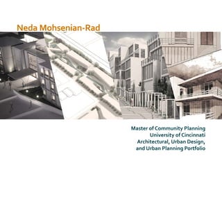
  • 1. Neda Mohsenian-Rad Master of Community Planning University of Cincinnati Architectural, Urban Design, and Urban Planning Portfolio
  • 2. Master of Community Planning, University of Cincinnati, 2014-2016 GPA:3.87 Specialization: Urban Design and Physical Planning Courses: Plan Making Workshop, Land Use, Methods of Physical Analysis, Structure & Dynamic of Human settlements Co-op, Architecture Internship, Summer 2015 Gresham, Smith and Partners, Nashville, TN School of Planning Newsletter Editor, Spring 2015 University of Cincinnati Research Assistant, Fall 2014 - 2016 University of Cincinnati Worked on informal settlements research project on five Iranian cities Intern Architect, 2011-2012 Nahour Company Bachelor of Architecture, Shahid Beheshti University, 2007-2012 GPA:17.4/20 Courses: Architecture Design Studios, Structure, Construction, Environment Conditions Control, Architecture History Certificate in Urban Design, University of Cincinnati, 2014-2016 Courses: Placemaking, Urban Design & Urbanism, Sustainable Development, Site Planning, Urban Design Practicum Neda Mohsenian-Rad Architect/Urban Designer Education Work Experience Teaching Assistant, Urban Planning & Design Studios, Fall 2014-Summer 2016 University of Cincinnati Graduate Assistant Scholarship, 2014-2016 University of Cincinnati Covering 100% tuition Outstanding Student Award, Graduate Assistant, 2016 University of Cincinnati Directors’ Choice Award for Best Thesis, 2016 University of Cincinnati 1st Place & $2,000 Prize, 2012Tehran Municipality, Tehran, Iran Tehran Contemporary Urban Facade Competition, 2nd Place & $1,000, 2012 Iran University of Science & Technology Designing Iran-Iraq War Veteran’s Memorial Competition Awards & Honors Revit SketchUp Photoshop Illustrator InDesign V-Ray AutoCad Microsoft Office GIS Rhino Web Design Will be provided upon request Contact Me Skills References Recreation neda.m.rad@gmail.com neda-mohsenian-rad.com An Architect by training with postgraduate education in Urban Design and Planning. Self-motivated with extensive experience in working as part of a team and under pressure to meet challenging deadlines and objectives. Excellent in hand-sketching and 3D modeling, visualization, and graphic software. Reading Hiking Travel Politic Craft Music Profile Teaching assistant for graduate and undergrad design studios. Prepared course syllabus and schedule. Taught sketching and hand drawing techniques, short lectures on assignments and tutorial for graphic softwares including Photoshop, InDesign, and Illustrator, and technical softwares such as GIS. Worked with students on their design concept to develop their works. Taught the physical model creating techniques. Graded students’ assignments and final projects. Course names: Methods of Physical Planning ( graduate studio), Planning Design Studio: Topical (fourth year studio), and Principles of Planning Design Graphics I, (freshman studio) Corporate and urban design studio, worked on three projects, including civic and office buildings on different phases of design and documentation, SD, DD, and CD. Primary used Revit to prepare all the design and construction documents. Also used sketchUp for conceptual design and Photoshop for post rendering image production. Weekly newsletter published for over 1300 recipients, including alumni, graduate and undergraduate students, and faculty, informing about the news, activities, accomplishments, and events by SOP community. Worked on luxury high-rise residential buildings. Prepared SD and DD documents with AutoCad. 2nd Place, 2010 Shahid Beheshti University Design & Sketch Competition for Medium Size Urban Retail
  • 3. 17 Revitalizing theTradition University of Dramatic Arts Layers of Life Residential Complex Diloville TheCanalDistrict for theFuture of NewOrleans Re-Greening the Place Green Infrastructure Improvement GIS Neighborhood Analysis Photography Free-hand Drawing & Sketches 01 07 TABLE OF CONTENT 13 31 2523
  • 4. 1 LAYERS OF LIFE Residential Complex,Tehran ArchitectureThesis Studio, Fall 2011 Background: The site is located in “Dar-Band” district, an originally summer house area in mid-20th century. Over the last three decades, gardens and villas in this area have been converted to apartments due to the overpopulation of the capital and the sprawl of the city to near lands, and Dar-band now became a dense urban environment. With overpopulation and using maximum lands for housing (due to high land prices), open spaces for social interaction has became hard to find. In addition, in contrast to the near past that most people used to live in large houses with yards and terraces, now apartments and condos are the regular places for leaving; however, people’s need for open and semi-open spaces is still vital.
  • 5. 2 Above: one of the first conceptual drawing, illustrating my design concept of multi-level gardens, and residential units that are surrounded by trees. Below: parking spaces moved down to provide a car-free community, providing a space for events and social interaction
  • 6. 3 The priority of the design: 1. Common area for communities: open spaces of Tehran’s residential complexes are mainly used as surface parking, interfacing pedestrian movement and making open spaces inappropriate for social interaction. Strengthening social interaction in a community provokes safety and promote liveliness of the environment. In comparison with gated communities, which are isolated and disconnected, this project is designed to d bind with its surrounding area. In addition, this project provides open, semi-open, and close places for community usage.
  • 7. 4 2. Open spaces for each unit: with the increase in population and density, Tehran’s residences are losing the benefits of open spaces and natural landscape for their homes, while the needs for these spaces is high. Therefore, the concept of this project is to build units surrounded by trees, where each has its own, in some completely private yard or terrace.
  • 8. 5 3. Following the topography and urban fabric: the site is located in foot of a mountain with steep slope. The neighborhood is occupied with gardens, that are last from the past, and small apartments making a fine-grained urban fabric with narrow organic roads and long steps for pedestrians. The project tries to imitate a fine-grained style despite the fact that this is a big project site. It also follows the topography, providing the continuity of the coming up and down of the urban fabric and gets benefit of this difference in height. The benefits include: enjoying cityscape for several units and in common open spaces, indoor sunlight in units, and yards for apartments.
  • 9. 6
  • 10. 7 DILLOVILLE District Design, New Orleans ULI Hines Competition, Spring 2015 The Competition: A two weeks design project, ULI Hines Competition is an urban design and real estate challenge engages multidisciplinary students teams consists of five graduate students. Our team were made of two master of Urban Planning, one Master of Architecture, one Master of Business Administration, and one Master of Design. My role in group were varied from research, urban design and buildings arrangement, post rendering works, and creating info graphs.
  • 11. 8 Project Narrative: New Orleans is an incredibly vibrant city suffered devastating consequences after Hurricane Katrina in 2005. As the displaced population continues to return to the city among a broader and younger demographic, the newly envisioned Diloville development will create a memorable place while bringing a new awareness of water that is so deeply woven into the cultural and historic fabric of the City. The site is located adjacent to two upcoming BioDistrict development, bringing about 34,000 new jobs. It is, in addition, in close distance from CBD and the French Quarter, the main tourism attraction of New Orleans.
  • 12. 9
  • 13. 10 Below: creating a community that provides diverse range of amenity and needs, and is active during the day and night.Active street will help the safety of the community, generate financial benefit to the community and city, and provide a walkable environment. Right: the infograph show different layers of thinking and design that shape the new community, and help it to be a cohesive and connected living, working, and fun neighborhood.
  • 14. 11
  • 15. 12
  • 16. 13 RE-GREENING THE PLACE Using Forgotten spaces to re-activate a neighborhood,West End, Cincinnati Green Infrastructure, Fall 2016 Background: Vacant places and forgotten spaces overwhelm the landscape of Cincinnati’s West End neighborhood. The target area for this green infrastructure improvement is the area with highest vacant land and lack of designed green spaces. This improvement is an addition to a revitalization plan that includes re-energizing the street, re-operating the storefronts, adding pocket parks, and new developments to the target area.
  • 17. 14 Store Fronts Community Activity Points Existing Buildings Legend Vacant Lots Green Infrastructure improvement corridors B A C D C D BA Green Alleys with permeable pavement create a new network for pedestrian and cyclists. Complete street provide safe place for pedestrians as well as manage storm water run-off. Shared space with permeable pavement in narrow streets with low traffic. Trees and shrubs filter the air close to the highway and help to absorb the water runoff.
  • 18. 15 E E I J H G K FreemanAve. Dayton Street A B C A B C York Street N F E G I Light garden improve the safety and provide an attraction in the area An example for sidewalks Small sitting area in front of stores and restaurants
  • 19. 16 Section A-A Section B-B Section C-C F H J Permeable pavement with concrete blocks and grass An example of permeable pavement for green alleys An example of permeable pavement for shared streets K An example of rain gardens
  • 20. 17 REVITALIZING TRADITION University of Dramatic Arts,Tehran Architecture StudioVII, Fall 2010 Background: The district of “Niavaran”, in North of Tehran, houses a series of buildings and places that are nationally recognized because of their modern and contemporary architecture styles, all noble in design but also influenced by the Persian architecture. From the North, there is a complex of palaces, nowadays function as museum and garden, a research institute, and cultural and entertainment places. Niavaran Street itself is one of the major and old streets in Tehran. Considering the location, function, and prestige of the buildings and their national architectural recognition, Niavaran has became a center and a representation of todays Iranian culture and art. This project aimed to utilize an empty land in Niavaran to build the University of Dramatic Arts to future improve Niavaran’s cultural and art landscape.
  • 21. 18 1. Considering the topography and the shape of the site, we can divide the site into two areas. 2. It also has the front, facing the main street and continuity of urban buildings and the back facing the secondary street, residential core. 3. Niavaran Street curves in front of the site, making the corner of the building more visible for passers. Multi-level yards: Multi-level yards are common in traditional Iranian architecture, especially on hilly sites, as they allow differentiating users, usage, and level of privacy and create a hierarchy of open spaces. This helps the building to have yards that interact with outside areas and yards that are private for student. Each yard will have different characteristics according to its usage. The topography of the site itself also nicely allows the multi-level yards. Persian Design Concepts
  • 22. 19 Koshk: The University of Dramatic Art will be located in a land full of trees, likely to be a center for novel dramatic art by young Iranian generation. Thinking of a building that looks to outside and proudly shows itself, reminds the concept of Koshk, a stand-alone historic Persian building located in the middle of a garden, facing openly to all sides.
  • 23. 20
  • 24. 21 Axis and Geometry: Following specific axis and a clear geometry to allow easy visual understanding of the place is also an important factor in the Persian architecture and a design goal.
  • 25. 22
  • 26. 23 GIS for Physical Planning Analysis City of Reading, OH Methods of Physical Planning, Spring 2015 The following maps are created by GIS as part of a physical analysis of the City of Reading, OH. The City of Reading, Ohio is located just north of Cincinnati. It is a relatively small community but a very walkable one. Buffer Zone; Five Minutes Walking Distance From the CBD Intersection
  • 27. 24 Land Cover AnalysisExisting Land Use Map ConnectivityClassification of Urban Street Hierarchy Five Minutes Walking Distance Buffer Zone from the Schools Zoning Map
  • 28. 25 SKETCHES The following free-hand drawings area made by marker, water color, and pen.
  • 29. 26
  • 30. 27
  • 31. 28
  • 32. 29
  • 33. 30
  • 34. 31 PHOTOGRAPHY Photos area from my trips to historic sites of Iran, India, and Turkey over the past few years. Dance of Light and Color, Paradise on the Earth Mosque, Shiraz, Iran