Geologic History of the Seminoe Mountains
•Download as PPTX, PDF•
0 likes•66 views

Given to the Gold Prospectors Association of America in 2018 this talk illustrates a workflow on how to research, evaluate and put together a resource prospect. it is designed to be from the type of individual who is planning a trip, how do they use the tools available to find and look for rocks and minerals.

Recommended
Recommended
More Related Content
What's hot
What's hot (20)
Similar to Geologic History of the Seminoe Mountains
Similar to Geologic History of the Seminoe Mountains (20)
More from Mike Bingle-Davis
More from Mike Bingle-Davis (12)
Recently uploaded
Recently uploaded (20)
Geologic History of the Seminoe Mountains
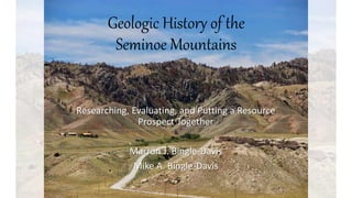
- 1. Geologic History of the Seminoe Mountains Researching, Evaluating, and Putting a Resource Prospect Together Marron J. Bingle-Davis Mike A. Bingle-Davis
- 2. The Seminoe Mts are in central Wyoming on southern flank of Sweetwater Arch ~40 mi northeast of Rawlins
- 3. A Little History • The Seminoe Mts were named for one of Fremont’s guides – Basil Cimineau Lajeunesse • In 1871, General Bradley’s troops set out to explore the Seminoe Mts because of reports of silver-bearing galena • They found gold instead along the flank of Bradley Peak • Several gold prospects were staked after this and by 1873 it was established but Indian attacks drove them away in 1874 • Penn Mining Company bought much of the area mines in 1885 and started mining • Iron prospecting started in the early 1900s but never really took off • An estimated 100 million tons of taconite from the BIFs 1880s
- 4. • ~1,500 – 2,000 ft high in relief • Bounded on SW by low-angle thrust fault, bounded on N by reverse fault • Precambrian rocks contact Cretaceous or younger rocks
- 5. Laramide Orogeny • The Seminoe Mts are one of several uplifts from the Laramide Orogeny from ~70 to 40 Ma • Cores are Precambrian rocks that were uplifted almost vertically; Flanks are younger rocks that are often steeply dipping • Mountains are broad and vertical
- 6. Mountain Mineralogy • Most outcrops Precambrian; Fragment of greenstone belt • Archean amphibolites (>2.7 Ga) intruded and folded by granodiorite (>2.6 Ga) • Divided into three mappable units: • Upper – Seminoe Formation (4,000 ft of metasedimentary rocks (BIFs)) • Middle – Bradley Peak (1,000 ft of ultramafic/mafic metavolcanics) • Lower – Sunday Morning Creek (11,000 ft of mafic schists)
- 7. Mineral Deposits • Copper-silver-gold veins • Gold placers • Iron formation • Nephrite Jade • Serpentine • Leopard Rock • Kimberlite indicator minerals • Rare Lead and Zinc
- 8. Where are the Deposits? • Most trace precious metals are found with the BIFs that mostly come out of the Seminoe Formation • BIFs not in the Sunday Morning Creek and rare in the Bradley Peak Penn Mines (1980s)
- 9. Where are the Deposits? • Jade is found along the northern flank of the Seminoes in the Bradley Peak ultramafics (amphibolite dikes) • Leopard Rock occurs in the Seminoe Fm with the best quality near Wood Creek • Diamond indicator minerals, like pyrope garnets, are found in alluvium
- 10. Introduction to Exploration • From nothing • Basic research • Basic Mapping • Advanced research • Advanced mapping • Planning • Site Determination-evaluation
- 11. FromNothing • Topic – Seminoe Mountains • Extreme basic – Internet • Greenstone Belt • Blog on gold in Seminoe Mtns. • Wikipedia • Gold anomalies at Bradley Peak • Low grade iron 100,000,000 tons • Serpentine, leopard rock, jade, jasperized banded iron, copper, zinc and lead
- 12. Serpentine, leopard rock, jade, jasperized banded iron, copper, zinc and lead (gold?)
- 13. Basic Research • Google (of course) • Google Scholar • Wyoming Geological Survey • US Geological Survey • Thesis and Dissertations • Google Earth • Layers for Google Earth
- 14. Basic Research • Search Seminoe Mtns. • Click MAPS • This screen pops • Each bookmark is clickable • Start word document with links • Also LAT/LONG
- 15. Basic Research • General search – go through as much as possible • Image search – grab maps, change search specs • Google maps coordinates • Build a document / folder of locations, maps, pictures, literature
- 16. Basic Mapping • Using the database and locations from your basic research • Google Earth Pro • Free, create a project • Load Public Land Survey System • Load Wyoming Geologic Map
- 17. Basic Mapping • Maps from Google • Maps from publications (scanned) • Ensure they can be georeferenced • The will be used to locate in advanced mapping and rubber sheeting
- 18. Advanced Research • Google Scholar • Peer reviewed journals • Open access thesis and dissertations
- 20. Advanced Mapping • Add the PLSS layer for reference • Know Google Earth Shortcuts • Mapped Nephrite location From Mindat • Use Geological Map on Google Earth, find trends • BE LEGAL!
- 21. Advanced Mapping • N,U, Crosshairs on Image • Now actual lat/long can be determined • As well as structural elements • Faults • Hard rock boundaries • Etc.
- 22. Advanced Mapping • Remember to pay attention to scales • Also township and ranges • Image will or may look distorted real world • Add points – Penn Gold Mine locations 1-5 • 5 locations in 4 miles square
- 23. Advanced Mapping • PGM #1: 42.151952°, -107.041416° • And so on… • Quick area survey on aerials • QA/QC • Road Access
- 24. Advanced Mapping
- 25. Advanced Mapping • Add all lat-long • Use aerials to survey • Plan routes • Bring gear • Correct vehicle choice • LEGALITY
- 26. Site Determination • Aerial review • Use historical imagery slider • Check land ownership • (Next slide) geologic faults, • ETC
- 27. Site Determination • Geology • Any areas that may have potential that were overlooked?
- 28. Conclusions • Seminoes rich in geology • Abundant minerals • Applicable to many projects • Gold • Minerals • Fossils • Metal Detecting • Caving • Anything you can imagine