Digital inclusion of flood affected communities to close the last mile data gap and to create actionable information for an improved preparedness and response
•
0 likes•215 views

Scientific poster UNISDR Science and Technology Conference on the Implementation of the Sendai Framework for Disaster Risk Reduction 2015-2030, 27-29 January 2016 in Geneva.

Recommended
More Related Content
Similar to Digital inclusion of flood affected communities to close the last mile data gap and to create actionable information for an improved preparedness and response
Similar to Digital inclusion of flood affected communities to close the last mile data gap and to create actionable information for an improved preparedness and response (20)
More from Data4Resilience
More from Data4Resilience (8)
Recently uploaded
Recently uploaded (20)
Digital inclusion of flood affected communities to close the last mile data gap and to create actionable information for an improved preparedness and response
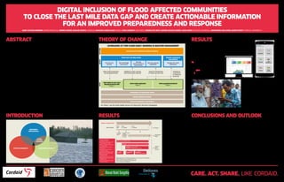
- 1. DIGITAL INCLUSION OF FLOOD AFFECTED COMMUNITIES TO CLOSE THE LAST MILE DATA GAP AND CREATE ACTIONABLE INFORMATION FOR AN IMPROVED PREPAREDNESS AND RESPONSE MARC VAN DEN HOMBERG (MHB@CORDAID.NL), ROBERT MONNÉ, MARLOU GEURTS (CORDAID), RAIHANUL HAQUE KHAN (RIMES), LYDIA CUMISKEY (DELTARES), CORNELIS DE WOLF, WAHIDA BASHAR AHMED, GIASH UDDIN (CONCERN UNIVERSAL), MOHAMMED ABU HAMID, MARCO SPRUIT (UTRECHT UNIVERSITY) ABSTRACT River floods affect the vulnerable communities living on the riverine islands in North West Bangladesh. The professional and the responding community implement preparedness and response activities to avoid loss of lives and protect livelihoods. We determined and clustered the information needs of these decision makers during the 2014 floods by conducting and coding 37 semi-structured interviews and three focus group discussions. We mapped the available data sets on the needs as a function of time and identified data gaps, most notably the lack of timely, sufficiently granular and geospatial data. We identified three ways to address these by leveraging ICT to engage with and empower flood affected communities. First of all, a Coordinated Data Scramble and data governance among the many organizations involved is a very effective way to reach a higher level of coordination in the data collection process, avoiding duplicates and promoting coherence. Secondly, data at household level can be collected during and after the flood with an easy-to-use app by equipping with a smartphone and training volunteers and government officials. Thirdly, a geospatial sharing dashboard can be used to feedback the collected data to the responding and professional community. We have piloted a first prototype of the app and dashboard to collect and display baseline and post 2015 flood data and we will demonstrate the prototype alongside the poster. In the next phase of the project, we aim at piloting during the monsoon period and –ultimately– at embedding these approaches into the disaster management framework of Bangladesh. INTRODUCTION THEORY OF CHANGE RESULTS RESULTS CONCLUSIONS AND OUTLOOK Mapping available data sources on the information requirements of responders is key for identifying the data gaps that currently exist. Main gaps are the lack of local and timely data. To tackle these gaps we co-created a smartphone application in Bengali that disaster management volunteers can use to collect data just before and during the floods. In 2016 the dashboard and app will be used by the local government, gauge readers and specially assigned volunteers to collect data on flood inundation, early warning effectiveness, local flood impacts and damages during the floods. For sustainability it will be key to scale up training of enumerators and adoption of the app/dashboard by embedding the approach in the government’s disaster management framework and processes, to utilize train the trainer and peer to peer learning, to evolve towards a multi-hazard app/dashboard and to allocate to the enumerators possibly dynamically priced data collection tasks based on their location, time and user-attributes. 25 volunteers trained in using the app. Post-flood survey of over 400 households in 5 unions. dashboard an interactive platform where we are in the process of visualizing the existing information products complemented with the locally collected data. Plug ins will be prepared to make the inundation mapping and damage calculation automated. Information needs of and existing data and information products for responding and professional community identified in six categories: situation overview (accessibility), humanitarian needs, coordination, baseline data on context, flood news, locations. app for disseminating early warning, collecting feedback on warning effectiveness, local damage and need assessment during floods and pulling and pushing data to dashboard in both Bangla and English. RESPONDING PROFESSIONALS AFFECTED COMMUNITY RESPONDING COMMUNITY CARE. ACT. SHARE. LIKE CORDAID. Company No. 1278887 Charity No. 272465 Annual Report 2012-13 Company No. 1278887 Charity No. 272465 Annual Report 2012-13 Timing First 2 months First 1-2 weeks First 48hBefore disaster Disaster 13 August 2014 Disaster Data Sources *DDM: Department of Disaster Management of the Government of Bangladesh *HCTT: Humanitarian Coordination Task Team *FFWC: Flood Forecasting and Warning Centre *GoB: Government of Bangladesh ▪ Situational Overview ▪ Needs ▪ Context/Livelihood/ Baseline ▪ Coordination ▪ Flood News ▪ Locations Information Needs ▪ Geodash (Geographic Information, GoB) ▪ 4W Database, who what where when (Relational, DDM) ▪ District Disaster Management plan (PDF, DDM) ▪ Secondary Data Assessment (PDF, HCTT) ▪ Disaster incident database (Relational, DDM) ▪ Hazard map (Geospatial, DDM) ▪ Union fact sheets (PDF, DDM) ▪ Flood predictions (Website, FFWC) ▪ Flood shelter list (Excel, DDM) ▪ Bangladesh Bureau of Statistics (Website, BBS) ▪ National water resources data (Website, WARPO) Flood Updates (Website, FFWC) 16 August: Flood related news (Website, local news agencies) 20 August: Situation Reports (PDF based on SOS and D-Form, DDM) 14 August: SOS Form Unknown Date: D-Form 8 September: Joint Needs Assessment Increasing detail, quality and accuracy For Phase 1 see the Poster Mobile Services for Flood Early Warning in Bangladesh leveraging ict for flood early warning disaster management OUTCOMEOUTPUTINPUT Saving lives an livelihoods building resilience Flood early warning system Disaster response coordination Online geospatial dashboard Phase 2 Smart mobile application Phase 2 GSM mobile services Voice Message Broadcast SMS Phase 1 Forecast and warning Embedding in the institutional setting Capacity building at all levels Financial sustainability and scaling up Risk knowledge and analysis Water level monitoring warning dissemination Feedback on early warning effectiveness and response Improved visualization of impacts at local level Collection visualization of impacts at local level Warning communication dissemination Warning response capabilities Damage and needs assessment TRAINED VOLUNTEER RESPONDERS