The future of drones in construction
•
4 likes•346 views

Drones are shaping the construction industry as we know it. There are obvious - and less obvious - applications of these flying wonders for the construction and engineering industries. In this post, we look at the ‘state of the art’ as it is today, and touch on a few key themes for the future.

Recommended
Recommended
More Related Content
What's hot
What's hot (20)
Similar to The future of drones in construction
Similar to The future of drones in construction (20)
Recently uploaded
Recently uploaded (20)
The future of drones in construction
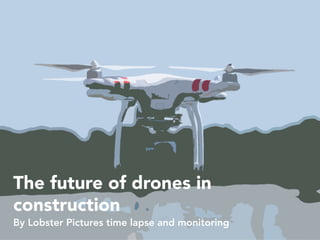
- 1. The future of drones in construction By Lobster Pictures time lapse and monitoring
- 2. Drones have surged in popularity in the last few years as the technology gets better, cheaper, lighter and more versatile.
- 3. It wasn’t long ago that piloting a remote control helicopter took as much skill and concentration as the real thing Constant manual adjustments to the controls were required, or the whole thing could easily turn into a flaming wreck of twisted metal - craft used to need petrol to fly.
- 4. But what has changed to make drones ubiquitous in our skies? One word:
- 5. But what has changed to make drones ubiquitous in our skies? One word: SMARTPHONES
- 6. The miniaturisation of GPS, tilt and altitude sensors mean that a drone ‘knows’ precisely where it is and which way it’s going, updated hundreds of times a second.
- 7. The miniaturisation of GPS, tilt and altitude sensors mean that a drone ‘knows’ precisely where it is and which way it’s going, updated hundreds of times a second. More computer power in a smaller space means that this information can feed back to motors instantly, meaning the user doesn’t have to think about correction or compensation.
- 8. The miniaturisation of GPS, tilt and altitude sensors mean that a drone ‘knows’ precisely where it is and which way it’s going, updated hundreds of times a second. More computer power in a smaller space means that this information can feed back to motors instantly, meaning the user doesn’t have to think about correction or compensation. Batteries getting smaller and lighter mean that aircraft can stay in the air for longer, and phone camera technology means a small drone can now lift a high quality camera that weighs just a few grams.
- 9. Video and photography for marketing
- 11. The most obvious use of drones is for video and photography - easily obtaining the height required to view buildings as completed structures, or as works-in-progress. Previously, this sort of work needed a helicopter or aeroplane.
- 12. The most obvious use of drones is for video and photography - easily obtaining the height required to view buildings as completed structures, or as works-in-progress. Previously, this sort of work needed a helicopter or aeroplane. There are still huge benefits to helicopters or planes however. Manned flights can:
- 13. The most obvious use of drones is for video and photography - easily obtaining the height required to view buildings as completed structures, or as works-in-progress. Previously, this sort of work needed a helicopter or aeroplane. There are still huge benefits to helicopters or planes however. Manned flights can: - Cover far more ground in an hour
- 14. The most obvious use of drones is for video and photography - easily obtaining the height required to view buildings as completed structures, or as works-in-progress. Previously, this sort of work needed a helicopter or aeroplane. There are still huge benefits to helicopters or planes however. Manned flights can: - Cover far more ground in an hour - Carry high-quality, heavy cameras
- 15. The most obvious use of drones is for video and photography - easily obtaining the height required to view buildings as completed structures, or as works-in-progress. Previously, this sort of work needed a helicopter or aeroplane. There are still huge benefits to helicopters or planes however. Manned flights can: - Cover far more ground in an hour - Carry high-quality, heavy cameras - …and go to many places where drones can’t - above busy urban areas, for example.
- 16. However, the ability of a drone to ‘just fly’ simply and cheaply has revolutionised construction photography and video. Our favourite companies in this field are Skyhook and the Flying Camera Company - both based here in Bristol, and working all over the world.
- 17. Inspection
- 18. Our colleagues at Cyberhawk - headquartered in Scotland - have transformed the surveying of large engineering and infrastructure assets and projects, using high-quality drones and cameras - with both visual and thermal cameras.
- 19. Our colleagues at Cyberhawk - headquartered in Scotland - have transformed the surveying of large engineering and infrastructure assets and projects, using high-quality drones and cameras - with both visual and thermal cameras. Their pilots have the best training in the business - they’re typically taught for over eighteen months before being allowed to work offshore. Training starts with small, ‘toy’ quadcopters, working up to using the full AscTec Falcon range of professional octocopters with multiple redundant flight control systems.
- 20. Using drones for this work saves time and money compared to traditional methods, and GPS technology means they can be sent to the same spot, accurately, time after time, to measure progress or developing issues. Cyberhawk’s pilots are also trained to fly fully manually too, for areas where GPS is limited or doesn’t exist.
- 21. More importantly, reducing the need for operators to work at height improves safety on often hazardous sites.
- 22. Cyberhawk have built a comprehensive platform for visual asset management: iHawk. This takes in all the imagery and data from drones and other sources (including Lobster Vision on sites where we work together), allowing industry-qualified engineers to review and input expert analysis for sharing and collaboration.
- 23. Modelling
- 24. Another application for drones is the creation of accurate 3D models of buildings using drones This uses photogrammetry – the science of making measurements from photographs
- 25. Using this technology on a construction in progress means that a 3D or BIM model can be produced, allowing you to compare ‘the plan’ to the ‘as-built’ at regular intervals. This has a lot in common with our own BIM integration tool. It’s a process that is often combined with laser scanning, which can provide accurate measurements to the millimetre.
- 26. The use is not just restricted to works-in-progress however. Older structures, for which paper plans may or may not exist - benefit from this method, allowing detailed computer models to be created, which can assist restoration and repair. Our colleagues at Plowman Craven are the world leaders in this field, producing highly accurate survey data for use across a huge range of construction, engineering and heritage sites.
- 27. Measurement
- 28. Using the same photogrammetry techniques, and knowing altitudes and flight paths, some clever maths can be applied to calculate lengths, areas and volumes. So if you need to know how much earth has been excavated from site for example, drone measurement can do this quickly, easily and accurately.
- 29. The future
- 30. The technology around drones is moving fast, and could have huge benefits to our industry.
- 31. The technology around drones is moving fast, and could have huge benefits to our industry. Truly autonomous drones - which can take off, fly predetermined or terrain-responsive paths, land, recharge and transmit data, are already available.
- 32. The technology around drones is moving fast, and could have huge benefits to our industry. Truly autonomous drones - which can take off, fly predetermined or terrain-responsive paths, land, recharge and transmit data, are already available. Regulatory and safety issues mean that these can’t be used on many sites at the moment, but the rules are likely to be changed as the safety and backup systems in these machines get better.
- 33. The technology around drones is moving fast, and could have huge benefits to our industry. Truly autonomous drones - which can take off, fly predetermined or terrain-responsive paths, land, recharge and transmit data, are already available. Regulatory and safety issues mean that these can’t be used on many sites at the moment, but the rules are likely to be changed as the safety and backup systems in these machines get better. Often, the legislation has to catch up with the technology.
- 34. Longer flight times (and autonomous recharging) could have implications on site security. Why cover the site with CCTV cameras, when a drone can simply traverse the site, covering far more area than a fixed position could?
- 35. Autonomous drones could even be used in the same way as our Lobster Pots - to take pictures from the same spot, at regular intervals, for years at a time. Our friend Jamie Brightmore has pioneered time lapse with drones with his ambitious and impressive ‘satlapse’ project.
- 36. We don’t see drones doing the ‘heavy lifting’ essential to construction in the future - however far the technology progresses; it’s always going to be simpler and cheaper to get steel and concrete to a site by land-based methods.
- 37. We don’t see drones doing the ‘heavy lifting’ essential to construction in the future - however far the technology progresses; it’s always going to be simpler and cheaper to get steel and concrete to a site by land-based methods. Replacing the tower crane isn’t likely either - however safe it’s made, the huge spinning blades required to lift heavy objects are always going to be loud, drafty and disruptive!
- 38. Would you like to know more? Download our free spec sheet here: http://info.lobsterpictures.tv/gen eral-spec-sheet-free-download- page www.lobsterpictures.tv