SlideShare a Scribd company logo
1 of 17
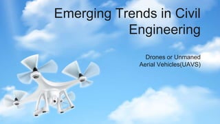
Emerging Trends in Civil
Engineering
Drones or Unmaned
Aerial Vehicles(UAVS)
Table of contents
01.
03.
02.
04.
Significance
Objective
Current Status of Research
Opinion on the importance of the trend
Significance
01.
Significance
Drones in construction and
infrastructure have revolutionized the
entire project life cycle, which helps
construction companies regularly track
the construction progress, streamline
communication and decision-making,
build detailed maps and 3D models, and
keep site workers out of hazardous
areas. The impact of drones in
construction has already transformed
the efficiency and accuracy of the
industry
list of benefits can be extensive, and here are
the main benefits that drones have brought to
construction and civil engineering companies.
Drones are a faster and safer
alternative to traditional
land-based surveying methods
in construction projects.
They can complete survey work
in 60% to 70% less time and
eliminate risks to personnel
in rugged terrain.
Fast data Collection
Drones are more affordable
than mobilizing a technical
inspection team. For
instance, when inspecting a
tall building with cracks,
drones can capture shots
inside and outside without
the need for a crane or
dedicated team.
Cost Saving
Previously, construction
workers had to climb roofs or
use scaffolding for
inspections, which was
dangerous and limiting. With
construction drones, you can
ensure safety, inspect the
entire site, and monitor in
real-time..
Increased Safety
Drones enhance construction
site communication by up to
65%. Real-time video data
enables accurate and
efficient information
exchange among team members,
eliminating communication
problems caused by radios and
cell phones.
Improved Communication
Revolutionize Construction using UAVS
Objectives
02.
General Objective
-Explore the applications of
drones through different phases
of life cycle of the construction
project.
Current Status of
Research
03.
Application of Drones Across the
Project Lifecycle
Drones can be used across the entire project lifecycle – starting from the early
stages of pre-planning and design, passing through the construction stage, to
the late stages of asset management, operation, and management. This
section elaborates on the major applications for drones across the different
phases of a construction project. While there is no single definition of what
constitute the lifecycle of a construction project, this paper adopts the
following three phases that are commonly referenced in drones related
research: preconstruction phase, construction phase, and postconstruction
phase
Pre construction
phase
The pre-construction phase of a construction
project includes all stages that are needed
before the physical construction starts. During
this phase, drones can be used for designing,
bidding, and site planning.
In the design stage, the use of drones can provide designers
with a good understanding of the project environment.
Designers can also benefit from the geometrically accurate
3D scans that drones offer.
Design stage
In the bidding stage, drone images can provide contractors
with a detailed view of the site location and its surrounding to
expose possible risks and hazards that should be accounted
for while creating their bid.
Bidding stage
As for site planning, the high accuracy of the drone data
allows for an accurate identification of site boundaries and
presentation of the construction plot area.
Site Planning
Construction phase
The construction phase of a project includes all
the physical construction that happens on the
construction site. Drones can serve multiple
purposes
● drones can be used for safety and health
purposes
● Drones can also be used for resource and
logistics management. Drones can provide
real-time measurement of the volume of
materials on site such as soil and
aggregates
● Another use for drones is to track progress
on the construction sites.
Post Construction phase
The post-construction phase of a construction project
includes all stages happening after the physical
construction ends. During this phase, drones can be
used for different mapping, marketing, monitoring, and
inspecting purposes.
● Drones can be used to map inaccessible and
hazardous areas, especially with their ability to
enter areas and reach certain heights that can be
hard to capture manually or by laser scanners
● Drones can also play a vital role in monitoring and
inspecting structures.
● Another major use-case for drones is post-disaster
reconnaissance. Fires, explosions, and natural
disasters such as earthquakes, floods, hurricanes,
tornadoes, and landslides can cause unavoidable
damage to buildings and infrastructure.
Opinion on the Importance
of the trend
04.

More Related Content

Similar to Drone Presentation

Best Drones for Construction Industry
Best Drones for Construction IndustryBest Drones for Construction Industry
Best Drones for Construction IndustryJone Smith
 
5 Remarkable Benefits of Using Drone Surveying and Mapping
5 Remarkable Benefits of Using Drone Surveying and Mapping5 Remarkable Benefits of Using Drone Surveying and Mapping
5 Remarkable Benefits of Using Drone Surveying and MappingEye-bot
 
10 Major Pros of Unmanned Aerial Vehicle(UAV) Drones.pptx
10 Major Pros of Unmanned Aerial Vehicle(UAV) Drones.pptx10 Major Pros of Unmanned Aerial Vehicle(UAV) Drones.pptx
10 Major Pros of Unmanned Aerial Vehicle(UAV) Drones.pptxFALCON 3D
 
Drone Inspection Services Utilities by the Industry.pptx
Drone Inspection Services Utilities by the Industry.pptxDrone Inspection Services Utilities by the Industry.pptx
Drone Inspection Services Utilities by the Industry.pptxCanada Sky Drone Services
 
Ten Applications for Drones in Construction
Ten Applications for Drones in ConstructionTen Applications for Drones in Construction
Ten Applications for Drones in ConstructionStuart Taylor
 
Selection Criteria of Equipment in Construction Project
Selection Criteria of Equipment in Construction ProjectSelection Criteria of Equipment in Construction Project
Selection Criteria of Equipment in Construction ProjectIRJET Journal
 
Navigating the Landscapes with Drone Surveys in India.pdf
Navigating the Landscapes with Drone Surveys in India.pdfNavigating the Landscapes with Drone Surveys in India.pdf
Navigating the Landscapes with Drone Surveys in India.pdfGarud Survey Private Limited
 
Discovering the Levels of Light Observation and Ranging with LiDAR.pdf
Discovering the Levels of Light Observation and Ranging with LiDAR.pdfDiscovering the Levels of Light Observation and Ranging with LiDAR.pdf
Discovering the Levels of Light Observation and Ranging with LiDAR.pdfLiDAR Solution
 
What are the technologies shifting the civil engineering industry.pdf
What are the technologies shifting the civil engineering industry.pdfWhat are the technologies shifting the civil engineering industry.pdf
What are the technologies shifting the civil engineering industry.pdfKarpagam Engineering
 
Drone Mapping Services Revolutionizing the Future of Surveying and Mapping.pptx
Drone Mapping Services Revolutionizing the Future of Surveying and Mapping.pptxDrone Mapping Services Revolutionizing the Future of Surveying and Mapping.pptx
Drone Mapping Services Revolutionizing the Future of Surveying and Mapping.pptxfalconsurveyme
 
Augmented Reality to Access Dam Cracks Information
Augmented Reality to Access Dam Cracks InformationAugmented Reality to Access Dam Cracks Information
Augmented Reality to Access Dam Cracks InformationIJERA Editor
 
Drone Threats in Building and Infrastructure Projects
Drone Threats in Building and Infrastructure ProjectsDrone Threats in Building and Infrastructure Projects
Drone Threats in Building and Infrastructure ProjectsNovoQuad
 
Site layout cpm module4
Site layout cpm module4Site layout cpm module4
Site layout cpm module4ahsanrabbani
 
National building code
National building codeNational building code
National building codeMayank Rawat
 
IRJET - Surveying using Drones and Providing Results by using Photogrammm...
IRJET -  	  Surveying using Drones and Providing Results by using Photogrammm...IRJET -  	  Surveying using Drones and Providing Results by using Photogrammm...
IRJET - Surveying using Drones and Providing Results by using Photogrammm...IRJET Journal
 
IRJET- Surveying using Drones and Providing Results by using Photogrammme...
IRJET-  	  Surveying using Drones and Providing Results by using Photogrammme...IRJET-  	  Surveying using Drones and Providing Results by using Photogrammme...
IRJET- Surveying using Drones and Providing Results by using Photogrammme...IRJET Journal
 
Top Drone Surveys and Mapping.pptx
Top Drone Surveys and Mapping.pptxTop Drone Surveys and Mapping.pptx
Top Drone Surveys and Mapping.pptxFALCON 3D
 

Similar to Drone Presentation (20)

Drone For Construction.pptx
Drone For Construction.pptxDrone For Construction.pptx
Drone For Construction.pptx
 
Best Drones for Construction Industry
Best Drones for Construction IndustryBest Drones for Construction Industry
Best Drones for Construction Industry
 
5 Remarkable Benefits of Using Drone Surveying and Mapping
5 Remarkable Benefits of Using Drone Surveying and Mapping5 Remarkable Benefits of Using Drone Surveying and Mapping
5 Remarkable Benefits of Using Drone Surveying and Mapping
 
Drone survey
Drone surveyDrone survey
Drone survey
 
10 Major Pros of Unmanned Aerial Vehicle(UAV) Drones.pptx
10 Major Pros of Unmanned Aerial Vehicle(UAV) Drones.pptx10 Major Pros of Unmanned Aerial Vehicle(UAV) Drones.pptx
10 Major Pros of Unmanned Aerial Vehicle(UAV) Drones.pptx
 
Drone Inspection Services Utilities by the Industry.pptx
Drone Inspection Services Utilities by the Industry.pptxDrone Inspection Services Utilities by the Industry.pptx
Drone Inspection Services Utilities by the Industry.pptx
 
What is the use of land surveying.pdf
What is the use of land surveying.pdfWhat is the use of land surveying.pdf
What is the use of land surveying.pdf
 
Ten Applications for Drones in Construction
Ten Applications for Drones in ConstructionTen Applications for Drones in Construction
Ten Applications for Drones in Construction
 
Selection Criteria of Equipment in Construction Project
Selection Criteria of Equipment in Construction ProjectSelection Criteria of Equipment in Construction Project
Selection Criteria of Equipment in Construction Project
 
Navigating the Landscapes with Drone Surveys in India.pdf
Navigating the Landscapes with Drone Surveys in India.pdfNavigating the Landscapes with Drone Surveys in India.pdf
Navigating the Landscapes with Drone Surveys in India.pdf
 
Discovering the Levels of Light Observation and Ranging with LiDAR.pdf
Discovering the Levels of Light Observation and Ranging with LiDAR.pdfDiscovering the Levels of Light Observation and Ranging with LiDAR.pdf
Discovering the Levels of Light Observation and Ranging with LiDAR.pdf
 
What are the technologies shifting the civil engineering industry.pdf
What are the technologies shifting the civil engineering industry.pdfWhat are the technologies shifting the civil engineering industry.pdf
What are the technologies shifting the civil engineering industry.pdf
 
Drone Mapping Services Revolutionizing the Future of Surveying and Mapping.pptx
Drone Mapping Services Revolutionizing the Future of Surveying and Mapping.pptxDrone Mapping Services Revolutionizing the Future of Surveying and Mapping.pptx
Drone Mapping Services Revolutionizing the Future of Surveying and Mapping.pptx
 
Augmented Reality to Access Dam Cracks Information
Augmented Reality to Access Dam Cracks InformationAugmented Reality to Access Dam Cracks Information
Augmented Reality to Access Dam Cracks Information
 
Drone Threats in Building and Infrastructure Projects
Drone Threats in Building and Infrastructure ProjectsDrone Threats in Building and Infrastructure Projects
Drone Threats in Building and Infrastructure Projects
 
Site layout cpm module4
Site layout cpm module4Site layout cpm module4
Site layout cpm module4
 
National building code
National building codeNational building code
National building code
 
IRJET - Surveying using Drones and Providing Results by using Photogrammm...
IRJET -  	  Surveying using Drones and Providing Results by using Photogrammm...IRJET -  	  Surveying using Drones and Providing Results by using Photogrammm...
IRJET - Surveying using Drones and Providing Results by using Photogrammm...
 
IRJET- Surveying using Drones and Providing Results by using Photogrammme...
IRJET-  	  Surveying using Drones and Providing Results by using Photogrammme...IRJET-  	  Surveying using Drones and Providing Results by using Photogrammme...
IRJET- Surveying using Drones and Providing Results by using Photogrammme...
 
Top Drone Surveys and Mapping.pptx
Top Drone Surveys and Mapping.pptxTop Drone Surveys and Mapping.pptx
Top Drone Surveys and Mapping.pptx
 

Recently uploaded

Ground Improvement Technique: Earth Reinforcement
Ground Improvement Technique: Earth ReinforcementGround Improvement Technique: Earth Reinforcement
Ground Improvement Technique: Earth ReinforcementDr. Deepak Mudgal
 
Electromagnetic relays used for power system .pptx
Electromagnetic relays used for power system .pptxElectromagnetic relays used for power system .pptx
Electromagnetic relays used for power system .pptxNANDHAKUMARA10
 
Digital Communication Essentials: DPCM, DM, and ADM .pptx
Digital Communication Essentials: DPCM, DM, and ADM .pptxDigital Communication Essentials: DPCM, DM, and ADM .pptx
Digital Communication Essentials: DPCM, DM, and ADM .pptxpritamlangde
 
UNIT 4 PTRP final Convergence in probability.pptx
UNIT 4 PTRP final Convergence in probability.pptxUNIT 4 PTRP final Convergence in probability.pptx
UNIT 4 PTRP final Convergence in probability.pptxkalpana413121
 
Databricks Generative AI Fundamentals .pdf
Databricks Generative AI Fundamentals  .pdfDatabricks Generative AI Fundamentals  .pdf
Databricks Generative AI Fundamentals .pdfVinayVadlagattu
 
INTERRUPT CONTROLLER 8259 MICROPROCESSOR
INTERRUPT CONTROLLER 8259 MICROPROCESSORINTERRUPT CONTROLLER 8259 MICROPROCESSOR
INTERRUPT CONTROLLER 8259 MICROPROCESSORTanishkaHira1
 
Passive Air Cooling System and Solar Water Heater.ppt
Passive Air Cooling System and Solar Water Heater.pptPassive Air Cooling System and Solar Water Heater.ppt
Passive Air Cooling System and Solar Water Heater.pptamrabdallah9
 
Introduction to Artificial Intelligence ( AI)
Introduction to Artificial Intelligence ( AI)Introduction to Artificial Intelligence ( AI)
Introduction to Artificial Intelligence ( AI)ChandrakantDivate1
 
Hostel management system project report..pdf
Hostel management system project report..pdfHostel management system project report..pdf
Hostel management system project report..pdfKamal Acharya
 
litvinenko_Henry_Intrusion_Hong-Kong_2024.pdf
litvinenko_Henry_Intrusion_Hong-Kong_2024.pdflitvinenko_Henry_Intrusion_Hong-Kong_2024.pdf
litvinenko_Henry_Intrusion_Hong-Kong_2024.pdfAlexander Litvinenko
 
fitting shop and tools used in fitting shop .ppt
fitting shop and tools used in fitting shop .pptfitting shop and tools used in fitting shop .ppt
fitting shop and tools used in fitting shop .pptAfnanAhmad53
 
Hospital management system project report.pdf
Hospital management system project report.pdfHospital management system project report.pdf
Hospital management system project report.pdfKamal Acharya
 
Design For Accessibility: Getting it right from the start
Design For Accessibility: Getting it right from the startDesign For Accessibility: Getting it right from the start
Design For Accessibility: Getting it right from the startQuintin Balsdon
 
Danikor Product Catalog- Screw Feeder.pdf
Danikor Product Catalog- Screw Feeder.pdfDanikor Product Catalog- Screw Feeder.pdf
Danikor Product Catalog- Screw Feeder.pdfthietkevietthinh
 
Augmented Reality (AR) with Augin Software.pptx
Augmented Reality (AR) with Augin Software.pptxAugmented Reality (AR) with Augin Software.pptx
Augmented Reality (AR) with Augin Software.pptxMustafa Ahmed
 
Post office management system project ..pdf
Post office management system project ..pdfPost office management system project ..pdf
Post office management system project ..pdfKamal Acharya
 
8th International Conference on Soft Computing, Mathematics and Control (SMC ...
8th International Conference on Soft Computing, Mathematics and Control (SMC ...8th International Conference on Soft Computing, Mathematics and Control (SMC ...
8th International Conference on Soft Computing, Mathematics and Control (SMC ...josephjonse
 
NO1 Top No1 Amil Baba In Azad Kashmir, Kashmir Black Magic Specialist Expert ...
NO1 Top No1 Amil Baba In Azad Kashmir, Kashmir Black Magic Specialist Expert ...NO1 Top No1 Amil Baba In Azad Kashmir, Kashmir Black Magic Specialist Expert ...
NO1 Top No1 Amil Baba In Azad Kashmir, Kashmir Black Magic Specialist Expert ...Amil baba
 
S1S2 B.Arch MGU - HOA1&2 Module 3 -Temple Architecture of Kerala.pptx
S1S2 B.Arch MGU - HOA1&2 Module 3 -Temple Architecture of Kerala.pptxS1S2 B.Arch MGU - HOA1&2 Module 3 -Temple Architecture of Kerala.pptx
S1S2 B.Arch MGU - HOA1&2 Module 3 -Temple Architecture of Kerala.pptxSCMS School of Architecture
 
Worksharing and 3D Modeling with Revit.pptx
Worksharing and 3D Modeling with Revit.pptxWorksharing and 3D Modeling with Revit.pptx
Worksharing and 3D Modeling with Revit.pptxMustafa Ahmed
 

Recently uploaded (20)

Ground Improvement Technique: Earth Reinforcement
Ground Improvement Technique: Earth ReinforcementGround Improvement Technique: Earth Reinforcement
Ground Improvement Technique: Earth Reinforcement
 
Electromagnetic relays used for power system .pptx
Electromagnetic relays used for power system .pptxElectromagnetic relays used for power system .pptx
Electromagnetic relays used for power system .pptx
 
Digital Communication Essentials: DPCM, DM, and ADM .pptx
Digital Communication Essentials: DPCM, DM, and ADM .pptxDigital Communication Essentials: DPCM, DM, and ADM .pptx
Digital Communication Essentials: DPCM, DM, and ADM .pptx
 
UNIT 4 PTRP final Convergence in probability.pptx
UNIT 4 PTRP final Convergence in probability.pptxUNIT 4 PTRP final Convergence in probability.pptx
UNIT 4 PTRP final Convergence in probability.pptx
 
Databricks Generative AI Fundamentals .pdf
Databricks Generative AI Fundamentals  .pdfDatabricks Generative AI Fundamentals  .pdf
Databricks Generative AI Fundamentals .pdf
 
INTERRUPT CONTROLLER 8259 MICROPROCESSOR
INTERRUPT CONTROLLER 8259 MICROPROCESSORINTERRUPT CONTROLLER 8259 MICROPROCESSOR
INTERRUPT CONTROLLER 8259 MICROPROCESSOR
 
Passive Air Cooling System and Solar Water Heater.ppt
Passive Air Cooling System and Solar Water Heater.pptPassive Air Cooling System and Solar Water Heater.ppt
Passive Air Cooling System and Solar Water Heater.ppt
 
Introduction to Artificial Intelligence ( AI)
Introduction to Artificial Intelligence ( AI)Introduction to Artificial Intelligence ( AI)
Introduction to Artificial Intelligence ( AI)
 
Hostel management system project report..pdf
Hostel management system project report..pdfHostel management system project report..pdf
Hostel management system project report..pdf
 
litvinenko_Henry_Intrusion_Hong-Kong_2024.pdf
litvinenko_Henry_Intrusion_Hong-Kong_2024.pdflitvinenko_Henry_Intrusion_Hong-Kong_2024.pdf
litvinenko_Henry_Intrusion_Hong-Kong_2024.pdf
 
fitting shop and tools used in fitting shop .ppt
fitting shop and tools used in fitting shop .pptfitting shop and tools used in fitting shop .ppt
fitting shop and tools used in fitting shop .ppt
 
Hospital management system project report.pdf
Hospital management system project report.pdfHospital management system project report.pdf
Hospital management system project report.pdf
 
Design For Accessibility: Getting it right from the start
Design For Accessibility: Getting it right from the startDesign For Accessibility: Getting it right from the start
Design For Accessibility: Getting it right from the start
 
Danikor Product Catalog- Screw Feeder.pdf
Danikor Product Catalog- Screw Feeder.pdfDanikor Product Catalog- Screw Feeder.pdf
Danikor Product Catalog- Screw Feeder.pdf
 
Augmented Reality (AR) with Augin Software.pptx
Augmented Reality (AR) with Augin Software.pptxAugmented Reality (AR) with Augin Software.pptx
Augmented Reality (AR) with Augin Software.pptx
 
Post office management system project ..pdf
Post office management system project ..pdfPost office management system project ..pdf
Post office management system project ..pdf
 
8th International Conference on Soft Computing, Mathematics and Control (SMC ...
8th International Conference on Soft Computing, Mathematics and Control (SMC ...8th International Conference on Soft Computing, Mathematics and Control (SMC ...
8th International Conference on Soft Computing, Mathematics and Control (SMC ...
 
NO1 Top No1 Amil Baba In Azad Kashmir, Kashmir Black Magic Specialist Expert ...
NO1 Top No1 Amil Baba In Azad Kashmir, Kashmir Black Magic Specialist Expert ...NO1 Top No1 Amil Baba In Azad Kashmir, Kashmir Black Magic Specialist Expert ...
NO1 Top No1 Amil Baba In Azad Kashmir, Kashmir Black Magic Specialist Expert ...
 
S1S2 B.Arch MGU - HOA1&2 Module 3 -Temple Architecture of Kerala.pptx
S1S2 B.Arch MGU - HOA1&2 Module 3 -Temple Architecture of Kerala.pptxS1S2 B.Arch MGU - HOA1&2 Module 3 -Temple Architecture of Kerala.pptx
S1S2 B.Arch MGU - HOA1&2 Module 3 -Temple Architecture of Kerala.pptx
 
Worksharing and 3D Modeling with Revit.pptx
Worksharing and 3D Modeling with Revit.pptxWorksharing and 3D Modeling with Revit.pptx
Worksharing and 3D Modeling with Revit.pptx
 

Drone Presentation

  • 1. Emerging Trends in Civil Engineering Drones or Unmaned Aerial Vehicles(UAVS)
  • 2. Table of contents 01. 03. 02. 04. Significance Objective Current Status of Research Opinion on the importance of the trend
  • 4. Significance Drones in construction and infrastructure have revolutionized the entire project life cycle, which helps construction companies regularly track the construction progress, streamline communication and decision-making, build detailed maps and 3D models, and keep site workers out of hazardous areas. The impact of drones in construction has already transformed the efficiency and accuracy of the industry
  • 5. list of benefits can be extensive, and here are the main benefits that drones have brought to construction and civil engineering companies. Drones are a faster and safer alternative to traditional land-based surveying methods in construction projects. They can complete survey work in 60% to 70% less time and eliminate risks to personnel in rugged terrain. Fast data Collection
  • 6. Drones are more affordable than mobilizing a technical inspection team. For instance, when inspecting a tall building with cracks, drones can capture shots inside and outside without the need for a crane or dedicated team. Cost Saving Previously, construction workers had to climb roofs or use scaffolding for inspections, which was dangerous and limiting. With construction drones, you can ensure safety, inspect the entire site, and monitor in real-time.. Increased Safety
  • 7. Drones enhance construction site communication by up to 65%. Real-time video data enables accurate and efficient information exchange among team members, eliminating communication problems caused by radios and cell phones. Improved Communication
  • 10. General Objective -Explore the applications of drones through different phases of life cycle of the construction project.
  • 12. Application of Drones Across the Project Lifecycle Drones can be used across the entire project lifecycle – starting from the early stages of pre-planning and design, passing through the construction stage, to the late stages of asset management, operation, and management. This section elaborates on the major applications for drones across the different phases of a construction project. While there is no single definition of what constitute the lifecycle of a construction project, this paper adopts the following three phases that are commonly referenced in drones related research: preconstruction phase, construction phase, and postconstruction phase
  • 13. Pre construction phase The pre-construction phase of a construction project includes all stages that are needed before the physical construction starts. During this phase, drones can be used for designing, bidding, and site planning.
  • 14. In the design stage, the use of drones can provide designers with a good understanding of the project environment. Designers can also benefit from the geometrically accurate 3D scans that drones offer. Design stage In the bidding stage, drone images can provide contractors with a detailed view of the site location and its surrounding to expose possible risks and hazards that should be accounted for while creating their bid. Bidding stage As for site planning, the high accuracy of the drone data allows for an accurate identification of site boundaries and presentation of the construction plot area. Site Planning
  • 15. Construction phase The construction phase of a project includes all the physical construction that happens on the construction site. Drones can serve multiple purposes ● drones can be used for safety and health purposes ● Drones can also be used for resource and logistics management. Drones can provide real-time measurement of the volume of materials on site such as soil and aggregates ● Another use for drones is to track progress on the construction sites.
  • 16. Post Construction phase The post-construction phase of a construction project includes all stages happening after the physical construction ends. During this phase, drones can be used for different mapping, marketing, monitoring, and inspecting purposes. ● Drones can be used to map inaccessible and hazardous areas, especially with their ability to enter areas and reach certain heights that can be hard to capture manually or by laser scanners ● Drones can also play a vital role in monitoring and inspecting structures. ● Another major use-case for drones is post-disaster reconnaissance. Fires, explosions, and natural disasters such as earthquakes, floods, hurricanes, tornadoes, and landslides can cause unavoidable damage to buildings and infrastructure.
  • 17. Opinion on the Importance of the trend 04.