SlideShare a Scribd company logo
1 of 28
Harmonizing and linking conceptual
models of geospatial information
Technologies for information modelling in
Geographic Information Systems (GIS), Intelligent Transport Systems (ITS) and
Building Information Modelling (BIM)
Knut Jetlund
Norwegian University of Science and Technology
Norwegian Public Roads Administration
knut.jetlund@vegvesen.no
Twitter: @Jetgeo
LinkedIn: https://www.linkedin.com/in/knut-jetlund/
Photo: Knut Opeide, Statens vegvesen
1 27
Agenda
• Motivation
• Research questions
• Scientific approach
• Theory
• Results
• Conclusions
• Further work
Photo: Knut Opeide, Statens vegvesen
1 27
Three application domains,
one real world
GIS
Analyze and present
BIM
Plan, develop,
construct and maintain
ITS
Plan and control
transportation
2 27
Photo: Knut Opeide, Statens vegvesen
Reuse of information across domain borders
• The challenge:
• Reuse requires a common
understanding of how the real
world is described in information
models
• Modelling language
• Terminology
• Geometry and location
referencing
• Exchange formats
GIS
Analyze and present
BIM
Plan, develop,
construct and maintain
ITS
Plan and control
transportation
3 27
Photo: Knut Opeide, Statens vegvesen
Research question:
“How can approaches and
technologies for information
modelling be applied for
harmonization and linking of
conceptual models of
geospatial information from
the three application
domains of GIS, ITS and
BIM?”
Harmonization
GIS
Linking
BIM ITS
Harmonization
Harmonization
How can we achieve a common understanding?
4 27
SRQ1
State
of
the
art
SRQ2 GIS-ITS
SRQ3 GIS-BIM
SRQ4 Harmonization
SRQ5 Ontologies and linking
Article 1 Article 5 CP1 SP3
Article 4 Article 5 SP4
Article 5 Article 1 Article 4
Article 2 Article 3 Article 4
Article 3
5 27
Scientific approach
GIS
BIM ITS
SRQ3 SRQ2
SRQ4
SRQ5
A generic information
model for exchange GIS
to ITS
Modelling rules and rules for
conversion from UML to OWL
A structure of UML profiles for
GIS, ITS and BIM
IFC schemas in ISO/TC
211 UML
6 27
DIKW
- Data, Information, Knowledge and Wisdom
Data
Information
Knowledge
Wisdom
Information model:
• “… a formal description of types of ideas, facts
and processes which together form a model of a
portion of interest of the real world and which
provides an explicit set of interpretation rules.”
(Schenck and Wilson, 1994).
• “… a representation of concepts, relationships,
constraints, rules, and operations to specify data
semantics for a chosen domain of discourse”
(Zhao et al., 2011)
The DIKW Hierarchy. Adapted from (Rowley, 2007).
7 27
Information modelling
Real world
Universe of discourse
Context
Perceived in
the context of
Defined in
Conceptualschema
Formally represented in
Conceptualschema language
Formal language
for representing
Conceptualmodel
Conceptualformalism
Provides concepts
for describing
Basis for
From the real world to conceptual models.
Adapted from ISO 19101-1:2014
8 27
Results
Photo: Torbjørn Braset, Statens vegvesen
9 27
SRQ1: State of the art
“What approaches and
technologies have been used for
modelling geospatial information
in GIS, ITS and BIM?”
10 27
• All three application domains:
– Conceptual schemas in UML
– Some degree of MDA
• UML and MDA for GIS the
most complete approach
– But with defeciencies
SRQ2: Information exchange from GIS to ITS
“How can models for exchange of
geospatial information from road
and mapping authorities to
geospatial databases for ITS be
improved?”
Requirement
Req 1: ISO/TC 211 MDA
Req 2: GIS exchange format
Req 3: Feature catalogue
Req 4: Feature catalogue exchange model
Req 5: Network model
Req 6: Generic feature exchange model
11 27
13
ISO/TC 211 MDA
GIS exchange format
Feature catalogue
Feature catalogue exchange model
Network model
Generic feature exchange model
1 2 3 4 5 6 7 8 9 10 11 12 27
Prototype experiment
14
Validation: The GIS to ITS prototype
Requirement Prototype approach
Req 1: ISO/TC 211 MDA Yes
Req 2: GIS exchange format Yes – GML in the prototype
Req 3: Feature catalogue
Any feature catalogue described as an ISO 19109
application schema.
Tested with INSPIRE and GDF in a case study
Req 4: Feature catalogue exchange model Yes – Implemented in GML
Req 5: Network model Yes
Req 6: Generic feature exchange model Yes – Implemented in GML
Future improvements:
• More complex road network models (GDF, NDS)
• Belts and Traffic spaces (GDF 5.2 and CityGML 3.0)
1 2 3 4 5 6 7 8 9 10 11 12 13 27
Syntactic
Semantic
Implementation
SRQ3: Integration of
models for GIS and BIM
“How can information models and
semantics for implementation
technologies for BIM be integrated
and linked with GIS standards?”
1 2 3 4 5 6 7 8 9 10 11 12 13 14 27
• Syntactic interoperability
– Most EXPRESS concepts
maintained
• Semantic interoperability
– Not all concepts could be linked
– Common concept preferred
• Implementation
– Extra semantics for EXPRESS
– Mapping of geometry concepts
vital for GML
Validation:
The BIM/GIS prototype
1 2 3 4 5 6 7 8 9 10 11 12 13 14 15 27
«FeatureType»
IfcProductExtension::IfcAlignment
+ predefinedType: IfcAlignmentTypeEnum [0..1]
::IfcObject
+ objectType: CharacterString [0..1]
::IfcRoot
+ globalId: IfcGloballyUniqueId
+ name: CharacterString [0..1]
+ description: CharacterString [0..1]
IfcGeometricRepresentationItem
«FeatureType»
IfcGeometryResource::IfcCurve
+ /dim: Integer
+ curve: Curve [0..1]
constraints
{derive dim}
IfcPositioningElement
«FeatureType»
IfcProductExtension::
IfcLinearPositioningElement
«FeatureType»
IfcGeometryResource::
IfcBoundedCurve
«FeatureType»
IfcGeometricConstraintResource:
:IfcAlignmentCurve
+ tag: CharacterString [0..1]
IfcGeometricRepresentationItem
«FeatureType»
IfcGeometricConstraintResource::
IfcAlignment2DHorizontal
+ startDistAlong: Length [0..1]
IfcAlignment2DSegment
«FeatureType»
IfcGeometricConstraintResource::
IfcAlignment2DHorizontalSegment
List aggregate
«FeatureType»
IfcGeometryResource::IfcCurveSegment2D
+ startDirection: Angle
+ segmentLength: Length
«EXPRESS_DERIVE»
{derive dim : Dim : IfcDimensionCount
:= IfcCurveDim(SELF)}
+horizontal
1..1
+curveGeometry
1
+segments
1..*
{ordered}
+axis 1..1
SRQ5: Ontologies for linking and mapping
“How can UML models of
geospatial information be
implemented as OWL
Ontologies, for linking and
mapping by applying Semantic
Web technologies?”
1 2 3 4 5 6 7 8 9 10 11 12 13 14 15 16 27
Harmonization
GIS
Linking
BIM ITS
Harmonization
Harmonization
Fundamental differences
Closed World Assumption (CWA)
• The information model is
complete in the given context
• Additional or deviating
information is invalid
Open World Assumption (OWA)
• The information model presents
only what is currently known in
the given context
• Additional information extends
the model
Structure of information
Meaning of concepts
1 2 3 4 5 6 7 8 9 10 11 12 13 14 15 16 17 27
Prototype experiment and validation
Prototype experiment:
• Extended UML profile for
OWL Encoding
– Global or shared properties
– Links to external concepts
– Implemented in the joint
approach (SRQ4)
• Adapted rules for modelling
and conversion
Prototype validation:
• Conversions for the studied issues
were improved by adding semantics
and modelling as suggested
1 2 3 4 5 6 7 8 9 10 11 12 13 14 15 16 17 18 27
Level of information flow
Conversions of restrictions from
the CWA to the OWA must be
configured according to the
selected level of information flow:
1. Ontologies for use only in the
Semantic Web
2. Unidirectional information
exchange to the Semantic Web
3. Bidirectional information exchange
1 2 3 4 5 6 7 8 9 10 11 12 13 14 15 16 17 18 19 27
SRQ4: A joint modelling approach
SRQ1
State
of
the
art
SRQ2 GIS-ITS
SRQ3 GIS-BIM
SRQ4 Harmonization
SRQ5 Ontologies and linking
Article 1 Article 5 CP1 SP3
Article 4 Article 5 SP4
Article 5 Article 1 Article 4
Article 2 Article 3 Article 4
Article 3
“How can information models
and semantics for
implementation technologies for
GIS, ITS and BIM be integrated
into a joint modelling approach?”
1 2 3 4 5 6 7 8 9 10 11 12 13 14 15 16 17 18 19 20 27
Prototype experiment:
A structure of UML
Profiles for GIS, ITS
and BIM
«profile»
Core Geospatial Profile
Base profiles
Community conceptual profiles
General encoding profiles
Community encoding profiles
Legend
«merge»
1 2 3 4 5 6 7 8 9 10 11 12 13 14 15 16 17 18 19 20 21 27
«profile»
OWL Encoding
«profile»
IFC EXPRESS Encoding
«profile»
GML Encoding
«profile»
DATEX II Conceptual
«profile»
IFC Conceptual
«profile»
DATEX II XML Encoding
«profile»
IFC XML Encoding
«profile»
Core Geospatial Profile
Base profiles
Community conceptual profiles
General encoding profiles
Community encoding profiles
Legend
«profile»
GDF Conceptual
«profile»
GDF MRS Encoding
«profile»
GDF XML Encoding
«merge»
«merge»
«merge»
«merge»
«merge»
«merge»
Prototype validation
• The structure could be implemented in UML sofware
• Existing and prototype models could be adapted
• Recommended actions:
– Revise UML profiles: ISO 19103 and ISO 19109
– Define formal UML profiles: ISO 19136 and ISO 19150-2
– Define encoding profiles: EXPRESS
– Define conceptual and encoding profiles: TPEG2
– Define mapping: DATEX II
1 2 3 4 5 6 7 8 9 10 11 12 13 14 15 16 17 18 19 20 22 22 23 27
Conclusions - main contribution
• A joint approach for
information modelling
• Prototypes for profiles and
models within the harmonized
approach
1 2 3 4 5 6 7 8 9 10 11 12 13 14 15 16 17 18 19 20 22 23 23 24 27
«profile»
OWL Encoding
«profile»
IFC EXPRESS Encoding
«profile»
GML Encoding
«profile»
DATEX II Conceptual
«profile»
IFC Conceptual
«profile»
DATEX II XML Encoding
«profile»
IFC XML Encoding
«profile»
Core Geospatial Profile
Base profiles
Community conceptual profiles
General encoding profiles
Community encoding profiles
Legend
«profile»
GDF Conceptual
«profile»
GDF MRS Encoding
«profile»
GDF XML Encoding
«merge»
«merge»
«merge»
«merge»
«merge»
«merge»
Conclusions
• Full harmonization not
appropriate
– Apply LinkSets for mapping
• Apply the joint modelling
approach for all three
domains
• Use common core concepts
– Data types from non-domain-
specific models
– Common concepts for geometry
and location referencing
Photo: Knut Opeide, Statens vegvesen
Harmonization
GIS
Linking
BIM ITS
Harmonization
Harmonization
1 2 3 4 5 6 7 8 9 10 11 12 13 14 15 16 17 18 19 20 22 23 24 24 25 27
Similar representations
• Tobler’s first law of geography (Tobler, 1970):
– “everything is related to everything else, but near things are
more related than distant things”.
• Modernized to a digital world with multiple representations of the same
physical ”thing”:
– “every digital representation of a thing can be linked to any
other digital representation of the same thing, but links
between similar representations are more precise than links
between dissimilar representations”.
1 2 3 4 5 6 7 8 9 10 11 12 13 14 15 16 17 18 19 20 22 23 24 25 25 26 27
Limitations and further research
• Limitation:
– Studied at a conceptual level,
need experiences from
implementations
• Further research:
– Common core concepts
– Use of OWL Ontologies
– Higher levels of interoperability
– Other application domains Photo: Knut Opeide, Statens vegvesen
1 2 3 4 5 6 7 8 9 10 11 12 13 14 15 16 17 18 19 20 22 23 24 25 26 26 27
Knut Jetlund
Norwegian University of Science and Technology
Norwegian Public Roads Administration
knut.jetlund@vegvesen.no
Twitter: @Jetgeo
LinkedIn: https://www.linkedin.com/in/knut-jetlund/
Photo: Knut Opeide, Statens vegvesen
Thanks for
listening!
1 2 3 4 5 6 7 8 9 10 11 12 13 14 15 16 17 18 19 20 22 23 24 25 26 26 27

More Related Content

Similar to Thesis presentation for defence

[Cib]achieving interoperability between bim and gis final
[Cib]achieving interoperability between bim and gis final[Cib]achieving interoperability between bim and gis final
[Cib]achieving interoperability between bim and gis finalAna Roxin
 
INSPIRE data scope
INSPIRE data scopeINSPIRE data scope
INSPIRE data scopeinspireeu
 
The Future is Big Graphs: A Community View on Graph Processing Systems
The Future is Big Graphs: A Community View on Graph Processing SystemsThe Future is Big Graphs: A Community View on Graph Processing Systems
The Future is Big Graphs: A Community View on Graph Processing SystemsNeo4j
 
GIS Standards and Interoperability
GIS Standards and InteroperabilityGIS Standards and Interoperability
GIS Standards and InteroperabilityNasr Khashoggi
 
Imcs review 2013_04_v7
Imcs review 2013_04_v7Imcs review 2013_04_v7
Imcs review 2013_04_v7Karel Charvat
 
Capella Days 2021 | An example of model-centric engineering environment with ...
Capella Days 2021 | An example of model-centric engineering environment with ...Capella Days 2021 | An example of model-centric engineering environment with ...
Capella Days 2021 | An example of model-centric engineering environment with ...Obeo
 
RECAP at ETSI Experiential Network Intelligence (ENI) Meeting
RECAP at ETSI Experiential Network Intelligence (ENI) MeetingRECAP at ETSI Experiential Network Intelligence (ENI) Meeting
RECAP at ETSI Experiential Network Intelligence (ENI) MeetingRECAP Project
 
Compressing and Sparsifying LLM in GenAI Applications
Compressing and Sparsifying LLM in GenAI ApplicationsCompressing and Sparsifying LLM in GenAI Applications
Compressing and Sparsifying LLM in GenAI ApplicationsMFatihSIRA
 
A spatial data model for moving object databases
A spatial data model for moving object databasesA spatial data model for moving object databases
A spatial data model for moving object databasesijdms
 
Improving Engineering Governance for Large Infrastructure Projects
Improving Engineering Governance for Large Infrastructure ProjectsImproving Engineering Governance for Large Infrastructure Projects
Improving Engineering Governance for Large Infrastructure ProjectsSMART Infrastructure Facility
 
Transport for London - London's Operations Digital Twin
Transport for London - London's Operations Digital TwinTransport for London - London's Operations Digital Twin
Transport for London - London's Operations Digital TwinNeo4j
 
OpenGeoData Italia 2014 - Marco Fago "Infrastrutture di dati territoriali, IN...
OpenGeoData Italia 2014 - Marco Fago "Infrastrutture di dati territoriali, IN...OpenGeoData Italia 2014 - Marco Fago "Infrastrutture di dati territoriali, IN...
OpenGeoData Italia 2014 - Marco Fago "Infrastrutture di dati territoriali, IN...giovannibiallo
 
Pathways Overview For Open House 19 Sep2010
Pathways Overview For Open House   19 Sep2010Pathways Overview For Open House   19 Sep2010
Pathways Overview For Open House 19 Sep2010jmorriso
 
Bhasin reinert barnes_golden
Bhasin reinert barnes_goldenBhasin reinert barnes_golden
Bhasin reinert barnes_goldenNASAPMC
 
SEMANCO - Integrating multiple data sources, domains and tools in urban ener...
SEMANCO - Integrating multiple data sources, domains and tools in  urban ener...SEMANCO - Integrating multiple data sources, domains and tools in  urban ener...
SEMANCO - Integrating multiple data sources, domains and tools in urban ener...Álvaro Sicilia
 
UGent Research Projects on Linked Data in Architecture and Construction
UGent Research Projects on Linked Data in Architecture and ConstructionUGent Research Projects on Linked Data in Architecture and Construction
UGent Research Projects on Linked Data in Architecture and ConstructionPieter Pauwels
 
UrbanIT Partner Presentation
UrbanIT Partner PresentationUrbanIT Partner Presentation
UrbanIT Partner Presentationatmm69
 
3D-­ICONS: Interactive storytelling through innovative interfaces, Carlotta C...
3D-­ICONS: Interactive storytelling through innovative interfaces, Carlotta C...3D-­ICONS: Interactive storytelling through innovative interfaces, Carlotta C...
3D-­ICONS: Interactive storytelling through innovative interfaces, Carlotta C...3D ICONS Project
 
OpenStreetMap in 3D - current developments
OpenStreetMap in 3D - current developmentsOpenStreetMap in 3D - current developments
OpenStreetMap in 3D - current developmentsvirtualcitySYSTEMS GmbH
 

Similar to Thesis presentation for defence (20)

[Cib]achieving interoperability between bim and gis final
[Cib]achieving interoperability between bim and gis final[Cib]achieving interoperability between bim and gis final
[Cib]achieving interoperability between bim and gis final
 
INSPIRE data scope
INSPIRE data scopeINSPIRE data scope
INSPIRE data scope
 
The Future is Big Graphs: A Community View on Graph Processing Systems
The Future is Big Graphs: A Community View on Graph Processing SystemsThe Future is Big Graphs: A Community View on Graph Processing Systems
The Future is Big Graphs: A Community View on Graph Processing Systems
 
GIS Standards and Interoperability
GIS Standards and InteroperabilityGIS Standards and Interoperability
GIS Standards and Interoperability
 
Imcs review 2013_04_v7
Imcs review 2013_04_v7Imcs review 2013_04_v7
Imcs review 2013_04_v7
 
Capella Days 2021 | An example of model-centric engineering environment with ...
Capella Days 2021 | An example of model-centric engineering environment with ...Capella Days 2021 | An example of model-centric engineering environment with ...
Capella Days 2021 | An example of model-centric engineering environment with ...
 
RECAP at ETSI Experiential Network Intelligence (ENI) Meeting
RECAP at ETSI Experiential Network Intelligence (ENI) MeetingRECAP at ETSI Experiential Network Intelligence (ENI) Meeting
RECAP at ETSI Experiential Network Intelligence (ENI) Meeting
 
Compressing and Sparsifying LLM in GenAI Applications
Compressing and Sparsifying LLM in GenAI ApplicationsCompressing and Sparsifying LLM in GenAI Applications
Compressing and Sparsifying LLM in GenAI Applications
 
A spatial data model for moving object databases
A spatial data model for moving object databasesA spatial data model for moving object databases
A spatial data model for moving object databases
 
Improving Engineering Governance for Large Infrastructure Projects
Improving Engineering Governance for Large Infrastructure ProjectsImproving Engineering Governance for Large Infrastructure Projects
Improving Engineering Governance for Large Infrastructure Projects
 
Transport for London - London's Operations Digital Twin
Transport for London - London's Operations Digital TwinTransport for London - London's Operations Digital Twin
Transport for London - London's Operations Digital Twin
 
OpenGeoData Italia 2014 - Marco Fago "Infrastrutture di dati territoriali, IN...
OpenGeoData Italia 2014 - Marco Fago "Infrastrutture di dati territoriali, IN...OpenGeoData Italia 2014 - Marco Fago "Infrastrutture di dati territoriali, IN...
OpenGeoData Italia 2014 - Marco Fago "Infrastrutture di dati territoriali, IN...
 
Pathways Overview For Open House 19 Sep2010
Pathways Overview For Open House   19 Sep2010Pathways Overview For Open House   19 Sep2010
Pathways Overview For Open House 19 Sep2010
 
Bhasin reinert barnes_golden
Bhasin reinert barnes_goldenBhasin reinert barnes_golden
Bhasin reinert barnes_golden
 
SEMANCO - Integrating multiple data sources, domains and tools in urban ener...
SEMANCO - Integrating multiple data sources, domains and tools in  urban ener...SEMANCO - Integrating multiple data sources, domains and tools in  urban ener...
SEMANCO - Integrating multiple data sources, domains and tools in urban ener...
 
UGent Research Projects on Linked Data in Architecture and Construction
UGent Research Projects on Linked Data in Architecture and ConstructionUGent Research Projects on Linked Data in Architecture and Construction
UGent Research Projects on Linked Data in Architecture and Construction
 
UrbanIT Partner Presentation
UrbanIT Partner PresentationUrbanIT Partner Presentation
UrbanIT Partner Presentation
 
3D-­ICONS: Interactive storytelling through innovative interfaces, Carlotta C...
3D-­ICONS: Interactive storytelling through innovative interfaces, Carlotta C...3D-­ICONS: Interactive storytelling through innovative interfaces, Carlotta C...
3D-­ICONS: Interactive storytelling through innovative interfaces, Carlotta C...
 
OpenStreetMap in 3D - current developments
OpenStreetMap in 3D - current developmentsOpenStreetMap in 3D - current developments
OpenStreetMap in 3D - current developments
 
LOD2 Webinar Series: CubeViz
LOD2 Webinar Series: CubeViz LOD2 Webinar Series: CubeViz
LOD2 Webinar Series: CubeViz
 

Recently uploaded

Cara Gugurkan Pembuahan Secara Alami Dan Cepat ABORSI KANDUNGAN 087776558899
Cara Gugurkan Pembuahan Secara Alami Dan Cepat ABORSI KANDUNGAN 087776558899Cara Gugurkan Pembuahan Secara Alami Dan Cepat ABORSI KANDUNGAN 087776558899
Cara Gugurkan Pembuahan Secara Alami Dan Cepat ABORSI KANDUNGAN 087776558899Cara Menggugurkan Kandungan 087776558899
 
Yale Historical Review Machava Interview PDF Spring 2024
Yale Historical Review Machava Interview PDF Spring 2024Yale Historical Review Machava Interview PDF Spring 2024
Yale Historical Review Machava Interview PDF Spring 2024yalehistoricalreview
 
Competitive Advantage slide deck___.pptx
Competitive Advantage slide deck___.pptxCompetitive Advantage slide deck___.pptx
Competitive Advantage slide deck___.pptxScottMeyers35
 
World Migratory Bird Day 2024 "Protect insects, Protect Birds"
World Migratory Bird Day  2024 "Protect insects, Protect Birds"World Migratory Bird Day  2024 "Protect insects, Protect Birds"
World Migratory Bird Day 2024 "Protect insects, Protect Birds"Christina Parmionova
 
YHRGeorgetown Spring 2024 America should Take Her Share
YHRGeorgetown Spring 2024 America should Take Her ShareYHRGeorgetown Spring 2024 America should Take Her Share
YHRGeorgetown Spring 2024 America should Take Her Shareyalehistoricalreview
 
Nitrogen filled high expansion foam in open Containers
Nitrogen filled high expansion foam in open ContainersNitrogen filled high expansion foam in open Containers
Nitrogen filled high expansion foam in open ContainersHarm Kiezebrink
 
Item ## 4a -- April 29, 2024 CCM Minutes
Item ## 4a -- April 29, 2024 CCM MinutesItem ## 4a -- April 29, 2024 CCM Minutes
Item ## 4a -- April 29, 2024 CCM Minutesahcitycouncil
 
2024 UN Civil Society Conference in Support of the Summit of the Future.
2024 UN Civil Society Conference in Support of the Summit of the Future.2024 UN Civil Society Conference in Support of the Summit of the Future.
2024 UN Civil Society Conference in Support of the Summit of the Future.Christina Parmionova
 
School Health and Wellness Programme -.pptx
School Health and Wellness Programme -.pptxSchool Health and Wellness Programme -.pptx
School Health and Wellness Programme -.pptxjumpyrelated
 
Introduction to The Guidelines for the Long-term Sustainability of Outer Spac...
Introduction to The Guidelines for the Long-term Sustainability of Outer Spac...Introduction to The Guidelines for the Long-term Sustainability of Outer Spac...
Introduction to The Guidelines for the Long-term Sustainability of Outer Spac...VICTOR MAESTRE RAMIREZ
 
PPT Item # 5 -- Announcements Powerpoint
PPT Item # 5 -- Announcements PowerpointPPT Item # 5 -- Announcements Powerpoint
PPT Item # 5 -- Announcements Powerpointahcitycouncil
 
Plant health, safe trade and digital technology.
Plant health, safe trade and digital technology.Plant health, safe trade and digital technology.
Plant health, safe trade and digital technology.Christina Parmionova
 
PPT Item # 7&8 6900 Broadway P&Z Case # 438
PPT Item # 7&8 6900 Broadway P&Z Case # 438PPT Item # 7&8 6900 Broadway P&Z Case # 438
PPT Item # 7&8 6900 Broadway P&Z Case # 438ahcitycouncil
 
Electric Vehicle infrastructure planning in Rural Planning Organizations
Electric Vehicle infrastructure planning in Rural Planning OrganizationsElectric Vehicle infrastructure planning in Rural Planning Organizations
Electric Vehicle infrastructure planning in Rural Planning OrganizationsRPO America
 
Electric vehicle infrastructure in rural areas
Electric vehicle infrastructure in rural areasElectric vehicle infrastructure in rural areas
Electric vehicle infrastructure in rural areasRPO America
 
Value, protect, respect and invest in our nuses for a sustainable future for ...
Value, protect, respect and invest in our nuses for a sustainable future for ...Value, protect, respect and invest in our nuses for a sustainable future for ...
Value, protect, respect and invest in our nuses for a sustainable future for ...Christina Parmionova
 
PPT Item # 9 2ndQTR Financial & Inv. Report
PPT Item # 9 2ndQTR Financial & Inv. ReportPPT Item # 9 2ndQTR Financial & Inv. Report
PPT Item # 9 2ndQTR Financial & Inv. Reportahcitycouncil
 
Unique Value Prop slide deck________.pdf
Unique Value Prop slide deck________.pdfUnique Value Prop slide deck________.pdf
Unique Value Prop slide deck________.pdfScottMeyers35
 

Recently uploaded (20)

Cara Gugurkan Pembuahan Secara Alami Dan Cepat ABORSI KANDUNGAN 087776558899
Cara Gugurkan Pembuahan Secara Alami Dan Cepat ABORSI KANDUNGAN 087776558899Cara Gugurkan Pembuahan Secara Alami Dan Cepat ABORSI KANDUNGAN 087776558899
Cara Gugurkan Pembuahan Secara Alami Dan Cepat ABORSI KANDUNGAN 087776558899
 
Yale Historical Review Machava Interview PDF Spring 2024
Yale Historical Review Machava Interview PDF Spring 2024Yale Historical Review Machava Interview PDF Spring 2024
Yale Historical Review Machava Interview PDF Spring 2024
 
Competitive Advantage slide deck___.pptx
Competitive Advantage slide deck___.pptxCompetitive Advantage slide deck___.pptx
Competitive Advantage slide deck___.pptx
 
World Migratory Bird Day 2024 "Protect insects, Protect Birds"
World Migratory Bird Day  2024 "Protect insects, Protect Birds"World Migratory Bird Day  2024 "Protect insects, Protect Birds"
World Migratory Bird Day 2024 "Protect insects, Protect Birds"
 
YHRGeorgetown Spring 2024 America should Take Her Share
YHRGeorgetown Spring 2024 America should Take Her ShareYHRGeorgetown Spring 2024 America should Take Her Share
YHRGeorgetown Spring 2024 America should Take Her Share
 
Nitrogen filled high expansion foam in open Containers
Nitrogen filled high expansion foam in open ContainersNitrogen filled high expansion foam in open Containers
Nitrogen filled high expansion foam in open Containers
 
Item ## 4a -- April 29, 2024 CCM Minutes
Item ## 4a -- April 29, 2024 CCM MinutesItem ## 4a -- April 29, 2024 CCM Minutes
Item ## 4a -- April 29, 2024 CCM Minutes
 
2024 UN Civil Society Conference in Support of the Summit of the Future.
2024 UN Civil Society Conference in Support of the Summit of the Future.2024 UN Civil Society Conference in Support of the Summit of the Future.
2024 UN Civil Society Conference in Support of the Summit of the Future.
 
School Health and Wellness Programme -.pptx
School Health and Wellness Programme -.pptxSchool Health and Wellness Programme -.pptx
School Health and Wellness Programme -.pptx
 
Introduction to The Guidelines for the Long-term Sustainability of Outer Spac...
Introduction to The Guidelines for the Long-term Sustainability of Outer Spac...Introduction to The Guidelines for the Long-term Sustainability of Outer Spac...
Introduction to The Guidelines for the Long-term Sustainability of Outer Spac...
 
PPT Item # 5 -- Announcements Powerpoint
PPT Item # 5 -- Announcements PowerpointPPT Item # 5 -- Announcements Powerpoint
PPT Item # 5 -- Announcements Powerpoint
 
BioandPicforRepKendrick_LastUpdatedMay2024
BioandPicforRepKendrick_LastUpdatedMay2024BioandPicforRepKendrick_LastUpdatedMay2024
BioandPicforRepKendrick_LastUpdatedMay2024
 
Plant health, safe trade and digital technology.
Plant health, safe trade and digital technology.Plant health, safe trade and digital technology.
Plant health, safe trade and digital technology.
 
PPT Item # 7&8 6900 Broadway P&Z Case # 438
PPT Item # 7&8 6900 Broadway P&Z Case # 438PPT Item # 7&8 6900 Broadway P&Z Case # 438
PPT Item # 7&8 6900 Broadway P&Z Case # 438
 
Electric Vehicle infrastructure planning in Rural Planning Organizations
Electric Vehicle infrastructure planning in Rural Planning OrganizationsElectric Vehicle infrastructure planning in Rural Planning Organizations
Electric Vehicle infrastructure planning in Rural Planning Organizations
 
Electric vehicle infrastructure in rural areas
Electric vehicle infrastructure in rural areasElectric vehicle infrastructure in rural areas
Electric vehicle infrastructure in rural areas
 
Value, protect, respect and invest in our nuses for a sustainable future for ...
Value, protect, respect and invest in our nuses for a sustainable future for ...Value, protect, respect and invest in our nuses for a sustainable future for ...
Value, protect, respect and invest in our nuses for a sustainable future for ...
 
PPT Item # 9 2ndQTR Financial & Inv. Report
PPT Item # 9 2ndQTR Financial & Inv. ReportPPT Item # 9 2ndQTR Financial & Inv. Report
PPT Item # 9 2ndQTR Financial & Inv. Report
 
Unique Value Prop slide deck________.pdf
Unique Value Prop slide deck________.pdfUnique Value Prop slide deck________.pdf
Unique Value Prop slide deck________.pdf
 
tOld settlement register shouldnotaffect BTR
tOld settlement register shouldnotaffect BTRtOld settlement register shouldnotaffect BTR
tOld settlement register shouldnotaffect BTR
 

Thesis presentation for defence

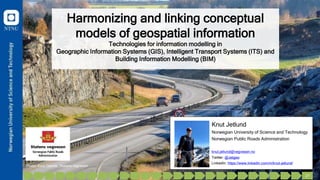
  • 1. Harmonizing and linking conceptual models of geospatial information Technologies for information modelling in Geographic Information Systems (GIS), Intelligent Transport Systems (ITS) and Building Information Modelling (BIM) Knut Jetlund Norwegian University of Science and Technology Norwegian Public Roads Administration knut.jetlund@vegvesen.no Twitter: @Jetgeo LinkedIn: https://www.linkedin.com/in/knut-jetlund/ Photo: Knut Opeide, Statens vegvesen 1 27
  • 2. Agenda • Motivation • Research questions • Scientific approach • Theory • Results • Conclusions • Further work Photo: Knut Opeide, Statens vegvesen 1 27
  • 3. Three application domains, one real world GIS Analyze and present BIM Plan, develop, construct and maintain ITS Plan and control transportation 2 27 Photo: Knut Opeide, Statens vegvesen
  • 4. Reuse of information across domain borders • The challenge: • Reuse requires a common understanding of how the real world is described in information models • Modelling language • Terminology • Geometry and location referencing • Exchange formats GIS Analyze and present BIM Plan, develop, construct and maintain ITS Plan and control transportation 3 27 Photo: Knut Opeide, Statens vegvesen
  • 5. Research question: “How can approaches and technologies for information modelling be applied for harmonization and linking of conceptual models of geospatial information from the three application domains of GIS, ITS and BIM?” Harmonization GIS Linking BIM ITS Harmonization Harmonization How can we achieve a common understanding? 4 27
  • 6. SRQ1 State of the art SRQ2 GIS-ITS SRQ3 GIS-BIM SRQ4 Harmonization SRQ5 Ontologies and linking Article 1 Article 5 CP1 SP3 Article 4 Article 5 SP4 Article 5 Article 1 Article 4 Article 2 Article 3 Article 4 Article 3 5 27
  • 7. Scientific approach GIS BIM ITS SRQ3 SRQ2 SRQ4 SRQ5 A generic information model for exchange GIS to ITS Modelling rules and rules for conversion from UML to OWL A structure of UML profiles for GIS, ITS and BIM IFC schemas in ISO/TC 211 UML 6 27
  • 8. DIKW - Data, Information, Knowledge and Wisdom Data Information Knowledge Wisdom Information model: • “… a formal description of types of ideas, facts and processes which together form a model of a portion of interest of the real world and which provides an explicit set of interpretation rules.” (Schenck and Wilson, 1994). • “… a representation of concepts, relationships, constraints, rules, and operations to specify data semantics for a chosen domain of discourse” (Zhao et al., 2011) The DIKW Hierarchy. Adapted from (Rowley, 2007). 7 27
  • 9. Information modelling Real world Universe of discourse Context Perceived in the context of Defined in Conceptualschema Formally represented in Conceptualschema language Formal language for representing Conceptualmodel Conceptualformalism Provides concepts for describing Basis for From the real world to conceptual models. Adapted from ISO 19101-1:2014 8 27
  • 10. Results Photo: Torbjørn Braset, Statens vegvesen 9 27
  • 11. SRQ1: State of the art “What approaches and technologies have been used for modelling geospatial information in GIS, ITS and BIM?” 10 27 • All three application domains: – Conceptual schemas in UML – Some degree of MDA • UML and MDA for GIS the most complete approach – But with defeciencies
  • 12. SRQ2: Information exchange from GIS to ITS “How can models for exchange of geospatial information from road and mapping authorities to geospatial databases for ITS be improved?” Requirement Req 1: ISO/TC 211 MDA Req 2: GIS exchange format Req 3: Feature catalogue Req 4: Feature catalogue exchange model Req 5: Network model Req 6: Generic feature exchange model 11 27
  • 13. 13 ISO/TC 211 MDA GIS exchange format Feature catalogue Feature catalogue exchange model Network model Generic feature exchange model 1 2 3 4 5 6 7 8 9 10 11 12 27 Prototype experiment
  • 14. 14 Validation: The GIS to ITS prototype Requirement Prototype approach Req 1: ISO/TC 211 MDA Yes Req 2: GIS exchange format Yes – GML in the prototype Req 3: Feature catalogue Any feature catalogue described as an ISO 19109 application schema. Tested with INSPIRE and GDF in a case study Req 4: Feature catalogue exchange model Yes – Implemented in GML Req 5: Network model Yes Req 6: Generic feature exchange model Yes – Implemented in GML Future improvements: • More complex road network models (GDF, NDS) • Belts and Traffic spaces (GDF 5.2 and CityGML 3.0) 1 2 3 4 5 6 7 8 9 10 11 12 13 27
  • 15. Syntactic Semantic Implementation SRQ3: Integration of models for GIS and BIM “How can information models and semantics for implementation technologies for BIM be integrated and linked with GIS standards?” 1 2 3 4 5 6 7 8 9 10 11 12 13 14 27
  • 16. • Syntactic interoperability – Most EXPRESS concepts maintained • Semantic interoperability – Not all concepts could be linked – Common concept preferred • Implementation – Extra semantics for EXPRESS – Mapping of geometry concepts vital for GML Validation: The BIM/GIS prototype 1 2 3 4 5 6 7 8 9 10 11 12 13 14 15 27 «FeatureType» IfcProductExtension::IfcAlignment + predefinedType: IfcAlignmentTypeEnum [0..1] ::IfcObject + objectType: CharacterString [0..1] ::IfcRoot + globalId: IfcGloballyUniqueId + name: CharacterString [0..1] + description: CharacterString [0..1] IfcGeometricRepresentationItem «FeatureType» IfcGeometryResource::IfcCurve + /dim: Integer + curve: Curve [0..1] constraints {derive dim} IfcPositioningElement «FeatureType» IfcProductExtension:: IfcLinearPositioningElement «FeatureType» IfcGeometryResource:: IfcBoundedCurve «FeatureType» IfcGeometricConstraintResource: :IfcAlignmentCurve + tag: CharacterString [0..1] IfcGeometricRepresentationItem «FeatureType» IfcGeometricConstraintResource:: IfcAlignment2DHorizontal + startDistAlong: Length [0..1] IfcAlignment2DSegment «FeatureType» IfcGeometricConstraintResource:: IfcAlignment2DHorizontalSegment List aggregate «FeatureType» IfcGeometryResource::IfcCurveSegment2D + startDirection: Angle + segmentLength: Length «EXPRESS_DERIVE» {derive dim : Dim : IfcDimensionCount := IfcCurveDim(SELF)} +horizontal 1..1 +curveGeometry 1 +segments 1..* {ordered} +axis 1..1
  • 17. SRQ5: Ontologies for linking and mapping “How can UML models of geospatial information be implemented as OWL Ontologies, for linking and mapping by applying Semantic Web technologies?” 1 2 3 4 5 6 7 8 9 10 11 12 13 14 15 16 27 Harmonization GIS Linking BIM ITS Harmonization Harmonization
  • 18. Fundamental differences Closed World Assumption (CWA) • The information model is complete in the given context • Additional or deviating information is invalid Open World Assumption (OWA) • The information model presents only what is currently known in the given context • Additional information extends the model Structure of information Meaning of concepts 1 2 3 4 5 6 7 8 9 10 11 12 13 14 15 16 17 27
  • 19. Prototype experiment and validation Prototype experiment: • Extended UML profile for OWL Encoding – Global or shared properties – Links to external concepts – Implemented in the joint approach (SRQ4) • Adapted rules for modelling and conversion Prototype validation: • Conversions for the studied issues were improved by adding semantics and modelling as suggested 1 2 3 4 5 6 7 8 9 10 11 12 13 14 15 16 17 18 27
  • 20. Level of information flow Conversions of restrictions from the CWA to the OWA must be configured according to the selected level of information flow: 1. Ontologies for use only in the Semantic Web 2. Unidirectional information exchange to the Semantic Web 3. Bidirectional information exchange 1 2 3 4 5 6 7 8 9 10 11 12 13 14 15 16 17 18 19 27
  • 21. SRQ4: A joint modelling approach SRQ1 State of the art SRQ2 GIS-ITS SRQ3 GIS-BIM SRQ4 Harmonization SRQ5 Ontologies and linking Article 1 Article 5 CP1 SP3 Article 4 Article 5 SP4 Article 5 Article 1 Article 4 Article 2 Article 3 Article 4 Article 3 “How can information models and semantics for implementation technologies for GIS, ITS and BIM be integrated into a joint modelling approach?” 1 2 3 4 5 6 7 8 9 10 11 12 13 14 15 16 17 18 19 20 27
  • 22. Prototype experiment: A structure of UML Profiles for GIS, ITS and BIM «profile» Core Geospatial Profile Base profiles Community conceptual profiles General encoding profiles Community encoding profiles Legend «merge» 1 2 3 4 5 6 7 8 9 10 11 12 13 14 15 16 17 18 19 20 21 27 «profile» OWL Encoding «profile» IFC EXPRESS Encoding «profile» GML Encoding «profile» DATEX II Conceptual «profile» IFC Conceptual «profile» DATEX II XML Encoding «profile» IFC XML Encoding «profile» Core Geospatial Profile Base profiles Community conceptual profiles General encoding profiles Community encoding profiles Legend «profile» GDF Conceptual «profile» GDF MRS Encoding «profile» GDF XML Encoding «merge» «merge» «merge» «merge» «merge» «merge»
  • 23. Prototype validation • The structure could be implemented in UML sofware • Existing and prototype models could be adapted • Recommended actions: – Revise UML profiles: ISO 19103 and ISO 19109 – Define formal UML profiles: ISO 19136 and ISO 19150-2 – Define encoding profiles: EXPRESS – Define conceptual and encoding profiles: TPEG2 – Define mapping: DATEX II 1 2 3 4 5 6 7 8 9 10 11 12 13 14 15 16 17 18 19 20 22 22 23 27
  • 24. Conclusions - main contribution • A joint approach for information modelling • Prototypes for profiles and models within the harmonized approach 1 2 3 4 5 6 7 8 9 10 11 12 13 14 15 16 17 18 19 20 22 23 23 24 27 «profile» OWL Encoding «profile» IFC EXPRESS Encoding «profile» GML Encoding «profile» DATEX II Conceptual «profile» IFC Conceptual «profile» DATEX II XML Encoding «profile» IFC XML Encoding «profile» Core Geospatial Profile Base profiles Community conceptual profiles General encoding profiles Community encoding profiles Legend «profile» GDF Conceptual «profile» GDF MRS Encoding «profile» GDF XML Encoding «merge» «merge» «merge» «merge» «merge» «merge»
  • 25. Conclusions • Full harmonization not appropriate – Apply LinkSets for mapping • Apply the joint modelling approach for all three domains • Use common core concepts – Data types from non-domain- specific models – Common concepts for geometry and location referencing Photo: Knut Opeide, Statens vegvesen Harmonization GIS Linking BIM ITS Harmonization Harmonization 1 2 3 4 5 6 7 8 9 10 11 12 13 14 15 16 17 18 19 20 22 23 24 24 25 27
  • 26. Similar representations • Tobler’s first law of geography (Tobler, 1970): – “everything is related to everything else, but near things are more related than distant things”. • Modernized to a digital world with multiple representations of the same physical ”thing”: – “every digital representation of a thing can be linked to any other digital representation of the same thing, but links between similar representations are more precise than links between dissimilar representations”. 1 2 3 4 5 6 7 8 9 10 11 12 13 14 15 16 17 18 19 20 22 23 24 25 25 26 27
  • 27. Limitations and further research • Limitation: – Studied at a conceptual level, need experiences from implementations • Further research: – Common core concepts – Use of OWL Ontologies – Higher levels of interoperability – Other application domains Photo: Knut Opeide, Statens vegvesen 1 2 3 4 5 6 7 8 9 10 11 12 13 14 15 16 17 18 19 20 22 23 24 25 26 26 27
  • 28. Knut Jetlund Norwegian University of Science and Technology Norwegian Public Roads Administration knut.jetlund@vegvesen.no Twitter: @Jetgeo LinkedIn: https://www.linkedin.com/in/knut-jetlund/ Photo: Knut Opeide, Statens vegvesen Thanks for listening! 1 2 3 4 5 6 7 8 9 10 11 12 13 14 15 16 17 18 19 20 22 23 24 25 26 26 27