SlideShare a Scribd company logo
1 of 4
Download to read offline
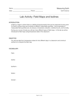
INTRODUCTION:

A field is a region in which there is a definite physical property that can be measured at every point.
On Earth’s surface there are hundreds of different measurable quantities. Some examples of
measurable field quantities are; air pressure, temperature, elevation, rainfall amounts, and humidity.
During your course of study you will see many different types of field maps. In this lab we will be
introduced to field maps using temperature data in the classroom.
OBJECTIVE:

You will use data from temperature values for two different days in a classroom and construct
isotherms to interpret the field map.
VOCABULARY:

Field -
Isoline-
Isotherm -
Isobar -
Isohyet -
Name: ___________________________________________ Measuring Earth
Date: __________________________ Period: ___________ Earth Science
Lab Activity: Field Maps and Isolines
"
Page " of "40 228
PROCEDURE A:

Using the Ames Stream Map below, draw in all the contour lines at 5 foot intervals on the map.
Letter A and B will be used in the discussion questions. Be sure to extend the contour lines to the
edges of the map.
AMES STREAM MAP


Lab Activity: Field Maps and Isolines
"
Page " of "41 228
PROCEDURE B:

Using the Hawaii Map, construct ocean floor depths using 1000 meter intervals on the map. Letter
A and B will be used in the discussion questions. Be sure to extend the contour lines to the edges
of the map or form complete rings. Elevations are in meters.
HAWAII MAP


Lab Activity: Field Maps and Isolines
"
Page " of "42 228
DISCUSSION QUESTIONS:

1. How many dimensions are represented on a standard isoline map?
2. Other than an elevation field map, name three other types of field maps.
3. List three rules that you should follow when constructing isolines.
4. Using the Ames Stream Map, calculate the gradient between points A and B.
5. Using the Hawaii Map, calculate the gradient between points A and B.
CONCLUSION: Describe, step by step, how we can map the field of a variable quantity?
Lab Activity: Field Maps and Isolines
"
Page " of "43 228

More Related Content

What's hot

Ge152 lecture2 terrestrial reference systems_2nd_sem2013-2014_s_reyes
Ge152 lecture2 terrestrial reference systems_2nd_sem2013-2014_s_reyesGe152 lecture2 terrestrial reference systems_2nd_sem2013-2014_s_reyes
Ge152 lecture2 terrestrial reference systems_2nd_sem2013-2014_s_reyeslouiecrmn
 
SURF_Poster_REU2016Team1
SURF_Poster_REU2016Team1SURF_Poster_REU2016Team1
SURF_Poster_REU2016Team1Mathew Prindle
 
C04 Cell Surface Area
C04 Cell Surface AreaC04 Cell Surface Area
C04 Cell Surface Areaswalden01
 
Satellite Mapping
Satellite MappingSatellite Mapping
Satellite MappingPinus57
 
Experiment 1
Experiment 1Experiment 1
Experiment 1aichin
 
Karakterisasi Letusan Merapi menggunakan Data SAR (Synthetic Aperture Radar)
Karakterisasi Letusan Merapi menggunakan Data SAR (Synthetic Aperture Radar)Karakterisasi Letusan Merapi menggunakan Data SAR (Synthetic Aperture Radar)
Karakterisasi Letusan Merapi menggunakan Data SAR (Synthetic Aperture Radar)Achmad Darul
 
Earth Coordinate Systems
Earth Coordinate Systems Earth Coordinate Systems
Earth Coordinate Systems Sheikh Maryam
 
Understandingprojectionsforarcgis 12794889760059-phpapp01
Understandingprojectionsforarcgis 12794889760059-phpapp01Understandingprojectionsforarcgis 12794889760059-phpapp01
Understandingprojectionsforarcgis 12794889760059-phpapp01Manisha Tomar
 
Evaluating aboveground terrestrial carbon flux as ecosystem planning
Evaluating aboveground terrestrial carbon flux as ecosystem planningEvaluating aboveground terrestrial carbon flux as ecosystem planning
Evaluating aboveground terrestrial carbon flux as ecosystem planningWorld Agroforestry (ICRAF)
 
G6 m5-a-lesson 4-s
G6 m5-a-lesson 4-sG6 m5-a-lesson 4-s
G6 m5-a-lesson 4-smlabuski
 

What's hot (11)

Ge152 lecture2 terrestrial reference systems_2nd_sem2013-2014_s_reyes
Ge152 lecture2 terrestrial reference systems_2nd_sem2013-2014_s_reyesGe152 lecture2 terrestrial reference systems_2nd_sem2013-2014_s_reyes
Ge152 lecture2 terrestrial reference systems_2nd_sem2013-2014_s_reyes
 
SURF_Poster_REU2016Team1
SURF_Poster_REU2016Team1SURF_Poster_REU2016Team1
SURF_Poster_REU2016Team1
 
C04 Cell Surface Area
C04 Cell Surface AreaC04 Cell Surface Area
C04 Cell Surface Area
 
Satellite Mapping
Satellite MappingSatellite Mapping
Satellite Mapping
 
Experiment 1
Experiment 1Experiment 1
Experiment 1
 
Q3 l1-motion
Q3 l1-motionQ3 l1-motion
Q3 l1-motion
 
Karakterisasi Letusan Merapi menggunakan Data SAR (Synthetic Aperture Radar)
Karakterisasi Letusan Merapi menggunakan Data SAR (Synthetic Aperture Radar)Karakterisasi Letusan Merapi menggunakan Data SAR (Synthetic Aperture Radar)
Karakterisasi Letusan Merapi menggunakan Data SAR (Synthetic Aperture Radar)
 
Earth Coordinate Systems
Earth Coordinate Systems Earth Coordinate Systems
Earth Coordinate Systems
 
Understandingprojectionsforarcgis 12794889760059-phpapp01
Understandingprojectionsforarcgis 12794889760059-phpapp01Understandingprojectionsforarcgis 12794889760059-phpapp01
Understandingprojectionsforarcgis 12794889760059-phpapp01
 
Evaluating aboveground terrestrial carbon flux as ecosystem planning
Evaluating aboveground terrestrial carbon flux as ecosystem planningEvaluating aboveground terrestrial carbon flux as ecosystem planning
Evaluating aboveground terrestrial carbon flux as ecosystem planning
 
G6 m5-a-lesson 4-s
G6 m5-a-lesson 4-sG6 m5-a-lesson 4-s
G6 m5-a-lesson 4-s
 

Similar to Kami export field maps and isolines lab

Kush Defense
Kush DefenseKush Defense
Kush Defensekbhusal
 
MeasurementKCSE
MeasurementKCSEMeasurementKCSE
MeasurementKCSELightkcse
 
Convective Heat Transfer Measurements at the Martian Surface
Convective Heat Transfer Measurements at the Martian SurfaceConvective Heat Transfer Measurements at the Martian Surface
Convective Heat Transfer Measurements at the Martian SurfaceSamet Baykul
 
Review 2 graphs_sc
Review 2 graphs_scReview 2 graphs_sc
Review 2 graphs_scLexume1
 
Introduction of surveying in Civil Engineering.
Introduction of surveying in Civil Engineering.Introduction of surveying in Civil Engineering.
Introduction of surveying in Civil Engineering.MD Sakib Hasan
 
Geothermal exploration using remote sensing techniques
Geothermal exploration using remote sensing techniquesGeothermal exploration using remote sensing techniques
Geothermal exploration using remote sensing techniquesSepideh Abadpour
 
Detailed analysis of plane table surveying
Detailed analysis of plane table surveyingDetailed analysis of plane table surveying
Detailed analysis of plane table surveyingsumitvikram
 
Basic Geodesy.pdf
Basic Geodesy.pdfBasic Geodesy.pdf
Basic Geodesy.pdfRamMishra65
 
Grade 8 Test - Lines of Latitude and Longitude.docx
Grade 8 Test - Lines of Latitude and Longitude.docxGrade 8 Test - Lines of Latitude and Longitude.docx
Grade 8 Test - Lines of Latitude and Longitude.docxDeighton Gooden
 
APPLICATION OF DEFINITE INTEGRAL
APPLICATION OF DEFINITE INTEGRALAPPLICATION OF DEFINITE INTEGRAL
APPLICATION OF DEFINITE INTEGRALChayanPathak5
 
Topography Lab
Topography LabTopography Lab
Topography LabJames Dunn
 
Modelo de informe topográfico
Modelo de informe topográficoModelo de informe topográfico
Modelo de informe topográficoPabloCampos696718
 
SOLAR IMPULSE - LAB WORK - MODELS (ENG)
SOLAR IMPULSE - LAB WORK - MODELS (ENG)SOLAR IMPULSE - LAB WORK - MODELS (ENG)
SOLAR IMPULSE - LAB WORK - MODELS (ENG)Solar Impulse
 
Basin Analysis Labs
Basin Analysis LabsBasin Analysis Labs
Basin Analysis LabsFaisal Hayat
 
INTRODUCTION TO SURVEYING
INTRODUCTION TO SURVEYINGINTRODUCTION TO SURVEYING
INTRODUCTION TO SURVEYINGfarhana saiyed
 
Lab for plate boundaries
Lab for plate boundariesLab for plate boundaries
Lab for plate boundariesLori Welsh
 
Lab for plate boundaries
Lab for plate boundariesLab for plate boundaries
Lab for plate boundariesLori Welsh
 
GI - Map skills and hypothesis
GI - Map skills and hypothesisGI - Map skills and hypothesis
GI - Map skills and hypothesisMissST
 

Similar to Kami export field maps and isolines lab (20)

Kush Defense
Kush DefenseKush Defense
Kush Defense
 
MeasurementKCSE
MeasurementKCSEMeasurementKCSE
MeasurementKCSE
 
Convective Heat Transfer Measurements at the Martian Surface
Convective Heat Transfer Measurements at the Martian SurfaceConvective Heat Transfer Measurements at the Martian Surface
Convective Heat Transfer Measurements at the Martian Surface
 
Review 2 graphs_sc
Review 2 graphs_scReview 2 graphs_sc
Review 2 graphs_sc
 
Introduction of surveying in Civil Engineering.
Introduction of surveying in Civil Engineering.Introduction of surveying in Civil Engineering.
Introduction of surveying in Civil Engineering.
 
Geothermal exploration using remote sensing techniques
Geothermal exploration using remote sensing techniquesGeothermal exploration using remote sensing techniques
Geothermal exploration using remote sensing techniques
 
Physics i hbsc4103
Physics i hbsc4103Physics i hbsc4103
Physics i hbsc4103
 
Detailed analysis of plane table surveying
Detailed analysis of plane table surveyingDetailed analysis of plane table surveying
Detailed analysis of plane table surveying
 
Basic Geodesy.pdf
Basic Geodesy.pdfBasic Geodesy.pdf
Basic Geodesy.pdf
 
Lesson5
Lesson5Lesson5
Lesson5
 
Grade 8 Test - Lines of Latitude and Longitude.docx
Grade 8 Test - Lines of Latitude and Longitude.docxGrade 8 Test - Lines of Latitude and Longitude.docx
Grade 8 Test - Lines of Latitude and Longitude.docx
 
APPLICATION OF DEFINITE INTEGRAL
APPLICATION OF DEFINITE INTEGRALAPPLICATION OF DEFINITE INTEGRAL
APPLICATION OF DEFINITE INTEGRAL
 
Topography Lab
Topography LabTopography Lab
Topography Lab
 
Modelo de informe topográfico
Modelo de informe topográficoModelo de informe topográfico
Modelo de informe topográfico
 
SOLAR IMPULSE - LAB WORK - MODELS (ENG)
SOLAR IMPULSE - LAB WORK - MODELS (ENG)SOLAR IMPULSE - LAB WORK - MODELS (ENG)
SOLAR IMPULSE - LAB WORK - MODELS (ENG)
 
Basin Analysis Labs
Basin Analysis LabsBasin Analysis Labs
Basin Analysis Labs
 
INTRODUCTION TO SURVEYING
INTRODUCTION TO SURVEYINGINTRODUCTION TO SURVEYING
INTRODUCTION TO SURVEYING
 
Lab for plate boundaries
Lab for plate boundariesLab for plate boundaries
Lab for plate boundaries
 
Lab for plate boundaries
Lab for plate boundariesLab for plate boundaries
Lab for plate boundaries
 
GI - Map skills and hypothesis
GI - Map skills and hypothesisGI - Map skills and hypothesis
GI - Map skills and hypothesis
 

Recently uploaded

CARE OF CHILD IN INCUBATOR..........pptx
CARE OF CHILD IN INCUBATOR..........pptxCARE OF CHILD IN INCUBATOR..........pptx
CARE OF CHILD IN INCUBATOR..........pptxGaneshChakor2
 
Q4-W6-Restating Informational Text Grade 3
Q4-W6-Restating Informational Text Grade 3Q4-W6-Restating Informational Text Grade 3
Q4-W6-Restating Informational Text Grade 3JemimahLaneBuaron
 
Student login on Anyboli platform.helpin
Student login on Anyboli platform.helpinStudent login on Anyboli platform.helpin
Student login on Anyboli platform.helpinRaunakKeshri1
 
1029 - Danh muc Sach Giao Khoa 10 . pdf
1029 -  Danh muc Sach Giao Khoa 10 . pdf1029 -  Danh muc Sach Giao Khoa 10 . pdf
1029 - Danh muc Sach Giao Khoa 10 . pdfQucHHunhnh
 
POINT- BIOCHEMISTRY SEM 2 ENZYMES UNIT 5.pptx
POINT- BIOCHEMISTRY SEM 2 ENZYMES UNIT 5.pptxPOINT- BIOCHEMISTRY SEM 2 ENZYMES UNIT 5.pptx
POINT- BIOCHEMISTRY SEM 2 ENZYMES UNIT 5.pptxSayali Powar
 
Mastering the Unannounced Regulatory Inspection
Mastering the Unannounced Regulatory InspectionMastering the Unannounced Regulatory Inspection
Mastering the Unannounced Regulatory InspectionSafetyChain Software
 
microwave assisted reaction. General introduction
microwave assisted reaction. General introductionmicrowave assisted reaction. General introduction
microwave assisted reaction. General introductionMaksud Ahmed
 
Privatization and Disinvestment - Meaning, Objectives, Advantages and Disadva...
Privatization and Disinvestment - Meaning, Objectives, Advantages and Disadva...Privatization and Disinvestment - Meaning, Objectives, Advantages and Disadva...
Privatization and Disinvestment - Meaning, Objectives, Advantages and Disadva...RKavithamani
 
How to Make a Pirate ship Primary Education.pptx
How to Make a Pirate ship Primary Education.pptxHow to Make a Pirate ship Primary Education.pptx
How to Make a Pirate ship Primary Education.pptxmanuelaromero2013
 
Call Girls in Dwarka Mor Delhi Contact Us 9654467111
Call Girls in Dwarka Mor Delhi Contact Us 9654467111Call Girls in Dwarka Mor Delhi Contact Us 9654467111
Call Girls in Dwarka Mor Delhi Contact Us 9654467111Sapana Sha
 
Z Score,T Score, Percential Rank and Box Plot Graph
Z Score,T Score, Percential Rank and Box Plot GraphZ Score,T Score, Percential Rank and Box Plot Graph
Z Score,T Score, Percential Rank and Box Plot GraphThiyagu K
 
Organic Name Reactions for the students and aspirants of Chemistry12th.pptx
Organic Name Reactions  for the students and aspirants of Chemistry12th.pptxOrganic Name Reactions  for the students and aspirants of Chemistry12th.pptx
Organic Name Reactions for the students and aspirants of Chemistry12th.pptxVS Mahajan Coaching Centre
 
Contemporary philippine arts from the regions_PPT_Module_12 [Autosaved] (1).pptx
Contemporary philippine arts from the regions_PPT_Module_12 [Autosaved] (1).pptxContemporary philippine arts from the regions_PPT_Module_12 [Autosaved] (1).pptx
Contemporary philippine arts from the regions_PPT_Module_12 [Autosaved] (1).pptxRoyAbrique
 
mini mental status format.docx
mini    mental       status     format.docxmini    mental       status     format.docx
mini mental status format.docxPoojaSen20
 
Arihant handbook biology for class 11 .pdf
Arihant handbook biology for class 11 .pdfArihant handbook biology for class 11 .pdf
Arihant handbook biology for class 11 .pdfchloefrazer622
 
The Most Excellent Way | 1 Corinthians 13
The Most Excellent Way | 1 Corinthians 13The Most Excellent Way | 1 Corinthians 13
The Most Excellent Way | 1 Corinthians 13Steve Thomason
 
Industrial Policy - 1948, 1956, 1973, 1977, 1980, 1991
Industrial Policy - 1948, 1956, 1973, 1977, 1980, 1991Industrial Policy - 1948, 1956, 1973, 1977, 1980, 1991
Industrial Policy - 1948, 1956, 1973, 1977, 1980, 1991RKavithamani
 
“Oh GOSH! Reflecting on Hackteria's Collaborative Practices in a Global Do-It...
“Oh GOSH! Reflecting on Hackteria's Collaborative Practices in a Global Do-It...“Oh GOSH! Reflecting on Hackteria's Collaborative Practices in a Global Do-It...
“Oh GOSH! Reflecting on Hackteria's Collaborative Practices in a Global Do-It...Marc Dusseiller Dusjagr
 

Recently uploaded (20)

CARE OF CHILD IN INCUBATOR..........pptx
CARE OF CHILD IN INCUBATOR..........pptxCARE OF CHILD IN INCUBATOR..........pptx
CARE OF CHILD IN INCUBATOR..........pptx
 
Q4-W6-Restating Informational Text Grade 3
Q4-W6-Restating Informational Text Grade 3Q4-W6-Restating Informational Text Grade 3
Q4-W6-Restating Informational Text Grade 3
 
Student login on Anyboli platform.helpin
Student login on Anyboli platform.helpinStudent login on Anyboli platform.helpin
Student login on Anyboli platform.helpin
 
1029 - Danh muc Sach Giao Khoa 10 . pdf
1029 -  Danh muc Sach Giao Khoa 10 . pdf1029 -  Danh muc Sach Giao Khoa 10 . pdf
1029 - Danh muc Sach Giao Khoa 10 . pdf
 
POINT- BIOCHEMISTRY SEM 2 ENZYMES UNIT 5.pptx
POINT- BIOCHEMISTRY SEM 2 ENZYMES UNIT 5.pptxPOINT- BIOCHEMISTRY SEM 2 ENZYMES UNIT 5.pptx
POINT- BIOCHEMISTRY SEM 2 ENZYMES UNIT 5.pptx
 
Mastering the Unannounced Regulatory Inspection
Mastering the Unannounced Regulatory InspectionMastering the Unannounced Regulatory Inspection
Mastering the Unannounced Regulatory Inspection
 
microwave assisted reaction. General introduction
microwave assisted reaction. General introductionmicrowave assisted reaction. General introduction
microwave assisted reaction. General introduction
 
Código Creativo y Arte de Software | Unidad 1
Código Creativo y Arte de Software | Unidad 1Código Creativo y Arte de Software | Unidad 1
Código Creativo y Arte de Software | Unidad 1
 
Privatization and Disinvestment - Meaning, Objectives, Advantages and Disadva...
Privatization and Disinvestment - Meaning, Objectives, Advantages and Disadva...Privatization and Disinvestment - Meaning, Objectives, Advantages and Disadva...
Privatization and Disinvestment - Meaning, Objectives, Advantages and Disadva...
 
How to Make a Pirate ship Primary Education.pptx
How to Make a Pirate ship Primary Education.pptxHow to Make a Pirate ship Primary Education.pptx
How to Make a Pirate ship Primary Education.pptx
 
Call Girls in Dwarka Mor Delhi Contact Us 9654467111
Call Girls in Dwarka Mor Delhi Contact Us 9654467111Call Girls in Dwarka Mor Delhi Contact Us 9654467111
Call Girls in Dwarka Mor Delhi Contact Us 9654467111
 
Z Score,T Score, Percential Rank and Box Plot Graph
Z Score,T Score, Percential Rank and Box Plot GraphZ Score,T Score, Percential Rank and Box Plot Graph
Z Score,T Score, Percential Rank and Box Plot Graph
 
Organic Name Reactions for the students and aspirants of Chemistry12th.pptx
Organic Name Reactions  for the students and aspirants of Chemistry12th.pptxOrganic Name Reactions  for the students and aspirants of Chemistry12th.pptx
Organic Name Reactions for the students and aspirants of Chemistry12th.pptx
 
Contemporary philippine arts from the regions_PPT_Module_12 [Autosaved] (1).pptx
Contemporary philippine arts from the regions_PPT_Module_12 [Autosaved] (1).pptxContemporary philippine arts from the regions_PPT_Module_12 [Autosaved] (1).pptx
Contemporary philippine arts from the regions_PPT_Module_12 [Autosaved] (1).pptx
 
mini mental status format.docx
mini    mental       status     format.docxmini    mental       status     format.docx
mini mental status format.docx
 
Arihant handbook biology for class 11 .pdf
Arihant handbook biology for class 11 .pdfArihant handbook biology for class 11 .pdf
Arihant handbook biology for class 11 .pdf
 
The Most Excellent Way | 1 Corinthians 13
The Most Excellent Way | 1 Corinthians 13The Most Excellent Way | 1 Corinthians 13
The Most Excellent Way | 1 Corinthians 13
 
Mattingly "AI & Prompt Design: The Basics of Prompt Design"
Mattingly "AI & Prompt Design: The Basics of Prompt Design"Mattingly "AI & Prompt Design: The Basics of Prompt Design"
Mattingly "AI & Prompt Design: The Basics of Prompt Design"
 
Industrial Policy - 1948, 1956, 1973, 1977, 1980, 1991
Industrial Policy - 1948, 1956, 1973, 1977, 1980, 1991Industrial Policy - 1948, 1956, 1973, 1977, 1980, 1991
Industrial Policy - 1948, 1956, 1973, 1977, 1980, 1991
 
“Oh GOSH! Reflecting on Hackteria's Collaborative Practices in a Global Do-It...
“Oh GOSH! Reflecting on Hackteria's Collaborative Practices in a Global Do-It...“Oh GOSH! Reflecting on Hackteria's Collaborative Practices in a Global Do-It...
“Oh GOSH! Reflecting on Hackteria's Collaborative Practices in a Global Do-It...
 

Kami export field maps and isolines lab

  • 1. INTRODUCTION: A field is a region in which there is a definite physical property that can be measured at every point. On Earth’s surface there are hundreds of different measurable quantities. Some examples of measurable field quantities are; air pressure, temperature, elevation, rainfall amounts, and humidity. During your course of study you will see many different types of field maps. In this lab we will be introduced to field maps using temperature data in the classroom. OBJECTIVE: You will use data from temperature values for two different days in a classroom and construct isotherms to interpret the field map. VOCABULARY: Field - Isoline- Isotherm - Isobar - Isohyet - Name: ___________________________________________ Measuring Earth Date: __________________________ Period: ___________ Earth Science Lab Activity: Field Maps and Isolines " Page " of "40 228
  • 2. PROCEDURE A: Using the Ames Stream Map below, draw in all the contour lines at 5 foot intervals on the map. Letter A and B will be used in the discussion questions. Be sure to extend the contour lines to the edges of the map. AMES STREAM MAP Lab Activity: Field Maps and Isolines " Page " of "41 228
  • 3. PROCEDURE B: Using the Hawaii Map, construct ocean floor depths using 1000 meter intervals on the map. Letter A and B will be used in the discussion questions. Be sure to extend the contour lines to the edges of the map or form complete rings. Elevations are in meters. HAWAII MAP Lab Activity: Field Maps and Isolines " Page " of "42 228
  • 4. DISCUSSION QUESTIONS: 1. How many dimensions are represented on a standard isoline map? 2. Other than an elevation field map, name three other types of field maps. 3. List three rules that you should follow when constructing isolines. 4. Using the Ames Stream Map, calculate the gradient between points A and B. 5. Using the Hawaii Map, calculate the gradient between points A and B. CONCLUSION: Describe, step by step, how we can map the field of a variable quantity? Lab Activity: Field Maps and Isolines " Page " of "43 228