Google Satelite Imagery vs Aerial Map Imagery
•Download as PPTX, PDF•
0 likes•227 views

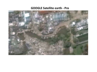
Google's satellite earth program provides an aerial map view of the earth from space. Users can zoom in on satellite images to see detailed aerial views from above. This program allows people to view locations from above and observe physical features and structures on the ground.

Recommended
More Related Content
What's hot
What's hot (17)
Viewers also liked
Viewers also liked (17)
Google Satelite Imagery vs Aerial Map Imagery
- 1. GOOGLE Satellite earth - Pro