SlideShare a Scribd company logo
1 of 1
Download to read offline
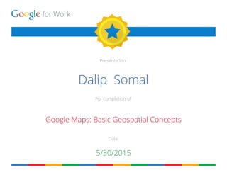
for Work
Presented to
For completion of
Date
Dalip Somal
Google Maps: Basic Geospatial Concepts
5/30/2015

More Related Content

What's hot

Google Maps and Earth
Google Maps and EarthGoogle Maps and Earth
Google Maps and EarthLucy Gray
 
ClimateScope: a Google Earth storytelling of climate change
ClimateScope: a Google Earth storytelling of climate changeClimateScope: a Google Earth storytelling of climate change
ClimateScope: a Google Earth storytelling of climate changeValentina Grasso
 
Cn tu12 6_isric_glada_mapping_of_desire_study_sites_bai
Cn tu12 6_isric_glada_mapping_of_desire_study_sites_baiCn tu12 6_isric_glada_mapping_of_desire_study_sites_bai
Cn tu12 6_isric_glada_mapping_of_desire_study_sites_baiErik van den Elsen
 
Collect earth & earth map
Collect earth & earth mapCollect earth & earth map
Collect earth & earth mapFAO
 
Google Satelite Imagery vs Aerial Map Imagery
Google Satelite Imagery vs Aerial Map ImageryGoogle Satelite Imagery vs Aerial Map Imagery
Google Satelite Imagery vs Aerial Map ImageryGarth Torasadhewa
 

What's hot (7)

POSTER
POSTERPOSTER
POSTER
 
Google Maps and Earth
Google Maps and EarthGoogle Maps and Earth
Google Maps and Earth
 
ClimateScope: a Google Earth storytelling of climate change
ClimateScope: a Google Earth storytelling of climate changeClimateScope: a Google Earth storytelling of climate change
ClimateScope: a Google Earth storytelling of climate change
 
Cn tu12 6_isric_glada_mapping_of_desire_study_sites_bai
Cn tu12 6_isric_glada_mapping_of_desire_study_sites_baiCn tu12 6_isric_glada_mapping_of_desire_study_sites_bai
Cn tu12 6_isric_glada_mapping_of_desire_study_sites_bai
 
Collect earth & earth map
Collect earth & earth mapCollect earth & earth map
Collect earth & earth map
 
South Sudan Image
South Sudan ImageSouth Sudan Image
South Sudan Image
 
Google Satelite Imagery vs Aerial Map Imagery
Google Satelite Imagery vs Aerial Map ImageryGoogle Satelite Imagery vs Aerial Map Imagery
Google Satelite Imagery vs Aerial Map Imagery
 

coursecompletion