Download as PDF, PPTX
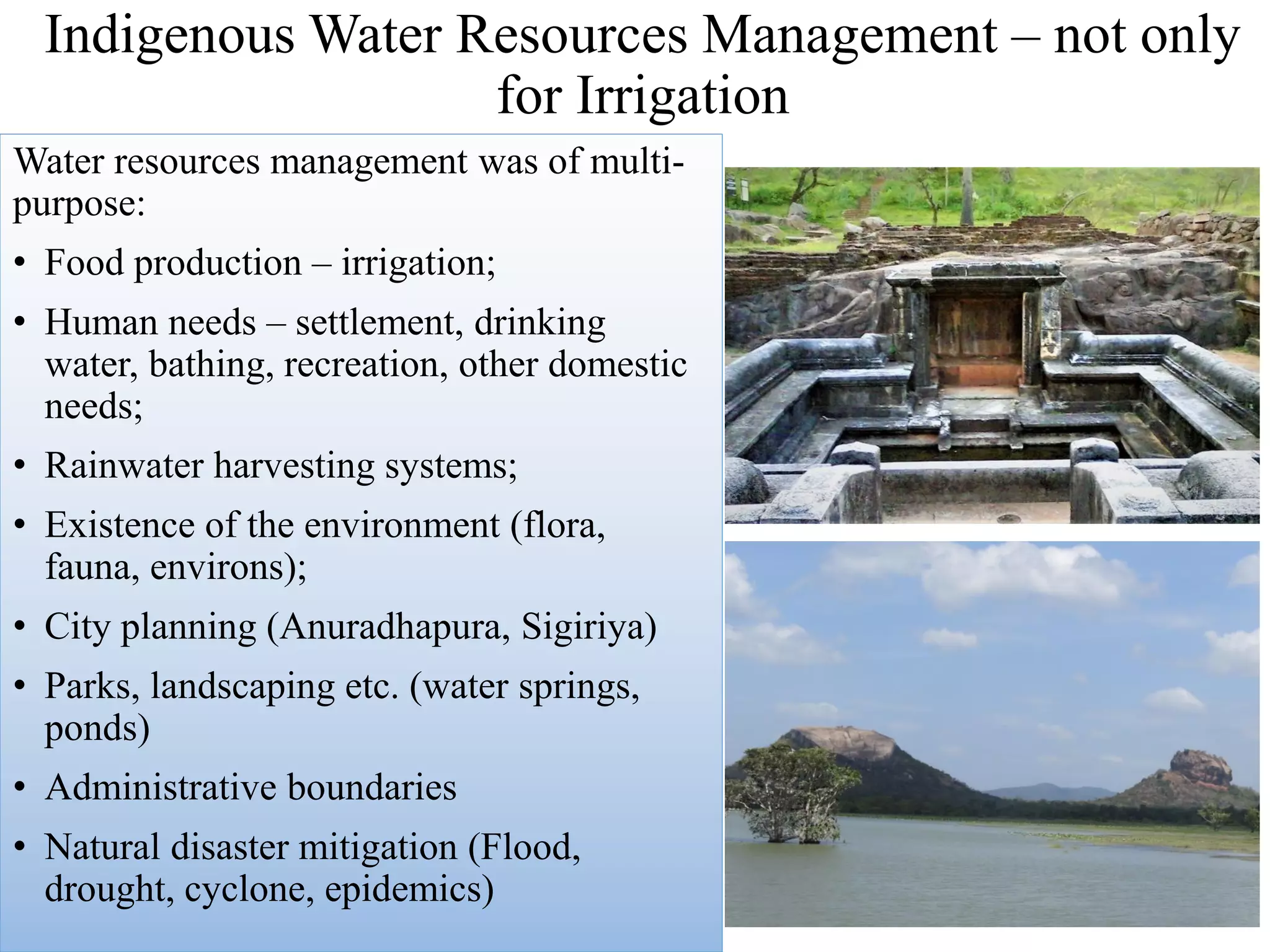
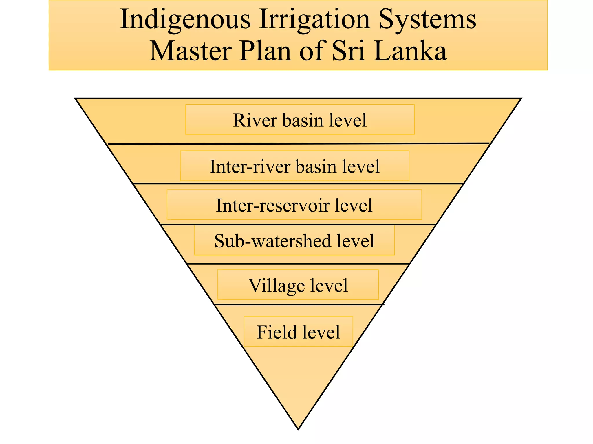
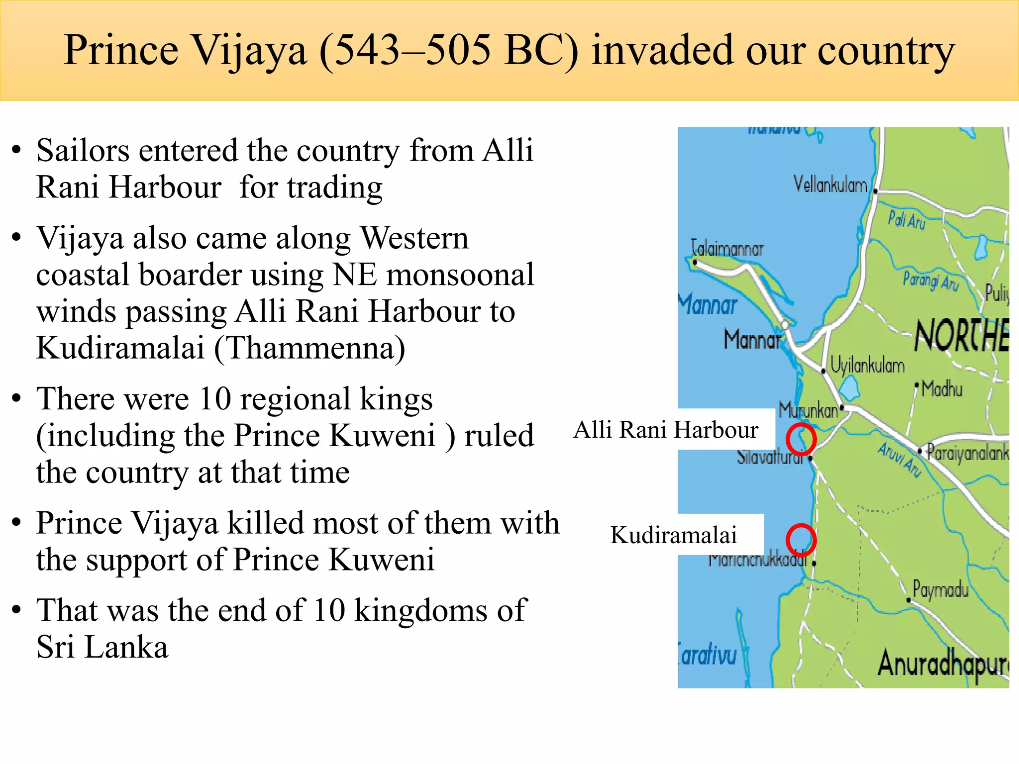
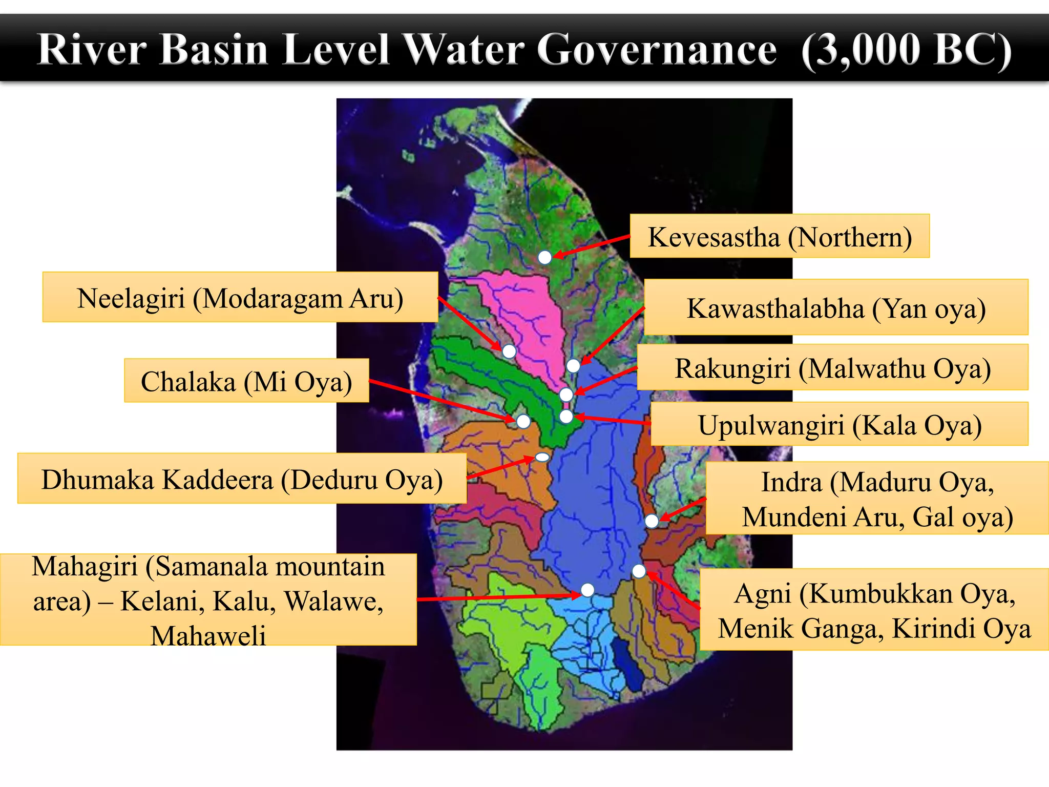
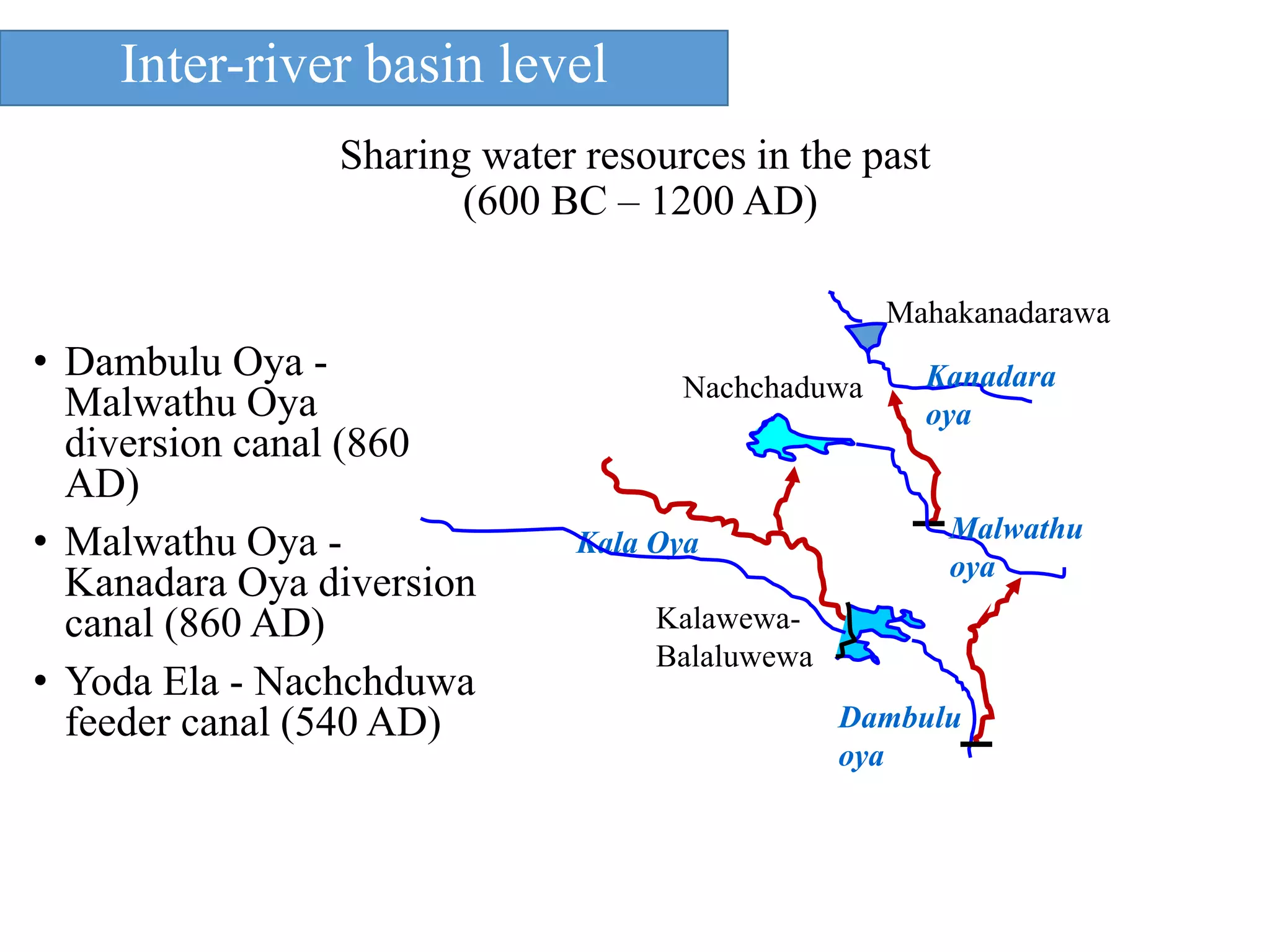


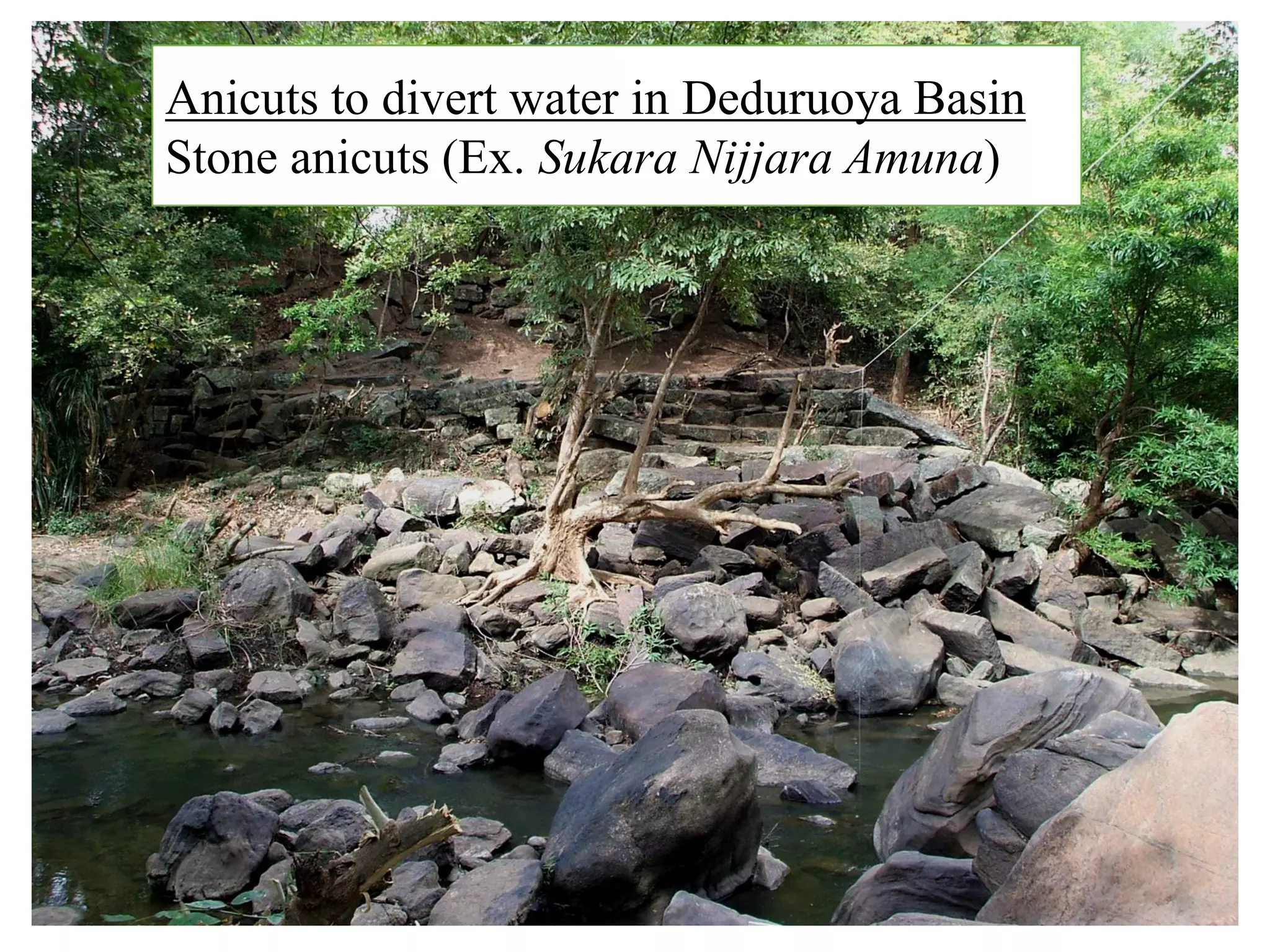
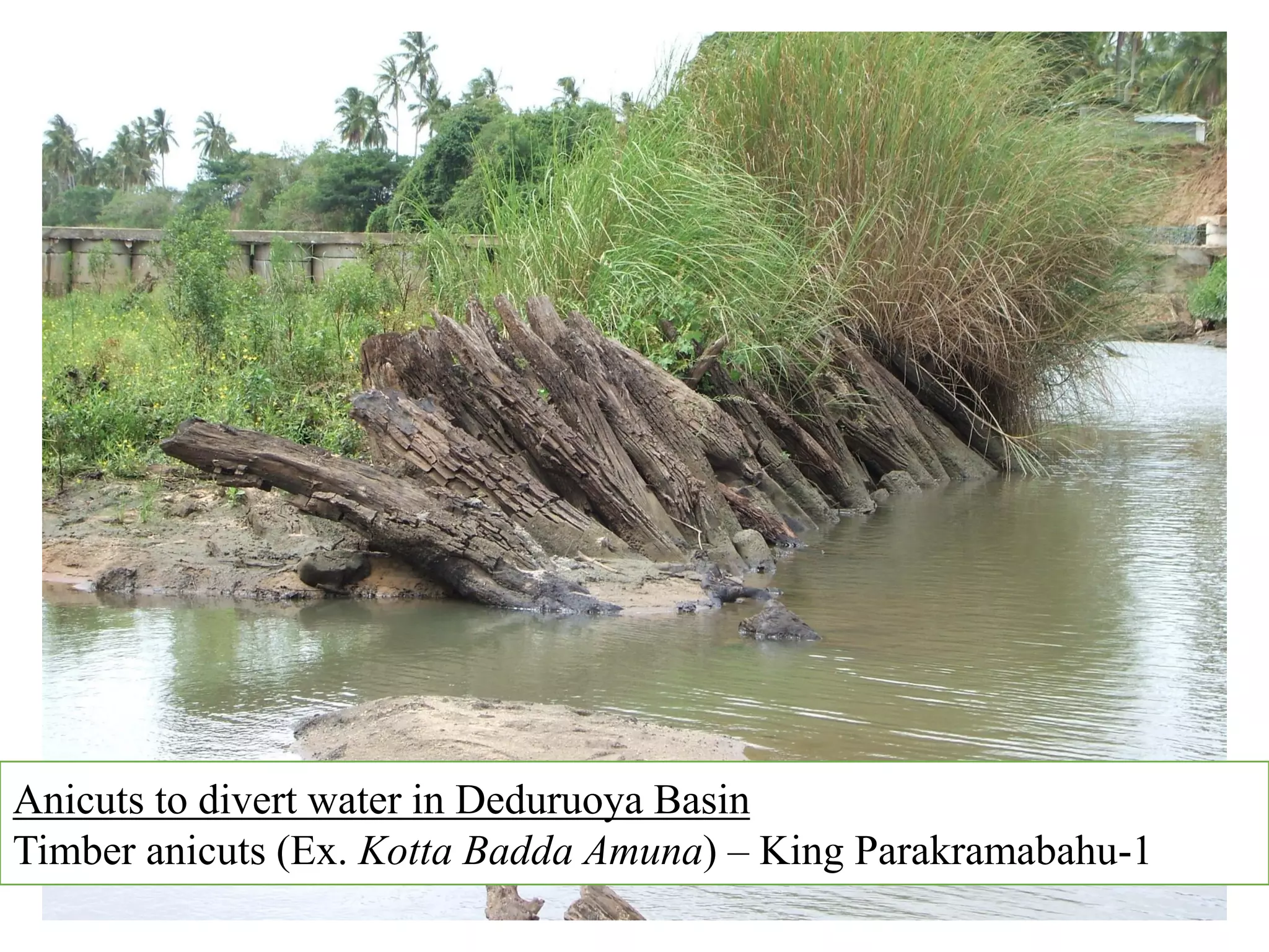
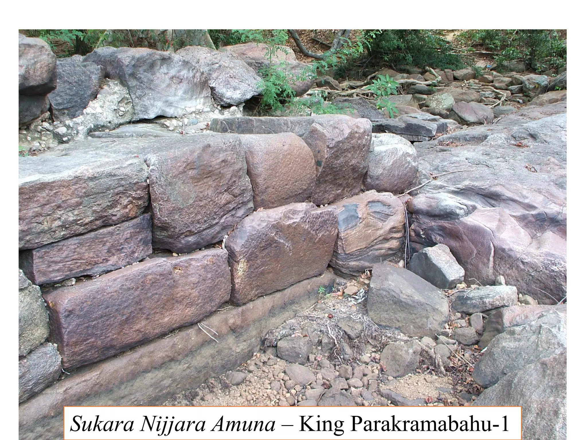
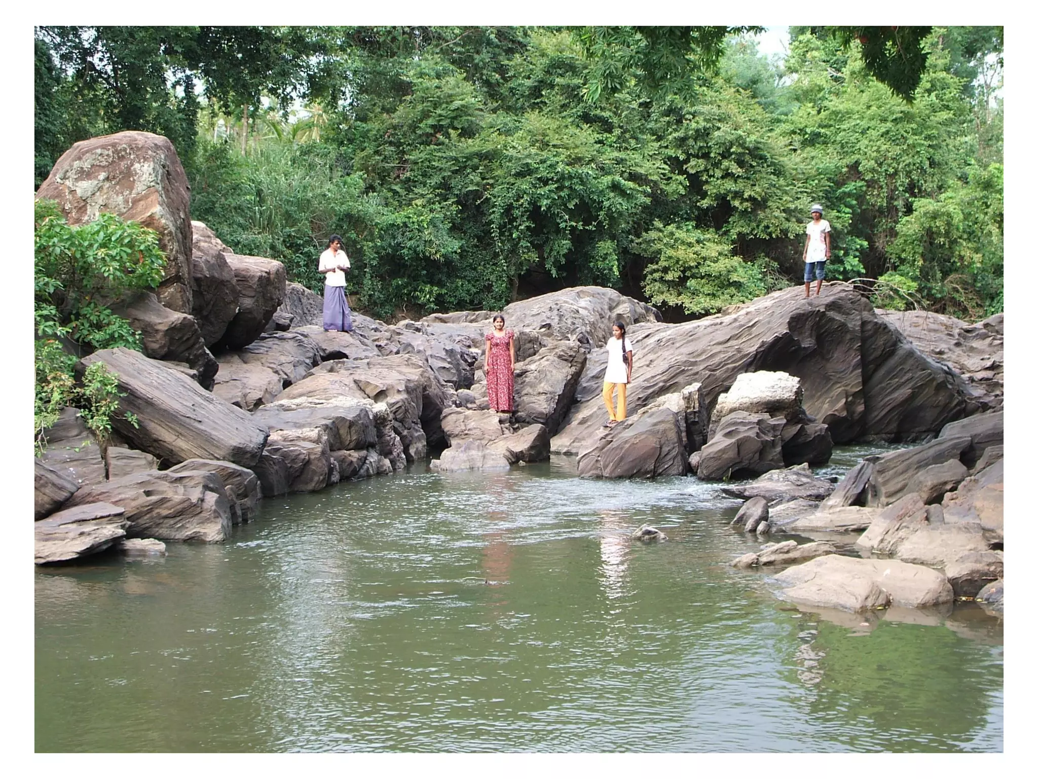
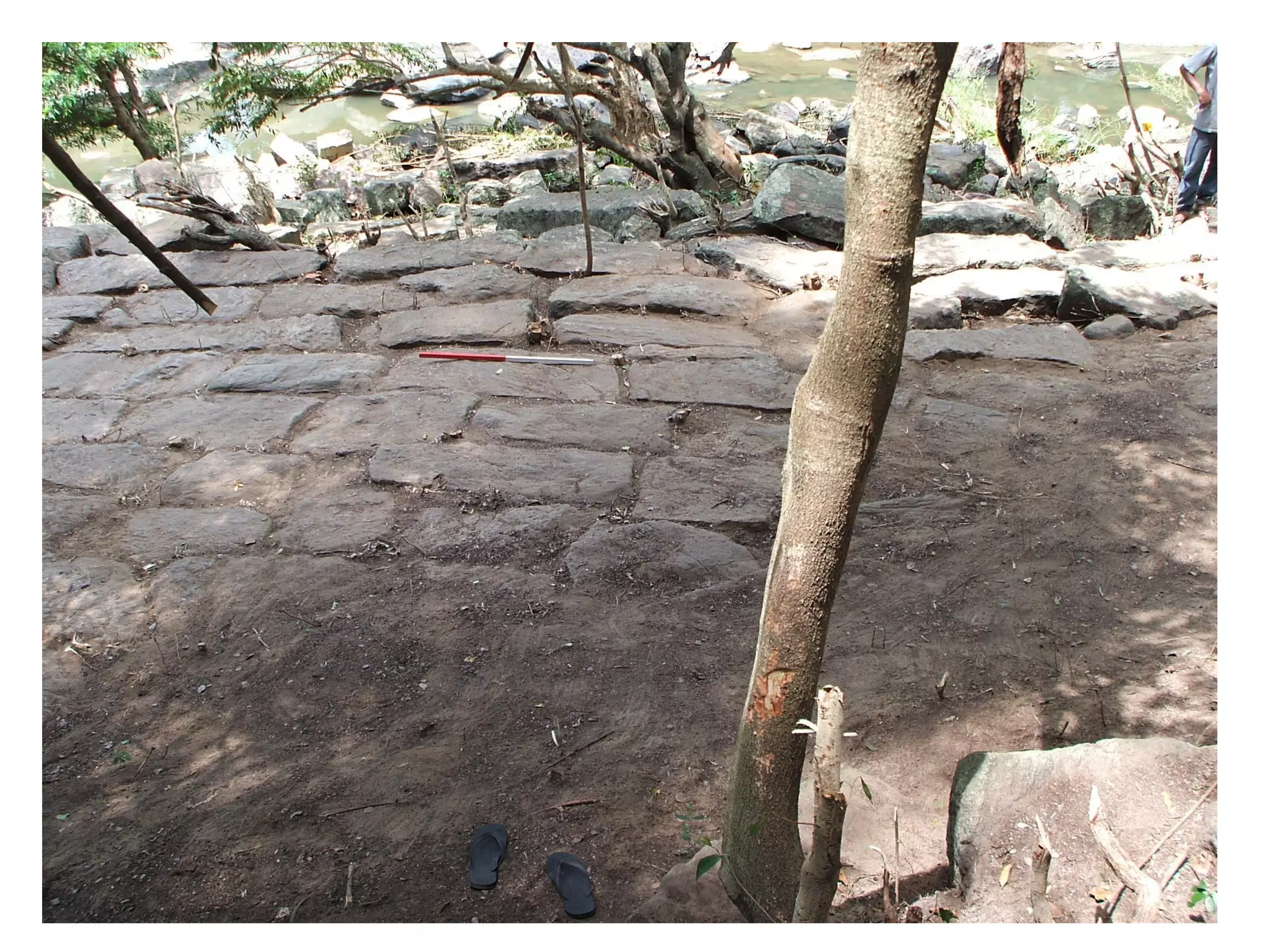
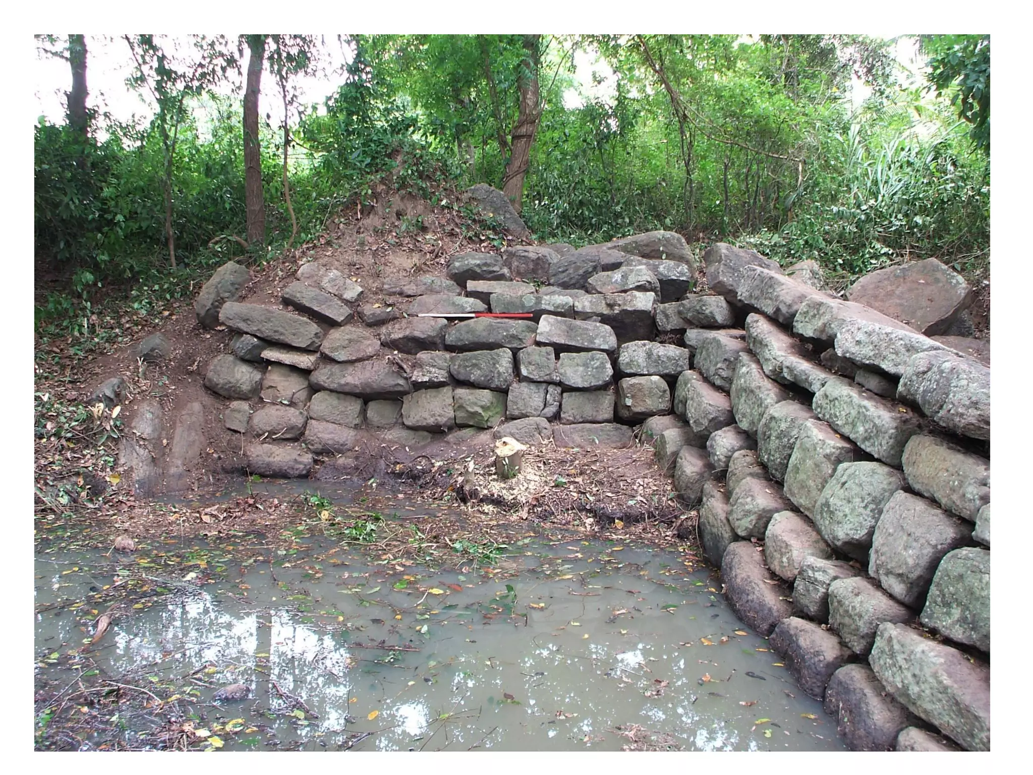

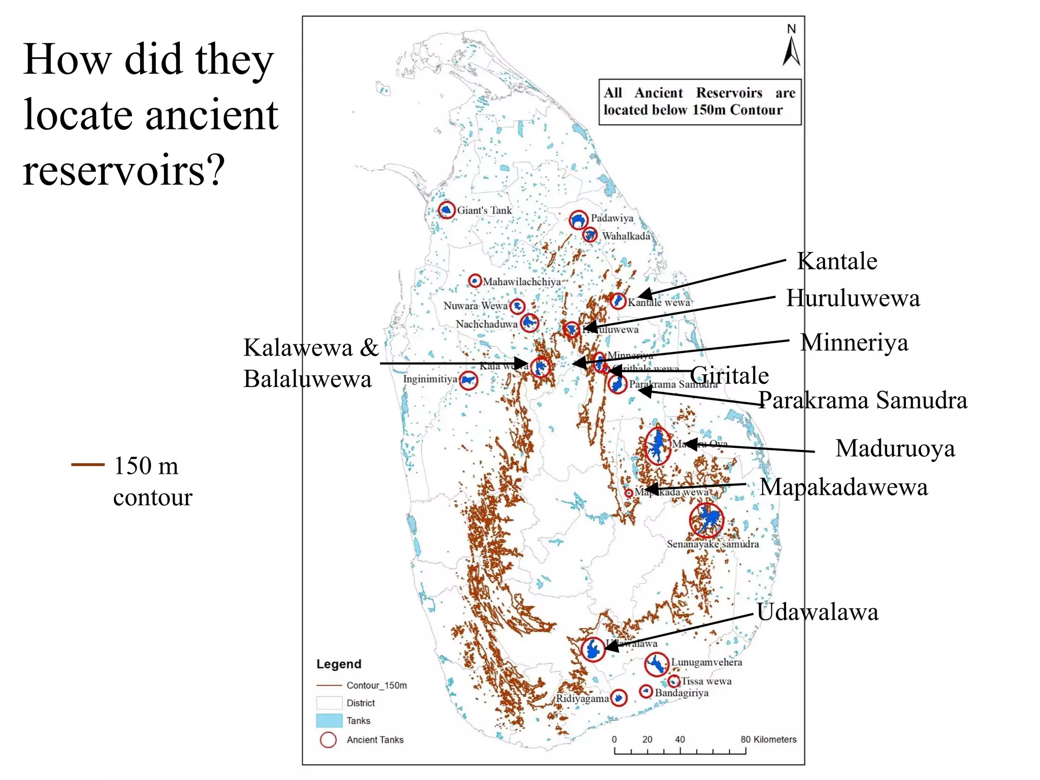
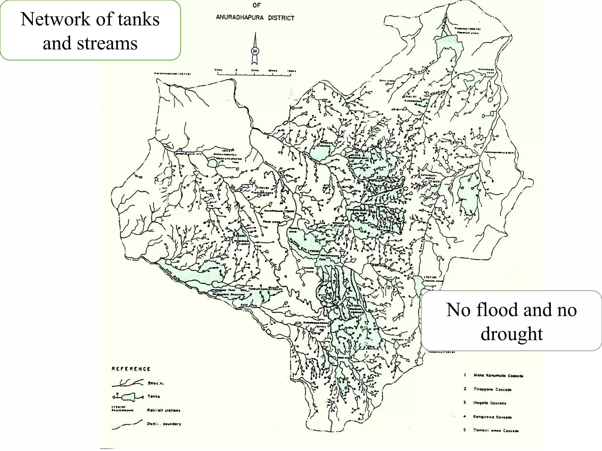
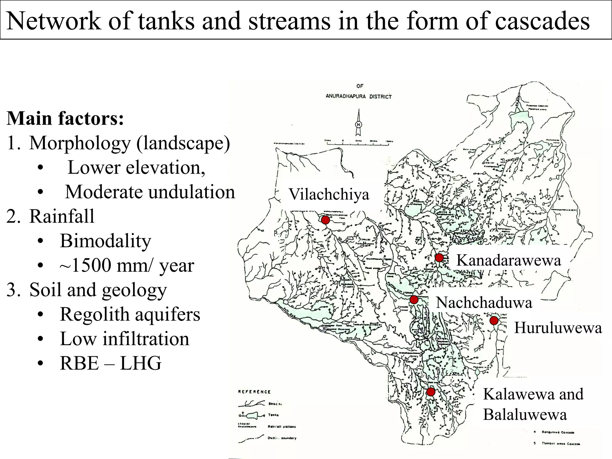
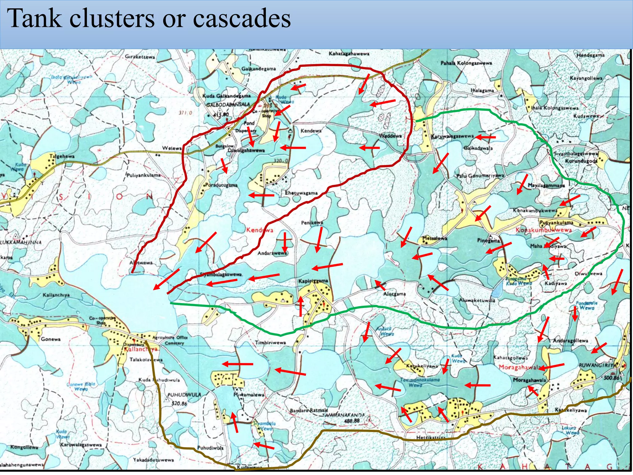
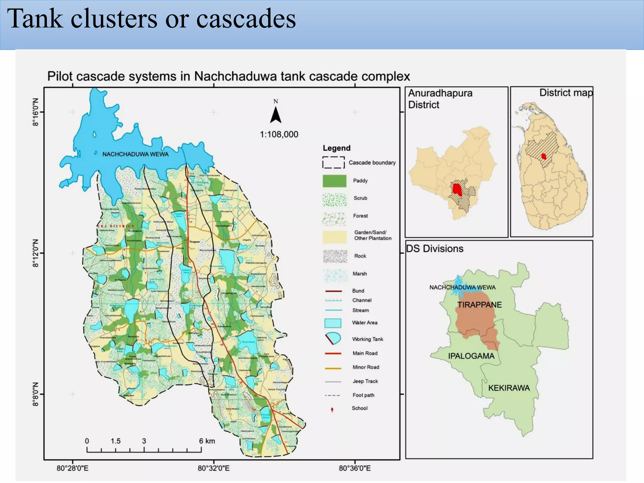
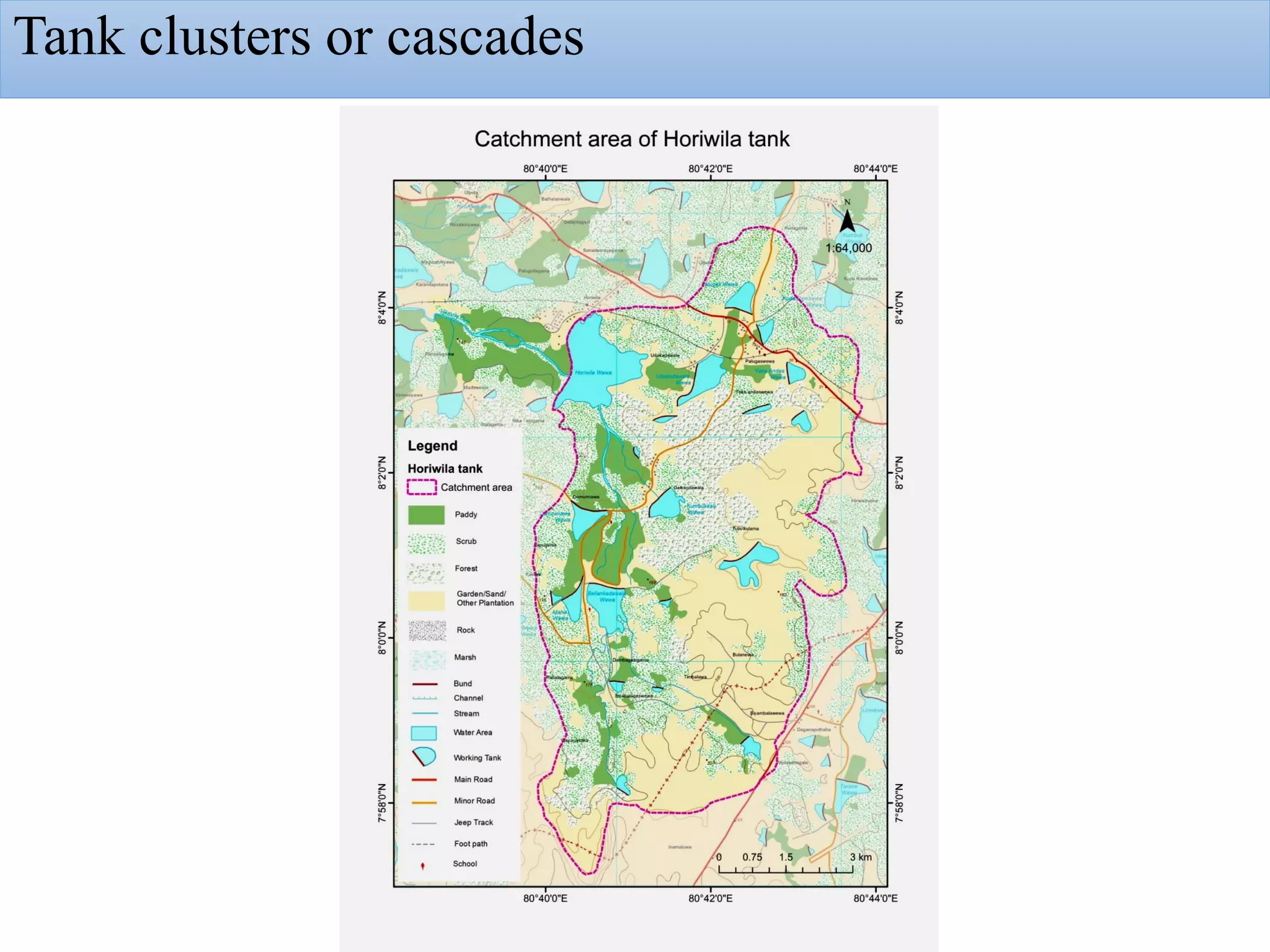
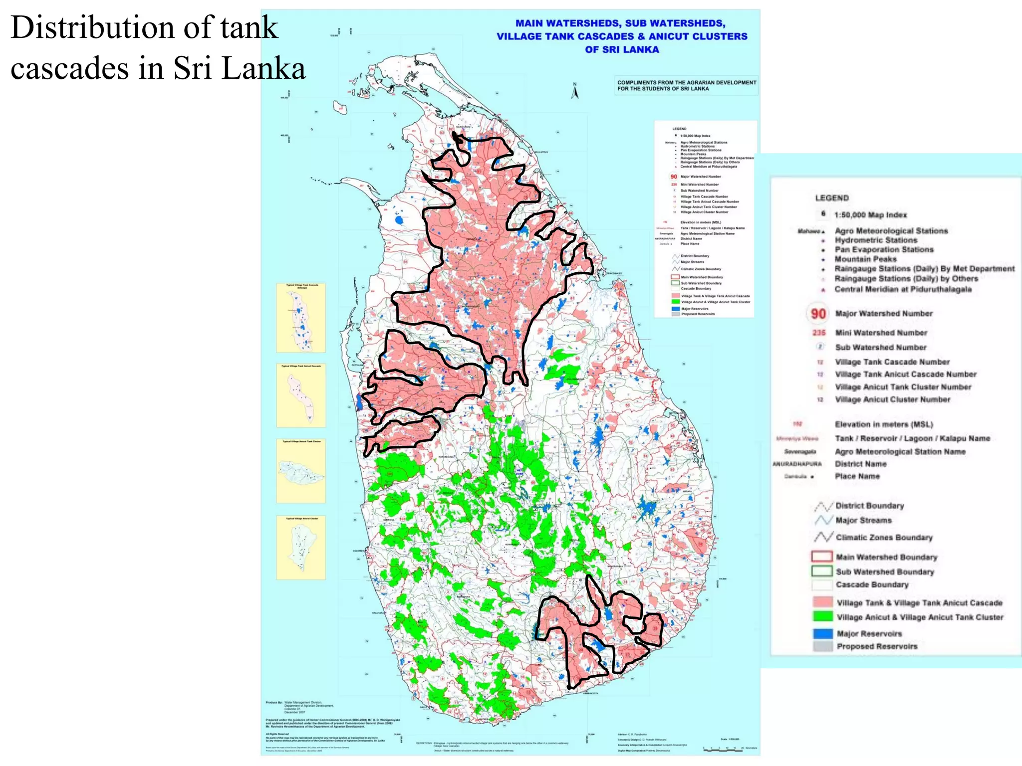
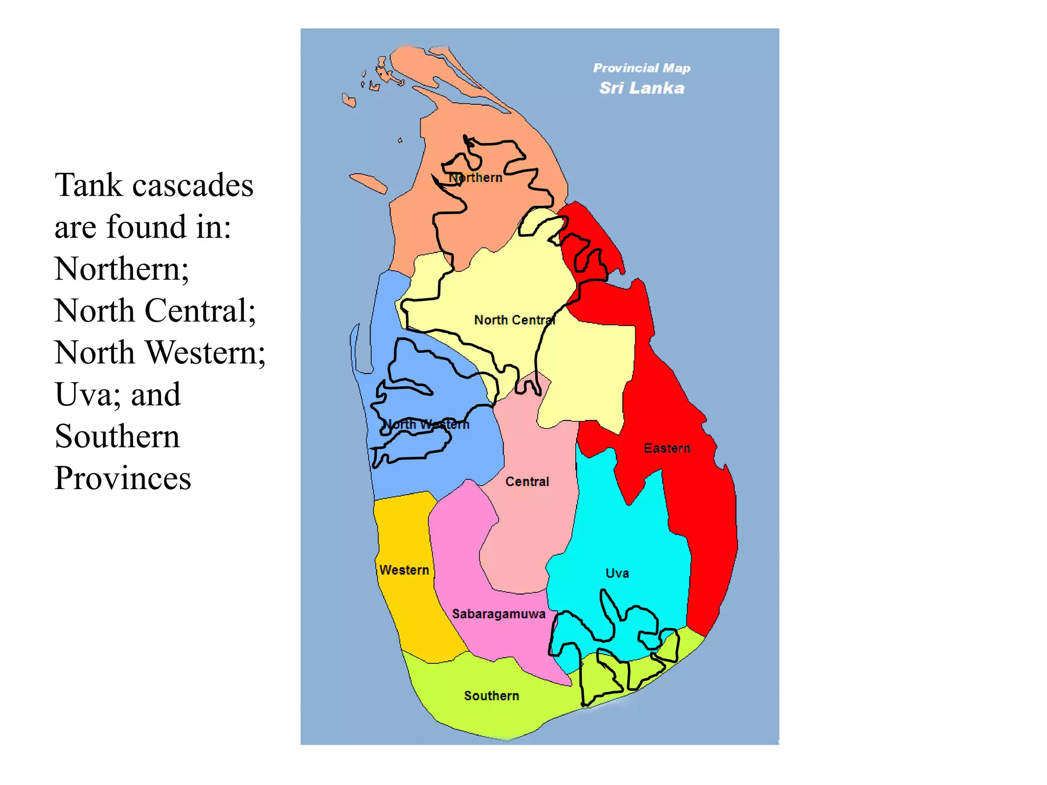
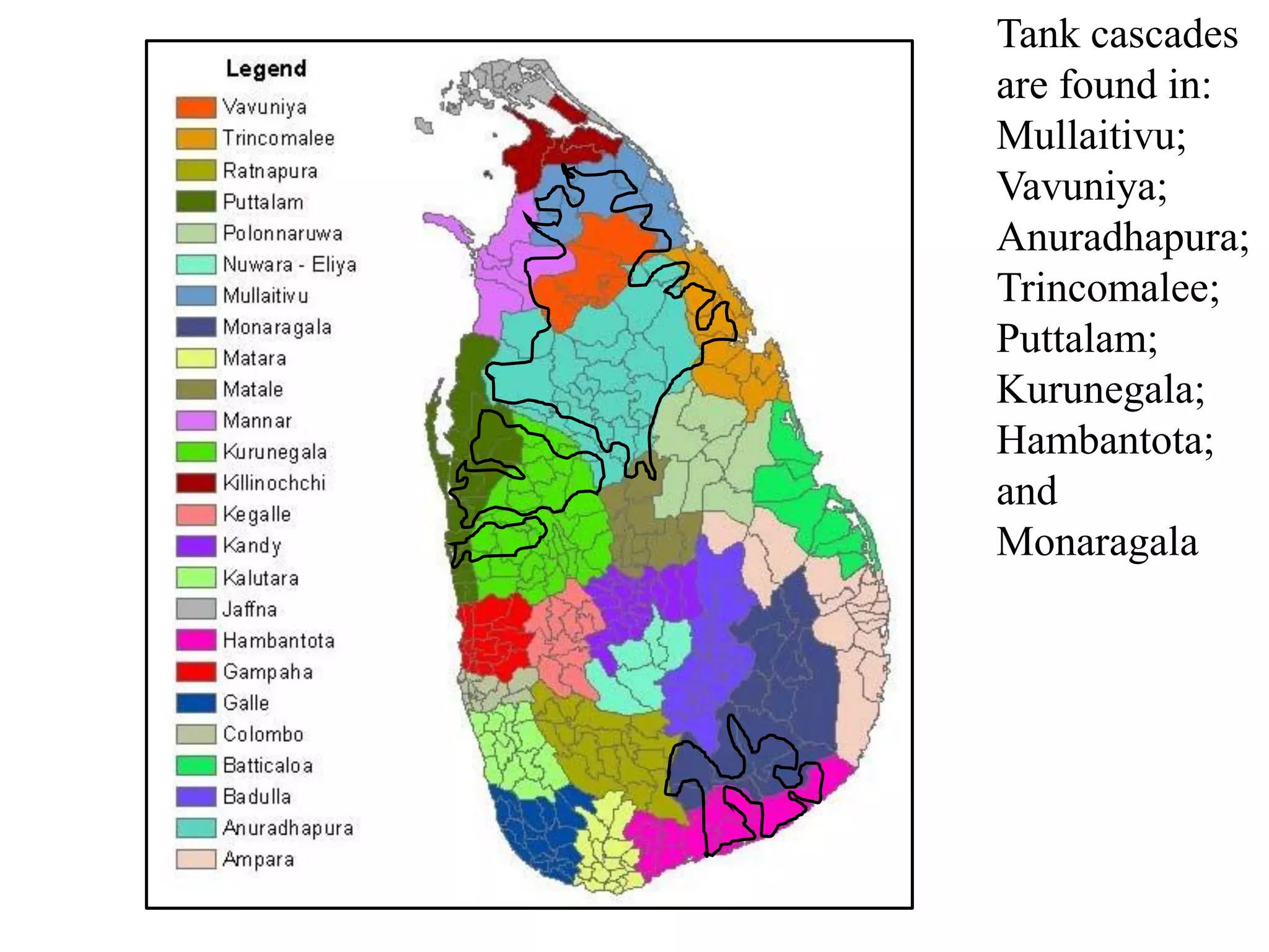
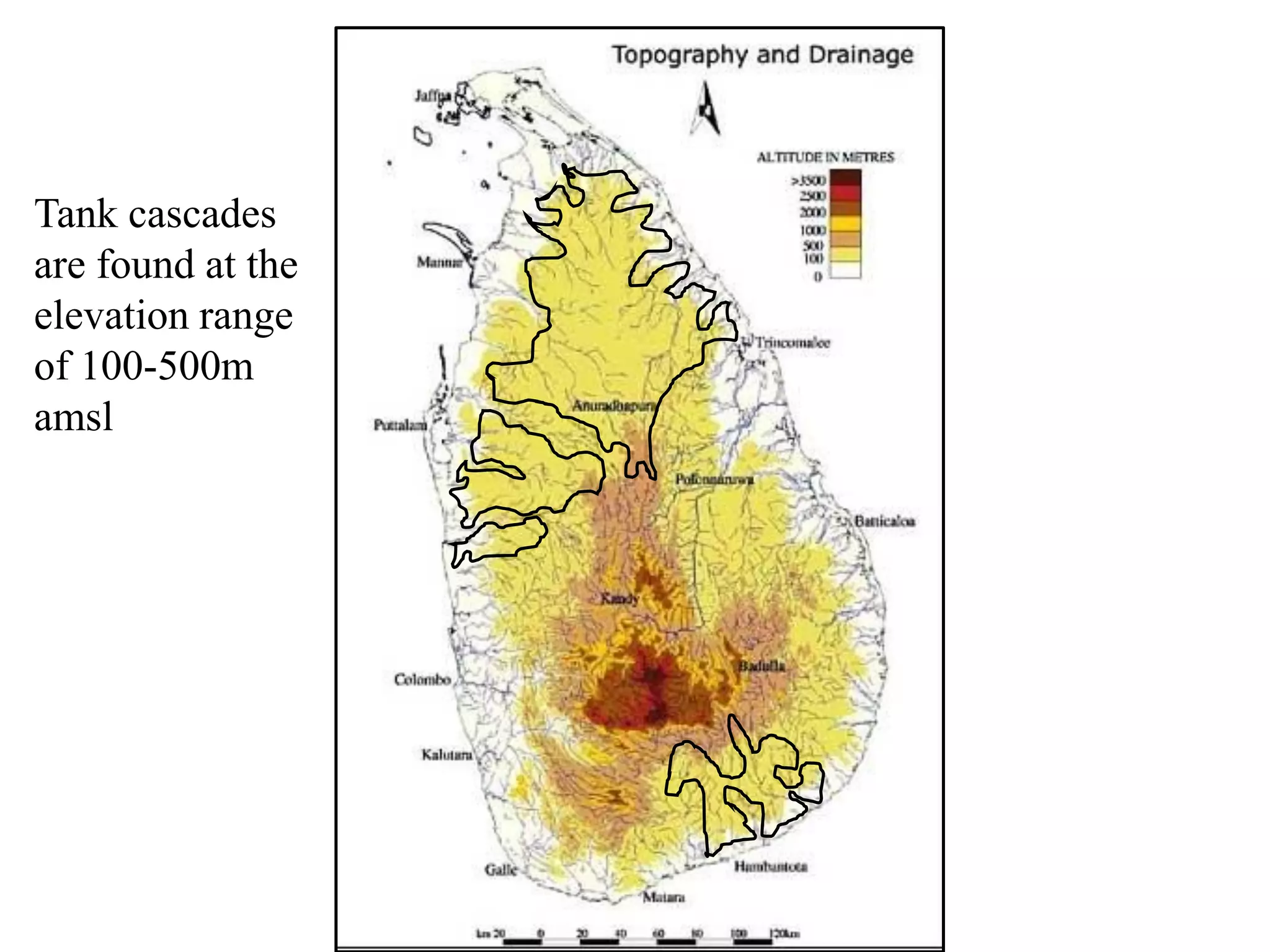
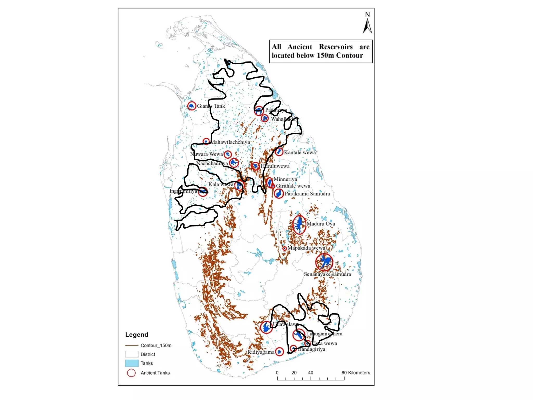
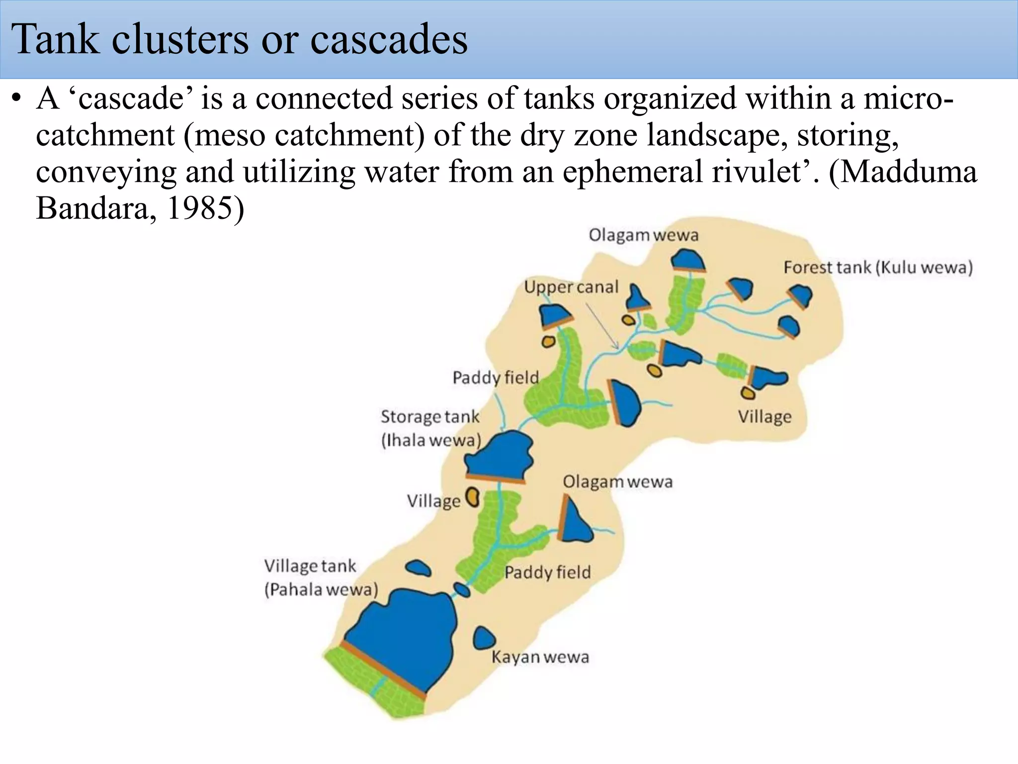
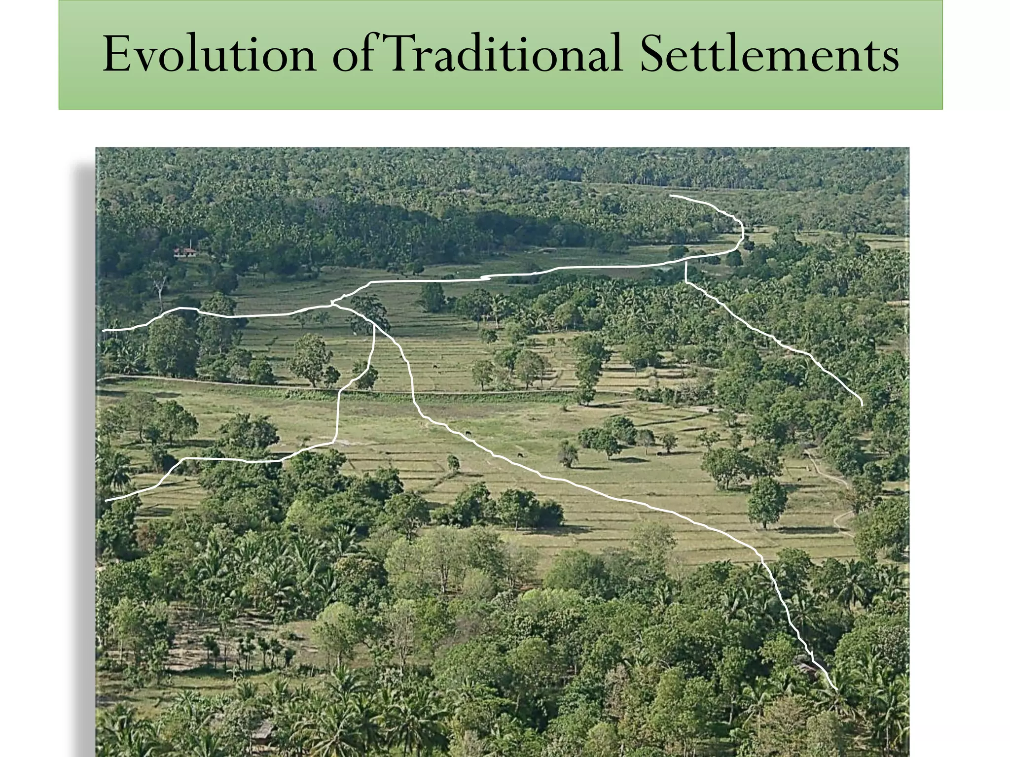
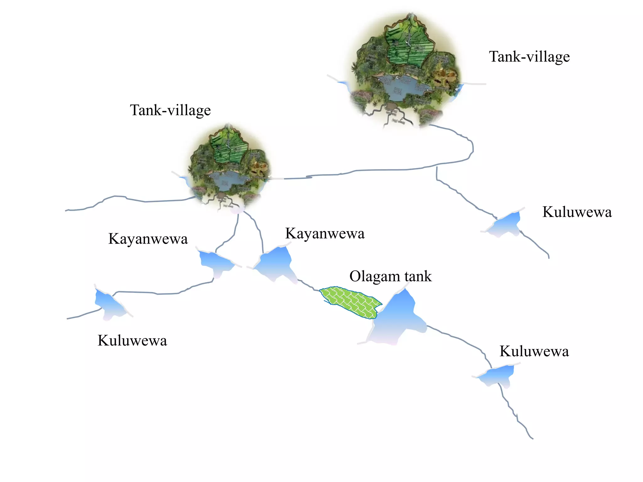
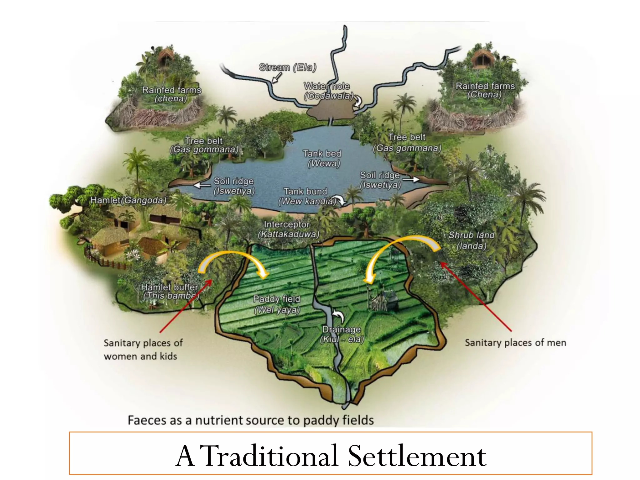
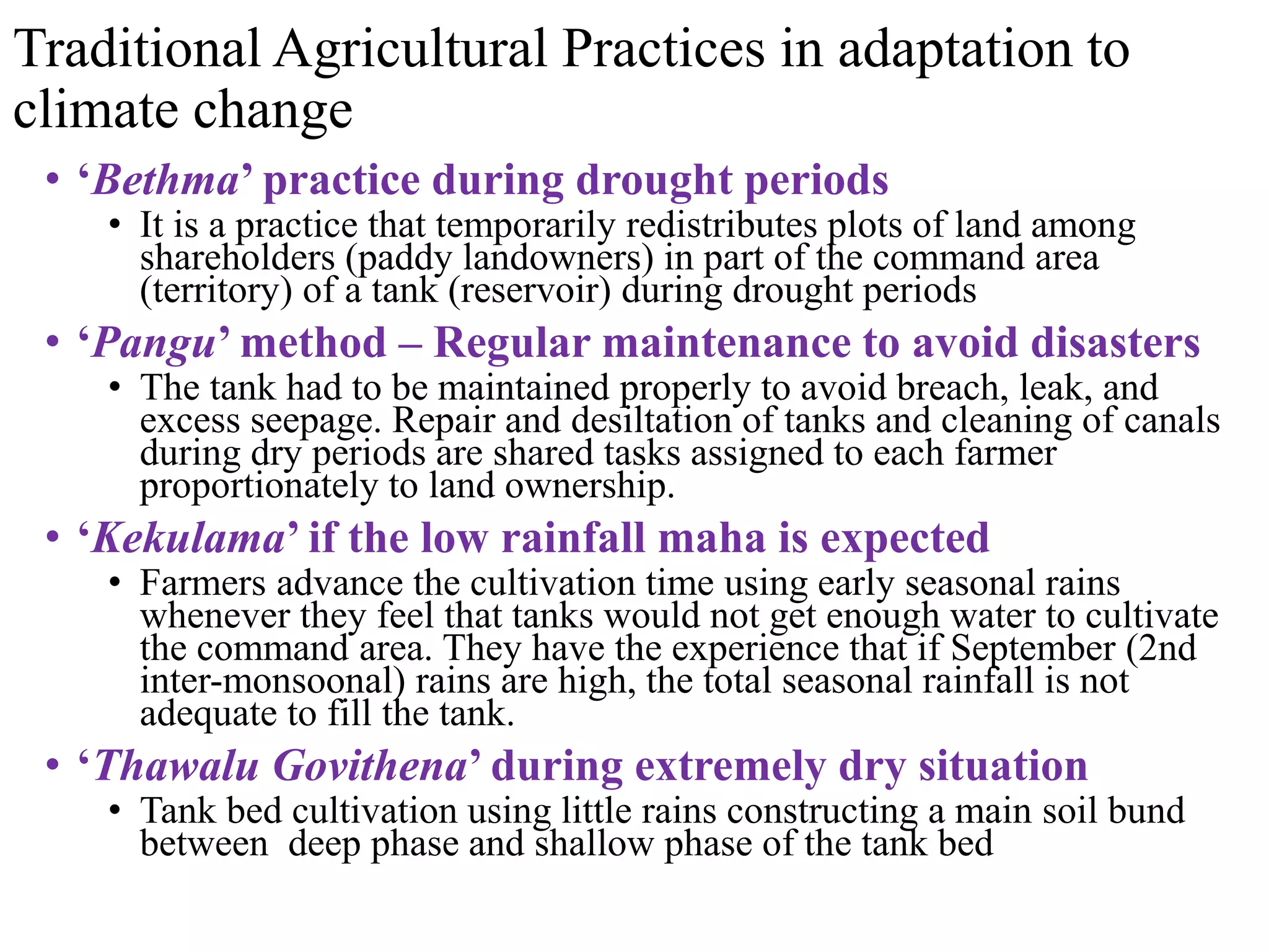
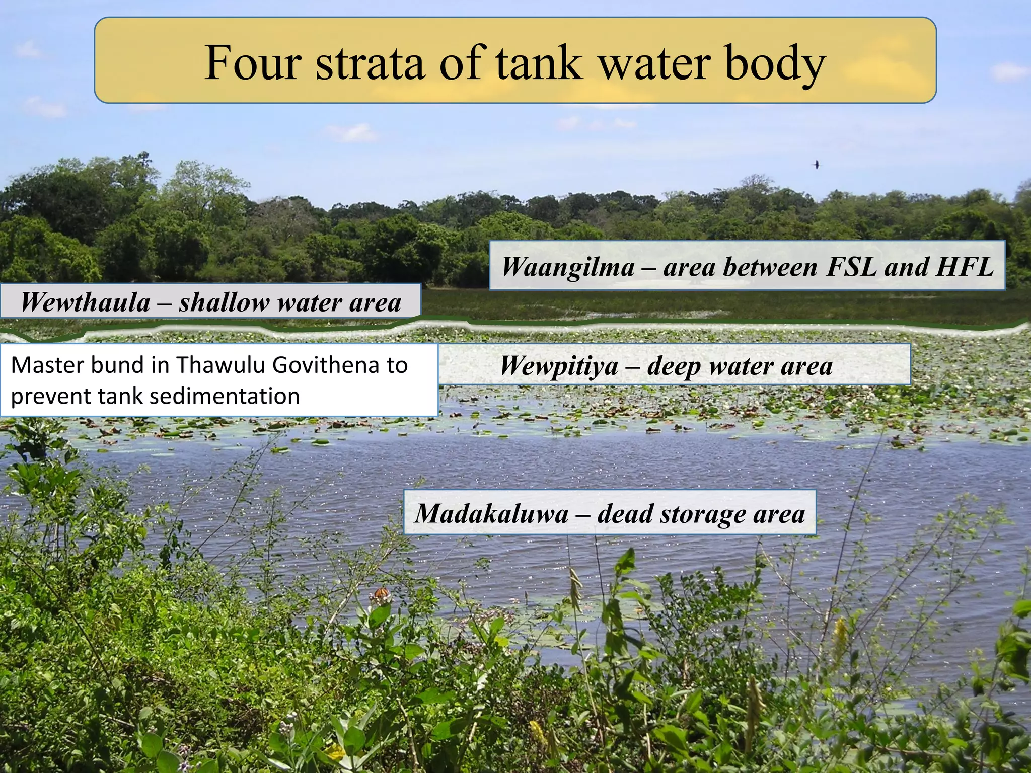
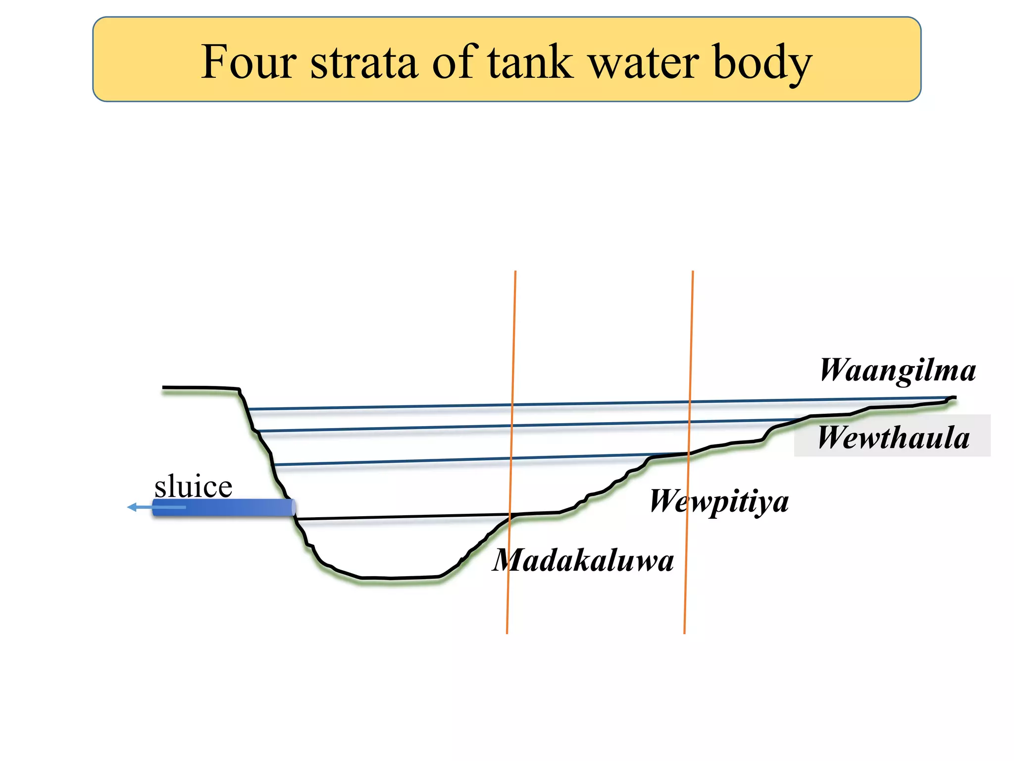
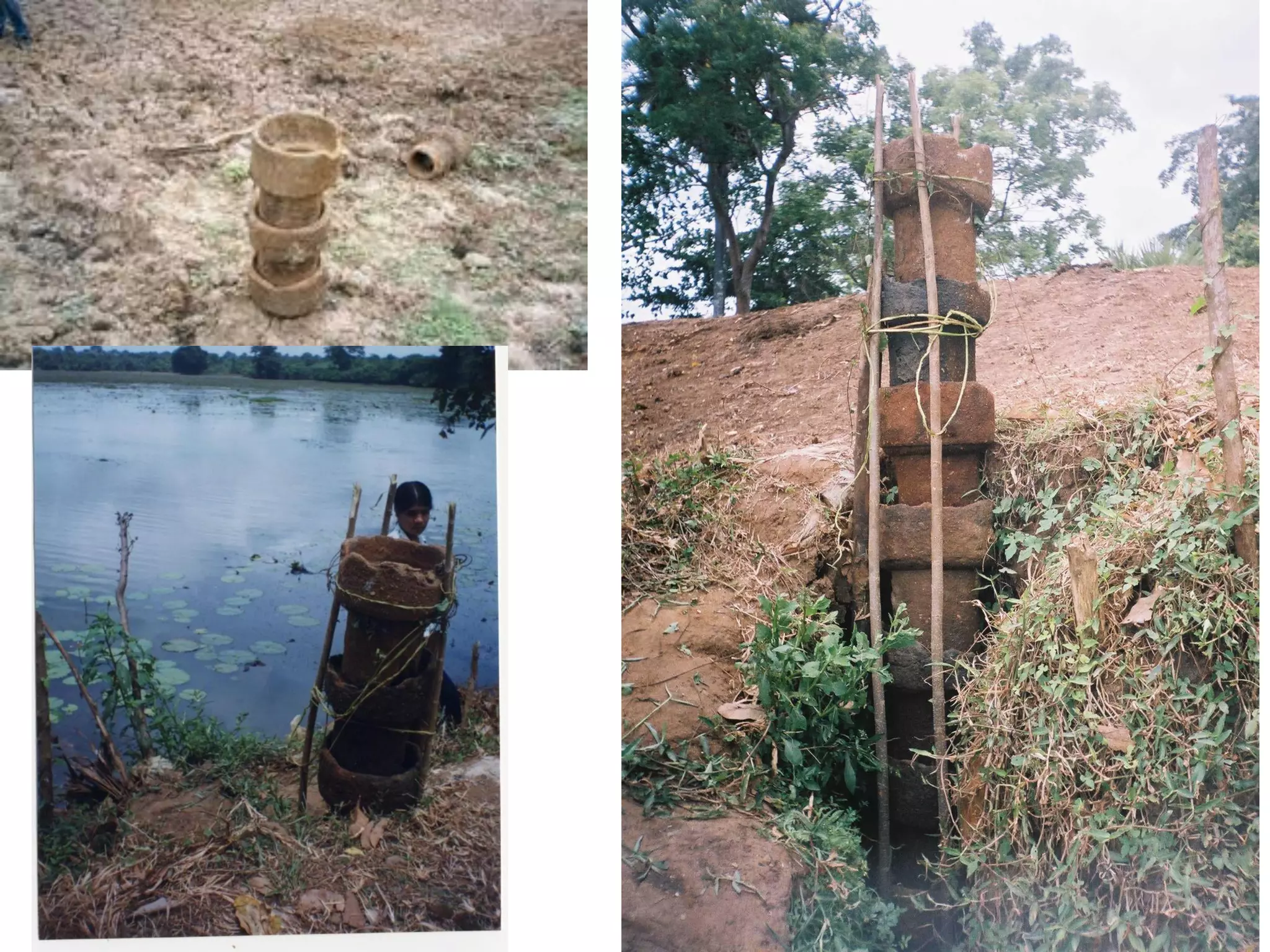
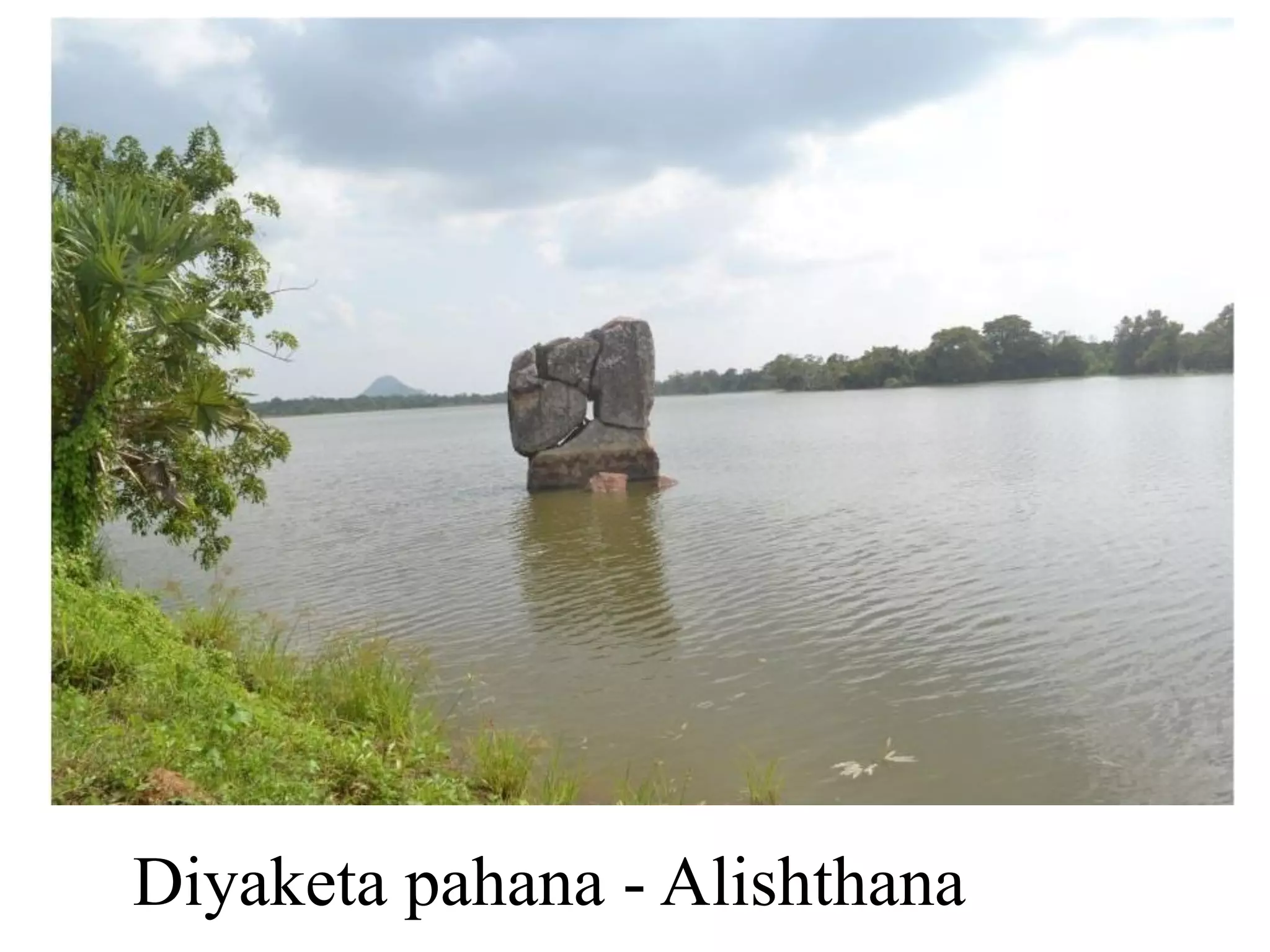
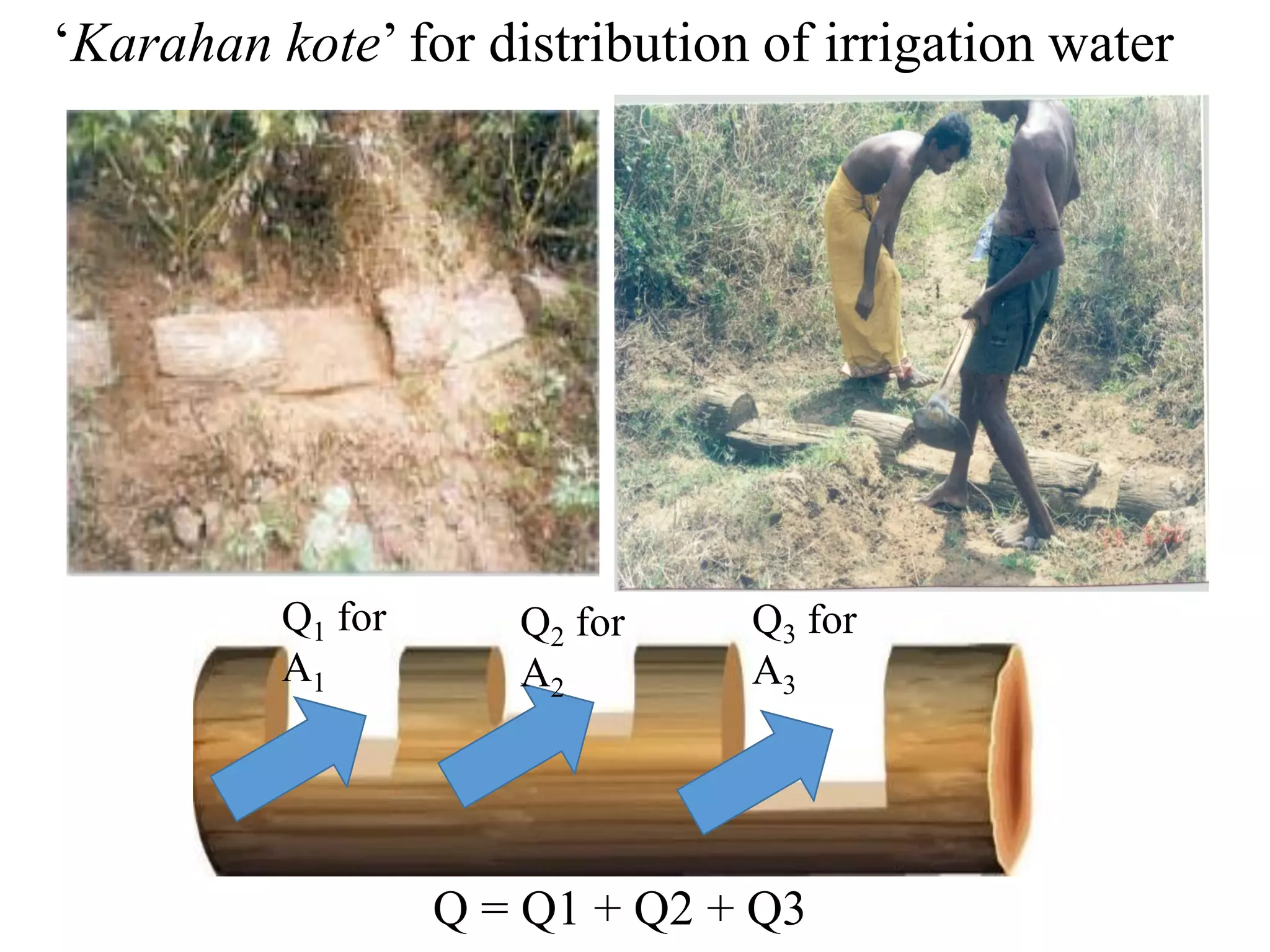
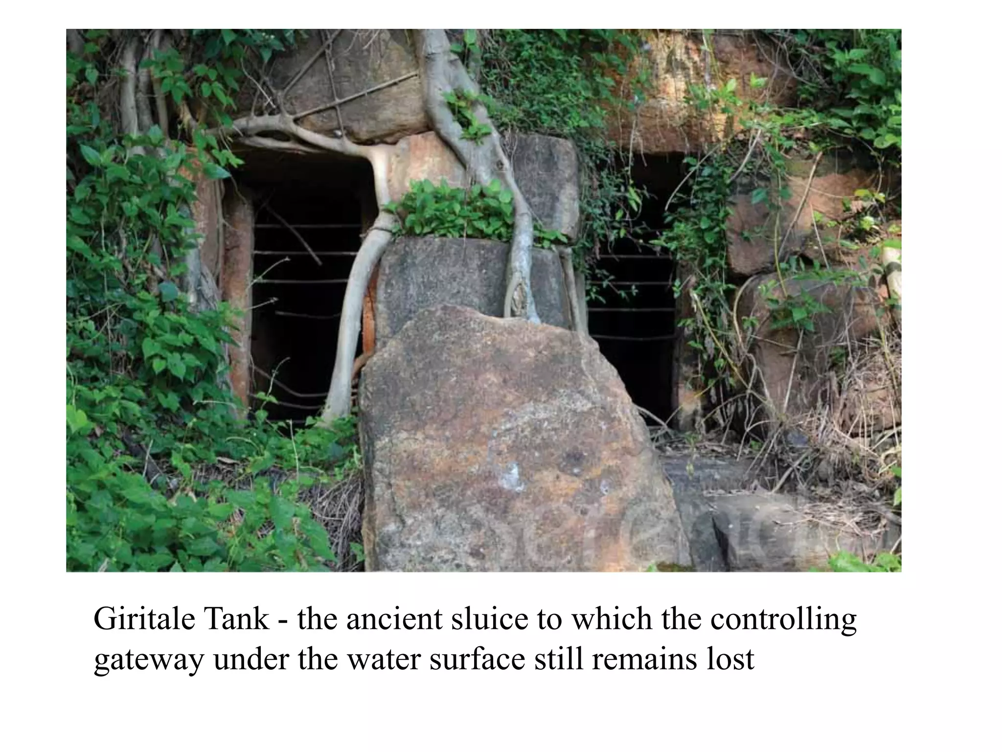
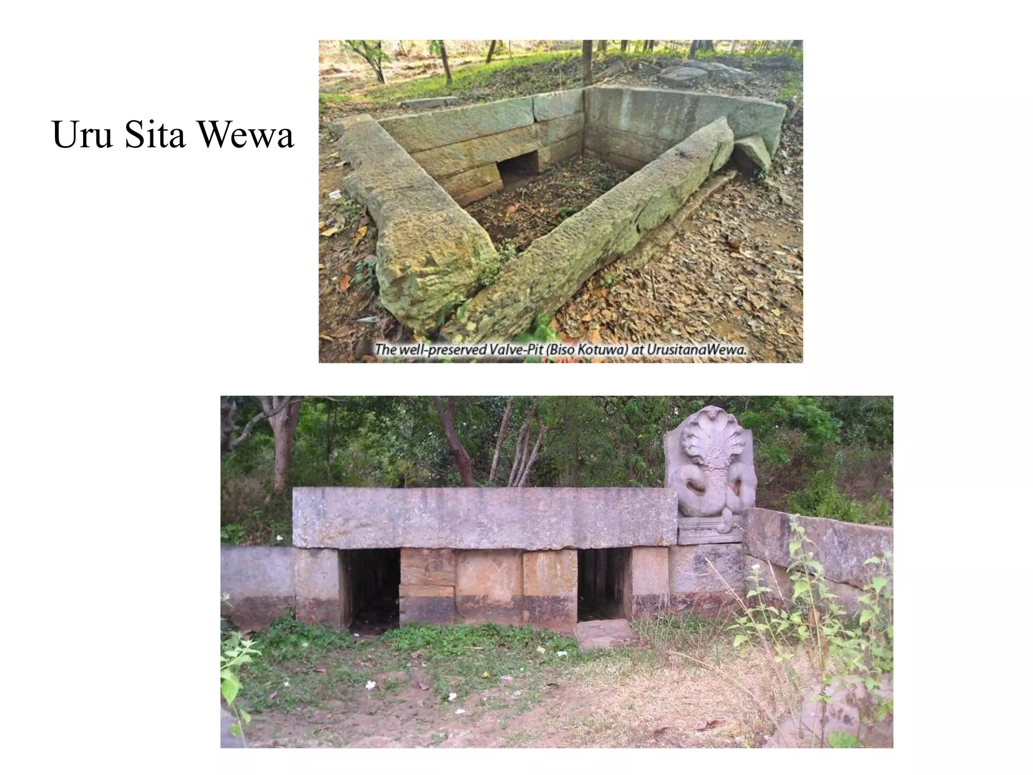
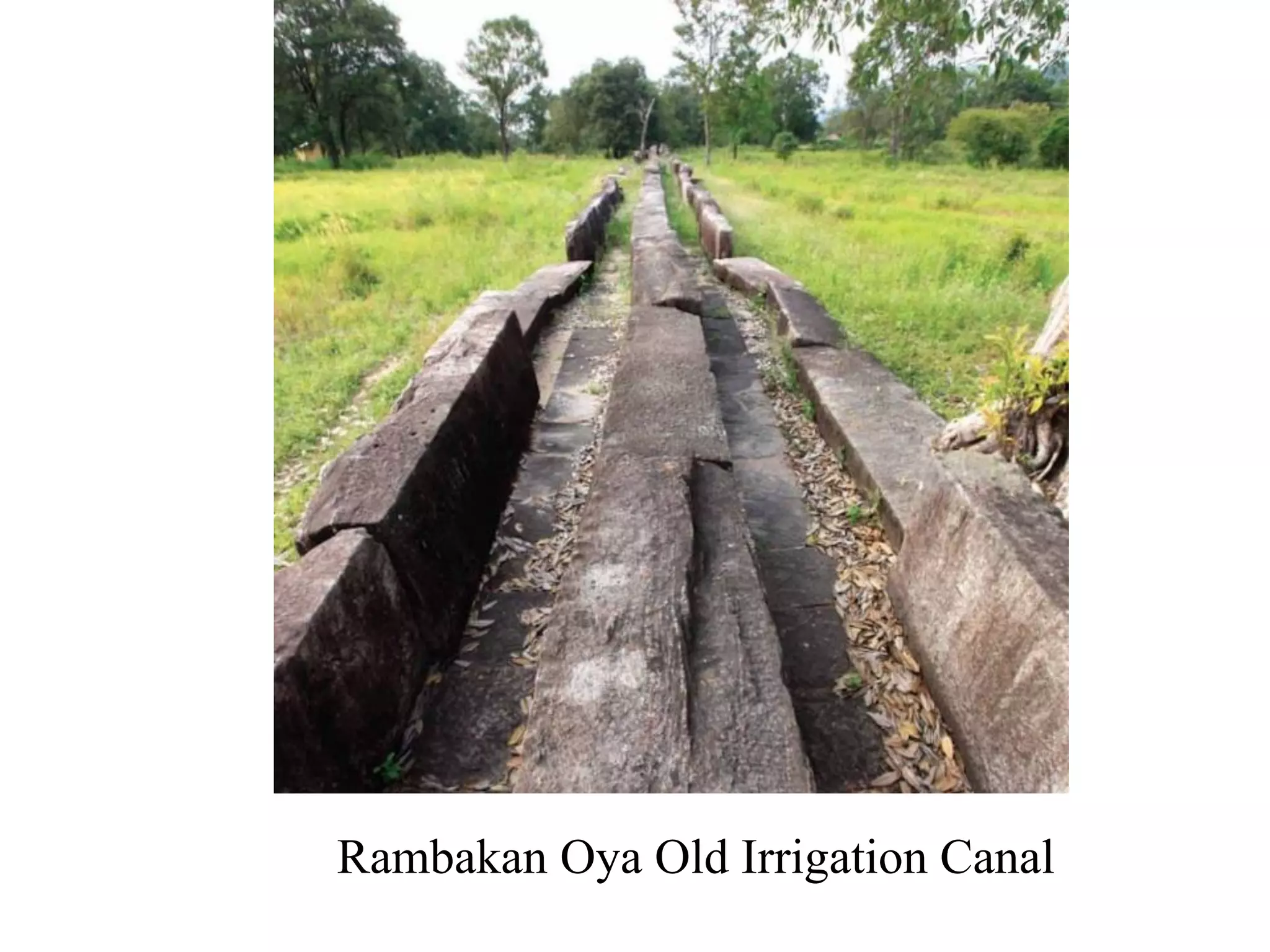

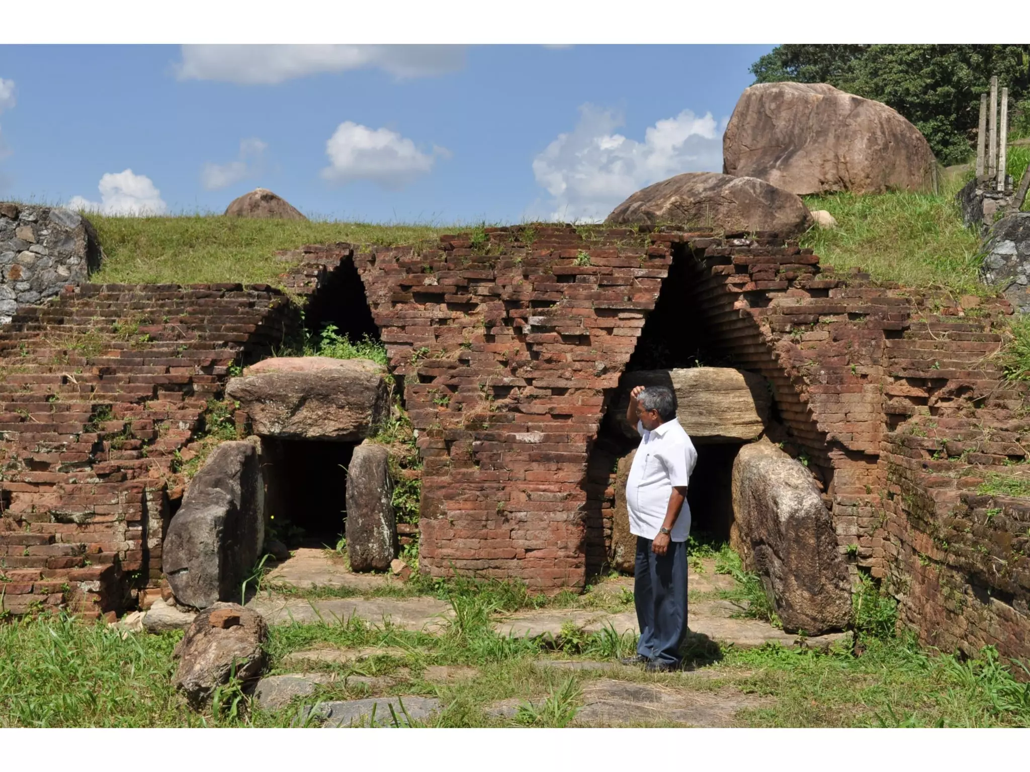
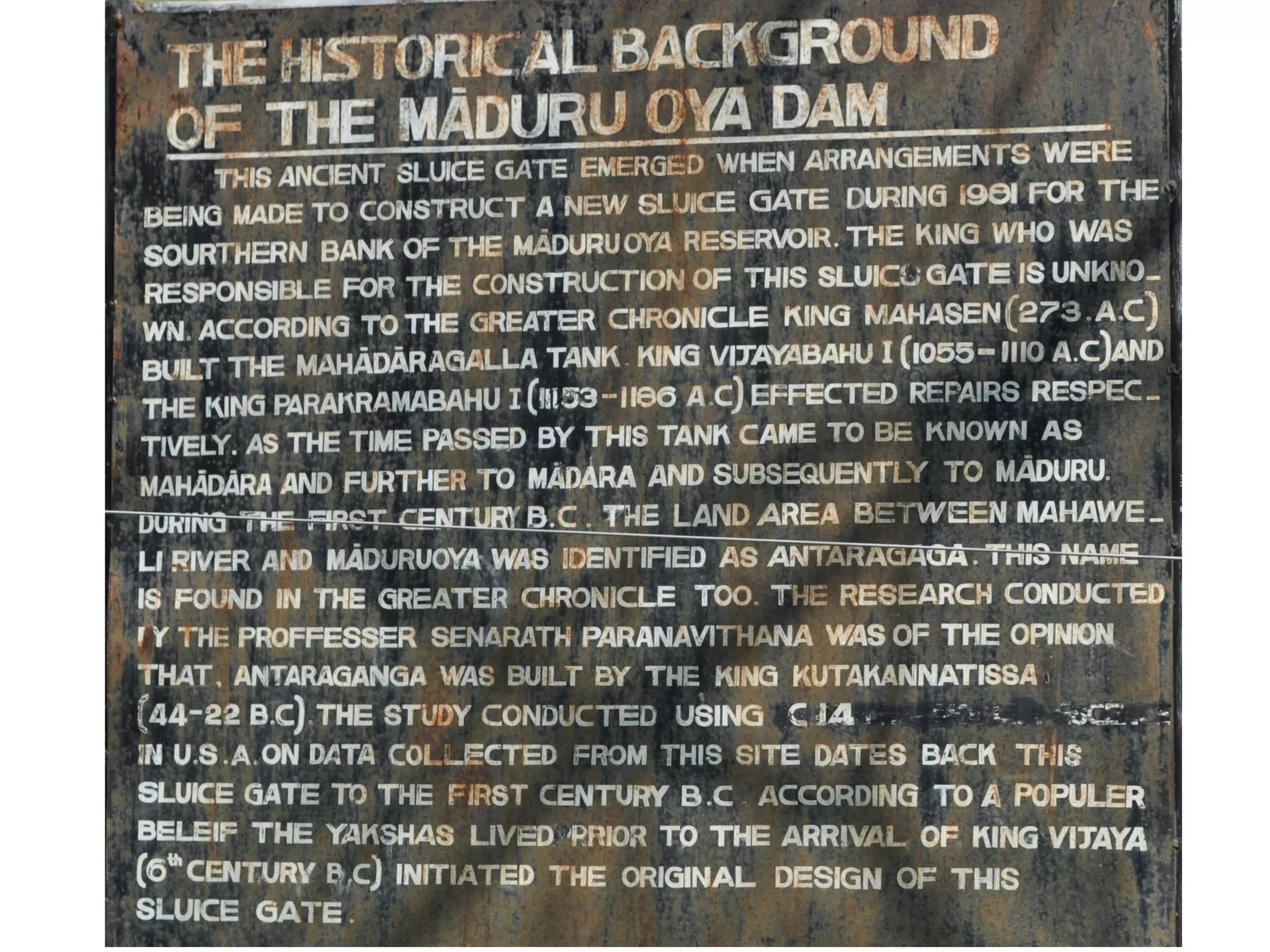


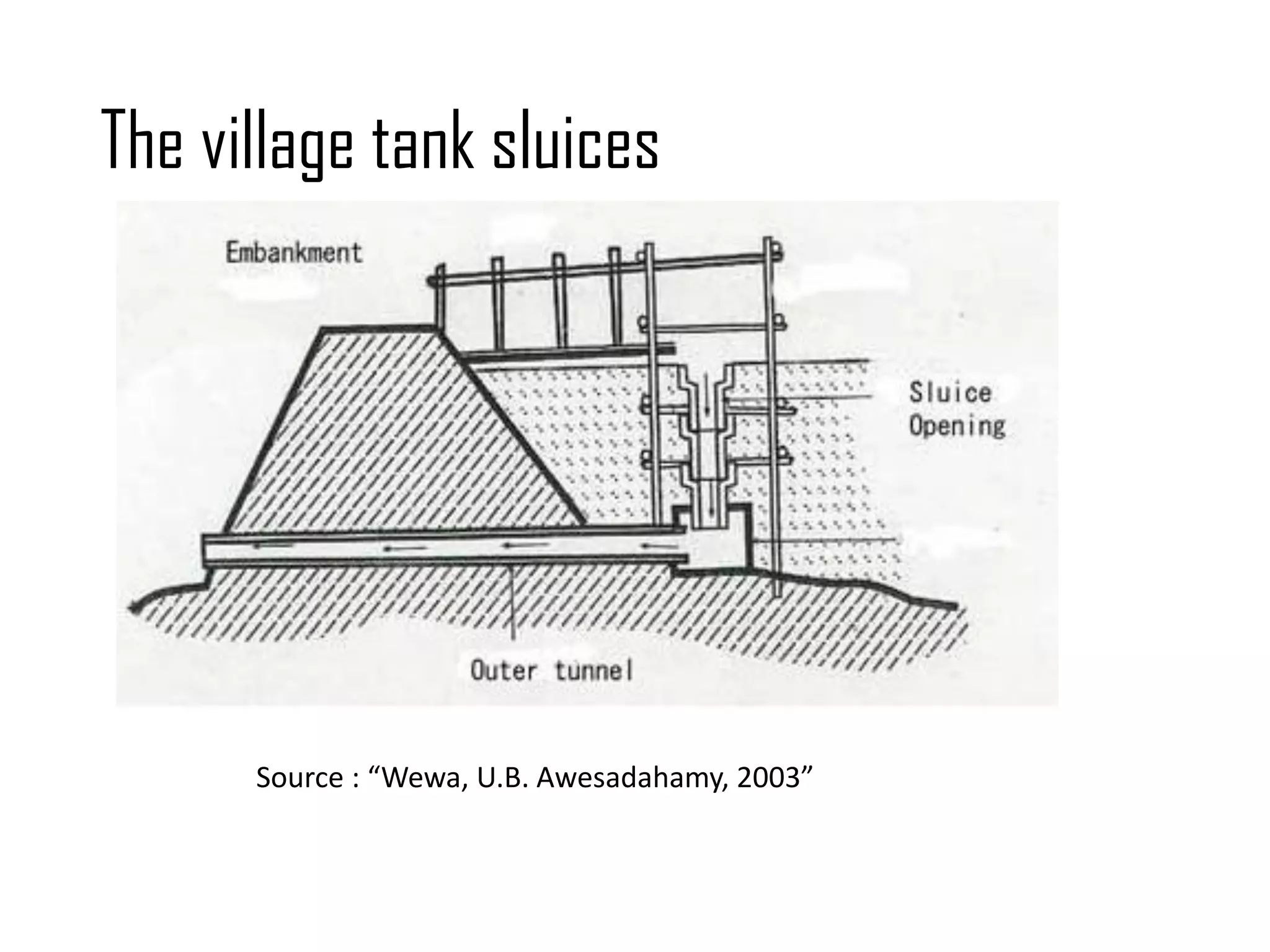
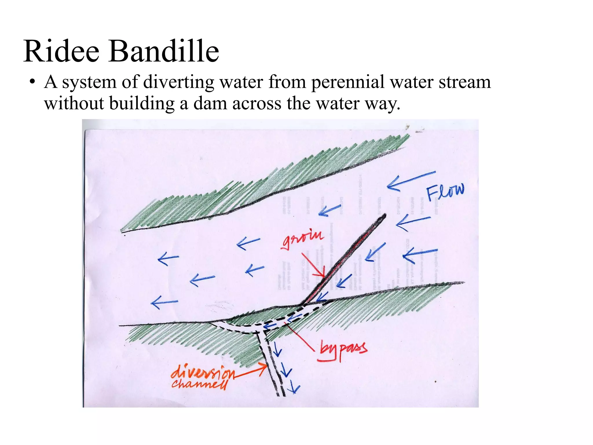
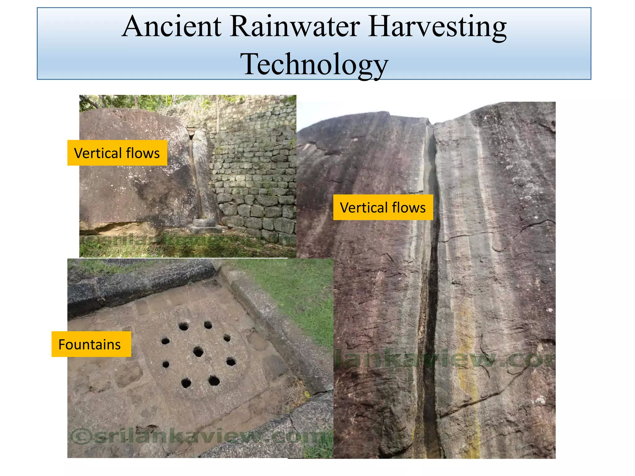
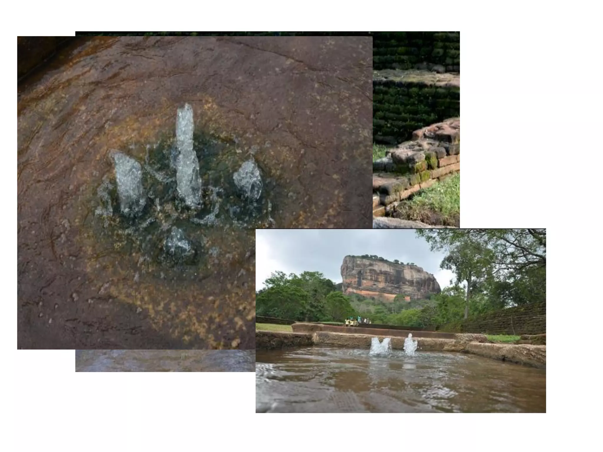

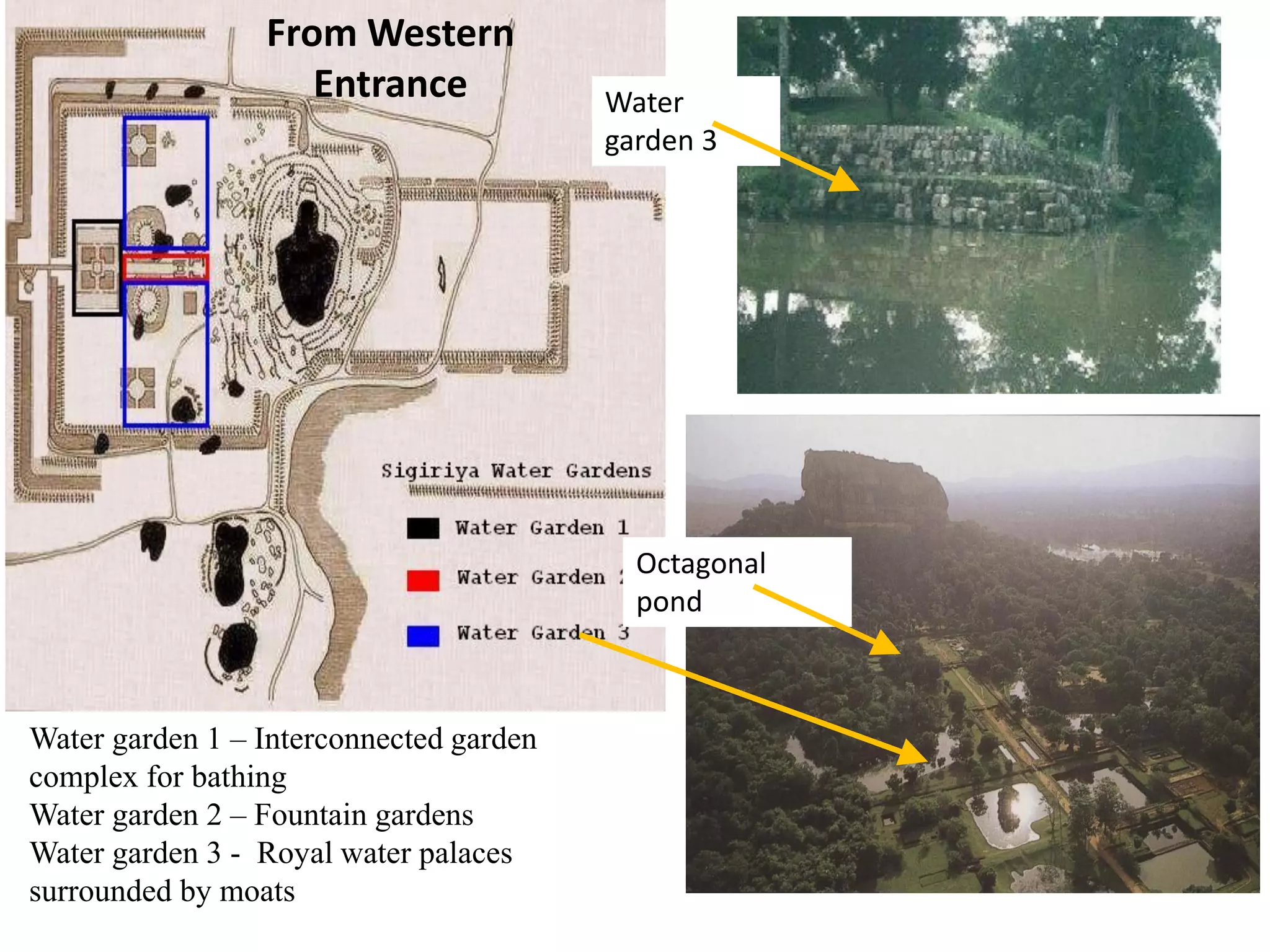
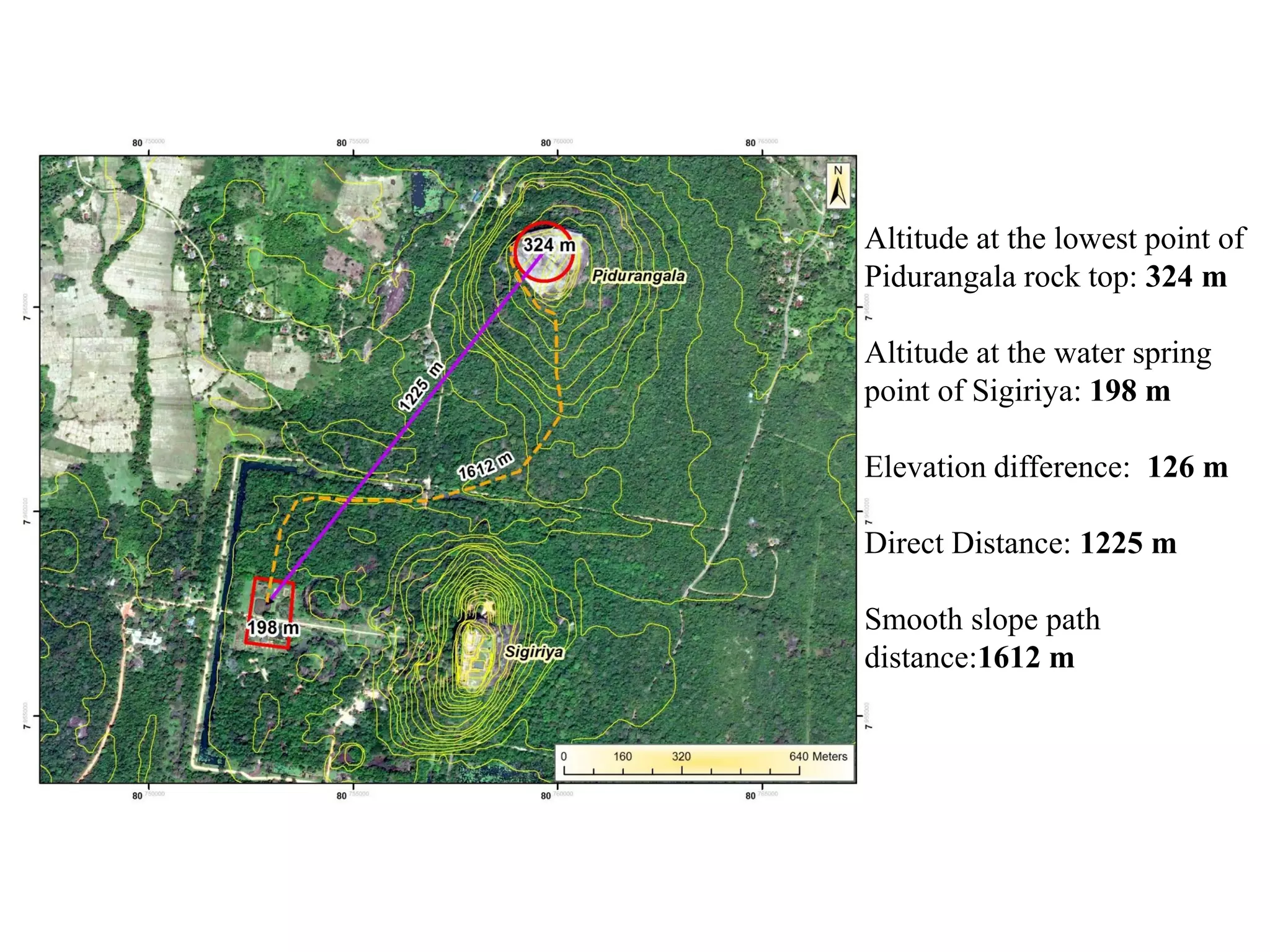
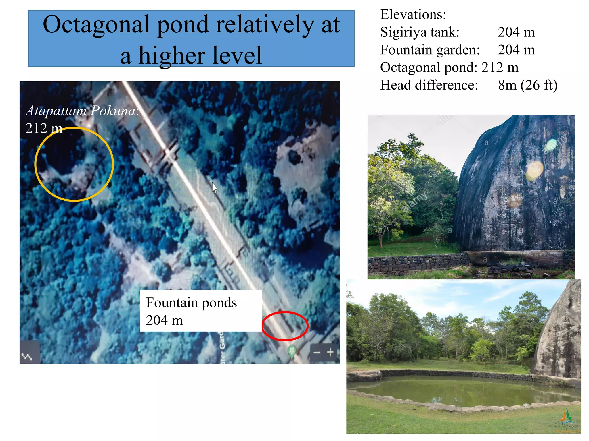


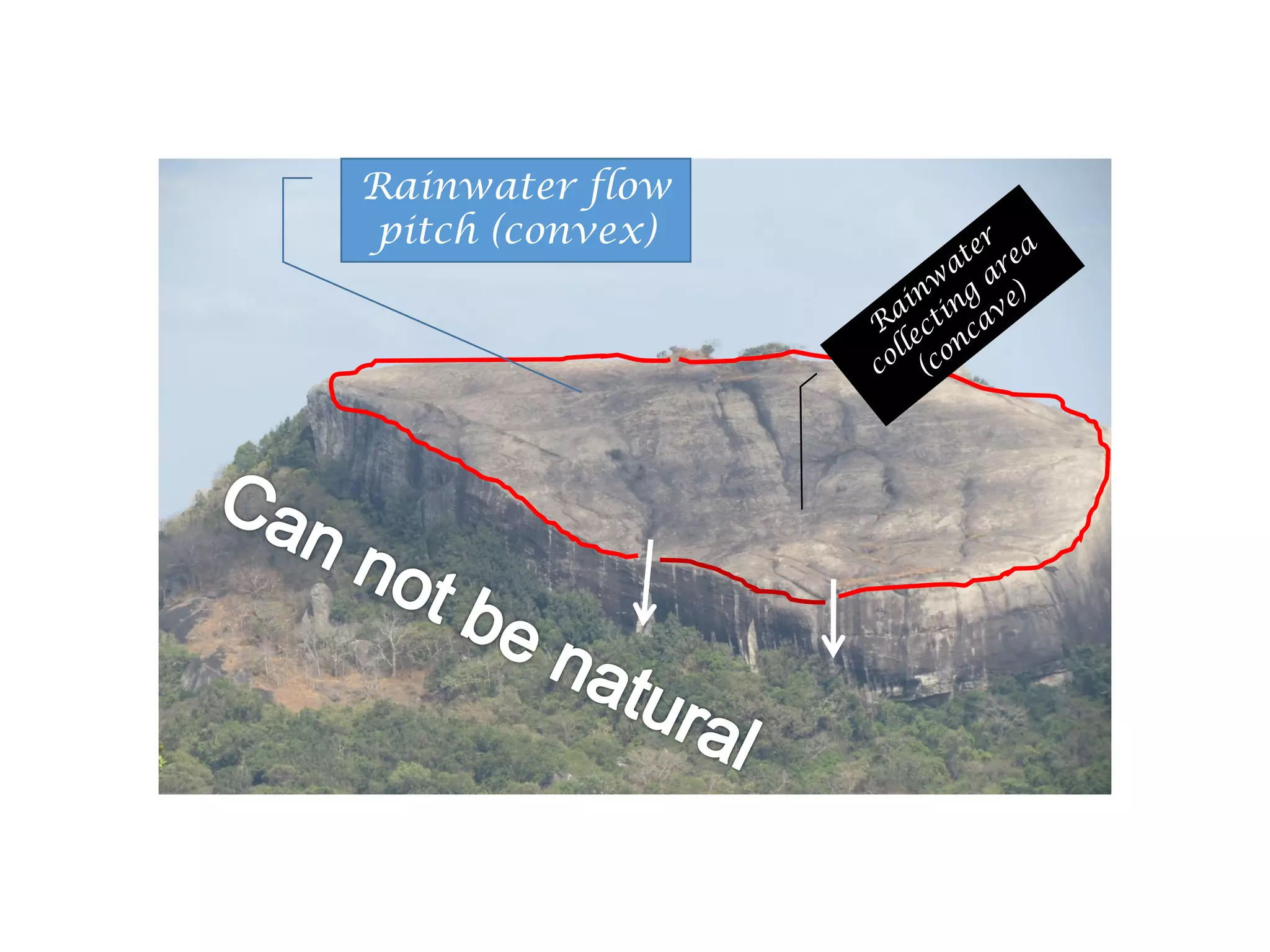


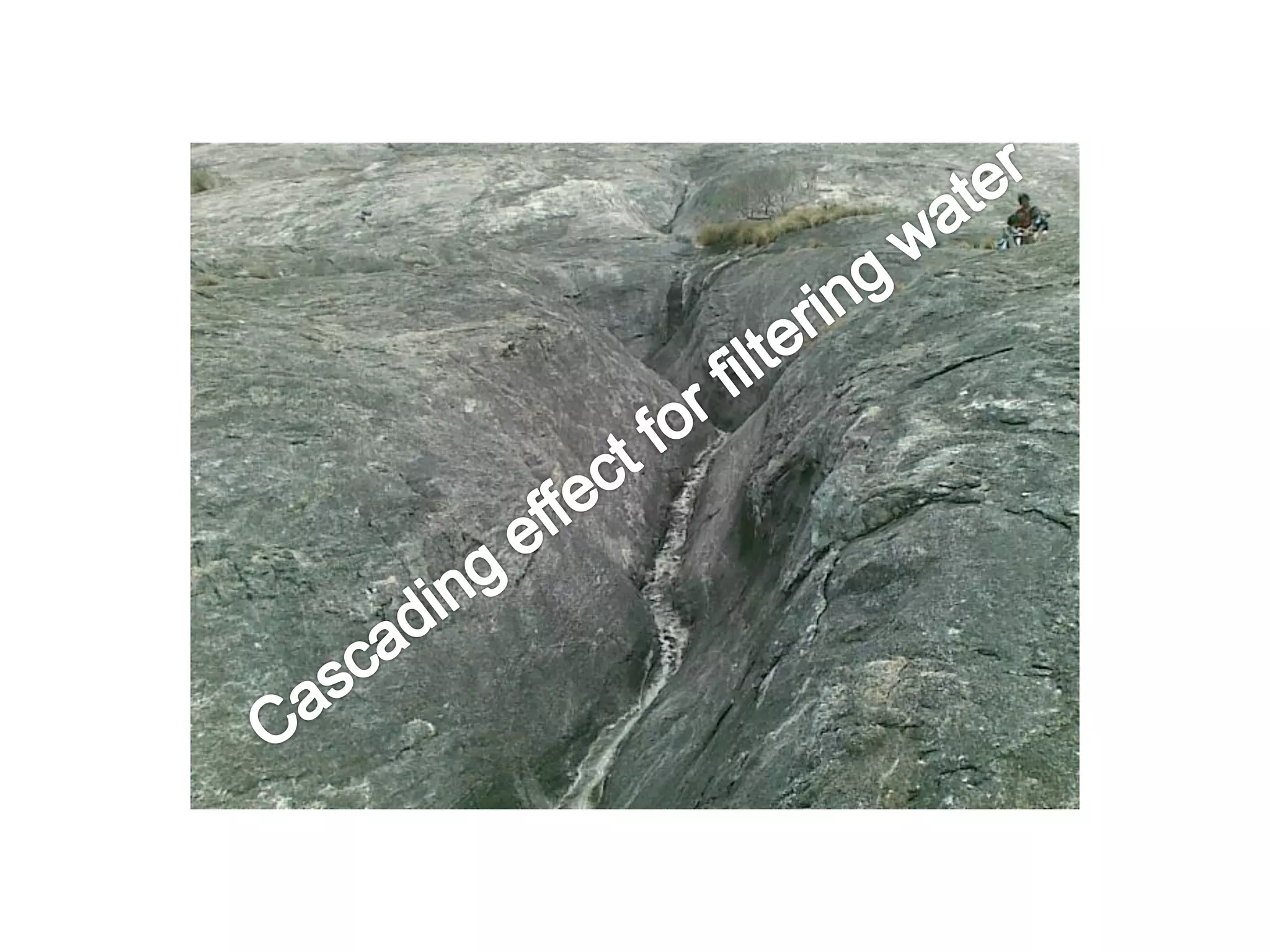
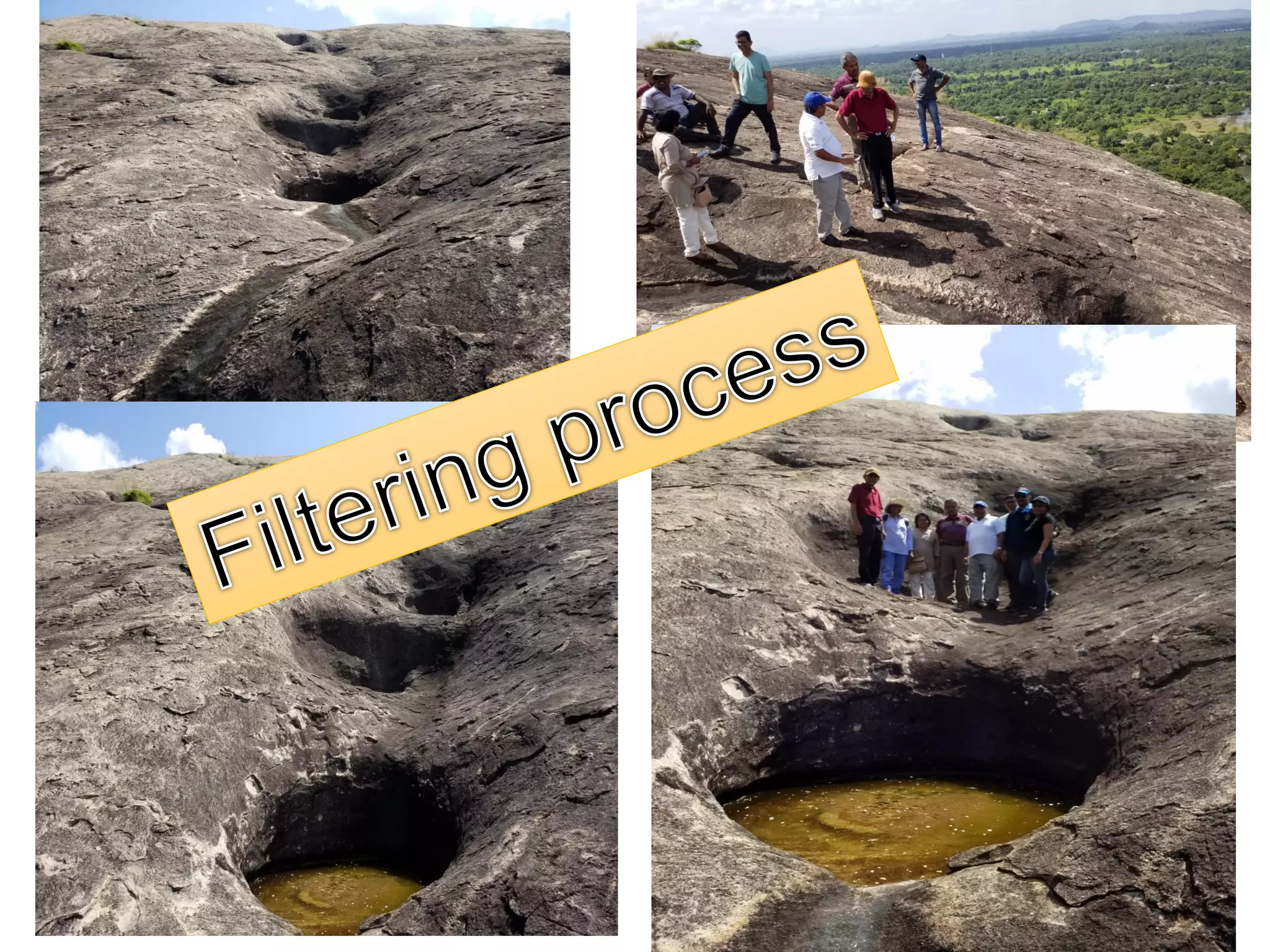
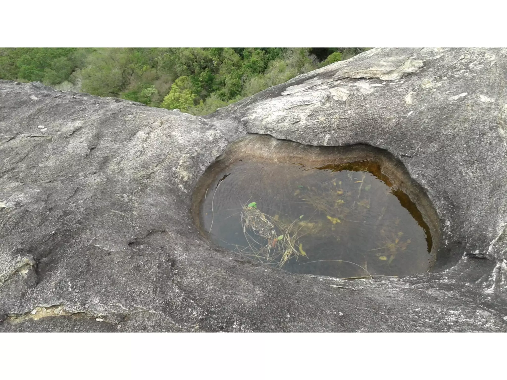
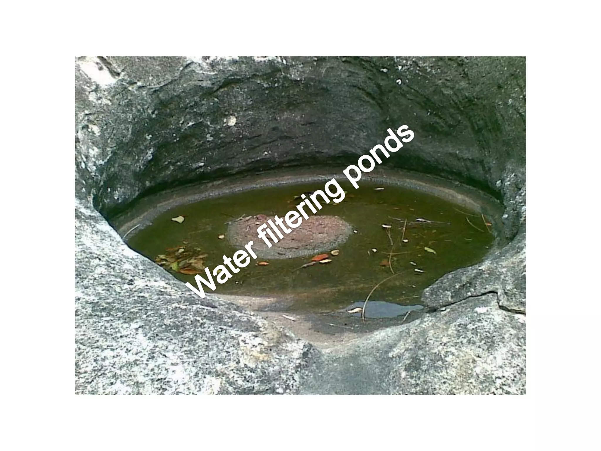
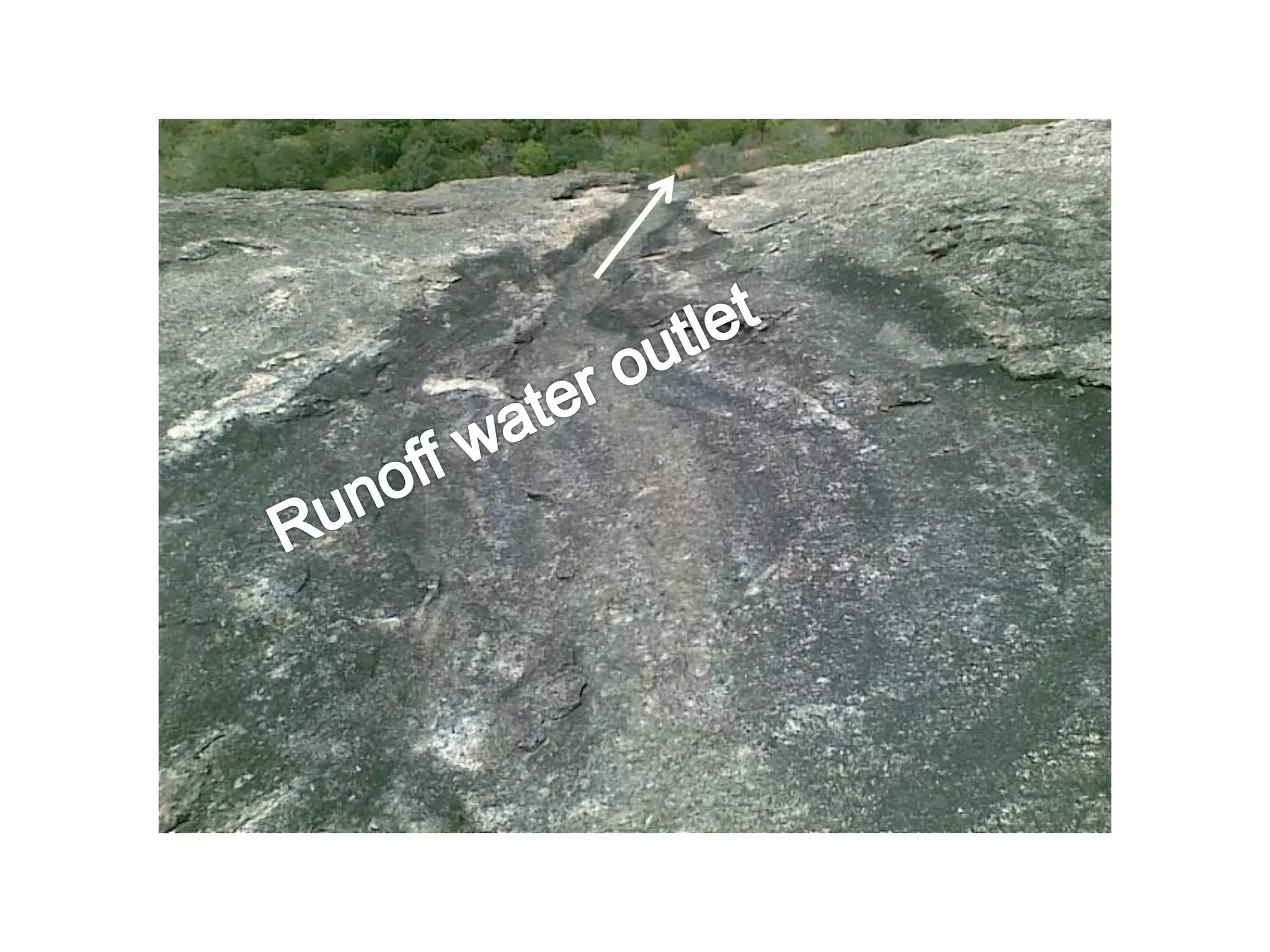
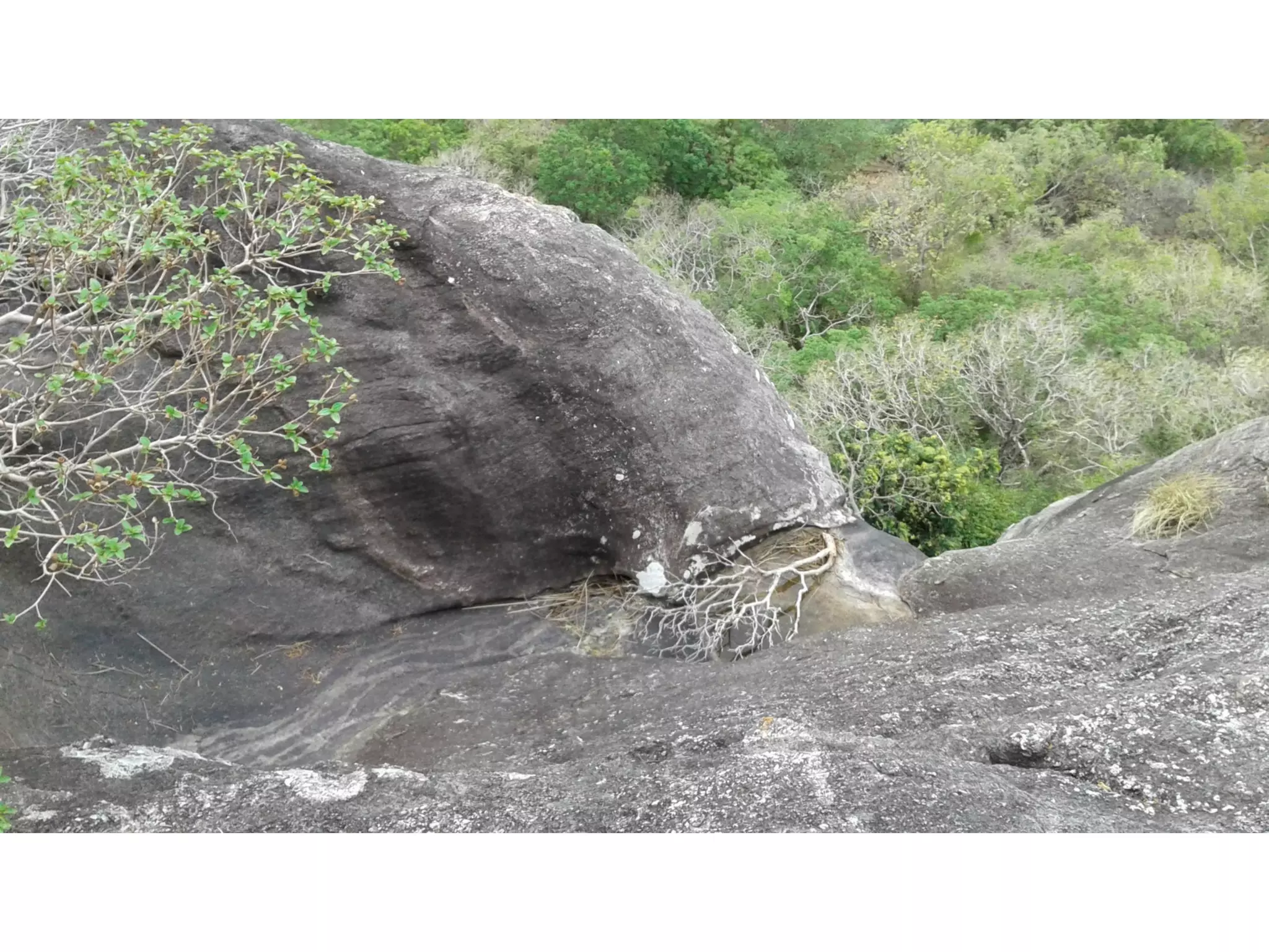
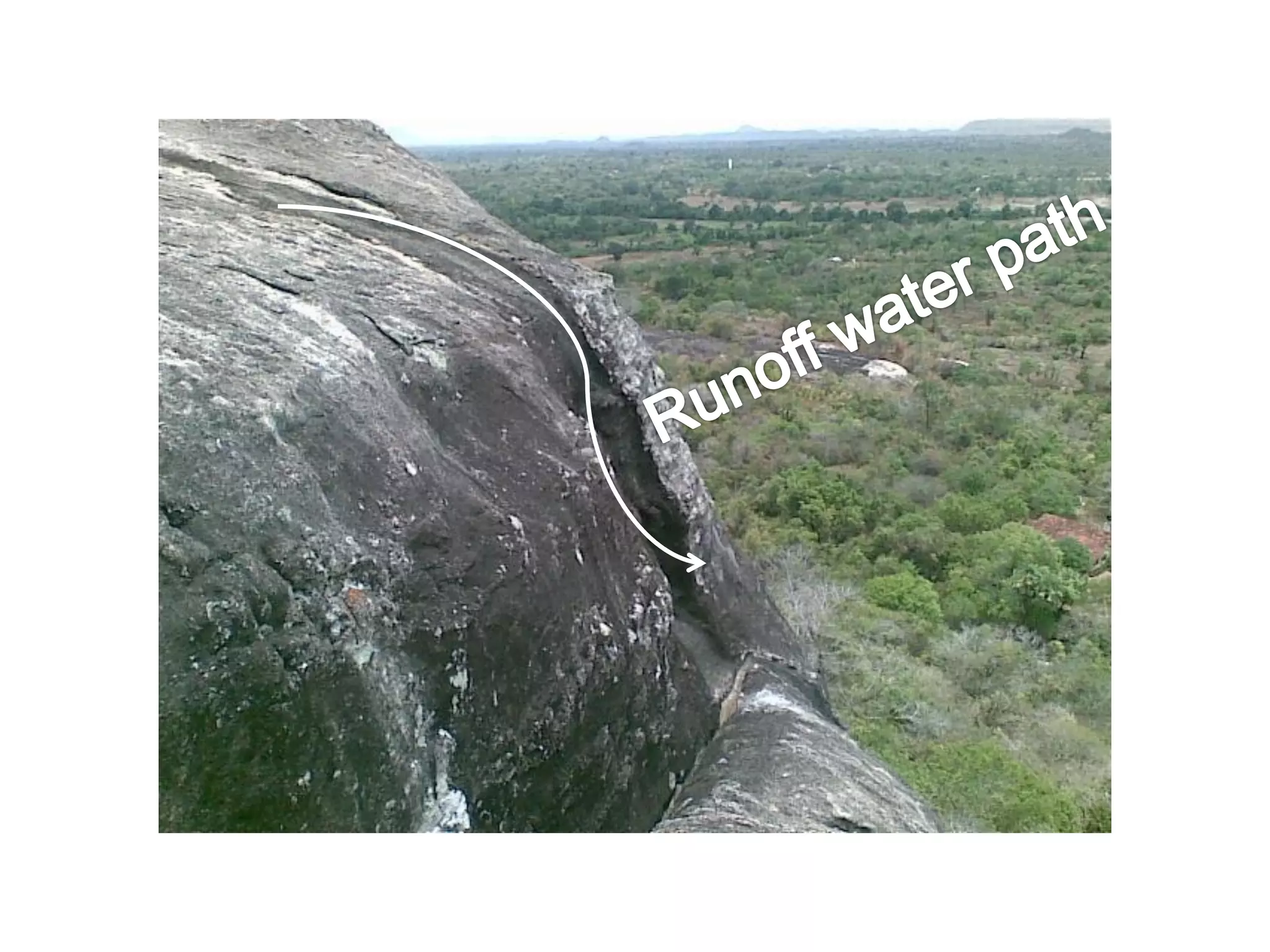

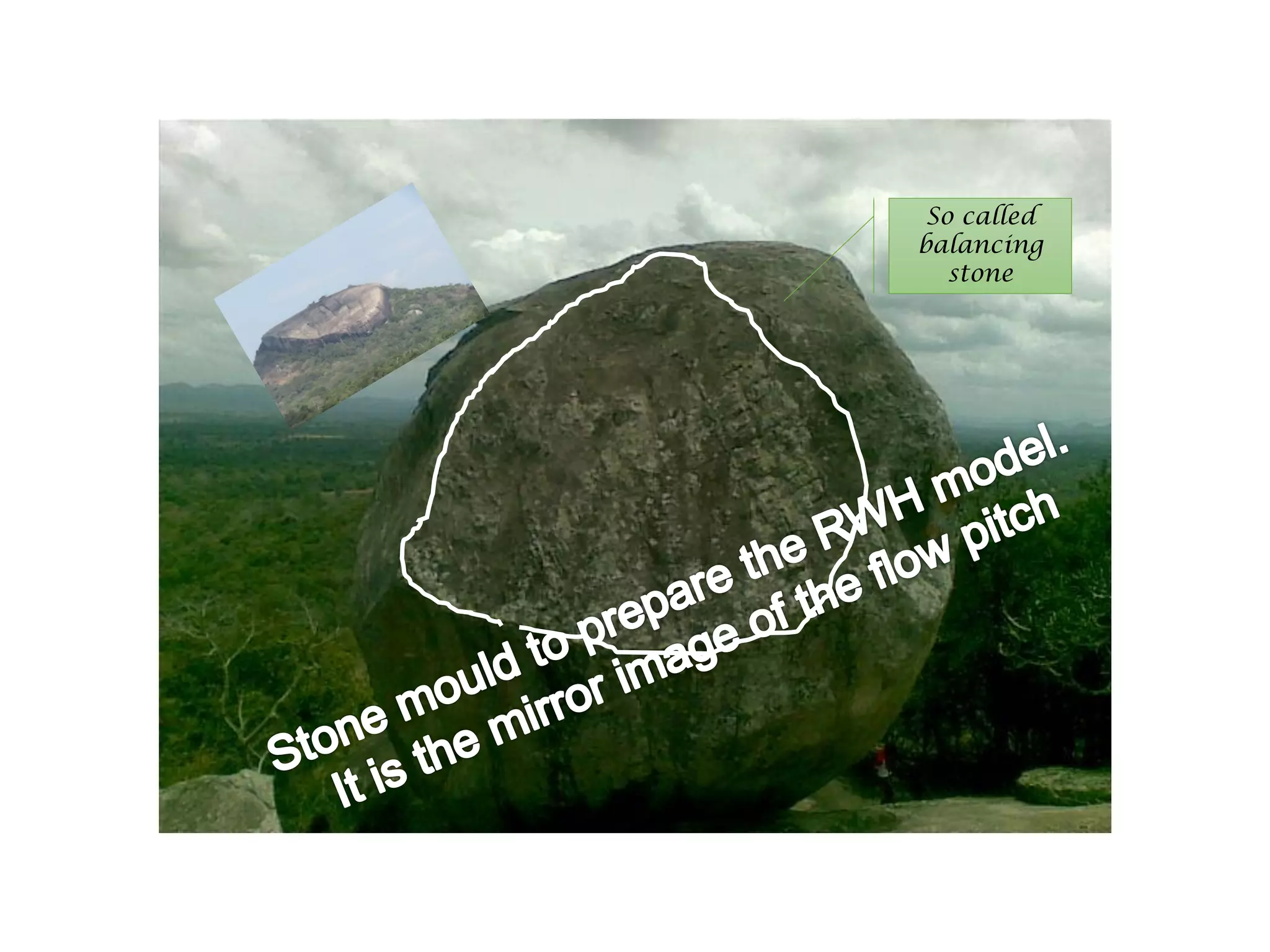


The document outlines a lesson on indigenous irrigation systems in Sri Lanka, focusing on cascade systems and water harvesting concepts, alongside a comprehensive overview of Sri Lankan agriculture's history, culture, and climate adaptation techniques. It details the evolution of traditional settlements and irrigation practices, emphasizing the importance of water resource management for various human and ecological needs. Additionally, it discusses ancient water governance methods, structures, and the ecological significance of tank cascades in the region.


