
Recommended
Recommended
More Related Content
What's hot
What's hot (12)
Viewers also liked
Similar to BVCP CU South community meeting presentation slides sept 26
Similar to BVCP CU South community meeting presentation slides sept 26 (20)
More from CityofBoulder
More from CityofBoulder (17)
Recently uploaded
Recently uploaded (20)
BVCP CU South community meeting presentation slides sept 26
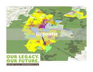
- 1. CU SOUTH
- 2. B O U L D E R V A L L E Y C O M P R E H E N S I V E P L A N City Staff Team 1. Lesli Ellis and Susan Richstone, Planning 2. Kurt Bauer, Flood Utilities 3. Don Damico and Mark Gershman, OSMP University of Colorado 1. Francis Draper 2. Jeff Lipton CU SOUTH CONTACTS Consultants: Claudia Brown (Biohabitats) Bill Fox (FTH) not present EMAIL: BVCPChanges@bouldercolorado.gov
- 3. CU SOUTH IS ONE OF THE BVCP TRACKS To analyze (land use suitability) and make recommendation for future land designations on the CU property B O U L D E R V A L L E Y C O M P R E H E N S I V E P L A N Looking west from south edge
- 4. THIS PROCESS B O U L D E R V A L L E Y C O M P R E H E N S I V E P L A N Site Suitability Study Phase 1: Site Analysis (Lead: City) Phase 2: Utilities and Service Analysis (Lead: CU) BVCP Land Use Change (Lead: City) Annexation Request (Lead: CU; following BVCP) City/CU Agreement (following 2015 BVCP) Outreach and Communication (Lead: City) Community Engagement BVCP and local engagement Boards and Commissions (Fall 2016, Early 2017) City: CC, PB, OSBT, others as needed County: BOCC, PC Flood Engineering and Site Development South Boulder Creek Flood Mitigation (Lead: City) BVCP Land Use City/CU Agreement
- 5. B O U L D E R V A L L E Y C O M P R E H E N S I V E P L A N Create a recommendation for future land use and later provisions of annexation agreement: 1. Engage community and stakeholders in discussion about future uses of property 2. Address flood safety, with Alternative D from South Boulder Creek Major Drainageway Plan as basis 3. Use analysis to inform community conversation and recommendations about future land uses 4. Recognize CU’s intent to plan for, annex, and develop some of the site 5. Conserve sensitive areas and other aspects of the site and maintain recreational uses OBJECTIVES
- 6. B O U L D E R V A L L E Y C O M P R E H E N S I V E P L A N INACCURATE INFORMATION
- 7. B O U L D E R V A L L E Y C O M P R E H E N S I V E P L A N CU SOUTH: OWNERSHIP – CU has owned 308 acres since 1996 – Flatiron Gravel mined for gravel and sand; farmed and grazed before that – Discussions between City and CU about future of the property have been occurring since late 1990s
- 8. AREA II Area I (city) Area II (county) CU South property is in Area II (county) since 1977 BVCP Eligible for annexation by the city
- 9. B O U L D E R V A L L E Y C O M P R E H E N S I V E P L A N BVCP LAND USE DESIGNATION • MDR, LDR, and OS‐ Other ‐ desired future uses (since 1977 plan) • OS‐Other: “Other public and private land designated prior to 1981 that the city and county would like to preserve through various methods including but not limited to intergovernmental agreements, dedications or acquisitions.” EXISTING LAND USES
- 10. B O U L D E R V A L L E Y C O M P R E H E N S I V E P L A N ADJACENT USES • City‐owned open space to east (sensitive lands) • Neighborhoods and trails to west and north
- 11. B O U L D E R V A L L E Y C O M P R E H E N S I V E P L A N Flood Mitigation: Option D approved in the South Boulder Creek Flood Major Drainageway Plan (Aug. 2015) SOUTH BOULDER CREEK
- 12. B O U L D E R V A L L E Y C O M P R E H E N S I V E P L A N Site Description and History 1. Size, location, context, ownership 2. History & previous work Analysis (First Phase) 1. Environmental factors 2. Views 3. Recreational uses 4. Adjacent properties 5. Transportation multi-modal analysis CU SOUTH ANALYSIS - OUTLINE Next phase: Understand land use and measure impacts: 1. Utilities (water, sewer) 2. Transportation (LOS and appropriate travel modes)
- 13. CU SOUTH SITE – INITIAL FINDINGS B O U L D E R V A L L E Y C O M P R E H E N S I V E P L A N • Environmental • Transportation • Recreational
- 15. Preliminary Conservation Suitability Analysis
- 18. CU South Informal and Adjacent Trails
- 19. 1. Access from US 36 (S. Loop road and Tantra Drive) 2. Multi-modal connections and access Still to do: Congestion and level of service analysis based on a range of different potential uses Initial Transportation Analysis
- 21. B O U L D E R V A L L E Y C O M P R E H E N S I V E P L A N • Further analysis (utilities, transportation, etc.) • Board discussion: Planning Board (Oct. 20) and OSBT (Nov. 9) • Tour of site and community events(s) for further input (Nov) • Additional board discussion – Nov/Dec. • City Council Study Session (Jan. 2017) • Decisions about land use designation (early 2017 bouldercolorado.gov/bvcp/cu-south NEXT STEPS
- 22. B O U L D E R V A L L E Y C O M P R E H E N S I V E P L A N • Q&A • Comment cards today and staff to answer questions at the boards • bouldercolorado.gov/bvcp/cu-south • Email: bvcpchanges@bouldercolorado.gov QUESTIONS AND FEEDBACK