

Recommended
More Related Content
What's hot
What's hot (20)
Viewers also liked
Similar to Physics seminar
Similar to Physics seminar (20)
Recently uploaded
Recently uploaded (20)
Physics seminar
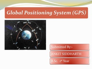
- 1. Global Positioning System (GPS) Submitted By:- ANKIT SIDDHARTH B.Sc. 1st Year
- 4. What Is GPS? Satellite based navigation system. Based on a constellation of about 24 satellites Developed by United States, Department of Defence (DOD)
- 5. What Is GPS? Can provide accurate positioning 24 hours a day, anywhere in the world. No subscription fees or setup charges to use GPS. GPS satellites also called NAVSTAR, the official U. S. DOD name for GPS.
- 6. Structure Space Segment Control Segment User Segment
- 7. How GPS Determines A Location
- 8. How GPS Determines A Location Things which need to be determined: Current Locations of GPS Satellites The Distance Between Receiver’s Position and The GPS Satellites
- 9. Current Locations of GPS Satellites GPS Satellites are orbiting the earth at an altitude of 11,000 Miles The orbits, and the locations of the satellites, are known in advance. GPS receivers store this orbit information for all of the GPS satellites in an ALMANAC*. *THE ALMANAC IS A FILE WHICH CONTAINS POSITIONAL INFORMATION FOR ALL OF THE GPS SATELLITES.
- 10. All 24 satellites are divided into 6 parts. There are 4 satellites in each part. A definite orbit is defined for each part. Each of these 3,000- to 4,000- pound solar-powered satellites.
- 11. DISTANCE BETWEEM RECEIVER’S POSITION & THE GPS SATELLITES •By measuring the amount of time taken by radio signal (the GPS signal) to travel from the satellite to the receiver. •Radio waves travel at the speed of light, i.e. about 186,000 miles per second. •The distance from the satellite to the receiver can be determined by the formula “distance = speed × time”.
- 12. GPS ERROR BUDGET Different errors can cause a deviation of +/- 50 – 100 meters from the actual GPS receiver position which are : ATMOSPHERIC CONDITIONS: •Speed of GPS signal is affected by ionosphere and troposphere. •Which cause a deviation of 0 to 30 m. from the actual position of receiver.
- 13. EPHEMERIS ERRORS: •The predicted changes in the orbit of a satellite. •Which cause a deviation of 0 to 5 m. from the actual position of receiver. CLOCK DRIFT: •Due to different code generations in satellite and receiver simultaneously. •Which cause a deviation of 0 to 1.5 m. from the actual position of receiver.
- 14. MULTIPATH: •Bouncing of a GPS signal due to a reflecting surface before reaching to receiver antenna. •Which cause a deviation of 0 to 1 m. from the actual position of receiver.
- 15. MEASURING GPS ACCURACY The geometry of the constellation is evaluated by Dilution Of Precision, DOP. DOP
- 17. Name Launch Date NAVSTAR 64 (USA 206) August 17, 2009 NAVSTAR 63 (USA 203) March 24, 2009 NAVSTAR 62 (USA 201) March 15, 2008 NAVSTAR 61 (USA 199) December 20, 2007 NAVSTAR 60 (USA 196) October 17, 2007 NAVSTAR 59 (USA 192) November 17, 2006 NAVSTAR 58 (USA 190) September 25, 2006 NAVSTAR 57 (USA 183) September 26, 2006 NAVSTAR 56 (USA 180) November 6, 2004 NAVSTAR 55 (USA 178) June 23, 2004 NAVSTAR 54 (USA 177) March 20, 2004 NAVSTAR 53 (USA 175) December 21, 2003 NAVSTAR 52 (USA 168) March 31, 2003 GPSOperationalSatellites
- 18. GPSOperationalSatellites Name Launch Date NAVSTAR 51 (USA 166) January 29, 2003 NAVSTAR 50 (USA 156) January 30, 2001 NAVSTAR 49 (USA 154) November 10, 2000 NAVSTAR 48 (USA 151) July 16, 2000 NAVSTAR 47 (USA 150) May 11, 2000 NAVSTAR 46 (USA 145) October 7, 1999 NAVSTAR 44 (USA 134) November 6, 1997 NAVSTAR 43 (USA 132) July 23, 1997 NAVSTAR 39 (USA 128) September 12, 1996 NAVSTAR 38 (USA 126) July 16, 1996 NAVSTAR 37 (USA 117) March 28, 1996 NAVSTAR 36 (USA 100) March 10, 1994
- 19. THANK YOU