River Bank Erosion, Risk Assessment and Communication planning fot communitti...
Protecting Communities from Flood Risk
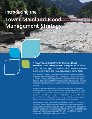
1. A new initiative is underway to develop a Lower
Mainland Flood Management Strategy to better protect
communities along the lower Fraser River and coast – from
Hope to Richmond and from Squamish to White Rock.
Partners in this inter-jurisdictional initiative have responsibilities or interests
that relate to flood management: the Government of Canada, the Province
of British Columbia, 25 local governments, and other entities in the region,
including those focused on transportation systems, agriculture and business.
The Fraser Basin Council serves as program manager and facilitator of the
process.
The Flood Management Strategy will identify opportunities to strengthen
flood management policies and practices as well as flood protection works
across the Lower Mainland. An integrated, collaborative approach to flood
protection is critically important, given the flood risks that Lower Mainland
communities face and given that a major flood would have serious social,
economic and environmental consequences for the entire region.
There are two phases to the strategy development. Phase 1 (2014-2015)
will build a better understanding of flood hazards in the Lower Mainland,
identify flood vulnerabilities across the region, and assess flood management
practices and policies from a regional perspective. In Phase 2 (2016 forward),
a strategy will be developed, based on the work from Phase 1, and will
include options for funding and implementation.
Introducing the
Lower Mainland Flood
Management Strategy
2. Most years there is flood, or risk of
flood, somewhere in British Columbia.
Communities in the Lower Mainland
are vulnerable to both river and coastal
flooding and related risks, such as
erosion, landslides and tsunami. The
risks of catastrophic loss from a major
flood are highest in the Lower Mainland
because the region has a large
population and significant infrastructure
of regional, provincial and national
importance situated in the floodplain.
The Fraser Valley and other parts of
the Fraser Basin have experienced two
major Fraser River floods of record, the
largest in 1894 and the second largest
in 1948.
Most of the flood protection works in
place today were constructed by the
federal-provincial Fraser River Flood
Control Program between 1968 and
1995. Updated modelling on the Fraser
River in 2006 revealed that dikes in the
Lower Mainland were too low to protect
against a Fraser River flood of record.
In 2007 the region faced a significant
threat of flood during spring freshet.
Communities gained access to
provincial funding for dike upgrades and
other urgent flood protection projects.
While flood protection has been
increased in specific Lower Mainland
locations through this and subsequent
investments, more work is required to
address region-wide vulnerabilities.
Today there is evidence that flood
hazards are changing as a result of sea
level rise, storm surge, extreme rainfall
and changes in river hydrology. In BC,
the base sea level is projected to rise by
about one metre by 2100, and possibly
higher in the years that follow.
The Flood Management Strategy will
allow authorities to stay current on the
nature of the flood risk, identify the
areas most vulnerable to flood, and
take actions that are cost-effective and
that protect the entire region.
The Face of Flood in the
Lower Mainland
A recent study by the Province of
BC indicates that the magnitude
and frequency of large floods along
the Fraser, from Hope to the river
mouth, will significantly increase
due to sea level rise and climate
change. The report notes that, by
the end of this century, a one in
50-year flood could be similar in
magnitude to floods that currently
have a return period of 200 or
500 years.
– Simulating the Effects of Sea Level
Rise and Climate Change on Fraser
River Flood Scenarios (2014)
A major flood in the Lower Mainland
is a threat to public health and safety,
and could result in billions of dollars in
damage to private and public property,
loss of infrastructure and community
services, disruption of business and
trade, degradation of water quality
and harmful environmental impacts.
RISKS TO INFRASTRUCTURE
Critical infrastructure in the Lower
Mainland is vulnerable to flooding.
There are risks to ports, airports,
highways, bridges, ferry terminals,
oil and gas pipelines, as well as
hydro-electricity, telecommunications,
water and wastewater infrastructure.
Most Lower Mainland communities
depend on common infrastructure. A
large magnitude flood is therefore likely
to affect a significant portion of the
region’s population (more than half of
the BC population), directly or indirectly
and disrupt local, regional, provincial
and national economic activity.
Financial liabilities or hardship may
also arise for government, the private
sector, and residents related to disaster
response and recovery.
3. KEY ELEMENTS OF THE STRATEGY
Phase 1 (2014-2015) of the Lower Mainland Flood Management Strategy sets
these priorities:
1. Analysis of Multiple Flood Scenarios. The project is analyzing a range of possible
flood scenarios in the Lower Mainland and the projected water levels for each scenario
to gain a more complete understanding of the risks.
2. Regional Assessment of Flood Vulnerabilities, Consequences and Costs.
The project is identifying the areas of greatest vulnerability to flood, and the impacts,
consequences and overall costs of a catastrophic flood.
3. Effectiveness of Flood Protection, Policies and Plans. The project is reviewing
the condition of flood protection works and effectiveness of current flood-proofing
measures, bylaws and floodplain management across the region. The focus is on
opportunities for improvement, both at a local and regional level.
Phase 2 (2016 forward) will develop a regional strategy and action plan,
including recommendations for a secure, sustained funding model.
PHASE 1 OUTCOMES
1. A better understanding of flood hazards
Decision-makers will benefit from a better understanding of a range of potential flood
scenarios for the Lower Mainland now and in future. The project is using hydraulic modelling
and technical analysis for these scenarios, considering both spring freshet and winter
coastal flood risks, and taking into account different peak flows, sea level rise and storm
surge events.
2. Identification of flood vulnerabilities across the region
Phase 1 work will also identify the social and economic consequences of a large flood event
in the Lower Mainland. The aim is to help the responsible authorities better understand the
benefits of investing in flood mitigation and to weigh priorities for that investment. Examples
of impacts that will be assessed:
• Direct flood damages by sector (e.g., residential, business, infrastructure, agriculture)
• Economic losses associated flood damage and disruption of infrastructure
• Population displacement or other impacts on residents (e.g., demand for emergency
services, loss of critical utilities infrastructure and loss of access to employment).
3. Regional assessment of current flood infrastructure, management
practices and policies
The project will document and analyze current flood management practices and policies on
a region-wide basis to help identify best practices and priorities for
capital investments.
In 2013 the Fraser Basin Council
undertook extensive consultations to
ascertain interest in, and support for,
a regional, collaborative approach
to flood management in the Lower
Mainland. Thanks to strong support
and input, FBC prepared a business
plan setting out the steps leading to
a strategy.
The Lower Mainland Flood
Management Strategy now
has participation and support
of the Government of Canada,
the Province of BC, 25 local
governments in the Lower Mainland
and other regional interests: see
page 4.
The development of a common
strategy will help all Lower Mainland
decision-makers identify and
address knowledge gaps, identify
priorities, coordinate efforts,
avoid duplication, and ensure
that flood protection strategies in
one area will not have unintended
adverse impacts for neighbouring
communities. Recognizing that all
communities are interdependent in
the face of flood, the emphasis is on
on developing strategies that protect
the entire region, including a plan to
prioritize, fund and implement flood
protection actions.
Benefits of a
Regional Flood Strategy
4. THE NEXT STEPS
The Lower Mainland Flood Management Strategy is an
inter-jurisdictional, collaborative and integrated approach to flood
management for all communities in the region.
Flood management is, in essence, risk management. The strategy will help
decision-makers in all orders of government, together with those in other
public and private sector entities, identify risks and vulnerabilities, develop
effective policies and practices, and make optimal investments in flood
protection works across the Lower Mainland.
The lessons learned and best practices that emerge from this strategy will
also help other communities and regions in BC.
The Fraser Basin Council will make progress reports and a final report at the
end of Phase 1 in 2015 on behalf of all partners in the initiative.
For more information, contact:
Steve Litke, Senior Program Manager
Fraser Basin Council
T: 604 488-5358
E: slitke@fraserbasin.bc.ca
W: www.fraserbasin.bc.ca
The Fraser Basin Council (FBC) is a charitable non-profit organization
that brings people together to advance sustainability in the Fraser River
Basin and across British Columbia.
Partners in the
Lower Mainland Flood
Management Strategy
as of July, 2014
Government of Canada
Province of BC:
• BC Ministry of Justice
(Emergency Management BC)
• BC Ministry of Forests, Lands and
Natural Resource Operations
• BC Ministry of Transportation and
Infrastructure
• BC Ministry of Environment
Lower Mainland Local Governments:
• City of Abbotsford
• Village of Belcarra
• City of Burnaby
• City of Chilliwack
• City of Coquitlam
• Corporation of Delta
• Fraser Valley Regional District
• District of Hope
• District of Kent
• Township of Langley
• Village of Lions Bay
• District of Maple Ridge
• City of New Westminster
• City of North Vancouver
• District of North Vancouver
• City of Pitt Meadows
• City of Port Coquitlam
• City of Port Moody
• City of Richmond
• District of Squamish
• City of Surrey
• City of Vancouver
• Metro Vancouver
• District of West Vancouver
• City of White Rock
Other Entities:
• BC Agriculture Council
• BC Wharf Operators Association
• Canadian National Railway
• Canadian Pacific Railway
• Greater Vancouver Gateway Council
• Pacific Institute for Climate Solutions
• Port Metro Vancouver
• Simon Fraser University (ACT)
• TransLink
• Vancouver International Airport