
Recommended
Recommended
More Related Content
Similar to Srikanth-PhD- PRE VIVA.pptx
Similar to Srikanth-PhD- PRE VIVA.pptx (20)
Recently uploaded
Recently uploaded (20)
Srikanth-PhD- PRE VIVA.pptx
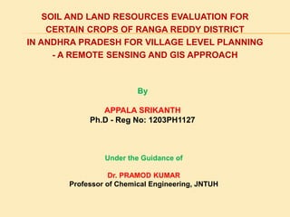
- 1. SOIL AND LAND RESOURCES EVALUATION FOR CERTAIN CROPS OF RANGA REDDY DISTRICT IN ANDHRA PRADESH FOR VILLAGE LEVEL PLANNING - A REMOTE SENSING AND GIS APPROACH By APPALA SRIKANTH Ph.D - Reg No: 1203PH1127 Under the Guidance of Dr. PRAMOD KUMAR Professor of Chemical Engineering, JNTUH
- 2. INTRODUCTION The soil and land resource inventory at regional and state level are providing a basis for blanket recommendation of various package of practice including fertilizer as other inputs. The inherent diversity in soils and the adopted practices with intensive apply, the soils are evidently expressing numerous, complex problems, which are identified at different stages. Further, it is becoming difficult to provide solution at later stages. The multi pronged problems of intensive cropping are very diversified in nature and manifesting physically, chemically, biologically and ultimately nutritionally, the blanket recommendations are not providing a suite of solutions.
- 3. Considering this fact with a view to asses the site specific constraints and provide potential for development and remediation, the present study is planned taking village as a unit. Approach is in consonance with the village land use planning in this entire village soil and land resources are systematically accounted and prepared a resource inventory, which act as ready reference reckoned for any planning activity for the development and improvement of village soil and land resources further. The entire study work encompass in accounting of the soil and land resources, which is providing a medium for the crop growth.
- 4. Essential soil and land resources of Chanvelly village are diversified in nature and characteristics in supplying nutrients and providing necessary anchorage for the crop growth and development. There are number of variations in growth and disparities in the packages adopted by farmers. Vary little attention was paid to study of the soils of this area of Ranga Reddy district. Most of the studies conducted earlier were only broad based and were conducted as a part of their study of soils of country or state. So, it is essential to understand the land suitability for certain crops of Chanvelly village of Ranga Reddy district
- 5. LOCATION MAP OF THE STUDY
- 6. DESCRIPTION OF THE STUDY AREA The Study area Chanvally village lies 7 km away from mandal headquarter Chavalla of Ranga Reddy district, Telangana state . This study area located between 17o15' and 17o16' North latitudes and 79o05' and 77o06' East longitudes. Geographical Area: 7493(sq.Km) The village is surrounded by on Bisthapur on the north and Damargidda village on north-east, Pamena village on the east, Ekkireddypally village and Yarrabally village on the south, Thadlapally on south-east village and Ganapur on the western side.
- 7. OBJECTIVES 1. To characterise and classify the soils in the study area, as well as to ascertain the significant soil physical, physico-chemical characteristics, and accessible nutrient status for surface and profile samples. 2. Evaluation of Soil suitability for few selected crops based on its physical and chemical properties. 3. Identification and assessment of soil related constraints i.e. physical, chemical and other nutritional constraints of crop production.
- 8. MATERIALS AND METHODS An investigation entitled “Soil and land resources evaluation for certain crops of Chanvelly village of Rangareddy district in Telangana state for village level planning-a methodological approach” was carried out in Chanvelly village For this study, soil samples were collected from fifteen profiles. The profiles were opened up to parent material or greater then 1.0 m depth and described for morphological characteristic as per the procedure given in the USDA soil survey manual (Soil Survey Staff, 1998). The particulars relating to the general description of the area, geographical setting of the study area viz., relief, drainage, climate, geology, collection and preparation of soil and plant samples and the analytical methods adopted in the investigation.
- 9. COLLECTION AND PROCESSING OF SOIL AND PLANT SAMPLES Soil samples were collected from each horizon of the fifteen profiles. Surface samples numbering forty were also collected randomly from the sites of interest. The samples were air dried, pounded with wooden pestle and were passed through 2 mm sieve. Particles greater than 2mm were considered as gravel. The sieved soil samples were used for determination of mechanical composition, bulk density, and physico-chemical and chemical properties. Undisturbed samples were collected from each horizon using brass cylinders of 15 cm height and 5 cm diameter for determining hydraulic conductivity and metal cores of 5 cm diameter and 5 cm height for bulk density estimations. Plant samples collected from identified profile and surface soil sampling fields. Two plant samples were collected to represent each pedon and a total of 30 plant samples of various crops were taken from study area. The samples were air dried for two days afterwards oven dried for one day at 50oC. The samples are grinded with plant sample grinder to pass throw 40 mesh sieve.
- 10. DATA PRODUCTS USED Development of Land suitability needs baseline data, thematic data, topographic data and collateral data. All such data products are derived and extracted through various sources which are given in the following table. Type of Data Source of Data Toposheets (1:50,000 Scale) SOI (Survey of India), Hyderabad Agricultural and Water Resources data AP Irrigation Departments and district Agricultural office Census data Bureau of Economics and Statistics (BES), Hyderabad Meteorological Data Indian Meteorological Department (IMD) Development of soil and water suitability criteria Jawaharlal Nehru Technological University Hyderabad. Software used Autocad, ArcGIS 9.1 ESRI – New Delhi
- 12. EXPERIMENTAL ANALYSIS Results of the analysis of morphological, physical and chemical characteristics of 40 surface samples representing different physiographic units and 15 pedons. 30 plant samples representing nutrient content in various crops of study area are presented under the following headings. Characterization of soils Physico-chemical properties Fertility status Nutrient content of plant samples Major soil constraints Soil classification Land evaluation and soil-site suitability
- 13. CHARACTERIZATION OF SOILS Description of profiles Morphological properties PHYSICO-CHEMICAL PROPERTIES Gravel Particle Size Distribution Sand Silt Clay Soil textural class Bulk density Saturated hydraulic conductivity (Ks) Moisture retention Soil reaction Electrical conductivity Cation exchange capacity Exchangeable cat ions Base saturation
- 14. FERTILITY STATUS PHYSICO-CHEMICAL PROPERTIES Soil reaction Electrical conductivity Cation Exchange Capacity (CEC) Exchangeable Cations Free calcium carbonate Chemical properties Organic carbon Available Nitrogen Available Phosphorus Available Potassium Available sulphur Available Micronutrients Nutrient status Nutrient content of plant samples Major soil constraints Soil classification Land evaluation and soil-site suitability
- 15. CLIMATIC DATA
- 16. PHYSICO-CHEMICAL PROPERTIES OF SOILS Profile Samples
- 17. Profile Samples
- 18. Surface Samples
- 19. ANALYSIS RESULTS: PARTICLE SIZE DISTRIBUTION OF SOILS Profile Samples
- 20. Profile Samples
- 21. Surface Samples
- 22. BULK DENSITY, HYDRAULIC CONDUCTIVITY AND MOISTURE RETENTION OF SOILS
- 24. EXCHANGEABLE CATIONS AND BASE SATURATION OF SOILS Profile Samples
- 25. Profile Samples
- 26. Surface Samples
- 27. ORGANIC CARBON AND AVAILABLE NUTRIENT CONTENT OF SOILS Profile Samples
- 28. Profile Samples
- 29. Surface Samples
- 30. SECONDARY NUTRIENTS AND CACO3 CONTENT OF SOILS Profile Samples
- 31. Profile Samples
- 32. AVAILABLE MICRONUTRIENT CONTENT OF SOILS Profile Samples
- 33. Profile Samples
- 34. SurfaceSample s
- 35. NITROGEN, PHOSPHOROUS AND POTASSIUM CONTENT IN PLANT SAMPLES
- 36. DESCRIPTION OF THE PROFILE
- 38. ORGANIC CARBON STATUS AVAILABLE NITROGEN STATUS
- 39. AVAILABLE PHOSPHORUS STATUS AVAILABLE POTASSIUM STATUS
- 40. AVAILABLE SULPHUR STATUS AVAILABLE ZINC STATUS
- 42. PARTICLE SIZE DISTRIBUTION OF THE SOILS
- 48. LAND EVALUATION Soil-site suitability evaluation for crops Soil suitability for major crop growing was evaluated based on FAO frame work (1976) for land evaluation. It involved formulation of climatic and soil requirements of crop and ratings of these parameters viz., highly suitable (S1), moderately suitable (S2), marginally suitable (S3) and unsuitable (N) for agriculture. Soil-site suitability for some of the major crops was evaluated based on the criteria suggested by Sehgal (1996) and Sys et al. (1991). Simple and maximum limitation method for land evaluation In this method land characteristics (or qualities) are compared with the crop requirements and the land class is attributed according to the less favourable characteristics or quality. The methodology suggests an evaluation of the climatic characteristics in the first place with an ultimate aim of one class level to be introduced in the total evaluation. The relationship between land classes or suitability classes and limitations are given below. Limitations Suitability class (land class) 0 : No S1 : Highly suitable 1 : Slight S2 : Moderately suitable 2 : Moderate S3 : Marginally suitable 3 : Severe N1 : Temporarily Unsuitable 4 : Very severe N2 : Permanently unsuitable
- 49. SOIL SITE SUITABILITY EVALUATION FOR PADDY
- 50. SOIL SITE SUITABILITY EVALUATION FOR CHILLI
- 51. SOIL SITE SUITABILITY EVALUATION FOR CABBAGE
- 52. SOIL SITE SUITABILITY EVALUATION FOR TOMATO
- 53. SOIL SITE SUITABILITY EVALUATION FOR COTTON
- 54. SOIL SITE SUITABILITY EVALUATION FOR REDGRAM
- 56. COMPARATIVE EVALUATION FOR PADDY
- 57. COMPARATIVE EVALUATION FOR CHILLI
- 58. COMPARATIVE EVALUATION FOR CABBAGE
- 59. COMPARATIVE EVALUATION FOR TOMATO
- 60. COMPARATIVE EVALUATION FOR COTTON
- 61. COMPARATIVE EVALUATION FOR REDGRAM
- 62. SUITABILITY CRITERIA FOR PADDY AND CHILLI
- 63. SUITABILITY CRITERIA FOR CABBAGE AND TAMATO
- 64. SUITABILITY CRITERIA FOR COTTON AND REDGRAM
- 65. SUMMARY AND CONCLUSIONS The present study was carried out with specific objectives of characterization and classification of soils of Chanvelly village of Ranga Reddy district in order to assess their suitability for paddy, chili, cabbage, tomato, cotton and red gram crops. The investigation consisted of study of morphological characteristics of soil profiles in the field and analysis of soil samples in the laboratory. The soils were finally classified as per the USDA system of soil taxonomy.
- 66. The soils were described in the field for their morphological properties and later characterized in the laboratory for their physical and chemical properties and classified up to family level in the Chanvelly village. Soil site suitability for some important crops was also evaluated in the study area. In between profiles, forty surface samples (0-30 cm) were drawn from the field and analyzed for fertility status. Thirty plant samples collected from study area and analyzed for nutrients like N, P & K and analyzed nutrient content of plant samples in relation to availability in soil. The findings of the investigations are summarized below. Fifteen soil profiles representing the study area were selected based on the topography from various physiolographic units identified in the area by field survey.
- 67. Depth of the soils ranged from shallow to very deep, the solum thickness increased from upper to the lower slopes in the study area. The colour of the soils varied from reddish brown to dark brown in uplands, this was found to be influenced mainly by the type of parent material, low organic matter content, warmer temperature regime and moderately high rainfall existing in the area. The colour varied from very pale brown to very dark grayish brown in lowlands. While might be influenced by the topography and impeded drainage in the sub-surface layers. The texture of soils was found to vary from sandy clay loam to clayey. The texture of lowland physiographic units was finer than upland and midlands mainly due to lateral movement of finer fractions from uplands and midlands.
- 68. Presence of argillic horizon was noticed in upland pedons ( pedon 1, 2 & 3 ) and midland pedons ( pedon 6 & 12)due to downward translocation of clay and its deposition in the sub- surface horizons, whereas Cambic horizon was found on lowlands and other midland soils. The common structure of study area was granular to sub- angular blocky in surface horizons except pedon 15. Surface horizon structure of pedon 15 was angular blocky. Soil reaction of upland soils was mostly neutral which is attributed to the presence of leaching of bases from the soil along with runoff and drainage water due to moderately high rainfall existing in the area. In lowlands, the soil reaction was neutral to slightly alkaline due to deposition of bases from the upland physiographic units.
- 69. The electrical conductivity of all the pedons was very negligible, which indicates non-saline nature. The organic carbon content in all the pedons vary between low to medium due to low vegetative cover (except P1, P5, P14 and P10). The soil erosion and warmer climate leading to low accumulation of organic carbon in the study area. The pedon 1, 5, 14 and 15 having high organic carbon content. The cation exchange capacity of the soil varied from low to medium. The upland physiographic units were low in cation exchange capacity values than midlands and lowlands owing to their low clay content, low organic matter, whereas lowlands exhibited moderate CEC values due to higher clay content. In all the pedons, calcium was most dominant cation followed by magnesium throughout the profile. The upland pedons have low exchangeable cations than lowland counterparts, because of excessive drainage from uplands. The base saturation was found to be between medium (uplands) to high (lowlands) in the study area due to variation in the texture and physiography.
- 70. Based on morphological, physical, physico-chemical and meteorological data, the soils of Chanvelly village of Ranga Reddy district, were classified upto family level as follows. Pedon Soil classification Pedon 1, 2, 3, 6 and 12 Fine loamy, mixed, Hyperthermic, Udic Haplustalfs Pedon 4 and 5 Fine loamy, mixed, Hyperthermic, Udic Ustorthents Pedon 7, 8,9,10, 11&13 Fine loamy, mixed, Hyperthermic, Udic Haplustepts Pedon 14 and 15 Fine, Clayey, mixed, Hyperthermic, Typic Halplusterts
- 71. Land capability classification was done based on the inherent soil characteristics, external land features and environmental factors. There are four land capability subclasses in the study area, viz., IIIsf , IVW, IVS and IVSt. The physiographic units of study area matched with the suitability for important crops like paddy, chili, cabbage, tomato, cotton and red gram crops. Most of the upland was marginally suitable or not suitable for rice, cabbage, tomato and cotton crops due to slope, depth, drainage and texture. The upland pedons 1 and 2 are moderately suitable to chilli and red gram with limitations of slope, coarse fragments, and organic carbon. Most of the midlands were moderately suitable for chilli, cabbage and red gram and marginally suitable for rice, tomato and cotton with limitation of depth, coarse fragments, organic carbon and soil reaction.
- 72. The low land pedons 14 and 15 were marginally suitable for these crops due to poor drainage were as lowland pedon 13 was moderately suitable for chilli, cabbage and cotton and marginally suitable for rice, tomato and cotton due to impeded drainage. Major soil constraints for crop production are slope, erosion, depth, coarse fragments, drainage, organic carbon, soil reaction and calcium carbonate, considering these constraints recommendations were suggested in the way to achieve sustainable yields and also maintains the soil health with out deterioration of future generations. In this study on the basis of nutrient availability limitations, all the pedons are low in nitrogen, phosphorous and potassium except 7, 8, 10, 13, 14 and 15 and while these pedons showing limitations of either nitrogen and phosphorous. Further the pedons 4, 5, 9, 11, 12 and 14 are exhibiting sulphur deficiency, and in the entire survey 66 percentage of pedons showing zinc deficiency. Considering the availability, the site-specific nutrient management strategies are recommended for harvesting good yields of crops.
- 73. THANK YOU
- 77. SATELLITE IMAGE OF RANGA REDDY DIST
- 83. GEOMORPHOLOGY MAP OF RANGA REDDY DISTRICT
- 84. LAND USE LAND COVER MAP OF RANGA REDDY DISTRICT