SlideShare a Scribd company logo
1 of 7
Magnitude 7.9 earthquake 
Aleutian Islands, U.S. 
Monday 23 June 2014 at 20:53:09 UTC 
A magnitude 7.9 earthquake occurred in the remote Aleutian Islands region of Alaska. The 
earthquake occurred at an intermediate depth of 108 km (67 miles). An initial tsunami advisory 
was given but later cancelled for coastal Alaska. After the initial tsunami warning, the town of 
Adak evacuated its 150 residents to a shelter. However, there are no initial reports of damage 
or injuries. The deep nature of the earthquake was probably not favorable for the generation 
of a large tsunami. The earthquake was followed by a number of large aftershocks.
Magnitude 7.9 earthquake 
Aleutian Islands, U.S. 
Monday 23 June 2014 at 20:53:09 UTC 
Where was the earthquake felt? 
Modified Mercalli Intensity Scale 
I. 
Instrumental 
Not felt by many people unless in favourable conditions. 
II. Weak Felt only by a few people at best, especially on the upper floors of buildings. Delicately 
suspended objects may swing. 
III. Slight Felt quite noticeably by people indoors, especially on the upper floors of buildings. 
Many to do not recognise it as an earthquake. Standing motor cars may rock slightly. 
Vibration similar to the passing of a truck. Duration estimated. 
IV. Moderate Felt indoors by many people, outdoors by a few people during the day. At night, some 
awakened. 
V. Rather 
Strong 
Felt outside by most, may not be felt by some people in non-favourable conditions. 
Dishes and windows may break and large bells will ring. Vibrations like train passing 
close to house. 
VI. Strong Felt by all; many frightened and run outdoors, walk unsteadily. Windows, dishes, 
glassware broken; books fall off shelves; some heavy furniture moved or overturned; a 
few instances of fallen plaster. Damage slight. 
VII. Very 
Strong 
Difficult to stand; furniture broken; damage negligible in building of good design and 
construction; slight to moderate in well-built ordinary structures; considerable damage 
in poorly built or badly designed structures; some chimneys broken. Noticed by people 
driving motor cars. 
VIII. 
Destructive 
Damage slight in specially designed structures; considerable in ordinary substantial 
buildings with partial collapse. Damage great in poorly built structures. Fall of chimneys, 
factory stacks, columns, monuments, walls. Heavy furniture moved. 
IX. Violent General panic; damage considerable in poorly designed structures, well designed 
frame structures thrown out of plumb. Damage great in substantial buildings, with 
partial collapse. Buildings shifted off foundations. 
X. Intense Some well build wooden structures destroyed; most masonry and frame structures 
destroyed with foundation. Rails bent. 
XI. Extreme Few, if any masonry structures remain standing. Bridges destroyed. Rails bent greatly. 
XII. 
Cataclysmic 
Total destruction – everything is destroyed. Lines of sight and level distorted. Objects 
thrown into the air. The ground moves in waves or ripples. Large amounts of rock move 
position. Landscape altered, or leveled by several meters. In some cases, even the 
routes of rivers are changed. 
The Modified-Mercalli intensity scale indicates the severity of 
ground shaking. 
Strong shaking (VII) would have been felt throughout the Rat 
Islands area of the Aleutian Islands, although due to the 
minimal population density in the region, this strong shaking 
was unlikely to have been felt by many people. 
USGS estimated shaking intensity in the region of 
the M7.9 earthquake
Magnitude 7.9 earthquake 
Aleutian Islands, U.S. 
Monday 23 June 2014 at 20:53:09 UTC 
The Aleutian Islands is a very seismically active region. Since 1900, 26 earthquakes with M7 or greater 
occurred within 250 km of the 2014 earthquake hypocentre. Significant events include an M 8.4 quake in 
1965 and a M 7.9 quake in 1996. The former generated a large tsunami across the Pacific Ocean. There 
was also a M8.4 earthquake in 1906. Most of these large earthquakes occurred at shallower depths than 
the June 23 event. 
Historic seismicity (since 1970) 
showing magnitudes of greater than 
5.5 in the region. Earthquakes are 
coloured by their hypocentral depth. 
The Jun 2014 earthquake epicentre 
is indicated by the red star. 
Earthquake locations from the USGS 
catalogue. 
Past earthquakes in the region
Magnitude 7.9 earthquake 
Aleutian Islands, U.S. 
Monday 23 June 2014 at 20:53:09 UTC 
What caused this earthquake to occur? 
The Aleutian Islands region is seismically active due to the northward subduction (59 - 76 mm/yr) of the 
Pacific plate into the mantle beneath the North America plate along an arc-shaped plate boundary. This 
underthrusting process is responsible for the formation of the Aleutian Islands and the deep-sea Aleutian 
trench. The strongest earthquakes in subduction zones normally occur along the shallow megathrust 
fault due to slip along the interface that separates two plates. Based on its mechanism and depth, the 23 
June earthquake likely occurred as a result of extension within the subducting Pacific slab. 
Tectonic 
setting of the 
central 
Aleutian 
region. The 23 
June 
earthquake is 
given by the 
red star. 
USGS focal mechanism of the 
earthquake indicating oblique 
normal faulting. 
Schematic illustration of 
oblique-normal faulting. 
North America plate 
Aleutian Trench 
Pacific plate 
For more information on Alaska and Aleutian Island 73 mm/yr 
tectonics, see this YouTube video: 
https://www.youtube.com/watch?v=2nMiVd0zo_Y
Magnitude 7.9 earthquake 
Aleutian Islands, U.S. 
Monday 23 June 2014 at 20:53:09 UTC 
Aftershocks 
So far, over 20 aftershocks with magnitude greater than 4.0 have been recorded by the USGS. Most of these 
have been small (M < 5), but the largest aftershock was a magnitude 6.6 earthquake that occurred around 
six hours after after the mainshock. Most aftershocks have so far occurred to the north-west of the 
mainshock epicentre. Further moderate-sized aftershocks can be expected. 
Map of aftershocks recorded 
(orange circles). 
M7. 9 mainshock 
M6.6 aftershock
Magnitude 7.9 earthquake 
Aleutian Islands, U.S. 
Monday 23 June 2014 at 20:53:09 UTC 
Recordings of the earthquake from the British 
Geological Survey seismometer network 
Time of 
earthquake 
First P-wave 
arrivals 
Surface wave 
arrivals 
The first seismic waves took ~13 minutes to travel from Alaska and arrive in the UK
Magnitude 7.9 earthquake 
Aleutian Islands, U.S. 
Monday 23 June 2014 at 20:53:09 UTC 
Find out more … 
• USGS webpage for this earthquakes: 
http://earthquake.usgs.gov/earthquakes/eventpage/usc000rki5#summary 
• Alaska earthquake center: http:// 
www.aeic.alaska.edu 
• BGS (British Geological Survey) – seismology and earthquakes – frequently asked questions 
http://www.earthquakes.bgs.ac.uk/education/faqs/faq_index.html 
• IRIS (Incorporated Research Institutions for Seismology) – learning about earthquakes 
http://www.iris.edu/hq/programs/education_and_outreach/students 
• UK School Seismology Project – classroom activities, videos and support documents 
http://www.bgs.ac.uk/schoolseismology/home.html 
• USGS (United States Geological Survey) – FAQs, glossary, posters, animations 
http://earthquake.usgs.gov/learn/ 
• EMSC (European Mediterranean Seismological Centre) 
http://www.emsc-csem.org/

More Related Content

What's hot

Earthquake and earthquake resistant design
Earthquake   and earthquake resistant designEarthquake   and earthquake resistant design
Earthquake and earthquake resistant designPARVEEN JANGRA
 
Geography minor hazards by ajohn
Geography minor   hazards by ajohnGeography minor   hazards by ajohn
Geography minor hazards by ajohnTom McLean
 
Earthquakes and faults (Grade 8 Lesson)
Earthquakes and faults (Grade 8 Lesson) Earthquakes and faults (Grade 8 Lesson)
Earthquakes and faults (Grade 8 Lesson) Riya Duran
 
Faults and earthquakes
Faults and earthquakesFaults and earthquakes
Faults and earthquakessssshekhar
 
Türkiye and earthquakes
Türkiye and earthquakesTürkiye and earthquakes
Türkiye and earthquakesFRANCA SORMANI
 
Lesson On Earthquakes Powerpoint.Ppt
Lesson On Earthquakes Powerpoint.PptLesson On Earthquakes Powerpoint.Ppt
Lesson On Earthquakes Powerpoint.Pptbasketballff4
 
Earthquakes And Evs
Earthquakes And EvsEarthquakes And Evs
Earthquakes And Evssjcc
 
Earthquakes Presentation Final
Earthquakes Presentation FinalEarthquakes Presentation Final
Earthquakes Presentation Finalguestfcdf90
 
Tectonics GW 2 Slides (Part 3)
Tectonics GW 2 Slides (Part 3)Tectonics GW 2 Slides (Part 3)
Tectonics GW 2 Slides (Part 3)LEEENNA
 
Earthquakes: An Introduction
Earthquakes: An IntroductionEarthquakes: An Introduction
Earthquakes: An Introductionkevinrchapman
 
Earthquake in Nepal 2015
Earthquake in Nepal 2015Earthquake in Nepal 2015
Earthquake in Nepal 2015Bishal Ghimire
 
3.4.1 Earthquake Hazards
3.4.1 Earthquake Hazards3.4.1 Earthquake Hazards
3.4.1 Earthquake Hazardstudorgeog
 
Study of an earthquake
Study of an earthquake Study of an earthquake
Study of an earthquake Jahangir Alam
 

What's hot (20)

Earthquake and earthquake resistant design
Earthquake   and earthquake resistant designEarthquake   and earthquake resistant design
Earthquake and earthquake resistant design
 
Geography minor hazards by ajohn
Geography minor   hazards by ajohnGeography minor   hazards by ajohn
Geography minor hazards by ajohn
 
Earthquake ppt
Earthquake pptEarthquake ppt
Earthquake ppt
 
Earthquakes and faults (Grade 8 Lesson)
Earthquakes and faults (Grade 8 Lesson) Earthquakes and faults (Grade 8 Lesson)
Earthquakes and faults (Grade 8 Lesson)
 
Earthquake
EarthquakeEarthquake
Earthquake
 
Faults and earthquakes
Faults and earthquakesFaults and earthquakes
Faults and earthquakes
 
Türkiye and earthquakes
Türkiye and earthquakesTürkiye and earthquakes
Türkiye and earthquakes
 
Lesson On Earthquakes Powerpoint.Ppt
Lesson On Earthquakes Powerpoint.PptLesson On Earthquakes Powerpoint.Ppt
Lesson On Earthquakes Powerpoint.Ppt
 
Earthquake
Earthquake Earthquake
Earthquake
 
Earthquakes And Evs
Earthquakes And EvsEarthquakes And Evs
Earthquakes And Evs
 
Earthquakes
EarthquakesEarthquakes
Earthquakes
 
Earthquakes Presentation Final
Earthquakes Presentation FinalEarthquakes Presentation Final
Earthquakes Presentation Final
 
Tectonics GW 2 Slides (Part 3)
Tectonics GW 2 Slides (Part 3)Tectonics GW 2 Slides (Part 3)
Tectonics GW 2 Slides (Part 3)
 
Earthquake
EarthquakeEarthquake
Earthquake
 
Earthquakes: An Introduction
Earthquakes: An IntroductionEarthquakes: An Introduction
Earthquakes: An Introduction
 
Eq tips full
Eq tips fullEq tips full
Eq tips full
 
Earthquakes
EarthquakesEarthquakes
Earthquakes
 
Earthquake in Nepal 2015
Earthquake in Nepal 2015Earthquake in Nepal 2015
Earthquake in Nepal 2015
 
3.4.1 Earthquake Hazards
3.4.1 Earthquake Hazards3.4.1 Earthquake Hazards
3.4.1 Earthquake Hazards
 
Study of an earthquake
Study of an earthquake Study of an earthquake
Study of an earthquake
 

Viewers also liked

Trade show booth design
Trade show booth designTrade show booth design
Trade show booth designcatalys19
 
Informe Visita de Trabajo Misionero a Filipinas oct 2015
Informe Visita de Trabajo Misionero a Filipinas oct 2015Informe Visita de Trabajo Misionero a Filipinas oct 2015
Informe Visita de Trabajo Misionero a Filipinas oct 2015Mfc Nacional
 
Bai 39 lop 11
Bai 39 lop 11Bai 39 lop 11
Bai 39 lop 11Minh Thu
 
The implications of innovation in e-government and communication strategy in ...
The implications of innovation in e-government and communication strategy in ...The implications of innovation in e-government and communication strategy in ...
The implications of innovation in e-government and communication strategy in ...Dr Beige Pureau
 
My (entire) day at a government office
My (entire) day at a government officeMy (entire) day at a government office
My (entire) day at a government officeLeon Irigoyen
 
Cooling tower, chilling plants ppt
Cooling tower, chilling plants pptCooling tower, chilling plants ppt
Cooling tower, chilling plants pptRajesh Patil
 

Viewers also liked (10)

Trade show booth design
Trade show booth designTrade show booth design
Trade show booth design
 
Prezi defining
Prezi definingPrezi defining
Prezi defining
 
Tti success insights international c group
Tti success insights international c groupTti success insights international c group
Tti success insights international c group
 
Informe Visita de Trabajo Misionero a Filipinas oct 2015
Informe Visita de Trabajo Misionero a Filipinas oct 2015Informe Visita de Trabajo Misionero a Filipinas oct 2015
Informe Visita de Trabajo Misionero a Filipinas oct 2015
 
Bai 39 lop 11
Bai 39 lop 11Bai 39 lop 11
Bai 39 lop 11
 
The implications of innovation in e-government and communication strategy in ...
The implications of innovation in e-government and communication strategy in ...The implications of innovation in e-government and communication strategy in ...
The implications of innovation in e-government and communication strategy in ...
 
My (entire) day at a government office
My (entire) day at a government officeMy (entire) day at a government office
My (entire) day at a government office
 
приглашение на обучение
приглашение на обучениеприглашение на обучение
приглашение на обучение
 
Planetary seismology
Planetary seismologyPlanetary seismology
Planetary seismology
 
Cooling tower, chilling plants ppt
Cooling tower, chilling plants pptCooling tower, chilling plants ppt
Cooling tower, chilling plants ppt
 

Similar to Alaska 230614 (20)

Earthquake
EarthquakeEarthquake
Earthquake
 
Tsunami
TsunamiTsunami
Tsunami
 
Dancing of earth – the earthquakes
Dancing of earth – the earthquakesDancing of earth – the earthquakes
Dancing of earth – the earthquakes
 
Inquiry Project 3
Inquiry Project 3Inquiry Project 3
Inquiry Project 3
 
Earthquake Resistance structures
Earthquake Resistance structuresEarthquake Resistance structures
Earthquake Resistance structures
 
Earthquakes!
Earthquakes!Earthquakes!
Earthquakes!
 
Earthquakes 1228796558996940-8
Earthquakes 1228796558996940-8Earthquakes 1228796558996940-8
Earthquakes 1228796558996940-8
 
Earthquakes
EarthquakesEarthquakes
Earthquakes
 
tsunami[1].ppt
tsunami[1].ppttsunami[1].ppt
tsunami[1].ppt
 
Earth quake
Earth quakeEarth quake
Earth quake
 
EarthQuake.pptx
EarthQuake.pptxEarthQuake.pptx
EarthQuake.pptx
 
Earthquake
EarthquakeEarthquake
Earthquake
 
Earthquakes 101
Earthquakes 101Earthquakes 101
Earthquakes 101
 
earthquakeppt-160308191544 (1) (1).pptx
earthquakeppt-160308191544 (1) (1).pptxearthquakeppt-160308191544 (1) (1).pptx
earthquakeppt-160308191544 (1) (1).pptx
 
earthquakeppt-160308191544.pptx
earthquakeppt-160308191544.pptxearthquakeppt-160308191544.pptx
earthquakeppt-160308191544.pptx
 
hi-eew_poster.final
hi-eew_poster.finalhi-eew_poster.final
hi-eew_poster.final
 
Alaska Earthquakes &amp; Tsunami Presentation
Alaska Earthquakes &amp; Tsunami PresentationAlaska Earthquakes &amp; Tsunami Presentation
Alaska Earthquakes &amp; Tsunami Presentation
 
MODULE 1. EARTHQUAKES AND FAULTS..pptx
MODULE 1. EARTHQUAKES AND FAULTS..pptxMODULE 1. EARTHQUAKES AND FAULTS..pptx
MODULE 1. EARTHQUAKES AND FAULTS..pptx
 
The 2015 Nepal earthquake
The 2015 Nepal earthquakeThe 2015 Nepal earthquake
The 2015 Nepal earthquake
 
Geological hazards earthquake unit v
Geological hazards earthquake unit vGeological hazards earthquake unit v
Geological hazards earthquake unit v
 

Alaska 230614

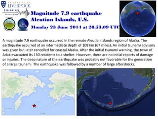
  • 1. Magnitude 7.9 earthquake Aleutian Islands, U.S. Monday 23 June 2014 at 20:53:09 UTC A magnitude 7.9 earthquake occurred in the remote Aleutian Islands region of Alaska. The earthquake occurred at an intermediate depth of 108 km (67 miles). An initial tsunami advisory was given but later cancelled for coastal Alaska. After the initial tsunami warning, the town of Adak evacuated its 150 residents to a shelter. However, there are no initial reports of damage or injuries. The deep nature of the earthquake was probably not favorable for the generation of a large tsunami. The earthquake was followed by a number of large aftershocks.
  • 2. Magnitude 7.9 earthquake Aleutian Islands, U.S. Monday 23 June 2014 at 20:53:09 UTC Where was the earthquake felt? Modified Mercalli Intensity Scale I. Instrumental Not felt by many people unless in favourable conditions. II. Weak Felt only by a few people at best, especially on the upper floors of buildings. Delicately suspended objects may swing. III. Slight Felt quite noticeably by people indoors, especially on the upper floors of buildings. Many to do not recognise it as an earthquake. Standing motor cars may rock slightly. Vibration similar to the passing of a truck. Duration estimated. IV. Moderate Felt indoors by many people, outdoors by a few people during the day. At night, some awakened. V. Rather Strong Felt outside by most, may not be felt by some people in non-favourable conditions. Dishes and windows may break and large bells will ring. Vibrations like train passing close to house. VI. Strong Felt by all; many frightened and run outdoors, walk unsteadily. Windows, dishes, glassware broken; books fall off shelves; some heavy furniture moved or overturned; a few instances of fallen plaster. Damage slight. VII. Very Strong Difficult to stand; furniture broken; damage negligible in building of good design and construction; slight to moderate in well-built ordinary structures; considerable damage in poorly built or badly designed structures; some chimneys broken. Noticed by people driving motor cars. VIII. Destructive Damage slight in specially designed structures; considerable in ordinary substantial buildings with partial collapse. Damage great in poorly built structures. Fall of chimneys, factory stacks, columns, monuments, walls. Heavy furniture moved. IX. Violent General panic; damage considerable in poorly designed structures, well designed frame structures thrown out of plumb. Damage great in substantial buildings, with partial collapse. Buildings shifted off foundations. X. Intense Some well build wooden structures destroyed; most masonry and frame structures destroyed with foundation. Rails bent. XI. Extreme Few, if any masonry structures remain standing. Bridges destroyed. Rails bent greatly. XII. Cataclysmic Total destruction – everything is destroyed. Lines of sight and level distorted. Objects thrown into the air. The ground moves in waves or ripples. Large amounts of rock move position. Landscape altered, or leveled by several meters. In some cases, even the routes of rivers are changed. The Modified-Mercalli intensity scale indicates the severity of ground shaking. Strong shaking (VII) would have been felt throughout the Rat Islands area of the Aleutian Islands, although due to the minimal population density in the region, this strong shaking was unlikely to have been felt by many people. USGS estimated shaking intensity in the region of the M7.9 earthquake
  • 3. Magnitude 7.9 earthquake Aleutian Islands, U.S. Monday 23 June 2014 at 20:53:09 UTC The Aleutian Islands is a very seismically active region. Since 1900, 26 earthquakes with M7 or greater occurred within 250 km of the 2014 earthquake hypocentre. Significant events include an M 8.4 quake in 1965 and a M 7.9 quake in 1996. The former generated a large tsunami across the Pacific Ocean. There was also a M8.4 earthquake in 1906. Most of these large earthquakes occurred at shallower depths than the June 23 event. Historic seismicity (since 1970) showing magnitudes of greater than 5.5 in the region. Earthquakes are coloured by their hypocentral depth. The Jun 2014 earthquake epicentre is indicated by the red star. Earthquake locations from the USGS catalogue. Past earthquakes in the region
  • 4. Magnitude 7.9 earthquake Aleutian Islands, U.S. Monday 23 June 2014 at 20:53:09 UTC What caused this earthquake to occur? The Aleutian Islands region is seismically active due to the northward subduction (59 - 76 mm/yr) of the Pacific plate into the mantle beneath the North America plate along an arc-shaped plate boundary. This underthrusting process is responsible for the formation of the Aleutian Islands and the deep-sea Aleutian trench. The strongest earthquakes in subduction zones normally occur along the shallow megathrust fault due to slip along the interface that separates two plates. Based on its mechanism and depth, the 23 June earthquake likely occurred as a result of extension within the subducting Pacific slab. Tectonic setting of the central Aleutian region. The 23 June earthquake is given by the red star. USGS focal mechanism of the earthquake indicating oblique normal faulting. Schematic illustration of oblique-normal faulting. North America plate Aleutian Trench Pacific plate For more information on Alaska and Aleutian Island 73 mm/yr tectonics, see this YouTube video: https://www.youtube.com/watch?v=2nMiVd0zo_Y
  • 5. Magnitude 7.9 earthquake Aleutian Islands, U.S. Monday 23 June 2014 at 20:53:09 UTC Aftershocks So far, over 20 aftershocks with magnitude greater than 4.0 have been recorded by the USGS. Most of these have been small (M < 5), but the largest aftershock was a magnitude 6.6 earthquake that occurred around six hours after after the mainshock. Most aftershocks have so far occurred to the north-west of the mainshock epicentre. Further moderate-sized aftershocks can be expected. Map of aftershocks recorded (orange circles). M7. 9 mainshock M6.6 aftershock
  • 6. Magnitude 7.9 earthquake Aleutian Islands, U.S. Monday 23 June 2014 at 20:53:09 UTC Recordings of the earthquake from the British Geological Survey seismometer network Time of earthquake First P-wave arrivals Surface wave arrivals The first seismic waves took ~13 minutes to travel from Alaska and arrive in the UK
  • 7. Magnitude 7.9 earthquake Aleutian Islands, U.S. Monday 23 June 2014 at 20:53:09 UTC Find out more … • USGS webpage for this earthquakes: http://earthquake.usgs.gov/earthquakes/eventpage/usc000rki5#summary • Alaska earthquake center: http:// www.aeic.alaska.edu • BGS (British Geological Survey) – seismology and earthquakes – frequently asked questions http://www.earthquakes.bgs.ac.uk/education/faqs/faq_index.html • IRIS (Incorporated Research Institutions for Seismology) – learning about earthquakes http://www.iris.edu/hq/programs/education_and_outreach/students • UK School Seismology Project – classroom activities, videos and support documents http://www.bgs.ac.uk/schoolseismology/home.html • USGS (United States Geological Survey) – FAQs, glossary, posters, animations http://earthquake.usgs.gov/learn/ • EMSC (European Mediterranean Seismological Centre) http://www.emsc-csem.org/