Unlocking the Potential: Deep dive into ocean of Ceramic Magnets.pptx
Streams 101 - Infrastructure Impacts
1. Hudson Estuary Watershed Resiliency Project
www.hudsonestuaryresilience.netBuilding Long-term Resilience to Extreme Weather and Climate Change in the
Hudson Estuary Watershed
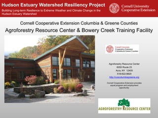
Cornell Cooperative Extension Columbia & Greene Counties
Agroforestry Resource Center & Bowery Creek Training Facility
Agroforestry Resource Center
6055 Route 23
Acra, NY 12405
518-622-9820
http://ccecolumbiagreene.org
Cornell Cooperative Extension provides
equal program and employment
opportunity.
2. Hudson Estuary Watershed Resiliency Project
www.hudsonestuaryresilience.net
An initiative of Cornell Cooperative Extension of
Columbia-Greene, Dutchess and Rockland Counties in
partnership with the NYS DEC Hudson River Estuary
Program, NY Water Resources Institute and Cornell
University with support from the NYS Environmental
Protection Fund.
Hudson Estuary Watershed
Resiliency Project
5. Hudson Estuary Watershed Resiliency Project
www.hudsonestuaryresilience.net
The area of land
in which all
precipitation
(rain, snow, etc.)
that falls on it
drains to a
common
waterway, such
as a stream,
lake, estuary,
wetland, aquifer,
or even the
ocean.
What is a Watershed?
6. Hudson Estuary Watershed Resiliency Project
www.hudsonestuaryresilience.net
Hudson
Watershed
• Hudson River
watershed is 13,390
square miles in size.
• Includes parts of NY,
VT, MA, CT and NJ.
• Land of abundant
freshwater
resources.
• More than 16,000
miles of streams
Hudson
Estuary Watershed
7. Hudson Estuary Watershed Resiliency Project
www.hudsonestuaryresilience.net
What is Resiliency?
The ability to plan for, withstand,
and recover from severe events
- without suffering permanent loss of functions,
devastating damage, diminished productivity or
decreased quality of life.
signsofpolitics.blogspot.com/2009/03/around-and-about-resilience.html
8. Hudson Estuary Watershed Resiliency Project
www.hudsonestuaryresilience.net
Outline
• Why are we here?
• Causes of increased flooding in our
municipalities
• A closer look at what is happening in our
streams
• How we are impacting streams (and
making flooding worse)
• Solutions and Resources
9. Hudson Estuary Watershed Resiliency Project
www.hudsonestuaryresilience.net
Why we are here… Catskill, NY Aug. 28, 2011
alloveralbany.com
Albany, NY
Albany, NY August 5, 2014
10. Hudson Estuary Watershed Resiliency Project
www.hudsonestuaryresilience.net
Why is this happening?
• Increased precipitation
• Land use changes
11. Hudson Estuary Watershed Resiliency Project
www.hudsonestuaryresilience.net
Era of Extreme Weather
The map shows percent
increases in the amount
of precipitation falling in
very heavy precipitation
events (defined as the
heaviest 1% of all daily
events) from 1958 to
2011 for each region.
Source: National Climate Assessment,
2014
Precipitation changes are
occurring now.
12. Hudson Estuary Watershed Resiliency Project
www.hudsonestuaryresilience.net
Say it isn’t so!
Northeast Regional Climate Center, 2003
Cornell Bulletin 1009, July 1966
14. Hudson Estuary Watershed Resiliency Project
www.hudsonestuaryresilience.net
Impervious Surfaces
• Materials like cement, asphalt, roofing, and compacted soil
that prevent water from seeping/percolating into the ground.
16. Hudson Estuary Watershed Resiliency Project
www.hudsonestuaryresilience.netBuilding Long-term Resilience to Extreme Weather and Climate Change in the
Hudson Estuary Watershed
As Impervious Surfaces increase…
• Infiltration
decreases
• Surface
Runoff
increases
17. Hudson Estuary Watershed Resiliency Project
www.hudsonestuaryresilience.net
Subdivision = Impervious Surface Area
• In the Catskill/Delaware
Watersheds, each new
subdivided parcel adds
an average 3,200 sq. ft.
of impervious surface
area within 20 years
(Anderson et al. 2012) 1 parcel
195 acres
ISA: 5,000 ft2
39 parcels
195 acres
ISA: 125,000 ft2
Recall: Losing 10% of forest cover to impervious
surface can double runoff and increase flood
frequency as much as 28%.
In this situation, subdivision resulted in a 25-fold
increase in impervious surface area.
18. Hudson Estuary Watershed Resiliency Project
www.hudsonestuaryresilience.net
Human Impacts on Stream Stability
Roadways, culverts
& ditches
Change in
Land Cover
Floodplain Development
19. Hudson Estuary Watershed Resiliency Project
www.hudsonestuaryresilience.net
What in the World Are We To Do?
• We live in close proximity to streams
and rivers.
• Much of our infrastructure is
vulnerable to flood damage.
• Many of our streams have unstable
reaches due to flooding &/or
development.
• Extreme precipitation events are
increasing the likelihood of flooding.
• We having a growing population and
therefore a demand for more
development.
20. Hudson Estuary Watershed Resiliency Project
www.hudsonestuaryresilience.net
Stream Science & Flood Resiliency
Luna Leopold
Dave Rosgen
21. Hudson Estuary Watershed Resiliency Project
www.hudsonestuaryresilience.net
What’s happening in our streams?
• Why are we here?
• Causes of increased flooding in our municipalities
• A closer look at what is happening in our streams
• Back to Basics
• What is a Floodplain
• How Energy Moves Through a Stream
• Streams Move More than Water
• How we are impacting streams (and making
flooding worse)
• Solutions and Resources
22. Hudson Estuary Watershed Resiliency Project
www.hudsonestuaryresilience.net
Precipitation
Infiltration
Evaporation
Condensation
Back to Basics: The Water Cycle
23. Hudson Estuary Watershed Resiliency Project
www.hudsonestuaryresilience.net
Precipitation
Infiltration
Evaporation
Condensation
The Effects of Land Use on Watersheds & the
Water Cycle
24. Hudson Estuary Watershed Resiliency Project
www.hudsonestuaryresilience.net
or Base Flow
Bankfull Flow: is associated with the flow
that just fills the channel to the top of its
banks and at a point where the water begins
to overflow its banks onto a floodplain.
Parts of a Stream
Base Flow: low flow or dry weather
flow. The component of streamflow
that comes from ground-water
discharge into streams.
Stream Channel: the physical
confine of a stream (river)
consisting of a bed (stream bottom)
and stream banks (stream sides).
25. Hudson Estuary Watershed Resiliency Project
www.hudsonestuaryresilience.net
Types of Flows
Base Flow
Bankfull
Flood
26. Hudson Estuary Watershed Resiliency Project
www.hudsonestuaryresilience.net
or Base Flow
Riparian: the area between land and
flowing surface water.
Parts of a Stream
Floodplain: land adjacent to a stream or
river that experiences periodic flooding or
is part of the river during storm
conditions
28. Hudson Estuary Watershed Resiliency Project
www.hudsonestuaryresilience.net
Riparian Wetlands
• http://youtu.be/ucb-Y8iipng
Otter Creek Video
http://youtu.be/ucb-Y8iipng
29. Hudson Estuary Watershed Resiliency Project
www.hudsonestuaryresilience.net
Land Use Impacts on Floodplains,
Riparian Buffers and Wetlands
• Pre and Post Floodplain development
30. Hudson Estuary Watershed Resiliency Project
www.hudsonestuaryresilience.net
Loss of Floodplain Forests & Wetlands
31. Hudson Estuary Watershed Resiliency Project
www.hudsonestuaryresilience.net
Why Do Streams Look the Way They Do?
• Topography
• Geology
• Amount of
Water
• Land Use
32. Hudson Estuary Watershed Resiliency Project
www.hudsonestuaryresilience.net
Streams Move Water
Velocity – speed of water
Discharge – quantity of
water passing a fixed
location or the volume flow
rate
Stream stage – depth of
water
Photo: USGS
http://waterdata.usgs.gov/
33. Hudson Estuary Watershed Resiliency Project
www.hudsonestuaryresilience.net
Flowing Water Moves Sediment
• As water moves over the land it picks up sediment,
forming the stream channel
• Streams create and maintain their shape and size
themselves, a result of:
• Volume of water
• Amount of sediment
• Type of sediment
35. Hudson Estuary Watershed Resiliency Project
www.hudsonestuaryresilience.net
Upland Stream Type: Step - Pool
Dissipating Energy Naturally
36. Hudson Estuary Watershed Resiliency Project
www.hudsonestuaryresilience.net
Deposition on the inside
of meander bend.
Erosion on outside
of meander bend.
Lowland Stream Type: Riffle – Pool &
Meander Bends
Meander Bends
are a natural way streams
slow the movement of
water or dissipate energy
in flat areas.
Riffle
Pool
37. Hudson Estuary Watershed Resiliency Project
www.hudsonestuaryresilience.net
Balancing Act
• Streams are said to be in equilibrium or
balance when the volume of water is enough
to transport the available sediment without building up
the channel (deposition) or cutting down the channel
(erosion).
38. Hudson Estuary Watershed Resiliency Project
www.hudsonestuaryresilience.net
Streams will Respond to Disturbances that
Create Instability
Unstable Streams will Evolve to Return to a Balanced State
Human Caused
OR
Natural
40. Hudson Estuary Watershed Resiliency Project
www.hudsonestuaryresilience.net
Further impacting our streams (aka
making flooding worse)
• Why are we here?
• Causes of increased flooding in our
municipalities
• A closer look at what is happening in our
streams
• How we are impacting streams (and
making flooding worse)
• Solutions and Resources
41. Hudson Estuary Watershed Resiliency Project
www.hudsonestuaryresilience.net
Human Impacts on Streams – Flood Response
Flood Response May Cause Stream Instability
Dredging
Berms
Channel
Straightening
Tree Removal
42. Hudson Estuary Watershed Resiliency Project
www.hudsonestuaryresilience.net
Does Dredging help flooding?
45. Hudson Estuary Watershed Resiliency Project
www.hudsonestuaryresilience.net
Channel Straightening
45
Shorter distance means a
steeper slope
A steeper slope increases
velocity
A steeper slope increases
erosion on the streambank
and bed
400’
Straightened
Channel
500’
Meandered
Channel
47. Hudson Estuary Watershed Resiliency Project
www.hudsonestuaryresilience.net
Human Impacts on Stream Stability
Roadways, culverts
& ditches Change in Land Cover
Dams & Diversions
Floodplain Development
What Can We Do?!!!
48. Hudson Estuary Watershed Resiliency Project
www.hudsonestuaryresilience.net
Utilizing the Climate Smart Communities
Certification Program as a framework
• Recognition of leadership
• Structured action framework
for emissions reductions,
energy savings, a more
livable community, climate
resiliency & adaptation
• Detailed certification
manual with over 130
action
http://www.dec.ny.gov/energy/50845.html
49. Hudson Estuary Watershed Resiliency Project
www.hudsonestuaryresilience.net
• Provides information on:
• Flood-smart strategies
• Preparing for a storm
• During a flood
• Recovery
• And more
http://www.lhccd.net/uploads/7/7/6/5/7765286/flood_guide_2014_v2.pdf
51. Hudson Estuary Watershed Resiliency Project
www.hudsonestuaryresilience.net
Codes & Ordinances
• Building Codes
• Wetlands, Streams &
Watercourses
• Protect and plant stream
buffers
• Protect wetlands
• NFIP regulations/ordinances
• Stronger Floodplain Ordinances
• Steep Slopes and Erosion
Control
• Stormwater and Erosion
Control
• Others…
http://landuse.law.pace.edu
52. Hudson Estuary Watershed Resiliency Project
www.hudsonestuaryresilience.net
Conduct a Vulnerability Assessment
• Understand the Risk /
Research relevant studies of
climate change projections
• Identify potential impacts to
assets and systems
• Identify and assess
vulnerabilities to assets and
systems
• Prioritize vulnerable assets and
systems and report results
• Begin remediation of priority
assests
• Establish a timeline for
re-assessing vulnerabilities
53. Hudson Estuary Watershed Resiliency Project
www.hudsonestuaryresilience.net
Take Stock of Your Infrastructure
BridgesCulverts
Roadside Ditching Resources:
• Cornell Research & Outreach on
Roadside Ditches & Flooding
• Innovations on bridge construction for
flood resiliency piloted in Delaware
County
• Post Flood Stream Intervention
Training for Highway Personnel
54. Hudson Estuary Watershed Resiliency Project
www.hudsonestuaryresilience.net
Culvert Prioritization Project
• Field work identifies culverts
• Assess culvert passability
• Model current and future
stream flow
• Prioritize culverts
• Work with municipalities to
fund replacement of top
priorities
Slide credit: Andrew Meyer, NYS DEC HREP
Some culverts in Rockland County impact
current stream flow and passability of
aquatic organisms
55. Hudson Estuary Watershed Resiliency Project
www.hudsonestuaryresilience.net
Dams Have an Impact
• Sediment Imbalance
• Spillway Scouring
• Flooding
• Downstream – Failure
• Upstream - Filling
Resources at www.hudsonestuaryresilience.net
• Information about dam safety seminars &
educational materials
• Brochure and resources on dams
56. Hudson Estuary Watershed Resiliency Project
www.hudsonestuaryresilience.net
Climate Resilient Vision and Adaptation
Strategies
Flood Resiliency Task Force
Communities: Catskill, Kingston,
Piermont and Stony Point
http://www.dec.ny.gov/energy/93950.html
57. Hudson Estuary Watershed Resiliency Project
www.hudsonestuaryresilience.net
Resources:
• Pace Land Use Law Center Gaining
Ground database
http://landuse.law.pace.edu
• NYS DEC Trees for Tribs plantings
to restore riparian buffers.
Conservation
• Local wetland and riparian buffer
ordinances.
• Encourage forest and wetland
stewardship by property owners.
58. Hudson Estuary Watershed Resiliency Project
www.hudsonestuaryresilience.net
Reconsider Land Use Within Floodplains
• Zoning codes and Overlay
Districts
• Strategic Relocation
Resources:
• Pace Land Use Law Center
Gaining Ground database
• Flooding and Land Use Planning:
A Guidance Document for
Municipal Officials and Planners
59. Hudson Estuary Watershed Resiliency Project
www.hudsonestuaryresilience.net
Post Flood Response in Streams
Resources:
• Post Flood Stream Intervention
Training
• NYS DEC Post Flood Stream
Intervention Training Manual
• Chemung County Stream
Processes – A Guide to Living in
Harmony with Streams
• Stream Stats
http://water.usgs.gov/osw/streamstats/
60. Hudson Estuary Watershed Resiliency Project
www.hudsonestuaryresilience.net
HREP Stewardship Grant-Funded Projects
River Access
• City of Kingston (Ulster) - $45,820
Natural Resource Inventories
• Upper Hudson Northern Catskill
Natural Resource Trust (Greene) -
$35,080
• Hudson Highlands Land Trust, Inc.
(Orange) - $49,348
• Town of Hillsdale (Columbia) -
$24,160
• City Parks Foundation (Richmond) -
$50,000
Climate Resiliency Plans
• The Nature Conservancy (Multiple) -
$49,206
Watershed Plans
• Orange County Water Authority
(Orange) - $29,079
• Pace University (Ulster & Orange) -
$27,541
• Village of Ravena (Albany) - $40,000
• City of Middletown (Orange) -
$50,000
• Trout Unlimited, Inc. (Columbia) -
$37,606
• Bard College (Dutchess) - $48,720
• Groundwork Hudson Valley
(Westchester) - $48,768
• Cornell Cooperative Extension of
Columbia and Greene Counties
(Columbia & Greene) - $23,063
• Hudson River Watershed Alliance
(Multiple) - $50,000
Grants Protect Water Quality, Increase Storm Resiliency,
and Improve Hudson River Access and Recreation
61. Hudson Estuary Watershed Resiliency Project
www.hudsonestuaryresilience.net
Resilient watersheds = better able to respond and recover from
extreme weather
Resilient Watershed Management:
• Maintain & enhance natural land cover, such as wetlands and forests.
• Minimize floodplain development.
• Minimize impacts on stream buffers, bank and bed.
• Limit impervious surfaces.
• Utilize green infrastructure techniques for stormwater management.
• Develop, maintain and follow flood
response plans.
Larry Federman
62. Hudson Estuary Watershed Resiliency Project
www.hudsonestuaryresilience.net
Hudson Estuary Watershed Resiliency
Project Team
CCE Columbia & Greene Counties
Audrey Kropp, Ron Frisbee, Tracey
Testo, Marilyn Wyman
518 622-9820
eml37@cornell.edu
CCE Rockland County
Jennifer Zunino
(845) 429-7085
jmz75@cornell.edu
CCE Dutchess County
Carolyn Klocker, Camille Marcotte,
Sean Carroll, Michelle Gluck
(845) 677-8223
cak97@cornell.edu
Cornell University
Shorna Allred
(607)255-2149
srb237@cornell.edu
Hudson River Estuary Program
Kristin Marcell, Scott Cuppett
(845) 256-3017
kristin.marcell@dec.ny.gov
NYS Water Resources Institute
Christina Tonitto
(607) 252-6825
ctonitto@cornell.edu