
Recommended
More Related Content
What's hot
What's hot (11)
Similar to Planning for Bicycling and Pedestrian Accommodations
Similar to Planning for Bicycling and Pedestrian Accommodations (20)
More from RPO America
More from RPO America (20)
Recently uploaded
Recently uploaded (20)
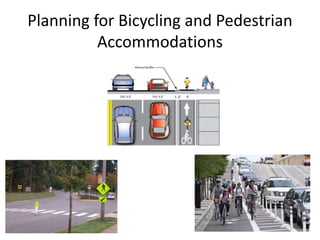
Planning for Bicycling and Pedestrian Accommodations
- 1. Planning for Bicycling and Pedestrian Accommodations
- 2. KYTC Pedestrian and Bicycle Travel Policy Adopted 2002 • The Kentucky Transportation Cabinet (KYTC) shall consider the accommodation of bicycles and pedestrians on all new or reconstructed state-maintained roadways.
- 3. The Goal (KYTC Policy) 1. Plans for connecting people via all modes of transportation 2. Providing access for all modes of transportation 3. Connecting people to the places they want/need to go
- 4. The Plan 1. Assessing the walkability and bikeability for a community (focus areas) 2. Develop a master plan or projects for the community 3. Prioritizing projects, improvements, education programs, enforcement programs, and encouragement/marketing ideas,
- 5. Creating Plans & Projects The KYTC Bicycle & Pedestrian program team is working with 28 cities and or counties to improve or develop a master plan or individual project (2014)
- 6. Collecting Data to Make Plans/Maps
- 7. The Future / Maps Needed
- 8. GIS Creates/Solves/Displays the Picture
- 9. ADD Data Collection • Area Development Districts – Kentucky Regional planning organizations – Annual KYTC work program contract – Various multimodal data • Freight generators • Rail yards • Truck parking
- 10. Plan Information Availability http://transportation.ky.gov/bike-walk/Pages/Local-Info.aspx
- 11. Phase I: Plan Data Collection • Provided a database for structured data entry – Cities with 1,500 or more population – Links to any plan information we know • Asked ADDs to contact every city & county for: – Master and bike/ped plan info – Any identified projects – Existing B/P facilities and events
- 13. Plan Information Availability http://maps.kytc.ky.gov/photolog/?config=BikePedPlan Versailles, Paris, Danville, Richmond,& Berea have city plans Powell County has a countywide plan Lexington has a Metropolitan Planning Organization plan and indicate facilities data collection efforts
- 14. Phase II: Facilities Data Collection – Each ADD was assigned 2 cities – KYTC provided a structured database – Basic Data Rules: 1. Collect only facilities that are highway-adjacent 2. All facilities must be associated with the highway centerline 3. Data may be collected by viewing aerials but must be field verified
- 15. Standard sidewalks, crosswalks, multi-use path
- 16. Mid-block crosswalk?! Crosswalks all over the place?!
- 18. ArcMap Tools to Assist Collection • Linear Referencing Tool to ID route and location • Plot the collected data – Display Route Events – Generate field for errors
- 19. We’ve Got Data - Now We Want Everybody to Have It! • Internal KYTC • Public data – Interactive map for both plans & facilities – Downloadable data
- 20. Bike/Ped Facilities Availability: Internal KYTC The State Highway Engineer’s (SHE) ArcGIS map template. Bicycle and Pedestrian Facilities (sidewalks, crosswalks, bike lanes, etc.) is a layer that may be added to the template map for review and analysis.
- 21. Bike/Ped Facilities Availability: Interactive Map http://maps.kytc.ky.gov/photolog/?config=BikePedPlan
- 22. Bike/Ped Facilities Availability: Interactive Map KYTC’s Photo Van application – showing street photos at specified milepoints.
- 23. Bike/Ped Facilities Availability: Downloadable Data • Table/Spreadsheet format from: – KYTC Data Mart • GIS Shapefile format from: – KYTC Data Mart – Division of Planning web page – Kentucky GeoNet
- 24. Bike/Ped Facilities Availability: Downloadable Data KYTC Data Mart may be accessed from the Cabinet home page: http://transportation.ky.gov/Pages/default.aspx
- 25. Bike/Ped Facilities Availability: Downloadable Data – KYTC Data Mart
- 26. Bike/Ped Facilities Availability: Downloadable Data – Planning Web Page http://transportation.ky.gov/Planning/Pages/HIS-Extracts.aspx
- 27. Bike/Ped Facilities Availability: Downloadable Data – Ky GeoNet
- 28. What’s Next? • Publicize data availability • Continue to collect at least 2 cities per ADD per year • Capture new plans/facilities • Collect other data (Share the Road signs, non-roadway adjacent facilities, etc.) • Investigate other technologies • Incorporate donated data
- 30. Contact Us Troy Hearn, Bicycle & Pedestrian Program Coordinator KYTC Division of Planning, MultiModal Branch Troy.Hearn@ky.gov (502) 782-5060 Carol Brent Data Specialist-GURU KYTC Division of Planning, MultiModal Branch Carol.Brent@ky.gov (502) 782-5048
Editor's Notes
- KY has a very well written Bike/Ped Transportation Policy. KYTC will also consider accommodating bicycle transportation when resurfacing of roadways, including shoulders. Check list for consideration: * A pedestrian facility already exists on the current roadway * A state locally, or regionally adopted pedestrian or bicycle network or policy has designated pedestrian/ bike improvements in the area of the specific roadway project or for that classification of roadway. * Pedestrian traffic exists along the current roadway: This may be determined by the observation of pedestrian traffic or by the public-involvement process. * Public interest in and demand for pedestrian facilities are determined at the planning and preliminary engineering public-involvement stages * KYTC project-level decisions will complement local pedestrian plans to the maximum reasonable extent * KYTC project-level decisions will evaluate future connections to close gaps in parallel connectivity between projects and developed areas/community destinations or existing pedestrian facilities within 300 feet beyond normal project limits within existing publicly owned rights of way. · KYTC project-level decisions will evaluate future connections to close gaps in perpendicular connectivity to developed areas/community destinations or existing pedestrian facilities within 100 feet of the roadway edge of pavement within existing publicly owned rights of way. · KYTC project-level decisions will consider pedestrian access to existing and planned transit stops.
- Included in early planning work Many times is difficult to consider or justify a transportation mode that is not present when doing the field surveys/reviews. Cyclists and pedestrians are often the silent/ unseen users of the roadways. It is the responsibility of the local government to choose the priority areas that need sidewalks, bike lanes, bike paths, and all other transportation facilities/projects. Many times the local government will rely on an outside/private organization to provide the associated information on the cyclists and pedestrian needs.
- Assess Develop Build rank new projects or improvements and much more are included in the plan
- Winchester, Shelbyville, City of Franklin, Richmond, Frankfort & Franklin County, Campbellsville, Paris, Georgetown, Morehead, Princeton, Big Sandy Area, Bowling Green, Glasgow, Carroll County, Raceland, Paintsville, Lebanon, Salyersville, Middlesboro, Elizabethtown, Somerset, Greensburg, Mayfield, Maysville, Meade County, Hardford, Manchester, and Clay County
- Why? Starts with knowing what you have now find missing links List the connections between these places Data collection in Carrollton, KY for all sidewalks, bike lanes, multiuse paths, and cross walks.
- Knowledge is Power Easy to add layers of the projects, needs, priorities Information for local government, bike clubs, citizens, and tourist The pedestrian planning maps are usually in smaller focus area Bicycle planning maps can cover a larger area (county wide or regional) Great place to start your ADA Transition Plans The work you do to develop the vision can now be displayed via GIS mapping There is a lot more work that goes into this “master plan” vision, but being able to accurately map and show this information in this way is very helpful The local community must share the desired projects and plans with the Transportation planners (KYTC, ADDs, and MPOs)
- ADDs seemed the most logical and efficient means of obtaining the needed data. ADDS are rural planning organizations, 15 in Kentucky, similar to Councils of Governments in other states Deal with Health Care and ADA, Kentucky Infrastructure Authority, economic development among others Among the current ADD AGIS activities that I am familiar with are: collect GIS/GPS data on water and sewer infrastructure, highway centerlines, HIS roadway data Never know where GIS people will show up: Adam in ride sharing public announcement ADDs the Rural Transportation Planning Organizations recommended in MAP-21 Each has a transportation planner who deals with both the local officials and the Transportation Cabinet Since they already collect some data for us, B/P data was a logical addition in the annual contract
- The old way to access plan info – web links to the site for a city, county or regional plan, no visual representation of their location. For those who want it, we still have these plans listed on the Planning web page.
- Comp plan? Bike and/or ped plan therein? Electronic – if so, link? Bike/ped master plan, sponsoring org with contact and link to plan, Does the community desire to develop or improve a bike/ped plan – created list of people for Troy to contact Notes of any locations already identified Any bike/ped shops and the amount of business – no responses Used Access to structure the data entry so could compile into single file and map the data (and reduce post-processing time by me!)
- New format – visual ID of those with data, combines all bike/ped data in one interactive map Only those plans that are hosted on a local authority web site – city government, local tourism agency, local development agency
- First year was a pilot project and therefore a lot of trial and error 2 cities chosen based on perceived demand based on the number of email or phone contacts to Troy Not MPOs because they have their own staffs to do this Data structure of B/P facilities: Link the facilities to the highway using HIS route ID and milepoints (Have the backbone tree, now add the branches) Only roadway-adjacent facilities Trial and error first year pilot project
- Collecting sidewalks, crosswalks, bike lanes, shared bike lanes, separated bike lanes, multi-use paths How hard can this be? Guidance document is 2 pages long, 27 fields we wanted data on: surface, facility user, ADA transition facilities
- Just as bad, some route IDs make right-angle turns onto another road, how do you code the crosswalks at that intersection? The final guidance document is 23 pages, only 9 fields of data to collect!
- GIS staffing varies among the ADDs, so collection process varied by ADD from GIS staff doing all work to Transportation Planner doing all work (after their GIS staff provided good tools.) One benefit of the data collection effort was the working relationships developed between the planners and the GIS people. Required: Route ID, milepoints, side of route, facility type, (need to change to add the shared use paths for bikes/motor vehicles – sharrows – painted symbol in driving lane. Asked for begin and end locations to aid in QC and description of the facility segment Combined all data collected into a single excel sheet, imported into highways GIS Inventory sheet useful for those without GIS experience to know what to collect and how to attribute each section. Some ADDs used it religiously, especially for QC of their data, others not at all. Since Access is not as user-friendly for mass data entry, for FY 2015, switched from Access to Excel, with auto-complete route ID
- The main issue with submitted data was that route ID was wrong (not within the network) or that the milepoints were incorrect (directionality of the centerlines, route ID changed at an intersection) Linear Referencing Tool could be used to click on the route in the measured shapefile to find the route ID and milepoint at a specific location. Plot, Plot, Plot before submitting, using the option to generate a field for errors. Errors that could not be helped were the one section of new highway which was not “officially” open but for which the ADD had the route ID and milepoints. Had to wait several months for the route to be added before entering the new facilities into the HIS database.
- ADDs have a head start on most people. Randall Embry and Jessica Blankenship have both been proactive in using the results of the data collection with their local officials and programs. Others may not be using it so we have provided it in as many places as we can think of.
- KYTC has very active GIS core group who have created an amazing ArcMap template for the Cabinet. As best I could tell, there are 33 categories of GIS data that can be added to the map. Within those categories, the Bike/Ped data is one of 47 possible layers in the Asset Group (also includes shoulder type and width, traffic counts, number of lanes, access control, ferry boats and permits!) Available layers also include imagery and other backgrounds, natural resources and on and on and on….
- This is the map Troy showed you earlier: the Info available varies by scale. BTW, this has been a challenge and wake up call for some cities: why is their information not on this map. It gives Troy the opportunity to work with them on developing plans. Plans: Red dots for each city bike ped plan, Green polygons for counties with approved plans, Gray polygons for MPOs with plans, Facilities: Pink dots for cities already inventoried for facilities Blue dots for cities assigned to be inventoried for facilities, Interactive map zoomed to the city of Paris showing bicycle and pedestrian facilities. Note the dark blue line indicating Shared Bike Lanes. Dark brown lines indicate sidewalks, lighter brown lines indicate crosswalks. There are buttons at top right to switch between base map, aerial photography and, as in next slide, the photo van “street view” images.
- Used for viewing/collecting bike/ped data Also used for showing data that has been collected Measure distance or assets?
- Cabinet very proud of all of the enterprise data available on this site from highway funding and performance measures, to design plans to Bridge and traffic data. Accessed from the Cabinet home page
- From the Advanced Query button, you click to the HIVEi to download the Bike/Ped data in tabular format From the Spatial button, you may download a zipped shapefile (including table that can be opened with Excel)
- Another place to download the zipped GIS shapefile is the Division of Planning page for Highway System extracts
- If you are searching the GeoNet for GIS data, you may search for bike ped and find the zipped GIS shapefile along with its metadata.
- OK – now we have data on bike/ped plans around the state, we have some data on bike/ped facility locations in specified locations around the state, NOW WHAT? Troy keeps finding folks both in KYTC and in the communities who don’t know about the data available for their use. Over 400 incorporated areas in Kentucky but many are small so ADDs may collect more than 2 per year Collect sign type and location data or painted symbols on the highway Structure or data connection for collecting non-roadway adjacent facilities for system continuity Other technologies such as 1) obtaining/harvesting data from photo van images, 2) using Bentley’s spatial capture application to keep route info and spatial location Challenges with fitting donated data into our architecture (polygons vs lines, linear referencing systems, route IDs or names) Have received or been offered Kenton County, Louisville, Woodford County