Pierre beland-osm-condatos-natural-disaster-response
•Download as ODP, PDF•
0 likes•2,293 views

Natural Disaster Response Session, II Conferencia Regional de Datos Abiertos en América Latina y el Caribe (CONDATOS)

Recommended
Recommended
More Related Content
What's hot
What's hot (20)
Viewers also liked
Viewers also liked (18)
Similar to Pierre beland-osm-condatos-natural-disaster-response
Similar to Pierre beland-osm-condatos-natural-disaster-response (20)
Pierre beland-osm-condatos-natural-disaster-response
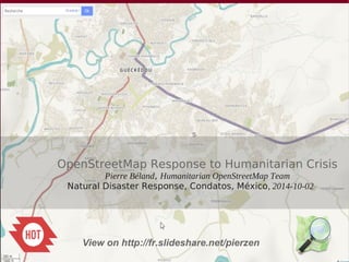
- 1. s OpenStreetMap Response to Humanitarian Crisis Pierre Béland, Humanitarian OpenStreetMap Team Natural Disaster Response, Condatos, México, 2014-10-02 View on http://fr.slideshare.net/pierzen
- 3. West Africa Ebola outbreak Crowdsource map of Monrovia http://pierzen.dev.openstreetmap.org/hot/leaflet/OSM-Compare-before-after.html#14/6.3334/-10.7868
- 4. OSM Crowdsourcing contribution - Task Manager Jobs Haiyan Typhoon West Africa Ebola, first 6 months 1,600 contributors / 4.5 million objects 1,333 contributors, 7.4 million objects 40,000 square km 200 km x 200 km uMap Data : OpenStreetMap Contributors Nov-Dec 2013 March – Sept 2014
- 5. The OpenStreetMap response to Disasters Organization The Humanitarian OpenStreetMap Team acts as a bridge between the OpenStreetMap community and the humanitarian actors ● Assures a quick response, interacting and establishing the priorities with the humanitarian actors : UN agencies, International organizations, national governments, Imagery providers ● Imagery acquisition and processing ● Crowdsource Remote mapping ● Opensource Tools development ● Assure Data Exports in various formats ● Respond to humanitarians specific needs
- 6. The OpenStreetMap response to Disasters The OpenData , Various Data inputs into OpenStreetMap ● Aerial imagery provided free by various Imagery providers (pre and post-event) ● OpenData Data Imports compatible with OSM OdbL License – Administrative limits, Locality names, Infrastructures ● Contributors inputs – Locality / Street names, infrastructures Map services and Data Exports ● Various Map Services and Data Exports free and OpenData – Daily updates for GIS analysis, Mobile devices maps and road navigation (Android, IOS, GPS) – Online Maps & Road navigation, – Paper Maps with street index – FieldPapers for field team data collection
- 7. Data Imports ● For each new crisis, the problem of importing Settlement place names, administrative boundaries and vital infrastructures emerge ● Given the limited technical capacities of the administration of many Development countries, there is often no georeferenced data readily available about important infrastructures such as hospitals, schools, features that can be used as shelters. ● When the data is available, there are often Data access limitations or Licensing problems to use rapidly such data in context of rapid response to humanitarian needs ● A plan should be developped to support governments in the development of OpenData that can be shared with humanitarian organizations in the context of humanitarian crisis ● To assure that such data be imported in OpenStreetMap, the data should be accessible with standard formats of exchange and there should be no license restriction for commercial use
- 8. Infrastructures data collection ● A lot of efforts are made by various organizations, coordinating with OCHA and other actors to provide geolocated data. The process is complex and there are licensing issues ● Collecting the data in emergency context, licenses issues are not considered. ODK Data collection Forms could be used to feed OSM ● OSM offers the possibility to develop an ecosystem very flexible where various organizations can collaborate, add edit sharable data Plan for other activations ● We should look for long term solutions, assure that the Data collection is better systematized and sharable – Data collection methods should assure to license as OpenData (avoid using commercial geolocation tools) – New mobile devices offer new possibilities. The humanitarian organizations should plan to collect and share as OpenData – The possibility to share data stored on OpenStreetMap should be examined – OSM edit tools and Data Collection Forms for Mobile devices should be adapted to facilitate collection of humanitarian sharable data
- 9. OpenData as a Common Asset We need to share Data ● OpenData licences restriction often do not let bring vital informations into OSM ● Humanitarians organizations and national governments have valuable data in various forms ● We need to think of a way for the various organizations to share data more effectively – Let's take the Mobile device revolution, use it to share data – Let's react more rapidly to disasters ● It is important that Civil Society organizations like OpenStreetMap have a voice in International events to progress with such challenges
- 10. OpenStreetMap : An ecosystem for rapid and efficient intervention With the OpenStreetMap rapid intervention for Haiyan, Philippines and West Africa Ebola, this was the defacto Reference map for these international interventions. The capacity to mobilize international volunteers through Internet assures access to essential products and services The Black and white map - OSM database and Maps updated to the minute - Humanitarian style - Paper Maps + FieldPapers Maps for field survey - Offline Android / IOS - GIS Download Let's color the map with thematics We need a change of culture and adapt to small mobile technology. What data and how the government and humanitarians could share with other organizations ? Government OpenData to share administrative limits and other public data Humanitarian Organizations Field Teams Collecting - infrastructure data - Locality names - etc Coordination with UN and humanitarians Humanitarian OpenStreetMap Team makes the bridge with the humanitarians
- 11. Layers that do not talk one to the other Let's develop ways to communicate and share data
- 12. The grants from Hewlett will support organizations working on a variety of high-priority public health initiatives for Ebola Response, including the Humanitarian OpenStreetMap
- 13. A detailed presentation of the Ebola Response is availabe from http://fr.slideshare.net/pierzen OpenStreetMap Response to Humanitarian Crisis West Africa Ebola Outbreak, 2014 Case Pierre Béland, Humanitarian OpenStreetMap Team GeOnG, Chambéry, 2014-09-23
Editor's Notes
- http://umap.openstreetmap.fr/en/map/hot-yolanda-haiyan-typhoon-activation_3628#8/11.558/124.887 Red : Post-disaster, blue : pre-disaster HOT / OSM community Activation for the Haiyan Typhoon, Nov 8, 2013 This map shows grossly the affected zone. We also see the various zones remotely mapped by the OSM community from internet, coordinating via the HOT task Manager.
- https://www.gfdrr.org/sites/gfdrr.org/files/3_JRC-Remote_Sensing.pdf Damage assesments What are the limits? •Satellite images map products have limitations: – due to spatial resolution, viewing configuration, non-optimal timing – because of non-optimal atmospheric conditions (haze, clouds) – due to errors in processing (e.g. geocoding) or interpretation (subjectivity) – due to incompleteness, lack of reference data, etc. Port-au-Prince 2010 – The underestimation of damages in satellite data compared to aerial imagery and field observations was striking
- https://www.gfdrr.org/sites/gfdrr.org/files/3_JRC-Remote_Sensing.pdf Damage assesments What are the limits? •Satellite images map products have limitations: – due to spatial resolution, viewing configuration, non-optimal timing – because of non-optimal atmospheric conditions (haze, clouds) – due to errors in processing (e.g. geocoding) or interpretation (subjectivity) – due to incompleteness, lack of reference data, etc. Port-au-Prince 2010 – The underestimation of damages in satellite data compared to aerial imagery and field observations was striking
- https://www.gfdrr.org/sites/gfdrr.org/files/3_JRC-Remote_Sensing.pdf Damage assesments What are the limits? •Satellite images map products have limitations: – due to spatial resolution, viewing configuration, non-optimal timing – because of non-optimal atmospheric conditions (haze, clouds) – due to errors in processing (e.g. geocoding) or interpretation (subjectivity) – due to incompleteness, lack of reference data, etc. Port-au-Prince 2010 – The underestimation of damages in satellite data compared to aerial imagery and field observations was striking
- Nov.7, Andrew Buck invites the HOT community. 10,000 buildings traced in Tacloban. Sunday 10th Nov: HOT official Activation > Coordination with various actors including OCHA, the American Red Cross, VISOV and the US State Dept Humanitarian Information Unit (HIU). The International Charter 'Space & Major Disasters' imagery providers realigning satellites to obtain post-disaster imagery. Our imagery specialists look for Imagery, process and host it. A revised humanitarian mapping workflow is setup with a tagging scheme for damaged buildings and infrastructures Adaptation of the various tools to deliver appropriate maps. Monday 11th Nov : The European Commission released the first post-disaster imageries of Tacloban. Wednesday 13th Nov : HIU delivers Post-disaster imagery from Digital Globe and the first Post-disaster Task Manager job is available for mappers to look at damaged buildings of Tacloban.