(RIA) Call Girls Bhosari ( 7001035870 ) HI-Fi Pune Escorts Service
Andes neotectonica 2010
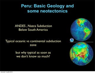
1. Peru: Basic Geology and
some neotectonics
ANDES , Nazca Subduction
Below South America
Typical oceanic vs continental subduction
zone
but why typical as soon as
we don’t know so much?
mercredi 14 juillet 2010
2. • Central ANDES = 5 countries .....Bolivia Peru Chile Argentina and Brazil....
• Politics and Geology... field access....... Bolivia first, then closed, Chile and
Argentina.....then no pieces of land free of instruments...thus Peru now...
• Peru strongest points: overview, highly variable morphologies
• Widest, highest :High plateau ( 4000m ) , high chain ( 6500 m), canyons (2000m).... ....
• Subduction seismicity ( 1960, biggest..)
• Arid desertic Atacama vs tropical Amazonia
• Thérèse BOUYSSE-CASSAGNE ( Volcanoes, earthquakes ...
myths and culture , Healers of the Bolivian Andes....
The good devil, mining cults , lake Titicaca ; assimilating christianism ?...)
Geology , politics...culture of the Central Andes
mercredi 14 juillet 2010
3. • Data acquisition is going on, but Scientists are mainly discussing
processes...
• Questions are :
- how did the Andes grow ? And where first?
- what is the main contribution to uplift ? Magmatic, tectonic, cimatic,
distributed or focused shortening, mantle flow, lower lithospheric
flow, delamination, tectonic erosion ?
- what happened on the western flank ? If nothing happened ...why?
- Extensional collapse ? Delamination ...See Barnes and Ehlers ,
2009
• The South American margin, despite a geologic history of more
than 200 million years of continuous subduction, did not begin to
grow high topography until ~50 million years ago.
Andean geology
mercredi 14 juillet 2010
4. 3900 KONOE? a•.: Mou•rrAiN BUILDINGIN THE CENTRALANDES
HOW TO FORM
A HIGH PLATEAU?
•..,,::..-'!::...!•:.-:•:::•.?..::..',;-•?':.•.
:.:".!.•.%..":i':i!'.?:."i:;!'i:"•",?:?.:.:L'?..:.:";=?.'.'?'•:i:•.:'.?!
MAGMA ADDITION
FOLDING
ß ß
REPEATED THRUSTS
THERMAL EFFECTS CRUSTAL DOUBLING
Fig. 9. Processeswhichcanform an extendedplateauof highaltitude
(comparewith a similarfigurein Allmendinger[1986]. Thethreeon the
right involve somesortof crustalshortening,while the two on the left
rely onthesupplyof volcanicmaterialor heatfrombelow.
Altiplano-Puna was formed there. The absenceof a back arc
factorin the WesternCordillera,but doesno
east,where the crustappearsto consistof P
zoic sedimentaryand metamorphicrocks. T
wasstudiedby FroidevauxandIsacks[1984
the CentralAndesis essentiallyin equilibriu
is thatthetopographyshouldbe compensate
or by the lithosphere,becauseof the sizeof t
However,we think thisratherunlikelybecau
asymmetry;if the easternpart is supportedb
lithosphereunderneath,similarlyhot or even
shouldexistunderthe WesternCordillera,le
compensationof thesurfaceloadthem.
We concludethata singlemechanismcann
port the topographicfeaturesof the CentralA
proposethattwo differentmechanismsoperat
the western and easternhalves: magma ad
shortening(Figure 10). A combinationof the
agent which contributedto make the Centra
mountain chain associatedwith a subdu
existenceof high plateausof wide extentand
arc basins.
In the westernhalf of the Central Andes, a s
of magmahasbeenaddedto the crustfrom
the crustandraisingthe plateauwithoutseve
geologic formations. The reason for this
(10ø-30ø) and fast (about 10 cm/yr) subduc
Building a Plateau
Kono et al., 1989
mercredi 14 juillet 2010
5. • 3D feature
• EW cross sections
• NS variations
• History of the subducting
plate but also of the upper
plate
• .......
• I will focus on Central
Andes, Northern part, in
Peru ...
Andean geology
mercredi 14 juillet 2010
8. Megard 1978
800 1000
DIST. (Km)
I I I I I I
I
O 400 200 . 400 600
~' WLSTERN E A S T L R N
COAST
CORD. CO! D.
I
-------
Pretty much the same now....
Once the uplift begon, nothing changed ?
Data from East to West , best known to less known
East West Segmented Andes ??
Garzione et al., 2008
mercredi 14 juillet 2010
9. Climate by promoting or inhibiting sedimentation, may help to focus the available plate-
driving forces to portions of subducting plate boundaries, raising the local shear stresses
to levels needed to support mountain belts with elevations 3 km.Lamb and davis,2003
Onset of Convective Rainfall During Gradual Late Miocene
Rise of the Central Andes .Poulsen et al., 2010
Climatic Andes
mercredi 14 juillet 2010
10. • Mamani et al., 2010
Mamani et al.
numerous isotopic ages published for the region
and other information from the literature, and
to the north by up to 200 km in the western part
of the study area, and it occupied this position
Nazca
Ridge
trench
Tacaza arc and
backarc (30-24 Ma)
?
Andahuaylas-Anta arc (45-30 Ma)
Huaylillas arc (24-10 Ma)
Lower Barroso arc (10-3 Ma)
Upper Barroso arc (3-1 Ma)
Frontal arc (<1 Ma)
Chocolate arc (~310-91 Ma)
Toquepala arc (91-45 Ma)
?
?
Quinsachata backarc
volcanism
(<1 Ma)
Lima
Nazca
Peru
Bolivia
Chile
17°S
15°S
13°S
71°W73°W75°W77°W 69°W
N
100 km
Figure 2. Location, extension, and age (Ma) of the volcanic arcs and backarc areas distin-
guished in southern Peru. The successive arcs approximately extended between the labeled
lines of same color and thickness, drawn on the basis of dated outcrops and available geo-
logical maps. Extension of Nazca Ridge (white dashed lines) is after Hampel (2002).
From 91 Ma to 30 Ma, the
magmatic arc was large enough
to form a significant, continuous
relief, thus indicating incipient
crustal thickenIng. Migrated
North between 45 and 30 Myrs;
and retro migrated 30Myrs ago..
The major crustal thickening
typical of the Andean orogeny
has developed since the mid-
Oligocene (30 Ma), while the
main arc has migrated back
toward the trench.
No delamination
Volcanic Andes
major- and trace-element data points, and 650 Sr-, 610 Nd-, and 570 Pb-
isotopic analyses of Mesozoic-Cenozoic (190–0 Ma)
mercredi 14 juillet 2010
11. • Allochtonous accretion on the Western flank
and ... brazilian carton on the Eastern flank
• Crustal thickening , extension, compression,
post rifting...( thinning), slab flattening...
✦ Magmatism on both sides
✦ Tectonism on only one side?
✦ Migrating widening or narrowing volcanic arcs
✦ Distribution or localized processes..
Andean geology
mercredi 14 juillet 2010
12. • => Andes / Old Craton /deeper than 500km
earthquakes in the slab : Striking Exact same
shape?
• What define the bolivian Orocline ... Rotations
Brazilian shield undethrusting or both?
USGS
«Old» craton
mercredi 14 juillet 2010
13. Ramos 2008
A long time ago...before the Andes
Martignole and
Martelat, 2003.
Precambrian inliers, Mollendo-
Camana Block
Inherited zircon
in both domains suggests a
c. 1900 Ma age for the
protolith of the Arequipa
massif.
mercredi 14 juillet 2010
14. • Paleomagnetic data
• Magnetic anomalies
• Geology
• Paleo volcanic arcs
• Geochemistry
• Rotation and formation of
the Bolivian Orocline
• Low Andes
• Wetland...Sea East of the
Central Andes
Lomize, 2008
Sebrier et al., 1988
Hoorn et al., 2010;
Roperch et al, 2007
50 to 25 Myrs
mercredi 14 juillet 2010
15. Roperch et al., 2006
?
Paleomagnetic data
Allmendinger et al., 2005 shows that the same pattern is observed in GPS data.
Some of the interseismic deformation field must reflect permanent deformation.
Rotations acquired PRIOR to shortening ( >25MA).
mercredi 14 juillet 2010
17. • Kley and Eisbacher, 1999, Eastern Andes and intial state before major uplift
• Sempere et al., 1994 ; 2002
• Ramos 2008
«Rift» and thinned Lithosphere pre 25Ma
This 110-Ma-long interval of lithospheric thinning ended 160 Ma ago with the onset of
Cretaceous rift inversion in the Eastern Cordillera area.
mercredi 14 juillet 2010
18. J. Kley et al. / Tectonophysics 301 (1999) 75–94 85
Fig. 5. Different modes of continental extension produce different styles of foreland deformation upon later inversion. (a) Extension
• Different modes of continental extension produce different styles of foreland
deformation upon later inversion.
Eastern Andes, EC and SA
mercredi 14 juillet 2010
19. • Kley et al., 1997, De celles,
Horton , Baby,
McQuarrie ....... Balanced
cross sections.......
• 25-0 Myrs, shortening EC first
( thick skinned ) and then
followed by in the subandes
( Thin skinned )
Eastern Andes , SA
mercredi 14 juillet 2010
20. Shortening estimates in southern Peru
Subandean zone of Bolivia (Dunn et al., 1995;
Baby et al., 1997; McQuarrie, 2002a; Barke
and Lamb, 2006; McQuarrie et al., 2008).
Airy isostatic equilibrium and then compare the
shortening predictions to our measured values.
We made predictions assuming initial crustal
work, however, has assumed a 40–45 km initial
crustal thickness, so we include calculations us-
ing this initial condition for comparison (e.g.,
A A′
185 km
10 km
0 km
–10 km
–20 km
Preferred shortening estimate 123 km
A A′
185 km
10 km
0 km
–10 km
–20 km
décollement dip required
by mapped stratigraphy is steeper
than minimum 1°
Minimum shortening estimate 58 km
basement shortening is much less than
overlying strata requiring matching basement
shortening to west
A A′
185 km
10 km
0 km
–10 km
–20 km
Maximum shortening estimate 333 km
basement involved
deformation required here
Hanging-wall cutoff here
restores to footwall cutoff here
requiring the majority of slip on one structureextra area due to steeper
décollement that needs
to be filled with deformed strata
depth of footwall flat to match hanging-wall
ramp creates a mismatch of thickness
in the thrust sheet
Figure 6. Variations in the way shortening is accommodated in our preferred, minimum, and maximum shortening estimates. Annotations
indicate problems with the kinematics in the maximum and minimum shortening estimates. Stratigraphic color key is given in Figure 2.DeCelles and Horton, 2003 suggests 500km of total shortening since Paleocene...enough to
explain the crustal thickenning and they suggest altiplano and western shortening is included.
Gotberg, et al., 2010
Eastern Andes , SA
mercredi 14 juillet 2010
21. Vertical or Horizontal ?
Baby et al., 1997
Dorbath et al., 1993
mercredi 14 juillet 2010
22. • Carlier et al.,2005
Vertical ?
The Altiplano of southern Peru
displays a large spectrum of
Cenozoic potassic and
ultrapotassic mafic rocks that
delineate two deep lithospheric
mantle blocks
Those blocks have undergone
different depletion and enrichment
events and favour a vertical limit
between EC and SA
25-23, 7-5,2-0Myrs old
mercredi 14 juillet 2010
23. CCEPTED
MANUSCRI
12°
64°66°0°
14°
16°
24°
26°
AL
WC
PrC
PU
SB
EC
EC
IA
SA
La
Paz
Potosi
B
2 σ/std. error region
1 σ/std. error region
4 6
7
5
paleobotany
paleoclimate correction
Age (Ma)
Plateauelevation(km)
0510152025
1
0
2
3
4 modern
5
13
14
15del18O
16
17
18
clumped 13
C-18
O
1
4
19
5
20
13-18
7
6
12
8 2
9
10
22
3
?
Uplift
1.7 ± 0.7 km
since 12-9 Ma
2.7 ± 0.4 km
10.3 - 6.7 Ma
2.3 -3.4 km
since
11-10 Ma
>2 km
AP elev by
19-13 Ma
m since
5 Ma >2 km since
~25-16 Ma
Barnes and Ehlers, 2009
• Neogene uplift
• But ˜1000m Andes
• existed before 25Ma.
• Plateau but West ?
• Smoother gradual uplift?
Uplift of the plateau, Central Andes
mercredi 14 juillet 2010
24. Tavera et al., 2002
Dorbath et al., 1991
West/East cross section
NS
For 12 Myrs , entered North of Peru
and then southeastward migration
«small» ridge in comparison to Carnegie (Ecuador ) but much
bigger than Juan Fernandez ridge ( Chile )
Older plate ?
Oblique? Tectonic erosion from below?
Uplift and then
subsidence on the coastal area
But didn’t reach southern Peru yet.
12 Myrs ago....Subduction of the nazca ridge
mercredi 14 juillet 2010
25. KoNo œT,st,.:MOUNTan• BUILDINO IN THE CENTRAL ANDES 3901
WesternCordilleraAltiplano EasternCordillera
primarily smalldeformationprimarilyuplift
magmaticgrowth bycompression
smalldeformationr.r• faultsandfolds
nearlyisostatic• notisostatic
++++++++ •
+++++++ • •
• ++++++++++++ •
buoyantyoung• ,&,• ,•,--- ,.--,• , *-., heatedmantle
oceanicplate •ø•'!,.,.'""•t• c'-- • '• • andcrust
_ stro.ngcoupling "•*.•o6'•,,•' ...,"-,__,• secondaryconvectionlar e thrust events
largethrustevents • • • • inducedbysubduction
• • (carriesheatupward
.,._•• •ind volcanicline)
widezøne•- • •
magmageneration • •
Fig. 10. A cartoonshowingtheprocessesoperatingin theformationof theCentralAndes.Not to scale.
hit doesnot appearon the surfacedue to the overlying
ssivecrust. Accretionof suchvolcanicmaterialsis the
asonfor the thickeningof the crustobservedin the Cen-
des,especiallyin the Altiplano and the WesternCordil-
Eastern Cordillera and Andean foreland basin, there is
dencefor extensivemagmaintrusiondubrig the Ceno-
e. Instead,thick Paleozoicrocks have been extensively
and faulted. Crustal seismicactivity showshohzontal
ssionalmost perpendicularto the mountain axis. The
desforeland basin is formed by a seriesof folds and
pingreversefaultsactivefrom at leastPliocenetime to
ent[Suarezet al., 1983;Allmendinger,1986]. Suchevi-
secondaryeffectcomparedwith the formertwo processes.
Thusour modelof the mountainupliftingcanbe summarized
as follows. Becauseof the relatively shallowsubductionof the
young oceanicplate, magma is generatedin an extensivearea
abovethedescendingslab. Accretionof magmaticmaterialinto
the crust is most extensiveat the volcanicfront and progres-
sivelydecreaseseastward.The Andesblock,evenat its eastern
end, is heatedand softenedby the extensivevolcanismand is
pushedwestwardby the hardblockof the Brazilian shield. The
deformationdue to this pushis severestat the Amazonianfore-
land basin and the Eastern Cordillera, but also extends to the
west with decreasingmagnitude. These two mountainranges
Kono et al., 1989
KONO œ?AL: MOUNTAIN BoreDtoO IN THE CœYmAL ANDF.S 389
xx• z•x
....I....I....I....I....[....I....[....I....[....I'•
.... I .... I .... I .... I .... I .... I .... I .... I .... [ .... I
lO0 200 300 400 500 600 '700 800 900 !000
DIS;TRNCE [KFI]
4000
2000
o
-2ooo
-4ooo
-6000
•oo
-lOO
-200
-300
-400
-500
(•
,s-
z
rn
Fig. 6. Gravityanomaliesobtainedfor the routeNazca-PuertoMaldonado,whichspansfrom thePacificcoastthroughthe
WesternandEasternCordilleraandtheAltiplanoandcontinuesto theflatlandof theAmazonfiver,wheretheheightis only
about200 m [Fukaoet al., thisissue].Fromtopto bottom,stationheight(dots)andheightsof gridpointsin a 100-kmbelt
containingthe traverseroute,Bouguergravityanomalyon land[Fukaoet al., thisissue]andfree air anomalyon the sea
[Hayes,1966], andthe crustalstructuremodel.
[1971] suggestedtectonicerosionasanimportantelementof his
modelof the CentralAndespartlybecauseof thisapparentage
progressionfrom west to east. However,mostof the volcanic
rocksassociatedwith theAltiplanoareof Cenozoicage. Recent
radiomelricage determinationsshow no definite trend in the
tribution and are the evidenceof the very strong volcan
activity in the late Tertiary [Rutlandet al., 1965; Guest, 196
Francis and Rundle, 1976; Kussmaulet al., 1977; Baker an
Francis, 1978; Baker, 1981; Lahsen, 1982; Francis et a
1983]. Somecenterof volcanicactivitymay havelastedseve
Gravimetry
Magmatic thickening fits the gravity on the western side if you
consider that no shortening occured west...
mercredi 14 juillet 2010
26. Kendrick et al., 2001
GPS , partitionning.... West...?
c
mercredi 14 juillet 2010
29. Carlos Benavente, INGEMMET, Peru
Hernando Tavera, IGP, PEru
Saillard Marianne, LMTG, Toulouse France
Claire David, IRSN , France
Sarah Hall, UC Santa Cruz, USA
Daniel Farber, UCSC/LLNL, USA
Tectonic activity on the western side of the Andes
Faults
Transpressionnal and reverse
mercredi 14 juillet 2010
30. Carlos Benavente, INGEMMET, Peru
Hernando Tavera, IGP, PEru
Saillard Marianne, LMTG, Toulouse France
Claire David, IRSN , France
Sarah Hall, UC Santa Cruz, USA
Daniel Farber, UCSC/LLNL, USA
Tectonic activity on the western side of the Andes
Topographic cross section
Faults
Transpressionnal and reverse
mercredi 14 juillet 2010
31. Offshore/Onshore ODP,DSDP and Oil companies
Onshore, low interest on Tertiary deposits and lower
on Quaternary... Now everybody is gathering data,
ages, and stratigraphy in order to constrain the
forearc evolution.
Major Cannyons, ......no tectonics neither analysis of
crustal seismicity.
mercredi 14 juillet 2010
33. • Desert Varnish
• Two distinct
surfaces
Quaternary dynamic forearc ? Upper forearc
10Be dating of abandoned and reincised surfaces
Hall et al., 2008
mercredi 14 juillet 2010
34. • Desert Varnish
• Two distinct
surfaces
Quaternary dynamic forearc ? Upper forearc
10Be dating of abandoned and reincised surfaces
Hall et al., 2008
mercredi 14 juillet 2010
35. Cerro El Huevo 492 mNW SE
NWSE Cerro Tres Hermanas
Uplifted marine terraces ( Be10 datation ) Quaternary < 1Ma
⇒ 15 levels
Quaternary dynamic forearc ? Coastal forearc
Saillard et al., in revision
mercredi 14 juillet 2010
39. 2.3. MARCO GEOL ´OGICO Y ESTRUCTURAL DEL BORDE OESTE DEL
ALTIPLANO 43
Figura 2.11: Marco tect´onico conocido de la Precordillera del Codo de Arica.
Tavera et al., 2007; Mw5.4, 17km
Onshore: Tertiary to Quaternary active faults
mercredi 14 juillet 2010
40. Local and temporal seismic networks: Subduction seismicity82
CAP´ITULO 3. AN ´ALISIS DE LA SISMICIDAD DEBAJO DEL ANTE-ARCO Y DEL
ARCO VOLC ´ANICO DEL OROCLINO DE LOS ANDES CENTRALES
figura 3.15 espec´ıfica tambi´en las redes locales y regionales que registraron estos datos.
Estos datos se adquirieron en periodos distintos:
- en 1981 en la regi´on de Caman´a-Arequipa, Sur del Per´u,
- en 2003 en la regi´on de Tacna-Moquegua, Sur del Per´u
- y entre 1996 y 2003 en el Norte de Chile.
Figura 3.15: Eventos locales de magnitud mL ≤ 4,0, registrados por las redes locales temporales en
1981 y en 2003 y por las redes permanentes entre 1981-2004 y entre 1996-2003, procesados en este
trabajo y en trabajos anteriores. El rect´angulo rojo ilustra el ´area de ruptura del terremoto de Arequipa.
La flecha azul representa la brecha s´ısmica del Oroclino. Las l´ıneas negras representan la orientaci´on
de las secciones ortogonales a la fosa. La topograf´ıa y la batimetr´ıa son de Sandwell and Smith [1997]
ETOPO de 2 minutos de ´angulo, muestreadas a 30 segundos de ´angulo.
La figura 3.16 presenta las mismas secciones perpendiculares a la fosa E1, E2, E3, E4, E5, E6
que la figura 3.14. No aparece la secci´on E7 ya que los datos locales procesados en esta zona
est´an afuera de la cobertura de la red.
David PhD 2007
mercredi 14 juillet 2010
41. Local and temporal seismic networks: Subduction seismicity82
CAP´ITULO 3. AN ´ALISIS DE LA SISMICIDAD DEBAJO DEL ANTE-ARCO Y DEL
ARCO VOLC ´ANICO DEL OROCLINO DE LOS ANDES CENTRALES
figura 3.15 espec´ıfica tambi´en las redes locales y regionales que registraron estos datos.
Estos datos se adquirieron en periodos distintos:
- en 1981 en la regi´on de Caman´a-Arequipa, Sur del Per´u,
- en 2003 en la regi´on de Tacna-Moquegua, Sur del Per´u
- y entre 1996 y 2003 en el Norte de Chile.
Figura 3.15: Eventos locales de magnitud mL ≤ 4,0, registrados por las redes locales temporales en
1981 y en 2003 y por las redes permanentes entre 1981-2004 y entre 1996-2003, procesados en este
trabajo y en trabajos anteriores. El rect´angulo rojo ilustra el ´area de ruptura del terremoto de Arequipa.
La flecha azul representa la brecha s´ısmica del Oroclino. Las l´ıneas negras representan la orientaci´on
de las secciones ortogonales a la fosa. La topograf´ıa y la batimetr´ıa son de Sandwell and Smith [1997]
ETOPO de 2 minutos de ´angulo, muestreadas a 30 segundos de ´angulo.
La figura 3.16 presenta las mismas secciones perpendiculares a la fosa E1, E2, E3, E4, E5, E6
que la figura 3.14. No aparece la secci´on E7 ya que los datos locales procesados en esta zona
est´an afuera de la cobertura de la red.
David PhD 2007
104
CAP´ITULO 3. AN ´ALISIS DE LA SISMICIDAD DEBAJO DEL ANTE-ARCO Y DEL
ARCO VOLC ´ANICO DEL OROCLINO DE LOS ANDES CENTRALES
Figura 3.28: Mecanismos focales determinados a partir de los eventos registrados por la red perma-
nente del Norte de Chile [David et al., 2002].
En la secci´on a (figura 3.30), el mecanismo focal asociado a un sismo a 20 km de profundidad
debajo del frente precordillerano corresponde a un movimiento normal.
mercredi 14 juillet 2010
42. 39High obliquity > 30° , where does the partitionning go?
Normal faults in the volcanic arc and on the Altiplano do not reflect necesarly extension but
a rotating σ1 (stretching lower than 1percent) Sebrier et al., 1985
Normal faults // trench, extension and collapse?
mercredi 14 juillet 2010
44. 41
South Peru
ESC Image/NASA
Coastal Cordillera
Central basin
OE
Active Reverse fault systems
More and more vertical…..
// to the margin Compressive component
Onshore: Western Cordillera piedmont
Audin et al., submitted
mercredi 14 juillet 2010
45. Reverse fault systems
// to the trench
Compressive component
500m
Onshore: Western Cordillera piedmont
Audin et al., submitted
mercredi 14 juillet 2010
46. Crustal faults in the foerarc
Re Activated after a subduction
earthquake ( M>8)
Onshore: Western Cordillera piedmont
David, 2007
mercredi 14 juillet 2010
47. Onshore: Coastal Cordillera
Reverse and normal
Perpendicular to the
trench faults
4.1. EL SISTEMA TECT ´ONICO DE LA CORDILLERA DE LA COSTA Y LA
SISMICIDAD ASOCIADA
David, 2007
mercredi 14 juillet 2010
48. Normal faults , perpendicular
to the trench
Active, some lateral components
2
0
0
1
Onshore: Coastal Cordillera
mercredi 14 juillet 2010
49. Normal faults , perpendicular to the trench
Active, even offshore on the margin
Linked somehow to the NS subduction segmentation ?
Audin et al., 2008 ; Calderon 2008
Onshore: Coastal Cordillera
mercredi 14 juillet 2010
62. T1 3m: 41.6 ± 9.4 ka
T2 10m: 218 ± 20.6 ka
T3 20m: 541 ± 67.8 ka
Incision Rate:
0.04-0.09 mm/yr
Incision Summary:
Hall et al. submitted
mercredi 14 juillet 2010
63. T1 25m: 195 ± 29 ka
T1 25m: 193 ± 28 ka
Incision Rate:
0.1 ± 0.03mm/yr
T1 3m: 41.6 ± 9.4 ka
T2 10m: 218 ± 20.6 ka
T3 20m: 541 ± 67.8 ka
Incision Rate:
0.04-0.09 mm/yr
Incision Summary:
Hall et al. submitted
mercredi 14 juillet 2010
64. T1 28m: 51.1 ± 25.3 ka
Incision Rate:
0.5 mm/yr
T1 25m: 195 ± 29 ka
T1 25m: 193 ± 28 ka
Incision Rate:
0.1 ± 0.03mm/yr
T1 3m: 41.6 ± 9.4 ka
T2 10m: 218 ± 20.6 ka
T3 20m: 541 ± 67.8 ka
Incision Rate:
0.04-0.09 mm/yr
Incision Summary:
Hall et al. submitted
mercredi 14 juillet 2010
65. T1 28m: 51.1 ± 25.3 ka
Incision Rate:
0.5 mm/yr
T1 6m: 26.1 ± 2.8 ka
Incision Rate:
0.2 mm/yr
T1 25m: 195 ± 29 ka
T1 25m: 193 ± 28 ka
Incision Rate:
0.1 ± 0.03mm/yr
T1 3m: 41.6 ± 9.4 ka
T2 10m: 218 ± 20.6 ka
T3 20m: 541 ± 67.8 ka
Incision Rate:
0.04-0.09 mm/yr
Incision Summary:
Hall et al. submitted
mercredi 14 juillet 2010
66. T1 28m: 51.1 ± 25.3 ka
Incision Rate:
0.5 mm/yr
T1 6m: 26.1 ± 2.8 ka
Incision Rate:
0.2 mm/yr
T1 25m: 195 ± 29 ka
T1 25m: 193 ± 28 ka
Incision Rate:
0.1 ± 0.03mm/yr
T1A 43m: 170 ± 29.9 ka
T1A 79m: 201 ± 22.6 ka
T2B 98m: 445 ± 35.3 ka
Incision Rate:
0.2-0.4 mm/yr
T1 3m: 41.6 ± 9.4 ka
T2 10m: 218 ± 20.6 ka
T3 20m: 541 ± 67.8 ka
Incision Rate:
0.04-0.09 mm/yr
Incision Summary:
Hall et al. submitted
mercredi 14 juillet 2010
68. • Pleistocene age surfaces exist within the forearc which
yield erosion rates <0.1m/Ma
• Active structures yield uplift rates ranging from 0.05 -
0.5 mm/yr
• Contractile structures accommodate compressional
stresses within the forearc of southern Peru
• Incision rates during the past ~600 ka are consistent
with incision rates calculated for periods during the last
10Ma.
mercredi 14 juillet 2010
69. g. 1.4.Distribution of deformation ages across the Southern CentralAndes (21° S) based on published and own data (modified from Elger
al. 2005). a Compilation of deformation ages: Western Flank (Victor et al. 2004), Precordillera (Haschke and Günther 2003), Altiplano
lger et al. 2005; Ege 2004; Silva-González 2004), Eastern Cordillera (Gubbels et al. 1993; Müller et al. 2002), Interandean (Kley 1996; Ege
04), and Subandean (Kley 1996). b Balanced cross section at 21° S compiled from Victor et al. (2004; Altiplano West Flank), Elger et al.
005; Altiplano), and Müller et al. (2002, Eastern Cordillera and Subandean), Moho and Andean Low Velocity Zone (ALVZ) from receiver
Oncken, 2006
Megard, 1978
Rigid ?
mercredi 14 juillet 2010
70. CONCLUSION
Continental plateaus, such as the Altiplano-Puna plateau in the central Andes, are
the result of exceptional tectonic and climatic conditions.
A number of different mechanisms may be operating at the same time but which ones ?
In the Andes, there is an active magmatic arc, the Brazilian craton is underthrusting the
eastern flank, both thin- and thick-skinned deformation is found throughout the plateau.
Climatic factors affect the growth of the plateau, where internally-drained basins
appears to be important.
The Andean Plateau probably results from a combination of different, interacting
mechanisms. Initial crustal thickening may result in weak, gravitationally unstable
crust, which could lead to lithospheric delamination, lower crustal flow and even
extensional collapse, ok but not everywhere along the Andes....
Plateaus also create their own arid climate, leading to internal drainage, which may
help sustain plateau morphology. Shortening alone explain the crustal thickening.
mercredi 14 juillet 2010
71. Cooperation in Earth
Sciences in Peru
• INGEMMET
• IGP, INRENA
• Universities UNI, San Marcos,
• Univ. Cuzco,Tacna,Arequipa
• UNALM La Agraria Lima
• Petroperu
• IMARPE,SENAHMI
mercredi 14 juillet 2010