Cosmoquest Curiosity Gale Crater Field Trip 1
•Download as PPTX, PDF•
1 like•678 views

An introduction to the geomorphology of Gale crater as seen from Curiosity and from Mars orbiters

Recommended
More Related Content
What's hot
What's hot (17)
Similar to Cosmoquest Curiosity Gale Crater Field Trip 1
Similar to Cosmoquest Curiosity Gale Crater Field Trip 1 (20)
Recently uploaded
Recently uploaded (20)
Cosmoquest Curiosity Gale Crater Field Trip 1
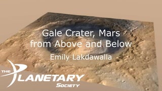
- 1. Gale Crater, Mars from Above and Below Emily Lakdawalla
- 2. This is Mars • (The view is from Rosetta during its February 2007 flyby)
- 3. This is Mars • (The view is from Rosetta during its February 2007 flyby)
- 4. This is Mars • (The view is from Rosetta during its February 2007 flyby)
- 5. (Phobos) This is Mars Gale Crater • (The view is from Rosetta during its February 2007 flyby)
- 6. Zooming in… • Gale Crater is 154 km wide • Near the equator • On the highland/lowland boundary • Specifically: 5°S, 138°E • Opportunity is at 2°S, 355°E • Spirit was at 15°S, 175°E
- 7. Zooming in… • Gale Crater is 154 km wide • Near the equator • On the highland/lowland boundary • Specifically: 5°S, 138°E • Opportunity is at 2°S, 355°E • Spirit was at 15°S, 175°E
- 8. Zooming in… • Gale Crater is 154 km wide • Near the equator • On the highland/lowland boundary • Specifically: 5°S, 138°E • Opportunity is at 2°S, 355°E • Spirit was at 15°S, 175°E
- 9. Zooming in… • Gale Crater is 154 km wide • Near the equator • On the highland/lowland boundary Gale Crater • Specifically: 5°S, 138°E • Opportunity is at 2°S, 355°E • Spirit was at 15°S, 175°E
- 10. Gale Crater is a deep hole containing a big mountain • Landing site is in lowest part of crater, north of central mound • Landing site is at about 4500 meters below Mars average • Central mound rises about 5500 Gale Crater meters from that • Central mound officially named Aeolis Mons • Before it was officially named Curiosity science team unofficially titled it Mount Sharp
- 11. Gale Crater is a deep hole containing a big mountain • Landing site is in lowest part of crater, north of central mound • Landing site is at about 4500 meters below Mars average • Central mound rises about 5500 meters from that • Central mound officially named Aeolis Mons • Before it was officially named Curiosity science team unofficially titled it Mount Sharp
- 12. Gale is an OLD crater • Here’s a fresh, biggish Martian crater, Tooting • Note crisp, continuous rim with arcuate slumps • Flat floor • Pointy peak • Ejecta splash • Caveat: 27 kilometers, only 1/6 the size of Gale
- 13. Gale is an OLD crater • Rim subdued, discontinuous, dissected • A lot of topography in floor • Mound is WAY bigger than a central peak • (Gale most likely had a peak ring to begin with) • The whole thing has probably been buried, exhumed, eroded, partially refilled, eroded some more
- 14. Curiosity aimed here • Landing ellipse: 20 x 7 kilometers
- 16. A note before we zoom in more… • The image at right is composed of data from three orbiters: • Image data from Mars Reconnaissance Orbiter CTX • Elevation data from Mars Express HRSC • Color data from Viking Orbiter • Yes, Viking Orbiter • When we zoom to higher resolution, we will lose color because resolution is too low.
- 17. Zoom in some more
- 20. Some distances • From landing location to “Glenelg” – 400 m • From landing location to nearest spot at base of mound – 6 km • From landing location to point where they’ll turn to cross the dune field – 8 km • Green traverse in straight-line segments (actual odometry will be much higher) – 25 km • To do that in 687 days, will have to average about 250 m/week
- 21. The view from here (Looking south)
- 22. The view from here (Looking south)
- 23. The view from here (Looking south) • With some effort you can match up a lot of the features seen in orbital images
- 24. The view from here (Looking south) • With some effort you can match up a lot of the features seen in orbital images • This contains the area they’re planning to drive • But most of the drive is in a valley hidden from view • And that’s where the good stuff is