Download as PDF, PPTX
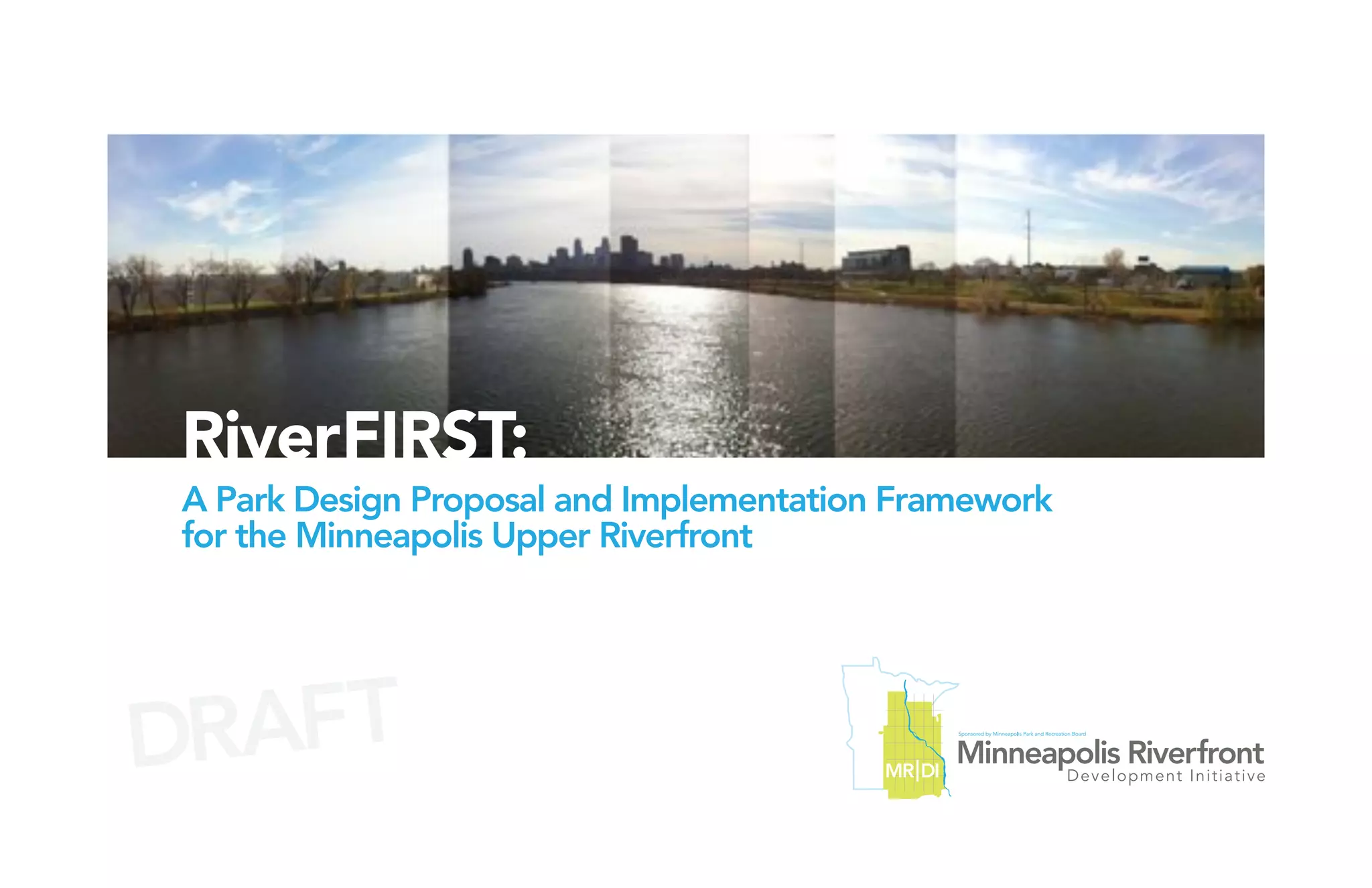
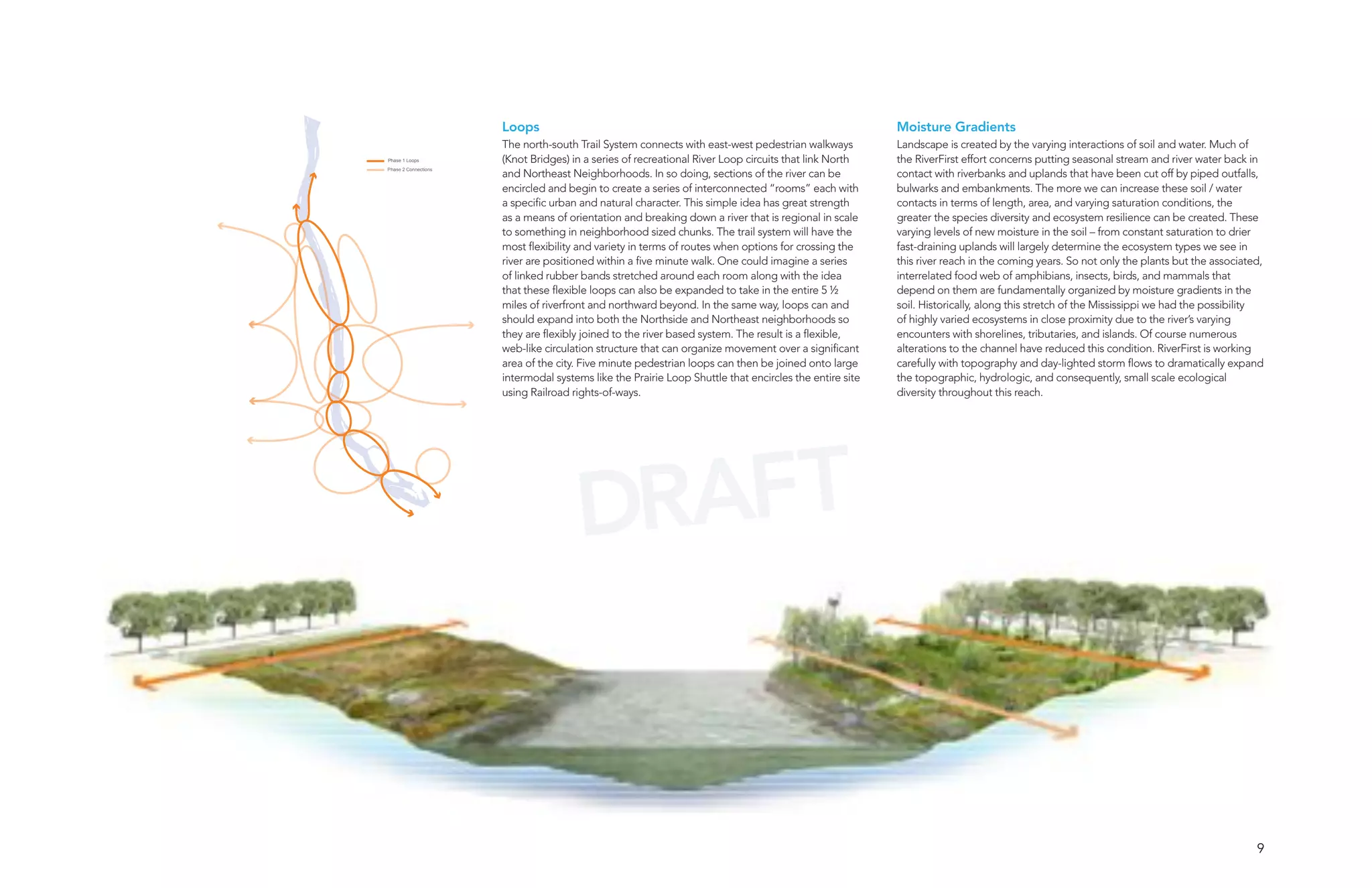
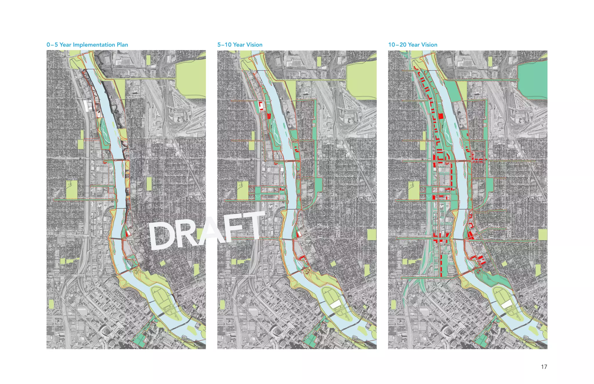
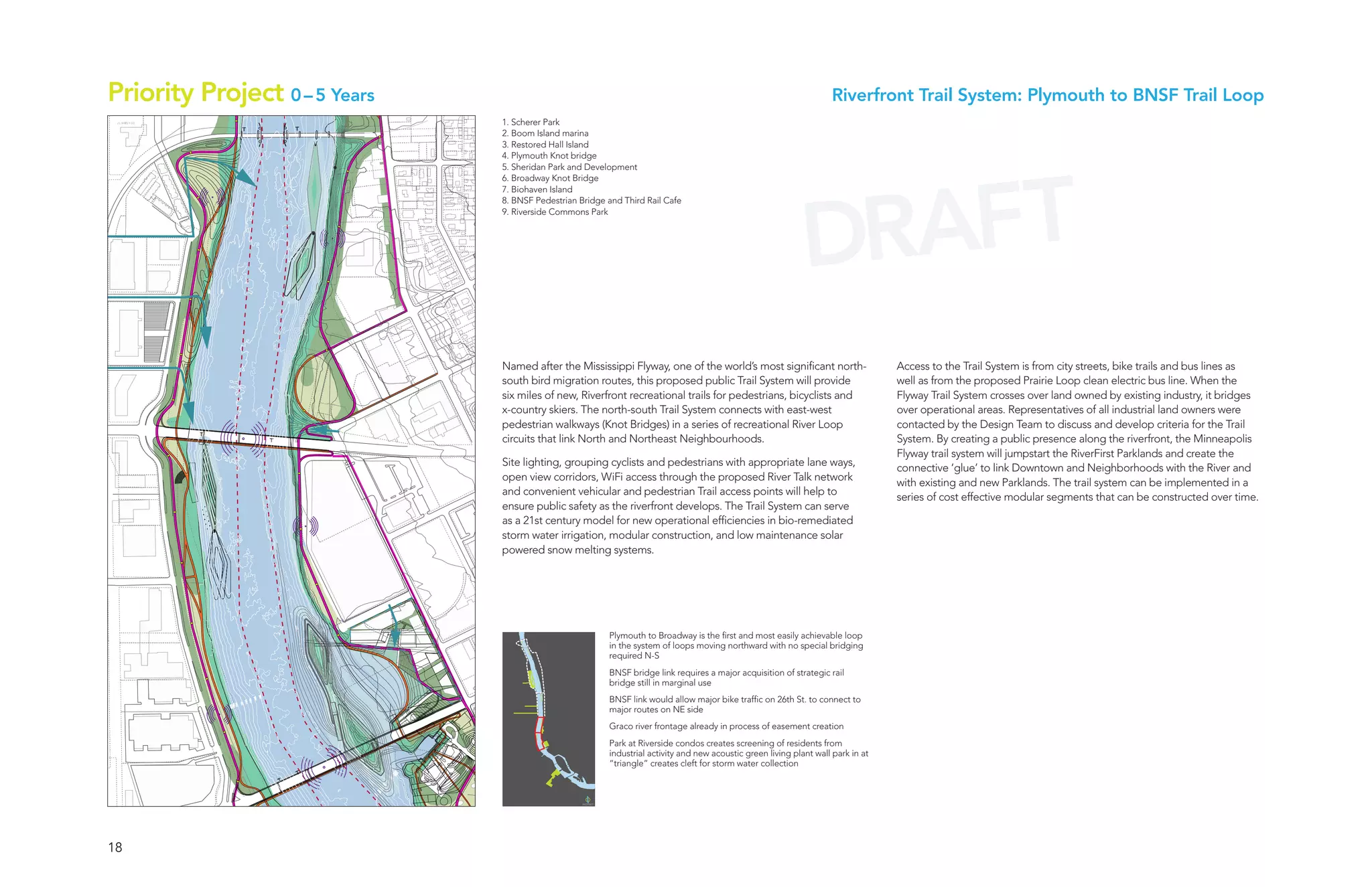
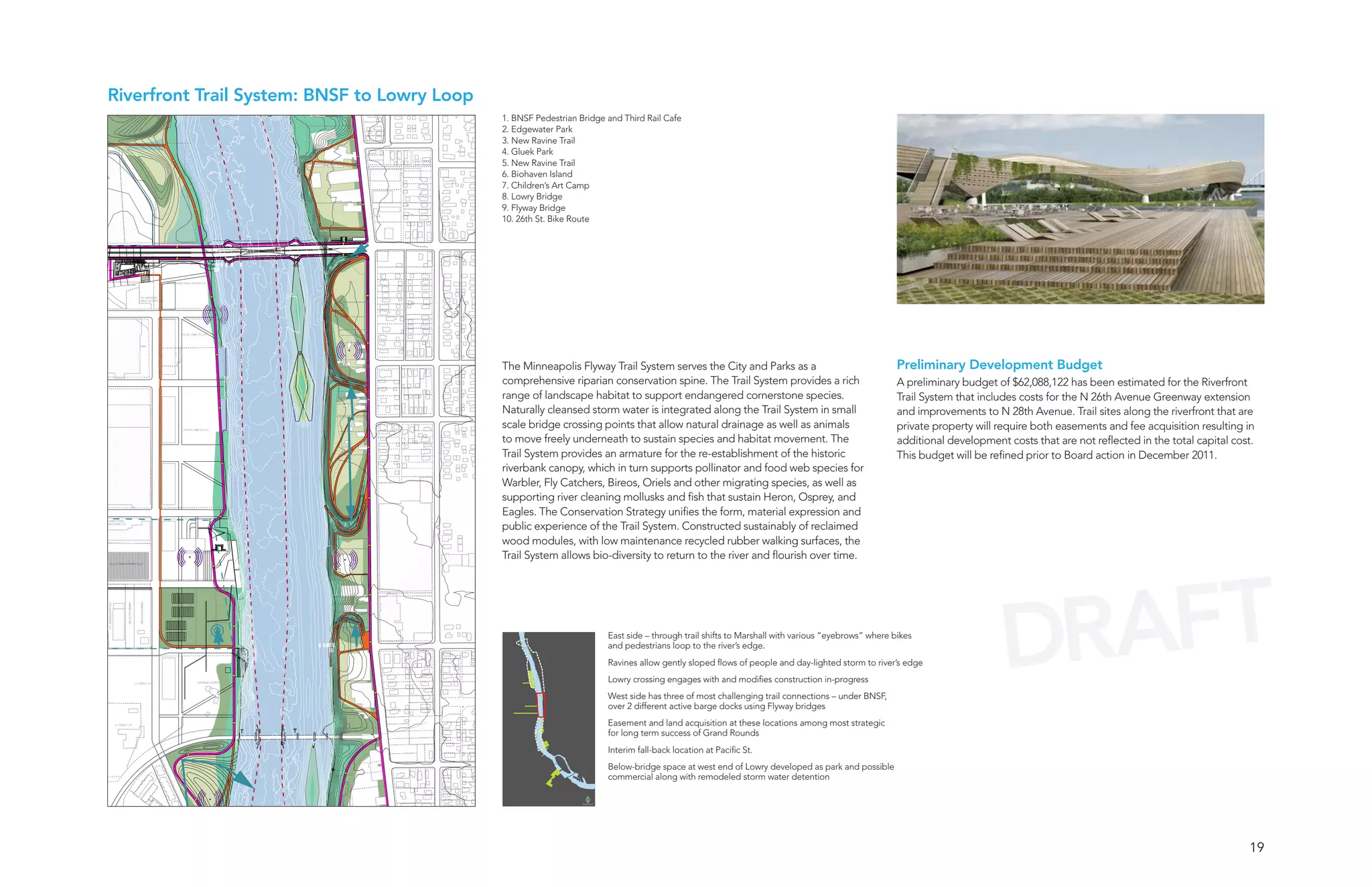
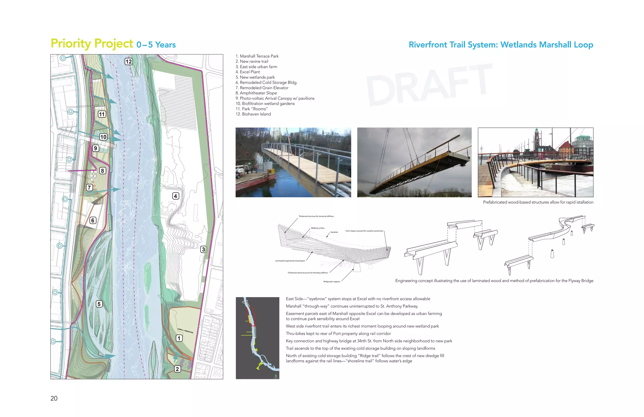
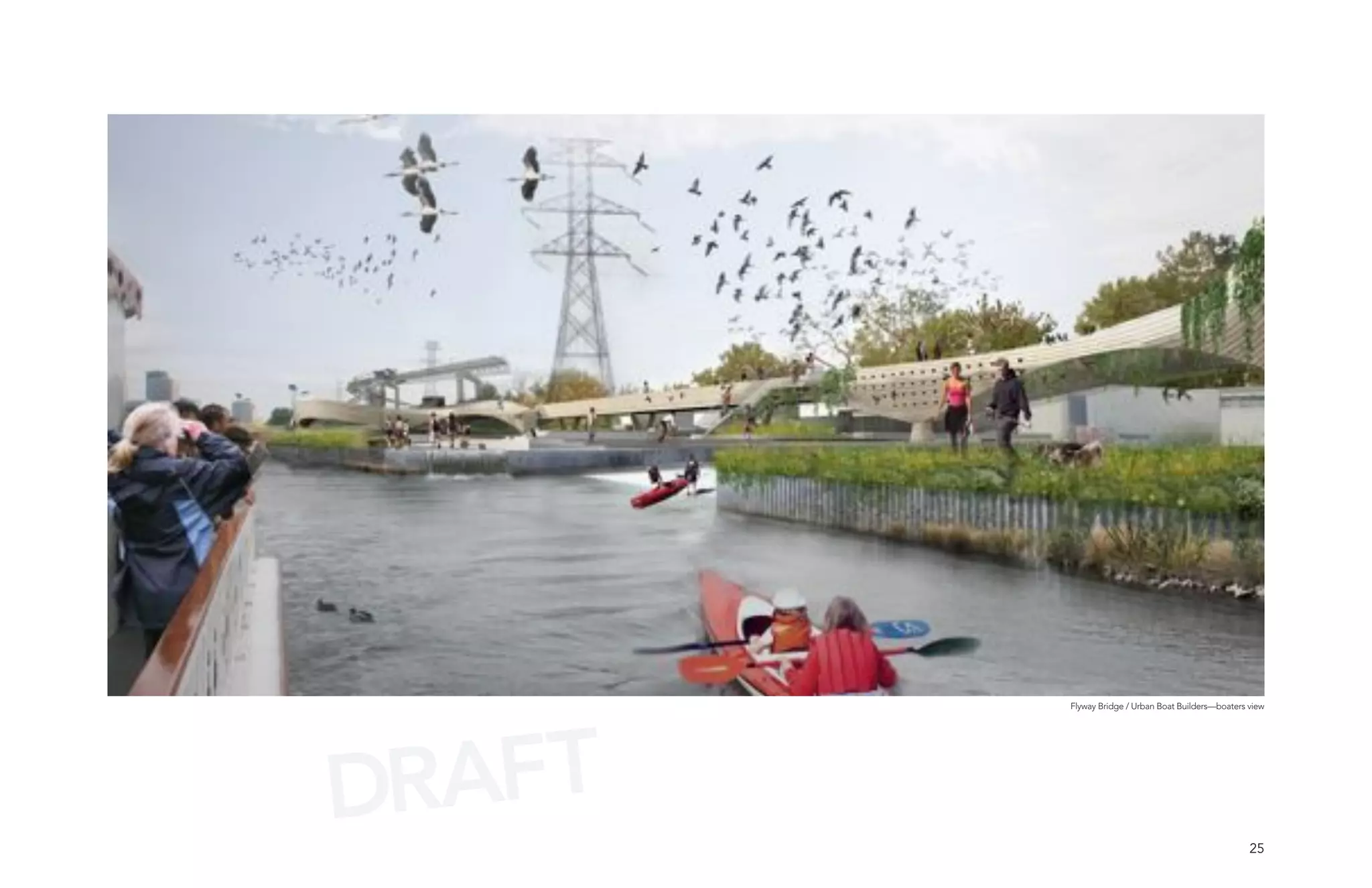
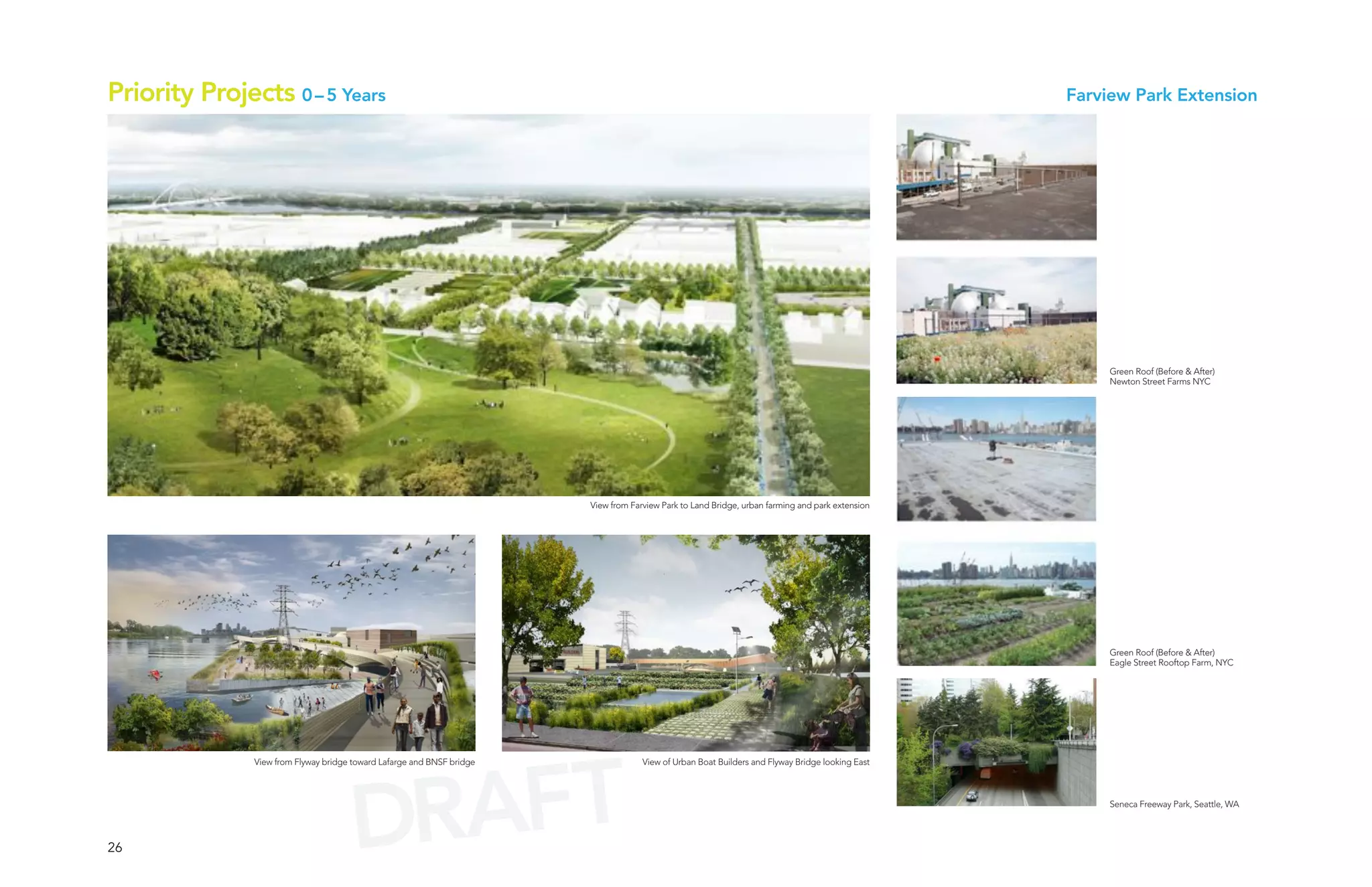
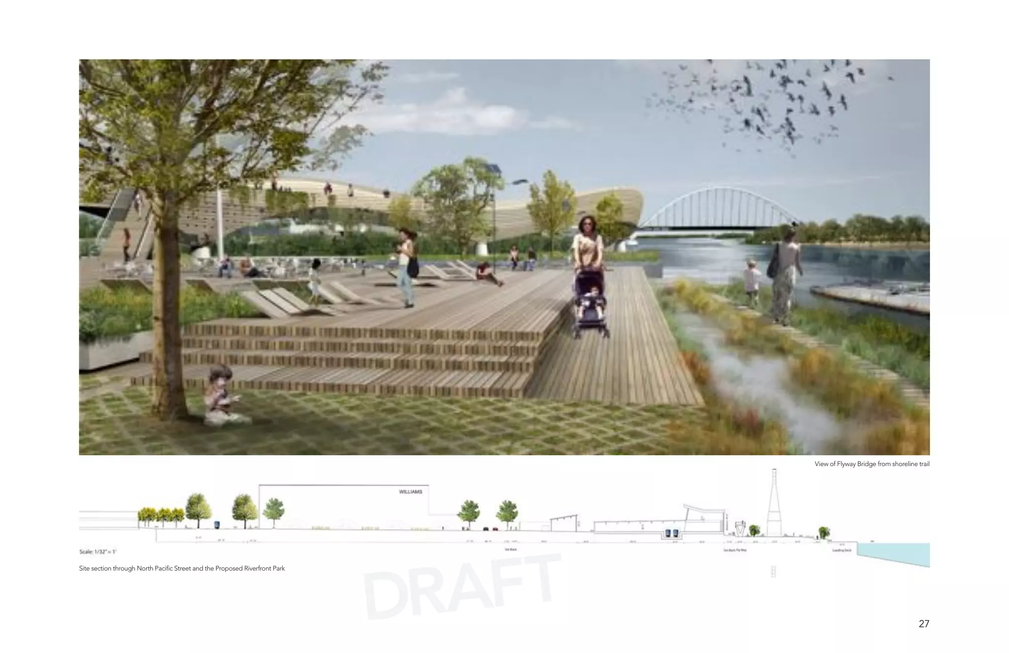
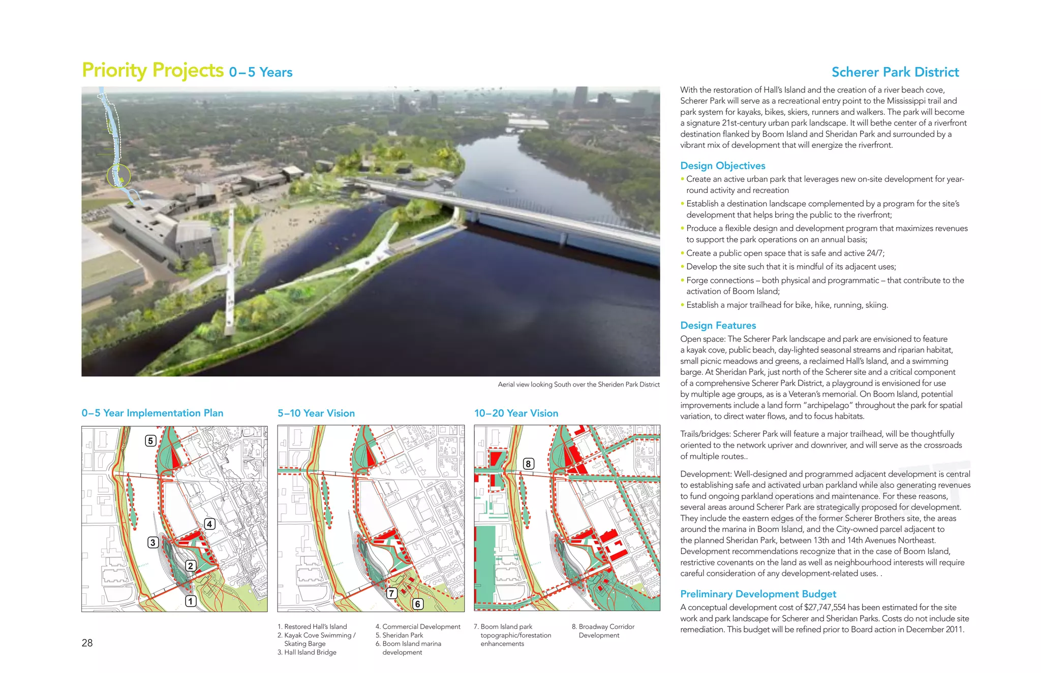
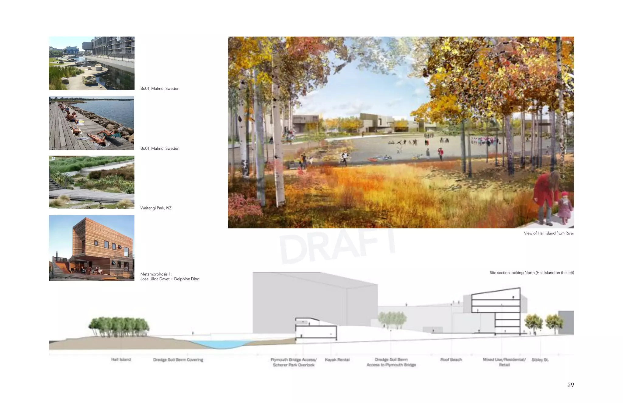
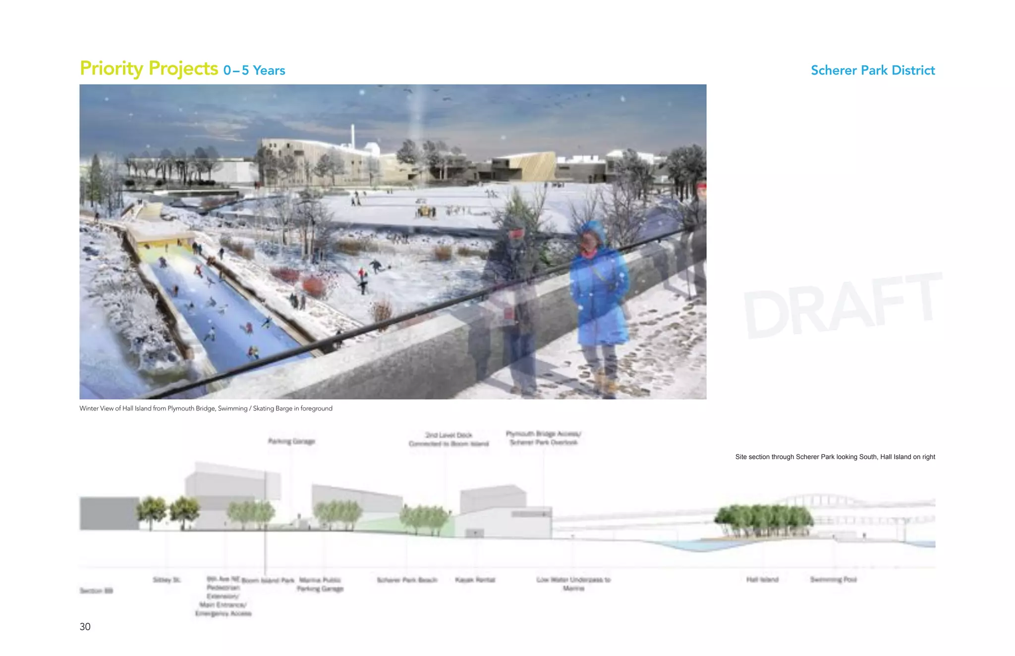
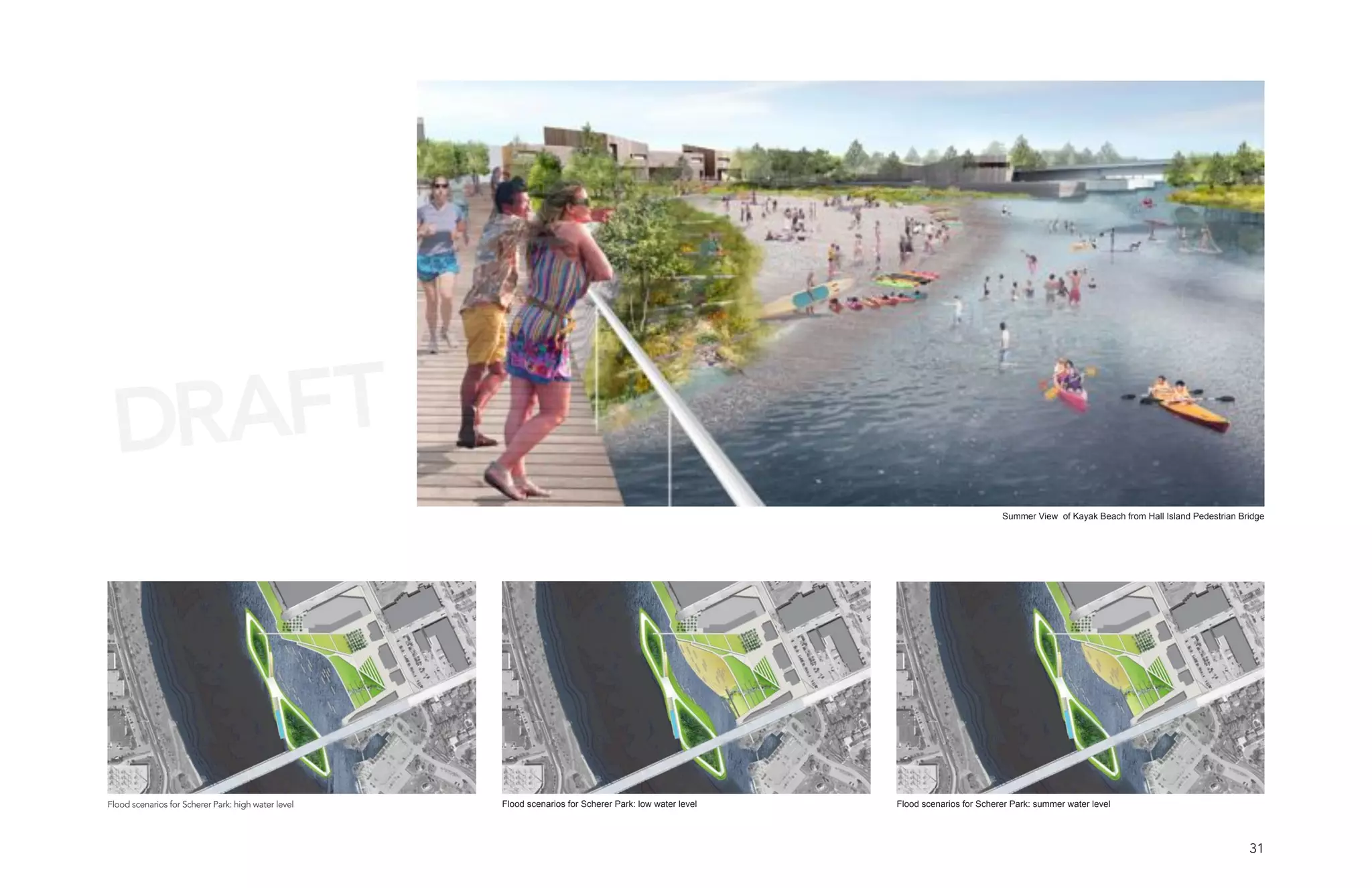
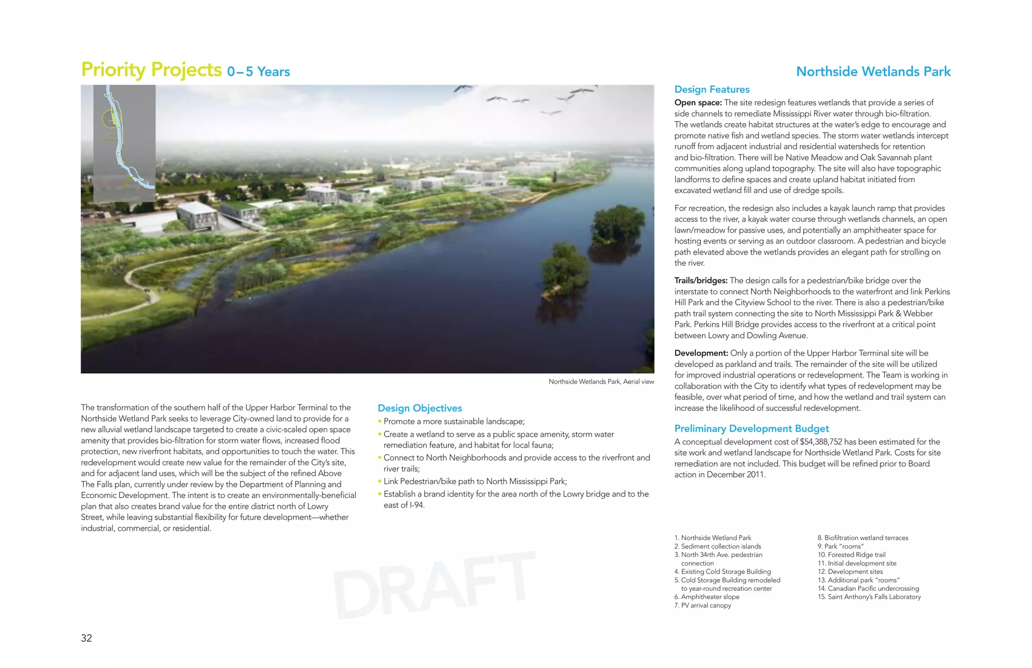
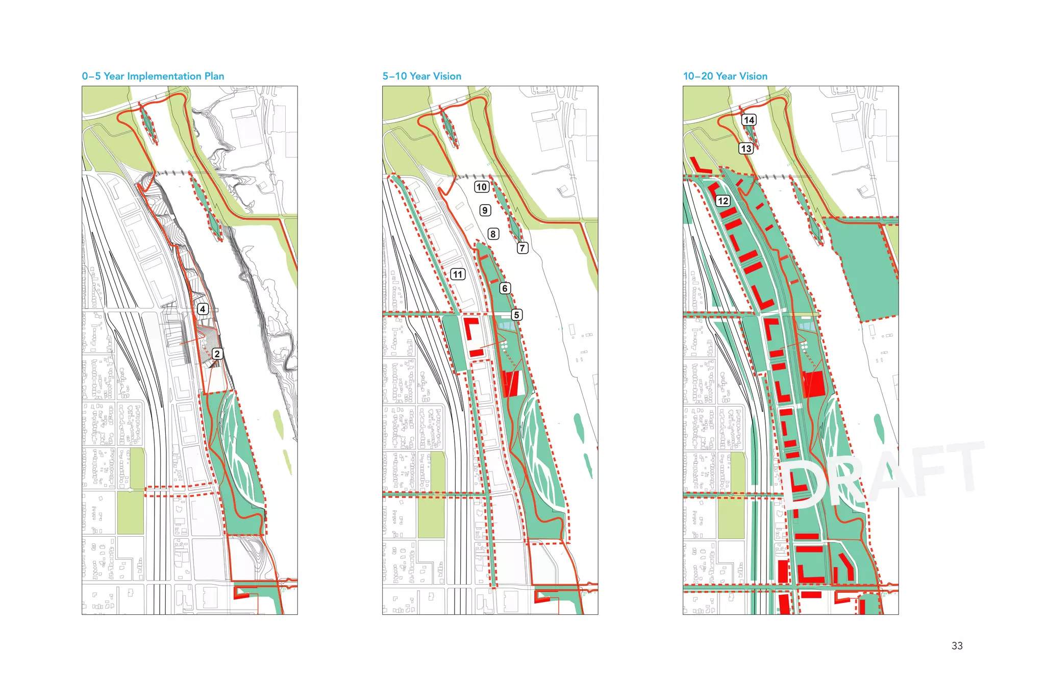
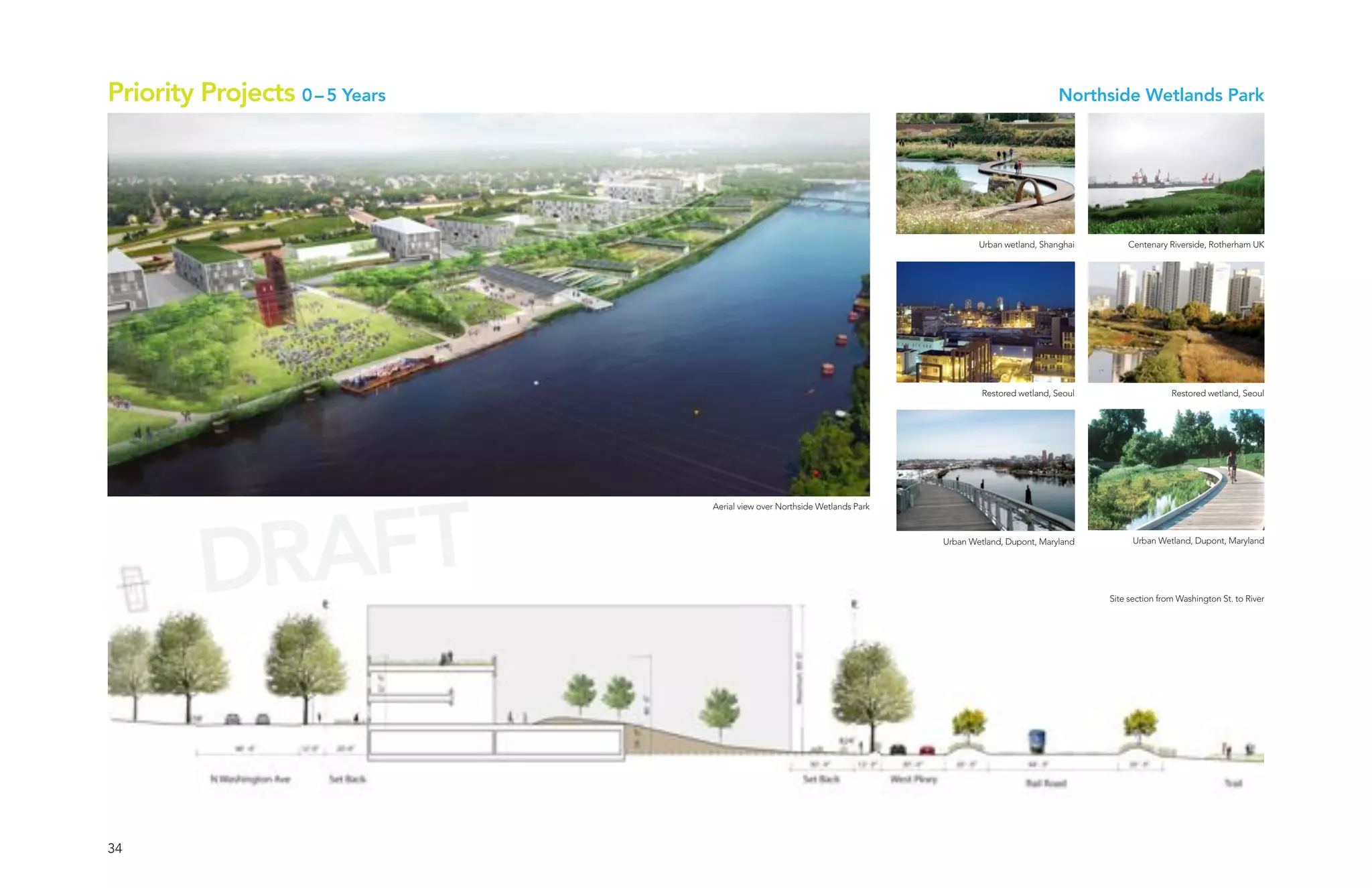
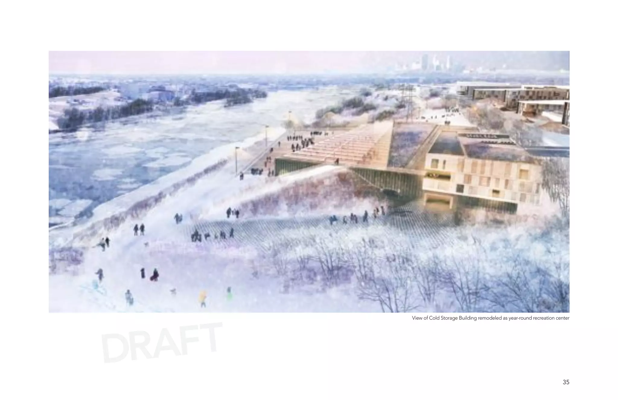
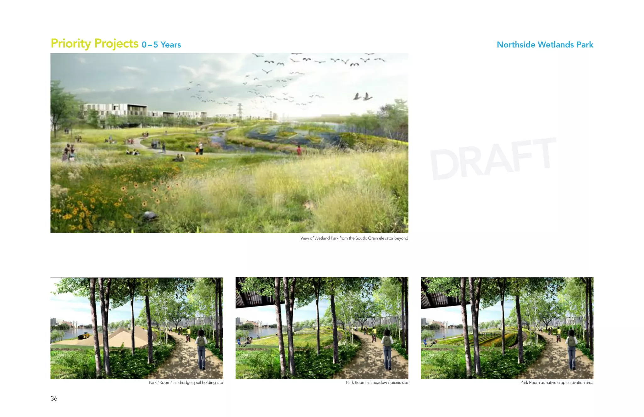
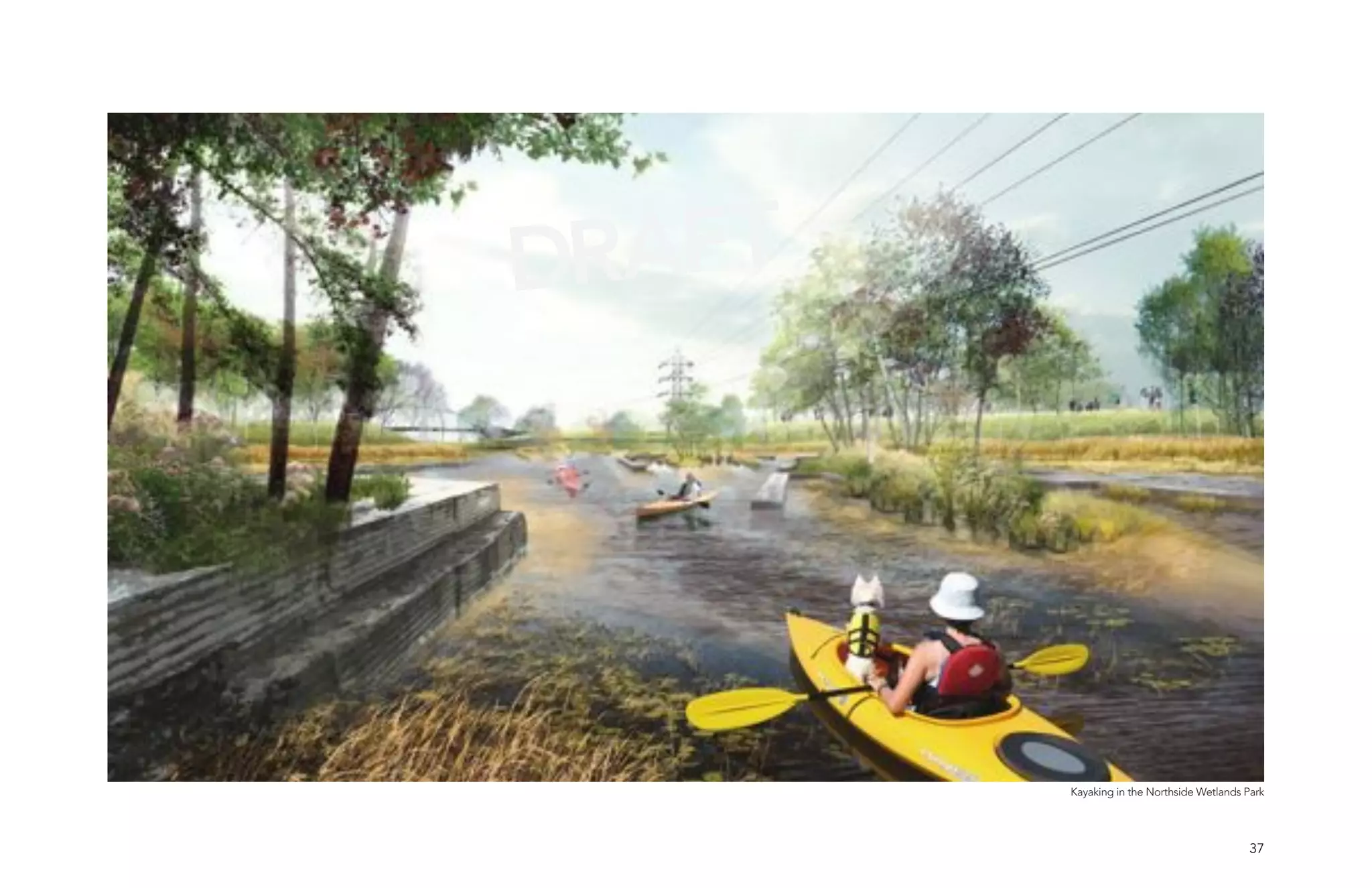
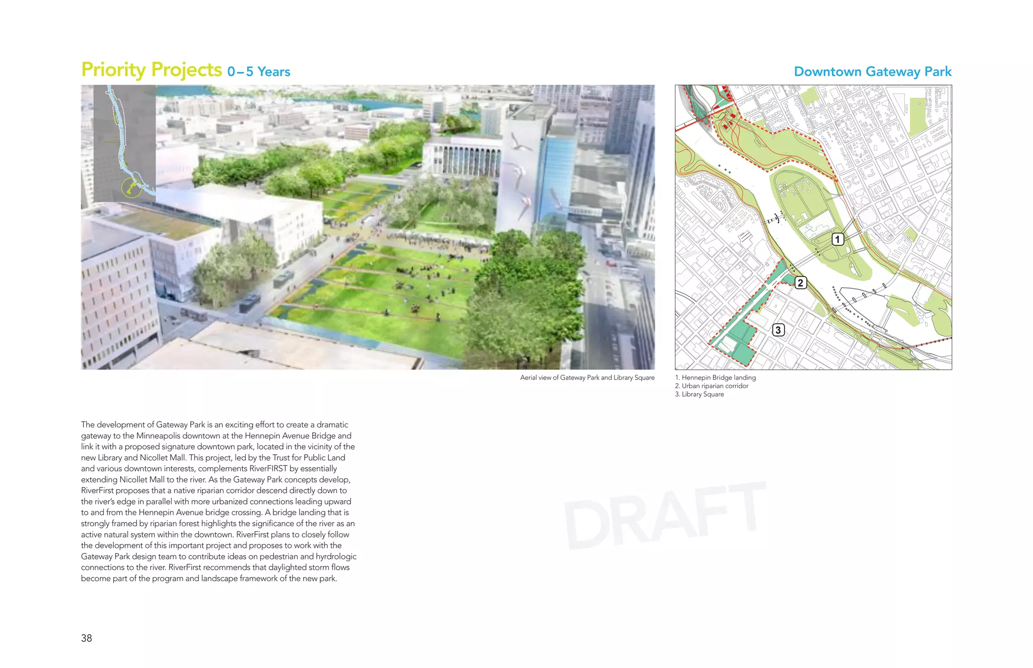
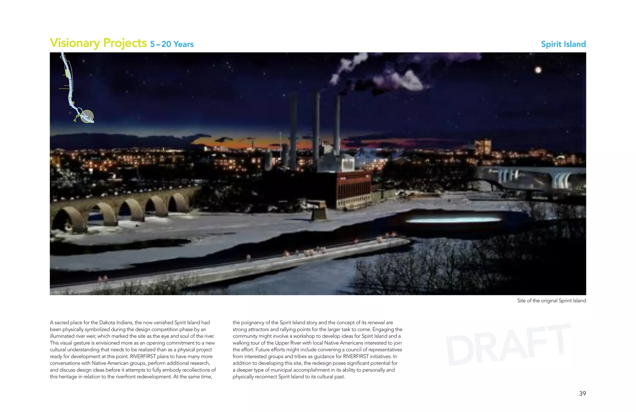
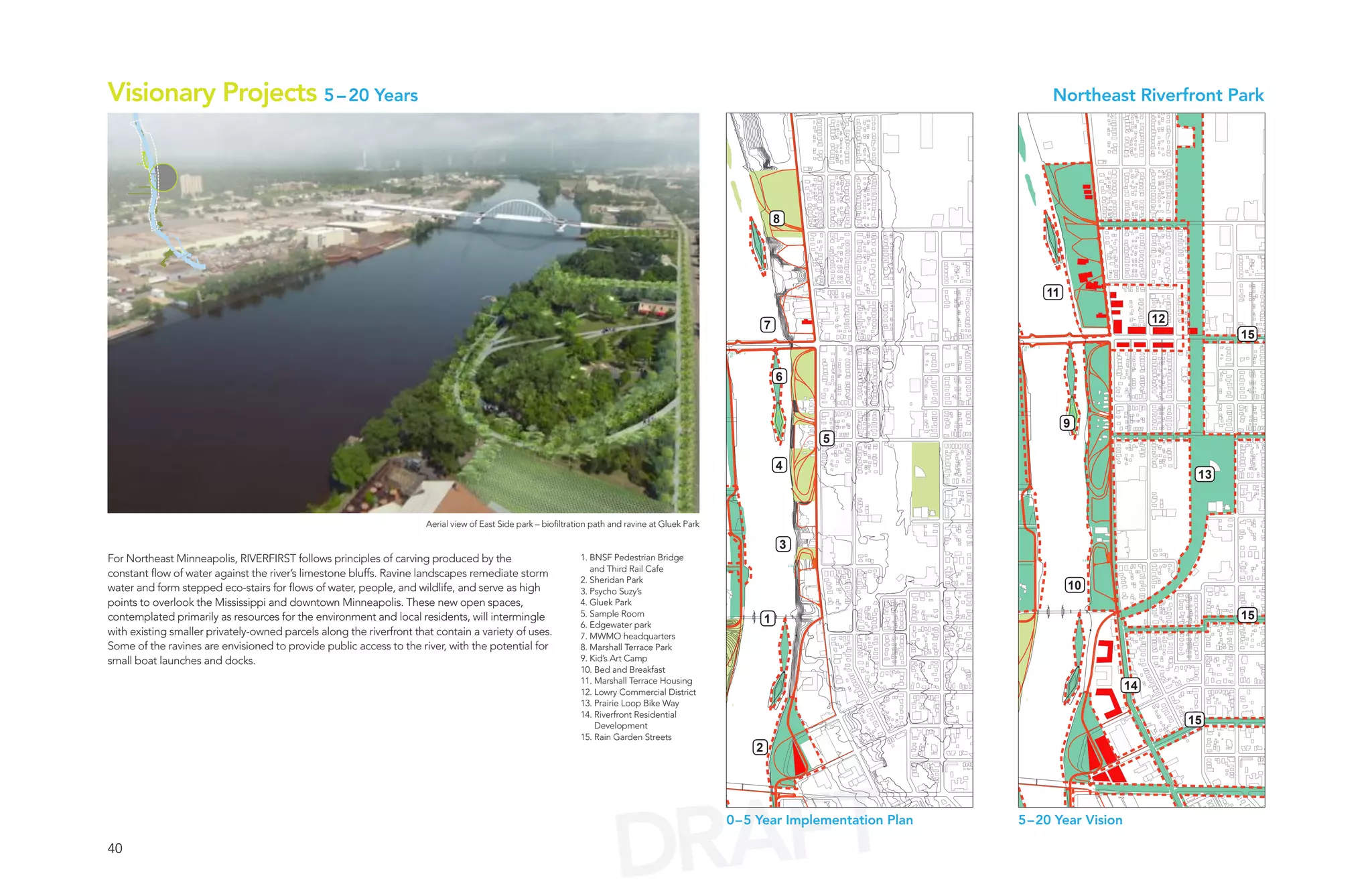
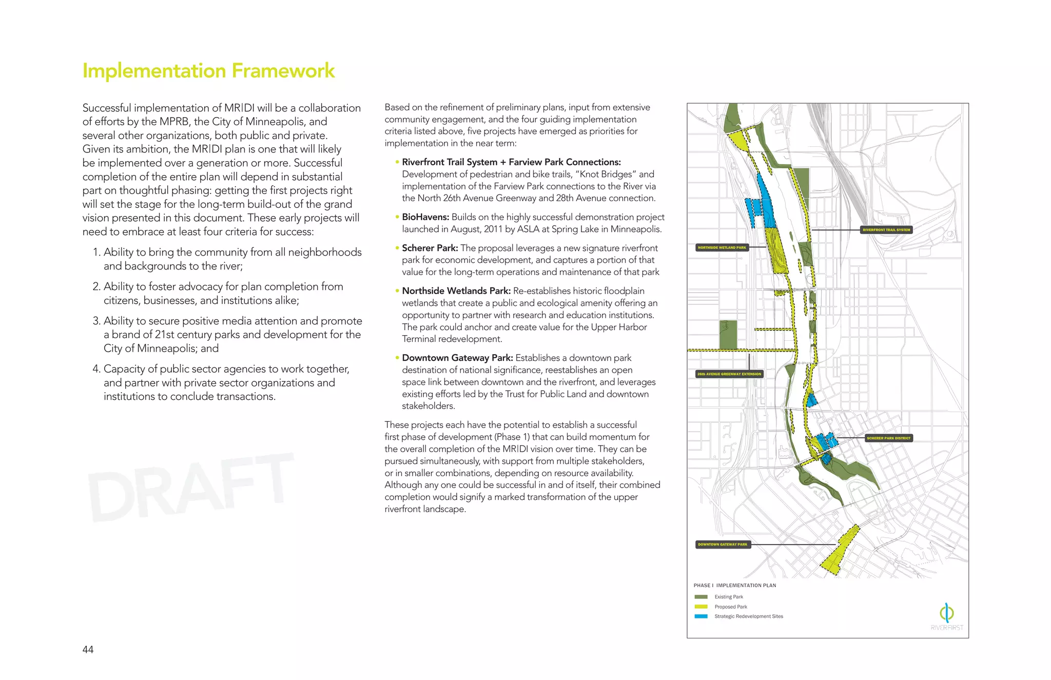
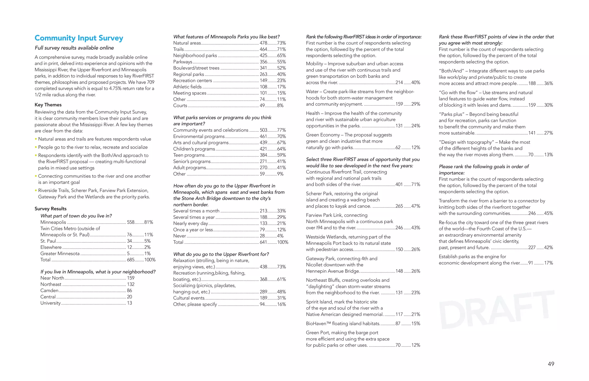
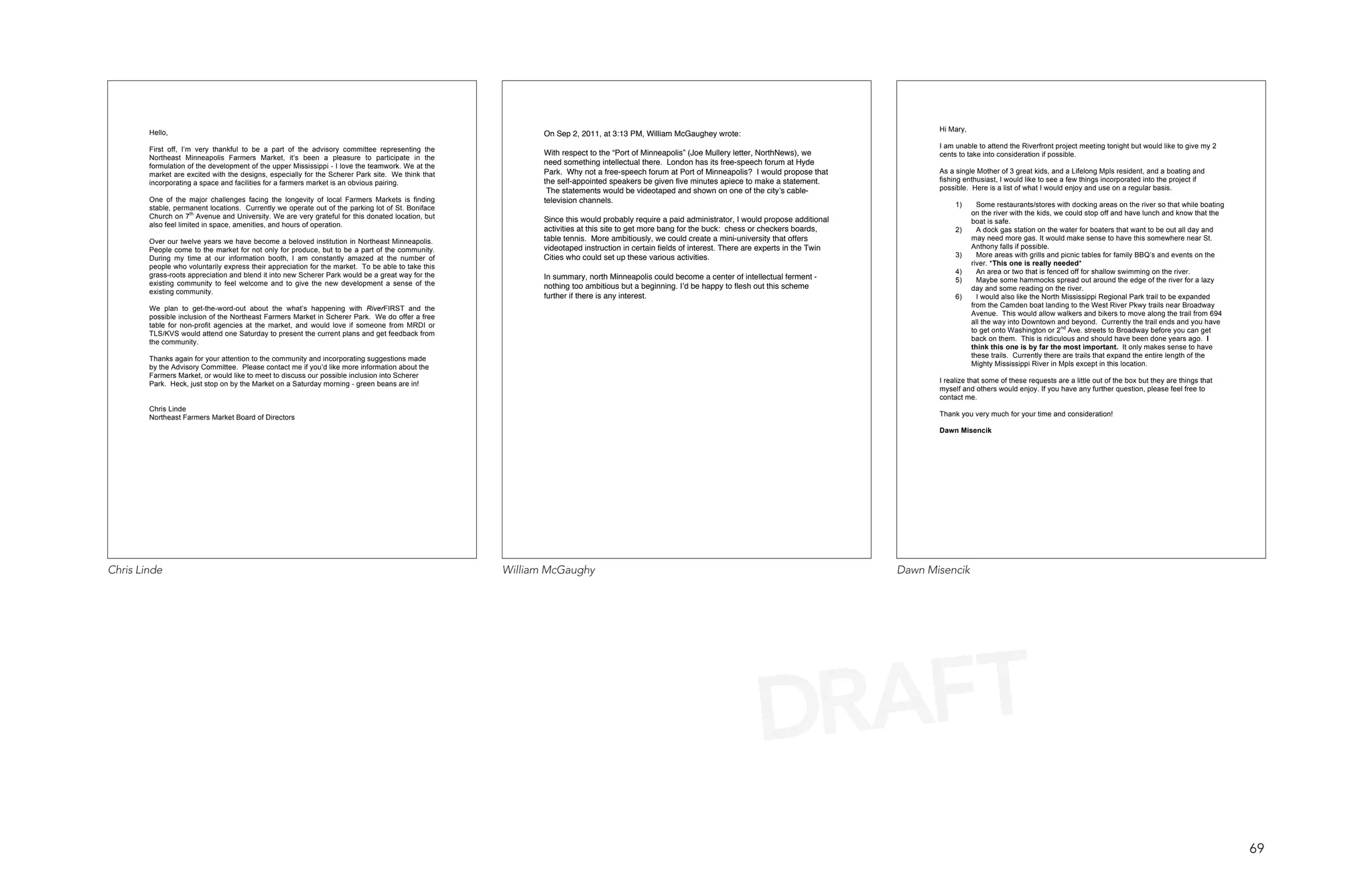
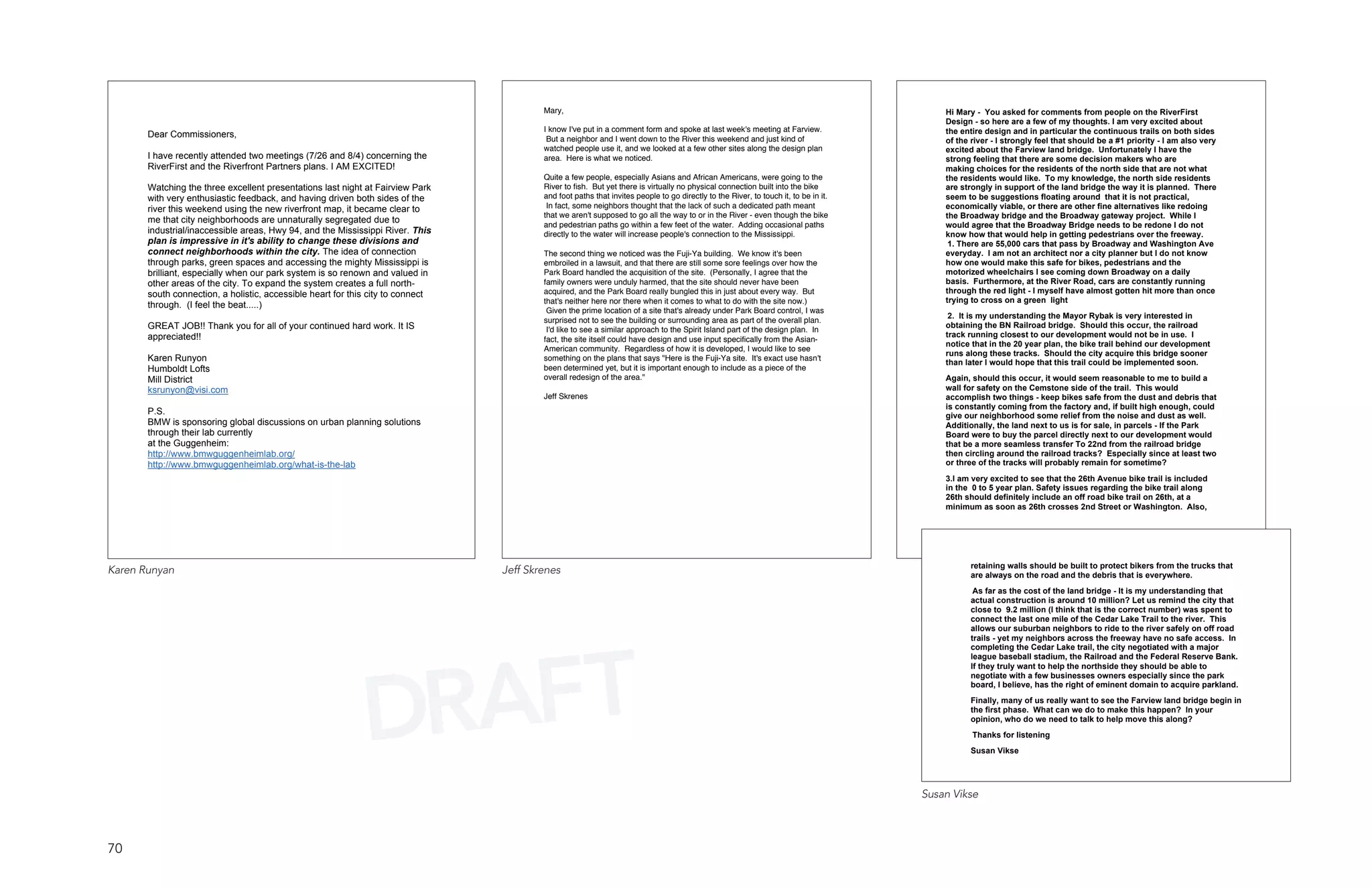
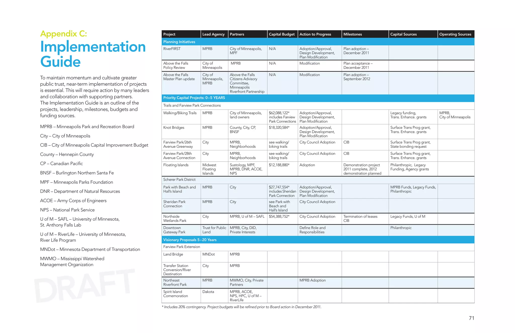

The RiverFirst initiative proposes a comprehensive plan for the Minneapolis upper riverfront, aiming to enhance public parks and integrate the river into the community's identity while fostering economic development. It identifies key areas for transformation, including new parks, trail systems, and ecological restorations, built through extensive community engagement and design competitions. Ultimately, this proposal seeks to create a sustainable, vibrant, and connected riverfront that serves as an environmental and cultural asset for future generations.


![[보도자료]방향제·탈취제 80%에서 알러지 유발물질 검출(2013년)](https://cdn.slidesharecdn.com/ss_thumbnails/random-130313233300-phpapp02-thumbnail.jpg?width=640&height=640&fit=bounds)


![[SIP 2015] Design Proposal: Design and animated prototype](https://cdn.slidesharecdn.com/ss_thumbnails/sipproposal-150921101919-lva1-app6892-thumbnail.jpg?width=640&height=640&fit=bounds)


![Chapter4_Initiation_of_Sediment_Motion_v2[1].pptx](https://cdn.slidesharecdn.com/ss_thumbnails/chapter4initiationofsedimentmotionv21-251208223747-f94ef163-thumbnail.jpg?width=640&height=640&fit=bounds)


![Wondershare Filmora 15.0.11 Crack for Mac Key Full Download [Latest] pptx](https://cdn.slidesharecdn.com/ss_thumbnails/software-251207184836-1d16ba16-thumbnail.jpg?width=640&height=640&fit=bounds)


![Driver Easy Pro Key 7.1.0.2641 Full Mac Crack Free Activated Download [2026]....](https://cdn.slidesharecdn.com/ss_thumbnails/software-251207185324-b2fb71b4-thumbnail.jpg?width=640&height=640&fit=bounds)


![Soundtoys Mac v5.5.5.0 Crack for MacOS Full Version [Latest] pptx](https://cdn.slidesharecdn.com/ss_thumbnails/softwareoverview-251207193711-91d8ae6b-thumbnail.jpg?width=640&height=640&fit=bounds)