2013 Enterprise Track, Delta County’s GIS solution for Public Safety and Public Access by James Kelt and Paul Healy
•
1 like•347 views

This session will cover all aspects of the County’s GIS initiatives as it relates to enterprise wide GIS deployment. Delta County GIS Department has leveraged the power of Esri’s ArcGIS Server 10.1 integrating dispatching software for the Computer Aided Dispatch module and Public Web interface. Real-time calls for service are plotted for dispatchers, enabling them with full GIS capabilities when responding and dispatching deputies. This has given Delta County a common operational picture to make intelligent decisions based on real world locations covering a 1,149 square mile area. It also serves as the the County’s public web portal providing citizens with GIS capabilities, searches, queries and a wealth of additional functionality.

Recommended
Recommended
More Related Content
Similar to 2013 Enterprise Track, Delta County’s GIS solution for Public Safety and Public Access by James Kelt and Paul Healy
Similar to 2013 Enterprise Track, Delta County’s GIS solution for Public Safety and Public Access by James Kelt and Paul Healy (20)
More from GIS in the Rockies
More from GIS in the Rockies (20)
Recently uploaded
Recently uploaded (20)
2013 Enterprise Track, Delta County’s GIS solution for Public Safety and Public Access by James Kelt and Paul Healy
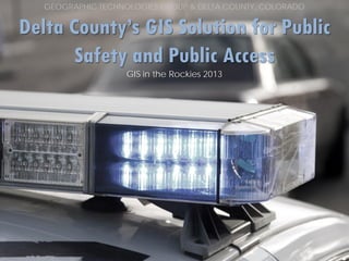
- 1. GEOGRAPHIC TECHNOLOGIES GROUP & DELTA COUNTY, COLORADO Delta County’s GIS Solution for Public Safety and Public Access GIS in the Rockies 2013
- 2. TABLE OF CONTENTS INTRODUCTION VANTAGE POINTS DISPATCH VANTAGE POINTS WEB SOFTWARE REVIEW GEOGRAPHIC TECHNOLOGIES GROUP & DELTA COUNTY, COLORADO
- 3. TABLE OF CONTENTS INTRODUCTION VANTAGE POINTS DISPATCH VANTAGE POINTS WEB SOFTWARE REVIEW GEOGRAPHIC TECHNOLOGIES GROUP & DELTA COUNTY, COLORADO
- 4. Introduction Delta County, Colorado- Welcome to beautiful Delta County, located on Colorado's western slope at the base of Grand Mesa, one of the largest flat top mountains in the world. Our mission as a County is to provide a safe and healthy community for present and future generations by providing equitable and quality service to the public, by treating one another with respect and dignity, and by acting with fiscal responsibility. GEOGRAPHIC TECHNOLOGIES GROUP & DELTA COUNTY, COLORADO
- 5. Introduction Geographic Technologies Group, Inc. (GTG) was established in 1997 with offices in North Carolina, Florida, Texas, and California. GTG is an Award Winning Company and is the #1 Firm in North America for GIS System Integration, GIS Software Engineering, GIS Training and Education. • • Over 400 GIS Implementations Software Integration 700+ Clients Esri User Conference 2012 Special Achievement in GIS Award International Esri Award for Mobile GIS Software GEOGRAPHIC TECHNOLOGIES GROUP & DELTA COUNTY, COLORADO
- 6. TABLE OF CONTENTS INTRODUCTION VANTAGE POINTS DISPATCH VANTAGE POINTS WEB SOFTWARE REVIEW GEOGRAPHIC TECHNOLOGIES GROUP & DELTA COUNTY, COLORADO
- 7. Vantage Points Built on the technology of Vantage Points uses ArcGIS Server & ArcGIS Online
- 8. Vantage Points WH Y 1 Simple Integration to all other databases ? 2 Feature Rich Software that’s easy to use 3 A Scalable solution that includes Mobile GIS Tools
- 9. Vantage Points 10 CRI TI CAL GI S FUNCTI ONS OF VANTAGE POINTS 1 2 3 4 5 6 7 8 M a p T i p s & Tr a n s p a r e n c y To o l s Heat Maps Executive Dashboard Multi-Criteria Dynamic Visualization Advanced Repor ting Configuration Connects to Computer Aided Dispatch 9 SAF (Security Access Functionality) 10 Multiple Base Maps
- 10. Vantage Points Dispatch GEOGRAPHIC TECHNOLOGIES GROUP & DELTA COUNTY, COLORADO
- 11. Vantage Points Dispatch GEOGRAPHIC TECHNOLOGIES GROUP & DELTA COUNTY, COLORADO
- 12. Vantage Points Dispatch GEOGRAPHIC TECHNOLOGIES GROUP & DELTA COUNTY, COLORADO
- 13. Vantage Points Dispatch GEOGRAPHIC TECHNOLOGIES GROUP & DELTA COUNTY, COLORADO
- 14. Vantage Points Dispatch GEOGRAPHIC TECHNOLOGIES GROUP & DELTA COUNTY, COLORADO
- 15. Vantage Points Dispatch GEOGRAPHIC TECHNOLOGIES GROUP & DELTA COUNTY, COLORADO
- 16. Vantage Points Dispatch GEOGRAPHIC TECHNOLOGIES GROUP & DELTA COUNTY, COLORADO
- 18. TABLE OF CONTENTS INTRODUCTION VANTAGE POINTS DISPATCH VANTAGE POINTS WEB SOFTWARE REVIEW GEOGRAPHIC TECHNOLOGIES GROUP & DELTA COUNTY, COLORADO
- 19. Vantage Points Web GEOGRAPHIC TECHNOLOGIES GROUP & DELTA COUNTY, COLORADO
- 20. Vantage Points Web GEOGRAPHIC TECHNOLOGIES GROUP & DELTA COUNTY, COLORADO
- 21. Vantage Points Web GEOGRAPHIC TECHNOLOGIES GROUP & DELTA COUNTY, COLORADO
- 22. Vantage Points Web GEOGRAPHIC TECHNOLOGIES GROUP & DELTA COUNTY, COLORADO
- 23. Vantage Points Web GEOGRAPHIC TECHNOLOGIES GROUP & DELTA COUNTY, COLORADO
- 24. Vantage Points Web GEOGRAPHIC TECHNOLOGIES GROUP & DELTA COUNTY, COLORADO
- 25. Vantage Points WH Y U S E V A N T A G E P O I N T S ? 1 2 3 4 5 6 7 8 9 10 11 12 13 14 15 16 17 Improve Efficiency Increase productivity Save Time Save Money Make Better Quality & More Effective Decisions Improve Data Accuracy A u t o m a t e Wo r k f l o w P r o c e d u r e s Save Lives Improved Information Processing Comply with State and Federal Mandates P r o t e c t Yo u r C o m m u n i t y Improve Communication, Coordination, & Collaboration P ro vid e Da t a t o Re g ula t o r s, De ve lo p e r s, & o t he r Int e r e s t e d Pa r t ie s Respond More Quickly to Citizen Requests Improve Citizen Access to Government Effective Management of Assets and Resources Environmental Sustainability It’s the Power of 17
- 26. GEOGRAPHIC TECHNOLOGIES GROUP & DELTA COUNTY, COLORADO Delta County’s GIS Solution for Public Safety and Public Access GIS in the Rockies 2013