1. Metro Seamlessly Tracks Over
$360 Million in Public Investments
with Terramet
TerraTrak is the open source version of the
Terramet platform
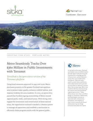
Using bond measures approved in 1995 and 2006, Metro
purchases property in the greater Portland metropolitan
area to protect water quality, enhance wildlife habitat, and
improve livability for area residents. In 2013, an option levy
passed that funded ongoing stewardship of Metro-owned
regional parks, trails, and natural areas. With strong voter
support for investment and conservation of these natural
areas, the organization realized it needed a cohesive system
to manage all operations and establish a mechanism to
efficiently share program results with the general public.
T E R R A T R A K C A S E S T U D Y : P O R T L A N D M E T R O
Customer Success
As far back as the 1950s, Portland
area leaders saw an unfilled need to
provide region-wide planning and
coordination to manage growth,
infrastructure, and development
issues that cross jurisdictional
boundaries. They also saw a
need to protect farms and forests
from urbanization and to provide
services that are regional in nature.
More than 30 years ago, Metro was
created to fill that void, becoming
the nation’s first directly-elected
regional government. Today,
Metro serves more than 1.5 million
people in Clackamas, Multnomah,
and Washington counties as
they work with communities,
businesses, and residents to
chart a wise course for the future
while protecting the things
everyone loves about the region.
2. THE CHALLENGE
In order to increase visibility, report on progress, and share program
results, Metro needed to solve the following three issues:
1. Decentralized Data
Data from over 330 prior property purchases were spread
across multiple Access databases, dozens of Excel
spreadsheets, and several overflowing filing cabinets.
2. Inconsistent Business Process and Workflow
Metro needed a secure and centralized due diligence
process to track new purchases through each pre-sale
stage and administer post-sale stewardship.
3. Inability to Easily Summarize and Share Results
Since the data was not all collected in a central repository,
summarizing and sharing results to a broader audience
was very difficult and time consuming.
THE SOLUTION
Assess Current Processes and Outline Steps for Improvement
Sitka conducted a complete DataDiagnostic™ assessment of Metro’s
data management needs for its Natural Area Program. The assessment
included dozens of interviews with program staff—including attorneys,
paralegals, scientists, property managers, planners, finance managers, and
GIS specialists. These one-on-one and group interviews yielded a list of
over 100 data-related tasks that the new system could address. Metro and
Sitka worked together to prioritize these findings based on criticality and
frequency. This work culminated in Sitka presenting a new data model and
workflow process that established the groundwork for the Terramet system.
Real-time Visibility of Site-specific Data
Sitka’s iterative development approach included multiple releases of
the new system to implement the defined Lean Improvement Plan.
This allowed Metro staff to immediately begin using the new system
and quickly experience the benefits of having all of their Natural Area
Program data in one place. In addition to centralized control, Metro’s
senior management gained increased visibility into program status
via the following easily accessible data grids and interactive maps:
T E R R A T R A K C A S E S T U D Y : P O R T L A N D M E T R O
DataDiagnostic™ is
a detailed assessment
of your current data
management practices
and systems to provide
you with a clearly-defined
Lean Improvement Plan.
With TerraMet, program
managers, engineers, and
ecologists can proactively
align actions and see how
these actions contribute to
defined performance goals,
budgets, and measures.
“With the workflow improvements that Sitka has helped us identify,
our people can stay focused on their core mission of protecting and
enhancing lands for the public to enjoy.” Katy Weil | Portland Metro
3. Trail map displaying current gaps and progress
Acquisition detail and workflow
Target areas showing progress towards goals
T E R R A T R A K C A S E S T U D Y : P O R T L A N D M E T R O
By the end of 2015,
the platform had over
90 active users,
500+ closed acquisitions,
and 249 prospective
or pending property
purchases representing
a $360 million public
investment spanning
13,200 acres of land
and 24 miles of trails.
With Terramet, Metro has a single, secure source for monitoring every
component of the acquisition and stewardship process. Real-time visibility
into site-specific data enables program managers to proactively align actions
with defined performance goals. With this new level of control, Metro can
address potential acquisition and management issues before they arise.