1 example sample for assignment #1 re 363 parcel asses
1. 1
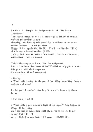
EXAMPLE - Sample for Assignment #1 RE 363: Parcel
Assessment
This vacant parcel is for sale. Please go to Zillow or Redfin’s
website (or another of your
choosing) and look up this parcel by its address or tax parcel
number Address: 24000 SE Black
Nugget Rd Issaquah WA 98029. Tax Parcel Number (TPN)
aka Assessor Parcel Number (APN):
39019 186th Ave SE Auburn WA 98092. Tax Parcel Number:
0620069066. MLS 1548440
This is the sample problem. Not the assignment
Part I: Use identified parts of ZATTSSUM to help you evaluate
this parcel with short responses
for each item. (1 or 2 sentences)
• Zoning:
o What is the zoning for the parcel (use iMap from King County
website and search
by Tax parcel number? See helpful hints on launching iMap
below
▪ The zoning is A10.
o What is the size (in square feet) of the parcel? (Use listing or
iMap. If the listing
only has size in acres, then multiply acres by 43,560 to get
square feet (SF). (1
acre = 43,560 Square feet. 10.5 acres = 457,380 SF).
2. ▪ The parcel size is 441,262 square feet (10.14 acres)
o What is an allowed use on the parcel? (Once you determine
the zoning, use King
County Permitted Use Table below. Only list the uses that
include a “P”
(Permitted use) in the box.
▪ The allowed residential uses are: Single (family) detached,
Residential
Accessory Uses, Home Occupation and Bed & Breakfast Guest
House.
Helpful Hint. Look at the highlighted use table below. It
shows the allowed uses for this
property.
2
Permitted Use Table; Allowed Uses
3
• Access:
3. o Do you have direct access from a public or private street?
Yes, you have direct
access via 186th Ave SE, which is a private road
o Do you see any challenges to access the site? (Use iMap and
Google street view):
No visual challenges are observed.
IMap Basemap:
4
• Title Report: (skip for this assignment)
• Topography (Topo):
o Describe the topography of the site (use King County iMap—
Layers List,
Elevation Contours).
o Do you see a lot of contour lines on the property bunched
tightly together
showing a steep slope, moderate slope, gentle slope or relative
flat?
o What direction does the slope go (i.e. east to west?)
▪ The property has a moderate slope from the south to the north,
4. from
about elevation 550 to 510.
Helpful Hint: For a refresher video on reading topo lines on a
map, you can watch this short
video: https://www.youtube.com/watch?v=CoVcRxza8nI
https://www.youtube.com/watch?v=CoVcRxza8nI
5
• Soils: (skip for this assignment)
• Sensitive Areas:
o Describe what, if any sensitive areas are on or adjacent to the
site use King
County iMap— Layers List, Environmentally Sensitive Areas
Tab).
o Toggle on and off the a few like Erosion hazard, Stream,
Wetland and Sensitive
Area Notice on Title). Are any present on or adjacent to the
site?
▪ On the property, there is a water feature (stream or drainage
ditch) cutting
across a small section on the northeast corner of our site. There
is also an
5. off-site stream on an adjacent site and another adjacent parcel
has a
sensitive area notice on title.
6
• Utilities:
o What utilities are on or near the site (water, sewer, power)
(iMap will identify if
there if there is a Water District or Sewer District that services
this property. If it
says “Water District” or “Sewer District” or “Public”, then we
can figure that utility
service is likely available at our site. Also, use Google Street
view to look around
for power lines (electricity), fire hydrants (water) and sewer
manholes (sewer) in
the street in front of (or near) the property (if you can spot
those, you know the
utility is there. If you don’t, it is an indication that it might not
be available).
▪ King County does not show any public water or public sewer
service to
the property. The MLS listing says it is served by a private
well, a private
septic system and power has already been installed on the site.
6. 7
• Market Study (skip for this assignment)
Part II: Reflecting on the information you have learned from the
ZATTSSUM framework, what
are your thoughts about this parcel? Are you ready to buy it or
what additional research would
you want to do and why before purchasing it? (Summarize in 1-
3 paragraphs)
In addition to Redfin or Zillow, use:
• Google Street View
• King County iMap:
https://kingcounty.gov/services/gis/Maps/imap.aspx
• King County Permitted Use table (Proved below)
Helpful hints to launch iMap and find our property
• https://kingcounty.gov/services/gis/Maps/imap.aspx
• Select “Launch” under the map icon
• Enter the Address or Tax Parcel Number (TPN / APN) in
search area on top left
• Property will have an icon next to it saying search result.
7. • Click/Select the Lot (you may have to click twice) and more
information appears
• Click Assessors Report Link
• Click Property Detail Tab near the top right
https://kingcounty.gov/services/gis/Maps/imap.aspx
https://kingcounty.gov/services/gis/Maps/imap.aspx
8
1
Assignment #1 RE 363: Parcel Assessment
This vacant parcel is for sale. Please go to Zillow or Redfin’s
website (or another of your
choosing) and look up: MLS 1687649. You might also be able
to find it using the Address or tax
parcel number. Address: 24000 SE Black Nugget Rd Issaquah
WA 98029. Tax Parcel Number
(TPN) aka Assessor Parcel Number (APN): 2224069135
Part I (50%): Use identified parts of ZATTSSUM (See table on
last page of assignment) to help
you evaluate this parcel with short responses for each item. (1
or 2 sentences)
• Zoning:
o What is the zoning for the parcel (use iMap from King County
website and search
8. by Tax parcel number? See helpful hints on using iMap on the
next page
o What is the size (in square feet) of the parcel? (Use listing or
iMap. If the listing
only has size in acres, then multiply acres by 43,560 to get
square feet (SF). (1
acre = 43,560 Square feet. 10.5 acres = 457,380 SF).
o What is an allowed use on the parcel? (Once you determine
the zoning, use King
County Permitted Use Table below. Only list the uses that
include a “P”
(Permitted use) in the box.
Helpful Hint. Look at the sample problem with highlighted use
table. It shows the allowed uses
for that property. Follow the same format for this one.
• Access:
o Do you have direct access from a public or private street?
o Do you see any challenges to access the site? (Use iMap and
Google street view)
• Title Report: (skip for this assignment)
• Topography (Topo):
o Describe the topography of the site (use King County iMap—
Layers List,
Elevation Contours).
o Do you see a lot of contour lines on the property bunched
tightly together
9. showing a steep slope, gentle slope or relative flat?
o What direction does the slope go (i.e. east to west?)
Helpful Hint: For a refresher video on reading topo lines on a
map, you can watch this short
video: https://www.youtube.com/watch?v=CoVcRxza8nI
• Soils: (skip for this assignment)
• Sensitive Areas:
o Describe what, if any sensitive areas are on or adjacent to the
site use King
County iMap— Layers List, Environmentally Sensitive Areas
Tab).
o Toggle on and off the a few like Erosion hazard, Stream,
Wetland and Sensitive
Area Notice on Title). Are any present on or adjacent to the
site?
https://www.youtube.com/watch?v=CoVcRxza8nI
2
• Utilities:
o What utilities are on or near the site (water, sewer, power)
(iMap will identify if
there if there is a Water District or Sewer District that services
this property. If it
says “Water District” or “Sewer District” or “Public”, then we
can figure that utility
service is likely available at our site. Also, use Google Street
10. view to look around
for power lines (electricity), fire hydrants (water) and sewer
manholes (sewer) in
the street in front of (or near) the property (if you can spot
those, you know the
utility is there. If you don’t, it is an indication that it might not
be available).
• Market Study (skip for this assignment)
Part II (50%): Reflecting on the information you have learned
from the ZATTSSUM framework,
what are your thoughts about this parcel? Are you ready to buy
it or what additional research
would you want to do and why before purchasing it?
(Summarize in 1-3 paragraphs)
In addition to Redfin or Zillow, use:
• Google Street View
• King County iMap:
https://kingcounty.gov/services/gis/Maps/imap.aspx
• King County Permitted Use table (Proved below)
Helpful hints to launch iMap and find our property
• https://kingcounty.gov/services/gis/Maps/imap.aspx
• Select “Launch” under the map icon
• Enter the Address or Tax Parcel Number (TPN / APN) in
search area on top left
• Property will have an icon next to it saying search result.
11. • Click/Select the Lot (you may have to click twice) and more
information appears
• Click Assessors Report Link
• Click Property Detail Tab near the top right
https://kingcounty.gov/services/gis/Maps/imap.aspx
https://kingcounty.gov/services/gis/Maps/imap.aspx
3
Permitted Use Table; Allowed Uses
4