Wetland Mitigation Recommendaitons
•
0 likes•231 views

Provide wetland mitigation plans to the town of Guilford, Connecticut regarding a parcel of property with areas of concern regarding presumed filled wetlands.

More Related Content
What's hot
What's hot (17)
Viewers also liked
Similar to Wetland Mitigation Recommendaitons
Similar to Wetland Mitigation Recommendaitons (20)
More from Andrea Drabicki
More from Andrea Drabicki (8)
Wetland Mitigation Recommendaitons
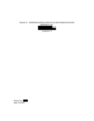
- 1. PHASE II : PROPOSED MITIGATION PLAN RECOMMENDATIONS PROPERTY OF : Mark E. DeAngelis et al 354 Old Whitfield Road Guilford, CT Project No.: 43520 Date: 6/8/2007
- 2. SITE SUMMARY Owner : Mark E. DeAngelis Site : 354 Old Whitfield Street Guilford, CT Parcel ID : 029016B List No. : 9509A / 9509 Total ac. : 3 ac. Altered Area : ¾ ac. of UPL and wetlands PROJECT BACKGROUND To provide recommendations to the town of Guilford for the proposed wetland mitigation plan of the project site. Summation of past site land use found in historical city directories for the town of Guilford, available for review at the Connecticut State Library in Hartford, Connecticut, listed the Site as early as 1967 operating as the Arnold Foundry Company. The Site use was for the production of non ferrous metal alloy castings, aluminum and bronze, with a manifest of solid waste at 20-tons of sand per year. Files found at the CT DEP indicate in 1980 apparent business closure and remnant debris of castings, sand, slag and machine parts remained at the Site. Mark E. DeAngelis appears to have acquired the property around 1988 where the primary Site use is masonry and construction related. In 2005 an “After the Fact ” Regulated Activity application was filed, and approved from the Guilford Inland Wetlands Commission, for the request to place fill in buffer and on-site dumpsters. In April of 2006 a local neighborhood coalition: Committee to Save Guilford Shoreline, Inc. filed an application to intervene pursuant under Conn. Gen. Stat. § 22a-19, the Connecticut Environmental Protection Act (CEPA). It is the understanding of GZA that the Applicant has engaged with a certified Wetland/Soil scientist, Michael S. Klein, and has provided a conceptual mitigation plan for the Site. It is in accordance with the objectives and goals provided by the client, the Town of Guilford, that GZA review all referenced applications and file materials and make recommendations where deemed necessary to supplement the existing Phase II Wetland Mitigation Plan and Existing Conditions Site Plan. 2
- 3. RECOMMENDATIONS Soil/Wetland Scientist – Michael S. Klein o Area of concern is at an upper most range of tidal influence, freshwater wetland species recommended for remediation o Area of concern: South – Maximum depth to groundwater observed: 1.3’ Typical of wetland conditions. Regrading is not required within southern restoration area o Area of concern: North – Maximum depth to groundwater observed: 2.4’ Regrading required within northern restoration area to obtain wetland conditions o Create a secondary treatment area to establish a buffer between onsite invasive plant species, Phragmites australis, and the restoration area o Establish a multi-step restoration process using chemical control, glyphosate (Rodeo), and mechanical control as well as salt-tolerant shrubs to shade out invasive plant species o A 5-year monitoring and maintenance schedule CONCLUSIONS Graphically illustrate through cross-sections existing groundwater elevation depths with existing contour elevations Develop a specified 5-year maintenance plan with scheduled timeline of related remedial activity and applications of process RECOMMENDATIONS Original Site Conditions o Site area established within 100-year flood zone; determine original base flood elevations o Delineate site specific tidal flood zone, calculate total area o Evaluate the area of concern: Is it a part of a flood storage area? Is it a part of a ground water recharge system? What is ground water elevation at full saturation? o Delineate freshwater wetland areas, calculate total area CONCLUSIONS Graphically illustrate through delineated mapping and corresponding tables the topic information listed above in Original Site Condition Recommendations 3
- 4. RECOMMEDATIONS Past Land Use History o Address the concerns of the citizen action group: Committee to Save Guilford Sound (CSGS) as stated in their application to intervene May 26, 2006 that : “debris removal which is reasonably likely to contain hazardous materials with no real plan to insure proper handling of those materials on or off the site…” [ Section C, 3, point A] o [Section C, 3, point D] “ Existing piles of soils of undisclosed origin and unknown composition, along with heretofore mentioned likely contaminated fill, trash and equipment are presently unprotected from flood waters and thus pose and unreasonable risk of release into inland and coastal waters”. CONCLUSIONS In good faith and restoration of public trust address concerns as listed in the cease and desist order issued by the intervene party, CSGS, not mentioned in the recommendations and conclusions provided RECOMMENDATIONS Current Land Use o Establish baseline elevations o Conduct soil testing to determine extent and type of fill currently on site premises o Define the extent of debris containing fill placed into areas delineated as wetlands o Provide a site assessment of existing wetland functions and values present on the site o Conduct observations of existing surface water flow preventing minimal disturbance to neighboring residential properties. CONCLUSIONS Include site-wide topography at 2’ contour intervals with spot elevations to indicate areas of low depression or high elevation points 4
- 5. RECOMMENDATIONS Proposed Site Remediation o Provide a site plan with existing and proposed contours demonstrating regrading restoration o Provide a planting schedule indicating: the species name, common name, planting quantity for specified planting area o Save any original native material encountered o Provide site plans indicating existing and proposed drainage features, i.e. west side of parcel adjacent to residential properties o Comply with established E&S control plans per Phase II Wetland Mitigation Plan o Apply BMP where deemed necessary by certified specialists, i.e. soil management plan, dewatering, stormwater management, etc. o Comply with the removal of debris per “After the Fact” application request & approval CONCLUSIONS Provide supplemental material, as recommended above, consistent with Items A through G of the Inland Wetlands and Watercourses regulation under Section 271-23 in preparation of the Phase II Wetland Mitigation Plan Provide a program statement of wetland conservation and use to mitigate future adverse impacts of the site RECOMMENDATIONS Monitoring Goals & Maintenance o Develop a specified 5-year maintenance plan with scheduled timeline of related remedial activity and applications of process as listed by Michael S. Klein, April 13, 2007 o Continue soil, surface, ground and subsurface water testing per recommendations of certified scientists o Additional Wetland Nurseries as recommended by the U.S. Fish & Wildlife Service – National Wetland Inventory : New England Environmental Services Blackledge River Nursery 155 Jerry Drive Road Marlborough, CT 06477 5