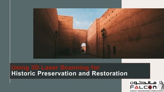
Using 3D Laser Scanning for Historic Preservation and Restoration
•Download as PPTX, PDF•
0 likes•9 views

We'll explore how 3D laser scanning is changing the game in the world of historic preservation and restoration. Know More: https://www.falconsurveyme.com/our-services/laser-scanning/

Recommended
More Related Content
Similar to Using 3D Laser Scanning for Historic Preservation and Restoration
Similar to Using 3D Laser Scanning for Historic Preservation and Restoration (20)
More from falconsurveyme
More from falconsurveyme (18)
Recently uploaded
Recently uploaded (20)
Using 3D Laser Scanning for Historic Preservation and Restoration
- 1. Using 3D Laser Scanning for Historic Preservation and Restoration
- 2. Introduction Preserving history is like guarding a valuable jewel, a window into the past that allows us to understand and respect those who came before us. Technology has proven a useful ally in historic preservation and restoration. One such technological marvel is 3D laser scanning. In this blog, we'll explore how 3D laser scanning is changing the game in the world of historic preservation and restoration. 8 / 0 5 / 2 0 X X
- 3. What is historic Preservation? The activity of conserving and maintaining our historic structures, buildings, and sites is known as historic preservation. It is about ensuring that these historical treasures survive the test of time so that future generations can connect with their heritage and learn from history. 8 / 0 5 / 2 0 X X
- 4. The Role of 3D Laser Scanning • Precision and Detail: 3D laser scanning can capture even the tiniest details of historic structures, including ornate carvings, intricate moldings, and architectural elements that are often difficult to document accurately using traditional methods. • Non-Invasive: Unlike traditional measurement methods that may involve physical contact with delicate historical artifacts, 3D laser scanning is non-invasive. It doesn't harm or disturb the structure being scanned, making it ideal for preserving fragile heritage sites. 8 / 0 5 / 2 0 X X
- 5. • Speed and Efficiency: 3D laser scanning is incredibly efficient. It can capture vast amounts of data in a relatively short period, saving time and resources in the preservation process. • Data Preservation: The digital nature of 3D laser scanning survey services data ensures that a high- fidelity record of the structure is preserved indefinitely. This is crucial for ongoing maintenance and restoration efforts. 8 / 0 5 / 2 0 X X
- 6. Applications in Historic Preservation • Site Documentation: 3D laser scanning can create accurate digital representations of entire historic sites, helping preservationists and architects better understand the structure's current condition. • Conservation Planning: By analyzing the 3D scans, experts can identify areas that require immediate attention and plan preservation or restoration efforts accordingly. • Structural Analysis: Detailed scans assist in assessing the structural integrity of historic buildings, making it easier to determine if any parts need reinforcement or repair. • Restoration and Replication: 3D scans can aid in recreating missing or damaged elements of a structure with remarkable precision, ensuring historical accuracy in restoration projects. 8 / 0 5 / 2 0 X X
- 7. Preserving the Past for the Future 3D laser scanning is a major changer for those dedicated to conserving our rich cultural legacy. Because of its precision, efficiency, and non-invasive character, it is an essential tool in the toolbox of historic preservationists. By applying this technology, we can ensure that the stories of the past are relayed through the well-preserved and renovated historic sites that stand as testaments to our history. In this digital age, 3D laser scanning assists us in bridging the gap between the past and the present, guaranteeing that historical items continue to inspire and amaze future generations. 8 / 0 5 / 2 0 X X
- 8. 8 / 0 5 / 2 0 X X Contact Us Address: 209, 2nd Floor - Apricot Tower, P.O. Box : 238544, Dubai Silicon Oasis, Dubai - United Arab Emirates. : +97143271414 : info@falconsurveyme.com : http://www.falconsurveyme.com/
- 9. 8 / 0 5 / 2 0 X X 9 T H A N K Y O U