SlideShare a Scribd company logo
1 of 19
Download to read offline
www.uscgboating.org
1
U.S.Aids to Navigation System
WhatYou Need to KnowAbout the Markers on theWater
A Handy Guide from the United States Coast Guard
U.S.Aids to Navigation System www.uscgboating.org www.uscgboating.org
1 2
U.S.Aids to Navigation System
Aids to Navigation can provide a boater with information similar to
that which drivers get from street signs, stop signals, road barri-
ers, detours, and traffic lights.
This booklet will give you, the recreational boater, the basic
information you need about the U.S.Aids to Navigation System
(USATONS). This information will help you recognize, understand, and
navigate by the colors, shapes, numbers, and lights you will encounter on
the water. It will also give you the basic tools you need to read a nautical chart.
In addition, you will find information on safety, the proper way to interact with other ves-
sels, tips on boating at night, and how to handle special situations you might encounter,
like bridges and locks.
Take some time to review this booklet, and keep it onboard your boat as a quick refer-
ence. Your understanding of the markers you see on the water will help ensure that you,
your family, and your friends have fun – and safe – boating trips.
			 Best Regards,
			 United States Coast Guard Boating Safety Division
STOP Read This Booklet. Stay Safe on the Water.
AIDS TO
NAVIGATION ARE
THE WATERWAYS’
ROAD SIGNS
Most boating accidents are preventable! Be sure to:
Boaters call navigation rules – the basic laws governing the steering or sailing of a boat –
“The Rules of the Road.” The Rules of the Road define the roles and responsibilities of
vessel operators. If all operators obeyed these rules, most accidents could be avoided.
One of the reasons the Rules of the Road exist is to keep boats
from colliding with each other and with other objects. Since
collisions are the number one type of accident on the water,
boaters should remember the following Rules of the Road.
Post a lookout. Designate someone to watch for dangers
that may come from any direction.
Maintain a safe speed. Except where speed is restricted
by regulation or the waterway is marked by a “No Wake”
or “Slow Speed”Aid, you must judge “safe speed” for
yourself, taking into account visibility, vessel traffic, your boat’s ability to
maneuver, and the weather conditions.
Avoid a collision. The Rules of the Road include the actions to take when encountering
another vessel on the water. Some of the most common situations you may encounter
are: overtaking, meeting head on, and crossing the bow of another vessel. In each
case, the boat designated as the “give-way” vessel is required to yield to the other
boat, while the boat designated as the “stand-on” vessel should maintain its course
and speed.
The Rules vary slightly depending on whether you are
boating on inland or on international waters. As an
example, when operating on inland waters, sound signals
are signals of intent; when operating on international
waters, they are signals of action.
•	 Always wear your life jacket and require the
same of your passengers
•	 Never boat under the influence
•	 Take a boating safety course
•	 Get a free Vessel Safety Check
1. Navigation Rules (Rules of the Road)Introduction
U.S.Aids to Navigation System www.uscgboating.org www.uscgboating.org
3 4
U.S.Aids to Navigation System
2 short blasts
(1 sec.each)
1 short blast
(1 sec.each)
2 short blasts
(1 sec.each)
1 short blast
(1 sec.each)
Stand-on Vessel
Overtaken
Give-way Vessel
Overtaking
(keep clear)
Overtaking Situation (Navigation Rule 13) Head-On Situation (Navigation Rule 14)
Port-to-Port Passing (preferred)
Action(s): The give-way vessel (bottom) can pass on either side of the stand-on
vessel (top).
Sound signals, inland: Passing portside requires two short (1-second) blasts on the horn
signaling the overtaking boat’s intention, and two short blasts for the stand-on vessel’s
agreement. Passing to starboard requires one short blast for intent and agreement.
Sound signals, international: Passing portside requires two prolonged (4-6 seconds)
and two short blasts for the overtaking boat’s intention, two short blasts for the stand-on
vessel’s agreement. Passing to starboard requires two prolonged and one short blast for
intention.An agreement signal is only required when operating
in a narrow channel or fairway; then the following blast pattern
signals your agreement: one prolonged/one short/one
prolonged/one short.
1 short blast (1 sec.) 1 short blast (1 sec.)
Action(s): When meeting another vessel head on, a port-to-port passing is preferred.
Passing starboard-to-starboard is acceptable when necessary.
Sound signals: Passing port-to-port requires one short horn blast to signal intention and
one short blast for agreement. Passing to starboard requires two short blasts from each
vessel.
2 short blasts
(1 sec. each)
2 short blasts
(1 sec. each)
1 short blast
(1 sec.)
1 short blast (1 sec.)
2 short blasts (1 sec. each) 2 short blasts (1 sec. each)
1 short blast (1 sec.)
1 short blast
(1 sec.)
Stand-On Vessel
Overtaken
Give-Way Vessel
Overtaking
(keep clear)
Starboard-to-Starboard Passing
U.S.Aids to Navigation System www.uscgboating.org www.uscgboating.org
5 6
U.S.Aids to Navigation System
Crossing Situation (Navigation Rule 15)
Action(s): In a crossing situation,
the give-way vessel must act to
avoid a collision. This may include
altering its course to pass astern
of the stand-on vessel or slowing
down. The stand-on vessel should
maintain its course and speed.
Sound signals, inland: The give-way vessel signals the stand-on vessel with one short
horn blast. The stand-on vessel agrees with one short horn blast.
Sound signals, international: The give-way vessel signals the stand-on vessel with one
short horn blast. No agreement signal by the stand-on vessel is required.
There is much more to the Navigation Rules than can be covered here. For more
information, go to www.uscgboating.org or www.navcen.uscg.gov.
When meeting another boat, make early and substantial changes to your course.
This helps the other operator understand your intentions.
The two main types of Aids to Navigation
are buoys and beacons.
Buoys are Aids that float on top of the
water, but are moored to the bottom of the
body of water. Some have a light affixed to
the top; some do not. A buoy with a cylin-
drical shape and a conical top is referred to
as a “nun.” A buoy with a cylindrical shape
and a flat top is called a “can.”
Beacons are Aids that are permanently
fixed, most commonly to the bottom of a
body of water. A beacon that has a light
attached is simply referred to as a “light”;
a beacon without a light attached is called
a “daybeacon.”
Both buoys and beacons can provide
a variety of navigation information via
shape, color, light, and/or audible signal.
Dayboards are informational signboards.
The term topmark refers to a non-lighting
element, such as a sphere, that may be
affixed to the top of an Aid.
2. The Essential Markers: On the Water and On the Charts
R "2A"
G
C "5A"
FI R 4s
30ft 6M "4"
RG
N "CF"
R "4"
Q R
FI G 4s 15ft 5M "5"
RED LIGHTED BUOY
Red: always even numbers
RED LIGHT
GREEN CAN BUOY
Green: always odd numbers
GREEN LIGHT
RED/GREEN NUN BUOY
RED DAYBEACON
Give-Way Vessel
should alter course to
pass astern (behind)
1 short blast (1 sec.)
Stand-On Vessel
should maintain its
course and speed
1 short blast (1 sec.)
U.S.Aids to Navigation System www.uscgboating.org www.uscgboating.org
7 8
U.S.Aids to Navigation System
Understanding the Symbols in This Booklet
Buoys, beacons, and all other Aids have a corresponding symbol used on nautical
charts. In this booklet, you will see representations of Aids, each alongside its nautical
chart symbol:
Nautical Charts
It is critical to know where you are going, what routes
to take, and which areas to avoid before you begin
your boating trip. Nautical charts are the boating
equivalent of road maps. A nautical chart provides
boaters with an aerial view of a waterway with its
Aids to Navigation, landmarks, and bridges, as well
as information on water depth, latitude and longi-
tude, and a variety of other important navigational
information.
Nautical chart
symbol
Nautical chart
abbreviation
Indication of lighted Aid*
Letter* (B)
Flash Period* (6 seconds)
Light color* (red)
Aid type
Aid color (red-green)
* Not on all Aids
Aid color (red-green)
Light characteristic*
(composite group
flashing)
RG “B”
FI (2+1) R 6s
•	 Always use a current navigation chart and be sure to check www.navcen.uscg.gov for
any relevant Notices to Mariners before your trip.
•	 While electronic chart systems (ECS) can provide boaters with excellent information,
keep relevant paper charts on board. Should your ECS or GPS malfunction, you will
be very glad to have a backup.
•	 Remember that most accidents are caused by human error. Do not let an electronic
navigation device take the place of knowing and adhering to the Navigation Rules.
What You See Depends on Where You Boat
The Aids to Navigation system used on the majority of American waterways is referred to
as the U.S.Aids to Navigation System or IALA-B. A description of USATONS follows.
The Mississippi River and its tributaries follow a variation of USATONS called the Western
Rivers Marking System. An explanation of this system begins on page 23.
The system used exclusively on the Intracoastal Waterway, which runs along the United
States coast from New Jersey through Texas, is described beginning on page 25.
Another system, called the Uniform State Waterway Marking System, has mostly been
phased out. However, these Aids are shown on page 26 as you may occasionally en-
counter them.
There are also private Aids to Navigation, which are Aids that are neither owned nor
maintained by the U.S. Coast Guard. These typically look similar to those in the
systems described in this booklet and are represented by the same nautical chart
symbols, with the addition of “Priv,” or “Priv maintd.”
B
B
Retro-reflective
panel*
Light*
Letter
Aid
RG “B”
FI (2+1) R 6s
Lighted Buoy
Lighted Buoy
U.S.Aids to Navigation System www.uscgboating.org www.uscgboating.org
9 10
U.S.Aids to Navigation System
Lateral Aids to Navigation
Lateral Aids to Navigation are generally used for well-defined channels to indicate the
route to be followed. These Aids show the sides of a navigable channel, mark junctions
and forks or splits in the channel, indicate the safe side to pass a hazard to navigation,
and mark the safe centerline on wide bodies of water.
They are used in conjunction with a conventional direction of buoyage (a local direction
of buoyage when approaching a harbor, river estuary, or other waterway from seaward).
“Red, Right, Returning”
You may have heard the phrase,“Red, Right, Returning.” This expression refers to the
fact that when returning (entering a channel from the open sea or proceeding upstream),
a boater must keep the red Aids on the right (starboard) side of the boat. These Aids
have even numbers, and the numbers should increase as you proceed inland.
When proceeding toward open water (seaward), navigate so that the green Aids are
to starboard. In this instance, you will see odd numbers on the Aids and the numbers
should decrease as you proceed toward open water (seaward).
If there is no route marked, navigate clockwise around landmasses.
1
Green colors and
lights should be
on your right
(starboard) side
when traveling
toward open waters
(seaward)
12 1 2
open water
open waterchannel
channel
channel
channel
7
5
3
1
8
6
4
Green Aids: Odd Numbers
Square dayboards, buoys, and
cans
Proceeding Upstream
Open Water
(seaward)
Red Aids: Even Numbers
Red, Right, Returning: when
proceeding upstream, keep the
red Aids to starboard
Daybeacon
G
“7”
R
“8”
Daybeacon
Can
G
C “3”
R
N “4”
Nun
Lighted Buoy
G “1”
FI G 4s
R “2”
FI R 4s
Lighted Buoy
Light
“5”
FI G 6s
“6”
FI R 6s
Light
Characteristics
•	 Beacons may have green odd numbers.
•	 Buoys may have white odd numbers.
•	 If lit, the light will be green and is likely to flash in one
of the following patterns:
Flashing (2)
Flashing
Occulting
Quick Flashing
Isophase
Flashing (2)
Flashing
Occulting
Quick Flashing
Isophase
Characteristics
•	 Beacons may have red even numbers.
•	 Buoys may have white even numbers.
•	 If lit, the light will be red and is likely to flash in one of
the following patterns:
(see page 22 for more on lights)
2
2
Red colors and
lights should be
on your right
(starboard) side
when traveling
from open waters
(shoreward)
3. U.S. Aids to Navigation System (IALA-B)
U.S.Aids to Navigation System www.uscgboating.org www.uscgboating.org
11 12
U.S.Aids to Navigation System
Daybeacon
Can Buoy
Daybeacon
Nun Buoy
GR
“U”
RG
“G”
GR
C “S”
RG
N “C”
GR “A”
FI (2+1) G 6s
RG “B”
FI (2+1) R 6s
Preferred-Channel Aids
Beacons and buoys that have horizontal bands of both red and
green mark the junction of navigable channels.The top-most color
indicates the direction of the preferred, or primary, channel.
When returning (entering a channel from the open sea or proceed-
ing upstream), keeping the Aids with red as the top-most color on the right (starboard)
side of the boat will place the boater in the preferred channel, while keeping those
Aids on the port side will place the boater in the secondary channel. When proceeding
toward open water (seaward), keeping the Aids with green as the top-most color on the
right (starboard) side of the boat will place the boater in the preferred channel, while
keeping those Aids on the port side will place the boater in the secondary channel.
Characteristics
•	 Green on top.
•	 Have a letter designation.
•	 Buoys will feature a white letter.
•	 If lit:
Characteristics
•	 Red on top.
•	 Have a letter designation.
•	 Buoys will feature a white letter.
•	 If lit:
Characteristics
•	 White with red, green, or black diamonds.
•	 Usually lettered (the letter can be matched to a nautical chart to check position).
•	 In the illustrations above,“NR,”“NG,”and“NB”indicate non-lateral red,green,and black.  The chart
symbol is to the lower right of each illustration (e.g.,“RW Bn” indicates a red-and-white beacon).U
S
A
G
C
B
Lighted Buoy Lighted Buoy
COMPOSITE GROUP
FLASHING (2+1)
COMPOSITE GROUP
FLASHING (2+1)
(see page 22 for more on lights)
Non-Lateral Aids to Navigation
Non-lateral Aids are the on-the-water versions of the informational, regulatory, and
warning signs encountered on the road.
Diamond-Shaped Dayboards
Diamond shaped dayboards are used to help determine location. They are the nautical
equivalent of “You Are Here” markers. An appropriate nautical chart must be consulted
to determine your exact position.
N
GA
N
N
RW “N”
Unlighted
with or w/o
sound
N
GA
N
MR
RW “A”
N
GA
N
Spherical
SP “G”
N
GA
N
Can
RW “N”
N
GA
N
N
RW “N”
Mo (A)
RW
Bn
NR
GW “A”
Bn
NG
BW “M”
Bn
NB
A M
Characteristics
•	 White and red vertical stripes.
•	 A variety of shapes.
•	 May be lettered.
•	 Buoy may have red topmark.
•	 If lit:
(Morse Code “A”)
Preferred
Channel
Safe Water Marks
These Aids are used to mark fairways, mid-channels, and offshore approach points.
They have unobstructed water on all sides. A buoy, lighted or unlighted, may show a red
topmark. An appropriate nautical chart must be consulted to determine exact position.
Lighted
with or w/o
sound
U.S.Aids to Navigation System www.uscgboating.org www.uscgboating.org
13 14
U.S.Aids to Navigation System
Isolated Danger Marks
These Aids indicate an isolated danger that may be passed on all sides. Use caution
when approaching.
A C
BR “A”
FI (2) 5s
Lighted
BR “C”
Unlighted
Characteristics
•	 Rectangular with two colors arranged as three vertical
stripes.
•	 May be lettered.
•	 When lit, rear light will be higher then the front light.
•	 Light characteristics may vary; usually the rear (upper)
light remains lit (fixed), while the front (lower) light flashes.
Characteristics
•	 Buoy with black and red horizontal
bands.
•	 May be lettered.
•	 Black double-sphere topmark.
•	 If lit: FI (2) 5s
Range Dayboards
These Aids, which are usually shore-mounted, come in pairs to help the vessel operator
maintain a straight and safe course within a navigable channel. Each member of the
pair is separated from the next in
distance and elevation, with the one
in front shorter than the one behind it.
When the two appear to be vertically
stacked, the vessel is on the range
line.
Rear light
Front light
Side View
Front View
Left of
range line
Right of
range line
On range
line
When the front (bottom) marker is
to the right of the rear (top) one,
you are to the left of the range.
You should turn right (starboard)
to get onto the range line.
When the front (bottom) marker
is to the left of the rear (top)
one, you are to the right of the
range. You should turn left
(port) to get onto the range line.
The two range markers
are in line, which
indicates you are on
the range line.
Front
marker
Front
marker
Front
marker
Front marker Front marker Front marker
Rear markerRear markerRear marker
Rear marker Rear marker Rear marker
The colors of range dayboards do not impact navigation – colors are simply
chosen based on how well they stand out from the background scenery.
Some combinations:
KGW KWG KBW KWB KWR KRW KRB KBR KGB KBG KGR KRG
Iso R 1 QR
U.S.Aids to Navigation System www.uscgboating.org www.uscgboating.org
15 16
U.S.Aids to Navigation System
Information and Regulatory Marks
These orange-and-white Aids are used to alert vessel operators to various warnings and
regulations.
Information

Marks with a square
provide helpful
information such as
directions, distances,
and locations
Restricted
Operations

Marks with a circle
indicate areas with
regulated operations
Danger

A diamond shape
alerts boaters to
hazards
Exclusion

A diamond shape
with a cross means
boats are prohibited
from the area
Symbol
DANGER
GAS
DOCK
BOAT
RAMP
NO WAKE
IDLE SPEED
BOATS
KEEP OUT
SWIM AREA
ROCK
mph
5
Meaning Examples
Characteristics
•	 White with an orange horizontal band at both top and bottom.
•	 Black text within or around an orange square, circle, or diamond;
or black text outside a diamond with an orange cross.
•	 May be buoys or beacons.
•	 If lit, the light will be white and may have any light rhythm except
quick flashing, flashing (2), or Morse code “A.”
•	 The chart symbol for this type of buoy is:
Characteristics
•	 All-yellow.
•	 Come in a variety of shapes.
•	 May have one black letter.
•	 If lit:
Characteristics
•	 White with blue horizontal band.
•	 Cylinder and sphere shapes.
•	 May show a white reflector or display white or yellow light.
Characteristics
•	 Black-and-white vertically striped buoy.
•	 May show a white reflector or display a quick-flashing white light.
Special Aids
These Aids indicate special areas or features such as anchoring, traffic separation,
fishnet area, cables or pipelines, military exercise areas, and jetties.
Mooring Buoys
While not a navigational Aid, mooring buoys are
worth mentioning. They are the only type of buoys
to which mooring is permitted. Most mooring
buoys are privately owned or are rental buoys.
Permission is usually needed to use them.
State Waters Obstruction Mark
The State Water Obstruction Mark indicates to a
vessel operator that an obstruction to navigation
extends from the nearest shore to the buoy. Do not
pass between the buoy and the shore.
A C
A
B
Y
C “A”
Y
N “C”
Y “B”
FI Y
Y “A”
Bn
Unlighted
Lighted
or
W Or
U.S.Aids to Navigation System www.uscgboating.org www.uscgboating.org
17 18
U.S.Aids to Navigation System
3
1
1
5
3
2
2
4
2
8
6
4
1
3
5
7
2
2
VisualBuoyageGuideExample
NauticalChartExample
PreferredChannel
SecondaryChannel
IntracoastalWaterway
“1”
FI(2)G6s
RG
FI(2+1)R6s
R“2”
FIR6s
R“4”
OcR6s
G“3”
FIG6s
G“1”
IsoG4s
BR“C”
FI(2)5s
G“5”
FI(2)G6s
G“7”
FIG4s
R“4”
G“5”R“6”
FI(2)R6s
R“8”
FIR4s
RW
Mo(A)
“2”
IsoR6s
IsoR6s
QR
“1”
IsoG4s
“2”
FIR4s
R
N“2”
G“3”
R“2”
RW
Bn
G
C“3”
(fictitious;samecircumstancesasabove)
(fictitious)
U.S.Aids to Navigation System www.uscgboating.org www.uscgboating.org
19 20
U.S.Aids to Navigation System
Boating at night can make even familiar waters unrecognizable. Visual depth perception
is lessened and lights from the shore can be difficult to distinguish from those on the
water. To make nighttime boating safer, keep the following in mind.
Navigation Lights
Vessels are required to show navigation lights from sunset to sunrise and during periods
of restricted visibility. Understanding these light displays will provide invaluable informa-
tion to the boater, as these lights can help the boater determine the length of another
vessel, its orientation in relation to
your boat, and the general direction in
which it is headed. All operators must
ensure that their vessel’s navigation
lights are working and that the posi-
tioning and distance from which they
can be seen meet federal regulations.
It is important to know which naviga-
tion lights you will see from another
boat in certain situations. This can help you determine if you are in an overtaking, meet-
ing, or crossing situation. The following chart illustrates the navigation lights you will see
from various angles:
Whenever you see a red navigation light from another vessel, give way. It is the stand-
on vessel. According to the Rules of the Road, it has the right of way (see page 2).
If you see both the red and green sidelights of another boat, it is coming straight
toward you. You should take action to change course in order to avoid a collision.
Starboard Bow Stern Port Side
Keep in Mind
•	 It is risky to rely on memory or to take shortcuts at night. Stick to the main channel.  
Your best bet is to navigate by the appropriate chart and identify the corresponding
Aids to Navigation.
•	 Make sure you are familiar with the handling characteristics of your boat so you can
concentrate on interpreting the Aids to Navigation.
•	 Slow down. Distances are more difficult to judge at night and you will need more
time to distinguish the various types of lights you will see: navigation lights, lights
from Aids, and lights on shore.
•	 Listen.  You might hear certain sounds before you see the related objects or situ-
ations that require you to change course, such as another boat’s engine or sound
signals, an Aid’s bell or gong, or noises from shore. (Note that sound travels far over
water.)
•	 Turn on your navigation lights from sunset to sunrise and during daytime periods of
reduced visibility, such as rain and fog.
•	 Turn off any lights that might interfere with, or be confused with, navigation lights.
Temporary image
4. Boating at Night
U.S.Aids to Navigation System www.uscgboating.org www.uscgboating.org
21 22
U.S.Aids to Navigation System
NighttimeBuoyageGuideExample
=
(fictitious;samecircumstancesaspages17-18)
The various combinations of these characteristics enable boaters to tell one Aid from
another in darkness. The following shows how common light display characteristics are
illustrated and how they operate:
Chart	
Abbreviation	Type/Description
F	Fixed
Shines continuously and steadily; no dark phase.
Fl	Flashing
The light goes on at regular intervals; the duration
of the light phases are less than the duration of
the dark phases.
Fl (2)	 Group Flashing
Groups of two flashes that are repeated several
times a minute.
Fl (2+1)	Composite Group Flashing
A group of two flashes followed by a single flash,
the entirety repeated several times a minute.
Iso	Isophase
All durations of light and dark are equal.
Mo (A)	 Morse Code
Short (“dots”) and long (“dashes”) flashes of light
are used to represent Morse code; usually flashes
the letter “A.”
Oc	Occulting
The light goes on at regular intervals; the duration
of the light phases is greater than the duration of
the dark phases.
Q	 Quick (Flashing)
Very rapid flashing (more than 60 flashes a minute).
Illustration
Aids to Navigation at Night
At night,Aids to Navigation can only be identified by their light characteristics:
•   Color (red     , green     , white     , or yellow     ).
•   Light display (sequence of flashes).
•   Period (time it takes to go through one sequence of flashes).
•   Equipped with retroreflective material.
U.S.Aids to Navigation System www.uscgboating.org www.uscgboating.org
23 24
U.S.Aids to Navigation System
•	 Crossing daybeacons are used to assist river traffic by indicating where the chan-
nel has changed from one side of the river to the other; the aid that marks this
channel change will be on the opposite side of the river. When encountered, a
vessel operator should head for the Aid, using its color as a channel mark.
•	 Isolated danger marks and safe-water marks are not used.
•	 River banks are named based on their downstream direc-
tion: either “left bank” and “right bank” or “left descending
bank” and “right descending bank.”
•	 Because of their somewhat temporary nature, Western River
buoys do not have numbers or letters and are not always
marked on river charts because they tend to drift due to
fluctuating water level, current speed, and shifting shoals.
Characteristics
If lit, the light will be green
and will flash as:
Flashing
		 FI (2+1) G
Characteristics
If lit, the light will be red
and will flash as:
Flashing
		 FI (2+1) R
Upstream
Downstream
Lighted buoy Lighted buoy
Can Nun
Daybeacon Daybeacon
Preferred-Channel Aids
Western Rivers Marking System
When on the Mississippi River, tributaries above Baton Rouge, and several other rivers
that flow toward the Gulf of Mexico, boaters must follow a system called the Western
Rivers Marking System, a variation of the U.S.Aids to Navigation System.
Upstream (proceeding inland)
Port Side/
Right Descending Bank
Starboard Side/
Left Descending Bank
Downstream (proceeding to Gulf of Mexico)
Characteristics
If lit, the light will be green or
white and may flash as:
Flashing
Isophase
Characteristics
If lit, the light will be red or
white and may flash as:
Flashing (2)
Isophase
In the Western Rivers Marking System:
•	 Buoys are not numbered.
•	 Beacons are not numbered, but normally have a mile marker that indicates the
distance in statute miles from a fixed point, typically the river’s mouth.
Port and Starboard Aids
5. Aids to Navigation Systems
U.S.Aids to Navigation System www.uscgboating.org www.uscgboating.org
25 26
U.S.Aids to Navigation System
43
7
Uniform State Waterway Marking System
The Uniform State Waterway Marking System (USWMS) was discontinued and replaced
by the U.S.Aids to Navigation System (USATONS) in 2003. Should you come across
one that has not yet been replaced, a guide is provided below:
43
7
3 4
Acts as the green
can buoy in
USATONS
Acts as the red
nun buoy in
USATONS
South or West North or East
Lateral System – USWMS
Cardinal System – USWMS
Cardinal buoys serve as the USWMS version of USATONS’ preferred-channel markers,
as they indicate the primary route. They are named “cardinal” buoys after the cardinal
points (north, south, east, and west) of the compass:
43
7
43
7
The USMWS system’s red-
and-white vertically striped
buoy means obstruction.
In USATONS, a red-and-
white vertically striped buoy
means safe water.
Larger
Body of Water
Smaller
Body of Water
Intracoastal Waterway
The Intracoastal Waterway (ICW) runs just inland and parallel to the Atlantic and Gulf
coasts from Manasquan, New Jersey to the Mexican border. The Aids to Navigation of
the ICW closely resemble the green and red buoys and beacons of the lateral system
previously discussed.
When operating in the ICW, the color of the Aids will typically correspond to the
USATONS scheme (Red, Right, Returning).The yellow squares, triangles, and bands
attached to the Aids are the primary ICW indicators. Boaters need to understand these
markings to safely navigate the ICW. Some examples:
7
3
1 1
8
4
2 2 3
2
There are three types of symbols:
When following the ICW from New Jersey through Texas, keep yellow triangles on
your starboard and yellow squares on your port, regardless of the color of the Aid on
which they appear.
The yellow horizontal band reflector can be found
on any non-lateral Aid. It simply identifies the Aid as
marking the ICW.
ICW beacons and buoys do not correspond to IALA-B’s color system because ICW and
non-ICW routes may travel next to each other in opposing directions – and share the
same Aids.Thus, when following the ICW, navigate by the yellow symbols; otherwise,
navigate by the color of the Aid itself.
Arrows do not indicate
the actual location of
the ICW.Arrows depict
how aids to navigation
are oriented when
operating in the ICW.
U.S.Aids to Navigation System www.uscgboating.org www.uscgboating.org
27 28
U.S.Aids to Navigation System
Clearance Gauges
If it is not obvious whether or not there is enough vertical room to travel under a certain
bridge, boaters should refer to its clearance gauge (affixed to the bridge’s right side
upon approach). This marks the distance between the “low steel” of the bridge channel
span and the waterline, not the depth of the water under the bridge.
WATERLINE
LOW STEEL
CLEARANCE (feet)
CLEARANCE
GAUGE
Drawbridge-Opening Protocol
When passage under an open drawbridge is required, the boater
must make a request of the drawbridge operator. The bridge
tender will acknowledge the signal. The most common protocols are:
VHF-FM
•	 Boaters may hail the drawbridge operator on channels 13 or 16.  
(Channel 9 should be used in Florida, Georgia, and South Carolina.)
•	 Always use the low-power output (1 watt) setting.
Sound Signals
Approaching a Closed Draw
•	 An opening signal consists of one prolonged blast (4 to 6 seconds) and one short
blast (1 second); this can be from a whistle, horn, megaphone, or hailer.
•	 The operator will reply with the prolonged-then-short blast if the draw will be
opened immediately.
•	 Five short blasts in rapid succession mean that the operator cannot comply at that
moment.
Approaching an Open Draw
•	 If the draw is already open, an opening signal (prolonged blast plus short blast)
must be made.
•	 If no reply is received within 30 seconds, you may proceed with caution.
•	 Five short blasts in rapid succession mean that the operator must close the draw;
do not proceed.
Upstream
Bridges
Lighting Systems
Bridges are lit to help boaters navigate under them from sunset to sunrise and during
other periods of reduced visibility. In general, red lights indicate portions of the bridge
where it is unsafe to attempt passage, and green lights indicate areas of safe passage.
See key below.
A
A
A
A
E
A
B
E
G
G
E
D(Main Channel)
Fixed Bridge
Double Leaf (Lift) Bascule Bridge Vertical Leaf Span Bridge
(open)
Double Opening Swing Bridge
(open)
Vertical Lift Span Bridge
(closed)
closed
open
closed
open
Double-Opening Swing Bridge
(closed)
A
A
AA
A
E
A A A
FF
F
A
A	 –	Piers and supports.
B	 –	Centerline of navigable channel.
C	 –	Three white lights stacked vertically show the preferred route, if
there is more than one navigable channel.
D	 –	Used on some lift bridges to indicate the lift is closed.
E	 –	Lift is open to vessel traffic.
F	 –	Double-opening swing bridges show three red lights when closed.
G	 –	Double-opening swing bridges show two green lights when open.
6. Special Situations
U.S.Aids to Navigation System www.uscgboating.org www.uscgboating.org
29 30
U.S.Aids to Navigation System
•	 Wait for the lock operator to signal you with horn blasts; additional signals may
include traffic lights or flashing lights.
•	 Enter the lock at reduced speed.
•	 Make sure all passengers remain seated and wear their life jackets.
•	 Tie your craft to the mooring devices after entering; a minimum of 50 feet of
line is recommended.
•	 Use fenders to avoid damage to your vessel and to lock walls.
•	 When through, wait for the lock operator’s signal (horn and/or lights), then leave
the lock at idle speed.
There is a specific order of lockage priority among vessels. Military and most commercial
vessels have priority over recreational vessels.
Low-Head Dams
Low-head dams have been built to
raise the level of rivers or streams for
various reasons.They can be extremely
dangerous to small boats and swim-
mers; so much so, they have been
nicknamed “drowning machines.”
Small boats may easily become caught
within the circular motion (hydraulic) of
the dam’s fast-moving water. The boat
and its passengers may be unable to escape. Low-head dams are particularly difficult
to spot on the upstream side; and from any vantage point, they can look harmless.
Remember that no matter how short a drop the dam may have, it can still be deadly.
•	 Always portage around low-head dams, regardless of direction of approach.  
Exit the water well before the dam and return well after.
•	 Not all low-head dams are marked by signage or a danger buoy.  Therefore,
familiarize yourself with any stream or river before traveling on it.
•	 When traveling downstream, watch for a smooth horizon line.  This is a subtle but
telltale sign that you are approaching a low-head dam. The scenery beyond it
might have the illusion of being cut off or shortened.
Controlled-Access Areas
In order to ensure public safety and national security, the Coast Guard periodically estab-
lishes controlled-access areas that have special operational or navigational requirements.
Safety Zones, Security Zones, and Regulated Navigation Areas might require reduced
speed within a certain radius of a salvage operation, for example, or restrict access
altogether near a high-profile event or a power plant. These areas should be avoided or
approached with caution.
To make sure you know where the controlled-access areas are – and the specific pa-
rameters of each – always have the most current nautical chart and the latest Notices
to Mariners before you head out (www.navcen.uscg.gov). Contact the local Coast Guard
office or other law enforcement agency for specific details about such areas.
As a general rule, however, it is wise to avoid dams, power plants, and commercial port op-
eration areas, especially those that involve the military, cruise lines, or petroleum facilities.
Naval Vessel Protection Zones
A Naval Vessel Protection Zone is a per-
manent controlled-access area that
surrounds every U.S. naval vessel. The
parameters are clear: do not come
closer than 100 yards of a vessel,
and operate at minimum speed
within 500 yards of the vessel. Vio-
lating a Naval Vessel Protection Zone
is a felony offense with the possibility of a
prison sentence and/or fines of up to $250,000.
Locks
A lock is an engineered structure that enables vessels to move between waterways of
differing heights. As when traveling under drawbridges, there are specific procedures in
place for navigating through locks. Specifics may vary in certain regions, but in general:
•	 Stay between the red and green buoys that mark the river’s navigable channel.
•	 Request an opening with a sound signal consisting of one prolonged blast (4 to 6
seconds) and one short blast (1 second) within one mile of the lock; this can be
made by using the lock’s pull-cord or your whistle, horn, megaphone, or hailer.
Backwash
Boil
Escape Route
Low-head Dam
OPERATE AT MINIMUM SPEED
KEEP OUTKEEP OUT
100YARDS
500YARDS
If you feel you must enter a controlled-access area to ensure safe navigation,
immediately contact the Coast Guard on VHF-FM Channel 16.
U.S.Aids to Navigation System www.uscgboating.org www.uscgboating.org
31 32
U.S.Aids to Navigation System
7. Always Wear Your Life Jacket!
(and require the same of your passengers)
The number one cause of on-the-water fatalities is drowning. The number one way to
prevent drowning is to wear a life jacket.
The U.S. Coast Guard requires recreational vessels to have a wearable life jacket for
each person on board.
All life jackets must be:
•	 U. S. Coast Guard-approved.
•	 The proper size for the intended wearer.
•	 In good and serviceable condition.
•	 Properly stowed (readily accessible).
Children Must Wear Life Jackets
Federal regulations require that on a
recreational vessel underway, children
under 13 must wear an appropriate
U. S. Coast Guard-approved life jacket,
unless they are below decks or in
an enclosed cabin. Within a state’s
waters, if that state has established a
child lifejacket wear requirement, that
state’s requirement applies.
The Coast Guard recommends all passengers wear a life jacket at all times when the
vessel is underway.
Tips for a Proper Fit – Try It On
•	 Use the manufacturer’s label as a guide to choosing the proper life jacket for your
size and weight. It should have a comfortably snug fit.
•	 With all straps, zippers, and ties securely fastened, raise your arms over your head.  
The jacket should stay in place and not ride up.
•	 With your arms at your sides, have someone lift your life jacket straight up at the
shoulders. If the jacket comes up more than a few inches, it is too loose.
•	 It is best to try on a life jacket before a boat trip.
•	 Life jackets designed for adults will not work for children!
America’s Waterway Watch
The U.S. Coast Guard is asking boaters to help keep America’s waterways safe and
secure.
The Coast Guard has developed a program called America’s Waterway Watch
(www.americaswaterwaywatch.org). It asks boaters to call 877-24WATCH if they notice
suspicious activity or behavior on or near the water.
Things to report include:
•	 Someone taking pictures, video, or
making sketches of facilities like
bridges, tunnels, ferry transport
systems, fuel docks, or power plants.
•	 Someone asking a series of ques-
tions about access to one of these
facilities.
•	 Someone anchoring, fishing, or
diving in an area not typically used
for that activity.
•	 Unattended vessels in unusual
locations.
•	 Unusual transfer of personnel
or cargo while underway.
•	 Seeing a hole in a security fence around an industrial facility.
Do not take matters into your own hands. Call 877-24WATCH. In cases of immediate
danger to life or property, call the Coast Guard on Channel 16 VHF-FM, or dial 911 for
emergencies.
U.S.Aids to Navigation System www.uscgboating.org www.uscgboating.org
33 34
U.S.Aids to Navigation System
Key to the U.S. Aids to Navigation System (IALA-B)
How to Report Aids to Navigation Discrepancies to the Coast Guard
Please report discrepancies or outages to any Aid to Navigation (GPS, DGPS, buoys,
lights, dayboards, etc.) to the nearest U.S. Coast Guard station. You can do this 24
hours a day, 7 days a week via radio, telephone, fax, visiting www.navcen.uscg.gov, or by
e-mailing navcen@uscg.mil.To reach the U.S. Coast Guard Navigation Center by
telephone, call (703) 313-5900.
Reporting can help prevent accidents caused by such defects; you will be helping other
boaters stay safe.
All Aids to Navigation are Protected By Law
It is a criminal offense to cause any damage or hindrance to the proper operation of any
Aid. Do not alter, deface, move, or destroy any Aid to Navigation. Never tie a vessel to
a buoy, daybeacon, or light structure. Avoid anchoring so close to an Aid that the Aid is
obstructed (hidden) from sight of another vessel. Report all intentional or unintentional
collisions with navigation Aids to the U.S. Coast Guard.
B – Black
Bn – Beacon
examples:
	
C – Can Buoy
examples:
		
F – Fixed	
Fl – Flashing
Fl (2) – Group Flashing
Fl (2+1) – Composite Group-Flashing
G – Green
Iso – Isophase
J – Junction (S or T Dayboard)
examples:
M – Safe Water (Octagonal)
example:
Mo (A) – Morse Code letter “A”
N – Nun Buoy
examples: 	
	
Oc – Occulting
Or – Orange
Pri – Private
Q – Quick (Flashing)
R – Red
S – Square Dayboard
examples:
	
s – seconds
T – Triangle Dayboard
examples:
W – White
Y – Yellow
Surprisingly Comfortable
Today’s life jackets are lightweight, easy to move in, and come in many sizes, styles,
and shapes for every person and every sport.  (There are even ones for pets!)  Some
examples:
Inflatable
for general recreational
boating 	
Belt Pack Inflatable
for general recreational
boating
	
Vest-Type Flotation Aid
for personal watercraft,
waterskiing, and water
sports
Child Hybrid Inflatable
for general recreational
boating 	
Child Life Jacket
for general recreational
boating
	
Flotation Aid
for general recreational
boating
Vest Type
for general
recreational boating
Inflatable Fishing Vest
for angling and
hunting
Paddling Jacket
for paddlesports 	
Offshore Vest
for offshore boating
and racing
Position of light
U.S.Aids to Navigation System www.uscgboating.org
35
Most boating accidents are preventable! Be sure to:
•	 Always wear your life jacket and
require the same of your passengers
•	 Never boat under the influence
•	 Take a boating safety course
•	 Get a free Vessel Safety Check
www.uscgboating.org
06/2011
For more information please contact:

More Related Content

What's hot

Ship Anchor and it's application
Ship Anchor and it's applicationShip Anchor and it's application
Ship Anchor and it's applicationAnujSharma815
 
Ships_Deck_Fittings.pptx
Ships_Deck_Fittings.pptxShips_Deck_Fittings.pptx
Ships_Deck_Fittings.pptxssusercdbc6e
 
Nautical Rules of the Road
Nautical Rules of the RoadNautical Rules of the Road
Nautical Rules of the RoadLynn Seckinger
 
Design of a Pleasure Craft with Catamaran Hull
Design of a Pleasure Craft with Catamaran HullDesign of a Pleasure Craft with Catamaran Hull
Design of a Pleasure Craft with Catamaran HullHtike Aung Kyaw
 
ADVANCEMENT IN SENSOR TECHNOLOGY IN SHIPPING.pptx
ADVANCEMENT IN SENSOR TECHNOLOGY IN SHIPPING.pptxADVANCEMENT IN SENSOR TECHNOLOGY IN SHIPPING.pptx
ADVANCEMENT IN SENSOR TECHNOLOGY IN SHIPPING.pptxNoomanShaikh
 
Introduction to Nautical Charts
Introduction to Nautical ChartsIntroduction to Nautical Charts
Introduction to Nautical ChartsCandi Abbott
 
2nd mates orals questions set
2nd mates orals questions set2nd mates orals questions set
2nd mates orals questions setsumeet25
 
Set and drift
Set and driftSet and drift
Set and driftMH RAHMAN
 
Inclining Experiment and Angle of Loll 23 Sept 2019.pptx
Inclining Experiment and Angle of Loll 23 Sept 2019.pptxInclining Experiment and Angle of Loll 23 Sept 2019.pptx
Inclining Experiment and Angle of Loll 23 Sept 2019.pptxReallyShivendra
 
MANEUVERING & COLLISION AVOIDANCE
MANEUVERING & COLLISION AVOIDANCEMANEUVERING & COLLISION AVOIDANCE
MANEUVERING & COLLISION AVOIDANCELearnmarine
 
Navigation Rules (Basic)
Navigation Rules (Basic)Navigation Rules (Basic)
Navigation Rules (Basic)NASBLA
 

What's hot (20)

Timber deck code
Timber deck codeTimber deck code
Timber deck code
 
Ship Anchor and it's application
Ship Anchor and it's applicationShip Anchor and it's application
Ship Anchor and it's application
 
Ships_Deck_Fittings.pptx
Ships_Deck_Fittings.pptxShips_Deck_Fittings.pptx
Ships_Deck_Fittings.pptx
 
Planning of the mooring operation
Planning of the mooring operationPlanning of the mooring operation
Planning of the mooring operation
 
Nautical Rules of the Road
Nautical Rules of the RoadNautical Rules of the Road
Nautical Rules of the Road
 
Lights and shapes lrg
Lights and shapes lrgLights and shapes lrg
Lights and shapes lrg
 
75346996 a-is
75346996 a-is75346996 a-is
75346996 a-is
 
Design of a Pleasure Craft with Catamaran Hull
Design of a Pleasure Craft with Catamaran HullDesign of a Pleasure Craft with Catamaran Hull
Design of a Pleasure Craft with Catamaran Hull
 
PROFILE OF MINE
PROFILE OF MINEPROFILE OF MINE
PROFILE OF MINE
 
ADVANCEMENT IN SENSOR TECHNOLOGY IN SHIPPING.pptx
ADVANCEMENT IN SENSOR TECHNOLOGY IN SHIPPING.pptxADVANCEMENT IN SENSOR TECHNOLOGY IN SHIPPING.pptx
ADVANCEMENT IN SENSOR TECHNOLOGY IN SHIPPING.pptx
 
Introduction to Nautical Charts
Introduction to Nautical ChartsIntroduction to Nautical Charts
Introduction to Nautical Charts
 
2nd mates orals questions set
2nd mates orals questions set2nd mates orals questions set
2nd mates orals questions set
 
Set and drift
Set and driftSet and drift
Set and drift
 
Inclining Experiment and Angle of Loll 23 Sept 2019.pptx
Inclining Experiment and Angle of Loll 23 Sept 2019.pptxInclining Experiment and Angle of Loll 23 Sept 2019.pptx
Inclining Experiment and Angle of Loll 23 Sept 2019.pptx
 
Solas ffa
Solas ffaSolas ffa
Solas ffa
 
MANEUVERING & COLLISION AVOIDANCE
MANEUVERING & COLLISION AVOIDANCEMANEUVERING & COLLISION AVOIDANCE
MANEUVERING & COLLISION AVOIDANCE
 
Radar plotting lrg
Radar plotting lrgRadar plotting lrg
Radar plotting lrg
 
Gyrocompass
GyrocompassGyrocompass
Gyrocompass
 
The Ism Code
The Ism CodeThe Ism Code
The Ism Code
 
Navigation Rules (Basic)
Navigation Rules (Basic)Navigation Rules (Basic)
Navigation Rules (Basic)
 

Viewers also liked

#5 aton chris r 201107
#5 aton chris r 201107#5 aton chris r 201107
#5 aton chris r 201107chrisatrtc
 
Sea Sailing Adventure - www.seasailingadventure.co.za
Sea Sailing Adventure - www.seasailingadventure.co.zaSea Sailing Adventure - www.seasailingadventure.co.za
Sea Sailing Adventure - www.seasailingadventure.co.zaShane Smith
 
Presentasi abenetwork-wira
Presentasi abenetwork-wiraPresentasi abenetwork-wira
Presentasi abenetwork-wiraWira Nuradli
 
Boaters Safety Slideshow #3
Boaters Safety Slideshow #3Boaters Safety Slideshow #3
Boaters Safety Slideshow #3bprybil
 
Boaters Safety Slideshow #2
Boaters Safety Slideshow #2Boaters Safety Slideshow #2
Boaters Safety Slideshow #2bprybil
 
Buoyage & chart symbols
Buoyage & chart symbolsBuoyage & chart symbols
Buoyage & chart symbolsCandi Abbott
 
Essential Boating Safety Tips
Essential Boating Safety TipsEssential Boating Safety Tips
Essential Boating Safety TipsDavid Neagle
 
Aids to navigation- Buoys and beacons
Aids to navigation- Buoys and beaconsAids to navigation- Buoys and beacons
Aids to navigation- Buoys and beaconsALMARIN
 

Viewers also liked (9)

#5 aton chris r 201107
#5 aton chris r 201107#5 aton chris r 201107
#5 aton chris r 201107
 
Sea Sailing Adventure - www.seasailingadventure.co.za
Sea Sailing Adventure - www.seasailingadventure.co.zaSea Sailing Adventure - www.seasailingadventure.co.za
Sea Sailing Adventure - www.seasailingadventure.co.za
 
Presentasi abenetwork-wira
Presentasi abenetwork-wiraPresentasi abenetwork-wira
Presentasi abenetwork-wira
 
Buoyage
BuoyageBuoyage
Buoyage
 
Boaters Safety Slideshow #3
Boaters Safety Slideshow #3Boaters Safety Slideshow #3
Boaters Safety Slideshow #3
 
Boaters Safety Slideshow #2
Boaters Safety Slideshow #2Boaters Safety Slideshow #2
Boaters Safety Slideshow #2
 
Buoyage & chart symbols
Buoyage & chart symbolsBuoyage & chart symbols
Buoyage & chart symbols
 
Essential Boating Safety Tips
Essential Boating Safety TipsEssential Boating Safety Tips
Essential Boating Safety Tips
 
Aids to navigation- Buoys and beacons
Aids to navigation- Buoys and beaconsAids to navigation- Buoys and beacons
Aids to navigation- Buoys and beacons
 

Similar to US safety aids to navigation system for sea enthusiasts and travelers.

IALA BOUYAGE SYSTEM AUG 2020.docx
IALA BOUYAGE SYSTEM AUG 2020.docxIALA BOUYAGE SYSTEM AUG 2020.docx
IALA BOUYAGE SYSTEM AUG 2020.docxGibyJohn4
 
Hot Products Mark Hahn 300 Legal Requirements- Phoenix Patriot Foundation JET...
Hot Products Mark Hahn 300 Legal Requirements- Phoenix Patriot Foundation JET...Hot Products Mark Hahn 300 Legal Requirements- Phoenix Patriot Foundation JET...
Hot Products Mark Hahn 300 Legal Requirements- Phoenix Patriot Foundation JET...K 38
 
Deck Reference Library Read list for Deck
Deck Reference Library Read list for DeckDeck Reference Library Read list for Deck
Deck Reference Library Read list for DeckMichalisPouris1
 
James Law- Coast Guard Prevention and Investigation
James Law- Coast Guard Prevention and InvestigationJames Law- Coast Guard Prevention and Investigation
James Law- Coast Guard Prevention and InvestigationNASBLA
 
2018 NTSB Safety at Sea Report
2018 NTSB Safety at Sea Report2018 NTSB Safety at Sea Report
2018 NTSB Safety at Sea ReportRocky Marchiano
 
Navigator Express Q3 2021 (rev 6) compressed
Navigator Express Q3 2021 (rev 6) compressedNavigator Express Q3 2021 (rev 6) compressed
Navigator Express Q3 2021 (rev 6) compressedRoger Bazeley, USA
 
_______ uk-masters-orals
  _______ uk-masters-orals  _______ uk-masters-orals
_______ uk-masters-oralsRabah HELAL
 
Topic 1.2- Electronic Equipment used on ships (Navigational Equipment).pptx
Topic 1.2- Electronic Equipment used on ships (Navigational Equipment).pptxTopic 1.2- Electronic Equipment used on ships (Navigational Equipment).pptx
Topic 1.2- Electronic Equipment used on ships (Navigational Equipment).pptxMartMantilla1
 
Navigator Express Q2 2022 .pdf
Navigator Express Q2 2022 .pdfNavigator Express Q2 2022 .pdf
Navigator Express Q2 2022 .pdfRoger Bazeley, USA
 
Meeting the Threat of MaritimeImprovised Explosive Devices.docx
Meeting the Threat of MaritimeImprovised Explosive Devices.docxMeeting the Threat of MaritimeImprovised Explosive Devices.docx
Meeting the Threat of MaritimeImprovised Explosive Devices.docxbuffydtesurina
 
LB2CAT Safety In Navigation for Personal Water Craft (PWC) Competitors
LB2CAT Safety In Navigation for Personal Water Craft (PWC) CompetitorsLB2CAT Safety In Navigation for Personal Water Craft (PWC) Competitors
LB2CAT Safety In Navigation for Personal Water Craft (PWC) CompetitorsK 38
 
2010 VSC POWERPOINT 2010 b909
2010 VSC POWERPOINT 2010 b9092010 VSC POWERPOINT 2010 b909
2010 VSC POWERPOINT 2010 b909Douglas Peters
 
Rules of the road (Ror), colerags rules.pdf
Rules of the road (Ror), colerags rules.pdfRules of the road (Ror), colerags rules.pdf
Rules of the road (Ror), colerags rules.pdfimamhussain50
 
D-WATCH-1-Handout-Week-1-History-and-Principles-of-Collision-Regulations.pdf
D-WATCH-1-Handout-Week-1-History-and-Principles-of-Collision-Regulations.pdfD-WATCH-1-Handout-Week-1-History-and-Principles-of-Collision-Regulations.pdf
D-WATCH-1-Handout-Week-1-History-and-Principles-of-Collision-Regulations.pdfGlennJuanson
 
ARC-1 Ropeless Fishing Manual For Commercial Fishers
ARC-1 Ropeless Fishing Manual For Commercial FishersARC-1 Ropeless Fishing Manual For Commercial Fishers
ARC-1 Ropeless Fishing Manual For Commercial FishersJacobWolf22
 
Combined Lake Swim 2015 Safety Plan
Combined Lake Swim 2015 Safety PlanCombined Lake Swim 2015 Safety Plan
Combined Lake Swim 2015 Safety PlanDarren Green
 

Similar to US safety aids to navigation system for sea enthusiasts and travelers. (20)

IALA BOUYAGE SYSTEM AUG 2020.docx
IALA BOUYAGE SYSTEM AUG 2020.docxIALA BOUYAGE SYSTEM AUG 2020.docx
IALA BOUYAGE SYSTEM AUG 2020.docx
 
Hot Products Mark Hahn 300 Legal Requirements- Phoenix Patriot Foundation JET...
Hot Products Mark Hahn 300 Legal Requirements- Phoenix Patriot Foundation JET...Hot Products Mark Hahn 300 Legal Requirements- Phoenix Patriot Foundation JET...
Hot Products Mark Hahn 300 Legal Requirements- Phoenix Patriot Foundation JET...
 
Deck Reference Library Read list for Deck
Deck Reference Library Read list for DeckDeck Reference Library Read list for Deck
Deck Reference Library Read list for Deck
 
James Law- Coast Guard Prevention and Investigation
James Law- Coast Guard Prevention and InvestigationJames Law- Coast Guard Prevention and Investigation
James Law- Coast Guard Prevention and Investigation
 
Navigation Rules1-5
Navigation Rules1-5Navigation Rules1-5
Navigation Rules1-5
 
2018 NTSB Safety at Sea Report
2018 NTSB Safety at Sea Report2018 NTSB Safety at Sea Report
2018 NTSB Safety at Sea Report
 
Navigator Express Q3 2021 (rev 6) compressed
Navigator Express Q3 2021 (rev 6) compressedNavigator Express Q3 2021 (rev 6) compressed
Navigator Express Q3 2021 (rev 6) compressed
 
_______ uk-masters-orals
  _______ uk-masters-orals  _______ uk-masters-orals
_______ uk-masters-orals
 
Topic 1.2- Electronic Equipment used on ships (Navigational Equipment).pptx
Topic 1.2- Electronic Equipment used on ships (Navigational Equipment).pptxTopic 1.2- Electronic Equipment used on ships (Navigational Equipment).pptx
Topic 1.2- Electronic Equipment used on ships (Navigational Equipment).pptx
 
Navigator Express Q2 2022 .pdf
Navigator Express Q2 2022 .pdfNavigator Express Q2 2022 .pdf
Navigator Express Q2 2022 .pdf
 
Session 42 Markus Lundkvist
Session 42 Markus LundkvistSession 42 Markus Lundkvist
Session 42 Markus Lundkvist
 
Meeting the Threat of MaritimeImprovised Explosive Devices.docx
Meeting the Threat of MaritimeImprovised Explosive Devices.docxMeeting the Threat of MaritimeImprovised Explosive Devices.docx
Meeting the Threat of MaritimeImprovised Explosive Devices.docx
 
LB2CAT Safety In Navigation for Personal Water Craft (PWC) Competitors
LB2CAT Safety In Navigation for Personal Water Craft (PWC) CompetitorsLB2CAT Safety In Navigation for Personal Water Craft (PWC) Competitors
LB2CAT Safety In Navigation for Personal Water Craft (PWC) Competitors
 
2010 VSC POWERPOINT 2010 b909
2010 VSC POWERPOINT 2010 b9092010 VSC POWERPOINT 2010 b909
2010 VSC POWERPOINT 2010 b909
 
Nav rules
Nav rulesNav rules
Nav rules
 
Rules of the road (Ror), colerags rules.pdf
Rules of the road (Ror), colerags rules.pdfRules of the road (Ror), colerags rules.pdf
Rules of the road (Ror), colerags rules.pdf
 
D-WATCH-1-Handout-Week-1-History-and-Principles-of-Collision-Regulations.pdf
D-WATCH-1-Handout-Week-1-History-and-Principles-of-Collision-Regulations.pdfD-WATCH-1-Handout-Week-1-History-and-Principles-of-Collision-Regulations.pdf
D-WATCH-1-Handout-Week-1-History-and-Principles-of-Collision-Regulations.pdf
 
ARC-1 Ropeless Fishing Manual For Commercial Fishers
ARC-1 Ropeless Fishing Manual For Commercial FishersARC-1 Ropeless Fishing Manual For Commercial Fishers
ARC-1 Ropeless Fishing Manual For Commercial Fishers
 
Embedding Risk in Everything we do
Embedding Risk in Everything we doEmbedding Risk in Everything we do
Embedding Risk in Everything we do
 
Combined Lake Swim 2015 Safety Plan
Combined Lake Swim 2015 Safety PlanCombined Lake Swim 2015 Safety Plan
Combined Lake Swim 2015 Safety Plan
 

Recently uploaded

Where to Stay in Lagos, Portugal.pptxasd
Where to Stay in Lagos, Portugal.pptxasdWhere to Stay in Lagos, Portugal.pptxasd
Where to Stay in Lagos, Portugal.pptxasdusmanghaniwixpatriot
 
Moroccan Architecture presentation ( Omar & Yasine ).pptx
Moroccan Architecture presentation ( Omar & Yasine ).pptxMoroccan Architecture presentation ( Omar & Yasine ).pptx
Moroccan Architecture presentation ( Omar & Yasine ).pptxOmarOuazzani1
 
5S - House keeping (Seiri, Seiton, Seiso, Seiketsu, Shitsuke)
5S - House keeping (Seiri, Seiton, Seiso, Seiketsu, Shitsuke)5S - House keeping (Seiri, Seiton, Seiso, Seiketsu, Shitsuke)
5S - House keeping (Seiri, Seiton, Seiso, Seiketsu, Shitsuke)Mazie Garcia
 
Haitian culture and stuff and places and food and travel.pptx
Haitian culture and stuff and places and food and travel.pptxHaitian culture and stuff and places and food and travel.pptx
Haitian culture and stuff and places and food and travel.pptxhxhlixia
 
69 Girls ✠ 9599264170 ✠ Call Girls In East Of Kailash (VIP)
69 Girls ✠ 9599264170 ✠ Call Girls In East Of Kailash (VIP)69 Girls ✠ 9599264170 ✠ Call Girls In East Of Kailash (VIP)
69 Girls ✠ 9599264170 ✠ Call Girls In East Of Kailash (VIP)Escort Service
 
Italia Lucca 1 Un tesoro nascosto tra le sue mura
Italia Lucca 1 Un tesoro nascosto tra le sue muraItalia Lucca 1 Un tesoro nascosto tra le sue mura
Italia Lucca 1 Un tesoro nascosto tra le sue murasandamichaela *
 
Hoi An Ancient Town, Vietnam (越南 會安古鎮).ppsx
Hoi An Ancient Town, Vietnam (越南 會安古鎮).ppsxHoi An Ancient Town, Vietnam (越南 會安古鎮).ppsx
Hoi An Ancient Town, Vietnam (越南 會安古鎮).ppsxChung Yen Chang
 
Aeromexico Airlines Flight Name Change Policy
Aeromexico Airlines Flight Name Change PolicyAeromexico Airlines Flight Name Change Policy
Aeromexico Airlines Flight Name Change PolicyFlyFairTravels
 
"Fly with Ease: Booking Your Flights with Air Europa"
"Fly with Ease: Booking Your Flights with Air Europa""Fly with Ease: Booking Your Flights with Air Europa"
"Fly with Ease: Booking Your Flights with Air Europa"flyn goo
 
Dubai Call Girls O528786472 Call Girls Dubai Big Juicy
Dubai Call Girls O528786472 Call Girls Dubai Big JuicyDubai Call Girls O528786472 Call Girls Dubai Big Juicy
Dubai Call Girls O528786472 Call Girls Dubai Big Juicyhf8803863
 
8377087607 Full Enjoy @24/7 Call Girls in INA Market Dilli Hatt Delhi NCR
8377087607 Full Enjoy @24/7 Call Girls in INA Market Dilli Hatt Delhi NCR8377087607 Full Enjoy @24/7 Call Girls in INA Market Dilli Hatt Delhi NCR
8377087607 Full Enjoy @24/7 Call Girls in INA Market Dilli Hatt Delhi NCRdollysharma2066
 
Authentic Travel Experience 2024 Greg DeShields.pptx
Authentic Travel Experience 2024 Greg DeShields.pptxAuthentic Travel Experience 2024 Greg DeShields.pptx
Authentic Travel Experience 2024 Greg DeShields.pptxGregory DeShields
 
Revolutionalizing Travel: A VacAI Update
Revolutionalizing Travel: A VacAI UpdateRevolutionalizing Travel: A VacAI Update
Revolutionalizing Travel: A VacAI Updatejoymorrison10
 
Apply Indian E-Visa Process Online (Evisa)
Apply Indian E-Visa Process Online (Evisa)Apply Indian E-Visa Process Online (Evisa)
Apply Indian E-Visa Process Online (Evisa)RanjeetKumar108130
 
Exploring Sicily Your Comprehensive Ebook Travel Guide
Exploring Sicily Your Comprehensive Ebook Travel GuideExploring Sicily Your Comprehensive Ebook Travel Guide
Exploring Sicily Your Comprehensive Ebook Travel GuideTime for Sicily
 
How Safe Is It To Witness Whales In Maui’s Waters
How Safe Is It To Witness Whales In Maui’s WatersHow Safe Is It To Witness Whales In Maui’s Waters
How Safe Is It To Witness Whales In Maui’s WatersMakena Coast Charters
 
question 2: airplane vocabulary presentation
question 2: airplane vocabulary presentationquestion 2: airplane vocabulary presentation
question 2: airplane vocabulary presentationcaminantesdaauga
 
Inspirational Quotes About Italy and Food
Inspirational Quotes About Italy and FoodInspirational Quotes About Italy and Food
Inspirational Quotes About Italy and FoodKasia Chojecki
 

Recently uploaded (20)

Where to Stay in Lagos, Portugal.pptxasd
Where to Stay in Lagos, Portugal.pptxasdWhere to Stay in Lagos, Portugal.pptxasd
Where to Stay in Lagos, Portugal.pptxasd
 
Enjoy ➥8448380779▻ Call Girls In Sector 62 Noida Escorts Delhi NCR
Enjoy ➥8448380779▻ Call Girls In Sector 62 Noida Escorts Delhi NCREnjoy ➥8448380779▻ Call Girls In Sector 62 Noida Escorts Delhi NCR
Enjoy ➥8448380779▻ Call Girls In Sector 62 Noida Escorts Delhi NCR
 
Moroccan Architecture presentation ( Omar & Yasine ).pptx
Moroccan Architecture presentation ( Omar & Yasine ).pptxMoroccan Architecture presentation ( Omar & Yasine ).pptx
Moroccan Architecture presentation ( Omar & Yasine ).pptx
 
5S - House keeping (Seiri, Seiton, Seiso, Seiketsu, Shitsuke)
5S - House keeping (Seiri, Seiton, Seiso, Seiketsu, Shitsuke)5S - House keeping (Seiri, Seiton, Seiso, Seiketsu, Shitsuke)
5S - House keeping (Seiri, Seiton, Seiso, Seiketsu, Shitsuke)
 
Haitian culture and stuff and places and food and travel.pptx
Haitian culture and stuff and places and food and travel.pptxHaitian culture and stuff and places and food and travel.pptx
Haitian culture and stuff and places and food and travel.pptx
 
69 Girls ✠ 9599264170 ✠ Call Girls In East Of Kailash (VIP)
69 Girls ✠ 9599264170 ✠ Call Girls In East Of Kailash (VIP)69 Girls ✠ 9599264170 ✠ Call Girls In East Of Kailash (VIP)
69 Girls ✠ 9599264170 ✠ Call Girls In East Of Kailash (VIP)
 
Enjoy ➥8448380779▻ Call Girls In Sector 74 Noida Escorts Delhi NCR
Enjoy ➥8448380779▻ Call Girls In Sector 74 Noida Escorts Delhi NCREnjoy ➥8448380779▻ Call Girls In Sector 74 Noida Escorts Delhi NCR
Enjoy ➥8448380779▻ Call Girls In Sector 74 Noida Escorts Delhi NCR
 
Italia Lucca 1 Un tesoro nascosto tra le sue mura
Italia Lucca 1 Un tesoro nascosto tra le sue muraItalia Lucca 1 Un tesoro nascosto tra le sue mura
Italia Lucca 1 Un tesoro nascosto tra le sue mura
 
Hoi An Ancient Town, Vietnam (越南 會安古鎮).ppsx
Hoi An Ancient Town, Vietnam (越南 會安古鎮).ppsxHoi An Ancient Town, Vietnam (越南 會安古鎮).ppsx
Hoi An Ancient Town, Vietnam (越南 會安古鎮).ppsx
 
Aeromexico Airlines Flight Name Change Policy
Aeromexico Airlines Flight Name Change PolicyAeromexico Airlines Flight Name Change Policy
Aeromexico Airlines Flight Name Change Policy
 
"Fly with Ease: Booking Your Flights with Air Europa"
"Fly with Ease: Booking Your Flights with Air Europa""Fly with Ease: Booking Your Flights with Air Europa"
"Fly with Ease: Booking Your Flights with Air Europa"
 
Dubai Call Girls O528786472 Call Girls Dubai Big Juicy
Dubai Call Girls O528786472 Call Girls Dubai Big JuicyDubai Call Girls O528786472 Call Girls Dubai Big Juicy
Dubai Call Girls O528786472 Call Girls Dubai Big Juicy
 
8377087607 Full Enjoy @24/7 Call Girls in INA Market Dilli Hatt Delhi NCR
8377087607 Full Enjoy @24/7 Call Girls in INA Market Dilli Hatt Delhi NCR8377087607 Full Enjoy @24/7 Call Girls in INA Market Dilli Hatt Delhi NCR
8377087607 Full Enjoy @24/7 Call Girls in INA Market Dilli Hatt Delhi NCR
 
Authentic Travel Experience 2024 Greg DeShields.pptx
Authentic Travel Experience 2024 Greg DeShields.pptxAuthentic Travel Experience 2024 Greg DeShields.pptx
Authentic Travel Experience 2024 Greg DeShields.pptx
 
Revolutionalizing Travel: A VacAI Update
Revolutionalizing Travel: A VacAI UpdateRevolutionalizing Travel: A VacAI Update
Revolutionalizing Travel: A VacAI Update
 
Apply Indian E-Visa Process Online (Evisa)
Apply Indian E-Visa Process Online (Evisa)Apply Indian E-Visa Process Online (Evisa)
Apply Indian E-Visa Process Online (Evisa)
 
Exploring Sicily Your Comprehensive Ebook Travel Guide
Exploring Sicily Your Comprehensive Ebook Travel GuideExploring Sicily Your Comprehensive Ebook Travel Guide
Exploring Sicily Your Comprehensive Ebook Travel Guide
 
How Safe Is It To Witness Whales In Maui’s Waters
How Safe Is It To Witness Whales In Maui’s WatersHow Safe Is It To Witness Whales In Maui’s Waters
How Safe Is It To Witness Whales In Maui’s Waters
 
question 2: airplane vocabulary presentation
question 2: airplane vocabulary presentationquestion 2: airplane vocabulary presentation
question 2: airplane vocabulary presentation
 
Inspirational Quotes About Italy and Food
Inspirational Quotes About Italy and FoodInspirational Quotes About Italy and Food
Inspirational Quotes About Italy and Food
 

US safety aids to navigation system for sea enthusiasts and travelers.

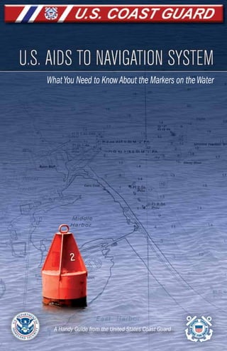
  • 1. www.uscgboating.org 1 U.S.Aids to Navigation System WhatYou Need to KnowAbout the Markers on theWater A Handy Guide from the United States Coast Guard
  • 2. U.S.Aids to Navigation System www.uscgboating.org www.uscgboating.org 1 2 U.S.Aids to Navigation System Aids to Navigation can provide a boater with information similar to that which drivers get from street signs, stop signals, road barri- ers, detours, and traffic lights. This booklet will give you, the recreational boater, the basic information you need about the U.S.Aids to Navigation System (USATONS). This information will help you recognize, understand, and navigate by the colors, shapes, numbers, and lights you will encounter on the water. It will also give you the basic tools you need to read a nautical chart. In addition, you will find information on safety, the proper way to interact with other ves- sels, tips on boating at night, and how to handle special situations you might encounter, like bridges and locks. Take some time to review this booklet, and keep it onboard your boat as a quick refer- ence. Your understanding of the markers you see on the water will help ensure that you, your family, and your friends have fun – and safe – boating trips. Best Regards, United States Coast Guard Boating Safety Division STOP Read This Booklet. Stay Safe on the Water. AIDS TO NAVIGATION ARE THE WATERWAYS’ ROAD SIGNS Most boating accidents are preventable! Be sure to: Boaters call navigation rules – the basic laws governing the steering or sailing of a boat – “The Rules of the Road.” The Rules of the Road define the roles and responsibilities of vessel operators. If all operators obeyed these rules, most accidents could be avoided. One of the reasons the Rules of the Road exist is to keep boats from colliding with each other and with other objects. Since collisions are the number one type of accident on the water, boaters should remember the following Rules of the Road. Post a lookout. Designate someone to watch for dangers that may come from any direction. Maintain a safe speed. Except where speed is restricted by regulation or the waterway is marked by a “No Wake” or “Slow Speed”Aid, you must judge “safe speed” for yourself, taking into account visibility, vessel traffic, your boat’s ability to maneuver, and the weather conditions. Avoid a collision. The Rules of the Road include the actions to take when encountering another vessel on the water. Some of the most common situations you may encounter are: overtaking, meeting head on, and crossing the bow of another vessel. In each case, the boat designated as the “give-way” vessel is required to yield to the other boat, while the boat designated as the “stand-on” vessel should maintain its course and speed. The Rules vary slightly depending on whether you are boating on inland or on international waters. As an example, when operating on inland waters, sound signals are signals of intent; when operating on international waters, they are signals of action. • Always wear your life jacket and require the same of your passengers • Never boat under the influence • Take a boating safety course • Get a free Vessel Safety Check 1. Navigation Rules (Rules of the Road)Introduction
  • 3. U.S.Aids to Navigation System www.uscgboating.org www.uscgboating.org 3 4 U.S.Aids to Navigation System 2 short blasts (1 sec.each) 1 short blast (1 sec.each) 2 short blasts (1 sec.each) 1 short blast (1 sec.each) Stand-on Vessel Overtaken Give-way Vessel Overtaking (keep clear) Overtaking Situation (Navigation Rule 13) Head-On Situation (Navigation Rule 14) Port-to-Port Passing (preferred) Action(s): The give-way vessel (bottom) can pass on either side of the stand-on vessel (top). Sound signals, inland: Passing portside requires two short (1-second) blasts on the horn signaling the overtaking boat’s intention, and two short blasts for the stand-on vessel’s agreement. Passing to starboard requires one short blast for intent and agreement. Sound signals, international: Passing portside requires two prolonged (4-6 seconds) and two short blasts for the overtaking boat’s intention, two short blasts for the stand-on vessel’s agreement. Passing to starboard requires two prolonged and one short blast for intention.An agreement signal is only required when operating in a narrow channel or fairway; then the following blast pattern signals your agreement: one prolonged/one short/one prolonged/one short. 1 short blast (1 sec.) 1 short blast (1 sec.) Action(s): When meeting another vessel head on, a port-to-port passing is preferred. Passing starboard-to-starboard is acceptable when necessary. Sound signals: Passing port-to-port requires one short horn blast to signal intention and one short blast for agreement. Passing to starboard requires two short blasts from each vessel. 2 short blasts (1 sec. each) 2 short blasts (1 sec. each) 1 short blast (1 sec.) 1 short blast (1 sec.) 2 short blasts (1 sec. each) 2 short blasts (1 sec. each) 1 short blast (1 sec.) 1 short blast (1 sec.) Stand-On Vessel Overtaken Give-Way Vessel Overtaking (keep clear) Starboard-to-Starboard Passing
  • 4. U.S.Aids to Navigation System www.uscgboating.org www.uscgboating.org 5 6 U.S.Aids to Navigation System Crossing Situation (Navigation Rule 15) Action(s): In a crossing situation, the give-way vessel must act to avoid a collision. This may include altering its course to pass astern of the stand-on vessel or slowing down. The stand-on vessel should maintain its course and speed. Sound signals, inland: The give-way vessel signals the stand-on vessel with one short horn blast. The stand-on vessel agrees with one short horn blast. Sound signals, international: The give-way vessel signals the stand-on vessel with one short horn blast. No agreement signal by the stand-on vessel is required. There is much more to the Navigation Rules than can be covered here. For more information, go to www.uscgboating.org or www.navcen.uscg.gov. When meeting another boat, make early and substantial changes to your course. This helps the other operator understand your intentions. The two main types of Aids to Navigation are buoys and beacons. Buoys are Aids that float on top of the water, but are moored to the bottom of the body of water. Some have a light affixed to the top; some do not. A buoy with a cylin- drical shape and a conical top is referred to as a “nun.” A buoy with a cylindrical shape and a flat top is called a “can.” Beacons are Aids that are permanently fixed, most commonly to the bottom of a body of water. A beacon that has a light attached is simply referred to as a “light”; a beacon without a light attached is called a “daybeacon.” Both buoys and beacons can provide a variety of navigation information via shape, color, light, and/or audible signal. Dayboards are informational signboards. The term topmark refers to a non-lighting element, such as a sphere, that may be affixed to the top of an Aid. 2. The Essential Markers: On the Water and On the Charts R "2A" G C "5A" FI R 4s 30ft 6M "4" RG N "CF" R "4" Q R FI G 4s 15ft 5M "5" RED LIGHTED BUOY Red: always even numbers RED LIGHT GREEN CAN BUOY Green: always odd numbers GREEN LIGHT RED/GREEN NUN BUOY RED DAYBEACON Give-Way Vessel should alter course to pass astern (behind) 1 short blast (1 sec.) Stand-On Vessel should maintain its course and speed 1 short blast (1 sec.)
  • 5. U.S.Aids to Navigation System www.uscgboating.org www.uscgboating.org 7 8 U.S.Aids to Navigation System Understanding the Symbols in This Booklet Buoys, beacons, and all other Aids have a corresponding symbol used on nautical charts. In this booklet, you will see representations of Aids, each alongside its nautical chart symbol: Nautical Charts It is critical to know where you are going, what routes to take, and which areas to avoid before you begin your boating trip. Nautical charts are the boating equivalent of road maps. A nautical chart provides boaters with an aerial view of a waterway with its Aids to Navigation, landmarks, and bridges, as well as information on water depth, latitude and longi- tude, and a variety of other important navigational information. Nautical chart symbol Nautical chart abbreviation Indication of lighted Aid* Letter* (B) Flash Period* (6 seconds) Light color* (red) Aid type Aid color (red-green) * Not on all Aids Aid color (red-green) Light characteristic* (composite group flashing) RG “B” FI (2+1) R 6s • Always use a current navigation chart and be sure to check www.navcen.uscg.gov for any relevant Notices to Mariners before your trip. • While electronic chart systems (ECS) can provide boaters with excellent information, keep relevant paper charts on board. Should your ECS or GPS malfunction, you will be very glad to have a backup. • Remember that most accidents are caused by human error. Do not let an electronic navigation device take the place of knowing and adhering to the Navigation Rules. What You See Depends on Where You Boat The Aids to Navigation system used on the majority of American waterways is referred to as the U.S.Aids to Navigation System or IALA-B. A description of USATONS follows. The Mississippi River and its tributaries follow a variation of USATONS called the Western Rivers Marking System. An explanation of this system begins on page 23. The system used exclusively on the Intracoastal Waterway, which runs along the United States coast from New Jersey through Texas, is described beginning on page 25. Another system, called the Uniform State Waterway Marking System, has mostly been phased out. However, these Aids are shown on page 26 as you may occasionally en- counter them. There are also private Aids to Navigation, which are Aids that are neither owned nor maintained by the U.S. Coast Guard. These typically look similar to those in the systems described in this booklet and are represented by the same nautical chart symbols, with the addition of “Priv,” or “Priv maintd.” B B Retro-reflective panel* Light* Letter Aid RG “B” FI (2+1) R 6s Lighted Buoy Lighted Buoy
  • 6. U.S.Aids to Navigation System www.uscgboating.org www.uscgboating.org 9 10 U.S.Aids to Navigation System Lateral Aids to Navigation Lateral Aids to Navigation are generally used for well-defined channels to indicate the route to be followed. These Aids show the sides of a navigable channel, mark junctions and forks or splits in the channel, indicate the safe side to pass a hazard to navigation, and mark the safe centerline on wide bodies of water. They are used in conjunction with a conventional direction of buoyage (a local direction of buoyage when approaching a harbor, river estuary, or other waterway from seaward). “Red, Right, Returning” You may have heard the phrase,“Red, Right, Returning.” This expression refers to the fact that when returning (entering a channel from the open sea or proceeding upstream), a boater must keep the red Aids on the right (starboard) side of the boat. These Aids have even numbers, and the numbers should increase as you proceed inland. When proceeding toward open water (seaward), navigate so that the green Aids are to starboard. In this instance, you will see odd numbers on the Aids and the numbers should decrease as you proceed toward open water (seaward). If there is no route marked, navigate clockwise around landmasses. 1 Green colors and lights should be on your right (starboard) side when traveling toward open waters (seaward) 12 1 2 open water open waterchannel channel channel channel 7 5 3 1 8 6 4 Green Aids: Odd Numbers Square dayboards, buoys, and cans Proceeding Upstream Open Water (seaward) Red Aids: Even Numbers Red, Right, Returning: when proceeding upstream, keep the red Aids to starboard Daybeacon G “7” R “8” Daybeacon Can G C “3” R N “4” Nun Lighted Buoy G “1” FI G 4s R “2” FI R 4s Lighted Buoy Light “5” FI G 6s “6” FI R 6s Light Characteristics • Beacons may have green odd numbers. • Buoys may have white odd numbers. • If lit, the light will be green and is likely to flash in one of the following patterns: Flashing (2) Flashing Occulting Quick Flashing Isophase Flashing (2) Flashing Occulting Quick Flashing Isophase Characteristics • Beacons may have red even numbers. • Buoys may have white even numbers. • If lit, the light will be red and is likely to flash in one of the following patterns: (see page 22 for more on lights) 2 2 Red colors and lights should be on your right (starboard) side when traveling from open waters (shoreward) 3. U.S. Aids to Navigation System (IALA-B)
  • 7. U.S.Aids to Navigation System www.uscgboating.org www.uscgboating.org 11 12 U.S.Aids to Navigation System Daybeacon Can Buoy Daybeacon Nun Buoy GR “U” RG “G” GR C “S” RG N “C” GR “A” FI (2+1) G 6s RG “B” FI (2+1) R 6s Preferred-Channel Aids Beacons and buoys that have horizontal bands of both red and green mark the junction of navigable channels.The top-most color indicates the direction of the preferred, or primary, channel. When returning (entering a channel from the open sea or proceed- ing upstream), keeping the Aids with red as the top-most color on the right (starboard) side of the boat will place the boater in the preferred channel, while keeping those Aids on the port side will place the boater in the secondary channel. When proceeding toward open water (seaward), keeping the Aids with green as the top-most color on the right (starboard) side of the boat will place the boater in the preferred channel, while keeping those Aids on the port side will place the boater in the secondary channel. Characteristics • Green on top. • Have a letter designation. • Buoys will feature a white letter. • If lit: Characteristics • Red on top. • Have a letter designation. • Buoys will feature a white letter. • If lit: Characteristics • White with red, green, or black diamonds. • Usually lettered (the letter can be matched to a nautical chart to check position). • In the illustrations above,“NR,”“NG,”and“NB”indicate non-lateral red,green,and black. The chart symbol is to the lower right of each illustration (e.g.,“RW Bn” indicates a red-and-white beacon).U S A G C B Lighted Buoy Lighted Buoy COMPOSITE GROUP FLASHING (2+1) COMPOSITE GROUP FLASHING (2+1) (see page 22 for more on lights) Non-Lateral Aids to Navigation Non-lateral Aids are the on-the-water versions of the informational, regulatory, and warning signs encountered on the road. Diamond-Shaped Dayboards Diamond shaped dayboards are used to help determine location. They are the nautical equivalent of “You Are Here” markers. An appropriate nautical chart must be consulted to determine your exact position. N GA N N RW “N” Unlighted with or w/o sound N GA N MR RW “A” N GA N Spherical SP “G” N GA N Can RW “N” N GA N N RW “N” Mo (A) RW Bn NR GW “A” Bn NG BW “M” Bn NB A M Characteristics • White and red vertical stripes. • A variety of shapes. • May be lettered. • Buoy may have red topmark. • If lit: (Morse Code “A”) Preferred Channel Safe Water Marks These Aids are used to mark fairways, mid-channels, and offshore approach points. They have unobstructed water on all sides. A buoy, lighted or unlighted, may show a red topmark. An appropriate nautical chart must be consulted to determine exact position. Lighted with or w/o sound
  • 8. U.S.Aids to Navigation System www.uscgboating.org www.uscgboating.org 13 14 U.S.Aids to Navigation System Isolated Danger Marks These Aids indicate an isolated danger that may be passed on all sides. Use caution when approaching. A C BR “A” FI (2) 5s Lighted BR “C” Unlighted Characteristics • Rectangular with two colors arranged as three vertical stripes. • May be lettered. • When lit, rear light will be higher then the front light. • Light characteristics may vary; usually the rear (upper) light remains lit (fixed), while the front (lower) light flashes. Characteristics • Buoy with black and red horizontal bands. • May be lettered. • Black double-sphere topmark. • If lit: FI (2) 5s Range Dayboards These Aids, which are usually shore-mounted, come in pairs to help the vessel operator maintain a straight and safe course within a navigable channel. Each member of the pair is separated from the next in distance and elevation, with the one in front shorter than the one behind it. When the two appear to be vertically stacked, the vessel is on the range line. Rear light Front light Side View Front View Left of range line Right of range line On range line When the front (bottom) marker is to the right of the rear (top) one, you are to the left of the range. You should turn right (starboard) to get onto the range line. When the front (bottom) marker is to the left of the rear (top) one, you are to the right of the range. You should turn left (port) to get onto the range line. The two range markers are in line, which indicates you are on the range line. Front marker Front marker Front marker Front marker Front marker Front marker Rear markerRear markerRear marker Rear marker Rear marker Rear marker The colors of range dayboards do not impact navigation – colors are simply chosen based on how well they stand out from the background scenery. Some combinations: KGW KWG KBW KWB KWR KRW KRB KBR KGB KBG KGR KRG Iso R 1 QR
  • 9. U.S.Aids to Navigation System www.uscgboating.org www.uscgboating.org 15 16 U.S.Aids to Navigation System Information and Regulatory Marks These orange-and-white Aids are used to alert vessel operators to various warnings and regulations. Information
 Marks with a square provide helpful information such as directions, distances, and locations Restricted Operations
 Marks with a circle indicate areas with regulated operations Danger
 A diamond shape alerts boaters to hazards Exclusion
 A diamond shape with a cross means boats are prohibited from the area Symbol DANGER GAS DOCK BOAT RAMP NO WAKE IDLE SPEED BOATS KEEP OUT SWIM AREA ROCK mph 5 Meaning Examples Characteristics • White with an orange horizontal band at both top and bottom. • Black text within or around an orange square, circle, or diamond; or black text outside a diamond with an orange cross. • May be buoys or beacons. • If lit, the light will be white and may have any light rhythm except quick flashing, flashing (2), or Morse code “A.” • The chart symbol for this type of buoy is: Characteristics • All-yellow. • Come in a variety of shapes. • May have one black letter. • If lit: Characteristics • White with blue horizontal band. • Cylinder and sphere shapes. • May show a white reflector or display white or yellow light. Characteristics • Black-and-white vertically striped buoy. • May show a white reflector or display a quick-flashing white light. Special Aids These Aids indicate special areas or features such as anchoring, traffic separation, fishnet area, cables or pipelines, military exercise areas, and jetties. Mooring Buoys While not a navigational Aid, mooring buoys are worth mentioning. They are the only type of buoys to which mooring is permitted. Most mooring buoys are privately owned or are rental buoys. Permission is usually needed to use them. State Waters Obstruction Mark The State Water Obstruction Mark indicates to a vessel operator that an obstruction to navigation extends from the nearest shore to the buoy. Do not pass between the buoy and the shore. A C A B Y C “A” Y N “C” Y “B” FI Y Y “A” Bn Unlighted Lighted or W Or
  • 10. U.S.Aids to Navigation System www.uscgboating.org www.uscgboating.org 17 18 U.S.Aids to Navigation System 3 1 1 5 3 2 2 4 2 8 6 4 1 3 5 7 2 2 VisualBuoyageGuideExample NauticalChartExample PreferredChannel SecondaryChannel IntracoastalWaterway “1” FI(2)G6s RG FI(2+1)R6s R“2” FIR6s R“4” OcR6s G“3” FIG6s G“1” IsoG4s BR“C” FI(2)5s G“5” FI(2)G6s G“7” FIG4s R“4” G“5”R“6” FI(2)R6s R“8” FIR4s RW Mo(A) “2” IsoR6s IsoR6s QR “1” IsoG4s “2” FIR4s R N“2” G“3” R“2” RW Bn G C“3” (fictitious;samecircumstancesasabove) (fictitious)
  • 11. U.S.Aids to Navigation System www.uscgboating.org www.uscgboating.org 19 20 U.S.Aids to Navigation System Boating at night can make even familiar waters unrecognizable. Visual depth perception is lessened and lights from the shore can be difficult to distinguish from those on the water. To make nighttime boating safer, keep the following in mind. Navigation Lights Vessels are required to show navigation lights from sunset to sunrise and during periods of restricted visibility. Understanding these light displays will provide invaluable informa- tion to the boater, as these lights can help the boater determine the length of another vessel, its orientation in relation to your boat, and the general direction in which it is headed. All operators must ensure that their vessel’s navigation lights are working and that the posi- tioning and distance from which they can be seen meet federal regulations. It is important to know which naviga- tion lights you will see from another boat in certain situations. This can help you determine if you are in an overtaking, meet- ing, or crossing situation. The following chart illustrates the navigation lights you will see from various angles: Whenever you see a red navigation light from another vessel, give way. It is the stand- on vessel. According to the Rules of the Road, it has the right of way (see page 2). If you see both the red and green sidelights of another boat, it is coming straight toward you. You should take action to change course in order to avoid a collision. Starboard Bow Stern Port Side Keep in Mind • It is risky to rely on memory or to take shortcuts at night. Stick to the main channel. Your best bet is to navigate by the appropriate chart and identify the corresponding Aids to Navigation. • Make sure you are familiar with the handling characteristics of your boat so you can concentrate on interpreting the Aids to Navigation. • Slow down. Distances are more difficult to judge at night and you will need more time to distinguish the various types of lights you will see: navigation lights, lights from Aids, and lights on shore. • Listen. You might hear certain sounds before you see the related objects or situ- ations that require you to change course, such as another boat’s engine or sound signals, an Aid’s bell or gong, or noises from shore. (Note that sound travels far over water.) • Turn on your navigation lights from sunset to sunrise and during daytime periods of reduced visibility, such as rain and fog. • Turn off any lights that might interfere with, or be confused with, navigation lights. Temporary image 4. Boating at Night
  • 12. U.S.Aids to Navigation System www.uscgboating.org www.uscgboating.org 21 22 U.S.Aids to Navigation System NighttimeBuoyageGuideExample = (fictitious;samecircumstancesaspages17-18) The various combinations of these characteristics enable boaters to tell one Aid from another in darkness. The following shows how common light display characteristics are illustrated and how they operate: Chart Abbreviation Type/Description F Fixed Shines continuously and steadily; no dark phase. Fl Flashing The light goes on at regular intervals; the duration of the light phases are less than the duration of the dark phases. Fl (2) Group Flashing Groups of two flashes that are repeated several times a minute. Fl (2+1) Composite Group Flashing A group of two flashes followed by a single flash, the entirety repeated several times a minute. Iso Isophase All durations of light and dark are equal. Mo (A) Morse Code Short (“dots”) and long (“dashes”) flashes of light are used to represent Morse code; usually flashes the letter “A.” Oc Occulting The light goes on at regular intervals; the duration of the light phases is greater than the duration of the dark phases. Q Quick (Flashing) Very rapid flashing (more than 60 flashes a minute). Illustration Aids to Navigation at Night At night,Aids to Navigation can only be identified by their light characteristics: • Color (red , green , white , or yellow ). • Light display (sequence of flashes). • Period (time it takes to go through one sequence of flashes). • Equipped with retroreflective material.
  • 13. U.S.Aids to Navigation System www.uscgboating.org www.uscgboating.org 23 24 U.S.Aids to Navigation System • Crossing daybeacons are used to assist river traffic by indicating where the chan- nel has changed from one side of the river to the other; the aid that marks this channel change will be on the opposite side of the river. When encountered, a vessel operator should head for the Aid, using its color as a channel mark. • Isolated danger marks and safe-water marks are not used. • River banks are named based on their downstream direc- tion: either “left bank” and “right bank” or “left descending bank” and “right descending bank.” • Because of their somewhat temporary nature, Western River buoys do not have numbers or letters and are not always marked on river charts because they tend to drift due to fluctuating water level, current speed, and shifting shoals. Characteristics If lit, the light will be green and will flash as: Flashing FI (2+1) G Characteristics If lit, the light will be red and will flash as: Flashing FI (2+1) R Upstream Downstream Lighted buoy Lighted buoy Can Nun Daybeacon Daybeacon Preferred-Channel Aids Western Rivers Marking System When on the Mississippi River, tributaries above Baton Rouge, and several other rivers that flow toward the Gulf of Mexico, boaters must follow a system called the Western Rivers Marking System, a variation of the U.S.Aids to Navigation System. Upstream (proceeding inland) Port Side/ Right Descending Bank Starboard Side/ Left Descending Bank Downstream (proceeding to Gulf of Mexico) Characteristics If lit, the light will be green or white and may flash as: Flashing Isophase Characteristics If lit, the light will be red or white and may flash as: Flashing (2) Isophase In the Western Rivers Marking System: • Buoys are not numbered. • Beacons are not numbered, but normally have a mile marker that indicates the distance in statute miles from a fixed point, typically the river’s mouth. Port and Starboard Aids 5. Aids to Navigation Systems
  • 14. U.S.Aids to Navigation System www.uscgboating.org www.uscgboating.org 25 26 U.S.Aids to Navigation System 43 7 Uniform State Waterway Marking System The Uniform State Waterway Marking System (USWMS) was discontinued and replaced by the U.S.Aids to Navigation System (USATONS) in 2003. Should you come across one that has not yet been replaced, a guide is provided below: 43 7 3 4 Acts as the green can buoy in USATONS Acts as the red nun buoy in USATONS South or West North or East Lateral System – USWMS Cardinal System – USWMS Cardinal buoys serve as the USWMS version of USATONS’ preferred-channel markers, as they indicate the primary route. They are named “cardinal” buoys after the cardinal points (north, south, east, and west) of the compass: 43 7 43 7 The USMWS system’s red- and-white vertically striped buoy means obstruction. In USATONS, a red-and- white vertically striped buoy means safe water. Larger Body of Water Smaller Body of Water Intracoastal Waterway The Intracoastal Waterway (ICW) runs just inland and parallel to the Atlantic and Gulf coasts from Manasquan, New Jersey to the Mexican border. The Aids to Navigation of the ICW closely resemble the green and red buoys and beacons of the lateral system previously discussed. When operating in the ICW, the color of the Aids will typically correspond to the USATONS scheme (Red, Right, Returning).The yellow squares, triangles, and bands attached to the Aids are the primary ICW indicators. Boaters need to understand these markings to safely navigate the ICW. Some examples: 7 3 1 1 8 4 2 2 3 2 There are three types of symbols: When following the ICW from New Jersey through Texas, keep yellow triangles on your starboard and yellow squares on your port, regardless of the color of the Aid on which they appear. The yellow horizontal band reflector can be found on any non-lateral Aid. It simply identifies the Aid as marking the ICW. ICW beacons and buoys do not correspond to IALA-B’s color system because ICW and non-ICW routes may travel next to each other in opposing directions – and share the same Aids.Thus, when following the ICW, navigate by the yellow symbols; otherwise, navigate by the color of the Aid itself. Arrows do not indicate the actual location of the ICW.Arrows depict how aids to navigation are oriented when operating in the ICW.
  • 15. U.S.Aids to Navigation System www.uscgboating.org www.uscgboating.org 27 28 U.S.Aids to Navigation System Clearance Gauges If it is not obvious whether or not there is enough vertical room to travel under a certain bridge, boaters should refer to its clearance gauge (affixed to the bridge’s right side upon approach). This marks the distance between the “low steel” of the bridge channel span and the waterline, not the depth of the water under the bridge. WATERLINE LOW STEEL CLEARANCE (feet) CLEARANCE GAUGE Drawbridge-Opening Protocol When passage under an open drawbridge is required, the boater must make a request of the drawbridge operator. The bridge tender will acknowledge the signal. The most common protocols are: VHF-FM • Boaters may hail the drawbridge operator on channels 13 or 16. (Channel 9 should be used in Florida, Georgia, and South Carolina.) • Always use the low-power output (1 watt) setting. Sound Signals Approaching a Closed Draw • An opening signal consists of one prolonged blast (4 to 6 seconds) and one short blast (1 second); this can be from a whistle, horn, megaphone, or hailer. • The operator will reply with the prolonged-then-short blast if the draw will be opened immediately. • Five short blasts in rapid succession mean that the operator cannot comply at that moment. Approaching an Open Draw • If the draw is already open, an opening signal (prolonged blast plus short blast) must be made. • If no reply is received within 30 seconds, you may proceed with caution. • Five short blasts in rapid succession mean that the operator must close the draw; do not proceed. Upstream Bridges Lighting Systems Bridges are lit to help boaters navigate under them from sunset to sunrise and during other periods of reduced visibility. In general, red lights indicate portions of the bridge where it is unsafe to attempt passage, and green lights indicate areas of safe passage. See key below. A A A A E A B E G G E D(Main Channel) Fixed Bridge Double Leaf (Lift) Bascule Bridge Vertical Leaf Span Bridge (open) Double Opening Swing Bridge (open) Vertical Lift Span Bridge (closed) closed open closed open Double-Opening Swing Bridge (closed) A A AA A E A A A FF F A A – Piers and supports. B – Centerline of navigable channel. C – Three white lights stacked vertically show the preferred route, if there is more than one navigable channel. D – Used on some lift bridges to indicate the lift is closed. E – Lift is open to vessel traffic. F – Double-opening swing bridges show three red lights when closed. G – Double-opening swing bridges show two green lights when open. 6. Special Situations
  • 16. U.S.Aids to Navigation System www.uscgboating.org www.uscgboating.org 29 30 U.S.Aids to Navigation System • Wait for the lock operator to signal you with horn blasts; additional signals may include traffic lights or flashing lights. • Enter the lock at reduced speed. • Make sure all passengers remain seated and wear their life jackets. • Tie your craft to the mooring devices after entering; a minimum of 50 feet of line is recommended. • Use fenders to avoid damage to your vessel and to lock walls. • When through, wait for the lock operator’s signal (horn and/or lights), then leave the lock at idle speed. There is a specific order of lockage priority among vessels. Military and most commercial vessels have priority over recreational vessels. Low-Head Dams Low-head dams have been built to raise the level of rivers or streams for various reasons.They can be extremely dangerous to small boats and swim- mers; so much so, they have been nicknamed “drowning machines.” Small boats may easily become caught within the circular motion (hydraulic) of the dam’s fast-moving water. The boat and its passengers may be unable to escape. Low-head dams are particularly difficult to spot on the upstream side; and from any vantage point, they can look harmless. Remember that no matter how short a drop the dam may have, it can still be deadly. • Always portage around low-head dams, regardless of direction of approach. Exit the water well before the dam and return well after. • Not all low-head dams are marked by signage or a danger buoy. Therefore, familiarize yourself with any stream or river before traveling on it. • When traveling downstream, watch for a smooth horizon line. This is a subtle but telltale sign that you are approaching a low-head dam. The scenery beyond it might have the illusion of being cut off or shortened. Controlled-Access Areas In order to ensure public safety and national security, the Coast Guard periodically estab- lishes controlled-access areas that have special operational or navigational requirements. Safety Zones, Security Zones, and Regulated Navigation Areas might require reduced speed within a certain radius of a salvage operation, for example, or restrict access altogether near a high-profile event or a power plant. These areas should be avoided or approached with caution. To make sure you know where the controlled-access areas are – and the specific pa- rameters of each – always have the most current nautical chart and the latest Notices to Mariners before you head out (www.navcen.uscg.gov). Contact the local Coast Guard office or other law enforcement agency for specific details about such areas. As a general rule, however, it is wise to avoid dams, power plants, and commercial port op- eration areas, especially those that involve the military, cruise lines, or petroleum facilities. Naval Vessel Protection Zones A Naval Vessel Protection Zone is a per- manent controlled-access area that surrounds every U.S. naval vessel. The parameters are clear: do not come closer than 100 yards of a vessel, and operate at minimum speed within 500 yards of the vessel. Vio- lating a Naval Vessel Protection Zone is a felony offense with the possibility of a prison sentence and/or fines of up to $250,000. Locks A lock is an engineered structure that enables vessels to move between waterways of differing heights. As when traveling under drawbridges, there are specific procedures in place for navigating through locks. Specifics may vary in certain regions, but in general: • Stay between the red and green buoys that mark the river’s navigable channel. • Request an opening with a sound signal consisting of one prolonged blast (4 to 6 seconds) and one short blast (1 second) within one mile of the lock; this can be made by using the lock’s pull-cord or your whistle, horn, megaphone, or hailer. Backwash Boil Escape Route Low-head Dam OPERATE AT MINIMUM SPEED KEEP OUTKEEP OUT 100YARDS 500YARDS If you feel you must enter a controlled-access area to ensure safe navigation, immediately contact the Coast Guard on VHF-FM Channel 16.
  • 17. U.S.Aids to Navigation System www.uscgboating.org www.uscgboating.org 31 32 U.S.Aids to Navigation System 7. Always Wear Your Life Jacket! (and require the same of your passengers) The number one cause of on-the-water fatalities is drowning. The number one way to prevent drowning is to wear a life jacket. The U.S. Coast Guard requires recreational vessels to have a wearable life jacket for each person on board. All life jackets must be: • U. S. Coast Guard-approved. • The proper size for the intended wearer. • In good and serviceable condition. • Properly stowed (readily accessible). Children Must Wear Life Jackets Federal regulations require that on a recreational vessel underway, children under 13 must wear an appropriate U. S. Coast Guard-approved life jacket, unless they are below decks or in an enclosed cabin. Within a state’s waters, if that state has established a child lifejacket wear requirement, that state’s requirement applies. The Coast Guard recommends all passengers wear a life jacket at all times when the vessel is underway. Tips for a Proper Fit – Try It On • Use the manufacturer’s label as a guide to choosing the proper life jacket for your size and weight. It should have a comfortably snug fit. • With all straps, zippers, and ties securely fastened, raise your arms over your head. The jacket should stay in place and not ride up. • With your arms at your sides, have someone lift your life jacket straight up at the shoulders. If the jacket comes up more than a few inches, it is too loose. • It is best to try on a life jacket before a boat trip. • Life jackets designed for adults will not work for children! America’s Waterway Watch The U.S. Coast Guard is asking boaters to help keep America’s waterways safe and secure. The Coast Guard has developed a program called America’s Waterway Watch (www.americaswaterwaywatch.org). It asks boaters to call 877-24WATCH if they notice suspicious activity or behavior on or near the water. Things to report include: • Someone taking pictures, video, or making sketches of facilities like bridges, tunnels, ferry transport systems, fuel docks, or power plants. • Someone asking a series of ques- tions about access to one of these facilities. • Someone anchoring, fishing, or diving in an area not typically used for that activity. • Unattended vessels in unusual locations. • Unusual transfer of personnel or cargo while underway. • Seeing a hole in a security fence around an industrial facility. Do not take matters into your own hands. Call 877-24WATCH. In cases of immediate danger to life or property, call the Coast Guard on Channel 16 VHF-FM, or dial 911 for emergencies.
  • 18. U.S.Aids to Navigation System www.uscgboating.org www.uscgboating.org 33 34 U.S.Aids to Navigation System Key to the U.S. Aids to Navigation System (IALA-B) How to Report Aids to Navigation Discrepancies to the Coast Guard Please report discrepancies or outages to any Aid to Navigation (GPS, DGPS, buoys, lights, dayboards, etc.) to the nearest U.S. Coast Guard station. You can do this 24 hours a day, 7 days a week via radio, telephone, fax, visiting www.navcen.uscg.gov, or by e-mailing navcen@uscg.mil.To reach the U.S. Coast Guard Navigation Center by telephone, call (703) 313-5900. Reporting can help prevent accidents caused by such defects; you will be helping other boaters stay safe. All Aids to Navigation are Protected By Law It is a criminal offense to cause any damage or hindrance to the proper operation of any Aid. Do not alter, deface, move, or destroy any Aid to Navigation. Never tie a vessel to a buoy, daybeacon, or light structure. Avoid anchoring so close to an Aid that the Aid is obstructed (hidden) from sight of another vessel. Report all intentional or unintentional collisions with navigation Aids to the U.S. Coast Guard. B – Black Bn – Beacon examples: C – Can Buoy examples: F – Fixed Fl – Flashing Fl (2) – Group Flashing Fl (2+1) – Composite Group-Flashing G – Green Iso – Isophase J – Junction (S or T Dayboard) examples: M – Safe Water (Octagonal) example: Mo (A) – Morse Code letter “A” N – Nun Buoy examples: Oc – Occulting Or – Orange Pri – Private Q – Quick (Flashing) R – Red S – Square Dayboard examples: s – seconds T – Triangle Dayboard examples: W – White Y – Yellow Surprisingly Comfortable Today’s life jackets are lightweight, easy to move in, and come in many sizes, styles, and shapes for every person and every sport. (There are even ones for pets!) Some examples: Inflatable for general recreational boating Belt Pack Inflatable for general recreational boating Vest-Type Flotation Aid for personal watercraft, waterskiing, and water sports Child Hybrid Inflatable for general recreational boating Child Life Jacket for general recreational boating Flotation Aid for general recreational boating Vest Type for general recreational boating Inflatable Fishing Vest for angling and hunting Paddling Jacket for paddlesports Offshore Vest for offshore boating and racing Position of light
  • 19. U.S.Aids to Navigation System www.uscgboating.org 35 Most boating accidents are preventable! Be sure to: • Always wear your life jacket and require the same of your passengers • Never boat under the influence • Take a boating safety course • Get a free Vessel Safety Check www.uscgboating.org 06/2011 For more information please contact: