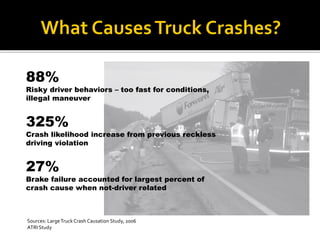
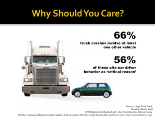
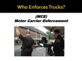
Andy Belcher 
Research Associate / Senior GIS Analyst 
Institute for Transportation Research 
and Education (ITRE) 
North Carolina State University 
Raleigh, NC 
GECO in the Rockies 
Grand Junction, CO 
September 25, 2014 
Rob Hudson 
Engagement Manager 
Astadia 
Jacksonville, Florida
Sources: Large Truck Crash Causation Study, 2006 
ATRI Study 
88% 
Risky driver behaviors –too fast for conditions, illegal maneuver 
325% 
Crash likelihood increase from previous reckless driving violation 
27% 
Brake failure accounted for largest percent of crash cause when not-driver related
Sources: Large Truck Crash 
Causation Study, 2006 
ATA Relative Contribution/Fault in Car-Truck Crashes, February 2013, 
FMCSA -Highway Safety Information System: An Examination of Fault, Unsafe Driving Acts, and Total Harm in Car-Truck Collisions, 2004 
56% 
of these cite car driver behavior as ‘critical reason’ 
66% 
truck crashes involve at least one other vehicle
(MCE) 
Motor Carrier Enforcement
CMV Safety 
Infrastructure Protection
PARTNERSHIP
Commercial Vehicle Enforcement Resource Lab
Decision Management For Operational Enforcement Planning
TROOP 
First Sergeants 
STATE 
Command Staff
Data 
Collection 
Integration and Processing 
GeocodeCrashes 
Crash Patterns 
Infrastructure Layers 
Poor Condition Posted Bridges and Roads 
Road Vulnerability Index 
Vulnerable Roads 
Harvest Data 
Data Warehouse 
Online Map “Layers” 
Printed Maps 
Enforcement Capture 
Enforcement Patterns 
COVERLAB ANALYTICS 
Scorecard / Dashboard 
Web Services
CRASHESvsENFORCEMENT
SCORECARD 
2% Goal 
3.57% Status
DASHBOARD
Lowest Troop 
9.4%
Who? 
Right Click…
Bottom 3 
Top Carriers
DEMO
1.1stVersion Released2.Obtained Troop Feedback3.2ndVersion Release –April 20144.Add Maps to Dashboard5.Add Size and Weight Scorecard (MAP-21) 6.TOD/DOW “HeatGrid”
1.Measuring Adoption Effectiveness 
2.How much are Troops changing strategies? 
3.Are changing strategies affecting outcomes?
Greg Ferrara-Program Manager919.515.8656 |gpferrar@ncsu.edu 
Burke Foley-BI / GIS Technologist919.515.7877 |pbfoley@ncsu.edu 
Andy Belcher-Senior GIS Analyst919.515.8651 |cabelch2@ncsu.edu 
Matt Kuliani-Data Visualization Specialist 919.515.8587 |mlkull@ncsu.edu
Question: Which logging carriers are cited the most statewide, and where are they being cited?
“Extreme Transport”
Fatal and Injury 
Crashes 
City of Fayetteville
#1 
Disregarded Traffic Signals

Underwood esri serug