SlideShare a Scribd company logo
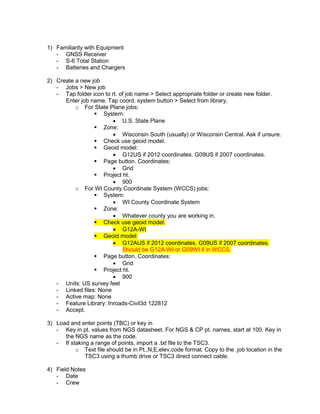
1) Familiarity with Equipment
- GNSS Receiver
- S-6 Total Station
- Batteries and Chargers
2) Create a new job
- Jobs > New job
- Tap folder icon to rt. of job name > Select appropriate folder or create new folder.
Enter job name. Tap coord. system button > Select from library.
o For State Plane jobs:
 System:
 U.S. State Plane
 Zone:
 Wisconsin South (usually) or Wisconsin Central. Ask if unsure.
 Check use geoid model.
 Geoid model:
 G12US if 2012 coordinates. G09US if 2007 coordinates.
 Page button. Coordinates:
 Grid
 Project ht.
 900
o For WI County Coordinate System (WCCS) jobs:
 System:
 WI County Coordinate System
 Zone:
 Whatever county you are working in.
 Check use geoid model.
 G12A-WI
 Geoid model:
 G12AUS if 2012 coordinates. G09US if 2007 coordinates.
Should be G12A-WI or G09WI if in WCCS.
 Page button. Coordinates:
 Grid
 Project ht.
 900
- Units: US survey feet
- Linked files: None
- Active map: None
- Feature Library: Inroads-Civil3d 122812
- Accept.
3) Load and enter points (TBC) or key in
- Key in pt. values from NGS datasheet. For NGS & CP pt. names, start at 100. Key in
the NGS name as the code.
- If staking a range of points, import a .txt file to the TSC3.
o Text file should be in Pt.,N,E,elev,code format. Copy to the .job location in the
TSC3 using a thumb drive or TSC3 direct connect cable.
4) Field Notes
- Date
- Crew
- Temp. weather conditions
- Tasks worked on that day
5) GNSS Checkpoint and Document in Field Notes
a. Turn phone Wi-Fi hotspot on.
b. After that is on, turn on collector. Wait 10 seconds.
c. General Survey > Measure > VRS GNSS > Measure topo > Select TSC3 owner
user name > Use existing internet connection OK > CMR+ GNSS > Wait for fixed
solution “initialization has been gained”. Escape out to main menu. Stakeout >
Stake pts > Make sure “List” tab at bottom is selected. Tap “add” tab at bottom >
Add “all keyed in pts” > Tap “nearest” tab at bottom & stake NGS pt. Pay
attention to deltas & hit Measure. Put pt. name at 1000, add CK before code
name (ex: “CK100) Occupy for 1 minute & store.
d. Document in Field Notes
6) Total Station work
- Set Control and Occupy
a. 2- 90 second occupations of control break initialization between measurements
i. Measure > VRS GNSS > Measure topo. For method, select “topo pt.” For
pt. name, continue in the 100’s. Measure for 90 seconds & store.
Re-initialize: Escape to main menu. Measure > Initialization > Change
method from “known pt.” to “on the fly”. Tap “Init” & then “Start”. Escape
to main menu. Measure > VRS GNSS > Measure topo. Enter in same pt.
name again, measure for 90 seconds, select “average values”, store.
- Setup total station
o Setup tripod.
ii. One leg up hill
iii. Screw tribrach on top of tripod.
iv. Look through the tribrach 90° sight, pick up 2 of the legs, pivoting tripod
on one leg to find the CP (Put foot near CP to help find it).
v. Step in all tripod feet as firmly as possible. Use knobs to center
crosshairs on CP
vi. Level the bubble very roughly by extending/retracting individual legs.
vii. Fine level using the tribrach adjusting knobs.
viii. Look through the 90° sight, unscrew the tribrach, slide over the CP.
ix. Fine level using the tribrach adjusting knobs.
x. Look through the 90° sight to make sure it is still centered over the CP.
o Turn on total station. Wait 10 seconds. TSC3: General survey > Measure >
Page to VX & S series > Station setup > Level the instrument looking at the
level bubble displayed on TSC3 (faceplate on total sta should be facing
toward you), accept > put in temperature, accept > Enter occupied CP in sta.
setup. Enter ht. measured to bottom notch (Tap arrow to make sure ht. is
defaulted to “bottom notch”). Enter backsight CP. Tap on prism rod symbol at
rt. side of screen & select “custom” prism for using standard prism on tripod.
Tap on total station symbol at rt. side of screen & make sure “auto-lock” is
selected. Enter backsight ht. (true ht., to center of prism).
- Backsight – on tripod. At least use a bipod if sighting to Multitrack circular prism.
Always measure to center of prisms for rod ht.
- Analyze orientation
o Difference in horizontal distance between GNSS control and total station
o Vertical difference between GNSS control and total station
- Document in Field Notes Total Station
- Start pt. name in 1000’s
7) GPS work
a. Turn phone Wi-Fi hotspot on.
b. After that is on, turn on collector. Wait 10 seconds.
c. General Survey > Measure > VRS GNSS > Measure topo > Select TSC3 owner
user name > Use existing internet connection OK > CMR+ GNSS > Wait for fixed
solution “initialization has been gained”. For quick topo’s requiring 0.1’+/-
accuracy, change method from “Topo point” to “Rapid point”.
d. Start Pt. name in 1000’s

More Related Content

Viewers also liked (11)

The United Nations in Post-War Bosnia (expanded version)
The United Nations in Post-War Bosnia (expanded version)The United Nations in Post-War Bosnia (expanded version)
The United Nations in Post-War Bosnia (expanded version)
 
Wars in the Pacific
Wars in the PacificWars in the Pacific
Wars in the Pacific
 
Presentation_2_CED_PP_LP_Presentation
Presentation_2_CED_PP_LP_PresentationPresentation_2_CED_PP_LP_Presentation
Presentation_2_CED_PP_LP_Presentation
 
dissertation-china
dissertation-chinadissertation-china
dissertation-china
 
Writing_Sample_3_Sexual_education_Latinos
Writing_Sample_3_Sexual_education_LatinosWriting_Sample_3_Sexual_education_Latinos
Writing_Sample_3_Sexual_education_Latinos
 
Industria del caucho
Industria del cauchoIndustria del caucho
Industria del caucho
 
[2014]TungstenSolutions-FLEXPay
[2014]TungstenSolutions-FLEXPay[2014]TungstenSolutions-FLEXPay
[2014]TungstenSolutions-FLEXPay
 
Viewpoint for Projects - Collaborative project management made simple
Viewpoint for Projects - Collaborative project management made simpleViewpoint for Projects - Collaborative project management made simple
Viewpoint for Projects - Collaborative project management made simple
 
Presentation_3_HSHPS_Presentation
Presentation_3_HSHPS_PresentationPresentation_3_HSHPS_Presentation
Presentation_3_HSHPS_Presentation
 
Presentation_1_BRFSS_Presentation_2011
Presentation_1_BRFSS_Presentation_2011Presentation_1_BRFSS_Presentation_2011
Presentation_1_BRFSS_Presentation_2011
 
Fichas del-cuaderno-3-preescolar-completo
Fichas del-cuaderno-3-preescolar-completoFichas del-cuaderno-3-preescolar-completo
Fichas del-cuaderno-3-preescolar-completo
 

Similar to Training outline markup

36591202 carlson-surv ce-getting-started-tutorial
36591202 carlson-surv ce-getting-started-tutorial36591202 carlson-surv ce-getting-started-tutorial
36591202 carlson-surv ce-getting-started-tutorial
triboedi bedu
 
Design and implementation of GPS Tracker
Design and implementation of GPS TrackerDesign and implementation of GPS Tracker
Design and implementation of GPS Tracker
Vignesh Kannan
 
13f impulse momentum-wireless 3-3-09
13f impulse momentum-wireless 3-3-0913f impulse momentum-wireless 3-3-09
13f impulse momentum-wireless 3-3-09
joseflesco
 
Project 1- Levelling
Project 1- Levelling Project 1- Levelling
Project 1- Levelling
seenyee
 
Levelling final
Levelling finalLevelling final
Levelling final
seenyee
 
2000_All_Series_WS3.pdf
2000_All_Series_WS3.pdf2000_All_Series_WS3.pdf
2000_All_Series_WS3.pdf
RamaSry
 
Autodesk_Field_Layout_Guide
Autodesk_Field_Layout_GuideAutodesk_Field_Layout_Guide
Autodesk_Field_Layout_Guide
Jarrod Krug
 
solar tracker manual with wind sensor
solar tracker manual with wind sensorsolar tracker manual with wind sensor
solar tracker manual with wind sensor
Mangesh Islur
 
Last Rev. August 2014 Calibration and Temperature Measurement.docx
Last Rev. August 2014 Calibration and Temperature Measurement.docxLast Rev. August 2014 Calibration and Temperature Measurement.docx
Last Rev. August 2014 Calibration and Temperature Measurement.docx
smile790243
 
Kmem 3116 al2 report (keb090001)
Kmem 3116 al2 report (keb090001)Kmem 3116 al2 report (keb090001)
Kmem 3116 al2 report (keb090001)
Aliff Azmi
 

Similar to Training outline markup (20)

GNSS Observation Using U-BLOX (5)
GNSS Observation Using U-BLOX (5)GNSS Observation Using U-BLOX (5)
GNSS Observation Using U-BLOX (5)
 
Advanced surveying equipment ppt
Advanced surveying equipment pptAdvanced surveying equipment ppt
Advanced surveying equipment ppt
 
172674393 tems-investigation
172674393 tems-investigation172674393 tems-investigation
172674393 tems-investigation
 
BasicTools-Histogram.ppt
BasicTools-Histogram.pptBasicTools-Histogram.ppt
BasicTools-Histogram.ppt
 
Why do we all need to use CheckFox and what’s so Sigfox special about it?
Why do we all need to use CheckFox and what’s so Sigfox special about it?Why do we all need to use CheckFox and what’s so Sigfox special about it?
Why do we all need to use CheckFox and what’s so Sigfox special about it?
 
36591202 carlson-surv ce-getting-started-tutorial
36591202 carlson-surv ce-getting-started-tutorial36591202 carlson-surv ce-getting-started-tutorial
36591202 carlson-surv ce-getting-started-tutorial
 
Design and implementation of GPS Tracker
Design and implementation of GPS TrackerDesign and implementation of GPS Tracker
Design and implementation of GPS Tracker
 
13f impulse momentum-wireless 3-3-09
13f impulse momentum-wireless 3-3-0913f impulse momentum-wireless 3-3-09
13f impulse momentum-wireless 3-3-09
 
Project 1- Levelling
Project 1- Levelling Project 1- Levelling
Project 1- Levelling
 
Levelling final
Levelling finalLevelling final
Levelling final
 
2000_All_Series_WS3.pdf
2000_All_Series_WS3.pdf2000_All_Series_WS3.pdf
2000_All_Series_WS3.pdf
 
GPS Device Instructions with Area Calculation of Field
GPS Device Instructions with Area Calculation of FieldGPS Device Instructions with Area Calculation of Field
GPS Device Instructions with Area Calculation of Field
 
Autodesk_Field_Layout_Guide
Autodesk_Field_Layout_GuideAutodesk_Field_Layout_Guide
Autodesk_Field_Layout_Guide
 
1569909951 (2)
1569909951 (2)1569909951 (2)
1569909951 (2)
 
solar tracker manual with wind sensor
solar tracker manual with wind sensorsolar tracker manual with wind sensor
solar tracker manual with wind sensor
 
Ndg operating tips new
Ndg operating tips newNdg operating tips new
Ndg operating tips new
 
Heatmap
HeatmapHeatmap
Heatmap
 
Phoenics tutorial
Phoenics tutorialPhoenics tutorial
Phoenics tutorial
 
Last Rev. August 2014 Calibration and Temperature Measurement.docx
Last Rev. August 2014 Calibration and Temperature Measurement.docxLast Rev. August 2014 Calibration and Temperature Measurement.docx
Last Rev. August 2014 Calibration and Temperature Measurement.docx
 
Kmem 3116 al2 report (keb090001)
Kmem 3116 al2 report (keb090001)Kmem 3116 al2 report (keb090001)
Kmem 3116 al2 report (keb090001)
 

Recently uploaded

Panchayat Season 3 - Official Trailer.pdf
Panchayat Season 3 - Official Trailer.pdfPanchayat Season 3 - Official Trailer.pdf
Panchayat Season 3 - Official Trailer.pdf
Suleman Rana
 

Recently uploaded (13)

Q4 WEEK 1 JUDGE THE RELEVANCE AND WORTH OF IDEAS.pptx
Q4 WEEK 1 JUDGE THE RELEVANCE AND WORTH OF IDEAS.pptxQ4 WEEK 1 JUDGE THE RELEVANCE AND WORTH OF IDEAS.pptx
Q4 WEEK 1 JUDGE THE RELEVANCE AND WORTH OF IDEAS.pptx
 
A KING’S HEART THE STORY OF TSAR BORIS III (Drama) (Feature Film Project in D...
A KING’S HEART THE STORY OF TSAR BORIS III (Drama) (Feature Film Project in D...A KING’S HEART THE STORY OF TSAR BORIS III (Drama) (Feature Film Project in D...
A KING’S HEART THE STORY OF TSAR BORIS III (Drama) (Feature Film Project in D...
 
The Evolution of Animation in Film - Mark Murphy Director
The Evolution of Animation in Film - Mark Murphy DirectorThe Evolution of Animation in Film - Mark Murphy Director
The Evolution of Animation in Film - Mark Murphy Director
 
Lite version of elevator game simplified.pptx
Lite version of elevator game simplified.pptxLite version of elevator game simplified.pptx
Lite version of elevator game simplified.pptx
 
Barbie Presentation Template.pptx aaaaaa
Barbie Presentation Template.pptx aaaaaaBarbie Presentation Template.pptx aaaaaa
Barbie Presentation Template.pptx aaaaaa
 
Doorstep ꧁❤8901183002❤꧂Lucknow #ℂall #Girls , Lucknow #ℂall #Girls For Shot...
Doorstep ꧁❤8901183002❤꧂Lucknow  #ℂall #Girls , Lucknow  #ℂall #Girls For Shot...Doorstep ꧁❤8901183002❤꧂Lucknow  #ℂall #Girls , Lucknow  #ℂall #Girls For Shot...
Doorstep ꧁❤8901183002❤꧂Lucknow #ℂall #Girls , Lucknow #ℂall #Girls For Shot...
 
A Collection of Little Johnny Jokes.pptx
A Collection of Little Johnny Jokes.pptxA Collection of Little Johnny Jokes.pptx
A Collection of Little Johnny Jokes.pptx
 
The Ultimate Guide to Mom IPTV- Everything You Need to Know in 2024.pdf
The Ultimate Guide to Mom IPTV- Everything You Need to Know in 2024.pdfThe Ultimate Guide to Mom IPTV- Everything You Need to Know in 2024.pdf
The Ultimate Guide to Mom IPTV- Everything You Need to Know in 2024.pdf
 
NO1 Pandit Black Magic Specialist Expert In Bahawalpur, Sargodha, Sialkot, Sh...
NO1 Pandit Black Magic Specialist Expert In Bahawalpur, Sargodha, Sialkot, Sh...NO1 Pandit Black Magic Specialist Expert In Bahawalpur, Sargodha, Sialkot, Sh...
NO1 Pandit Black Magic Specialist Expert In Bahawalpur, Sargodha, Sialkot, Sh...
 
Dehradun Girls 9719300533 Heat-lava { Dehradun } Whiz ℂall Serviℂe By Our
Dehradun Girls 9719300533 Heat-lava { Dehradun } Whiz ℂall Serviℂe By OurDehradun Girls 9719300533 Heat-lava { Dehradun } Whiz ℂall Serviℂe By Our
Dehradun Girls 9719300533 Heat-lava { Dehradun } Whiz ℂall Serviℂe By Our
 
NO1 Pandit Amil Baba In Uk Usa Uae London Canada England America Italy German...
NO1 Pandit Amil Baba In Uk Usa Uae London Canada England America Italy German...NO1 Pandit Amil Baba In Uk Usa Uae London Canada England America Italy German...
NO1 Pandit Amil Baba In Uk Usa Uae London Canada England America Italy German...
 
A DARK AND HOLLOW STAR BY ASHLEY SHUTTLEWORTH
A DARK AND HOLLOW STAR BY ASHLEY SHUTTLEWORTHA DARK AND HOLLOW STAR BY ASHLEY SHUTTLEWORTH
A DARK AND HOLLOW STAR BY ASHLEY SHUTTLEWORTH
 
Panchayat Season 3 - Official Trailer.pdf
Panchayat Season 3 - Official Trailer.pdfPanchayat Season 3 - Official Trailer.pdf
Panchayat Season 3 - Official Trailer.pdf
 

Training outline markup

  • 1. 1) Familiarity with Equipment - GNSS Receiver - S-6 Total Station - Batteries and Chargers 2) Create a new job - Jobs > New job - Tap folder icon to rt. of job name > Select appropriate folder or create new folder. Enter job name. Tap coord. system button > Select from library. o For State Plane jobs:  System:  U.S. State Plane  Zone:  Wisconsin South (usually) or Wisconsin Central. Ask if unsure.  Check use geoid model.  Geoid model:  G12US if 2012 coordinates. G09US if 2007 coordinates.  Page button. Coordinates:  Grid  Project ht.  900 o For WI County Coordinate System (WCCS) jobs:  System:  WI County Coordinate System  Zone:  Whatever county you are working in.  Check use geoid model.  G12A-WI  Geoid model:  G12AUS if 2012 coordinates. G09US if 2007 coordinates. Should be G12A-WI or G09WI if in WCCS.  Page button. Coordinates:  Grid  Project ht.  900 - Units: US survey feet - Linked files: None - Active map: None - Feature Library: Inroads-Civil3d 122812 - Accept. 3) Load and enter points (TBC) or key in - Key in pt. values from NGS datasheet. For NGS & CP pt. names, start at 100. Key in the NGS name as the code. - If staking a range of points, import a .txt file to the TSC3. o Text file should be in Pt.,N,E,elev,code format. Copy to the .job location in the TSC3 using a thumb drive or TSC3 direct connect cable. 4) Field Notes - Date - Crew
  • 2. - Temp. weather conditions - Tasks worked on that day 5) GNSS Checkpoint and Document in Field Notes a. Turn phone Wi-Fi hotspot on. b. After that is on, turn on collector. Wait 10 seconds. c. General Survey > Measure > VRS GNSS > Measure topo > Select TSC3 owner user name > Use existing internet connection OK > CMR+ GNSS > Wait for fixed solution “initialization has been gained”. Escape out to main menu. Stakeout > Stake pts > Make sure “List” tab at bottom is selected. Tap “add” tab at bottom > Add “all keyed in pts” > Tap “nearest” tab at bottom & stake NGS pt. Pay attention to deltas & hit Measure. Put pt. name at 1000, add CK before code name (ex: “CK100) Occupy for 1 minute & store. d. Document in Field Notes 6) Total Station work - Set Control and Occupy a. 2- 90 second occupations of control break initialization between measurements i. Measure > VRS GNSS > Measure topo. For method, select “topo pt.” For pt. name, continue in the 100’s. Measure for 90 seconds & store. Re-initialize: Escape to main menu. Measure > Initialization > Change method from “known pt.” to “on the fly”. Tap “Init” & then “Start”. Escape to main menu. Measure > VRS GNSS > Measure topo. Enter in same pt. name again, measure for 90 seconds, select “average values”, store. - Setup total station o Setup tripod. ii. One leg up hill iii. Screw tribrach on top of tripod. iv. Look through the tribrach 90° sight, pick up 2 of the legs, pivoting tripod on one leg to find the CP (Put foot near CP to help find it). v. Step in all tripod feet as firmly as possible. Use knobs to center crosshairs on CP vi. Level the bubble very roughly by extending/retracting individual legs. vii. Fine level using the tribrach adjusting knobs. viii. Look through the 90° sight, unscrew the tribrach, slide over the CP. ix. Fine level using the tribrach adjusting knobs. x. Look through the 90° sight to make sure it is still centered over the CP. o Turn on total station. Wait 10 seconds. TSC3: General survey > Measure > Page to VX & S series > Station setup > Level the instrument looking at the level bubble displayed on TSC3 (faceplate on total sta should be facing toward you), accept > put in temperature, accept > Enter occupied CP in sta. setup. Enter ht. measured to bottom notch (Tap arrow to make sure ht. is defaulted to “bottom notch”). Enter backsight CP. Tap on prism rod symbol at rt. side of screen & select “custom” prism for using standard prism on tripod. Tap on total station symbol at rt. side of screen & make sure “auto-lock” is selected. Enter backsight ht. (true ht., to center of prism). - Backsight – on tripod. At least use a bipod if sighting to Multitrack circular prism. Always measure to center of prisms for rod ht. - Analyze orientation o Difference in horizontal distance between GNSS control and total station o Vertical difference between GNSS control and total station
  • 3. - Document in Field Notes Total Station - Start pt. name in 1000’s 7) GPS work a. Turn phone Wi-Fi hotspot on. b. After that is on, turn on collector. Wait 10 seconds. c. General Survey > Measure > VRS GNSS > Measure topo > Select TSC3 owner user name > Use existing internet connection OK > CMR+ GNSS > Wait for fixed solution “initialization has been gained”. For quick topo’s requiring 0.1’+/- accuracy, change method from “Topo point” to “Rapid point”. d. Start Pt. name in 1000’s