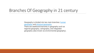
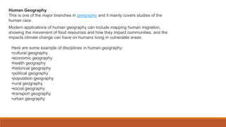
This document discusses post-modernism in geography and the future of geography as a discipline. It provides context around the rise of post-modernism as a critique of modernism in the late 1980s. It outlines some key themes and pioneers of post-modernism geography. The document also discusses the development of geography in the 21st century, including tools used by geographers like GIS and remote sensing, as well as branches of geography like physical, human, and regional geography.
Human geography is the study of how humans interact with their environments and the relationships between people, place, and space over time. It focuses on patterns of human social interaction and how these relationships influence and are influenced by the natural environment. Human geography has a long history but grew in importance in the 18th and 19th centuries. It uses methods from social sciences and humanities to provide geographic analysis of topics like culture, economics, health, politics, population, transportation, and urbanization while applying geographic concepts of space, place, mobility, and nature. The scope of human geography is broad, examining how physical environments influence human societies and how human societies use and change the environments and landscapes in which they live.
QUANTITATIVE REVOLUTION IN GEOGRAPHY.pdfPlutus IAS
The Quantitative Revolution, but natural, was strongly opposed and the dominance of environmental determinism delayed the process of establishment of the scientific basis that the quantifiers wanted to provide.
This document discusses key concepts in the study and teaching of geography and sociology. It covers:
- The founders and early development of sociology as a field, including the contributions of Auguste Comte, Herbert Spencer, Karl Marx, Emile Durkheim, and Max Weber.
- The four traditions of geography: spatial, area studies, human-environment interaction, and earth science.
- Key concepts in sociology like social interaction, symbolic interactionism, and the development of social classes and identity.
- Tools used in geography like maps and methods like fieldwork.
It provides an overview of important topics and thinkers that shaped the development of both geography and sociology as academic disciplines
Role of Remote Sensing(RS) and Geographical Information System (GIS) in Geogr...Prof Ashis Sarkar
since1970s, there has been a sharp rise in Global Resource Information System (gris) facilitated by satellites/satellite-aided geodetic, cartographic and geostatistical methods. This enormous information base needs an entirely new methods of analysis and interpretation. Hence, emerged an entirely new branch of learning and methodology, “geoinformatics”.
1. The document summarizes the philosophical basis and themes of geography as a discipline. It discusses how geography involves the descriptive and explanatory analysis of spatial differences on Earth's surface.
2. Key aspects of geography's philosophical foundation include being goal-oriented, descriptive through quantitative analysis of spatial and cartographic data, and providing geographical explanations.
3. The document outlines five major themes that geographers use to conceptualize the field: areal differentiation, landscape, man-environment interactions, and spatial distribution. Geography entwines physical and social sciences to understand human life and civilization across different regions.
This page include the short and precise overview about geography. It contains all touched knowledge about geography including definition, history and types,
Carl Sauer was an influential American geographer known for his cultural geography approach. He studied how human cultures interact with and transform the natural environment over time through land use and other activities. Sauer had a long career as a geography professor, first at the University of Michigan and later the University of California, Berkeley. He made significant contributions to the field and was dedicated to advancing the study of geography.
Class 12th Chapter 1(Human Geography Nature and Scope) Geography Book Fundamentals of Human Development Complete Explanation of all concept of NCERT class 12th
It is easy to understand
All concept are taken under Guidance of Mrs Kavita Chabbra
Here are a few examples of influential human geographers and their approaches:
- David Harvey (marxist): Focuses on urbanization, globalization and capitalism. Examines how the dynamics of capitalism shape the built environment and social relations.
- Doreen Massey (feminist): Known for her work on space and place. Critiques dominant conceptualizations of these terms from a feminist perspective. Examines gender relations and power dynamics.
- Edward Said (post-colonial): Critiqued Orientalism and how the West constructs the East. His work influenced post-colonial theory and how we understand representations of other cultures.
- Michel Foucault (post-structural
let's learn about dichotomy and dualism. Dichotomy is a division or contrast between two things that are or are represented as being opposed or entirely different. It can also mean repeated branching into two equal parts1. For example, there is often a dichotomy between what politicians say and what they do. Hello, this is Bing. Dualism has different meanings depending on the context. In general, it is the division of something conceptually into two opposed or contrasted aspects, or the state of being so divided1. For example, in philosophy, dualism is a theory that considers reality to consist of two irreducible elements or modes, such as mind and matter2. In religion, dualism is the belief in two supreme opposed powers or gods, or sets of divine or demonic beings, that caused the world to exist3.
What kind of dualism are you interested in? 🤔
Learn more:
1. bing.com
2. merriam-webster.com
3. britannica.com
4. dictionary.com
5. plato.stanford.edu
+3 more
Like
Dislike
Copy
Export
Philosophical dualism.
Religious dualism.
Other types of dualism.
Postmodern geography emerged as a reaction to modernism and its emphasis on grand theories and rational explanations of human behavior and society. Postmodernism rejects the idea of objective truth and universal reason, instead emphasizing particular perspectives and pluralism. It first appeared in fields like architecture and literature before being incorporated into geography starting in the 1970s. Postmodern geographers reject meta-narratives and focus on specific contexts and differences in space. They also aim to restore the importance of geography by emphasizing how spatial factors shape social and economic processes. However, postmodern geography has been criticized for potentially promoting intellectual nihilism and for deemphasizing important concepts like social class.
Urban geography examines cities and how they change over time. It analyzes the internal structure of cities and relationships between cities. There are four traditions in urban geography: physical, human-environmental, regional, and spatial. In recent decades, trends include the rise of global cities, feminist perspectives, studying urban culture, and using GIS technology. The Chicago School emphasized systems of cities while the Los Angeles School stressed how hinterlands influence cities. New Urbanism promotes sustainable, pedestrian-oriented development.
The quantitative revolution in geography began in the 1950s with Schaefer's critique of the traditional regional geography approach. Schaefer argued geography should seek general patterns and laws across regions using quantitative methods rather than focusing on unique regions. This sparked a major transformation in the field toward spatial analysis and modeling using statistics, mathematics, and later computers. By the 1960s, the "new geography" focused on rigorous theory testing and had largely replaced the older descriptive regional approach. However, criticisms emerged in the 1970s that quantitative methods dehumanized geography and were unable to fully explain human spatial patterns. This led to the rise of qualitative approaches. While quantitative geography declined, it resurged in the 1990s with new spatial analysis techniques
My Experiments with the Innovative Research Techniques in GeographyProf Ashis Sarkar
This presentation elaborates and chronicles the application of the steadily evolving research methods in geographical analysis beginning from the college days of the author in the early 1970s.
This document provides an overview of key areas, concepts, and influential figures in human geography. It discusses the emergence of geography as an academic discipline in the 18th-19th centuries and various theoretical approaches that developed over time, including quantitative, critical, and radical geography. Some of the main subfields of human geography mentioned are cultural geography, economic geography, health geography, population geography, and urban geography. Influential geographers highlighted include David Harvey, Doreen Massey, Yi-Fu Tuan, and Nigel Thrift.
Towards post modernism_Jamila Yasmin.pptxRohamatMandal
This document discusses post-modernism and geography in the 21st century. It explains that post-modernism rejects absolute truths and modernist theories, instead seeing truth as contextual. In geography, post-modernism became prominent in the late 1980s and questioned existing narratives. The document then outlines some notable post-modern geographers like Edward Soja and their works. Finally, it discusses trends in 21st century geography like feminist approaches, cultural studies, GIS, development indices, and focus on climate change.
developments of human centered theoriesPooja Kumari
This document provides information about behaviouralism in geography. It discusses how behaviouralism developed due to dissatisfaction with positivist models based on economic rationality. The behavioural approach emphasizes subjective and decision-making variables that influence human-environment relationships. It lists the objectives and fundamental arguments of behavioural geography, including that people have environmental images that influence decision-making. The document also provides details about humanistic geography and its criticisms of quantitative models.
Space and place – two aspects of the human landscape relationship-2007iswoyo
some of the key theories of landscape experience and empirical research related to those theories.
They are grouped around three concepts: First, we survey theories dealing with landscapes perceived
as a physical space, covering topics such as environmental preference and the evolutionary
basis of the psychological processes through which preferences arise. Secondly, we summarize some
of the theories dealing with landscape perceived as place. Here we discuss concepts such as “sense of
place” and “place identity”.We emphasize that place identity is a particular element contributing to
sense of place.Thirdly, we discuss theory and research concerning the role of landscapes for psychological
restoration, which bridges the approaches that treat landscape as space and those which treat
it as place. In the conclusion, we provide some suggestions for further integrative work.
This document provides an overview of geography as an academic discipline. It begins by defining geography as the study of the earth's physical features and human systems. It then covers various key concepts in geography like place, space, environment, interconnection, sustainability, scale and change. The document also discusses the history and evolution of geography as a field of study. It outlines the key elements of geography and discusses the relationships between geography and other social sciences. Finally, it provides descriptions of the sub-disciplines of physical geography and human geography.
This document provides an overview of landscape biography as an approach to landscape research. It discusses how landscape biography aims to address increasing specialization and the divide between objectivist and constructivist approaches in landscape studies. The document then summarizes the development of biographical approaches from 1979 to present in human geography, social anthropology, and archaeology. It introduces key issues in further developing landscape biography, including who authors landscapes, whether landscapes are "socialized nature", how temporal dimensions of landscapes take shape, and how planning and design contribute to landscape histories.
This document provides an overview of the development of urban sociology from the Chicago School in the early 20th century to more recent trends. It discusses the key contributions and theories developed by scholars from the Chicago School like Robert Park, Louis Wirth, and Ernest Burgess. Their early studies focused on human ecology and analyzing how the social and physical environment of cities impacted their growth. The document also examines later political economic and postmodern approaches to urban sociology.
GEOGRAPHY AND MAPS –myth and contemporary realitiesProf Ashis Sarkar
This document discusses the field of geography from the perspective of Prof. Ashis Sarkar. It begins by providing background on Prof. Sarkar's career path and interests within geography. It then discusses the history and development of geography as a field, including key thinkers, paradigms, and the development of quantitative and digital methods. It also summarizes Waldo Tobler's First and Second Laws of Geography. Finally, it proposes imagining geography concepts within a "GeoCube" framework involving 6 planes and 54 parameters to represent the breadth of topics within the field. The document aims to provide an overview of the diverse topics and ongoing discussions within geography.
Rethinking the Theories Geopoliticses for One Hegemonic Of World Power for Bricsinventionjournals
The interpretation theories of the geographical reality of the contemporary world, in front of a perspective geopolitics, in its great majority, are restricted to a model based on French traditional regionalism, in principle, based on interpretative theoretical framework of the geographical French school, of century XIX, in this sense, necessary the intellectual search is done for overcoming of this paradigm, for the interpretation of the geographical and geopolitics phenomena, in function of the new world reality, in the powers new centers perspective. Therefore, the construction still in course of a world multipolar rebounds in the new centers emergency, like BRICS, it should think then, to the new possibilities light linked to the new bias theoretical and a new interpretative action, to objectify this goal, have as point of central reflection the theories neoeurasian and meridionalista, like compensation, was boarded the theory proposition of the multi-function geographicalgeopolitics scales. The ways thrashed for that goal were: The thought organization through the interpretative methodology of the two theories, soon after, an interpretation of a new possibility, where the central point are BRICS, followed by the new interpretative possibility of the proposition of multi-function scales geopolitics and result in a new theoretical cutting and of action in the world arena for this group in function of the current theories eurasian and meridionalista only attend a partial interpretation of the world reality.
Discipline and ideas in the social science week 1eiram030382
1. The document discusses several social science disciplines including history, anthropology, geography, political science, sociology, demography, and linguistics.
2. Social science is concerned with understanding society and finding solutions to social problems. It studies human behavior and societies.
3. The main social science disciplines covered are history, anthropology, geography, political science, sociology, demography, and linguistics. Each discipline is briefly defined.
This document discusses the differences between systematic and regional geography. Systematic geography studies one geographic topic or phenomenon globally, such as climatology or soils. Regional geography analyzes all geographic aspects of a particular place or region. While these were initially seen as separate approaches, geographers now recognize them as interconnected and complementary. The regional provides real-world examples and data to test theories from systematic geography, while systematic studies form rules and laws that can be applied to different regions. Together, they provide a more comprehensive understanding of geography.
Postmodernism emerged in the 1980s as a reaction against modernism and its ideas of logic, objectivity, and rationality. Postmodernism rejects the idea of grand narratives or objective truths about society and history, arguing that all perspectives are influenced by factors like gender and class. It is a theoretical approach in geography that questions authoritative definitions and blurs distinctions between high and popular culture.
This document provides a breakdown and descriptions of degree modules completed by Aimee-Mai in her BA (Hons) in Geography. It details modules taken in the 3rd, 2nd, and 1st years of study covering topics such as independent dissertation, gender and development, China's social and environmental development, geopolitics of media, and physical and human geography fundamentals. Fieldwork was an important element, starting with a week-long residential course in southern Spain during the first year.
POST-MODERNISM in india and along asian countriesJishnuShaji12
Postmodernism rejects modernity and established ideas and institutions. It believes in subjectivity over objectivity and rejects universal theories or "metanarratives". Postmodern geography emerged in the 1980s, influenced by postmodern thinkers who challenged the focus on order and objectivity in modernism. Key postmodern geographers like Edward Soja and David Harvey analyzed how postmodern ideas shaped new cultural and social landscapes in cities and society with a focus on pluralism and changing concepts of space. While initially controversial, postmodernism became an established part of geographic thought and analysis over the late 20th century.
Color Composites and Image Classification.pptxRohamatMandal
The document discusses color composites and image classification techniques in remote sensing. It describes natural color composites which resemble what the human eye would see, and false color composites which use non-visible bands to highlight different features. A standard false color composite is explained as using near-infrared in red, red in green, and green in blue. The document also summarizes supervised classification which uses training data to classify pixels into classes, and unsupervised classification which allows the computer to discover inherent groupings in the data without predefined classes.
1st Order Trend Surface Analysis is a statistical technique used in spatial analysis to model and understand linear trends or patterns in a dataset distributed across a geographic area. It involves fitting a simple, linear surface to the data points to provide insights into the overall trend present in the spatial distribution of the data. This analysis employs linear regression to model first-order, or linear, surface trends in geospatial datasets.
This document provides information about different types of soils. It begins with introducing the topic of soil geography and defining what soil is. It then discusses several key components that make up soil, such as mineral particles, air, water, organic matter, and texture. The document also examines different types of soils like black soil, red soil, laterite soil, desert soil, mountain soil, and saline/alkaline soils. It provides details on the composition, characteristics, and geographical distribution of each soil type. Finally, the document concludes with introducing the branches of soil sciences including pedology, edaphology, and soil geography.
A weather map represents current weather conditions over a region. It shows six key elements: temperature, rainfall, atmospheric pressure, wind direction, wind speed, cloud cover, and humidity. Meteorological departments use weather maps to forecast weather by analyzing these elements. Maps use lines, symbols, and abbreviations to depict elements like pressure (isobars), winds, clouds, and precipitation. Interpreting daily weather maps involves examining features like areas of high and low pressure, wind patterns, cloud cover, rainfall amounts and distribution, sea conditions, and how temperatures compare to normal levels for that area.
The document summarizes the structure and marking scheme for the CUET (PG) 2024 examination. It states that candidates can choose up to four question paper codes and the exam will contain 75 compulsory questions to be completed within 105 minutes. Four marks will be given for each correct answer while one mark will be deducted for incorrect answers. The marking scheme further clarifies that candidates will receive four marks for each correct response, one mark will be deducted for incorrect responses, and unanswered questions will receive no marks.
The document outlines the structure of question papers for the CUET (PG) 2024 examination. It states that candidates can choose up to four question paper codes, there will be no general test and candidates can choose general paper as a subject. The papers will be 105 minutes long and contain 75 questions, with 4 marks awarded for correct answers and 1 mark deducted for wrong answers. Papers will be in the relevant language except for linguistics which will be in English, while humanities, sciences and common papers will be bilingual. The exam will be conducted over three shifts.
CUET (PG)-2024 will be a single entrance exam for admission to postgraduate programs in central and participating universities. It will provide equal opportunities to all candidates, especially those from rural areas and the Northeast. The exam will be conducted by NTA in CBT mode over 3 shifts to allow candidates to apply to various universities. While NTA will handle registrations, testing, results, and scorecards, each university will use CUET scores to prepare their own merit lists and conduct individual counseling for admissions.
The document discusses the Indian monsoon season. It starts in Kerala on June 1st and spreads to all of India by July 15th. The monsoon lasts stably for 100-120 days with a pulsatory or fluctuating character. The monsoon described is the summer or rainy southwest monsoon that affects most of India.
This document provides information about online entrance test preparation courses for BA/BSc in Geography and MA/Msc in Geography and Geoinformatics for the CUET 2024 exam. The courses offer a guide for both papers of the exam, experienced teachers, weekly mock tests, personal guidance, guest lectures, remedial classes, complete study materials, live classes, and solved question papers with explanations. Students will learn through Google Meet and can join a WhatsApp group. Courses are available in Bengali, English, and Hindi and two helpline numbers are provided for assistance.
This document discusses different types of profiles that can be drawn from contour maps to better understand and visualize landforms and relief. It identifies serial profiles, superimposed profiles, projected profiles, and composite profiles as ways to analyze slopes corresponding to periods of landscape development and bring out significant surfaces that contour maps may fail to show clearly.
This document discusses postmodernism and its implications for geography. It begins by defining postmodernism as a departure from modernism that questions absolute truths and objectives. It describes some key characteristics of postmodernism like there being no single truth and truth being relative. The document then discusses the origins of postmodernism in the late 1950s and its criticism of modernism. It explores issues with postmodernism like its difficult and ambiguous nature. The document concludes by arguing that geography in the 21st century should help individuals develop a holistic understanding of the world through spatial knowledge.
Postmodernism emerged in reaction to modernism and lacks a clear definition or origin. It encompasses developments in many fields starting in the 1940s and peaking in the 1960s-1970s. Postmodernism rejects rationality and objectivity in favor of opinion and relative morality. It is characterized by embracing the absurdity of life, losing faith in authority, and feeling alienated from society. Postmodernism deliberately mixes styles while modernism rejected conventions. Some criticisms are that postmodernism is too narrow, subordinates truth to identity, is divisive, lacks self-criticism, and has no foundation.
Postmodernism emerged as a reaction to Modernism and the philosophies of the Enlightenment that emphasized objective facts and universal values. It refers to artistic and cultural movements that began in the mid-20th century, characterized by a rejection of clear distinctions between high and low culture and an emphasis on self-reference, irony, and absurdity.
This document discusses postmodernism in geography. It defines postmodernism as a theoretical approach that critiques modernism by rejecting the idea of absolute truth, instead believing that every person has their own truth. It identifies five components of postmodernism: as an object or era, an attitude, a style, a method, and an epoch located within the evolution of the global economy and geopolitics. Postmodernism in geography is characterized by ideas like there being no absolute truth, truth and error being synonymous, self-conceptualization, collective ownership, personal morality, all religions being valid, and emphasis on geo-social changes and issues like population growth and hunger.
This document discusses postmodernism and its implications for geography. It begins by defining characteristics of pre-modern, modern, and postmodern thought. Postmodernism rejects absolute truths and objectivity, instead seeing truth as subjective. It then outlines three major pioneers of postmodernism in social theory. Next, it discusses how postmodernism became influential in geography in the late 1980s, rejecting modernism's theories of absolute truth. The document lists five main themes explored by postmodern geographers and criticisms of postmodernism. It concludes by discussing the importance of geography education for understanding the world in the 21st century.
This document discusses Postmodernism and its impact on geography. It begins by defining Postmodernism and distinguishing it from Modernism. Some key characteristics of Postmodernism include relativism, rejecting grand narratives, and skepticism of science. Postmodernism emerged in the 1970s and is marked by fragmentation, paradox, unreliable narrators, and self-reference in literature. In geography, Postmodernism led to a rejection of comprehensive theories and an emphasis on difference, context, and critique. While Postmodernism challenges conventional thinking, it also makes analysis more complex and does not always provide solutions. The document concludes by discussing the importance of understanding Postmodern thinking to analyze today's multicultural, multidimensional societies.
This document discusses geography in the 21st century. It notes that the 21st century spans from 2001 to 2100. Postmodernism, as characterized by rejection of modernism, has influenced geography since around 2000. David Harvey's concept of time-space compression articulated how space and time are compressed. Feminism also influenced geography, as seen in Nancy Duncan's work on destabilizing geographies of gender. Overall, geography in the 21st century is characterized by postmodernism, with subjective truths and non-binary, non-universal, and dynamic approaches rather than fixed structures.
Postmodernism became prevalent in human geography in the late 1980s. It rejects the notion of absolute truth and modernism's belief in objective truth, instead arguing that individual life experiences lead to personal truths that cannot be proven wrong. Postmodernism is a subjective approach that emphasizes differing individual values and beliefs over universal experiences. It was an critique of modernism and its rational, scientific thinking.
This document discusses postmodernism and its impact on geography. It defines postmodernism as rejecting absolutes and emphasizing subjectivity. Postmodernism emerged in the 1930s-1940s and gained prominence in the 1970s as a critique of modernism. In geography, postmodernism is characterized as a style, method, and epoch. It uses historical, stylistic, and theoretical approaches. While difficult to understand, postmodernism emphasizes difference, lack of conformity, and questions the nature of knowledge and truth. It has influenced geography to embrace complexity, uncertainty, and see relationships between physical and human systems.
This document summarizes the key differences between modernism and postmodernism in geography. It notes that postmodernism emerged in the mid-20th century after World War II, rejecting notions of absolute truth and reality. Postmodernism is characterized by a lack of belief in unity and the view that truth is subjective. In contrast, modernism started in the 19th-early 20th century, was influenced by World War I, and rejected realism. The document also discusses the importance of geography in the 21st century in developing a holistic understanding of links between physical and human systems and dealing with complexity in real world contexts.
Jill Pizzola's Tenure as Senior Talent Acquisition Partner at THOMSON REUTERS...dsnow9802
Jill Pizzola's tenure as Senior Talent Acquisition Partner at THOMSON REUTERS in Marlton, New Jersey, from 2018 to 2023, was marked by innovation and excellence.
Leadership Ambassador club Adventist modulekakomaeric00
Aims to equip people who aspire to become leaders with good qualities,and with Christian values and morals as per Biblical teachings.The you who aspire to be leaders should first read and understand what the ambassador module for leadership says about leadership and marry that to what the bible says.Christians sh
MISS TEEN GONDA 2024 - WINNER ABHA VISHWAKARMADK PAGEANT
Abha Vishwakarma, a rising star from Uttar Pradesh, has been selected as the victor from Gonda for Miss High Schooler India 2024. She is a glad representative of India, having won the title through her commitment and efforts in different talent competitions conducted by DK Exhibition, where she was crowned Miss Gonda 2024.
A Guide to a Winning Interview June 2024Bruce Bennett
This webinar is an in-depth review of the interview process. Preparation is a key element to acing an interview. Learn the best approaches from the initial phone screen to the face-to-face meeting with the hiring manager. You will hear great answers to several standard questions, including the dreaded “Tell Me About Yourself”.
Exploring Career Paths in Cybersecurity for Technical CommunicatorsBen Woelk, CISSP, CPTC
Brief overview of career options in cybersecurity for technical communicators. Includes discussion of my career path, certification options, NICE and NIST resources.
thyroid case presentation.pptx Kamala's Lakshaman palatial
thought geo 203057.pptx
1. Towards post modernism
:geography in the 21st
century and future of
geography
Presented by : Souda Hasan
Roll no:Geo203057
Semester :6
Year :3
Guided by :Dr Nasrin Banu
3. 1.In the late 1980’s the postmodernism become a trend in the human geography .
2.It is a theoretical approach to human geography .
3. It is born as critique approach against the modernism .
It also rejected the theory of the modernism .
4.It believe in absolute truth and that every person has it’s own truth.
5.Everything is a subjective truth.
6.Science is a matter of faith.
Pioneers of postmodernism
1. Jean-Francois-Lyotard
2.Michel Foucault
3.Zygmunt Bauman
4. The Postmodern Human Geographers outlined the following main themes to be explored as:
1. Moral philosophy, moral geographies and the geographer’s morality – stressing the need to
downplay the dominant economic focus of geography and to replace it by the moral frameworks
which form life;
2. Processes of social differentiation - involving greater appreciation to race, ethnicity, class,
sexuality, age, health, etc. which have largely been taken for granted in discussions of spatial
differentiation;
3. Constructions and boundaries of the self - how individuals define themselves and relate to
others within the context of various categories used within society, which involves interrogating
psychoanalytic literature, something not previously undertaken by geographers;
4. Globality and territoriality - the location of individuals and groups in spaces and places and
cultural practices involved; and
5. Society, culture and natural environment - addressing the social construction of ‘nature’ and
‘environment’ their importance to approaches to the resolution of environmental problems
5. The Journal ‘Environment and Planning D. Society and Space, published first in the year
1983 theexclusively post modern theme dedicated write-ups,
1. Michael J Dear’s – ‘Post modern Urban planning'
2. Edward Soja's- 'Los Angeles' Post modern 'Spatialities'
They contributed a lot in post modern intellectual discourse.
Other contributions of noteworthy significance of the period were
1. David Harvey’s ‘Post modernism and the American city’ in Antipode,
2. David Ley’s ‘Post modern urbanism in Vancouver’ in Historical Geography
3. Dear’s ‘Post modern Challenge: restructuring of human Geography’ in Transaction
4. Derek Gregory’s ‘Areal differentiation and Post modern Geography’ in Horizons of
Humangeography
6. The year 1989 could be seen as the watershed year in firmly establishing the footholds of
postmodernism as a method as well as an epoch, for it saw the publication of two seminal
works on the theme of post modernism in geography.
First was the ‘Post modern Geographies’ by Edward Soja, the book highly influenced by the
work of hennery Lefebvre and M. Foucault. Soja is credited with bringing spatial back into
the focus in social theories.
The second work of eminence in the same year was by David Harvey’s ‘The condition of
post modernity .
Edward Soja another seminal work the ‘Third Space’ published in 1996.
In this work, he harped upon ‘critical Post modernism’ where he tries to fill the gap between
post colonial theory and post modern geography, using the idea of Third space.
The ‘postmodern’ perspective rejects, a priori, any paradigmatic closure, as
integralpart of human geography.
7. Geography IN 21 century
In the West during the second half of the 19th and the 20th century, the discipline of geography
went through four major phases: environmental determinism, regional geography, the quantitative
revolution, and critical geography.
Environmental determinism : it is the theory that a people's physical, mental and moral habits are
directly due to the influence of their natural environment. Prominent environmental
determinists included Carl Ritter, Ellen Churchill Semple, and Ellsworth Huntington.
Environmental determinist geographers attempted to make the study of such influences
scientific.
Regional geography was coined by a group of geographers known as possibilists and represented a
reaffirmation that the proper topic of geography was study of places (regions). Regional geographers
focused on the collection of descriptive information about places, as well as the proper methods for
dividing the earth up into regions. Well-known names from these period are Alfred Hettner in Germany
and Paul Vidal de la Blache in France.
8. The quantitative revolution in geography began in the 1950s. Geographers formulated geographical theories
and subjected the theories to empirical tests, usually using statistical methods (especially hypothesis testing).
This quantitative revolution laid the groundwork for the development of geographic information systems. Well-
known geographers from this period are Fred K. Schaefer, Waldo Tobler, William Garrison, Peter
Haggett, Richard J. Chorley, William Bunge, Edward Augustus Ackerman and Torsten Hägerstrand. An
important concept that emerged from this is the first law of geography, proposed by Waldo Tobler, which states
that "everything is related to everything else, but near things are more related than distant things."
Critical geography
Though positivist approaches remain important in geography, critical geography arose as a critique of
positivism. The first strain of critical geography to emerge was humanistic geography. Drawing on the
philosophies of existentialism and phenomenology, humanistic geographers (such as Yi-Fu Tuan) focused
on people's sense of, and relationship with, places.[59] More influential was Marxist geography, which
applied the social theories of Karl Marx and his followers to geographic phenomena. David Harvey, Milton
Santos and Richard Peet are well-known Marxist geographers. Feminist geography is, as the name
suggests, the use of ideas from feminism in geographic contexts. The most recent strain of critical
geography is postmodernist geography, which employs the ideas
of postmodernist and poststructuralist theorists to explore the social construction of spatial relations.
9. Geography in the Twenty-First
Century
New Tools Are Available to Teach Geography in More Engaging, Dynamic, and Effective Ways
Geography is considered one of the world’s oldest disciplines. It was first defined and formally
established by Eratosthenes in 250 BC and has a rich tradition of scholarship extending from 2,000
years ago to the present. As a scientific discipline, geography has always embraced new technologies,
research practices, instructional methods, skills, and content.
The challenge for geography teachers today is how to teach the subject effectively in the twenty-first
century while remaining true to its rich heritage and embracing emerging and exciting tools and
perspectives. Teaching geography is about leading students to an understanding of today’s challenges
including population, land-use, urban, economic, and health issues and natural hazards. Teaching
geography effectively in the twenty-first century requires a focus on scale, systems
thinking (such as climate, watersheds, and energy systems), and critical thinking.
10. Implementing Twenty-First Century Teaching Strategies and Tools This
is best accomplished through an inquiry-driven, hands-on, problem-based format
that uses technological tools to teach conceptual foundations, skills, and
geographic perspectives.
Rural, Urban, Economic, Land-Use, and Population Issues.
To better understand and more effectively teach these issues requires a
grounding in population dynamics (including such concepts as settlement,
age, birth rate, growth rate, and human-environment interaction), land use
(such as zoning and land-use practices), urban development (such as
historical and current development of cities, site versus situation, and
challenges facing cities), economic geography (including industrialization,
energy, employment, and measures of development), and physical
geography processes (watersheds, landform dynamics, and natural
hazards).
Core Geography Themes.
Embedded in studying these issues are core geography themes such as
considerations of scale in patterns and processes; interpreting maps and
interconnections among phenomena in places; defining regions and the
regionalization process; establishing a sense of place; and understanding
the nature and limitations of geographic data.
11. Spatial Perspectives and Tools.
The spatial perspective is critical to understanding geographic content and
processes. Being competent and confident in the application of the spatial
perspective to geographic understanding enhances and strengthens our
ability to communicate about and teach human geography. A number of
powerful web mapping and related tools such as ArcGIS Online
(arcgis.com) and story maps (storymaps.arcgis.com) are now available for
the geography instructor, and building familiarity and confidence in using
these tools is best done through hands-on activities.
12. Branches Of Geography in 21 century
Geography is divided into two main branches: human
geography and physical geography.
There are additional branches in geography such as
regional geography, cartography, and integrated
geography (also known as environmental geography).
13. Human Geography
This is one of the major branches in geography and it mainly covers studies of the
human race.
Modern applications of human geography can include mapping human migration,
showing the movement of food resources and how they impact communities, and the
impacts climate change can have on humans living in vulnerable areas.
Here are some example of disciplines in human geography:
•cultural geography
•economic geography
•health geography
•historical geography
•political geography
•population geography
•rural geography
•social geography
•transport geography
•urban geography
14. Physical Geography
Physical geography is a major branch of the science of geography, and it mainly deals
with the study of the natural characteristics of the Earth.
Some examples of disciplines studies in physical geography are:
•geomorphology
•climatology
•hydrology
•biogeography
Integrated Geography
Integrated geography can also be known as environmental geography, or human-
environment geography. Integrated geography takes human and physical
geographic issues and molds them together.
Regional Geography
Rather than look at geography on a global scale, regional geography breaks the science down into
more specific areas.
Regional geography looks at cultural and natural aspects of geography that are unique to a particular place.
Regional geography could include parceling out locations by looking at different watersheds, or just looking at
coastal areas, and so on.
15. Geomatics
Geomatics is most closely related to GIS (Geographic Information Systems) and
other geospatial sciences.
Geomatic engineers work to collect, distribute, store, analyze, process, and present
data that they have gathered with regards to geographic information.
Geomatics uses different technologies to assist with the above goals. Jobs that work
with geomatics can include urban planners, land surveys, space exploration,
agriculture, and geo marketing.
Cartography
Geographers who study cartography are usually more involved in the mapping of things. In
general, every geographer must have the essential knowledge that is required in displaying
data on maps.
Cartography focuses on ways in which the entire mapping procedure can be technologically
advanced by creating maps that are generally of higher quality.
16. TOOLS OF GEOGRAPHY
Geographers use a set of specialized tools to
describe, understand and explain the structure
of the Earth. Some of these tools have a long
history of use in the geographical sciences,
such as maps, the compass and surveying
equipment. Other tools take advantage of
modern technology made possible by the
Information Age and Space Age, especially
Global Positioning Systems. Geography is an
essential skill, whether guiding ships across
the ocean, positioning astronauts in space or
providing directions to grandma's house.
17. A map is, at its core, a drawing of a spatial area on Earth.
Different maps serve different functions. The most basic map
shows the physical features of an area, from a world map
depicting countries to a detailed walking map of every path on a
college campus. Other kinds of maps can give other data about
a region, for example, a color-coded a map of a continent
according to languages spoken or major exports, or a graded
map showing the relative elevations in a mountainous area.
MAPS
18. Surveying Equipment: The Power of
Precision
We have likely seen these tools used by construction
contractors while your car was stopped in traffic, but
geographers use them to perform the same task for their
jobs. The most recognizable is the theodolite, a level lens on a
tripod that helps measure relative distance and elevation.
Geographers combine the theodolite with a plumb line and
measuring tape to accurately assess even small details of an
area.
19. GPS: Space Age Systems
Global Positioning Systems help us navigate by feeding detailed
information about position and the geographical context
nearby. Aside from maps, this may be the geography tool you
are most familiar with. Global Information Systems and Global
Directional Systems are similar tools. GIS is a database of
geographic information consistently updated by academic,
business and military sources, while Global Directional Systems
help navigate from a database rather than live satellite feed.
Geographers use all three systems to help them access what is
already known about the Earth to help with ongoing research.
20. Remote Imaging: Photographic Evidence
Until the middle of the 20th century, geographers had to
make maps based on observations and measurements taken
on the ground. With the invention of reliable air travel, and
later of satellite imaging, geographers can now draw maps
and make observations based on photos taken from the same
perspective as a map of the area. Modern technology allows
geographers to use remote images that record information
beyond the visible spectrum, such as magnetic activity,
infrared temperature and subterranean water levels.
21. Topography
Topography is a broad term used to describe the
detailed study of the earth's surface. This includes
changes in the surface such as mountains and valleys as
well as features such as rivers and roads. It can also
include the surface of other planets, the moon, asteroids
and meteors. Topography is closely linked to the practice
of surveying, which is the practice of determining and
recording the position of points in relation to one
another.
22. Digital Mapping Systems
There are a variety of digital systems which utilize the basic data collected
from topographic surveying to produce maps:
GIS uses computer software to create highly detailed maps with distinct
layers displaying almost any type of element, such as roads, bridges,
buildings, rivers, political boundaries, soil types,
3-D rendering uses satellite or aerial images to produce a three-
dimensional model using computer software.
Aerial photography and photogrammetry combine photos from different
angles and use the process of triangulation to calculate the location of
elements.