Download to read offline
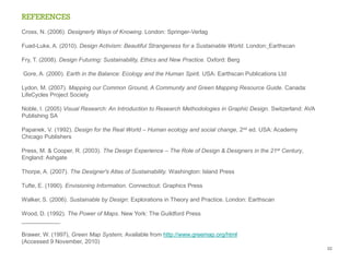
![www.greenmap.org/greenhouse/en/maps
There are over 550 projects in 50 countries
+ 650 Green Maps published [2009]
6](https://image.slidesharecdn.com/syahnazmohdmokhter-101115185345-phpapp01/85/Syahnaz-mohdmokhter-6-320.jpg)
![KEY RESEARCH QUESTIONS
Q1 What are the design choices, and the need for updates in design?
How effective are they?
Q2 How to develop existing GMS methodology of open development
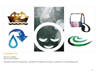
[CO-DESIGN] of future icons to be included in the universal symbols
for maps
Q3 Where to research on the places that will be mapped, by using specific
selection criteria to the information that will be included on the map
Q4 How to design a feasibility study and investigate the effectiveness
of the information icons. What is the data to be included on the map?
8](https://image.slidesharecdn.com/syahnazmohdmokhter-101115185345-phpapp01/85/Syahnaz-mohdmokhter-8-320.jpg)
![OBJECTIVES
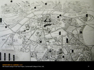
a Stimulate ecological consciousness to the population and to the
public health.
a Create awareness, especially among young generation groups, of the
importance of saving the ‘green areas’ and helping the preservation of
city’s ‘green areas’ in the future.
a Increase awareness, of environmentally sound architecture, design projects,
eco-systematic sites, solar, other renewable energy technologies, etc.
a Historical information about specific places.
a The importance of eco-information, social, political and health resources
[positive and negative aspects].
9](https://image.slidesharecdn.com/syahnazmohdmokhter-101115185345-phpapp01/85/Syahnaz-mohdmokhter-9-320.jpg)
![TARGET AUDIENCE
8 People in the London Metropolitan University - campus area
[students, staffs, resident officers, etc]
8 People outside the campus
[general public, nature society, non-profit organizations, school
students, government bodies, higher learning institution, etc]
8 Global: anyone engaged in green mapping
1
0](https://image.slidesharecdn.com/syahnazmohdmokhter-101115185345-phpapp01/85/Syahnaz-mohdmokhter-10-320.jpg)

![OUTLINE PROJECT PLAN
s Digital print promotional items
[publication design of GMS®
creative book art / guidebook]
s New created GMS local Icons©
s CD-ROM
s Final project -
exhibition of design works
www.greenmap.org/universities
12](https://image.slidesharecdn.com/syahnazmohdmokhter-101115185345-phpapp01/85/Syahnaz-mohdmokhter-12-320.jpg)
![www.commongroundproject.ca
GM NEW LOCAL ICON-MAKING PROCESS [adapted by F Syahnaz Mokhter]
13](https://image.slidesharecdn.com/syahnazmohdmokhter-101115185345-phpapp01/85/Syahnaz-mohdmokhter-13-320.jpg)
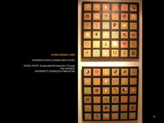
![Latest GM Standard Icons Charts Version 3 [2008] –
www.greenmap.org/greenhouse/en/about/iconintro
14](https://image.slidesharecdn.com/syahnazmohdmokhter-101115185345-phpapp01/85/Syahnaz-mohdmokhter-14-320.jpg)


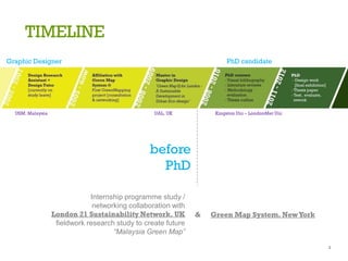
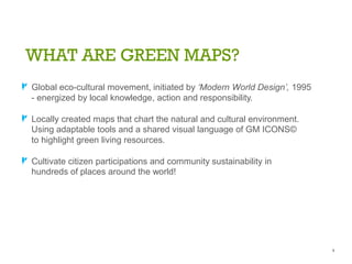
This document summarizes a presentation about developing a Green Map System (GMS) as a tool for sustainable urban planning. The presentation discusses: 1) What GMS is - a global movement that creates locally-made maps highlighting natural and cultural resources using shared iconography. 2) The design brief - to create an eco-friendly Malaysia Green Map reducing climate impact through cartography and icon design engaging diverse groups. 3) Research questions on design choices/updates, developing new universal icons through co-design, selecting map locations and inclusion criteria, and investigating icon effectiveness. 4) The project aims to increase environmental awareness and preservation of green spaces through the map.


