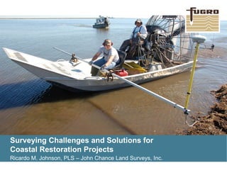
1. Surveying Challenges and Solutions for
Coastal Restoration Projects
Ricardo M. Johnson, PLS – John Chance Land Surveys, Inc.
2. www.fugro.com2
• Scope of Services
• Standards of Practice
• Typical CPRA Surveying Tasks
• Challenges & Examples
• Solutions & Results
• Conclusions
Presentation Outline
Integrating Surveying Techniques for Coastal Restoration Projects
3. www.fugro.com3
Scope of Services
Integrating Surveying Techniques for Coastal Restoration Projects
• The examples of Projects and Tasks illustrated on the following slides
represent Surveying Support on CPRA Surveying Contracts from the
perspective of a surveyor.
• The Scope of Services for tasks issued vary in size, scope, level of
detail, and required surveying accuracies.
• Understand the Scope, especially know what the final deliverables are.
• My Experience...The SOS should not be accepted as a Non-
negotiable, or final Document. Although required tasks are generally
specified in detail, the Surveying or Engineering Contractor may have
a more efficient solution during the data-collection process. These
solutions are typically more efficient, more accurate and reliable, and
save time and money with added value at no additional cost.
4. www.fugro.com4
• “A Contractor’s Guide to the
Standards of Practice” is a booklet
created for CPRA Survey
Contractors that utilize Static GPS
to determine orthometric heights
within the Louisiana Coastal Zone.
• Elevation is an important issue in
South Louisiana because of the
varying effects of local subsidence.
• Although NAVD88 is the required
Vertical datum in LCZ, this datum
has different epochs/geoid models.
...Elevations can vary in excess of
one foot depending on the location
and Geoid Model used.
Standards of Practice
Integrating Surveying Techniques for Coastal Restoration Projects
5. www.fugro.com5
Acceptance of the Scope, Cost Estimates
submitted, and Notice to Proceed issued...
• Planning and Scheduling (Safety Plan)
• Right-of-Entry Permits and Approval
• Louisiana One Call (GIS Research)
• Mobilize Crews and Commence Work
• Recon - Static GPS Surveys
• Real-time Kinematic Surveys and/or
Conventional Surveys with Total Station or
Leveling
• Bathymetric Surveys – Single-beam, Multi-
beam
• Magnetometer Surveys – Land and/or
Marine
• Cross-Checks, Quality Assurance*
• Processing/Adjusting
• Prepare Deliverables per SOW
Typical Tasks on Coastal Restoration Projects
Integrating Surveying Techniques for Coastal Restoration Projects
6. www.fugro.com6
Cannot walk on the ground! CRMS Sites consist of parallel board walkways that straddle
the deep rod RSET. This poses two challenges, performing a GPS observation on the
RSET without touching the ground and attempting to lower a crossboard rigid enough to
support the surveyor.
Challenges #1 and #2– Coastal Reference Monitoring System
Integrating Surveying Techniques for Coastal Restoration Projects
7. www.fugro.com7
Pipe with a Constant Offset is easily slipped over the RSET with
bottom resting on RSET Collar. Static GPS/RTK is easily
performed without using an awkward Tripod setup or disturbing the
ground surface.
A lightweight Aluminum Ladder was retro-fitted with an aluminum
plate and no skid surface attached for safety. The Ladder was
lowered and raised, drawbridge fashion, using a nylon rope.
Solutions #1 and #2 – CRMS Project
Integrating Surveying Techniques for Coastal Restoration Projects
8. www.fugro.com8
In addition to performing topographic surveys along transects at each NRDA site, the
survey crew was required to survey the existing shoreline for 1000 feet on either side of
the primary transect at 165 NRDA Sites. This would have been time consuming to acquire
enough points to accurately map the shoreline.
Challenge #3– Natural Resource Damage Assessment (NRDA)
Integrating Surveying Techniques for Coastal Restoration Projects
9. www.fugro.com9
The Solution was to fabricate an Aluminum square tubing “sliding pole” with a GPS Rover attached. Using Real-time Kinematic (RTK)
Surveying, the system was initialized to collect a point every 2 feet, automatically. The surveyor visually tracked the shoreline by
observing a hanging rope “Tag Line”, and adjusted the location effortlessly using roller brackets mounted to each side of the airboat.
Solution #3 – NRDA Project
Integrating Surveying Techniques for Coastal Restoration Projects
10. www.fugro.com10
This project combined a multitude of tasks to be integrated into one surface model. Tasks
included Multi-beam and Single-beam Bathymetric Surveys, Topographic using Real-time
Kinematic Surveys, Bathymetric using RTK. The primary challenge was performing Topographic
Surveys within a 200 Acre wooded area between the Mississippi River and LA Highway 23.
Proposed Transects in this area would have required clearing and grubbing.
Challenge #4 – Mid-Barataria Sediment Diversion Project
Integrating Surveying Techniques for Coastal Restoration Projects
11. www.fugro.com11
The client requested that our surveyors collect sufficient data to create a Digital Terrain Model (DTM),
not only in the wooded area, but also in the open areas which contained multitudes of field ditches and
drainage canals. JCLS proposed to use Aerial LiDAR Mapping to capture all topographic features
within the project footprint. Contour maps of the entire footprint could be then be generated. In addition,
Digital Orthoimagery mosiacs would be included as a deliverable.
Challenge #4 – Mid-Barataria Sediment Diversion Project
Integrating Surveying Techniques for Coastal Restoration Projects
12. www.fugro.com12
Once the LiDAR was collected and processed to filter the point cloud data to reveal bare earth
topo, a contour map was generated for the entire project footprint. The image below is a detail
of the wooded area plotted in Google Earth. Note the existing topographic features which
include field ditches, headrows, etc. This level of detail could not be achieved using
conventional surveying methods.
Solution #4 – Mid-Barataria Sediment Diversion Project
Integrating Surveying Techniques for Coastal Restoration Projects
13.
14. www.fugro.com14
Geoid Models are used to determine elevations
on benchmarks and are the vertical references
for all CPRA Projects. The CPRA Contractor
should have an understanding of what model(s)
are required for determining elevations,
typically specified in the SOW. Over the past
25 years, NGS has published a total of seven
Geoid Models, two which have been revised for
South Louisiana due to subsidence issues and
model errors. The latest published Geoid Model
is Geoid12A/B.
With continuing GPS observations and gravity
measurements being performed by NGS to
densify the GPS Network through the Height
Modernization Programs in the Louisiana
Coastal Zone, Geoid Models will constantly
change, mainly due to our subsidence issues
and updated gravity measurements.
Challenge #5 – What is the Surveyors’ Biggest Challenge in LCZ?
GEOIDS
15. www.fugro.com15
The map below reveals NGS Published Geoid Modeling errors when calculating
differences between Geoid12 and Geoid09 heights. This forced NGS to re-evaluate
Geoid12 calculations to remove benchmarks that corrupted the initial Geoid12 Model.
Geoid Errors – The Geoid12 (Original) Minus Geoid09 (cm)
Integrating Surveying Techniques for Coastal Restoration Projects
16. www.fugro.com16
NGS Note on Geoid12A…
…After detecting significant defects in the control data used to create GEOID12, GEOID12A
was developed as a replacement. Changes impacted regions in the states of Alabama,
Mississippi, Louisiana, Texas, Oklahoma, and Wisconsin. The final control data were effectively
determined as of August 10, 2012 and can be accessed through the link on NGS’s Website.
Geoid Errors – The Geoid12A Minus Geoid12 (Original) (cm)
Integrating Surveying Techniques for Coastal Restoration Projects
17. www.fugro.com17
Geoid Errors – The Geoid12A Minus Geoid12 (Original) (cm)
Integrating Surveying Techniques for Coastal Restoration Projects
There are different models, because there are slight differences in the GPSBM data used for each model. However, these
differences are limited to a few areas, mainly in southern tier states along the Gulf Coast and Puerto Rico.
GEOID12 is created using the GPSBM data of the National Adjustment of 2011. The median change in coordinates from previously
published values was approximately 2 centimeters horizontally and 1.5 centimeters vertically. However, some station coordinates
changed by more than 1 meter horizontally and 60 centimeters vertically.
GEOID12A uses the same GPSBM data as GEOID12, excluding the points in southern tier states along the Gulf Coast. See the
map below for details.
GEOID12B is identical to GEOID12A, except in Puerto Rico. Some discrepancies with respect to PRVD02 were found due to a few
GPSBMs that referred to local mean sea level rather than PRVD02. The problem was identified and corrected. A map of the
changes is shown below.
18. www.fugro.com18
Upon release of the Hybrid Geoid12A Model, random NGS Published benchmarks were
selected for the eastern Louisiana Coastal Zone and compared Geoid09 model values.
The map below illustrates the model differences in feet.
Geoid Differences - Geoid12A Minus Geoid09
Integrating Surveying Techniques for Coastal Restoration Projects
19. www.fugro.com19
2015 Experimental Geoid Models xGEOID15A and
xGEOID15B Now Available
Thursday, October 1, 2015
2015 Experimental Geoid Models xGEOID15A and
xGEOID15B Now Available
In 2022, the National Geodetic Survey (NGS) will
replace the current North American Vertical Datum of
1988 (NAVD 88) with a new vertical datum based on
the geoid: an equipotential surface that best
represents mean sea level.
Since 2014, we have been creating and releasing
annual models of the geoid in preparation for the new
vertical datum. This year's models - xGEOID15A and
xGEOID15B - are now available as experimental
products on NGS' beta website. Users can test these
models for the improvements gained by the addition of
new data from our Gravity for the Redefinition of the
American Vertical Datum (GRAV-D) Project. Grav-D
has been systematically collecting airborne gravity
data across the country since 2008.
The xGEOID models provide our constituents with a
regularly updated look at the expected impacts of the
2022 datum update. This 2015 final beta release
includes a Web based tool to allow you to identify
changes in your specific areas of interest by entering
the coordinates for those areas.
Future Challenges
Integrating Surveying Techniques for Coastal Restoration Projects
20. www.fugro.com20
• Know the Scope of Services
• Comply with Standards of Practice
• Use Common Sense Approaches
to overcome survey Challenges
• Elevation Determination in South
Louisiana is Dynamic...Keep
informed of the latest modeling
efforts.
• And Question everything!
Conclusions
Integrating Surveying Techniques for Coastal Restoration Projects
...even the
Pro’s err~!