Download as PDF, PPTX


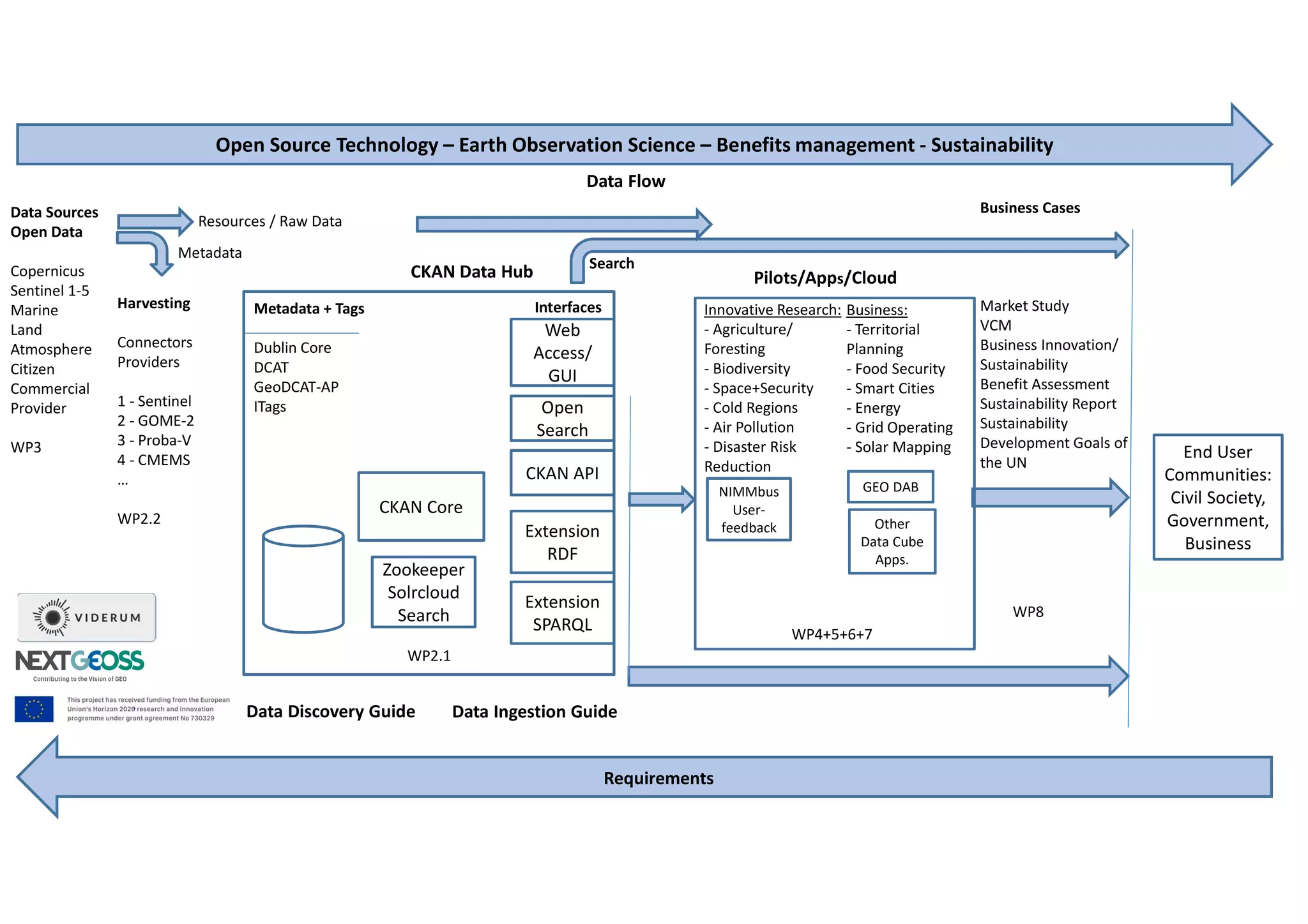
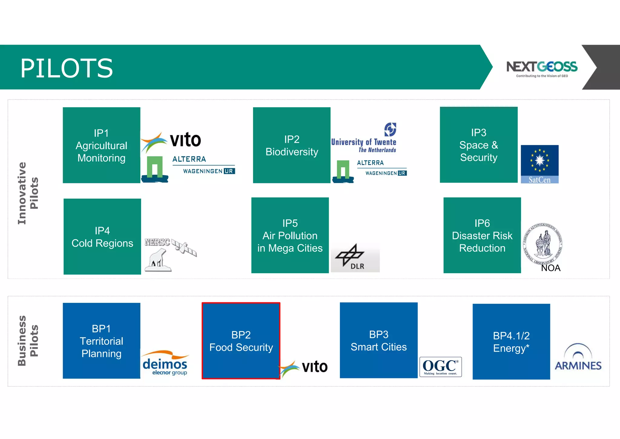
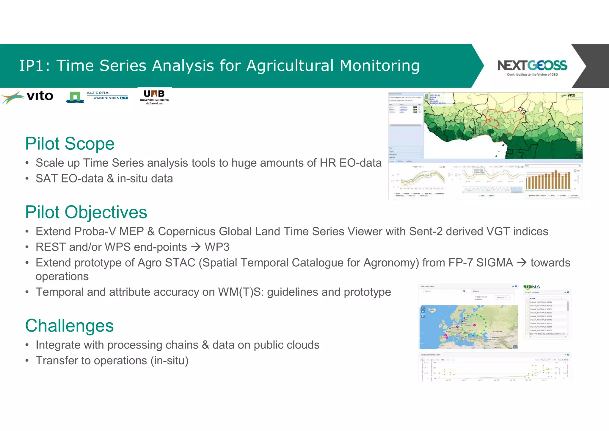

The document outlines the NextGEOSS project, part of the EU's Horizon 2020 program, which aims to enhance the use of open Earth observation data through various pilot projects in sectors like agriculture, biodiversity, and urban planning. It describes specific pilot projects focused on agricultural monitoring, biodiversity habitat mapping, air pollution analysis in megacities, and smart city integration, detailing objectives, challenges, and the data flow involved. The project involves collaboration among 27 partners and a budget of €10 million, emphasizing innovative research and business applications for societal benefit.


