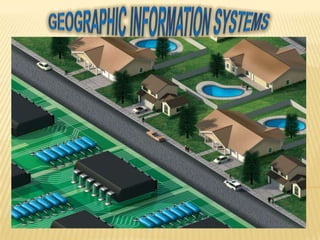
integrar la información moderna
adquisición, almacenamiento, análisis,
y herramientas de gestión de aplicaciones
que resuelven problemas relacionados con geoespacial
de la información.
INTEGRATION OF REMOTE SENSING DATA WITH GEOGRAPHIC INFORMATION SYSTEM (GIS): ...ijmpict
Remote Sensing and Geographic information System together comprise of Geographic Information Science (GIScience) which is a core research field that tries to emphasis on advanced geographic concepts in Geographic Information System and examines the impact of GIS on individuals and society as a whole and re-examines the themes with incorporation of most recent cognitive and Information Science. The Geographic Information System can be defined as a Computer based system and a tool, both hardware,
software and procedures, which manages geospatial data, solves spatial problems, and supports collection,
storage, transformation, analyzing, retrieving and display of data in a well desired manner. The integration
of GIS and Remote Sensing is a field of research and several implementations have been developed to gain
the maximum throughput out of these collective fields as these techniques have their own data analysis and
data representation methods. The application domain of remote sensing is from a base layer for GIS to the
development of thematic datasets, obtaining and extracting data from imagery and generation of unique
spatial datasets. In my paper I have focused on the integration of both the fields along with its usage in
Analysis and Modelling and also some models of error sources due to the integration of interface of the two
techniques. The paper also describes some error sources while integration as GIS and remote sensing both
are subject to errors and uncertainty. The paper has discussed some Change Detection Techniques used in
the modern sciences with their comparison.
TYBSC IT PGIS Unit I Chapter I- Introduction to Geographic Information SystemsArti Parab Academics
A Gentle Introduction to GIS The nature of GIS: Some fundamental observations, Defining GIS, GISystems, GIScience and GIApplications, Spatial data and Geoinformation. The real world and representations of it: Models and modelling, Maps, Databases, Spatial databases and spatial analysis
Mumbai University, T.Y.B.Sc.(I.T.), Semester VI, Principles of Geographic Information System, USIT604, Discipline Specific Elective Unit 1: Introduction to GIS
Visualization of cartographic systems in mobile devices is a challenge due to the its own
limitations to show all the relevant information that the user needs on the screen. Within this paper we review
current state-of- the-art technological solutions to face this problem and we classify them in a novel typology. In
addition, it is shown an example case of a developed system for a logistic company specialized in dangerous
goods. The system is able to calculate optimal routes and communicate the drivers the best path in order to
achieve a great management of the company resources
The basic intention of this presentation is to help the beginners in GIS to understand what GIS is? It is a simple presentation about GIS, i mean an introductory one. Hope anyone finds it useful.
My special talk on 'GIS & Remote Sensing-Introduction to the Primer’ is a part of the 'Learn from the Leaders- 2' webinar series organized by IEEE SIGHT, Bombay section on May 25th, 2021
Smart TV Buyer Insights Survey 2024 by 91mobiles.pdf91mobiles
91mobiles recently conducted a Smart TV Buyer Insights Survey in which we asked over 3,000 respondents about the TV they own, aspects they look at on a new TV, and their TV buying preferences.
TYBSC IT PGIS Unit I Chapter I- Introduction to Geographic Information SystemsArti Parab Academics
A Gentle Introduction to GIS The nature of GIS: Some fundamental observations, Defining GIS, GISystems, GIScience and GIApplications, Spatial data and Geoinformation. The real world and representations of it: Models and modelling, Maps, Databases, Spatial databases and spatial analysis
Mumbai University, T.Y.B.Sc.(I.T.), Semester VI, Principles of Geographic Information System, USIT604, Discipline Specific Elective Unit 1: Introduction to GIS
Visualization of cartographic systems in mobile devices is a challenge due to the its own
limitations to show all the relevant information that the user needs on the screen. Within this paper we review
current state-of- the-art technological solutions to face this problem and we classify them in a novel typology. In
addition, it is shown an example case of a developed system for a logistic company specialized in dangerous
goods. The system is able to calculate optimal routes and communicate the drivers the best path in order to
achieve a great management of the company resources
The basic intention of this presentation is to help the beginners in GIS to understand what GIS is? It is a simple presentation about GIS, i mean an introductory one. Hope anyone finds it useful.
My special talk on 'GIS & Remote Sensing-Introduction to the Primer’ is a part of the 'Learn from the Leaders- 2' webinar series organized by IEEE SIGHT, Bombay section on May 25th, 2021
Similar to Sistemas de información geográfica (20)
Smart TV Buyer Insights Survey 2024 by 91mobiles.pdf91mobiles
91mobiles recently conducted a Smart TV Buyer Insights Survey in which we asked over 3,000 respondents about the TV they own, aspects they look at on a new TV, and their TV buying preferences.
GraphRAG is All You need? LLM & Knowledge GraphGuy Korland
Guy Korland, CEO and Co-founder of FalkorDB, will review two articles on the integration of language models with knowledge graphs.
1. Unifying Large Language Models and Knowledge Graphs: A Roadmap.
https://arxiv.org/abs/2306.08302
2. Microsoft Research's GraphRAG paper and a review paper on various uses of knowledge graphs:
https://www.microsoft.com/en-us/research/blog/graphrag-unlocking-llm-discovery-on-narrative-private-data/
Encryption in Microsoft 365 - ExpertsLive Netherlands 2024Albert Hoitingh
In this session I delve into the encryption technology used in Microsoft 365 and Microsoft Purview. Including the concepts of Customer Key and Double Key Encryption.
Kubernetes & AI - Beauty and the Beast !?! @KCD Istanbul 2024Tobias Schneck
As AI technology is pushing into IT I was wondering myself, as an “infrastructure container kubernetes guy”, how get this fancy AI technology get managed from an infrastructure operational view? Is it possible to apply our lovely cloud native principals as well? What benefit’s both technologies could bring to each other?
Let me take this questions and provide you a short journey through existing deployment models and use cases for AI software. On practical examples, we discuss what cloud/on-premise strategy we may need for applying it to our own infrastructure to get it to work from an enterprise perspective. I want to give an overview about infrastructure requirements and technologies, what could be beneficial or limiting your AI use cases in an enterprise environment. An interactive Demo will give you some insides, what approaches I got already working for real.
Generating a custom Ruby SDK for your web service or Rails API using Smithyg2nightmarescribd
Have you ever wanted a Ruby client API to communicate with your web service? Smithy is a protocol-agnostic language for defining services and SDKs. Smithy Ruby is an implementation of Smithy that generates a Ruby SDK using a Smithy model. In this talk, we will explore Smithy and Smithy Ruby to learn how to generate custom feature-rich SDKs that can communicate with any web service, such as a Rails JSON API.
State of ICS and IoT Cyber Threat Landscape Report 2024 previewPrayukth K V
The IoT and OT threat landscape report has been prepared by the Threat Research Team at Sectrio using data from Sectrio, cyber threat intelligence farming facilities spread across over 85 cities around the world. In addition, Sectrio also runs AI-based advanced threat and payload engagement facilities that serve as sinks to attract and engage sophisticated threat actors, and newer malware including new variants and latent threats that are at an earlier stage of development.
The latest edition of the OT/ICS and IoT security Threat Landscape Report 2024 also covers:
State of global ICS asset and network exposure
Sectoral targets and attacks as well as the cost of ransom
Global APT activity, AI usage, actor and tactic profiles, and implications
Rise in volumes of AI-powered cyberattacks
Major cyber events in 2024
Malware and malicious payload trends
Cyberattack types and targets
Vulnerability exploit attempts on CVEs
Attacks on counties – USA
Expansion of bot farms – how, where, and why
In-depth analysis of the cyber threat landscape across North America, South America, Europe, APAC, and the Middle East
Why are attacks on smart factories rising?
Cyber risk predictions
Axis of attacks – Europe
Systemic attacks in the Middle East
Download the full report from here:
https://sectrio.com/resources/ot-threat-landscape-reports/sectrio-releases-ot-ics-and-iot-security-threat-landscape-report-2024/
Key Trends Shaping the Future of Infrastructure.pdfCheryl Hung
Keynote at DIGIT West Expo, Glasgow on 29 May 2024.
Cheryl Hung, ochery.com
Sr Director, Infrastructure Ecosystem, Arm.
The key trends across hardware, cloud and open-source; exploring how these areas are likely to mature and develop over the short and long-term, and then considering how organisations can position themselves to adapt and thrive.
JMeter webinar - integration with InfluxDB and GrafanaRTTS
Watch this recorded webinar about real-time monitoring of application performance. See how to integrate Apache JMeter, the open-source leader in performance testing, with InfluxDB, the open-source time-series database, and Grafana, the open-source analytics and visualization application.
In this webinar, we will review the benefits of leveraging InfluxDB and Grafana when executing load tests and demonstrate how these tools are used to visualize performance metrics.
Length: 30 minutes
Session Overview
-------------------------------------------
During this webinar, we will cover the following topics while demonstrating the integrations of JMeter, InfluxDB and Grafana:
- What out-of-the-box solutions are available for real-time monitoring JMeter tests?
- What are the benefits of integrating InfluxDB and Grafana into the load testing stack?
- Which features are provided by Grafana?
- Demonstration of InfluxDB and Grafana using a practice web application
To view the webinar recording, go to:
https://www.rttsweb.com/jmeter-integration-webinar
UiPath Test Automation using UiPath Test Suite series, part 3DianaGray10
Welcome to UiPath Test Automation using UiPath Test Suite series part 3. In this session, we will cover desktop automation along with UI automation.
Topics covered:
UI automation Introduction,
UI automation Sample
Desktop automation flow
Pradeep Chinnala, Senior Consultant Automation Developer @WonderBotz and UiPath MVP
Deepak Rai, Automation Practice Lead, Boundaryless Group and UiPath MVP
2. Systems Information Geographical (GIS) to integrate information modern acquisition,storage, analysis, and management tool in Applications to problems related to geospatial information . Among the special tools that (GIS) to use are :
3. remote sensing tools which use a variety of devices and methods to gather information on a given object or area from adistance.
4. geography tools to study the features, inhabitants, resources, and evolutions of the Earth and itsenvironment.
5. visualization software , which presents useful information from acquired data using 2D and 3D images oranimations.
6. These were the special tools of geographic information system the other issues dealt with in the article is about the specific problems and geographicallearn innovative techniques to address theseproblems in the rapidly growing interdisciplinarycommunity. The response to the callwas overwhelming, to center the subject and enlighteninterrelatedness of the challenges in a GISregion, I selected a set of articles addressinggeographic specific problems in China. I thinkyou will find informative articles, valuable, andrewarding, both in terms of new findingspresent and original techniques usedto solve urgent problems geographic.